Watch our series of short videos on the importance of the
Sacramento-San Joaquin Delta, how it works as a water hub for
California and the challenges it is facing.
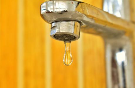
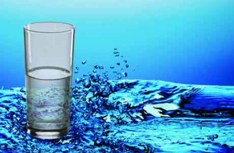
When a person opens a spigot to draw a glass of water, he or she
may be tapping a source close to home or hundreds of miles away.
Water gets to taps via a complex web of aqueducts, canals and
groundwater.
Learn more about our team in the office and on the Board of
Directors and how you can support our nonprofit mission by
donating in someone’s honor or memory, or becoming a regular
contributor or supporting specific projects.
Unlike California’s majestic rivers and massive dams and
conveyance systems, groundwater is out of sight and underground,
though no less plentiful. The state’s enormous cache of
underground water is a great natural resource and has contributed
to the state becoming the nation’s top agricultural producer and
leader in high-tech industries.
A new era of groundwater management began in 2014 in California
with the Sustainable Groundwater Management Act. The landmark law
turned 10 in 2024, with many challenges still ahead.
In December 2012, dam operators at Northern California’s Lake Mendocino watched as a series of intense winter storms bore down on them. The dam there is run by the U.S. Army Corps of Engineers’ San Francisco District, whose primary responsibility in the Russian River watershed is flood control. To make room in the reservoir for the expected deluge, the Army Corps released some 25,000 acre-feet of water downstream — enough to supply nearly 90,000 families for a year.
Registration is now open for
the Water Education Foundation’s 41ˢᵗ annual
Water Summitfeaturing leading
policymakers and experts in conversation about the latest
information and insights on water in California and the West.
The Kaweah subbasin is the second San Joaquin Valley region to
successfully escape state intervention, managers learned
today. In a phone call with state Water Resources Control
Board staff, managers of Kaweah’s three groundwater
sustainability agencies got the news that their efforts to
rewrite their groundwater management plans were good enough for
staff to recommend that they return to Department of Water
Resources oversight. … The Chowchilla subbasin
successfully made the u-turn from state enforcement back to
oversight in early June. Fukuda said Kaweah will follow much
the same path as Chowchilla. The Water Board will consider
the staff recommendation for Kaweah at a meeting in the fall,
when it can pass a resolution formally sending Kaweah back to
DWR. Returning to DWR oversight guarantees landowners
freedom from additional fees under the Sustainable Groundwater
Management Act, which mandates that overdraft stop and aquifers
reach balance by 2040.
Lake Mead has dropped about 2 feet since the beginning of June
as drought conditions continue to worsen across Nevada. On
the first of the month, the elevation was 1,057 ft and as of
June 29, it’s now at 1,055.13 ft. Currently, the elevation
higher than it’s record-breaking low year in 2022. However, the
reservoir is sitting lower than where it was in 2020, 2021,
2023, and 2024. The reservoir is currently at 31% capacity,
while Lake Powell sits at 32% capacity, according to the latest
teacup diagrams from Bureau of Reclamation (BOR). The current
unregulated inflow of water from the Colorado River to Lake
Powell is estimated to be 45% of average through July,
according to the latest 24-month Most Probable Study for the
Upper and Lower Colorado Basin Regions from BOR.
… To many of its visitors, and the several hundred people who
live along its 31-mile shoreline deep within the sprawling
Mendocino National Forest, Lake Pillsbury is the region’s
heartbeat. But Scott Dam, at the foot of Lake Pillsbury, and
another, smaller dam on the river 12 miles downstream, have
also become a headache for Pacific Gas & Electric Co., which
owns both dams. And that’s creating a controversy that’s drawn
interest from everyone from those who live on Lake Pillsbury,
to North Bay communities whose water supplies are linked to
both dams, to federal agencies now under control of President
Donald Trump. … PG&E is on track to decommission
those dams, and under a historic agreement reached earlier this
year, both are being slated to be torn down in what would be
the nation’s next big dam removal project, freeing up the
headwaters of California’s third longest river to help revive
its troubled salmon and steelhead trout runs.
When it rains in Pescadero, Irma Rodriguez gets to work —
lining up containers on her patio to catch as much water as she
can. … The small rural town has one public water system, and
it serves less than half of the population. Now, San
Mateo County is preparing to raise rates for that system —
potentially tripling costs — deepening concerns among residents
already struggling to get by and not addressing those who
have no clean running water at all. … Of the seven
public water systems within 2 miles of Pescadero assessed by
the California State Water Resources Control Board in 2024, six
were either failing or at risk of failing. Only one — County
Service Area No. 11, or CSA-11 — was deemed to have “no
risk.” The “no risk” rating doesn’t reflect how many
people in the area actually get their water from creeks or
private wells that may never be tested, leaving their water
safety uncertain.
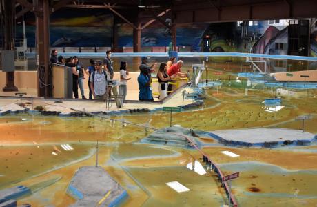
Operated by the U.S. Army Corps of Engineers, the
Bay Model is a giant hydraulic replica of San Francisco
Bay and the Sacramento-San Joaquin
Delta. It is housed in a converted World II-era
warehouse in Sausalito near San Francisco.
Hundreds of gallons of water are pumped through the
three-dimensional, 1.5-acre model to simulate a tidal ebb
and flow lasting 14 minutes.
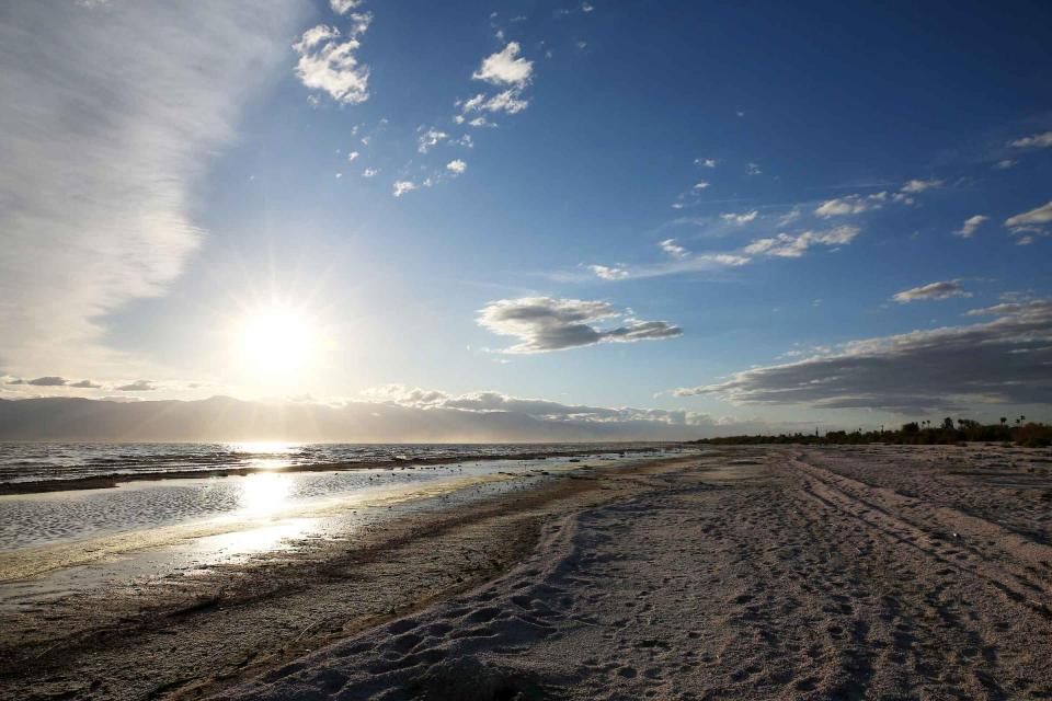
As part of the historic Colorado
River Delta, the Salton Sea regularly filled and dried for
thousands of years due to its elevation of 237 feet below
sea level.
The most recent version of the Salton Sea was formed in 1905 when
the Colorado River broke
through a series of dikes and flooded the seabed for two years,
creating California’s largest inland body of water. The
Salton Sea, which is saltier than the Pacific Ocean, includes 130
miles of shoreline and is larger than Lake Tahoe.
Drought—an extended period of
limited or no precipitation—is a fact of life in California and
the West, with water resources following boom-and-bust patterns.
During California’s 2012–2016 drought, much of the state
experienced severe drought conditions: significantly less
precipitation and snowpack, reduced streamflow and higher
temperatures. Those same conditions reappeared early in 2021
prompting Gov. Gavin Newsom in May to declare drought emergencies
in watersheds across 41 counties in California.


")