Serving as the “lifeline of the
Southwest,” and one of the most heavily regulated rivers in the
world, the Colorado River provides water to 35 million people and
more than 4 million acres of farmland in a region encompassing
some 246,000 square miles.
From its headwaters northwest of Denver in the Rocky Mountains,
the 1,450-mile long river and its tributaries pass through parts
of seven states: Arizona, California, Colorado, New Mexico,
Nevada, Utah and Wyoming and is also used by the
Republic of Mexico. Along the way, almost every drop of the
Colorado River is allocated for use.
The Colorado River Basin is also home to a range of habitats and
ecosystems from mountain to desert to ocean.
Southwestern Colorado is left with 6% of its peak snowpack
earlier than usual this season in part because of a rare,
sudden and large melt in late April. Snow that gathers in
Colorado’s mountains is a key water source for the state, and a
fast, early spring runoff can mean less water for farmers,
ranchers, ecosystems and others in late summer. While the snow
in northern Colorado is just starting to melt, southern river
basins saw their largest, early snowpack drop-off this season,
compared to historical data. For Ken Curtis, the only reason
irrigators in Dolores and Montezuma counties haven’t been short
on water for their farms and ranches is because the area’s
reservoir, McPhee Reservoir, had water supplies left over from
the above-average year in 2023. “Because of the carryover, the
impacts aren’t quite that crazy bad,” said Curtis, general
manager of the Dolores Water Conservancy District.
The federal government has released a 584-page document
detailing possible solutions to an invasive species that poses
“an unacceptable risk” to another fish that’s listed as
threatened. When it’s all said and done, officials want to give
smallmouth bass a cold shower — or a cool bath, anyway — to
discourage them from reproducing. Make no mistake, the U.S.
Bureau of Reclamation’s plan is a detailed “Cool Mix” strategy
on how to reduce the threat to the humpback chub in the
Colorado River below Glen Canyon Dam. Smallmouth bass are
voracious predators, and they’ve started to establish
populations below the dam where the chub is struggling to
survive. Biologists say the bass will feed on the chub, their
eggs, and pretty much anything else that will fit in its mouth.
The president of the Navajo Nation has signed the resolution
approving the historic Northeastern Arizona Indian Water Rights
Settlement Agreement. In doing so, he joined officials from the
Hopi and San Juan Paiute tribes. Before the historic signing,
Navajo speaker Crystalyne Curley pointed out how many Navajo
live off 10 to 30 gallons of water a day, a fraction of the
average American home. “Just even having the efficiency,
the convenience of turning on a faucet of water, that’s
something that’s going to change the livelihoods of many of our
Navajo people,” she said. Navajo president Buu Nygren said the
tribes need the agreement to survive. “Through COVID, through
all the national news over the last several years, people truly
understand the need for water on Navajo,” Nygren said. But
Nygren warned: If we don’t settle the water rights for the
Navajo Nation, the Hopi tribe and the San Juan Paiute, it’s
just another form of genocide.”
Monsoon Awareness Week – the annual effort by state, local and
federal agencies to prepare the public for these awesome, often
dangerously powerful storm patterns – is nearly upon us. As for
the monsoon storms themselves? Well, they will arrive.
Eventually. Maybe later than usual this year. But,
nevertheless, the message remains: Be prepared. Oh, sure, they
make some fun of our appropriation of the term “monsoon” in
India where rainfall at the peak of the summer monsoon season
in June and July averages 16-20 inches and where one uniquely
situated village averages 107 inches in July alone. But the
often fierce winds driving moisture from the Mexican tropics
into our arid Sonoran Desert region have a character and power
of their own.
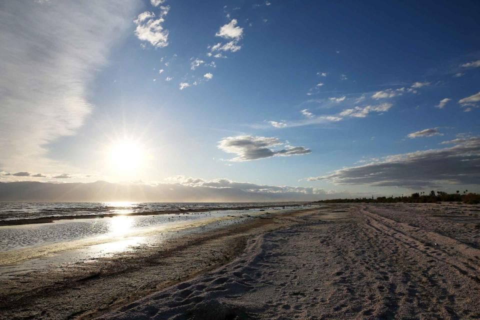
Back in 2003, farmers in California’s Imperial Valley agreed to
send some of their Colorado River water to cities on the coast.
The deal was touted as a win for thirsty Californians and a
boon for efforts to conserve water. But the deal also caused
dangerous pollution for those living near the Salton Sea,
according to a new study published in the American Journal of
Agricultural Economics on Wednesday. For the study, researchers
looked at 20 years of daily air pollution data collected from
around the inland and heavily saline Salton Sea between 1998 to
2018. As the water-transfer program reduced agricultural runoff
that replenishes the sea, once-underwater lakebed was exposed
to wind, leading to increased dust and air pollutants that can
cause heart and respiratory issues, they found.
Hey, Congress: Colorado is doing its part, now we need you to
do yours. As someone who was raised on the Western Slope,
I have always felt a deep connection to water. Whether it is
snow on the slopes, rapids in the river or irrigation on our
fields, water is the common thread that weaves together the
future of our communities across geographic, political and
socio-economic divides. Now, as the state senator who
represents the headwaters of the Colorado River, addressing my
constituents means prioritizing our state’s water interests,
which is becoming increasingly important. -Written by Dylan Roberts, a
Democratic state senator for District 8.
Within the heart of the Navajo Nation and in the shadow of the
sandstone arch that is the namesake of the tribal capital, a
simple greeting and big smiles were shared over and over again
Friday as tribal officials gathered: “Yá‘át’ééh abíní!” It was
a good morning, indeed, for Navajo President Buu Nygren as he
signed legislation in Window Rock, Arizona, outlining a
proposed settlement to ensure three Native American tribes have
water rights from the Colorado River and other sources — and
drought-stricken Arizona has more security in its supply. The
signature came a day after the Navajo Nation Council voted
unanimously in favor of the measure. The San Juan Southern
Paiute and Hopi tribes also approved the settlement this week.
The Colorado River is flowing again in its delta. While this is
welcome news for birds and people, the long-term progress to
keep the Colorado River alive in Mexico with habitat
restoration and water deliveries depends on high stakes
negotiations currently underway. For the third time since
2021, the United States and Mexico are collaborating to deliver
water to improve conditions in the long-desiccated delta.
Environmental water deliveries began mid-March and will
continue into October …
Lawmakers aim to amp up protections for water used by
Colorado’s largest electric utilities with a broadly supported
bill based on recommendations from water experts around the
state. Senate Bill 197 would help electric utilities hold onto
water rights that could otherwise be declared “abandoned” as
the state transitions to clean energy. It would also enhance
protections for environmental and agricultural water, and ease
access to funding for tribes. The bill grew out of water policy
recommendations developed by the Colorado River Drought Task
Force in 2023. The bill, which passed with bipartisan support,
is the legislature’s main effort this year to address those
recommendations — and to help Colorado address its uncertain
water future. Polis has until June 7 to sign the bill, allow it
to become law without his endorsement or veto it.
In Arizona, water used to be a bipartisan area of politics,
albeit a contentious one. But partisanship and tension have
increased as water has drained away. Kathleen Ferris is a water
policy expert of more than 40 years who helped craft Arizona’s
monumental 1980 Groundwater Management Act. “Everybody keeps
saying that water is bipartisan, and in fact it’s not. It’s not
anymore, let’s put it that way. It used to be. You could say
that back in 1980, when we passed the Groundwater Management
Act, but you can’t say that anymore,” she said. Ferris believes
Arizona’s prospects have darkened over the years, largely due
to rural communities resisting conservation efforts. “Willcox,
for example, did not want any part of the Groundwater
Management Act. And yet here they are today, desperate for
help,” Ferris said.
Fast-growing Northern Colorado won approval for two major water
loans from the state this month that will help finance a new
dam outside Loveland and a major regional water project
northwest of Fort Collins. Vetted by the Colorado Water
Conservation Board and approved by a bipartisan group of
lawmakers May 1, the $155 million for Chimney Hollow Reservoir
and the $100 million for the Northern Integrated Supply
Project, or NISP, are among the largest financing packages the
state has approved in recent years, according to the board.
… The projects are not without controversy, however.
Federal permitting for both began 20 years ago, according to
Stahla, and each has been delayed numerous times after
environmentalists sued over concerns about the impact on the
drought-strapped Colorado River, the supply that will
eventually fill Chimney Hollow, and the equally stressed Cache
la Poudre River, whose flows will be used by NISP.
Two groups of states submitted conflicting proposals in March
describing how federal officials should manage reservoirs on
the Colorado River after 2026. Former Colorado River Water
Conservation District General Manager Eric Kuhn, along with two
other water experts, have their own idea to pitch. Kuhn and his
co-authors, University of New Mexico professor John Fleck and
Utah State University professor Jack Schmidt want to add more
flexibility to dam operations to address environmental and
recreation concerns in the Grand Canyon below Glen Canyon Dam
(the dam that forms Lake Powell). Kuhn presented what has
been called the “academic proposal” during a Colorado Basin
Roundtable meeting in Glenwood Springs on Monday. He said the
document is not a “proposal” akin to the states’ proposals,
describing it as more of an “approach” that can be incorporated
with other proposals.
A House Natural Resources subcommittee will consider how to
shore up operations of major Western waterways, including the
Colorado and Klamath river basins. The Subcommittee on Water,
Wildlife and Fisheries will meet Wednesday to review four bills
targeting infrastructure and hydropower. Lawmakers will discuss
Nevada Democratic Rep. Susie Lee’s H.R. 7776, the “Help Hoover
Dam Act,” which would provide an additional $45 million in
operating funds for the nation’s second tallest dam.
Pronounced “He La,” the Gila Rivers’ headwaters originate in
New Mexico, where it is a wild and scenic mountain river. The
path of the Gila settles into broad valleys as it enters
Arizona, providing water for rural towns and agriculture along
the way. The Gila’s flow is interrupted by Coolidge Dam and San
Carlos Reservoir on the San Carlos Indian Reservation west of
Safford, Arizona. Water from the reservoir is managed by the
San Carlos Irrigation District for communities, farms, and
ranches downstream. The Ashurst-Hayden and Florence diversion
dams in Pinal County send what remains of the Gila River water
to Central Arizona farms, after which the river is a dry
channel except when there are high flows from rain and snow
melt. The combination of dams, diversions, and
drought earned the Gila River the title of Most Endangered
River in 2019 from American Rivers, a nonprofit advocacy
organization.
Gov. Spencer Cox said Thursday he is open to alternatives to
bring more Colorado River water to Southern Utah, including a
suggestion from the Utah Senate president to help California
fund desalination facilities in exchange for part of its water
share. … Earlier in the week, a report by Fox 13 News
and the Colorado River Collaborative journalism
initiative said that Utah Senate President J. Stuart Adams,
R-Layton, has put forward the idea of providing part of
the funds for California to construct desalination facilities
to remove salt and brine from Pacific Ocean water to convert it
to safe drinking water. In exchange, Utah would get a portion
of California’s share of the river’s water.
A coalition of Northwest Colorado governments has come out in
opposition to designating the Dolores Canyon region as a
national monument. The board of the Associated Governments of
Northwest Colorado this week approved a resolution urging
“President Biden, federal agencies and legislative bodies to
consider the adverse impacts such designation would have on
local governance, economy, access, and national security.” The
board’s action came the same week Mesa County commissioners
passed a resolution opposing the monument designation. … [The
AGNC] worries about potential impacts to things such as
farming/ranching and recreational access, and to potential
mining of uranium and lithium in the region that “represents a
critical matter of national security, particularly considering
the current state of global affairs.”
A Western Slope fundraising effort to buy the historic Shoshone
hydroelectric plant water rights is now more than half of the
way toward succeeding thanks to a $2 million contribution by
the City of Glenwood Springs, just downstream of the Glenwood
Canyon facility. Glenwood’s City Council unanimously approved
the funding Thursday. The city’s recreation-based economy
relies in part on reliable Colorado River flows through the
canyon, which the plant’s water rights help assure by virtue of
their seniority.
Colorado lawmakers gave the thumbs-up to 10 water measures this
year that will bring millions of dollars in new funding to help
protect streams, bring oversight to construction activities in
wetlands and rivers, make commercial rainwater harvesting
easier and support efforts to restore the clarity of Grand
Lake. Money for water conservation, planning and projects was a
big winner, with some $50 million approved, including $20
million to purchase the Shoshone water rights on the Colorado
River. Sen. Dylan Roberts, D-Frisco, chair of the Senate
Agriculture and Natural Resources Committee, expressed
gratitude for the legislature’s focus on water issues and for
funding the Shoshone purchase.
Imperial Irrigation District officials have figured out how to
surmount a key hurdle to complete a Colorado River conservation
deal worth nearly $800 million: pushing to have California
legislators quickly pass a bill that would immediately give
them the power to kill endangered fish and birds. District
staff, the bill’s sponsor and environmentalists say that likely
wouldn’t occur, thanks to funding to create habitat elsewhere,
and due to backstop federal species protections that are
actually stronger than the state’s. But it is a
counter-intuitive piece of lawmaking that has upset one
longtime critic. What’s driving the legislation are a tiny
desert pupfish and two types of birds, all nearing extinction,
which have found unlikely refuge in the Imperial Valley’s
concrete drainage channels and marshy areas by the fast-drying
Salton Sea.
Related Salton Sea and endangered species articles:
The U.S. government is dedicating $60 million over the next few
years to projects along the Rio Grande in southern New Mexico
and West Texas to make the river more resilient in the face of
climate change and growing demands. The funding announced
Friday by U.S. Interior Secretary Deb Haaland marks the first
disbursement from the Inflation Reduction Act for a basin
outside of the Colorado River system. While pressures on the
Colorado River have dominated headlines, Haaland and others
acknowledged that other communities in the West — from Native
American reservations to growing cities and agricultural
strongholds — are experiencing the effects of unprecedented
drought.
A proposed water rights settlement for three Native American
tribes that carries a price tag larger than any such agreement
enacted by Congress has taken a major step forward with its
introduction to the Navajo Nation Council. The Navajo Nation
has one of the largest single outstanding claims in the
Colorado River basin and will vote soon on the measure in a
special session. It’s the first of many approvals — ending with
Congress — that’s needed to finalize the deal presented on
Monday. Climate change, the coronavirus pandemic and demands on
the river like those that have allowed Phoenix, Las Vegas and
other desert cities to thrive pushed the tribes into settlement
talks. The Navajo, Hopi and San Juan Southern Paiute tribes are
hoping to close the deal quickly under a Democratic
administration in Arizona and with Joe Biden as president.
The Colorado River provides water to more than 40 million
people. The Basin includes 30 federally recognized Indian
tribes and seven states (Colorado, Wyoming, California,
Arizona, New Mexico, Utah, Nevada). Tribal nations in Colorado,
New Mexico, Utah and Wyoming have been left out of key
agreements involving the Colorado River for well over a century
now. In April, the Upper Colorado River Commission – that’s an
agency at the nexus of many Colorado River discussions in the
Upper Basin – voted to back a new proposed agreement that would
make regular meetings with tribes be mandatory for the first
time in the group’s 76-year history. Mira Barney is a
Diné (Navajo) woman working at the National Wildlife
Federation. She is also pursuing a graduate certificate in
Environmental Justice at CU Boulder, and works as Program
Assistance with Indigenous Women’s Leadership Network.
I have been on the Colorado River a few times, the first in
2014. It is hard to believe that in August, it will represent a
decade of dipping my toes in the water, so to speak, to better
understand this complex river described as the “Workhorse of
the West.” This river, at 1,450 miles, is often referred to as
the lifeblood of a rapidly growing region of the United States.
Arizona’s population is exploding, Utah consistently ranks as
the fastest growing state in the nation and New Mexico,
Colorado and Nevada are suffering from growing
pains. Suffice it to say, the West needs the river to
thrive. The West needs the river to be generous, supported by
bountiful snowpacks in the Upper Basin to support growth. -Written by Joi O’Donoghue and Emma Pitts,
reporters for Deseret News.
A team of researchers has been hard at work in the Rocky
Mountains to solve a mystery. Snow is vanishing into thin air.
Now, for the first time, a new study explains how much is
getting lost, and when, exactly, it’s disappearing. Their
findings have to do with snow sublimation, a process that
happens when snow evaporates before it has a chance to melt.
Perhaps most critical in the new findings is the fact that most
snow evaporation happen s in the spring, after snow totals have
reached their peak. This could help water managers around the
West know when to make changes to the amount of water they take
from rivers and reservoirs.
The Colorado River is in trouble. More than two decades of
megadrought fueled by climate change have sapped its supplies,
and those who use the river’s water are struggling to rein in
demand. Now, with current rules for river sharing set to expire
in 2026, policymakers have a rare opportunity to rework how
Western water is managed.
The ongoing drought across the western United States has led to
concerns about the future of hydropower. As reservoirs see
water levels drop, officials worry about electricity generation
being reduced, as well. This is an issue Syris
Valentine has written about. Valentine is the climate
solutions fellow with Grist Magazine. He joined The Show to
talk about what he’s learned.
A new study found that the Colorado River may experience a
rebound after two decades of decreased flows due to drought and
global warming. “Importantly, we find climate change will
likely increase precipitation in the Colorado headwaters,”
Professor Martin Hoerling, the study’s lead author, wrote to
The Salt Lake Tribune in an email. “This will compensate some
if not most of the depleting effects of further warming.”
Recently published in the Journal of Climate, the study by
researchers at the University of Colorado Boulder’s Cooperative
Institute for Research in Environmental Science used data from
the Intergovernmental Panel on Climate Change. … The
study’s climate projections forecast that there is a 70% chance
that climate change will lead to increased precipitation in the
Upper Basin between 2026 and 2050. That precipitation increase
could boost the river’s flows by 5% to 7%.
The American Southwest and its drinking water may not be in as
bad of shape as originally thought. A new study coming from
researchers at CU Boulder, reveals that precipitation, not
temperature, will keep the Colorado River fuller than previous
research told us. The Journal of Climate published the study
Tuesday as a guide for policymakers, water managers, states and
tribes to figure out how to monitor the river until 2050. New
guidelines are going to replace regulations from 2007, which
are set to expire at the end of 2026.
In another move to build water resilient systems in the West
and particularly in the Colorado River Basin, the U.S. Bureau
of Reclamation announced Monday $147 million in federal grants
to help underserved communities dogged by water scarcity
issues. The funding will support 42 projects in 10 states. In
eastern Utah, nearly $6.6 million was granted to the Ute Indian
Tribe of the Uintah and Ouray Reservation which operates the
Ute Tribe Water Systems, providing water service to tribal
members.
… Along the eastern edge of Imperial County, the landscape is
slowly changing. Acres of invasive saltcedar plants and other
weeds are vanishing, replaced by expanses of thorny green trees
dusted with bright yellow flowers. The shift is a result of the
Quechan Tribe’s ongoing efforts to restore the banks of the
parched Colorado River … where it winds through the Quechan
Reservation between California and Arizona.
The U.S. Bureau of Reclamation will examine the possibility of
drilling tunnels through Glen Canyon Dam to ensure water can
pass through it at low Lake Powell elevations, two
knowledgeable sources told the Arizona Daily Star. Such a
re-engineering project will be among several options the bureau
will look at due to new concerns about the ability to deliver
Colorado River water through the 61-year-old facility under
such circumstances. It could prevent a catastrophic occurrence
if lake elevations ever fall so low that no water could get
through the dam to serve farms and Lower River Basin cities,
including Tucson, Phoenix, Las Vegas, Los Angeles and San
Diego.
The U.S. has a long record of extracting resources on Native
lands and ignoring tribal opposition, but a decision by federal
energy regulators to deny permits for seven proposed hydropower
projects suggests that tide may be turning. As the U.S. shifts
from fossil fuels to clean energy, developers are looking for
sites to generate electricity from renewable sources. But in an
unexpected move, the Federal Energy Regulatory Commission
denied permits on Feb. 15, 2024, for seven proposed hydropower
projects in Arizona and New Mexico. The reason: These
projects were located within the Navajo Nation and were
proposed without first consulting with the tribe. FERC said it
was “establishing a new policy that the Commission will not
issue preliminary permits for projects proposing to use Tribal
lands if the Tribe on whose lands the project is to be located
opposes the permit.”
Good news on the Colorado River is rare. Its reservoirs, the
two largest in the country, have shrunk to record lows. The
policymakers who will decide its future are stuck at an
impasse. Climate change has driven more than two decades of
megadrought and strained the water supply for 40 million people
across the Southwest. But a new study is delivering a potential
dose of optimism for the next 25 years of the Colorado River.
The findings, published in the Journal of Climate, forecast a
70% chance the next quarter century will be wetter than the
last.
With squeals, shrieks and plenty of peer pressure, Palisade
High School students lined up to release endangered razorback
suckers — with a kiss for good luck — into the Colorado River.
“Grab a fish, kiss it, put it in the river,” Charlotte Allen,
18, a senior at the high school, told amped up students as they
prepared to hold the slippery fish. The school’s
endangered fish hatchery, which began in 2020, released its
thousandth razorback sucker Friday during its annual release
celebration. The program is part of a greater effort to restore
populations of the native fish — an effort that helps pull
water west in Colorado to benefit ecosystems, farmers,
communities and industries along the Colorado River.
Did you know Phoenix is home to wetlands? Located near 91st
Avenue and Broadway, lies a haven of biodiversity and
tranquility not usually found in the desert. The Tres Rios
Wetlands spans 700 acres of water and features a unique
ecosystem unlike anything in the Valley. From rare bird species
to lush vegetation, this hidden gem showcases seven miles of
hiking trails. … The recycled water goes through an
extensive cleaning process and then makes its way to Tres Rios,
providing an ecosystem for all kinds of fish like bass,
catfish, and tilapia. There are also numerous water-loving
plants you won’t see anywhere else in the state naturally.
Grand County and Northern Water have struck a deal that will
send more water running down Western Slope streams to benefit
farmers, boaters and the environment. Grand County in northern
Colorado is home to nearly 16,000 people, part of Rocky
Mountain National Park and the headwaters of the Colorado
River. Each year, four major diversion tunnels take up to
350,000 acre-feet of Colorado River water out of the county and
push it east to the Front Range. Now, the county and the water
provider are agreeing to release water in the opposite
direction, to the west.
Against a backdrop of the Colorado River, members of the
Colorado River Indian Tribes watched Secretary of the Interior
Deb Haaland, Arizona Gov. Katie Hobbs and Amelia Flores, the
tribe’s chairwoman, sign a historic agreement on April 26 that
asserts the tribe’s right to lease portions of their allocation
of the river’s water to users away from the tribal land. The
agreement between the tribe, the Interior Department and
Arizona gives the tribe the ability to lease, exchange or store
a portion of its Colorado River water entitlement. As one
leader expressed, the tribe is stepping away from the “outdated
framework” of federal restrictions that constrained their means
to supply water to areas off the tribal land.
A new memo from the U.S. Bureau of Reclamation is raising
concern about the infrastructure at the Glen Canyon Dam and its
ability to deliver water downstream should levels at Lake
Powell continue to decline. Environmental groups are calling it
“the most urgent water problem” for the Colorado River and the
40 million people who rely on it. … Without upgrades to
the dam’s infrastructure, the bureau’s ability to get water
downstream to the lower Colorado River basin as required by the
Colorado River Compact could be in jeopardy. Even after
record-breaking snowfall in 2023 and an above average 2024
winter, Lake Powell remains at about 32% full, according to
data from the bureau. And scientists estimate flows
in the river have decreased by roughly 20% over the last
century, with warming temperatures resulting in a
10% decrease in runoff.
State water management officials must work more closely with
local agencies to properly prepare California for the effects
of climate change, water scientists say. Golden State
officials said in the newly revised California Water
Plan that as the nation’s most populous state, California
is too diverse and complex for a singular approach to manage a
vast water network. On Monday, they recommended expanding the
work to better manage the state’s precious water resources —
including building better partnerships with communities most at
risk during extreme drought and floods and improving critical
infrastructure for water storage, treatment and distribution
among different regions and watersheds.
Six tribes in the Upper Colorado River Basin, including two in
Colorado, have gained long-awaited access to discussions about
the basin’s water issues — talks that were formerly
limited to states and the federal government. Under an
agreement finalized this month, the tribes will meet every two
months to discuss Colorado River issues with an interstate
water policy commission, the Upper Colorado River Commission,
or UCRC. It’s the first time in the commission’s 76-year
history that tribes have been formally included, and the timing
is key as negotiations about the river’s future intensify.
… Most immediately, the commission wants a key number:
How much water goes unused by tribes and flows down to the
Lower Basin?
The Federal Energy Regulatory Commission last week rejected a
massive pumped hydropower proposal on the Navajo Nation in
Arizona, cementing a new agency policy to no longer advance
energy projects opposed by tribes whose land would be affected.
The Navajo Nation filed comments last month opposing the
proposed Big Canyon Pumped Hydro project, which would have
dammed the Lower Colorado River and flooded hundreds of acres
to create reservoirs to store and dispatch power. The tribe
warned that the storage project could create “adverse impacts”
to water and cultural resources, as well as the tribe’s water
rights. Those comments were enough to nix the project’s
preliminary permit application, which had been pending since
2020.
The Pacific Northwest lays claim to well over two-fifths of
America’s dam-derived electricity. So when a drought hits the
region, the nation takes notice. That happened in 2023
when, according to a recent report, U.S. hydroelectric
power hit its lowest level in 22 years. … Last year offered
energy providers in the West a glimpse of the conditions they
may need to adapt to as the world warms and seasonal weather
patterns shift. While models predict climate change will plunge
California and the Southwest deeper into drought, what awaits
Washington and Oregon is less clear.
Conservationists lost an appeal to the Ninth Circuit on
Wednesday as they attempted to force the federal government to
reconsider climate change studies in managing the Glen Canyon
Dam and Colorado River. Save the Colorado, Living River and the
Center for Biological Diversity initially asked the U.S.
Department of the Interior to consider emerging climate science
and the severe potential of climate change in updating its
management plan in 2016 for the Glen Canyon Dam on Lake Powell,
which has a water level 3,564 feet above sea level.
… [The judges] concluded that the Interior did not
violate environmental law when developing its 20-year plan for
managing water releases from the dam or the plan’s accompanying
environmental analysis.
Farmers in the critically overdrafted Tulare Lake Subbasin in
the San Joaquin Valley are bracing for escalating costs as
state and local agencies assess fees on wells and groundwater
pumped. For the first time, the California State Water
Resources Control Board last week placed the subbasin on
probationary status as part of regulations under the state’s
landmark 2014 Sustainable Groundwater Management Act, or SGMA.
… Kings County Farm Bureau Executive Director Dusty Ference
said new state and local groundwater-related fees will impact
farmers and communities.
As the Bureau of Reclamation looks to prepare new rules for the
Colorado River, states across the West and other interested
stakeholders have proposed plans for the river’s future. These
alternative plans aim to shape the operation of the Colorado
River after many of the current rules expire in 2026. In April,
a coalition of conservation groups including Audubon,
Environmental Defense Fund, The Nature Conservancy, and others
submitted a plan for managing the Colorado River. Known as the
Cooperative Conservation Alternative, the proposal seeks to
broaden management efforts on the Colorado River to be more
inclusive of various interests, Tribes, and the environment.
State lawmakers are considering a bill that would let two
energy companies with coal-fired power plants in northwest
Colorado hang on to their water rights even after the plants’
planned closures in 2028. Senate Bill 197 says that industrial
water rights held by Xcel Energy and Tri-State Generation and
Transmission Association Inc. will be protected from
abandonment through 2050. Under Colorado law, a water right
that is not being used could end up on an abandonment list,
which is compiled every 10 years. Abandonment is the official
term for one of Colorado’s best-known water adages: Use it or
lose it. It means that the right to use the water is
essentially canceled and ceases to exist. The water goes back
into the stream where another water user can claim it.
Sustaining the American Southwest is the Colorado River. But
demand, damming, diversion, and drought are draining this vital
water resource at alarming rates. The future of water in the
region – particularly from the Colorado River – was top of mind
at the 10th Annual Eccles Family Rural West Conference, an
event organized by the Bill Lane Center for the American West
that brings together policymakers, practitioners, and scholars
to discuss solutions to urgent problems facing rural Western
regions.
Learn the history and challenges facing the West’s most dramatic
and developed river.
The Layperson’s Guide to the Colorado River Basin introduces the
1,450-mile river that sustains 40 million people and millions of
acres of farmland spanning seven states and parts of northern
Mexico.
The 28-page primer explains how the river’s water is shared and
managed as the Southwest transitions to a hotter and drier
climate.
A much-anticipated water bill brought by one of the most
powerful lawmakers on Capitol Hill became public Thursday.
Senate President Stuart Adams’s SB 211, titled “Generational
Water Infrastructure Amendments,” seeks to secure a water
supply for decades to come. It forms a new council comprised of
leadership from the state’s biggest water districts that will
figure out Utah’s water needs for the next 50 to 75 years. It
also creates a new governor-appointed “Utah Water Agent” with a
$1 million annual budget that will “coordinate with the council
to ensure Utah’s generational water needs are met,” according
to a news release. But combing through the text of the bill
reveals the water agent’s main job will be finding an
out-of-state water supply. … The bill also notes the
water agent won’t meddle with existing water compacts with
other states on the Bear and Colorado rivers.
Moab is a growing town of 5,300 that up to 5 million people
visit each year to hike nearby Arches and Canyonlands national
parks, ride mountain bikes and all-terrain vehicles, or raft
the Colorado River. Like any western resort town, it
desperately needs affordable housing. What locals say it
doesn’t need is a high-end development on a sandbar projecting
into the Colorado River, where groves of cottonwoods, willows
and hackberries flourish. “Delusional,” shameful” or
“outrageous” is what many locals call this Kane Creek
Preservation and Development project. - Written by Mary Moran, a contributor to Writers on
the Range
The attention is on Southern California right now, but an
atmospheric river’s path will extend inland with potential
flooding — and possible drought relief. If you’re watching the
weather, it’s still a little early to tell whether these storms
will go where they can hope Las Vegas the most. That’s anywhere
in the Upper Colorado River Basin, where there’s a chance they
could produce snow to help the river that supplies 90% of the
water used in Southern Nevada. … The paths of this
year’s atmospheric rivers are unlike the ones that slammed
the Sierras last year. Those storms carried snow straight
east through Northern Nevada and Utah, feeding the Rocky
Mountains with snowpack levels that reached 160% of normal by
the end of winter.
Water regulation in Arizona has devolved into a game of
chicken. The governor and farmers are rivals revving their
engines, hoping their opponent will flinch first. Caught
in the middle is Gila Bend, a groundwater basin south of
Buckeye, where the state could decide to impose its most
stringent form of regulation, whether folks like it or not.
Both sides are using Gila Bend as a bargaining chip to win
support for competing legislative proposals. But to what
end? - Written by Joanna Allhands, Arizona Republic digital
opinions editor
Colorado legislators in 2022 passed a bill that delivered $2
million to programs across the state for removal of turf in
urban areas classified as nonfunctional. By that, legislators
mean Kentucky bluegrass and other thirsty-grass species that
were meant to be seen but rarely, if ever, otherwise
used. Now, they are taking the next step. The Colorado
Senate on Tuesday, Jan. 30 voted in favor of a
bill, Senate Bill 24-005, that would prevent thirsty turf
species from being planted in certain places that rarely, if
ever, get foot traffic, except perhaps to be mowed.
The U.S. Senate Indian Affairs Committee is holding an
important hearing Thursday on S. 2385, a bill to
refine the tools needed to help Tribal communities gain access
to something that most non-Indian communities in the western
United States have long taken for granted: federally subsidized
systems to deliver safe, clean drinking water to our homes.
… This is the sort of bill (there’s a companion on the
House side) that makes a huge amount of sense, but could easily
get sidetracked in the chaos of Congress. The ideal path is for
the crucial vetting to happen in a process such as Thursday’s
hearing, and then to attach it to one of those omnibus things
that Congress uses these days to get non-controversial stuff
done. Clean water for Native communities should pretty clearly
be non-controversial.
For as long as he can remember, Rob Sowby has heard people call
Utah the second-driest state in the nation. Over the years,
that claim has become nearly inescapable, echoed by everyone
from state departments, city governments and water conservancy
districts to national news outlets without a clear citation for
what data it’s based on. … Now a Brigham Young
University civil engineering assistant professor focused on
sustainable water supplies, he decided to get to the bottom of
it. Using precipitation data, he found that Utah is actually
the nation’s third-driest state, behind Nevada and
Arizona.
The Topock Marsh has seen a significant drop in water levels
recently, with dry patches visible and locals concerned about
the effects on wildlife. The 4,000-acre Bureau of Reclamation
marsh is adjacent to the Colorado River in the Havasu National
Wildlife Refuge. Managed by the U.S. Fish and Wildlife Service,
it serves as a recreation area and wildlife habitat for the
Tri-state.
Apply for our 2024 Colorado River Water
Leaders program to deepen your knowledge
of the inconic Southwest river, build leadership
skills and develop policy ideas with a cohort to improve
management of the region’s most crucial natural resource.
Our biennial Water Leaders program, part of our Colorado River Project,
selects rising stars from the seven states that rely on
the river – Arizona, California, Colorado, New Mexico, Nevada,
Utah and Wyoming.
Get an overview of the program and tips on applying by watching
this virtual Q&A
session. Applications are due Jan. 22,
2024 and you can find
application materials here along with mandatory
program dates.
“I highly recommend the program to emerging water leaders.
The program’s immersive experience, relationship building and
mentorship opportunities cultivate leadership and collaborative
skills crucial for addressing complex challenges faced by all
those who rely upon the Colorado River now and into the
future.”
– JB Hamby, Class of ‘22 and Chair of the
Colorado River Board of California
After more than two decades of
drought, water utilities serving the largest urban regions in the
arid Southwest are embracing a drought-proof source of drinking
water long considered a supply of last resort: purified sewage.
Water supplies have tightened to the point that Phoenix and the
water supplier for 19 million Southern California residents are
racing to adopt an expensive technology called “direct potable
reuse” or “advanced purification” to reduce their reliance on
imported water from the dwindling Colorado River.
Join a
virtual Q&A session Dec. 7 to learn more about
applying for our 2024 Colorado River Water
Leaders cohort.
The biennial
program, which will run from March to September next
year, selects about a dozen rising stars from the
seven states that rely on the river – California, Nevada,
Arizona, Colorado, Wyoming, Utah and New Mexico.
The climate-driven shrinking of the
Colorado River is expanding the influence of Native American
tribes over how the river’s flows are divided among cities, farms
and reservations across the Southwest.
The tribes are seeing the value of their largely unused river
water entitlements rise as the Colorado dwindles, and they are
gaining seats they’ve never had at the water bargaining table as
government agencies try to redress a legacy of exclusion.
The application window is now open
for our Colorado River Water
Leaders program, which will run from March to
September next year.
Our biennial program, part of our Colorado River Project,
is patterned after our highly successful California Water Leaders
programand selects rising stars
from the seven states that rely on the river -
California, Nevada, Arizona, Colorado, Wyoming, Utah and New
Mexico – to take part in a cohort.
During the seven-month program designed for working
professionals, the cohort members explore issues surrounding the
iconic Southwest river, deepen their water knowledge and build
leadership skills.
“I highly recommend the program to emerging water leaders.
The program’s immersive experience, relationship building and
mentorship opportunities cultivate leadership and collaborative
skills crucial for addressing complex challenges faced by all
those who rely upon the Colorado River now and into the
future.”
– JB Hamby, Class of ‘22 & Chair of the Colorado River
Board of California
The states of the Lower Colorado
River Basin have traditionally played an oversized role in
tapping the lifeline that supplies 40 million people in the West.
California, Nevada and Arizona were quicker to build major canals
and dams and negotiated a landmark deal that requires the Upper
Basin to send predictable flows through the Grand Canyon, even
during dry years.
But with the federal government threatening unprecedented water
cuts amid decades of drought and declining reservoirs, the Upper
Basin states of Wyoming, Utah, Colorado and New Mexico are
muscling up to protect their shares of an overallocated river
whose average flows in the Upper Basin have already dropped
20 percent over the last century.
They have formed new agencies to better monitor their interests,
moved influential Colorado River veterans into top negotiating
posts and improved their relationships with Native American
tribes that also hold substantial claims to the river.
This tour explored the lower Colorado River firsthand where virtually every drop of the river is allocated, yet demand is growing from myriad sources — increasing population, declining habitat, drought and climate change.
The 1,450-mile river is a lifeline to some 40 million people in the Southwest across seven states, 30 tribal nations and Mexico. How the Lower Basin states – Arizona, California and Nevada – use and manage this water to meet agricultural, urban, environmental and industrial needs was the focus of this tour.
Hilton Garden Inn Las Vegas Strip South
7830 S Las Vegas Blvd
Las Vegas, NV 89123
This special Foundation water tour journeyed along the Eastern Sierra from the Truckee River to Mono Lake, through the Owens Valley and into the Mojave Desert to explore a major source of water for Southern California, this year’s snowpack and challenges for towns, farms and the environment.
When the Colorado River Compact was
signed 100 years ago, the negotiators for seven Western states
bet that the river they were dividing would have ample water to
meet everyone’s needs – even those not seated around the table.
A century later, it’s clear the water they bet on is not there.
More than two decades of drought, lake evaporation and overuse of
water have nearly drained the river’s two anchor reservoirs, Lake
Powell on the Arizona-Utah border and Lake Mead near Las Vegas.
Climate change is rendering the basin drier, shrinking spring
runoff that’s vital for river flows, farms, tribes and cities
across the basin – and essential for refilling reservoirs.
The states that endorsed the Colorado River Compact in 1922 – and
the tribes and nation of Mexico that were excluded from the table
– are now straining to find, and perhaps more importantly accept,
solutions on a river that may offer just half of the water that
the Compact assumed would be available. And not only are
solutions not coming easily, the relationships essential for
compromise are getting more frayed.
With 25 years of experience working
on the Colorado River, Chuck Cullom is used to responding to
myriad challenges that arise on the vital lifeline that seven
states, more than two dozen tribes and the country of Mexico
depend on for water. But this summer problems on the
drought-stressed river are piling up at a dizzying pace:
Reservoirs plummeting to record low levels, whether Hoover Dam
and Glen Canyon Dam can continue to release water and produce
hydropower, unprecedented water cuts and predatory smallmouth
bass threatening native fish species in the Grand Canyon.
“Holy buckets, Batman!,” said Cullom, executive director of the
Upper Colorado River Commission. “I mean, it’s just on and on and
on.”
As water interests in the Colorado
River Basin prepare to negotiate a new set of operating
guidelines for the drought-stressed river, Amelia Flores wants
her Colorado River Indian Tribes (CRIT) to be involved in the
discussion. And she wants CRIT seated at the negotiating table
with something invaluable to offer on a river facing steep cuts
in use: its surplus water.
CRIT, whose reservation lands in California and Arizona are
bisected by the Colorado River, has some of the most senior water
rights on the river. But a federal law enacted in the late 1700s,
decades before any southwestern state was established, prevents
most tribes from sending any of its water off its reservation.
The restrictions mean CRIT, which holds the rights to nearly a
quarter of the entire state of Arizona’s yearly allotment of
river water, is missing out on financial gain and the chance to
help its river partners.
Momentum is building for a unique
interstate deal that aims to transform wastewater from Southern
California homes and business into relief for the stressed
Colorado River. The collaborative effort to add resiliency to a
river suffering from overuse, drought and climate change is being
shaped across state lines by some of the West’s largest water
agencies.
This tour explored the lower Colorado River firsthand where virtually every drop of the river is allocated, yet demand is growing from myriad sources — increasing population, declining habitat, drought and climate change.
The 1,450-mile river is a lifeline to some 40 million people in the Southwest across seven states, 30 tribal nations and Mexico. How the Lower Basin states – Arizona, California and Nevada – use and manage this water to meet agricultural, urban, environmental and industrial needs was the focus of this tour.
Hyatt Place Las Vegas At Silverton Village
8380 Dean Martin Drive
Las Vegas, NV 89139
There is just about a week left to
apply for our inaugural Colorado River Water Leaders
program in 2022, which marks the 100th anniversary
of the Colorado River Compact.
The biennial program is modeled after our highly successful
Water Leaders
program in California, now 25 years strong.
Our Colorado River program will select rising stars from the
seven U.S. states and tribal nations that rely on the river -
California, Nevada, Arizona, Colorado, Wyoming, Utah and New
Mexico – to participate in the seven-month class designed for
working professionals. Class members will explore issues
surrounding the iconic Southwest river, deepen their water
knowledge and build leadership skills.
Climate scientist Brad Udall calls
himself the skunk in the room when it comes to the Colorado
River. Armed with a deck of PowerPoint slides and charts that
highlight the Colorado River’s worsening math, the Colorado State
University scientist offers a grim assessment of the river’s
future: Runoff from the river’s headwaters is declining, less
water is flowing into Lake Powell – the key reservoir near the
Arizona-Utah border – and at the same time, more water is being
released from the reservoir than it can sustainably provide.
The lower Colorado River has virtually every drop allocated, yet demand is growing from myriad sources — increasing population, declining habitat, drought and climate change.
The 1,450-mile river is a lifeline to 40 million people in the Southwest across seven states, 30 tribal nations and Mexico. How the Lower Basin states – Arizona, California and Nevada – use and manage this water to meet agricultural, urban, environmental and industrial needs was the focus of this tour.
Hyatt Place Las Vegas At Silverton Village
8380 Dean Martin Drive
Las Vegas, NV 89139
For more than 20 years, Tanya
Trujillo has been immersed in the many challenges of the Colorado
River, the drought-stressed lifeline for 40 million people from
Denver to Los Angeles and the source of irrigation water for more
than 5 million acres of winter lettuce, supermarket melons and
other crops.
Trujillo has experience working in both the Upper and Lower
Basins of the Colorado River, basins that split the river’s water
evenly but are sometimes at odds with each other. She was a
lawyer for the state of New Mexico, one of four states in the
Upper Colorado River Basin, when key operating guidelines for
sharing shortages on the river were negotiated in 2007. She later
worked as executive director for the Colorado River Board of
California, exposing her to the different perspectives and
challenges facing California and the other states in the river’s
Lower Basin.
Known for our popular Water Leaders
program in California – about to mark its 25th anniversary – we
are now launching a Colorado
River Water Leaders program in 2022, the 100th
anniversary of the Colorado River Compact.
The biennial program will select rising stars from the seven
U.S. states that rely on the river – California, Nevada, Arizona,
Colorado, Wyoming, Utah and New Mexico – to participate in the
seven-month class designed for working professionals. Class
members will explore issues surrounding the iconic Southwest
river, deepen their water knowledge and build leadership
skills.
Water is flowing once again
to the Colorado River’s delta in Mexico, a vast region that
was once a natural splendor before the iconic Western river was
dammed and diverted at the turn of the last century, essentially
turning the delta into a desert.
In 2012, the idea emerged that water could be intentionally sent
down the river to inundate the delta floodplain and regenerate
native cottonwood and willow trees, even in an overallocated
river system. Ultimately, dedicated flows of river water were
brokered under cooperative
efforts by the U.S. and Mexican governments.
Las Vegas, known for its searing summertime heat and glitzy casino fountains, is projected to get even hotter in the coming years as climate change intensifies. As temperatures rise, possibly as much as 10 degrees by end of the century, according to some models, water demand for the desert community is expected to spike. That is not good news in a fast-growing region that depends largely on a limited supply of water from an already drought-stressed Colorado River.
When you oversee the largest
supplier of treated water in the United States, you tend to think
big.
Jeff Kightlinger, general manager of the Metropolitan Water
District of Southern California for the last 15 years, has
focused on diversifying his agency’s water supply and building
security through investment. That means looking beyond MWD’s
borders to ensure the reliable delivery of water to two-thirds of
California’s population.
Twenty years ago, the Colorado River
Basin’s hydrology began tumbling into a historically bad stretch.
The weather turned persistently dry. Water levels in the system’s
anchor reservoirs of Lake Powell and Lake Mead plummeted. A river
system relied upon by nearly 40 million people, farms and
ecosystems across the West was in trouble. And there was no guide
on how to respond.
Managing water resources in the Colorado River Basin is not for the timid or those unaccustomed to big challenges. Careers are devoted to responding to all the demands put upon the river: water supply, hydropower, recreation and environmental protection.
All of this while the Basin endures a seemingly endless drought and forecasts of increasing dryness in the future.
Practically every drop of water that flows through the meadows, canyons and plains of the Colorado River Basin has reams of science attached to it. Snowpack, streamflow and tree ring data all influence the crucial decisions that guide water management of the iconic Western river every day.
Dizzying in its scope, detail and complexity, the scientific information on the Basin’s climate and hydrology has been largely scattered in hundreds of studies and reports. Some studies may conflict with others, or at least appear to. That’s problematic for a river that’s a lifeline for 40 million people and more than 4 million acres of irrigated farmland.
The Colorado River Compact of 1922
marked the first time in U.S. history that more than three states
negotiated an agreement among themselves to apportion the waters
of a stream or river.
The compact is the cornerstone of the “Law of the River” – a
complex set of interstate compacts, federal laws, court decisions
and decrees, contracts and federal actions that regulate use of
the Colorado River.
Out of sight and out of mind to most
people, the Salton Sea in California’s far southeast corner has
challenged policymakers and local agencies alike to save the
desert lake from becoming a fetid, hyper-saline water body
inhospitable to wildlife and surrounded by clouds of choking
dust.
The sea’s problems stretch beyond its boundaries in Imperial and
Riverside counties and threaten to undermine multistate
management of the Colorado River. A 2019 Drought Contingency Plan for the
Lower Colorado River Basin was briefly stalled when the Imperial
Irrigation District, holding the river’s largest water
allocation, balked at participating in the plan because, the
district said, it ignored the problems of the Salton Sea.
Colorado is home to the headwaters
of the Colorado River and the water policy decisions made in the
Centennial State reverberate throughout the river’s sprawling
basin that stretches south to Mexico. The stakes are huge in a
basin that serves 40 million people, and responding to the water
needs of the economy, productive agriculture, a robust
recreational industry and environmental protection takes
expertise, leadership and a steady hand.
Sprawled across a desert expanse
along the Utah-Arizona border, Lake Powell’s nearly 100-foot high
bathtub ring etched on its sandstone walls belie the challenges
of a major Colorado River reservoir at less than half-full. How
those challenges play out as demand grows for the river’s water
amid a changing climate is fueling simmering questions about
Powell’s future.
This event explored the lower Colorado River where virtually every drop of the river is allocated, yet demand is growing from myriad sources — increasing population, declining habitat, drought and climate change.
The 1,450-mile river is a lifeline to 40 million people in the Southwest across seven states and Mexico. How the Lower Basin states – Arizona, California and Nevada – use and manage this water to meet agricultural, urban, environmental and industrial needs was the focus of this tour.
Innovative efforts to accelerate
restoration of headwater forests and to improve a river for the
benefit of both farmers and fish. Hard-earned lessons for water
agencies from a string of devastating California wildfires.
Efforts to drought-proof a chronically water-short region of
California. And a broad debate surrounding how best to address
persistent challenges facing the Colorado River.
These were among the issues Western Water explored in
2019, and are still worth taking a look at in case you missed
them.
The Colorado River is arguably one
of the hardest working rivers on the planet, supplying water to
40 million people and a large agricultural economy in the West.
But it’s under duress from two decades of drought and decisions
made about its management will have exceptional ramifications for
the future, especially as impacts from climate change are felt.
Every other year we hold an
invitation-only Colorado River Symposium attended by various
stakeholders from across the seven Western states and Mexico that
rely on the iconic river. We host this three-day event in Santa
Fe, N.M., where the 1922 Colorado River Compact was signed, as
part of our mission to catalyze critical conversations to build
bridges and inform collaborative decision-making.
The Colorado River Basin’s 20 years
of drought and the dramatic decline in water levels at the
river’s key reservoirs have pressed water managers to adapt to
challenging conditions. But even more extreme — albeit rare —
droughts or floods that could overwhelm water managers may lie
ahead in the Basin as the effects of climate change take hold,
say a group of scientists. They argue that stakeholders who are
preparing to rewrite the operating rules of the river should plan
now for how to handle these so-called “black swan” events so
they’re not blindsided.
Dates are now set for two key
Foundation events to kick off 2020 — our popular Water 101
Workshop, scheduled for Feb. 20 at McGeorge School of Law in
Sacramento, and our Lower Colorado River Tour, which will run
from March 11-13.
In addition, applications will be available by the first week of
October for our 2020 class of Water Leaders, our competitive
yearlong program for early to mid-career up-and-coming water
professionals. To learn more about the program, check out our
Water Leaders program
page.
High in the headwaters of the Colorado River, around the hamlet of Kremmling, Colorado, generations of families have made ranching and farming a way of life, their hay fields and cattle sustained by the river’s flow. But as more water was pulled from the river and sent over the Continental Divide to meet the needs of Denver and other cities on the Front Range, less was left behind to meet the needs of ranchers and fish.
“What used to be a very large river that inundated the land has really become a trickle,” said Mely Whiting, Colorado counsel for Trout Unlimited. “We estimate that 70 percent of the flow on an annual average goes across the Continental Divide and never comes back.”
Summer is a good time to take a
break, relax and enjoy some of the great beaches, waterways and
watersheds around California and the West. We hope you’re getting
a chance to do plenty of that this July.
But in the weekly sprint through work, it’s easy to miss
some interesting nuggets you might want to read. So while we’re
taking a publishing break to work on other water articles planned
for later this year, we want to help you catch up on
Western Water stories from the first half of this year
that you might have missed.
We have an unknown distance yet to run, an unknown river to explore. What falls there are, we know not; what rocks beset the channel, we know not; what walls ride over the river, we know not. Ah, well! We may conjecture many things.
~John Wesley Powell
Powell scrawled those words in his journal as he and his expedition paddled their way into the deep walls of the Grand Canyon on a stretch of the Colorado River in August 1869. Three months earlier, the 10-man group had set out on their exploration of the iconic Southwest river by hauling their wooden boats into a major tributary of the Colorado, the Green River in Wyoming, for their trip into the “great unknown,” as Powell described it.
Even as stakeholders in the Colorado River Basin celebrate the recent completion of an unprecedented drought plan intended to stave off a crashing Lake Mead, there is little time to rest. An even larger hurdle lies ahead as they prepare to hammer out the next set of rules that could vastly reshape the river’s future.
Set to expire in 2026, the current guidelines for water deliveries and shortage sharing, launched in 2007 amid a multiyear drought, were designed to prevent disputes that could provoke conflict.
Bruce Babbitt, the former Arizona
governor and secretary of the Interior, has been a thoughtful,
provocative and sometimes forceful voice in some of the most
high-profile water conflicts over the last 40 years, including
groundwater management in Arizona and the reduction of
California’s take of the Colorado River. In 2016, former
California Gov. Jerry Brown named Babbitt as a special adviser to
work on matters relating to the Sacramento-San Joaquin Delta and
the Delta tunnels plan.
For the bulk of her career, Jayne
Harkins has devoted her energy to issues associated with the
management of the Colorado River, both with the U.S. Bureau of
Reclamation and with the Colorado River Commission of Nevada.
Now her career is taking a different direction. Harkins, 58, was
appointed by President Trump last August to take the helm of the
United States section of the U.S.-Mexico agency that oversees
myriad water matters between the two countries as they seek to
sustainably manage the supply and water quality of the Colorado
River, including its once-thriving Delta in Mexico, and other
rivers the two countries share. She is the first woman to be
named the U.S. Commissioner of the International Boundary and
Water Commission for either the United States or Mexico in the
commission’s 129-year history.
This tour explored the lower Colorado River where virtually every drop of the river is allocated, yet demand is growing from myriad sources — increasing population, declining habitat, drought and climate change.
The 1,450-mile river is a lifeline to 40 million people in the Southwest across seven states and Mexico. How the Lower Basin states – Arizona, California and Nevada – use and manage this water to meet agricultural, urban, environmental and industrial needs is the focus of this tour.
Silverton Hotel
3333 Blue Diamond Road
Las Vegas, NV 89139
Imported water from the Sierra
Nevada and the Colorado River built Southern California. Yet as
drought, climate change and environmental concerns render those
supplies increasingly at risk, the Southland’s cities have ramped
up their efforts to rely more on local sources and less on
imported water.
Far and away the most ambitious goal has been set by the city of
Santa Monica, which in 2014 embarked on a course to be virtually
water independent through local sources by 2023. In the 1990s,
Santa Monica was completely dependent on imported water. Now, it
derives more than 70 percent of its water locally.
The growing leadership of women in water. The Colorado River’s persistent drought and efforts to sign off on a plan to avert worse shortfalls of water from the river. And in California’s Central Valley, promising solutions to vexing water resource challenges.
These were among the topics that Western Water news explored in 2018.
We’re already planning a full slate of stories for 2019. You can sign up here to be alerted when new stories are published. In the meantime, take a look at what we dove into in 2018:
As stakeholders labor to nail down
effective and durable drought contingency plans for the Colorado
River Basin, they face a stark reality: Scientific research is
increasingly pointing to even drier, more challenging times
ahead.
The latest sobering assessment landed the day after Thanksgiving,
when U.S. Global Change Research Program’s Fourth National Climate
Assessment concluded that Earth’s climate is changing rapidly
compared to the pace of natural variations that have occurred
throughout its history, with greenhouse gas emissions largely the
cause.
As the Colorado River Basin becomes
drier and shortage conditions loom, one great variable remains:
How much of the river’s water belongs to Native American tribes?
Native Americans already use water from the Colorado River and
its tributaries for a variety of purposes, including leasing it
to non-Indian users. But some tribes aren’t using their full
federal Indian reserved water right and others have water rights
claims that have yet to be resolved. Combined, tribes have rights
to more water than some states in the Colorado River Basin.
The Colorado River Basin is more
than likely headed to unprecedented shortage in 2020 that could
force supply cuts to some states, but work is “furiously”
underway to reduce the risk and avert a crisis, Bureau of
Reclamation Commissioner Brenda Burman told an audience of
California water industry people.
During a keynote address at the Water Education Foundation’s
Sept. 20 Water Summit in Sacramento, Burman said there is
opportunity for Colorado River Basin states to control their
destiny, but acknowledged that in water, there are no guarantees
that agreement can be reached.
Water means life for all the Grand Canyon’s inhabitants, including the many varieties of insects that are a foundation of the ecosystem’s food web. But hydropower operations upstream on the Colorado River at Glen Canyon Dam, in Northern Arizona near the Utah border, disrupt the natural pace of insect reproduction as the river rises and falls, sometimes dramatically. Eggs deposited at the river’s edge are often left high and dry and their loss directly affects available food for endangered fish such as the humpback chub.
Amy Haas recently became the first non-engineer and the first woman to serve as executive director of the Upper Colorado River Commission in its 70-year history, putting her smack in the center of a host of daunting challenges facing the Upper Colorado River Basin.
Yet those challenges will be quite familiar to Haas, an attorney who for the past year has served as deputy director and general counsel of the commission. (She replaced longtime Executive Director Don Ostler). She has a long history of working within interstate Colorado River governance, including representing New Mexico as its Upper Colorado River commissioner and playing a central role in the negotiation of the recently signed U.S.-Mexico agreement known as Minute 323.
Nowhere is the domino effect in
Western water policy played out more than on the Colorado River,
and specifically when it involves the Lower Basin states of
California, Nevada and Arizona. We are seeing that play out now
as the three states strive to forge a Drought Contingency Plan.
Yet that plan can’t be finalized until Arizona finds a unifying
voice between its major water players, an effort you can read
more about in the latest in-depth article of Western Water.
Even then, there are some issues to resolve just within
California.
It’s high-stakes time in Arizona. The state that depends on the
Colorado River to help supply its cities and farms — and is
first in line to absorb a shortage — is seeking a unified plan
for water supply management to join its Lower Basin neighbors,
California and Nevada, in a coordinated plan to preserve water
levels in Lake Mead before
they run too low.
If the lake’s elevation falls below 1,075 feet above sea level,
the secretary of the Interior would declare a shortage and
Arizona’s deliveries of Colorado River water would be reduced by
320,000 acre-feet. Arizona says that’s enough to serve about 1
million households in one year.
As California embarks on its unprecedented mission to harness groundwater pumping, the Arizona desert may provide one guide that local managers can look to as they seek to arrest years of overdraft.
Groundwater is stressed by a demand that often outpaces natural and artificial recharge. In California, awareness of groundwater’s importance resulted in the landmark Sustainable Groundwater Management Act in 2014 that aims to have the most severely depleted basins in a state of balance in about 20 years.
We explored the lower Colorado River where virtually every drop
of the river is allocated, yet demand is growing from myriad
sources — increasing population, declining habitat, drought and
climate change.
The 1,450-mile river is a lifeline to 40 million people in
the Southwest across seven states and Mexico. How the Lower Basin
states – Arizona, California and Nevada – use and manage this
water to meet agricultural, urban, environmental and industrial
needs was the focus of this tour.
Hampton Inn Tropicana
4975 Dean Martin Drive, Las Vegas, NV 89118
Dramatic swings in weather patterns
over the past few years in California are stark reminders of
climate variability and regional vulnerability. Alternating years
of drought and intense rain events make long-term planning for
storing and distributing water a challenging task.
Current weather forecasting capabilities provide details for
short time horizons. Attend the Paleo Drought
Workshop in San Pedro on April 19 to learn more about
research efforts to improve sub-seasonal to seasonal
precipitation forecasting, known as S2S, and how those models
could provide more useful weather scenarios for resource
managers.
A drought has lingered in the
Colorado River Basin since 2000, causing reservoir storage to
decline from nearly full to about half of capacity. So far this
year, a meager snowpack in the Rocky Mountains hasn’t helped
much.
In fact, forecasters say this winter will likely go down as the
sixth-driest on record for the river system that supplies water
to seven states, including California, and Mexico.
On our Lower
Colorado River Tour, April 11-13, you will meet with water
managers from the three Lower Basin states: Nevada, Arizona and
California. The three states are working to finalize a Drought
Contingency Plan to take voluntary cuts to keep Lake Mead, the
nation’s largest reservoir, from hitting critical levels and
causing a shortage declaration.
California’s 2012-2016 drought
revealed vulnerabilities for water users throughout the state,
and the long-term record suggests more challenges may lie ahead.
An April 19
workshop in San Pedro will highlight new information about
drought durations in Southern California watersheds dating
back centuries.
Most people see the Grand Canyon from the rim, thousands of feet above where the Colorado River winds through it for almost 300 miles.
But to travel it afloat a raft is to experience the wondrous majesty of the canyon and the river itself while gaining perspective about geology, natural beauty and the passage of time.
Beginning at Lees Ferry, some 30,000 people each year launch downriver on commercial or private trips. Before leaving, they are dutifully briefed by a National Park Service ranger who explains to them about the unique environment that awaits them, how to keep it protected and, most importantly, how to protect themselves.
They also are told about the pair of ravens that will inevitably follow them through the canyon, seizing every opportunity to scrounge food.
Tickets are now on sale for the Water Education Foundation’s April 11-13 tour of the Lower Colorado River.
Don’t miss this opportunity to visit key sites along one of the nation’s most famous rivers, including a private tour of Hoover Dam, Central Arizona Project’s Mark Wilmer pumping plant and the Havasu National Wildlife Refuge. The tour also visits the Salton Sea, Slab City, the All-American Canal and farming regions in the Imperial and Coachella valleys.
Drought and climate change are having a noticeable impact on the
Colorado River Basin, and that is posing potential challenges to
those in the Southwestern United States and Mexico who rely on
the river.
In the just-released Winter 2017-18 edition of River
Report, writer Gary Pitzer examines what scientists
project will be the impact of climate change on the Colorado
River Basin, and how water managers are preparing for a future of
increasing scarcity.
Rising temperatures from climate change are having a noticeable
effect on how much water is flowing down the Colorado River. Read
the latest River Report to learn more about what’s
happening, and how water managers are responding.
This issue of Western Water discusses the challenges
facing the Colorado River Basin resulting from persistent
drought, climate change and an overallocated river, and how water
managers and others are trying to face the future.
This three-day, two-night tour explored the lower Colorado River
where virtually every drop of the river is allocated, yet demand
is growing from myriad sources — increasing population,
declining habitat, drought and climate change.
The 1,450-mile river is a lifeline to 40 million people in
the Southwest across seven states and Mexico. How the Lower Basin
states – Arizona, California and Nevada – use and manage this
water to meet agricultural, urban, environmental and industrial
needs is the focus of this tour.
Best Western McCarran Inn
4970 Paradise Road
Las Vegas, NV 89119
The Colorado River Delta once spanned nearly 2 million acres and
stretched from the northern tip of the Gulf of California in
Mexico to Southern California’s Salton Sea. Today it’s one-tenth
that size, yet still an important estuary, wildlife habitat and
farming region even though Colorado River flows rarely reach the
sea.
Since 2000, the Colorado River Basin has experienced an historic,
extended drought causing reservoir storage in the Colorado River
system to decline from nearly full to about half of capacity. For
the Lower Basin, a key point has been to maintain the level of
Lake Mead to prevent a shortage declaration.
A healthy snowfall in the Rockies has reduced the odds of a
shortage this year, but the basin states still must come to terms
with a static supply and growing demands, as well as future
impacts from climate change.
On our Lower
Colorado River Tour, April 5-7, you will meet with water
managers from the three Lower Basin states: Nevada, Arizona and
California. Federal, state and local agencies will update you on
the latest hydrologic conditions and how recent storms might
change plans for water supply and storage.
A troublesome invasive species is
the quagga mussel, a tiny freshwater mollusk that attaches itself
to water utility infrastructure and reproduces at a rapid rate,
causing damage to pipes and pumps.
First found in the Great Lakes in 1988 (dumped with ballast water
from overseas ships), the quagga mussel along with the zebra
mussel are native to the rivers and lakes of eastern Europe and
western Asia, including the Black, Caspian and Azov Seas and the
Dneiper River drainage of Ukraine and Ponto-Caspian
Sea.
This issue of Western Water examines the ongoing effort
between the United States and Mexico to develop a
new agreement to the 1944 Treaty that will continue the
binational cooperation on constructing Colorado River
infrastructure, storing water in Lake Mead and providing instream
flows for the Colorado River Delta.
As vital as the Colorado River is to the United States and
Mexico, so is the ongoing process by which the two countries
develop unique agreements to better manage the river and balance
future competing needs.
The prospect is challenging. The river is over allocated as urban
areas and farmers seek to stretch every drop of their respective
supplies. Since a historic treaty between the two countries was
signed in 1944, the United States and Mexico have periodically
added a series of arrangements to the treaty called minutes that
aim to strengthen the binational ties while addressing important
water supply, water quality and environmental concerns.
Lake Havasu is a reservoir on the Colorado River that supplies
water to the Colorado River
Aqueduct and Central Arizona Project. It is located at
the California/Arizona border, approximately 150 miles southeast
of Las Vegas, Nevada and 30 miles southeast of Needles,
California.
Situated in southwest Riverside County near the Santa Ana
Mountains – about 60 miles southeast of Los Angeles – Lake
Mathews is a
major reservoir in Southern California.
As one of the most productive agricultural regions in the world,
the Imperial Valley
receives its water from the Colorado River via the
All-American Canal. Rainfall is scarce in the desert region at
less than three inches per year and groundwater is of little
value.
This issue looks at the historic drought that has gripped the
Colorado River Basin since 2000 and discusses the lessons
learned, the continuing challenges and what the future might
hold.
The dramatic decline in water levels in Lake Mead and Lake Powell
is perhaps the most visible sign of the historic drought that has
gripped the Colorado River Basin for the past 16 years. In 2000,
the reservoirs stood at nearly 100 percent capacity; today, Lake
Powell is at 49 percent capacity while Lake Mead has dropped to
38 percent. Before the late season runoff of Miracle May, it
looked as if Mead might drop low enough to trigger the first-ever
Lower Basin shortage determination in 2016.
Read the excerpt below from the Sept./Oct. 2015 issue along
with the editor’s note. Click here to subscribe to Western
Water and get full access.
This issue looks at the dilemma of the shrinking Salton Sea. The
shallow, briny inland lake at the southeastern edge of California
is slowly evaporating and becoming more saline – threatening the
habitat for fish and birds and worsening air quality as dust from
the dry lakebed is whipped by the constant winds.
The shallow, briny inland lake at the southeastern edge of
California is slowly evaporating and becoming more saline –
threatening the habitat for fish and birds and worsening air
quality as dust from the dry lakebed is whipped by the constant
winds.
(Read this excerpt from the May/June 2015 issue along with
the editor’s note. Click here to
subscribe to Western Water and get full access.)
After much time, study and investment, the task of identifying
solutions to ensure the long-term sustainability of the Colorado
River is underway. People from the Upper and Lower basins
representing all interest groups are preparing to put their
signatures to documents aimed at ensuring the river’s vitality
for the next 50 years and beyond.
This 3-day, 2-night tour followed the course of the
lower Colorado River through Nevada, Arizona and California, and
included a private tour of Hoover Dam.
This issue updates progress on crafting and implementing
California’s 4.4 plan to reduce its use of Colorado River water
by 800,000 acre-feet. The state has used as much as 5.2 million
acre-feet of Colorado River water annually, but under pressure
from Interior Secretary Bruce Babbitt and the other six states
that share this resource, California’s Colorado River parties
have been trying to close the gap between demand and supply. The
article – delayed to include the latest information from
Babbitt’s Dec.
This issue updates progress on California’s Colorado River Water
Use Plan (commonly called the 4.4 Plan ), with a special focus on
the Salton Sea restoration/water transfer dilemma. It also
includes information on the proposed MWD-Palo Verde Irrigation
District deal, the Colorado River Delta, and the legislative
debate in the national and state capitals.
With passage of the original Dec. 31, 2002, deadline to have a
Quantification Settlement Agreement (QSA) in place for the
Colorado River, California suffered a cutback in the surplus
Colorado River flows it had relied upon by years. Further
negotiations followed in an attempt to bring the California
parties to an agreement. This issue examines the history leading
to the QSA, the state of affairs of the so-called 4.4 Plan as of
early March, and gives readers a clearer crystal ball with which
to speculate about California’s water future on the Colorado
River.
This issue of Western Water provides the latest information on
some of the philosophical, political and practical ideas being
discussed on the river. Some of these issues were discussed at
the Water Education Foundation’s Colorado River Symposium, “The
Ties that Bind: Policy and the Evolving Law of the Colorado
River,” held last fall at The Bishop’s Lodge in Santa Fe, New
Mexico – site of negotiations on the 1922 Colorado River Compact.
This issue of Western Water explores the issues
surrounding and the components of the Colorado River Basin
seven-state proposed agreement released Feb. 3 regarding sharing
shortages on the river, and new plans to improve the river’s
management. The article includes excerpts from the Foundation’s
September 2005 Colorado River Symposium held in Santa Fe, New
Mexico.
This issue of Western Water marks the 85th anniversary of the
Colorado River Compact and considers its role in the past and
present on key issues such as federal funding for water projects
and international issues. Much of the content for this magazine
came from the Foundation’s September Colorado River Symposium,
The Colorado River Compact at 85 and Changes on the River.
This card includes information about the Colorado River, who uses
the river, how the river’s water is divided and other pertinent
facts about this vital resource for the Southwest. Beautifully
illustrated with color photographs.
In 1997, the Foundation sponsored a three-day, invitation-only
symposium at Bishop’s Lodge, New Mexico, site of the 1922
Colorado River Compact signing, to discuss the historical
implications of that agreement, current Colorado River issues and
future challenges. The 204-page proceedings features the panel
discussions and presentations on such issues as the Law of the
River, water marketing and environmental restoration.
30-minute DVD that traces the history of the U.S. Bureau of
Reclamation and its role in the development of the West. Includes
extensive historic footage of farming and the construction of
dams and other water projects, and discusses historic and modern
day issues.
Redesigned in 2017, this beautiful map depicts the seven
Western states that share the Colorado River with Mexico. The
Colorado River supplies water to nearly 40 million people in
Arizona, California, Colorado, Nevada, New Mexico, Utah, Wyoming
and Mexico. Text on this beautiful, 24×36-inch map, which is
suitable for framing, explains the river’s apportionment, history
and the need to adapt its management for urban growth and
expected climate change impacts.
This 24×36 inch poster, suitable for framing, illustrates the
water resources available for Nevada cities, agriculture and the
environment. It features natural and manmade water resources
throughout the state, including the Truckee and Carson rivers,
Lake Tahoe, Pyramid Lake and the course of the Colorado River
that forms the state’s eastern boundary.
The 28-page Layperson’s Guide to Water Rights Law, recognized as
the most thorough explanation of California water rights law
available to non-lawyers, traces the authority for water flowing
in a stream or reservoir, from a faucet or into an irrigation
ditch through the complex web of California water rights.
The 20-page Layperson’s Guide to Water Marketing provides
background information on water rights, types of transfers and
critical policy issues surrounding this topic. First published in
1996, the 2005 version offers expanded information on
groundwater banking and conjunctive use, Colorado River
transfers and the role of private companies in California’s
developing water market.
Order in bulk (25 or more copies of the same guide) for a reduced
fee. Contact the Foundation, 916-444-6240, for details.
The 24-page Layperson’s Guide to California Water provides an
excellent overview of the history of water development and use in
California. It includes sections on flood management; the state,
federal and Colorado River delivery systems; Delta issues; water
rights; environmental issues; water quality; and options for
stretching the water supply such as water marketing and
conjunctive use. New in this 10th edition of the guide is a
section on the human need for water.
A new look for our most popular product! And it’s the perfect
gift for the water wonk in your life.
Our 24×36 inch California Water Map is widely known for being the
definitive poster that shows the integral role water plays in the
state. On this updated version, it is easier to see California’s
natural waterways and man-made reservoirs and aqueducts
– including federally, state and locally funded
projects – the wild and scenic rivers system, and
natural lakes. The map features beautiful photos of
California’s natural environment, rivers, water projects,
wildlife, and urban and agricultural uses and the
text focuses on key issues: water supply, water use, water
projects, the Delta, wild and scenic rivers and the Colorado
River.
This 3-day, 2-night tour follows the course of the lower Colorado River through Nevada, Arizona and California, and includes a private tour of Hoover Dam.
As part of the historic Colorado
River Delta, the Salton Sea regularly filled and dried for
thousands of years due to its elevation of 237 feet below
sea level.
The most recent version of the Salton Sea was formed in 1905 when
the Colorado River broke
through a series of dikes and flooded the seabed for two years,
creating California’s largest inland body of water. The
Salton Sea, which is saltier than the Pacific Ocean, includes 130
miles of shoreline and is larger than Lake Tahoe.
The Quantification Settlement Agreement (QSA), signed in 2003,
defined the rights to a portion of Colorado River water for San
Diego County Water Authority, Coachella Valley Water District,
Imperial Irrigation District and the Metropolitan Water District
of Southern California.
The Mexican Water Treaty of 1944 committed the U.S. to deliver
1.5 million acre-feet of water to Mexico on an annual basis, plus
an additional 200,000 acre-feet under surplus conditions. The
treaty is overseen by the International Boundary and Water
Commission.
Colorado River water is delivered to Mexico at Morelos Dam,
located 1.1 miles downstream from where the California-Baja
California land boundary intersects the river between the town of
Los Algodones in northwestern Mexico and Yuma County, Ariz.
The Colorado River Delta is located
at the natural terminus of the Colorado River at the Gulf of
California, just south of the U.S.-Mexico border. The desert
ecosystem was formed by silt flushed downstream from the Colorado
and fresh and brackish water mixing at the Gulf.
The Colorado River Delta once covered 9,650 square miles but has
shrunk to less than 1 percent of its original size due to
human-made water diversions.
The Lower Colorado River Multi-Species Conservation Program aims
to balance use of Colorado River water resources with the
conservation of native species and their habitat. A key component
of the program is the restoration and enhancement of existing
riparian and marsh habitat along the lower Colorado River.
Lee Ferry on the Arizona-Utah border is a key dividing point
between the Colorado River’s Upper and Lower basins.
This split is important when it comes to determining how much
water will be delivered from the Upper Basin to the Lower Basin
[for a description of the Upper and Lower basins, visit the
Colorado River page].
The construction of Glen Canyon Dam
in 1964 created Lake Powell. Both are located in north-central
Arizona near the Utah border. Lake Powell acts as a holding tank
for outflow from the Colorado River Upper Basin States: Colorado,
New Mexico, Utah and Wyoming.
The water stored in Lake Powell is used for recreation, power
generation and delivering water to the Lower Basin states of
California, Arizona, and Nevada.
John Wesley Powell (1834-1902) was historic and heroic for being
first to lead an expedition down the Colorado River in 1869. A major
who lost an arm in the Civil War Battle of Shiloh, he was an
explorer, geologist, geographer and ethnologist.
California’s Colorado River Water Use Plan (known colloquially as
the 4.4 Plan) intends to wean the state from its reliance on the
surplus flows from the river and return California to its annual
4.4 million acre-feet basic apportionment of the river.
In the past, California has also used more than its basic
apportionment. Consequently, the U.S. Department of
Interior urged California to devise a plan to reduce its water
consumption to its basic entitlement.
In 2005, after six years of severe
drought in the Colorado River Basin, federal officials and
representatives of the seven basin states — California, Arizona,
Nevada, New Mexico, Colorado, Utah and Wyoming — began building a
framework to better respond to drought conditions and coordinate
the operations of the basin’s two key reservoirs, Lake Powell and
Lake Mead.
The resulting Interim Guidelines for Lower Basin Shortages and
the Coordinated Operations for Lake Powell and Lake Mead (Interim
Guidelines) identified the conditions for shortage determinations
and details of coordinated reservoir operations. The 2007 Interim
Guidelines remain in effect through Dec. 31, 2025.
The turbulent Colorado River is one
of the most heavily regulated and hardest working rivers in the
world.
Geography
The Colorado falls some 10,000 feet on its way from the Rocky
Mountains to the Gulf of California, helping to sustain a range
of habitats and ecosystems as it weaves through mountains and
deserts.
This printed issue of Western Water examines how the various
stakeholders have begun working together to meet the planning
challenges for the Colorado River Basin, including agreements
with Mexico, increased use of conservation and water marketing,
and the goal of accomplishing binational environmental
restoration and water-sharing programs.
This printed issue of Western Water examines the
Colorado River Basin Water Supply and Demand Study and what its
finding might mean for the future of the lifeblood of the
Southwest.
The Colorado River is one of the most heavily relied upon water
supply sources in the world, serving 35 million people in seven
states and Mexico. The river provides water to large cities,
irrigates fields, powers turbines to generate electricity,
thrills recreational enthusiasts and serves as a home for birds,
fish and wildlife.
This printed issue of Western Water explores the
historic nature of some of the key agreements in recent years,
future challenges, and what leading state representatives
identify as potential “worst-case scenarios.” Much of the content
for this issue of Western Water came from the in-depth
panel discussions at the Colorado River Symposium. The Foundation
will publish the full proceedings of the Symposium in 2012.
This printed issue of Western Water examines the
Colorado River drought, and the ongoing institutional and
operational changes underway to maintain the system and meet the
future challenges in the Colorado River Basin.
This printed issue of Western Water explores some of the major
challenges facing Colorado River stakeholders: preparing for
climate change, forging U.S.-Mexico water supply solutions and
dealing with continued growth in the basins states. Much of the
content for this issue of Western Water came from the in-depth
panel discussions at the September 2009 Colorado River Symposium.
This printed copy of Western Water examines the Colorado River
Delta, its ecological significance and the lengths to which
international, state and local efforts are targeted and achieving
environmental restoration while recognizing the needs of the
entire river’s many users.
This issue of Western Water asks whether a groundwater
compact is needed to manage this shared resource today. In the
water-stressed West, there will need to be a recognition of
sharing water resources or a line will need to be drawn in the
sand against future growth.
“In the West, when you touch water, you touch
everything.” – Rep. Wayne Aspinall, D-Colorado, chair,
House Interior and Insular Affairs Committee, 1959-1973
Rapid population growth and chronic droughts could augur dramatic
changes for communities along the lower Colorado River. In
Arizona, California and Nevada, a robust economy is spurring
communities to find enough water to sustain the steady pace of
growth. Established cities such as Las Vegas and Phoenix continue
their expansion but there is also activity in smaller, rural
areas on Arizona’s northwest fringe where developers envision
hundreds of thousands of new homes in the coming decades.
With interstate discussions of critical Colorado River issues
seemingly headed for stalemate, Secretary of the Interior Gale
Norton stepped in May 2 to defuse, or at least defer, a
potentially divisive debate over water releases from Lake Powell.
With interstate discussions of critical Colorado River issues
seemingly headed for stalemate, Secretary of the Interior Gale
Norton stepped in May 2 to defuse, or at least defer, a
potentially divisive debate over water releases from Lake Powell.
In a letter to governors of the seven Colorado River Basin
states, Norton preserved the status quo of river operations for
five months, giving states and stakeholders a chance to move back
from the edge before positions had hardened on two key issues:
(1) shortage guidelines for the Lower Basin and (2) Upper Basin/
Lower Basin reservoir operations, particularly at Lake Powell.
But Norton served notice that she wants discussions on those two
issues to continue, possibly outside of the annual operation plan
(AOP) consultation process, which at least one observer described
as unwieldy.
Drawn from a special Colorado River stakeholder symposium held in
January 2002 at The Bishop’s Lodge in Santa Fe, New Mexico, this
article provides an overview of several Colorado River issues
that may or may not be resolved through consensus. Some of these
issues include providing water for the Colorado River Delta,
endangered species, dam re-operation and potential future trends
around the basin as they relate to the California 4.4 Plan,
drought and governance.
The situation is true anywhere: when resources are stretched,
tensions rise. In the arid Southwestern United States, this
resource is water and tensions over it have been ever present
since the westward migration in the 18th Century. Nowhere in this
region has the competition for water been fiercer than in the
Colorado River Basin. Whether it is more water for agriculture,
more water for cities, more water for American Indian tribes or
more water for the environment – there is a continuous quest by
parties to obtain additional supplies of this “liquid gold” from
the Colorado River. Sometimes the avenue chosen to acquire this
desert wealth is the court system, as exemplified by the landmark
Arizona v. California dispute that stretched for over 30 years.
Drawn from a special stakeholder symposium held in September 1999
in Keystone, Colorado, this issue explores how we got to where we
are today on the Colorado River; an era in which the traditional
water development of the past has given way to a more
collaborative approach that tries to protect the environment
while stretching available water supplies. Specific topics
addressed include the role of the Interior secretary in the
basin, California’s 4.4 plan, water marketing and future
challenges identified by participants.
Drawn from a special stakeholder symposium held in September 1999
in Keystone, Colorado, this issue explores how we got to where we
are today on the Colorado River; an era in which the traditional
water development of the past has given way to a more
collaborative approach that tries to protect the environment
while stretching available water supplies.


 and other tributaries of the upper Colorado River have declined dramatically and contributed to the precipitous declines of Lake Powell and Lake Mead. (Source: The Water Desk)")


")
")
")
")


")


")
")
")
")
")
")
")

")
")
")

")
")

")

")

")
")
")
")

 treats dry weather urban runoff to remove pollutants such as sediment, oil, grease, and pathogens for nonpotable use. (Image: City of Santa Monica)")
: Karla Nemeth, director, California Department of Water Resources; Gloria Gray, chair, Metropolitan Water District of Southern California; Brenda Burman, Bureau of Reclamation Commissioner; Jayne Harkins, commissioner, International Boundary and Water Commission, U.S. and Mexico; Amy Haas, executive director, Upper Colorado River Commission.")
")

")
")
")

")
")