Long before rising seas wash over San Francisco’s shores and
flood its streets, rising groundwater mixed with salt water
from the bay could touch and degrade underground structures
like sewage lines and building foundations. … That’s the
implication of a study released this week by
scientists at the University of Hawaii at Manoa. They compiled
research from around the globe showing that as sea levels rise,
coastal groundwater is lifted closer to the surface while also
becoming saltier, more corrosive and potentially more
destructive to subterranean systems. … Habel’s
publication aligns with a growing body of data from Bay Area
researchers and others about the risks posed by rising
groundwater as sea levels are projected to rise …
For the past two years, Mt. Shasta has emerged from winter
covered in thick blankets of white snow that conceal what
decades of drought have done to the Northern California
mountain’s ancient glaciers. The seasonal snows come and go on
the 14,179-foot peak. For hundreds of years, the glaciers have
clung to the mountain’s steep slopes, slowly changing and
moving over time. But for the past few decades, droughts and
periods of abnormally warm weather have caused the glaciers to
shrink. Scientists have studied the glaciers and documented
their demise as climate change — with its warmer temperatures
and dearth of snow — has slowly caused Mt. Shasta’s glacial
masses to dwindle, especially during the 2020-22 drought.
Since the first Earth Day in 1970, the world has experienced
profound ecological changes. Wildlife populations have
decreased by 69 percent, the result of habitat loss caused by
rapid industrialization and changing temperatures. 2023 was the
hottest year on record. Certain ancient practices could
mitigate the deleterious effects of global warming. From
building seaside gardens to water management in desert terrain,
these time-honored practices work with the natural world’s
rhythms.
The San Francisco Bay could experience a foot of water in sea
level rise by 2050 if high emissions continue, according to the
State of California’s Sea-Level Rise Guidance Report. There is
a push for major spending to control flooding in the Bay Area
before that scenario plays out – and one of the proposed
solutions is tidal marsh. Like many Pacific Islanders living
around East Palo Alto, the shoreline is a spiritual place to
Anthony Tongia and Violet Saena. … According to the
USDA Forest Service, more than 80 percent of the San Francisco
Bay’s original tidal wetlands have been altered or displaced.
This has impacted habitats and species that live along the
shoreline. It also partially led to recurring flooding in
several areas along the Bay.
… Scientists at Lawrence Berkeley National Laboratory
(Berkeley Lab) recently conducted a study … finding that more
intense atmospheric rivers are more likely to occur in
succession within a short period of time. … California’s
winter climate is largely defined by these atmospheric rivers –
long, narrow regions in the atmosphere that transfer water
vapor from the tropics, most commonly associated with the West
Coast coming from the Pacific Ocean. When they make landfall,
they can release massive amounts of rain and snow.
Record-breaking heat waves, severe floods and acute wildfires,
exacerbated by climate change, carry a colossal price tag: an
approximately 19% reduction in global income over just the next
26 years, a new study published Wednesday found. That financial
gut punch won’t just affect big governments and corporations.
According to the United Nations, the world is heading toward a
gain of nearly 3 degrees of global warming in the next century,
even with current climate policies and goals – and researchers
say individuals could bear the economic burden. The researchers
in Wednesday’s study, published in Nature, said financial pain
in the short-term is inevitable, even if governments ramp up
their efforts to tackle the crisis now.
The sunlight glints off a geometric shape across the glassy
surface of a reservoir in the Golan Heights. This is a solar
array, with panels mounted on floating pontoons, and anchored
to the banks, rising and falling with the water level. The
innovation of “dual use” reservoirs — providing water storage
on the one hand, and “green” energy on the other — is just the
latest advance pioneered by the Jewish National Fund (JNF),
which manages Israel’s forests and farmland. …
California has not seen a major reservoir built since the late
1970s, but Israel built hundreds of small reservoirs from 1990
to 2010, after a water crisis in the 1970s and 1980s prompted
the government to expand the system’s capacity.
Insurers in California have sounded the alarm: A warming
climate has dramatically raised the risk of devastating
wildfires, and with it the cost of providing coverage. But now
a Peninsula lawmaker says those insurance companies should
credit the state and homeowners for the work done to reduce our
vulnerability to wildfires. State Sen. Josh Becker, a Menlo
Park Democrat, has introduced a bill that would require
insurers to consider the state’s efforts to thin flammable
brush and trees as well as property owners’ steps to make their
homes more fire resistant, such as covering vents and clearing
vegetation. Those efforts would need to be incorporated into
their risk modeling to determine coverage decisions and costs.
Ecuador on Tuesday began to ration electricity in the country’s
main cities as a drought linked to the El Niño weather pattern
depletes reservoirs and limits output at hydroelectric plants
that produce about 75% of the nation’s power. The power cuts
were announced on Monday night by the ministry of energy, which
said in a statement that it would review its decision on
Wednesday night. … The power cuts in Ecuador come days after
dry weather forced Colombia’s capital city of Bogotá to ration
water as its reservoirs reached record lows, threatening local
supplies of tap water. In the town of La Calera, on the
outskirts of Bogotá, water trucks visited neighborhoods where
water has been scarce recently because a local stream that
supplies the town with water is drying up.
Rebuilding beaches after hurricanes is costing U.S. taxpayers
billions of dollars more than expected as the Army Corps of
Engineers pumps mountains of sand onto storm-obliterated
shorelines. Congress approved more than $770 million since 2018
for emergency beach “nourishment” projects after five
megastorms struck Florida, Georgia and the Carolinas. Those
costs shattered government expectations about the price of
preventing beaches from disappearing through decades-old
programs that in many cases were created before the dangerous
effects of climate change were fully understood. Four of those
storms — Michael, Maria, Irma and Ian — were among the most
powerful to make landfall in the United States, raising
questions about the rising costs of pumping, dumping and
spreading sand onto beaches that are increasingly jeopardized
by the effects of climbing temperatures.
Four years ago, over 97% of Big Basin Redwoods State Park in
Santa Cruz County burned during the state’s worst wildfire
season in recorded history. Last year, unprecedented winter
storms caused an estimated $190 million in damages to coastal
parks. And at Seacliff State Beach, also in Santa Cruz County,
storms flooded the campground and destroyed the beach’s
historic pier. Climate change and the resulting severe
wildfires, extreme storms and rising sea levels are
increasingly threatening our beloved state parks. … To
address this unprecedented threat, we need to create
climate-resilient state parks that can prepare for, adapt to
and recover from climate impacts. -Written by Rachel Norton, the executive director
of the California State Parks Foundation.
Erica Gies has always cared deeply about water. … Today, Gies
is an award-winning independent journalist and author who has
covered sustainability and water in outlets like The New York
Times, Scientific American, Nature, The Economist, and National
Geographic … River Partners sat down with Gies recently to
talk about bringing back floodplains, the importance of native
seeds and plants in restoration, what California is doing—and
what it could be doing—in managing water, and how optimistic
she is that we can thrive in an era of weather whiplash.
As the burning of fossil fuels and other human activities
continue to increase the levels of carbon dioxide in the
atmosphere, the ocean is absorbing a large portion of the CO2,
which is making seawater more acidic. … And here’s one
important fact about ocean acidification: It’s not happening at
the same rate everywhere. The California coast is one of the
regions of the world where ocean acidification
is occurring the fastest. … In particular, effluent
discharged from coastal sewage treatment plants, which has high
nitrogen levels from human waste, has been shown to
significantly contribute to ocean acidification off the
Southern California coast.
Earth’s worrisome warming trajectory continued unabated last
month, with March marking the 10th month in a row that the
planet has broken global heat records, international climate
officials announced this week. With an average surface
temperature of 57.45 degrees Fahrenheit, last month was warmer
globally than any previous March on record, according to the
European Union’s Copernicus Climate Change Service.
… There is a 62% chance that its cooler, drier
counterpart, La Niña, will develop between June and August.
That could be good news for temperatures but bad news for water
supplies — at least in Southern California.
The water in California’s San Francisco Bay could rise more
than two meters by the year 2100. For the region’s tidal
marshes and their inhabitants, such as the endangered Ridgway’s
rail and the salt marsh harvest mouse, it’s a potential death
sentence. Given enough time, space, and sediment, tidal marshes
can build layers of mud and decaying vegetation to keep up with
rising seas. Unfortunately, upstream dams and a long history of
dredging bays and dumping the sediment offshore are starving
many tidal marshes around the world of the sediment they need
to grow. To keep its marshes above water, San Francisco Bay
needs more than 545 million tonnes of dirt by 2100.
An interdisciplinary team of scientists and researchers from
University of California, Davis, are studying agave plants in
the Golden State as farmers are turning to the crop as a
potential drought-tolerant option of the future. The research
is centered on studying agave genetics, virus susceptibility,
pest control, soil management and crop productivity, said Ron
Runnebaum, a viticulture and enology professor who is leading
the team of researchers at the newly formed UC Davis Agave
Center. … Agave plants don’t require much water and
their hardy leaves are fire resistant. The crop can be used as
a fiber, distilled into spirits or converted into a sweetener.
That combination of traits could offer an alternative to
fallowing fields by switching from thirsty crops to one
requiring less water.
Wetlands have flourished along the world’s coastlines for
thousands of years, playing valuable roles in the lives of
people and wildlife. They protect the land from storm surge,
stop seawater from contaminating drinking water supplies, and
create habitat for birds, fish and threatened species. Much of
that may be gone in a matter of decades. As the planet warms,
sea level rises at an ever-faster rate. Wetlands have generally
kept pace by building upward and creeping inland a few meters
per year. But raised roadbeds, cities, farms and increasing
land elevation can leave wetlands with nowhere to go. Sea-level
rise projections for midcentury suggest the waterline will be
shifting 15 to 100 times faster than wetland migration has been
clocked. -Written by Randall W. Parkinson, Research Associate
Professor in Coastal Geology, Florida International
University.
… [C]occidioides, a fungus that causes a disease called
coccidioidomycosis, better known as valley fever. If inhaled,
microscopic spores from the fungus can lodge in the lungs.
About a third of those infected with cocci never have any
symptoms, and most of those infected clear the disease and
develop immunity. But for between 1 and 5% of those who inhale
it, cocci spreads through the bloodstream and wreaks havoc in
the body that can sometimes be lethal. And the changing climate
has allowed valley fever to spread far beyond its traditional
territory of Arizona and parts of Southern California.
… This marked the second year in a row with above-average
snowfall and was a huge turnaround from conditions at the
beginning of 2024, when the snowpack across the state was
barely a quarter of the historic average. … The
relationship between snowfall and climate change is not as
simple as it might first appear. Though rising temperatures
will cause some would-be snow to fall as rain, this is partly
balanced out by the fact that precipitation will become more
intense overall, since warmer air can hold more water vapor.
Some parts of Alaska and Northern Canada have
seen increases in snowfall over the last 40 years; in
these frigid locales the amount of snow is more limited by cold
weather, which decreases the amount of moisture in the air. -Written by Ned Kleiner, a scientist and catastrophe
modeler at Verisk.
A first-of-its-kind report has estimated that Los Angeles
County must invest billions of dollars through 2040 to protect
residents from worsening climate hazards, including extreme
heat, increasing precipitation, worsening wildfires, rising sea
levels and climate-induced public health threats. The report,
published this week by the nonprofit Center for Climate
Integrity, identified 14 different climate adaptation measures
that authors calculated would cost L.A. taxpayers at least
$12.5 billion over the next 15 years. … To mitigate
these impacts, the county must expand its stormwater drainage
infrastructure by installing bioswales, porous pavement and
other opportunities for stormwater to seep into the ground, the
report found.
… I asked my boss about his restaurant choice. He said he’d
gone vegan after learning how much Colorado River water
irrigates cattle feed — almost a third of all river
consumption, according to a recent study. His comment made
me reconsider my own beef consumption. … And most
Angelenos would find eating one less burger a week much easier
than tearing out their lawns (which I also advocate!). -Written by Aaron Mead, a writer based in the Los Angeles
area.
Zimbabwe declared a state of disaster Wednesday over a
devastating drought that’s sweeping across much of southern
Africa, with the country’s president saying it needs $2 billion
for humanitarian assistance. The declaration was widely
expected following similar actions by neighboring Zambia and
Malawi, where drought linked to the El Nino weather phenomenon
has scorched crops, leaving millions of people in need of food
assistance. … [President Emmerson Mnangagwa] appealed to
United Nations agencies, local businesses and faith
organizations to contribute towards humanitarian
assistance. El Nino, a naturally occurring climatic
phenomenon that warms parts of the Pacific Ocean every two to
seven years, has varied effects on the world’s weather. In
southern Africa, it typically causes below-average rainfall,
but this year has seen the worst drought in decades.
On April 2, 2024, the California Department of Water Resources
(DWR) released the California Water Plan Update 2023 (CWP 2023
Update). DWR’s press release dubs the plan “A Roadmap to Water
Management and Infrastructure for a Water Resilient Future.”
Resiliency is one of the key focuses for the CWP 2023 Update,
as its chapter on objectives is entitled the “Roadmap to
Resilience.” The plan is focused on the vision that “All
Californians benefit from water resources that are sustainable,
resilient to climate change, and managed to achieve shared
values and connections to our communities and the environment.”
Almost half of all homes in the U.S. are at severe or extreme
risk of flood, hurricane winds, wildfires, heat and/or
hazardous air quality. In the 2024 Housing and Climate Risk
Report, Realtor.com looked at homes across the nation to
analyze which cities had homes at the highest risk of those
disasters, which the site calls climate
risk. … About 9% of homes across the U.S. are at
severe to extreme air quality risk. The San Francisco
Bay Area tops the list. California’s
frequent droughts, wildfires and heat waves are largely at
fault. ”Shifts in environmental conditions, including
extreme heat, drought, and wildfires, are amplifying the
likelihood of heightened air pollution risk,” wrote
analysts.
On Jan. 26, there was an opening ceremony at the Salton Sea for
the construction of a big new plant to produce lithium.
Presiding at the ceremony was John Podesta, who is the senior
adviser to President Biden in implementing the $375 billion
Clean Energy and climate change bill that was part of the
Inflation Reduction Act passed in August 2022. It was Podesta
who worked with the U.S. Army Corps of Engineers to speed up
the environmental review for the lithium plant. But at the same
time, the Army Corps has recently announced that it is
postponing a restoration plan for the Salton Sea until 2030 or
2032. Many are saying that the method of extracting lithium at
the Salton Sea is less damaging to the environment than
traditional open pit mining and evaporation ponds. -Written by Chuck Parker, a Coachella Valley
resident who has been active in the Salton Sea Coalition
since 2018.
Journalist and author Stephen Robert Miller grew up in Tucson.
And now, he’s written a book taking a different look at his
childhood home. In “Over the Seawall,” Miller investigates how
lofty attempts to control nature and protect ourselves from
climate change often backfire — and how vulnerable people are
the most affected by it. It’s about unintended consequences and
good — and sometimes bad — intentions. And, in Arizona, it’s
about water – and our often futile attempts to get more of it
in our ever-growing metropolises. … I focused a lot on
agriculture and, obviously, you know, as everyone kind of does
and you start writing about climate change and especially
Arizona, because ag uses so much of the water, right about
three-quarters of the whole system.
With California snowpack and reservoirs at above-average levels
following two wet winters, Gov. Gavin Newsom stood on a snowy
field near Lake Tahoe on Tuesday and urged the state to do much
more to make its water supplies resilient to the extreme
droughts and flooding that come with climate change. … The
governor presented a new water plan that lays out priorities
for changing how the state captures, stores and moves water,
including efforts to replenish groundwater, recycle wastewater
and restore the natural ecosystems of watersheds. Newsom said
his administration is focusing on infrastructure projects such
as building the Sites Reservoir — the first new major reservoir
in decades — and he vowed to move ahead with the proposed Delta
Conveyance Project.
Successful aquatic restoration traditionally comes from
extensive research and knowledge of the system, collaboration
among stakeholders, and thorough planning. But what if there
was another way to ensure restorations are creating the results
we want to see? With increasing effects of climate change,
urbanization, and other anthropogenic factors, aquatic
organisms, especially ones that are endangered, need successful
restorations more than ever to aid in their survival. One Ph.D.
student at UC Davis, Madeline Eugenia Fallowfield— or Madge,
says she’s studying the “power of positive thinking” to improve
the success of aquatic restoration projects.
Deadly heat in the Southwest. Hot-tub temperatures in the
Atlantic Ocean. Sweltering conditions in Europe, Asia and South
America. That 2023 was Earth’s hottest year on record was in
some ways no surprise. For decades, scientists have been
sounding the alarm about rapidly rising temperatures driven by
humanity’s relentless burning of fossil fuels. But last year’s
sudden spike in global temperatures blew far beyond what
statistical climate models had predicted, leading one noted
climate scientist to warn that the world may be entering
“uncharted territory.” … [R]esearchers are scrambling to
explain why 2023 was so anomalously hot. Many theories have
been proposed, but “as yet, no combination of them has been
able to reconcile our theories with what has happened,” Schmidt
wrote.
Flooding could affect one out of every 50 residents in 24
coastal cities in the United States by the year 2050, a study
led by Virginia Tech researchers suggests. The study, published
this month in Nature, shows how the combination of land
subsidence—in this case, the sinking of shoreline terrain—and
rising sea levels can lead to the flooding of coastal areas
sooner than previously anticipated by research that had focused
primarily on sea level rise scenarios. … The study
combines measurements of land subsidence obtained from
satellites with sea level rise projections and tide charts,
offering a more holistic projection of potential flooding risks
in 32 cities located along the Atlantic, Pacific and Gulf
coasts.
Real estate websites are sharing more climate risk information
with home buyers and sellers. Why it matters: Of roughly 4,600
prospective buyers Zillow surveyed nationwide last spring, over
80% said they considered at least one climate risk when
shopping. State of play: Realtor.com, which was the first major
site to show a home’s flood risk, added heat, wind and
air-quality risks to listings this month. The company added
wildfire risk in 2022. Threat level: Nearly 45% of U.S. homes
face severe or extreme damage from environmental threats,
according to a new report from Realtor.com.
Birds and people need clean and abundant water in rivers,
lakes, streams, wetlands, and marshes in landscapes throughout
the country. Today, the White House is announcing several
new initiatives to celebrate World Water Day and protect
waterways, and access to clean water, across the country.
… The announcements are paired with updates from
previous water-related commitments from the Administration,
including historic levels of Bipartisan Infrastructure Law
funding for conservation in places like the Everglades, the
Great Lakes, and the Delaware River basin, safeguarding
wilderness and cultural areas to protect them from pollution
and development, and building resilience to climate change in
places threatened by flooding, drought, and wildfires like the
Colorado River Basin.
When Kelly Dunham heard that water was gushing out from a test
well earlier this month for a proposed lithium mine in the
middle of this rural city of 900 residents, she went to see it
for herself. Water was surging from the drilling rig and
flooding the test site as berms trapped it and directed the
water toward lagoons once used by an abandoned missile launch
complex nearby. Trucks sucked up the water with pumps and
hauled it away to disposal wells as fast as they could.
The drill had hit pockets of carbon dioxide gas and more water
than expected, according to state regulators and Anson
Resources, the company behind the direct lithium extraction
(DLE) project in which brine is pumped from deep aquifers to
the surface, where lithium and other minerals are extracted
from the water before it is sent back underground.
It’s the second straight year of above-average rain and snow in
California, amid the state’s driest period in 1,200 years. The
respite from drought is certainly welcome, despite flooding,
mudslides and associated miseries. Now meteorologists and
oceanographers are watching possible La Niña conditions develop
in the Pacific, perhaps signaling a return to drier times. It’s
an appropriate time to take stock — of how we weathered the
last two winters, what we’ve learned and what’s ahead.
… It’s also important to note that California got a
scary dose of climate change reality early in the winter when
all that precipitation failed to turn into Sierra snowpack. It
does us little good to get lots of rain or even snow if the
weather is too warm to permit snow accumulation on the slopes.
The annual snowpack‘s slow spring-and-summer melt has
historically been the primary source of water for California
cities and farm fields.
Years after a massive spill at a Los Angeles water treatment
facility dumped millions of gallons of raw sewage into the
Pacific, officials with the U.S. Environmental Protection
Agency have ordered several improvements at the plant to help
prevent another such disaster, even when facing more intense
storms from a changing climate. The administrative order of
consent, issued this month, requires the Hyperion Water
Reclamation Plant in Playa del Rey to make significant fixes to
its operations and infrastructure, including improving
monitoring systems and overflow channels, after the federal
agency’s review of the 2021 spill. The agreement, between the
EPA and the Los Angeles Sanitation and Environment division,
mandates the updates be implemented by the end of 2025, though
some are required to be completed as soon as within 30 days,
according to the order.
Thousands of leaking, idle oil wells are scattered across
California, creating toxic graveyards symbolic of a dying
industry. To tackle this “urgent climate and public
health crisis,” Santa Barbara Assemblymember Gregg Hart
introduced Assembly Bill 1866 last week. The bill would mandate
oil operators to develop plans to plug the 40,000 idle wells
(and counting) in the state within a decade, prioritizing those
within 3,200 feet of vulnerable communities. … Ann
Alexander, senior attorney with the Natural Resources Defense
Council, calls the system “very badly broken.” Companies “just
sit indefinitely on their defunct wells” as they leak methane
gas, pollute the air, and contaminate groundwater.
… Last fall, the county announced its plan to
spend $3.7 million to repair an “unpluggable” well at
Toro Canyon Creek. Drilled in the 19th century, this idle well
has leaked thousands of gallons of crude oil since
the 1990s, contaminating waterways and killing wildlife as a
result.
Nature is not what comes to mind when an outsider drives
into Bel Marin Keys, a tiny community that begins 1½ miles
east of Highway 101 in Marin County, reached by a single road
that passes a shopping center and small industrial buildings
along the way. The wide streets are monotonous, often lined
with homes that resemble those of countless 1960s subdivisions.
On some blocks, the only hint that creeks and wetlands might be
nearby are the red-winged blackbirds that touch down on utility
poles. … It’s a bucolic scene — and an engineering
landscape that wouldn’t exist if not for the intrusions into
former bay wetlands that now are at risk due to sea level
rise. That’s why residents of Bel Marin Keys voted to
approve a $30 million parcel tax this month aimed at building
stronger and taller levees, plus an improved set of locks to
keep adjacent waters from spilling into one of the lagoons that
give this precarious collection of 700 homes its character.
NASA and the German Space Agency at DLR (German Aerospace
Center) have agreed to jointly build, launch, and operate a
pair of spacecraft that will yield insights into how Earth’s
water, ice, and land masses are shifting by measuring monthly
changes in the planet’s gravity field. Tracking large-scale
mass changes – showing when and where water moves within and
between the atmosphere, oceans, underground aquifers, and ice
sheets – provides a view into Earth’s water cycle, including
changes in response to drivers like climate change.
A network of artificial streams is teaching scientists how
California’s mountain waterways — and the ecosystems that
depend on them — may be impacted by a warmer, drier climate.
Over the next century, climate change is projected to bring
less snowfall to the Sierra Nevada. … In a new study,
University of California, Berkeley, researchers used a series
of nine artificial stream channels off Convict Creek in Mammoth
Lakes, California, to mimic the behavior of headwater streams
under present-day conditions and future climate change
scenarios.
Can Texas, New Mexico, and Colorado agree to a new
apportionment of the Rio Grande’s waters without the U.S.
government’s approval? The Supreme Court of the United States
is set to hear a case next week that may affect access to water
for millions of Americans — and set a precedent that could
impact millions more, as increased usage and climate change
further strain supply of the precious resource. … If
[the court sides with the states], the government might be
understood to have less weight to throw around in other
negotiations, such as the one that is also happening about the
Colorado River.
In early February 2024 the Mountain Counties Water Resources
Association adopted new forest management principles with the
goal of solving the ongoing problem and severe effects of
California’s mega wildfires. “Over 100 years of
suppressing wildfires and changing climate have produced
overgrown forests and catastrophic mega wildfires that are
impacting communities, degrading California’s headwaters’ water
quality, water infrastructure and forest resources in Sierra
Nevada watersheds, (ultimately) creating a toxic smoke health
hazard throughout the state,” MCWRA’s website
reads. “These severe mega wildfires release tons of
greenhouse gases and eliminate the ability of forests to absorb
and store atmospheric carbon,” the website continues.
The United States suffers the world’s second-highest toll from
major weather disasters, according to a new analysis — even
when numbers are adjusted for the country’s wealth. The report
released late last month by Zurich-based reinsurance giant
Swiss Re, which analyzed the vulnerability and damages of 36
different countries, suggests that weather disasters may become
a heavy drag on the U.S. economy — especially as insurers
increasingly pull out of hazardous areas. Those disasters are
driving up insurance rates, compounding inflation and adding to
Americans’ high cost of living. … Some insurers have
stopped offering home insurance policies in California, which
has seen numerous large wildfires in the past few years.
What if the looming calamities of climate change, plastic
pollution, the energy crisis and our whole environmental
doom-scroll are symptoms of just one malady and it’s something
we actually can fix? That’s right, the planet is fighting a
single archvillain: Waste. Americans live in the most wasteful
civilization in history. … Waste is so deeply embedded in our
economy, products and daily lives that it’s hard to see
clearly, or to see at all. … How is it “normal”
that 40% of what our industrial farm and food system
produces ends up as garbage? … The average American
throws out three times more trash today than in 1960. Pin much
of that garbage growth on plastic waste, so pervasive now that
tiny bits of it are in food, water, beer and even human hearts,
lungs and newborn babies’ poop. -Written by Edward Humes, a Pulitzer Prize-winning
journalist. His latest book, “Total Garbage: How We Can Fix Our
Waste and Heal Our World,” will be published in April.
In January, the Sierra Nevada snowfall outlook was bleak.
California’s snowpack sat at levels less than half of normal,
and more sand than snow lined the shores of Lake Tahoe. Across
the West, experts voiced concern about snow drought. But, in
California, prospects turned around the following month as a
steady stream of storms added to the snowpack, culminating in
an epic blizzard. Things played out quite differently in other
parts of the country — large swaths of the U.S., including the
Midwest, lack healthy snow levels. … In the future,
snowy winters producing well above-normal snowpack like last
year may still occur, but “those kinds of winters are going to
become less common in a warming world,” said Brian
Brettschneider, a climate scientist at the National Weather
Service Alaska Region.
The Biden administration will be allocating more than $120
million to tribal governments to fight the impacts of climate
change, the Department of the Interior announced Thursday. The
funding is designed to help tribal nations adapt to climate
threats, including relocating infrastructure. Indigenous
peoples in the U.S. are among the communities most affected by
severe climate-related environmental threats, which have
already negatively impacted water resources, ecosystems and
traditional food sources in Native communities in every corner
of the U.S. “As these communities face the increasing
threat of rising seas, coastal erosion, storm surges, raging
wildfires and devastation from other extreme weather events,
our focus must be on bolstering climate resilience …”
Interior Secretary Deb Haaland, a member of the Pueblo of
Laguna, said in a Wednesday press briefing.
The rain and snow that have drenched California and much of the
American West over the last few months — at least relative to
some of the hellishly dry years we’ve gotten recently — are a
blessing not just for water supplies, but for energy. Or maybe
they’re a curse (for energy, not for water). It depends on whom
you ask. Much of the electricity powering our lights and
refrigerators and cellphones comes from rivers, their once
free-flowing waters backing up behind dams and trickling
through hydropower turbines.
The European Commission said on Wednesday it was taking Greece
to the EU’s top court for failing to revise its flood risk
management plans, a key tool for EU countries to prepare
themselves against floods. The action comes five months
after the worst rains in Greece flooded its fertile
Thessaly plain, devastating crops and livestock and raising
questions about the Mediterranean country’s ability to deal
with an increasingly erratic climate. Under EU rules,
countries need to update once in six years their flood
management plans, a set of measures aimed to help them mitigate
the risks of floods on human lives, the environment and
economic activities. Greece was formally notified by the
Commission last year that it should finalise its management
plans but the country has so far failed to review, adopt or
report its flood risk management plans, the Commission said in
a statement.
Climate change is driving up the thirst of crops
significantly in California’s San Joaquin Valley, new research
shows, adding to the critical water challenges faced by one of
the world’s leading agricultural regions. The total water
demand of orchards, vineyards and row crops in the area is up
4.4% over the past decade compared with the prior 30 years
because of hotter, drier conditions, and it’s likely to
continue growing, according to a federally funded study
published this week. In 2021, the water demand of crops was up
an astonishing 12.3%, the study shows. While the warming
atmosphere has long been known to dry out plants and soil, the
new research identifies the impact specific to the
San Joaquin Valley.
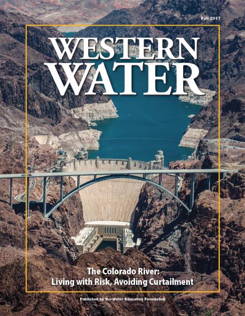
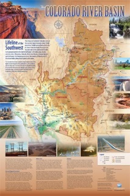
Learn the history and challenges facing the West’s most dramatic
and developed river.
The Layperson’s Guide to the Colorado River Basin introduces the
1,450-mile river that sustains 40 million people and millions of
acres of farmland spanning seven states and parts of northern
Mexico.
The 28-page primer explains how the river’s water is shared and
managed as the Southwest transitions to a hotter and drier
climate.
State health officials know that extreme heat can cost lives
and send people to the hospital, just like wildfire smoke. Now,
new research finds that when people are exposed to both hazards
simultaneously — as is increasingly the case in California —
heart and respiratory crises outpace the expected sum of
hospitalizations compared to when the conditions occur
separately. … The study joins a growing body of research
about the intersection of different climate risks. Last month,
California-based think-tank the Pacific
Institute published a report about how converging
hazards — including wildfires, drought, flooding, sea level
rise and intensifying storms — are harming access to drinking
water and sanitation in California and other parts of the
world. The deadly 2018 Camp fire in Butte
County impacted an estimated 2,438 private wells, the
report said.
After more than two decades of
drought, water utilities serving the largest urban regions in the
arid Southwest are embracing a drought-proof source of drinking
water long considered a supply of last resort: purified sewage.
Water supplies have tightened to the point that Phoenix and the
water supplier for 19 million Southern California residents are
racing to adopt an expensive technology called “direct potable
reuse” or “advanced purification” to reduce their reliance on
imported water from the dwindling Colorado River.
The climate-driven shrinking of the
Colorado River is expanding the influence of Native American
tribes over how the river’s flows are divided among cities, farms
and reservations across the Southwest.
The tribes are seeing the value of their largely unused river
water entitlements rise as the Colorado dwindles, and they are
gaining seats they’ve never had at the water bargaining table as
government agencies try to redress a legacy of exclusion.
Every five years the California Department of Water Resources
updates its strategic plan for managing the state’s water
resources, as required by state law.
The California Water Plan, or Bulletin 160, projects the
status and trends of the state’s water supplies and demands
under a range of future scenarios.
A new but little-known change in
California law designating aquifers as “natural infrastructure”
promises to unleash a flood of public funding for projects that
increase the state’s supply of groundwater.
The change is buried in a sweeping state budget-related law,
enacted in July, that also makes it easier for property owners
and water managers to divert floodwater for storage underground.
On average, more than half of
California’s developed water supply originates in the
Sierra
Nevada and the southern spur of the Cascade
Range. Our water supply is largely dependent on the health
of our Sierra forests, which are suffering from ecosystem
degradation, drought, wildfires and widespread tree
mortality.
Join us as we head into the Sierra to examine water issues
that happen upstream but have dramatic impacts downstream and
throughout the state.
The states of the Lower Colorado
River Basin have traditionally played an oversized role in
tapping the lifeline that supplies 40 million people in the West.
California, Nevada and Arizona were quicker to build major canals
and dams and negotiated a landmark deal that requires the Upper
Basin to send predictable flows through the Grand Canyon, even
during dry years.
But with the federal government threatening unprecedented water
cuts amid decades of drought and declining reservoirs, the Upper
Basin states of Wyoming, Utah, Colorado and New Mexico are
muscling up to protect their shares of an overallocated river
whose average flows in the Upper Basin have already dropped
20 percent over the last century.
They have formed new agencies to better monitor their interests,
moved influential Colorado River veterans into top negotiating
posts and improved their relationships with Native American
tribes that also hold substantial claims to the river.
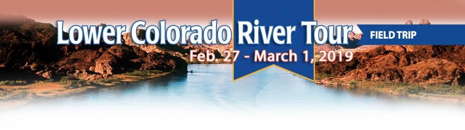
This tour explored the lower Colorado River firsthand where virtually every drop of the river is allocated, yet demand is growing from myriad sources — increasing population, declining habitat, drought and climate change.
The 1,450-mile river is a lifeline to some 40 million people in the Southwest across seven states, 30 tribal nations and Mexico. How the Lower Basin states – Arizona, California and Nevada – use and manage this water to meet agricultural, urban, environmental and industrial needs was the focus of this tour.
Hilton Garden Inn Las Vegas Strip South
7830 S Las Vegas Blvd
Las Vegas, NV 89123
This special Foundation water tour journeyed along the Eastern Sierra from the Truckee River to Mono Lake, through the Owens Valley and into the Mojave Desert to explore a major source of water for Southern California, this year’s snowpack and challenges for towns, farms and the environment.
Growing up in the shadow of the
Rocky Mountains, Andrew Schwartz never missed an opportunity to
play in – or study – a Colorado snowstorm. During major
blizzards, he would traipse out into the icy wind and heavy
drifts of snow pretending to be a scientist researching in
Antarctica.
Decades later, still armed with an obsession for extreme weather,
Schwartz has landed in one of the snowiest places in the West,
leading a research lab whose mission is to give California water
managers instant information on the depth and quality of snow
draping the slopes of the Sierra Nevada.
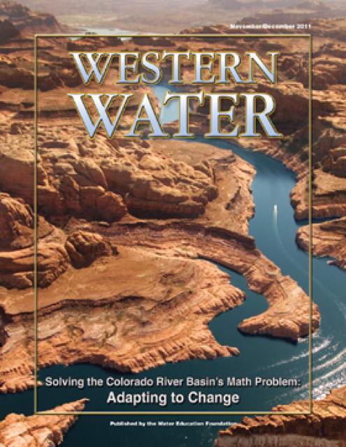
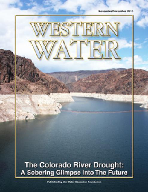
When the Colorado River Compact was
signed 100 years ago, the negotiators for seven Western states
bet that the river they were dividing would have ample water to
meet everyone’s needs – even those not seated around the table.
A century later, it’s clear the water they bet on is not there.
More than two decades of drought, lake evaporation and overuse of
water have nearly drained the river’s two anchor reservoirs, Lake
Powell on the Arizona-Utah border and Lake Mead near Las Vegas.
Climate change is rendering the basin drier, shrinking spring
runoff that’s vital for river flows, farms, tribes and cities
across the basin – and essential for refilling reservoirs.
The states that endorsed the Colorado River Compact in 1922 – and
the tribes and nation of Mexico that were excluded from the table
– are now straining to find, and perhaps more importantly accept,
solutions on a river that may offer just half of the water that
the Compact assumed would be available. And not only are
solutions not coming easily, the relationships essential for
compromise are getting more frayed.
With 25 years of experience working
on the Colorado River, Chuck Cullom is used to responding to
myriad challenges that arise on the vital lifeline that seven
states, more than two dozen tribes and the country of Mexico
depend on for water. But this summer problems on the
drought-stressed river are piling up at a dizzying pace:
Reservoirs plummeting to record low levels, whether Hoover Dam
and Glen Canyon Dam can continue to release water and produce
hydropower, unprecedented water cuts and predatory smallmouth
bass threatening native fish species in the Grand Canyon.
“Holy buckets, Batman!,” said Cullom, executive director of the
Upper Colorado River Commission. “I mean, it’s just on and on and
on.”
Managers of California’s most
overdrawn aquifers were given a monumental task under the state’s
landmark Sustainable Groundwater Management Act: Craft viable,
detailed plans on a 20-year timeline to bring their beleaguered
basins into balance. It was a task that required more than 250
newly formed local groundwater agencies – many of them in the
drought-stressed San Joaquin Valley – to set up shop, gather
data, hear from the public and collaborate with neighbors on
multiple complex plans, often covering just portions of a
groundwater basin.
Momentum is building for a unique
interstate deal that aims to transform wastewater from Southern
California homes and business into relief for the stressed
Colorado River. The collaborative effort to add resiliency to a
river suffering from overuse, drought and climate change is being
shaped across state lines by some of the West’s largest water
agencies.
This tour explored the lower Colorado River firsthand where virtually every drop of the river is allocated, yet demand is growing from myriad sources — increasing population, declining habitat, drought and climate change.
The 1,450-mile river is a lifeline to some 40 million people in the Southwest across seven states, 30 tribal nations and Mexico. How the Lower Basin states – Arizona, California and Nevada – use and manage this water to meet agricultural, urban, environmental and industrial needs was the focus of this tour.
Hyatt Place Las Vegas At Silverton Village
8380 Dean Martin Drive
Las Vegas, NV 89139
Climate scientist Brad Udall calls
himself the skunk in the room when it comes to the Colorado
River. Armed with a deck of PowerPoint slides and charts that
highlight the Colorado River’s worsening math, the Colorado State
University scientist offers a grim assessment of the river’s
future: Runoff from the river’s headwaters is declining, less
water is flowing into Lake Powell – the key reservoir near the
Arizona-Utah border – and at the same time, more water is being
released from the reservoir than it can sustainably provide.
The lower Colorado River has virtually every drop allocated, yet demand is growing from myriad sources — increasing population, declining habitat, drought and climate change.
The 1,450-mile river is a lifeline to 40 million people in the Southwest across seven states, 30 tribal nations and Mexico. How the Lower Basin states – Arizona, California and Nevada – use and manage this water to meet agricultural, urban, environmental and industrial needs was the focus of this tour.
Hyatt Place Las Vegas At Silverton Village
8380 Dean Martin Drive
Las Vegas, NV 89139
For more than 20 years, Tanya
Trujillo has been immersed in the many challenges of the Colorado
River, the drought-stressed lifeline for 40 million people from
Denver to Los Angeles and the source of irrigation water for more
than 5 million acres of winter lettuce, supermarket melons and
other crops.
Trujillo has experience working in both the Upper and Lower
Basins of the Colorado River, basins that split the river’s water
evenly but are sometimes at odds with each other. She was a
lawyer for the state of New Mexico, one of four states in the
Upper Colorado River Basin, when key operating guidelines for
sharing shortages on the river were negotiated in 2007. She later
worked as executive director for the Colorado River Board of
California, exposing her to the different perspectives and
challenges facing California and the other states in the river’s
Lower Basin.
Land and waterway managers labored
hard over the course of a century to control California’s unruly
rivers by building dams and levees to slow and contain their
water. Now, farmers, environmentalists and agencies are undoing
some of that work as part of an accelerating campaign to restore
the state’s major floodplains.
Stretching 450 miles long and up to
50 miles wide, the Sierra Nevada makes up more than a quarter of
California’s land area and forms its largest watersheds,
providing more than half of the state’s developed water supply to
residents, agriculture and other businesses.*
Water is flowing once again
to the Colorado River’s delta in Mexico, a vast region that
was once a natural splendor before the iconic Western river was
dammed and diverted at the turn of the last century, essentially
turning the delta into a desert.
In 2012, the idea emerged that water could be intentionally sent
down the river to inundate the delta floodplain and regenerate
native cottonwood and willow trees, even in an overallocated
river system. Ultimately, dedicated flows of river water were
brokered under cooperative
efforts by the U.S. and Mexican governments.
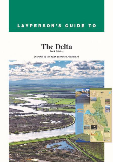
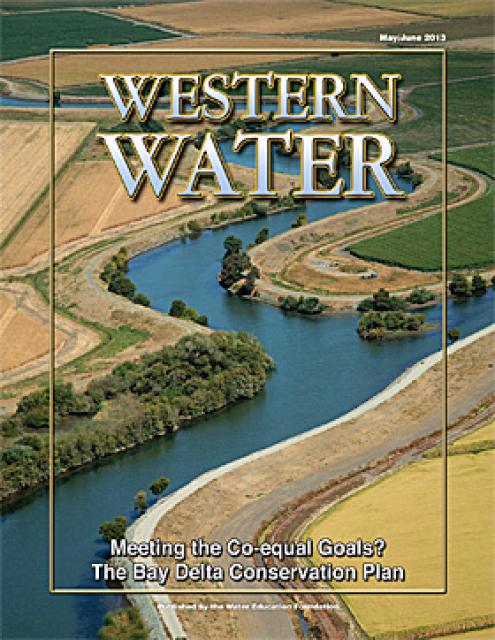
This tour guided participants on a virtual journey deep into California’s most crucial water and ecological resource – the Sacramento-San Joaquin Delta. The 720,000-acre network of islands and canals support the state’s two major water systems – the State Water Project and the Central Valley Project. The Delta and the connecting San Francisco Bay form the largest freshwater tidal estuary of its kind on the West coast.
Las Vegas, known for its searing summertime heat and glitzy casino fountains, is projected to get even hotter in the coming years as climate change intensifies. As temperatures rise, possibly as much as 10 degrees by end of the century, according to some models, water demand for the desert community is expected to spike. That is not good news in a fast-growing region that depends largely on a limited supply of water from an already drought-stressed Colorado River.
On average, more than 60 percent of
California’s developed water supply originates in the Sierra
Nevada and the southern spur of the Cascade Range. Our water
supply is largely dependent on the health of our Sierra forests,
which are suffering from ecosystem degradation, drought,
wildfires and widespread tree mortality.
This tour ventured into the Sierra to examine water issues
that happen upstream but have dramatic impacts downstream and
throughout the state.
As California’s seasons become
warmer and drier, state officials are pondering whether the water
rights permitting system needs revising to better reflect the
reality of climate change’s effect on the timing and volume of
the state’s water supply.
A report by the State Water Resources Control Board recommends
that new water rights permits be tailored to California’s
increasingly volatile hydrology and be adaptable enough to ensure
water exists to meet an applicant’s demand. And it warns
that the increasingly whiplash nature of California’s changing
climate could require existing rights holders to curtail
diversions more often and in more watersheds — or open
opportunities to grab more water in climate-induced floods.
Twenty years ago, the Colorado River
Basin’s hydrology began tumbling into a historically bad stretch.
The weather turned persistently dry. Water levels in the system’s
anchor reservoirs of Lake Powell and Lake Mead plummeted. A river
system relied upon by nearly 40 million people, farms and
ecosystems across the West was in trouble. And there was no guide
on how to respond.
Radically transformed from its ancient origin as a vast tidal-influenced freshwater marsh, the Sacramento-San Joaquin Delta ecosystem is in constant flux, influenced by factors within the estuary itself and the massive watersheds that drain though it into the Pacific Ocean.
Lately, however, scientists say the rate of change has kicked into overdrive, fueled in part by climate change, and is limiting the ability of science and Delta water managers to keep up. The rapid pace of upheaval demands a new way of conducting science and managing water in the troubled estuary.
Practically every drop of water that flows through the meadows, canyons and plains of the Colorado River Basin has reams of science attached to it. Snowpack, streamflow and tree ring data all influence the crucial decisions that guide water management of the iconic Western river every day.
Dizzying in its scope, detail and complexity, the scientific information on the Basin’s climate and hydrology has been largely scattered in hundreds of studies and reports. Some studies may conflict with others, or at least appear to. That’s problematic for a river that’s a lifeline for 40 million people and more than 4 million acres of irrigated farmland.
Sprawled across a desert expanse
along the Utah-Arizona border, Lake Powell’s nearly 100-foot high
bathtub ring etched on its sandstone walls belie the challenges
of a major Colorado River reservoir at less than half-full. How
those challenges play out as demand grows for the river’s water
amid a changing climate is fueling simmering questions about
Powell’s future.
This event explored the lower Colorado River where virtually every drop of the river is allocated, yet demand is growing from myriad sources — increasing population, declining habitat, drought and climate change.
The 1,450-mile river is a lifeline to 40 million people in the Southwest across seven states and Mexico. How the Lower Basin states – Arizona, California and Nevada – use and manage this water to meet agricultural, urban, environmental and industrial needs was the focus of this tour.
The islands of the western
Sacramento-San Joaquin Delta are sinking as the rich peat soil
that attracted generations of farmers dries out and decays. As
the peat decomposes, it releases tons of carbon dioxide – a
greenhouse gas – into the atmosphere. As the islands sink, the
levees that protect them are at increasing risk of failure, which
could imperil California’s vital water conveyance system.
An ambitious plan now in the works could halt the decay,
sequester the carbon and potentially reverse the sinking.
Shortly after taking office in 2019,
Gov. Gavin Newsom called on state agencies to deliver a Water
Resilience Portfolio to meet California’s urgent challenges —
unsafe drinking water, flood and drought risks from a changing
climate, severely depleted groundwater aquifers and native fish
populations threatened with extinction.
Within days, he appointed Nancy Vogel, a former journalist and
veteran water communicator, as director of the Governor’s Water
Portfolio Program to help shepherd the monumental task of
compiling all the information necessary for the portfolio. The
three state agencies tasked with preparing the document delivered
the draft Water Resilience Portfolio Jan. 3. The document, which
Vogel said will help guide policy and investment decisions
related to water resilience, is nearing the end of its comment
period, which goes through Friday, Feb. 7.
The Colorado River is arguably one
of the hardest working rivers on the planet, supplying water to
40 million people and a large agricultural economy in the West.
But it’s under duress from two decades of drought and decisions
made about its management will have exceptional ramifications for
the future, especially as impacts from climate change are felt.
Many of California’s watersheds are
notoriously flashy – swerving from below-average flows to jarring
flood conditions in quick order. The state needs all the water it
can get from storms, but current flood management guidelines are
strict and unyielding, requiring reservoirs to dump water each
winter to make space for flood flows that may not come.
However, new tools and operating methods are emerging that could
lead the way to a redefined system that improves both water
supply and flood protection capabilities.
It’s been a year since two devastating wildfires on opposite ends
of California underscored the harsh new realities facing water
districts and cities serving communities in or adjacent to the
state’s fire-prone wildlands. Fire doesn’t just level homes, it
can contaminate water, scorch watersheds, damage delivery systems
and upend an agency’s finances.
California is chock full of rivers and creeks, yet the state’s network of stream gauges has significant gaps that limit real-time tracking of how much water is flowing downstream, information that is vital for flood protection, forecasting water supplies and knowing what the future might bring.
That network of stream gauges got a big boost Sept. 30 with the signing of SB 19. Authored by Sen. Bill Dodd (D-Napa), the law requires the state to develop a stream gauge deployment plan, focusing on reactivating existing gauges that have been offline for lack of funding and other reasons. Nearly half of California’s stream gauges are dormant.
The Colorado River Basin’s 20 years
of drought and the dramatic decline in water levels at the
river’s key reservoirs have pressed water managers to adapt to
challenging conditions. But even more extreme — albeit rare —
droughts or floods that could overwhelm water managers may lie
ahead in the Basin as the effects of climate change take hold,
say a group of scientists. They argue that stakeholders who are
preparing to rewrite the operating rules of the river should plan
now for how to handle these so-called “black swan” events so
they’re not blindsided.
The majestic beauty of the Sierra
Nevada forest is awe-inspiring, but beneath the dazzling blue
sky, there is a problem: A century of fire suppression and
logging practices have left trees too close together. Millions of
trees have died, stricken by drought and beetle infestation.
Combined with a forest floor cluttered with dry brush and debris,
it’s a wildfire waiting to happen.
Fires devastate the Sierra watersheds upon which millions of
Californians depend — scorching the ground, unleashing a
battering ram of debris and turning hillsides into gelatinous,
stream-choking mudflows.
Even as stakeholders in the Colorado River Basin celebrate the recent completion of an unprecedented drought plan intended to stave off a crashing Lake Mead, there is little time to rest. An even larger hurdle lies ahead as they prepare to hammer out the next set of rules that could vastly reshape the river’s future.
Set to expire in 2026, the current guidelines for water deliveries and shortage sharing, launched in 2007 amid a multiyear drought, were designed to prevent disputes that could provoke conflict.
One of California Gov. Gavin
Newsom’s first actions after taking office was to appoint Wade
Crowfoot as Natural Resources Agency secretary. Then, within
weeks, the governor laid out an ambitious water agenda that
Crowfoot, 45, is now charged with executing.
That agenda includes the governor’s desire for a “fresh approach”
on water, scaling back the conveyance plan in the Sacramento-San
Joaquin Delta and calling for more water recycling, expanded
floodplains in the Central Valley and more groundwater recharge.
This tour explored the lower Colorado River where virtually every drop of the river is allocated, yet demand is growing from myriad sources — increasing population, declining habitat, drought and climate change.
The 1,450-mile river is a lifeline to 40 million people in the Southwest across seven states and Mexico. How the Lower Basin states – Arizona, California and Nevada – use and manage this water to meet agricultural, urban, environmental and industrial needs is the focus of this tour.
Silverton Hotel
3333 Blue Diamond Road
Las Vegas, NV 89139
Although Santa Monica may be the most aggressive Southern California water provider to wean itself from imported supplies, it is hardly the only one looking to remake its water portfolio.
In Los Angeles, a city of about 4 million people, efforts are underway to dramatically slash purchases of imported water while boosting the amount from recycling, stormwater capture, groundwater cleanup and conservation. Mayor Eric Garcetti in 2014 announced a plan to reduce the city’s purchase of imported water from Metropolitan Water District by one-half by 2025 and to provide one-half of the city’s supply from local sources by 2035. (The city considers its Eastern Sierra supplies as imported water.)
Imported water from the Sierra
Nevada and the Colorado River built Southern California. Yet as
drought, climate change and environmental concerns render those
supplies increasingly at risk, the Southland’s cities have ramped
up their efforts to rely more on local sources and less on
imported water.
Far and away the most ambitious goal has been set by the city of
Santa Monica, which in 2014 embarked on a course to be virtually
water independent through local sources by 2023. In the 1990s,
Santa Monica was completely dependent on imported water. Now, it
derives more than 70 percent of its water locally.
The growing leadership of women in water. The Colorado River’s persistent drought and efforts to sign off on a plan to avert worse shortfalls of water from the river. And in California’s Central Valley, promising solutions to vexing water resource challenges.
These were among the topics that Western Water news explored in 2018.
We’re already planning a full slate of stories for 2019. You can sign up here to be alerted when new stories are published. In the meantime, take a look at what we dove into in 2018:
As stakeholders labor to nail down
effective and durable drought contingency plans for the Colorado
River Basin, they face a stark reality: Scientific research is
increasingly pointing to even drier, more challenging times
ahead.
The latest sobering assessment landed the day after Thanksgiving,
when U.S. Global Change Research Program’s Fourth National Climate
Assessment concluded that Earth’s climate is changing rapidly
compared to the pace of natural variations that have occurred
throughout its history, with greenhouse gas emissions largely the
cause.
In the universe of California water, Tim Quinn is a professor emeritus. Quinn has seen — and been a key player in — a lot of major California water issues since he began his water career 40 years ago as a young economist with the Rand Corporation, then later as deputy general manager with the Metropolitan Water District of Southern California, and finally as executive director of the Association of California Water Agencies. In December, the 66-year-old will retire from ACWA.
Just because El Niño may be lurking
off in the tropical Pacific, does that really offer much of a
clue about what kind of rainy season California can expect in
Water Year 2019?
Will a river of storms pound the state, swelling streams and
packing the mountains with deep layers of heavy snow much like
the exceptionally wet 2017 Water Year (Oct. 1, 2016 to Sept. 30,
2017)? Or will this winter sputter along like last winter,
leaving California with a second dry year and the possibility of
another potential drought? What can reliably be said about the
prospects for Water Year 2019?
At Water Year
2019: Feast or Famine?, a one-day event on Dec. 5 in Irvine,
water managers and anyone else interested in this topic will
learn about what is and isn’t known about forecasting
California’s winter precipitation weeks to months ahead, the
skill of present forecasts and ongoing research to develop
predictive ability.
There’s going to be a new governor
in California next year – and a host of challenges both old and
new involving the state’s most vital natural resource, water.
So what should be the next governor’s water priorities?
That was one of the questions put to more than 150 participants
during a wrap-up session at the end of the Water Education
Foundation’s Sept. 20 Water Summit in Sacramento.
Amy Haas recently became the first non-engineer and the first woman to serve as executive director of the Upper Colorado River Commission in its 70-year history, putting her smack in the center of a host of daunting challenges facing the Upper Colorado River Basin.
Yet those challenges will be quite familiar to Haas, an attorney who for the past year has served as deputy director and general counsel of the commission. (She replaced longtime Executive Director Don Ostler). She has a long history of working within interstate Colorado River governance, including representing New Mexico as its Upper Colorado River commissioner and playing a central role in the negotiation of the recently signed U.S.-Mexico agreement known as Minute 323.
Sixty percent of California’s developed water supply
originates high in the Sierra Nevada mountains. Our water
supply is largely dependent on the health of our Sierra forests,
which are suffering from ecosystem degradation, drought,
wildfires and widespread tree mortality.
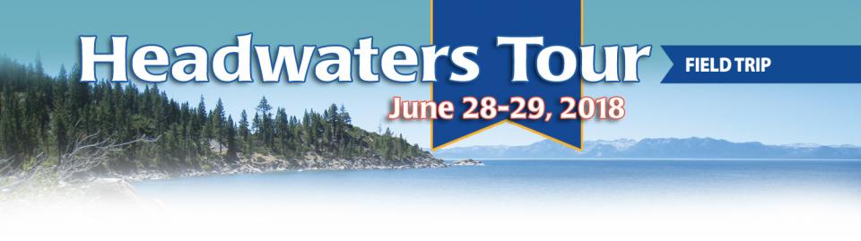
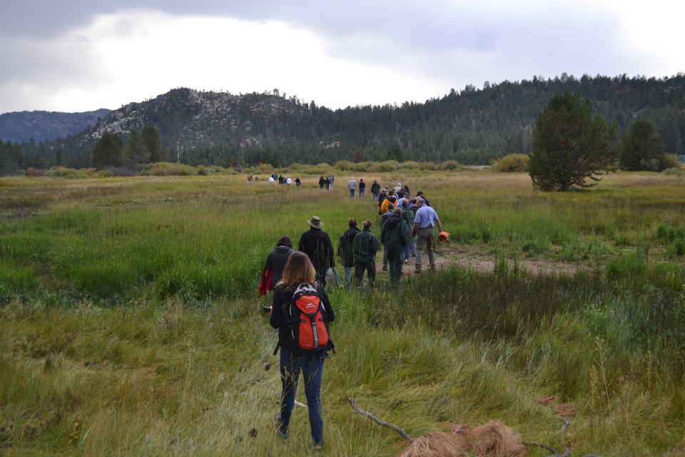
We headed into the foothills and the mountains to examine
water issues that happen upstream but have dramatic impacts
downstream and throughout the state.
GEI (Tour Starting Point)
2868 Prospect Park Dr.
Rancho Cordova, CA 95670.
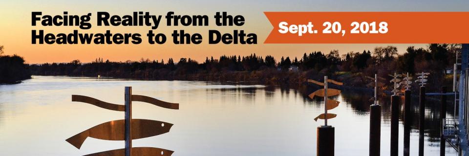
Our annual Water Summit, being held Sept. 20, will
feature critical conversations about water in California and
the West revolving around the theme: Facing
Reality from the Headwaters to the
Delta.
As debate continues to swirl around longer-term remedies for
California’s water challenges, the theme reflects the need for
straightforward dialogue about more immediate, on-the-ground
solutions.
Nowhere is the domino effect in
Western water policy played out more than on the Colorado River,
and specifically when it involves the Lower Basin states of
California, Nevada and Arizona. We are seeing that play out now
as the three states strive to forge a Drought Contingency Plan.
Yet that plan can’t be finalized until Arizona finds a unifying
voice between its major water players, an effort you can read
more about in the latest in-depth article of Western Water.
Even then, there are some issues to resolve just within
California.
Brenda Burman, commissioner of the
U.S. Bureau of Reclamation, will give the keynote lunch address
at our 35th annual conference, the Water
Summit, to be held Sept. 20 in Sacramento.
The daylong event will feature critical conversations about water
in California and the West revolving around the
theme: Facing Reality from the Headwaters to the
Delta.
We explored the lower Colorado River where virtually every drop
of the river is allocated, yet demand is growing from myriad
sources — increasing population, declining habitat, drought and
climate change.
The 1,450-mile river is a lifeline to 40 million people in
the Southwest across seven states and Mexico. How the Lower Basin
states – Arizona, California and Nevada – use and manage this
water to meet agricultural, urban, environmental and industrial
needs was the focus of this tour.
Hampton Inn Tropicana
4975 Dean Martin Drive, Las Vegas, NV 89118
Learn what new tree-ring studies in
Southern California watersheds reveal about drought, hear about
efforts to improve subseasonal to seasonal weather forecasting
and get the latest on climate change impacts that will alter
drought vulnerability in the future.
At our Paleo
Drought Workshop on April 19th in San Pedro, you will hear
from experts at NASA Jet Propulsion Laboratory, University of
Arizona and California Department of Water Resources.
Dramatic swings in weather patterns
over the past few years in California are stark reminders of
climate variability and regional vulnerability. Alternating years
of drought and intense rain events make long-term planning for
storing and distributing water a challenging task.
Current weather forecasting capabilities provide details for
short time horizons. Attend the Paleo Drought
Workshop in San Pedro on April 19 to learn more about
research efforts to improve sub-seasonal to seasonal
precipitation forecasting, known as S2S, and how those models
could provide more useful weather scenarios for resource
managers.
California’s 2012-2016 drought
revealed vulnerabilities for water users throughout the state,
and the long-term record suggests more challenges may lie ahead.
An April 19
workshop in San Pedro will highlight new information about
drought durations in Southern California watersheds dating
back centuries.
Every day, people flock to Daniel
Swain’s social media platforms to find out the latest news and
insight about California’s notoriously unpredictable weather.
Swain, a climate scientist at the Institute of the
Environment and Sustainability at UCLA, famously coined the
term “Ridiculously Resilient Ridge” in December 2013 to describe
the large, formidable high-pressure mass that was parked over the
West Coast during winter and diverted storms away from
California, intensifying the drought.
Swain’s research focuses on atmospheric processes that cause
droughts and floods, along with the changing character of extreme
weather events in a warming world. A lifelong Californian and
alumnus of University of California, Davis, and Stanford
University, Swain is best known for the widely read Weather West blog, which provides
unique perspectives on weather and climate in California and the
western United States. In a recent interview with Western
Water, he talked about the Ridiculously Resilient Ridge, its
potential long-term impact on California weather, and what may
lie ahead for the state’s water supply.
Sixty percent of California’s developed water supply
originates high in the Sierra Nevada mountains. Our water
supply is largely dependent on the health of our Sierra forests,
which are suffering from ecosystem degradation, drought,
wildfires and widespread tree mortality.
This three-day, two-night tour explored the lower Colorado River
where virtually every drop of the river is allocated, yet demand
is growing from myriad sources — increasing population,
declining habitat, drought and climate change.
The 1,450-mile river is a lifeline to 40 million people in
the Southwest across seven states and Mexico. How the Lower Basin
states – Arizona, California and Nevada – use and manage this
water to meet agricultural, urban, environmental and industrial
needs is the focus of this tour.
Best Western McCarran Inn
4970 Paradise Road
Las Vegas, NV 89119
Evidence shows that climate change is affecting California with
warmer temperatures, less snowfall and more extreme weather
events. This guide explains the causes of climate change, the
effects on water resources and efforts underway to better adapt
to a changing climate. It includes information on both California
water and the water of the Colorado River Basin, a widely shared
resource throughout the Southwest.
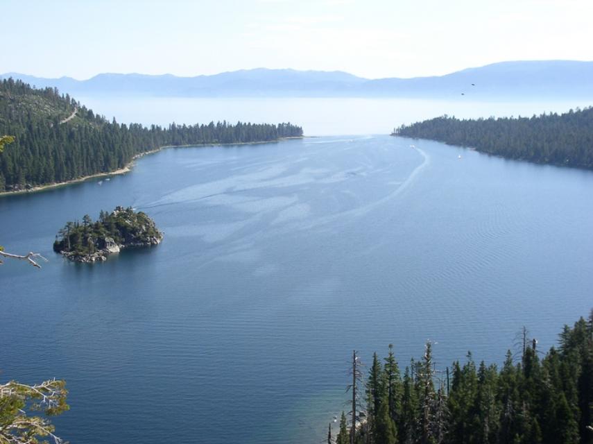
Lake Tahoe is one of the world’s most beautiful yet vulnerable
lakes. Renowned for its remarkable clarity, Tahoe straddles the
Nevada-California border, stretching 22 miles long and 12 miles
wide in a granitic bowl high in the Sierra Nevada.
Tahoe sits 6,225 feet above sea level. Its deepest point is 1,645
feet, making it the second-deepest lake in the nation, after
Oregon’s Crater Lake, and the tenth deepest in the world.
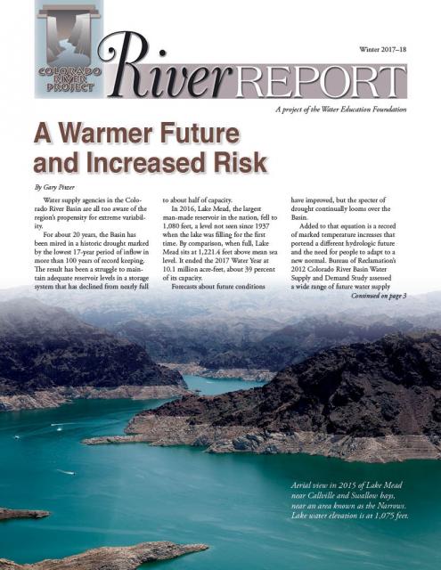
Drought and climate change are having a noticeable impact on the
Colorado River Basin, and that is posing potential challenges to
those in the Southwestern United States and Mexico who rely on
the river.
In the just-released Winter 2017-18 edition of River
Report, writer Gary Pitzer examines what scientists
project will be the impact of climate change on the Colorado
River Basin, and how water managers are preparing for a future of
increasing scarcity.
Rising temperatures from climate change are having a noticeable
effect on how much water is flowing down the Colorado River. Read
the latest River Report to learn more about what’s
happening, and how water managers are responding.
This issue of Western Water discusses the challenges
facing the Colorado River Basin resulting from persistent
drought, climate change and an overallocated river, and how water
managers and others are trying to face the future.
The atmospheric condition at any given time or place, measured by
wind, temperature, humidity, atmospheric pressure, cloudiness and
precipitation. Weather changes from hour to hour, day to day, and
season to season. Climate in a narrow sense is usually defined as
the average weather, during a period of time ranging from months
to thousands or millions of years.
Variations in the statistical analysis of the climate on all time
and space scales beyond that of individual weather events is
known as natural variability. Natural variations in climate over
time are caused by internal processes of the climate system, such
as El Niño, and
phenomena such as volcanic activity and variations in the output
of the sun.
California agriculture is going to have to learn to live with the
impacts of climate change and work toward reducing its
contributions of greenhouse gas emissions, a Yolo County walnut
grower said at the Jan. 26 California Climate Change Symposium in
Sacramento.
“I don’t believe we are going to be able to adapt our way out of
climate change,” said Russ Lester, co-owner of Dixon Ridge Farms
in Winters. “We need to mitigate for it. It won’t solve the
problem but it can slow it down.”
California had its warmest winter on record in 2014-2015, with
the average Sierra Nevada temperature hovering above 32 degrees
Fahrenheit – the highest in 120 years. Thus, where California
relies on snow to fall in the mountains and create a snowpack
that can slowly melt into reservoirs, it was instead raining.
That left the state’s snowpack at its lowest ever – 5 percent on
April 1, 2015.
Because he relays stats like these, climate scientist Brad Udall
says he doesn’t often get invited back to speak before the same
audience about climate change.
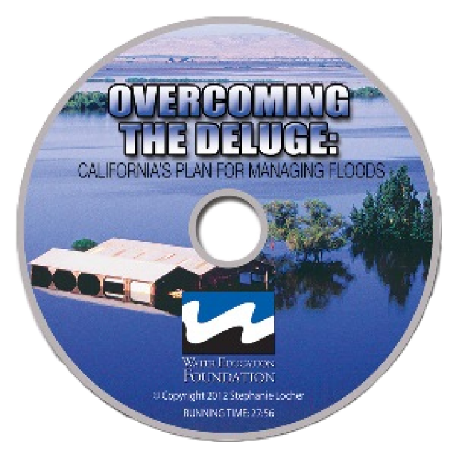
This 30-minute documentary, produced in 2011, explores the past,
present and future of flood management in California’s Central
Valley. It features stories from residents who have experienced
the devastating effects of a California flood firsthand.
Interviews with long-time Central Valley water experts from
California Department of Water Resources (FloodSAFE), U.S. Army
Corps of Engineers, Bureau of Reclamation, Central Valley Flood
Management Program and environmental groups are featured as they
discuss current efforts to improve the state’s 150-year old flood
protection system and develop a sustainable, integrated, holistic
flood management plan for the Central Valley.
This 25-minute documentary-style DVD, developed in partnership
with the California Department of Water Resources, provides an
excellent overview of climate change and how it is already
affecting California. The DVD also explains what scientists
anticipate in the future related to sea level rise and
precipitation/runoff changes and explores the efforts that are
underway to plan and adapt to climate.
20-minute DVD that explains the problem with polluted stormwater,
and steps that can be taken to help prevent such pollution and
turn what is often viewed as a “nuisance” into a water resource
through various activities.
Water truly has shaped California into the great state it is
today. And if it is water that made California great, it’s the
fight over – and with – water that also makes it so critically
important. In efforts to remap California’s circulatory system,
there have been some critical events that had a profound impact
on California’s water history. These turning points not only
forced a re-evaluation of water, but continue to impact the lives
of every Californian. This 2005 PBS documentary offers a
historical and current look at the major water issues that shaped
the state we know today. Includes a 12-page viewer’s guide with
background information, historic timeline and a teacher’s lesson.
Water as a renewable resource is depicted in this 18×24 inch
poster. Water is renewed again and again by the natural
hydrologic cycle where water evaporates, transpires from plants,
rises to form clouds, and returns to the earth as precipitation.
Excellent for elementary school classroom use.
Redesigned in 2017, this beautiful map depicts the seven
Western states that share the Colorado River with Mexico. The
Colorado River supplies water to nearly 40 million people in
Arizona, California, Colorado, Nevada, New Mexico, Utah, Wyoming
and Mexico. Text on this beautiful, 24×36-inch map, which is
suitable for framing, explains the river’s apportionment, history
and the need to adapt its management for urban growth and
expected climate change impacts.
The 28-page Layperson’s Guide to Water Rights Law, recognized as
the most thorough explanation of California water rights law
available to non-lawyers, traces the authority for water flowing
in a stream or reservoir, from a faucet or into an irrigation
ditch through the complex web of California water rights.
The 24-page Layperson’s Guide to the State Water Project provides
an overview of the California-funded and constructed State Water
Project.
The State Water Project is best known for the 444-mile-long
aqueduct that provides water from the Delta to San Joaquin Valley
agriculture and southern California cities. The guide contains
information about the project’s history and facilities.
The 24-page Layperson’s Guide to Integrated Regional Water
Management (IRWM) is an in-depth, easy-to-understand publication
that provides background information on the principles of IRWM,
its funding history and how it differs from the traditional water
management approach.
The 24-page Layperson’s Guide to the Central Valley Project
explores the history and development of the federal Central
Valley Project (CVP), California’s largest surface water delivery
system. In addition to the project’s history, the guide describes
the various CVP facilities, CVP operations, the benefits the CVP
brought to the state and the CVP Improvement Act (CVPIA).
The 24-page Layperson’s Guide to the Delta explores the competing
uses and demands on California’s Sacramento-San Joaquin Delta.
Included in the guide are sections on the history of the Delta,
its role in the state’s water system, and its many complex issues
with sections on water quality, levees, salinity and agricultural
drainage, fish and wildlife, and water distribution.
Climate change involves natural and man-made changes to weather
patterns that occur over millions of years or over multiple
decades.
In the past 150 years, human industrial activity has accelerated
the rate of change in the climate due to the increase in
greenhouse gases (carbon dioxide, methane and nitrous oxide,
among others). Scientific studies describing this climate change
continue to be produced and its expected impacts continue to be
assessed.
This printed issue of Western Water looks at California
groundwater and whether its sustainability can be assured by
local, regional and state management. For more background
information on groundwater please refer to the Foundation’s
Layperson’s Guide to Groundwater.
This printed issue of Western Water This issue of Western Water
looks at climate change through the lens of some of the latest
scientific research and responses from experts regarding
mitigation and adaptation.
This issue of Western Water looks at the BDCP and the
Coalition to Support Delta Projects, issues that are aimed at
improving the health and safety of the Delta while solidifying
California’s long-term water supply reliability.
This printed issue of Western Water features a
roundtable discussion with Anthony Saracino, a water resources
consultant; Martha Davis, executive manager of policy development
with the Inland Empire Utilities Agency and senior policy advisor
to the Delta Stewardship Council; Stuart Leavenworth, editorial
page editor of The Sacramento Bee and Ellen Hanak, co-director of
research and senior fellow at the Public Policy Institute of
California.
This printed issue of Western Water examines the issues
associated with the State Water Board’s proposed revision of the
water quality Bay-Delta Plan, most notably the question of
whether additional flows are needed for the system, and how they
might be provided.
This printed issue of Western Water explores the
historic nature of some of the key agreements in recent years,
future challenges, and what leading state representatives
identify as potential “worst-case scenarios.” Much of the content
for this issue of Western Water came from the in-depth
panel discussions at the Colorado River Symposium. The Foundation
will publish the full proceedings of the Symposium in 2012.
This printed issue of Western Water examines the
Colorado River drought, and the ongoing institutional and
operational changes underway to maintain the system and meet the
future challenges in the Colorado River Basin.
This printed issue of Western Water looks at the energy
requirements associated with water use and the means by which
state and local agencies are working to increase their knowledge
and improve the management of both resources.
This printed copy of Western Water examines climate change –
what’s known about it, the remaining uncertainty and what steps
water agencies are talking to prepare for its impact. Much of the
information comes from the October 2007 California Climate Change
and Water Adaptation Summit sponsored by the Water Education
Foundation and DWR and the November 2007 California Water Policy
Conference sponsored by Public Officials for Water and
Environmental Reform.
Perhaps no other issue has rocketed to prominence in such a short
time as climate change. A decade ago, discussion about greenhouse
gas (GHG) emissions and the connection to warming temperatures
was but a fraction of the attention now given to the issue. From
the United Nations to local communities, people are talking about
climate change – its characteristics and what steps need to be
taken to mitigate and adapt to the anticipated impacts.
This issue of Western Water looks at climate change and
its implications on water management in a region that is wholly
dependent on steady, predictable wet seasons to recharge supplies
for the lengthy dry periods. To what degree has climate change
occurred and what are the scenarios under which impacts will have
to be considered by water providers? The future is anything but
clear.
The inimitable Yogi Berra once proclaimed, “The future ain’t what
it used to be.” While the Hall of Fame baseball player was not
referring to the weather, his words are no less prophetic when it
comes to the discussion of a changing climate and its potential
impacts on water resources in the West.


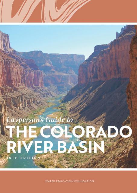


 and other tributaries of the upper Colorado River have declined dramatically and contributed to the precipitous declines of Lake Powell and Lake Mead. (Source: The Water Desk)")


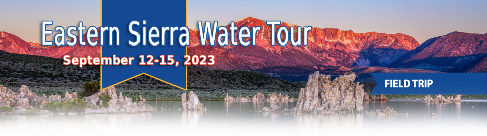
")
")
")
")
")
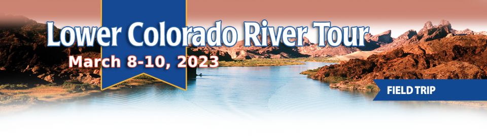
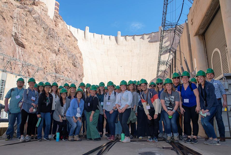
")

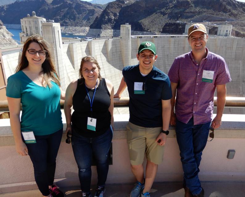
")
")

")
")

")
")
")
")
")
")
")
")
")
")
 and temperature. This gauge near downtown Sacramento measures water depth. (Source: California Department of Water Resources)")
")
")
")
")
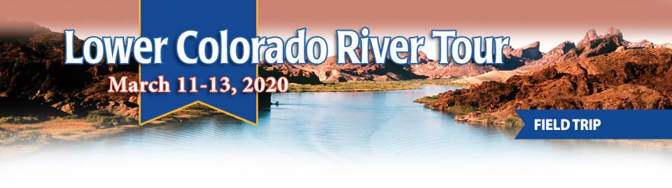
")
 treats dry weather urban runoff to remove pollutants such as sediment, oil, grease, and pathogens for nonpotable use. (Image: City of Santa Monica)")
: Karla Nemeth, director, California Department of Water Resources; Gloria Gray, chair, Metropolitan Water District of Southern California; Brenda Burman, Bureau of Reclamation Commissioner; Jayne Harkins, commissioner, International Boundary and Water Commission, U.S. and Mexico; Amy Haas, executive director, Upper Colorado River Commission.")
")
")
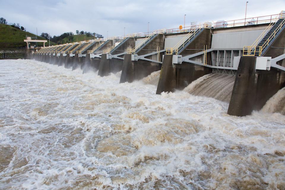
")
")