Hydroelectric power is generated by the ability to turn falling
water into electricity and in California accounts for about 15
percent of the state’s power supply annually.
Last year, U.S. hydropower electricity generation fell to
its lowest since 2001. This year, we expect hydropower to
increase 6% and account for 250 billion kilowatthours of
electricity generation in the power sector, based on forecasts
in our Short-Term Energy Outlook (STEO). We expect
hydropower to increase in nearly every part of the country,
with notable increases in the Southeast and in the Northwest
and Rockies. We expect other regions with significant
hydropower generation to either increase slightly, such as in
New York, or remain about the same, such as in California.
The U.S. has a long record of extracting resources on Native
lands and ignoring tribal opposition, but a decision by federal
energy regulators to deny permits for seven proposed hydropower
projects suggests that tide may be turning. As the U.S. shifts
from fossil fuels to clean energy, developers are looking for
sites to generate electricity from renewable sources. But in an
unexpected move, the Federal Energy Regulatory Commission
denied permits on Feb. 15, 2024, for seven proposed hydropower
projects in Arizona and New Mexico. The reason: These projects
were located within the Navajo Nation and were proposed without
first consulting with the tribe. FERC said it was “establishing
a new policy that the Commission will not issue preliminary
permits for projects proposing to use Tribal lands if the Tribe
on whose lands the project is to be located opposes the
permit.” -Written by Emily Benton Hite, Assistant
Professor of Sociology and Anthropology, Saint Louis
University; and Denielle Perry Associate, Professor
at the School of Earth and Sustainability, Northern
Arizona University.
… This year Western Slope leaders, led by the Colorado River
District, struck a $99 million deal to buy a tiny hydro plant’s
water rights from Xcel Energy and lease the water back to Xcel
to generate electricity. As part of the deal, Shoshone’s rights
would become the largest, most influential environmental water
right in state history. The change would protect fish and
habitat, but it would also beef up water security on the
Western Slope by protecting reliable westward flows for farmers
and tourist economies. … The Colorado River District’s
plan has drawn hawk-eyed attention from water players around
the state who are keen on protecting their supplies.
The Bureau of Reclamation announced Monday that recently
uncovered damage to the Glen Canyon Dam will require it to
reduce flows through portions of the structure as it looks to
repair the site and prevent future problems at one of the
nation’s major reservoirs. Wayne Pullan, the Bureau of
Reclamation’s Upper Colorado Basin regional director, said that
the agency — which is responsible for delivering water to
Arizona, California and Nevada — is investigating damage to the
lowest level of pipes at the dam, four structures known as the
“River Outlet Works.” “In nearly 60 years of operation in Glen
Canyon Dam, we didn’t need to address the issues that we’re
facing now,” Pullan said in a news conference. “We didn’t need
to consider the possible sustained operation of the River
Outlet Works at low elevations.”
Hydropower generated for electricity from Oregon and Washington
dams fell to historically low levels last year, and experts
expect it could drop further by year’s end. Officials at the
U.S. Energy Information Administration recently published data
showing that hydropower generation in the Northwest between
Oct. 1, 2022 and Sept. 30, 2023 dropped to a 22-year
low. … Across the West, hydropower generation in
2022 and 2023 was down 11% from 2021, according to the data.
California was an outlier, doubling the amount of hydropower
generated due to record rainfall and snowpack.
Two letters filed with the Federal Energy Regulatory Commission
(FERC) reveal details of the damage at PG&E’s Lake
Spaulding Powerhouse No. 1, which is out of service since early
March. The failure of the powerhouse, combined with a massive
rockslide over the PG&E-owned starting portion of the South
Yuba Canal, have effectively cut off water supplies from the
higher elevations to the Bear River and Deer Creek. The State
Historic Preservation Officer’s letter to FERC provides
additional information on the damage discovered by PG&E.
The Eel Russian Project Authority convened its second Board
meeting on March 19, 2024, addressing the debate surrounding
the fate of Scott Dam and the future of water diversion along
the Russian River. Held at the Board of Supervisors Chambers in
Ukiah on March 19, the meeting saw arguments from residents and
stakeholders, highlighting deep divisions over whether to
preserve the dam or pursue alternative solutions. Amidst calls
for preserving water storage and concerns over the impact on
fisheries, the Board ultimately voted to advance alternative
E-2, the Pumping Station, signaling a pivotal moment in the
ongoing saga of water management in the region. … Still
to be discussed are: the amount and timing of diverted water
from the planned facility, sediment transport modeling, water
allocation and water rights.
… Over the next several years, Pacific Gas and Electric Co.,
the current owner of the Potter Valley Project, is planning to
retire the hydroelectric plant and remove two dams on the Eel
River that provide water for the facility. With power
production shut down, tunneling water into the Russian River
won’t be necessary. … The Potter Valley Project provides a
portion of the water supply for large swaths of Mendocino and
Sonoma counties. … Scores of vineyards here are tethered
to water rights that are subject to restriction when river
levels drop. During the recent drought, hundreds of
water-rights holders were forced to stop pumping — a
scenario many believe was a preview of a future where the Eel
River doesn’t continue to supplement the Russian.
In 2023, PG&E announced its plans to remove both Scott and
Cape Horn dams on the Eel River as part of its license
surrender and decommissioning of the Potter Valley Project.
CalTrout has long advocated for removing both dams to improve
salmon and steelhead populations in the Eel River by
reconnecting the cold, perennial streams in the headwaters
behind the dams. CalTrout has also been working with water
users in the Russian River basin seeking to maintain the water
supplied by a transbasin diversion tunnel. On Tuesday, March
19, 2023, partners and stakeholders met to select a design
alternative for a potential future diversion from the Eel River
to the Russian River that balances both needs of water users
and fish.
The rain and snow that have drenched California and much of the
American West over the last few months — at least relative to
some of the hellishly dry years we’ve gotten recently — are a
blessing not just for water supplies, but for energy. Or maybe
they’re a curse (for energy, not for water). It depends on whom
you ask. Much of the electricity powering our lights and
refrigerators and cellphones comes from rivers, their once
free-flowing waters backing up behind dams and trickling
through hydropower turbines.
NID released a notice informing the public of cuts to the Bear
River water flows yesterday afternoon. The district cited
“unexpected maintenance work in the headwaters” in their
release. We can now confirm a shutdown of PG&E’s Spaulding
#1 powerhouse is the cause of what could be a prolonged outage
in water flows. According to a PG&E
spokesperson: During a routine inspection at PG&E’s
Spaulding 1 powerhouse on March 6, a leak was discovered
adjacent to a pressure relief valve. On March 7 a more detailed
inspection was made of the PRV [pressure relief valve] and
PG&E determined that repairs would need to be made before
the powerhouse could be returned to service. The estimated
return to service date is April 30.
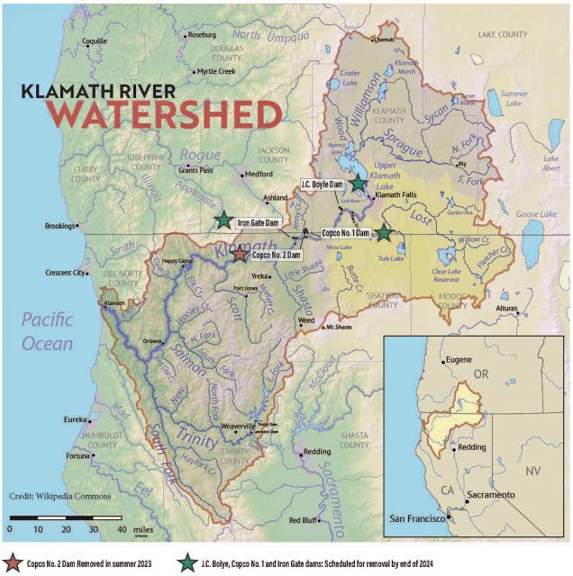
The Klamath River Basin was once one
of the world’s most ecologically magnificent regions, a watershed
teeming with salmon, migratory birds and wildlife that thrived
alongside Native American communities. The river flowed rapidly
from its headwaters in southern Oregon’s high deserts into Upper
Klamath Lake, collected snowmelt along a narrow gorge through the
Cascades, then raced downhill to the California coast in a misty,
redwood-lined finish.
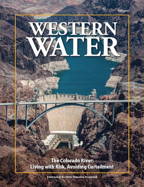
The states of the Lower Colorado
River Basin have traditionally played an oversized role in
tapping the lifeline that supplies 40 million people in the West.
California, Nevada and Arizona were quicker to build major canals
and dams and negotiated a landmark deal that requires the Upper
Basin to send predictable flows through the Grand Canyon, even
during dry years.
But with the federal government threatening unprecedented water
cuts amid decades of drought and declining reservoirs, the Upper
Basin states of Wyoming, Utah, Colorado and New Mexico are
muscling up to protect their shares of an overallocated river
whose average flows in the Upper Basin have already dropped
20 percent over the last century.
They have formed new agencies to better monitor their interests,
moved influential Colorado River veterans into top negotiating
posts and improved their relationships with Native American
tribes that also hold substantial claims to the river.
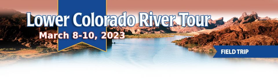
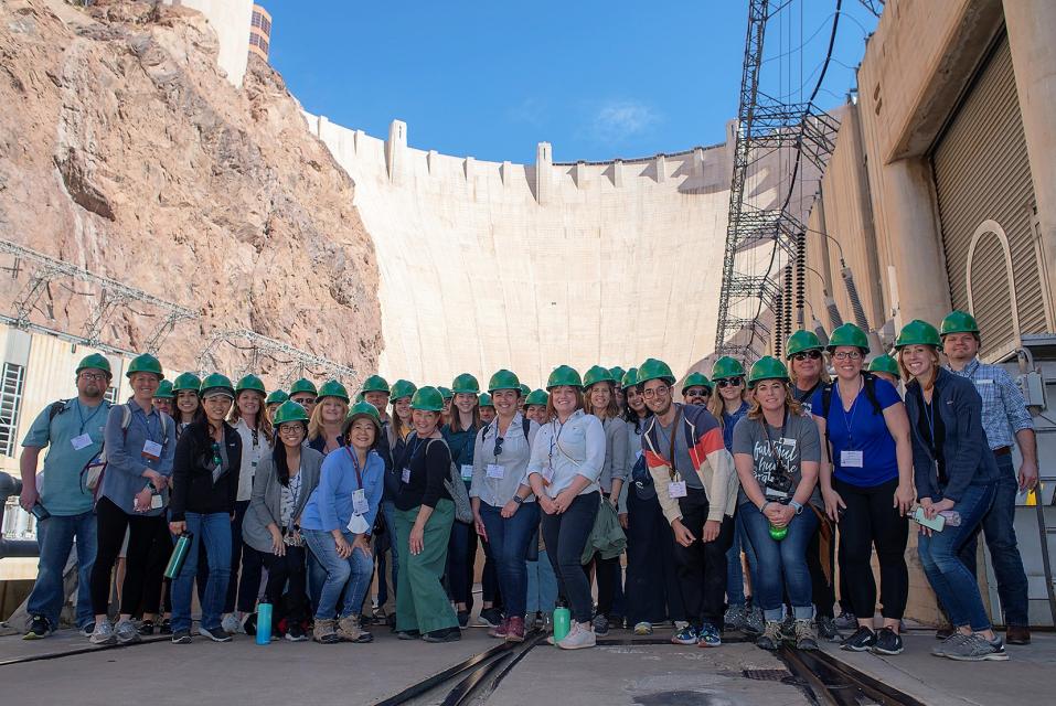
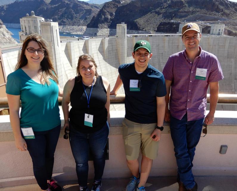
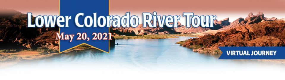
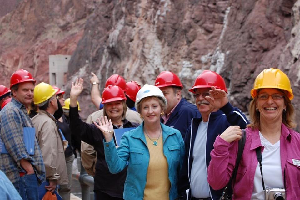
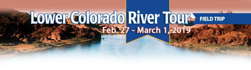
This tour explored the lower Colorado River firsthand where virtually every drop of the river is allocated, yet demand is growing from myriad sources — increasing population, declining habitat, drought and climate change.
The 1,450-mile river is a lifeline to some 40 million people in the Southwest across seven states, 30 tribal nations and Mexico. How the Lower Basin states – Arizona, California and Nevada – use and manage this water to meet agricultural, urban, environmental and industrial needs was the focus of this tour.
Hilton Garden Inn Las Vegas Strip South
7830 S Las Vegas Blvd
Las Vegas, NV 89123
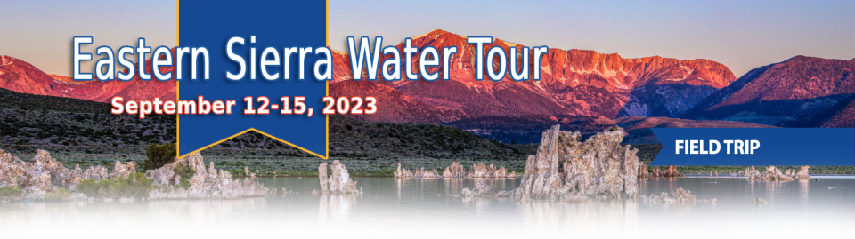
This special Foundation water tour journeyed along the Eastern Sierra from the Truckee River to Mono Lake, through the Owens Valley and into the Mojave Desert to explore a major source of water for Southern California, this year’s snowpack and challenges for towns, farms and the environment.
With 25 years of experience working
on the Colorado River, Chuck Cullom is used to responding to
myriad challenges that arise on the vital lifeline that seven
states, more than two dozen tribes and the country of Mexico
depend on for water. But this summer problems on the
drought-stressed river are piling up at a dizzying pace:
Reservoirs plummeting to record low levels, whether Hoover Dam
and Glen Canyon Dam can continue to release water and produce
hydropower, unprecedented water cuts and predatory smallmouth
bass threatening native fish species in the Grand Canyon.
“Holy buckets, Batman!,” said Cullom, executive director of the
Upper Colorado River Commission. “I mean, it’s just on and on and
on.”
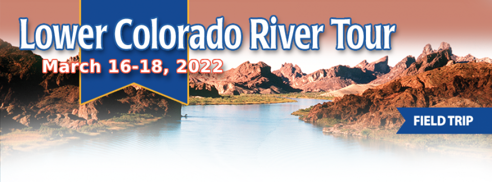
This tour explored the lower Colorado River firsthand where virtually every drop of the river is allocated, yet demand is growing from myriad sources — increasing population, declining habitat, drought and climate change.
The 1,450-mile river is a lifeline to some 40 million people in the Southwest across seven states, 30 tribal nations and Mexico. How the Lower Basin states – Arizona, California and Nevada – use and manage this water to meet agricultural, urban, environmental and industrial needs was the focus of this tour.
Hyatt Place Las Vegas At Silverton Village
8380 Dean Martin Drive
Las Vegas, NV 89139
Climate scientist Brad Udall calls
himself the skunk in the room when it comes to the Colorado
River. Armed with a deck of PowerPoint slides and charts that
highlight the Colorado River’s worsening math, the Colorado State
University scientist offers a grim assessment of the river’s
future: Runoff from the river’s headwaters is declining, less
water is flowing into Lake Powell – the key reservoir near the
Arizona-Utah border – and at the same time, more water is being
released from the reservoir than it can sustainably provide.
The lower Colorado River has virtually every drop allocated, yet demand is growing from myriad sources — increasing population, declining habitat, drought and climate change.
The 1,450-mile river is a lifeline to 40 million people in the Southwest across seven states, 30 tribal nations and Mexico. How the Lower Basin states – Arizona, California and Nevada – use and manage this water to meet agricultural, urban, environmental and industrial needs was the focus of this tour.
Hyatt Place Las Vegas At Silverton Village
8380 Dean Martin Drive
Las Vegas, NV 89139
This event explored the lower Colorado River where virtually every drop of the river is allocated, yet demand is growing from myriad sources — increasing population, declining habitat, drought and climate change.
The 1,450-mile river is a lifeline to 40 million people in the Southwest across seven states and Mexico. How the Lower Basin states – Arizona, California and Nevada – use and manage this water to meet agricultural, urban, environmental and industrial needs was the focus of this tour.
The majestic beauty of the Sierra
Nevada forest is awe-inspiring, but beneath the dazzling blue
sky, there is a problem: A century of fire suppression and
logging practices have left trees too close together. Millions of
trees have died, stricken by drought and beetle infestation.
Combined with a forest floor cluttered with dry brush and debris,
it’s a wildfire waiting to happen.
Fires devastate the Sierra watersheds upon which millions of
Californians depend — scorching the ground, unleashing a
battering ram of debris and turning hillsides into gelatinous,
stream-choking mudflows.
Even as stakeholders in the Colorado River Basin celebrate the recent completion of an unprecedented drought plan intended to stave off a crashing Lake Mead, there is little time to rest. An even larger hurdle lies ahead as they prepare to hammer out the next set of rules that could vastly reshape the river’s future.
Set to expire in 2026, the current guidelines for water deliveries and shortage sharing, launched in 2007 amid a multiyear drought, were designed to prevent disputes that could provoke conflict.
This tour explored the lower Colorado River where virtually every drop of the river is allocated, yet demand is growing from myriad sources — increasing population, declining habitat, drought and climate change.
The 1,450-mile river is a lifeline to 40 million people in the Southwest across seven states and Mexico. How the Lower Basin states – Arizona, California and Nevada – use and manage this water to meet agricultural, urban, environmental and industrial needs is the focus of this tour.
Silverton Hotel
3333 Blue Diamond Road
Las Vegas, NV 89139
The growing leadership of women in water. The Colorado River’s persistent drought and efforts to sign off on a plan to avert worse shortfalls of water from the river. And in California’s Central Valley, promising solutions to vexing water resource challenges.
These were among the topics that Western Water news explored in 2018.
We’re already planning a full slate of stories for 2019. You can sign up here to be alerted when new stories are published. In the meantime, take a look at what we dove into in 2018:
Amy Haas recently became the first non-engineer and the first woman to serve as executive director of the Upper Colorado River Commission in its 70-year history, putting her smack in the center of a host of daunting challenges facing the Upper Colorado River Basin.
Yet those challenges will be quite familiar to Haas, an attorney who for the past year has served as deputy director and general counsel of the commission. (She replaced longtime Executive Director Don Ostler). She has a long history of working within interstate Colorado River governance, including representing New Mexico as its Upper Colorado River commissioner and playing a central role in the negotiation of the recently signed U.S.-Mexico agreement known as Minute 323.
We explored the lower Colorado River where virtually every drop
of the river is allocated, yet demand is growing from myriad
sources — increasing population, declining habitat, drought and
climate change.
The 1,450-mile river is a lifeline to 40 million people in
the Southwest across seven states and Mexico. How the Lower Basin
states – Arizona, California and Nevada – use and manage this
water to meet agricultural, urban, environmental and industrial
needs was the focus of this tour.
Hampton Inn Tropicana
4975 Dean Martin Drive, Las Vegas, NV 89118
This issue of Western Water discusses the challenges
facing the Colorado River Basin resulting from persistent
drought, climate change and an overallocated river, and how water
managers and others are trying to face the future.
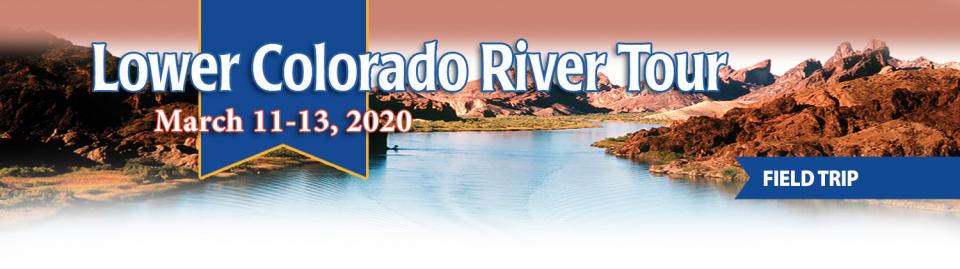
This three-day, two-night tour explored the lower Colorado River
where virtually every drop of the river is allocated, yet demand
is growing from myriad sources — increasing population,
declining habitat, drought and climate change.
The 1,450-mile river is a lifeline to 40 million people in
the Southwest across seven states and Mexico. How the Lower Basin
states – Arizona, California and Nevada – use and manage this
water to meet agricultural, urban, environmental and industrial
needs is the focus of this tour.
Best Western McCarran Inn
4970 Paradise Road
Las Vegas, NV 89119
Whiskeytown Lake, a major reservoir in the foothills of the
Klamath Mountains nine miles west of Redding, was
built at the site of one of Shasta County’s first Gold Rush
communities. Whiskeytown, originally called
Whiskey Creek Diggings, was founded in 1849 and named in
reference to a whiskey barrel rolling off a citizen’s pack mule;
it may also refer to miners drinking a barrel per day.
As one of the most productive agricultural regions in the world,
the Imperial Valley
receives its water from the Colorado River via the
All-American Canal. Rainfall is scarce in the desert region at
less than three inches per year and groundwater is of little
value.
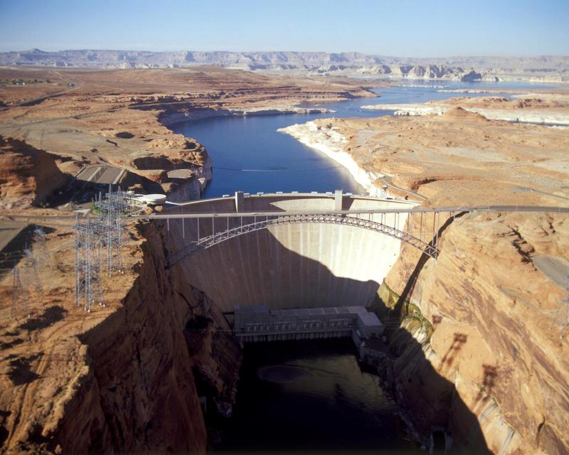
The construction of Glen Canyon Dam
in 1964 created Lake Powell. Both are located in north-central
Arizona near the Utah border. Lake Powell acts as a holding tank
for outflow from the Colorado River Upper Basin States: Colorado,
New Mexico, Utah and Wyoming.
The water stored in Lake Powell is used for recreation, power
generation and delivering water to the Lower Basin states of
California, Arizona, and Nevada.
The Klamath River Basin is one of the West’s most important and
contentious watersheds.
The watershed is known for its peculiar geography straddling
California and Oregon. Unlike many western rivers, the
Klamath does not originate in snowcapped mountains but rather on
a volcanic plateau.
A broad patchwork of spring-fed streams and rivers in
south-central Oregon drains into Upper Klamath Lake and down into
Lake Ewauna in the city of Klamath Falls. The outflow from Ewauna
marks the beginning of the 263-mile Klamath River.
The Klamath courses south through the steep Cascade Range and
west along the rugged Siskiyou Mountains to a redwood-lined
estuary on the Pacific Ocean just south of Crescent City,
draining a watershed of 10 million acres.
A bounty of resources – water, salmon, timber and minerals – and
a wide range of users turned the remote region into a hotspot for
economic development and multiparty water disputes (See
Klamath River
timeline).
Though the basin has only 115,000 residents, there is seldom
enough water to go around. Droughts are common. The water
scarcity inflames tensions between agricultural,
environmental and tribal interests, namely the basin’s four major
tribes: the Klamath Tribes, the Karuk, Hoopa Valley and Yurok.
Klamath water-use conflicts routinely spill into courtrooms,
state legislatures and Congress.
In 2023, a historic removal of four powers dams on the river
began, signaling hope for restoration of the river and its fish
and easing tensions between competing water interests. In
February 2024, Interior Secretary Deb Haaland
announced a “historic” agreement between tribes and farmers
in the basin over chronic water shortages. The deal
called for a wide range of river and creek restoration work and
modernization of agricultural water supply infrastructure.
Water Development
Farmers and ranchers have drawn irrigation water from basin
rivers and lakes since the late 1900s. Vast wetlands around
Upper Klamath Lake and upstream were drained to grow crops. Some
wetlands have been restored, primarily for migratory birds.
In 1905, the federal government authorized construction of the
Klamath Project, a network of irrigation canals, storage
reservoirs and hydroelectric dams to grow an agricultural
economy in the mostly dry Upper Basin. The Project managed by the
U.S. Bureau of Reclamation irrigates about 240,000 acres and
supplies the Lower Klamath Lake and Tule Lake national wildlife
refuges managed by the U.S. Fish and Wildlife Service.
Water Management
Since 1992, federal mandates to restore populations of fish
protected by the Endangered Species
Act have led in some dry years to drastic cuts in
water deliveries to Klamath Project irrigators.
Water in Upper Klamath Lake must be kept above certain
levels for the endangered shortnose and Lost River suckers. Lake
levels and Klamath River flows below Iron Gate Dam also must be
regulated for the benefit of threatened coho salmon (See
Klamath Basin
Chinook and Coho Salmon).
Conflict
In 2001, Reclamation all but cut off irrigation water to hundreds
of basin farmers and ranchers, citing a severe drought and legal
obligations to protect imperiled fish. In response, thousands of
farmers, ranchers and residents flocked to downtown Klamath Falls
to form a “bucket brigade” protest, emptying buckets of water
into the closed irrigation canal. The demonstrations stretched
into the summer, with protestors forcing open the irrigation
headgates on multiple occasions. Reclamation later released some
water to help farmers.
In September 2002, a catastrophic
disease outbreak in the lower Klamath River killed tens of
thousands of ocean-going salmon. The Pacific Coast Federation of
Fishermen’s Associations sued Reclamation, alleging the Klamath
Project’s irrigation deliveries had violated the Endangered
Species Act. The fishing industry eventually prevailed, and
a federal court ordered an increase to minimum flows in the lower
Klamath.
Compromise
The massive salmon kill and dramatic water shut-off set in motion
a sweeping compromise between the basin’s many competing water
interests: the Klamath Basin Restoration Agreement and the
Klamath Hydroelectric Settlement Agreement. The 2010 agreements
included:
Removal of four hydroelectric dams
$92.5 million over 10 years to pay farmers to use less water,
increase reservoir storage and help pay for water conservation
and groundwater management projects.
$47 million over 10 years to buy or lease water rights to
increase flows for salmon recovery.
Dam Removals
Congress never funded the two agreements, allowing the key
provisions to expire. The restoration accord dissolved in 2016.
The hydroelectric pact, however, was revived in an amended
version that did not require federal legislation.
The new deal led to the nation’s largest dam removal project ever
undertaken.
California and Oregon formed a
nonprofit organization called the Klamath River Renewal
Corporation to take control of the four essentially obsolete
power dams – J.C. Boyle, Copco No. 1, Copco No. 2 and Iron Gate –
and oversee a $450 million dam demolition and river restoration
project.
Taking out the dams will open more than 420 miles of river and
spawning streams that had been blocked for more than a century,
including cold water pools salmon and trout need to survive the
warming climate.
Demolition crews took out the smallest dam in 2023 and the others
were scheduled to come down by the end of 2024.
The images of yellow heavy machinery tearing into the dam’s
spillway gates prompted a cathartic release for many who have
been fighting for decades to open this stretch of the Klamath.
“I’m still in a little bit of shock,” said Toz Soto,
the Karuk fisheries program manager. “This is actually
happening…It’s kind of like the dog that finally caught the car,
except we’re chasing dam removal.”
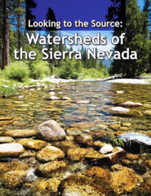
This 28-page report describes the watersheds of the Sierra Nevada
region and details their importance to California’s overall water
picture. It describes the region’s issues and challenges,
including healthy forests, catastrophic fire, recreational
impacts, climate change, development and land use.
The report also discusses the importance of protecting and
restoring watersheds in order to retain water quality and enhance
quantity. Examples and case studies are included.
This 30-minute documentary-style DVD on the history and current
state of the San Joaquin River Restoration Program includes an
overview of the geography and history of the river, historical
and current water delivery and uses, the genesis and timeline of
the 1988 lawsuit, how the settlement was reached and what was
agreed to.
Many Californians don’t realize that when they turn on the
faucet, the water that flows out could come from a source close
to home or one hundreds of miles away. Most people take their
water for granted; not thinking about the elaborate systems and
testing that go into delivering clean, plentiful water to
households throughout the state. Where drinking water comes from,
how it’s treated, and what people can do to protect its quality
are highlighted in this 2007 PBS documentary narrated by actress
Wendie Malick.
A 30-minute version of the 2007 PBS documentary Drinking Water:
Quenching the Public Thirst. This DVD is ideal for showing at
community forums and speaking engagements to help the public
understand the complex issues surrounding the elaborate systems
and testing that go into delivering clean, plentiful water to
households throughout the state.
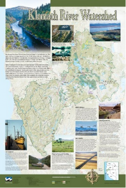
This beautiful 24×36 inch poster, suitable for framing, displays
the rivers, lakes and reservoirs, irrigated farmland, urban areas
and Indian reservations within the Klamath River Watershed. The
map text explains the many issues facing this vast,
15,000-square-mile watershed, including fish restoration;
agricultural water use; and wetlands. Also included are
descriptions of the separate, but linked, Klamath Basin
Restoration Agreement and the Klamath Hydroelectric Agreement,
and the next steps associated with those agreements. Development
of the map was funded by a grant from the U.S. Fish and Wildlife
Service.
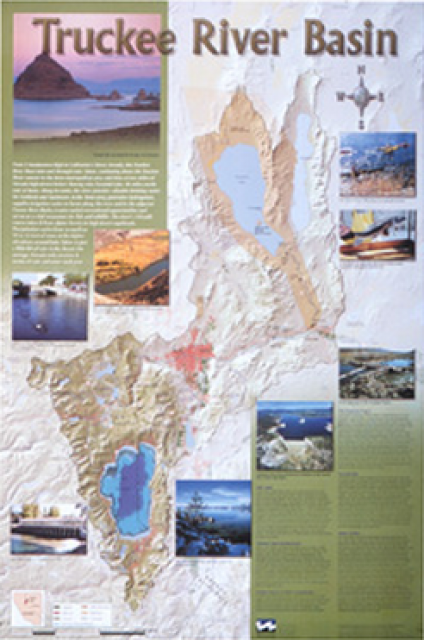
This beautiful 24×36 inch poster, suitable for framing, displays
the rivers, lakes and reservoirs, irrigated farmland, urban areas
and Indian reservations within the Truckee River Basin, including
the Newlands Project, Pyramid Lake and Lake Tahoe. Map text
explains the issues surrounding the use of the Truckee-Carson
rivers, Lake Tahoe water quality improvement efforts, fishery
restoration and the effort to reach compromise solutions to many
of these issues.
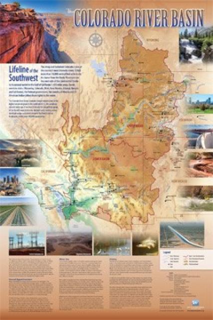
Redesigned in 2017, this beautiful map depicts the seven
Western states that share the Colorado River with Mexico. The
Colorado River supplies water to nearly 40 million people in
Arizona, California, Colorado, Nevada, New Mexico, Utah, Wyoming
and Mexico. Text on this beautiful, 24×36-inch map, which is
suitable for framing, explains the river’s apportionment, history
and the need to adapt its management for urban growth and
expected climate change impacts.
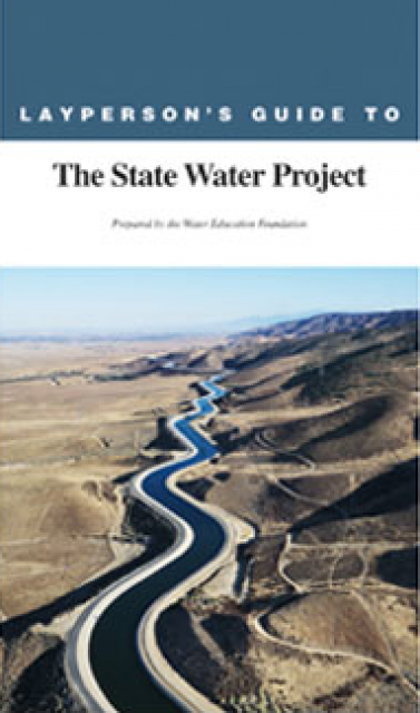
The 24-page Layperson’s Guide to the State Water Project provides
an overview of the California-funded and constructed State Water
Project.
The State Water Project is best known for the 444-mile-long
aqueduct that provides water from the Delta to San Joaquin Valley
agriculture and southern California cities. The guide contains
information about the project’s history and facilities.
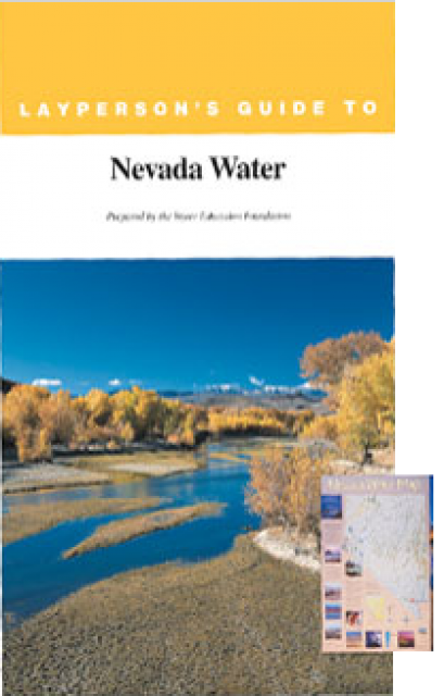
The 28-page Layperson’s Guide to Nevada Water provides an
overview of the history of water development and use in Nevada.
It includes sections on Nevada’s water rights laws, the history
of the Truckee and Carson rivers, water supplies for the Las
Vegas area, groundwater, water quality, environmental issues and
today’s water supply challenges.
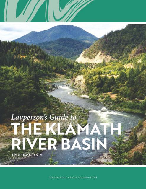
The Water Education Foundation’s second edition of
the Layperson’s Guide to The Klamath River Basin is
hot off the press and available for purchase.
Updated and redesigned, the easy-to-read overview covers the
history of the region’s tribal, agricultural and environmental
relationships with one of the West’s largest rivers — and a
vast watershed that hosts one of the nation’s oldest and
largest reclamation projects.
Dams have allowed Californians and others across the West to
harness and control water dating back to pre-European settlement
days when Native Americans had erected simple dams for catching
salmon.
Hydroelectric power is a relatively
pollution-free source of electricity generated at a comparatively
low cost. Its ability to generate electricity, however, can drop
significantly during a drought.
In 2022, hydropower accounted for more than
28% of all renewable electricity generation in the nation,
according to the U.S. Department of Energy.
The Yuba Accord is a landmark agreement that balances the
interests of environmental groups, agriculture, water agencies
and hydroelectric operators relying on water from the Yuba
River. A tributary of the Feather River, the Yuba is
located north of Sacramento.
Pieced together after two decades of lawsuits, the Yuba Accord
allows for fresh water flows to support native fish while also
providing water for hydropower, transfers and irrigation. The
Accord took effect in 2008 after two years as a pilot project.
Though seemingly a long-way from California’s Central Valley, the
Trinity Dam helps supply irrigation water for Valley farmers and
for hydropower production.
Constructed in the far northwest of California in the 1950s,
Trinity Dam and Lewiston Dam, just downstream, increased the
storage capacity of the federal Central Valley
Project by more than 2.5 million acre-feet.
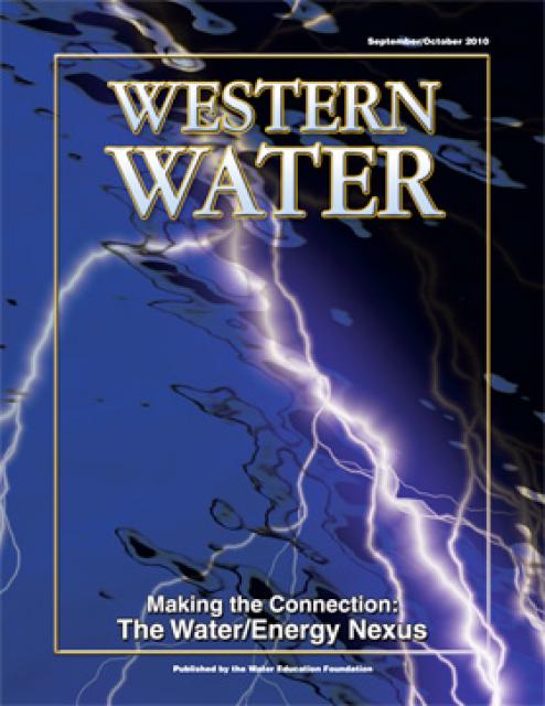
This printed issue of Western Water looks at the energy
requirements associated with water use and the means by which
state and local agencies are working to increase their knowledge
and improve the management of both resources.
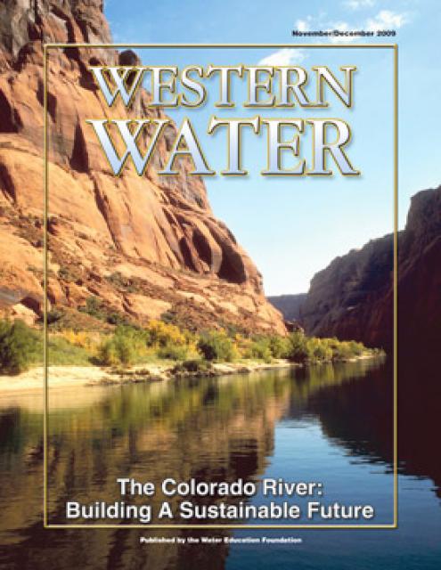
Diverting water for farms and cities, generating hydro-electric
power, supplying an ever-growing urban population and protecting
endangered species have all shaped the development and management
of the Colorado River we know today. How to sustain the system
and build a resilient future for what is known as the “lifeline
of the Southwest” is the task facing the region and the river’s
multiple users.
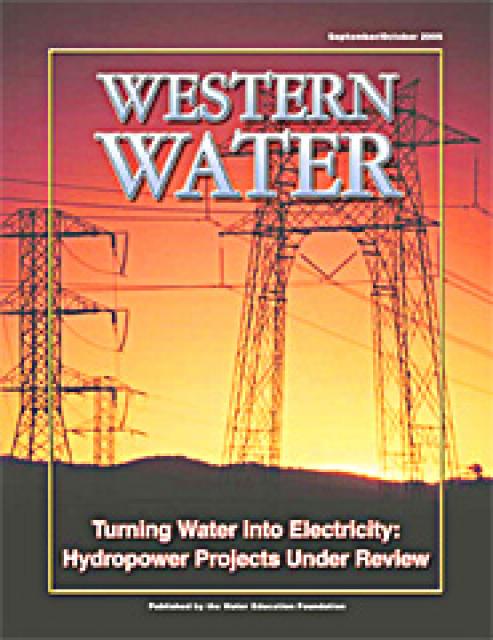
Hydropower generation is prevalent in the West, where rapidly
flowing river systems have been tapped for generations to produce
electricity. Hydropower is a clean, steady and reliable energy
source, but the damming of rivers has exacted a toll on the
environment, affecting, among other things, the migration of fish
to vestigial spawning grounds. Many of those projects are due to
be relicensed by the Federal Energy Regulatory Commission.
The vital importance of water in the West is a given. It is the
basis upon which everything moves forward – the burgeoning
subdivisions, the seemingly limitless acreage of fruits and
vegetables and the remaining stretches of wilderness that support
fish, fowl and wildlife. In addition to its life-sustaining
properties, water, more specifically the force of moving water,
plays a significant part of the nation’s power system by
providing an inexpensive, reliable and renewable generation
source.
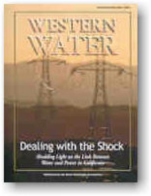
Those on the California water insider track know all too well the
fine line the state walks with regard to maintaining its water
supply. Hydrologic conditions put California at the mercy of the
weather and some are predicting this year could be the start of a
dry cycle not just for the state, but the Southwest as a whole.
Combine that with a regional dry spell in the Northwest and
California’s power woes, and a potential recipe for disaster
begins to solidify.


 and other tributaries of the upper Colorado River have declined dramatically and contributed to the precipitous declines of Lake Powell and Lake Mead. (Source: The Water Desk)")


")
")
")
")
: Karla Nemeth, director, California Department of Water Resources; Gloria Gray, chair, Metropolitan Water District of Southern California; Brenda Burman, Bureau of Reclamation Commissioner; Jayne Harkins, commissioner, International Boundary and Water Commission, U.S. and Mexico; Amy Haas, executive director, Upper Colorado River Commission.")
")

. Credit: U.S. Bureau of Reclamation")