The San Joaquin Valley stretches from across mid-California
between coastal ranges in west and the Sierras on the east. The
region includes large cities such as Fresno and Bakersfield,
national parks such as Yosemite and Kings and fertile farmland
and multi-billion dollar agriculture industry.
The federal Central Valley Project and State Water Project (about
30 percent of SWP water is used for irrigation) helped
deliver water to the valley. Today, San Joaquin Valley crops
include grapes, tomatoes, hay, sugar beets, nuts, cotton and a
multitude of other fruits and vegetables. At the same time, water
used to grow these crops has led to the need for agricultural
drainage.
The land had been sinking so fast for so long that the canal
was failing, so they built an entire new canal, but now that’s
sinking as well. It’s a dramatic reminder that after two good
years, California’s water challenges still run deep. The
Friant-Kern Canal, which runs along the east side of the San
Joaquin Valley, and it is the lifeline for many farmers and
communities in that region. The system starts at Millerton
Lake, and from there, it runs 152 miles to the south, powered
entirely by gravity. But gravity means going downhill and that
has gotten complicated. Decades of groundwater pumping have
caused the valley floor to sink, and the canal with it. KPIX
first toured the site back in August of 2022. The fix is a
duplicate canal built right along side the old one, only
higher, so the water can still flow downhill.
From Sequoia Park to the old Tulare Lake bed, local authorities
recount the same story. A deluge of biblical proportions,
including heavy rain and storm runoff, in the past year in the
Kaweah, Kings and Tule basins has caused hundreds of millions
of dollars in damage to the region’s road and bridge
infrastructure. … Still a year later, government
agencies continue to struggle to repair the extensive damage
requiring federal funding to make it happen.
Proposed state legislation to modify California’s longstanding
farmland conservation law could pave the way for large swaths
of farm acreage to be repurposed as sites for renewable energy
projects. The California Land Conservation Act of 1965,
commonly known as the Williamson Act, preserves farmland by
assessing property taxes based on the land’s agricultural value
rather than its full market value. Landowners with Williamson
Act contracts, which cover about half the state’s 30 million
acres of farm and ranchland, generally see a 20% to 75%
reduction in property taxes. … The proposed legislation
seeks to align the state’s renewable energy and groundwater
management goals. California’s Sustainable Groundwater
Management Act, or SGMA, requires users to bring groundwater
basins into balance within the next two decades.
The Wonderful Company, California-based maker of the popular
pomegranate juice POM, is the state’s second-largest user of
paraquat – a toxic herbicide banned in over 60 countries – a
new Environmental Working Group investigation finds.
Studies have found a strong connection between paraquat
exposure and an elevated risk of Parkinson’s disease. The
chemical has also been linked with non-Hodgkin lymphoma and
childhood leukemia. … Wonderful’s brands include POM
pomegranate juice, Landmark Vineyards wine and Fiji Water,
among many others. In 2021 alone, Wonderful sprayed more
than 56,000 pounds of paraquat on California fields where it
grows pistachios, almonds and pomegranates, according to state
and county records analyzed by EWG. … The herbicide can
remain in soil for years.
Kings County growers will face millions of dollars in fees and
a mandate to report groundwater pumping after California
officials voted unanimously today to put local agencies on
probation for failing to protect the region’s underground water
supply. The unprecedented decision is a first step that could
eventually lead to the state wresting control of a groundwater
basin in a severely depleted part of the San Joaquin
Valley. Before issuing the probation order, the State
Water Resources Control Board had repeatedly warned five
groundwater agencies in Kings County that their management plan
for the Tulare Lake basin is seriously deficient, failing to
rein in the dried-up wells, contaminated water and sinking
earth worsened by overpumping.
A stretch of California that’s considered one of the
fastest-sinking areas in the nation, where farms have pumped so
much water from the ground that the land has slowly collapsed,
is on the verge of state intervention. In a first-ever move,
California regulators are looking to step in and monitor
groundwater pumping in the Tulare Lake subbasin, an
837-square-mile hydrological region flush with cotton, hay and
almonds between Fresno and Bakersfield. Because of heavy
pumping, some places here are sinking a foot a year, causing
roads to buckle and canals to crack. … The looming
confrontation between the state and water agencies marks the
latest, and one of the most significant, developments with
California’s decade-old groundwater legislation, the
Sustainable Groundwater Management Act, or SGMA.
An interdisciplinary team of scientists and researchers from
University of California, Davis, are studying agave plants in
the Golden State as farmers are turning to the crop as a
potential drought-tolerant option of the future. The research
is centered on studying agave genetics, virus susceptibility,
pest control, soil management and crop productivity, said Ron
Runnebaum, a viticulture and enology professor who is leading
the team of researchers at the newly formed UC Davis Agave
Center. … Agave plants don’t require much water and
their hardy leaves are fire resistant. The crop can be used as
a fiber, distilled into spirits or converted into a sweetener.
That combination of traits could offer an alternative to
fallowing fields by switching from thirsty crops to one
requiring less water.
… U.S. Geological Service data shows Teton Valley’s aquifer
steadily declined in recent decades as development increased
and crop watering systems became more efficient, reducing
infiltration by replacing flood irrigation with pivots and
sprinklers. In addition, the area’s transition from
agricultural valley to recreation hub has meant less acreage
being watered: farms replaced by subdivisions full of houses
with domestic wells, each one a straw guzzling from the
valley’s all-important aquifer. … Recharge has benefited
farmers and fish in western communities like Idaho’s Eastern
Snake River Plain and California’s Central Valley, and the
group believes the data shows it can work in the Teton Basin.
They hope it can. In addition to providing a bulwark against
future water shortages or legislative changes to water rights
laws, they want to do something groundbreaking: create a
market-based system to pay farmers for incidental recharge.
As the date of reckoning for excessive groundwater pumping in
Tulare County grows closer, lobbying by water managers and
growers has ramped up. The Friant Water Authority, desperate to
protect its newly rebuilt – yet still sinking –
Friant-Kern Canal, has beseeched the Water Resources Control
Board to get involved. Specifically, it has asked board members
to look into how the Eastern Tule Groundwater Sustainability
Agency (GSA) has, or has not, curbed over pumping that affects
the canal. Meanwhile, the Eastern Tule groundwater agency has
been doing a bit of its own lobbying. It recently hosted all
five members of the Water Board on three separate tours of the
region, including the canal. Because the tours were staggered,
there wasn’t a quorum of board members, which meant they
weren’t automatically open to the public.
… [C]occidioides, a fungus that causes a disease called
coccidioidomycosis, better known as valley fever. If inhaled,
microscopic spores from the fungus can lodge in the lungs.
About a third of those infected with cocci never have any
symptoms, and most of those infected clear the disease and
develop immunity. But for between 1 and 5% of those who inhale
it, cocci spreads through the bloodstream and wreaks havoc in
the body that can sometimes be lethal. And the changing climate
has allowed valley fever to spread far beyond its traditional
territory of Arizona and parts of Southern California.
After 12 years of planning, gathering funding then completing
and re-doing – and re-doing again – environmental studies, the
City of Bakersfield has finally gone out to bid for the
northern extension of the Kern River Parkway Trail. “I’m very
excited, it’s been a long time coming,” Councilman Bob Smith
said of the 6-mile long addition to the nearly 40-mile-long
path that runs the length of the Kern River from Gordon’s Ferry
on the east all the way to the Buena Vista Lake Aquatic
Recreation Area on the west. This extension will take runners,
hikers and cyclists north at Coffee Road along the Friant-Kern
Canal up to 7th Standard Road, about a half mile west of the
Gossamer Grove development.
In an April 1, 2024 letter to three water boards, fishing and
conservation groups and the Winnemem Wintu Tribe urged
regulators to control recently measured excess levels of
selenium in Mud Slough. Mud Slough drains selenium-impaired
land on the west side of the San Joaquin Valley into the San
Joaquin River and ultimately San Francisco Bay.
… Selenium has long been known to cause
reproductive failure, deformities, and death in fish and
waterfowl, according to a statement from the California
Sportfishing Protection Alliance (CSPA). “Our groups have
spent over a decade at the water boards and in court trying to
bring runoff from Mud Slough into compliance with water quality
standards,” said Chris Shutes, Executive Director of the
California Sportfishing Protection Alliance.
At the Indian Wells Valley Groundwater Authority board meeting
on March 29, the IWVGA board approved motions to reimburse two
domestic well owners who had to replace their wells due to
declining groundwater levels. IWVGA reimbursed $37,996 for the
Halpin Well and $31,082 for the Byerly Well. Reimbursement
covers the estimated current value of the exhausted well and
the incremental costs of drilling a deeper well. California’s
Sustainable Groundwater Management Act requires groundwater
basins like the IWV groundwater basin to reach sustainability
by 2040. This is why the IWVGA initially formed to draft and
implement a Groundwater Sustainability Plan.
Canals in California may soon feature a new look — solar panel
canopies, designed to stop evaporation and soak up the sun’s
rays, created under a new project funded with help from the
federal government to boost green energy
infrastructure. Governor Gavin Newsom joined staff from
the U.S. Bureau of Reclamation on Thursday to highlight a new
“solar-over-canal” project along one of the state’s primary
aqueducts. The pilot project proposes placing a solar canopy to
“float” over a major waterway as a source of renewable energy
that can also prevent loss of precious water through
evaporation. Adam Nickels, Deputy Regional Director at the
Bureau of Reclamation, said that the Biden Inflation Reduction
Act helped make it possible to pick a portion of the
Delta-Mendota Canal for placement of a solar panel in Merced
County.
Winter brought just average rain and snow to Stanislaus
County’s main watershed, but most farmers will get abundant
supplies. That’s because reservoirs continue to hold much of
the runoff from last year’s truly wet conditions. Only in parts
of the West Side will water be limited. The storms also boosted
groundwater, which is part of the supply in many places. City
residents, too, can expect no cutbacks, but they still have to
follow rules against outdoor watering in the afternoon. Too
much demand on a hot summer day can tax the distribution
system.
Yesterday, Gov. Gavin Newsom surveyed the Sierra snowpack and
outlined a new state water plan focused on climate change.
Scott and KQED climate reporter Ezra David Romero are joined by
California’s former top water regulator Felicia Marcus. As
the state’s top water czar, she navigated severe droughts,
balancing demands for scare water by cities, farms, businesses
and homeowners.
The $171 million Kern Fan Groundwater Storage project – with a
unique “eco-twist” – received another chunk of public funding
just as the first section of the 1,300-acre project had a
formal christening on Wednesday. Officials with Rosedale-Rio
Bravo Water Storage District, Irvine Ranch Water District and
the Bureau of Reclamation gathered at the project site near
Enos Lane west of Bakersfield to look over construction of the
first part of Phase 1, which began in February. The Bureau
announced earlier in the week that it had approved a $3.9
million grant for the project, which is in addition to $4.7
million awarded by the Bureau in 2023. That funding requires a
75% match from Rosedale-Rio Bravo and Irvine Ranch.
In late February, the nonprofit Central Valley Joint
Venture took a group of environmental scientists, advocates and
nature enthusiasts on a tour of successful wetland restoration
projects in the south San Joaquin Valley. The tour focused on
the efforts to reclaim agricultural land for habitat and the
possibility of returning more of the valley to its original
state.
The basin depends on 7,650 acre feet of natural inflow each
year but users pump out nearly 28,000 acre feet annually,
creating a severe overdraft. As the Authority has worked to
comply with the Sustainable Groundwater Management Act (SGMA)
to bring the basin into balance numerous legal actions have
erupted. The Authority restricted pumping for most users. The
U.S. Navy, which operates the China Lake Navale Weapons Base in
the basin, got the lion’s share of pumping. While agricultural
users, such as Mojave Pistachios, which started planting in the
high desert around 2010, received zero pumping allocation.
Some Bee colleagues and I recently took a tour of Westlands
Water District — the nation’s largest agricultural water
district, located on the western edges of Fresno and Kings
counties. … But facing the twin challenges of drought
and new state restrictions on groundwater use, Westlands
farmers and counterparts throughout the San Joaquin Valley are
considering a new money maker for their land: solar power.
Rep. John Duarte (R-Hughson) was in Turlock, as well as other
Central Valley communities, on Monday to deliver Community
Project Funding checks — as part of the Consolidated
Appropriations Act of 2024 — that totaled about $11 million.
Turlock received $1.2 million for its Golden State Boulevard
sewer-extension project, and $1 million for the city’s
stormwater infrastructure project. … Turlock’s Golden State
sewer-extension project focuses on extending an 18-inch
diameter sewer main near Taylor Road. The extension, according
to the city, will provide utility services to an unserved area
of Stanislaus County currently on wells and septic
tanks. The other project — the Positive Drainage Project —
involves replacement and upsizing of 1,120 feet of pipe in the
city to create a positive drainage system that would increase
flood capacity and alleviate flooding concerns.
Kings County growers are organizing to stop a set of
groundwater and land fees they say will wipe out small farmers,
even as the drumbeat of a looming state takeover grows louder.
Managers of the Mid-Kings River Groundwater Sustainability
Agency (GSA), which covers the northern tip of Kings County,
have been holding a flurry of meetings asking farmers to
approve the fees – a combination of $95-per-acre-foot of water
pumped and $25-per-acre of land – at its April 23
meeting. That is after April 16, when the state Water Resources
Control Board will hold a hearing to decide whether to put all
of Kings County, known as the Tulare Lake groundwater subbasin,
into probation for failing to come up with an adequate plan to
stop over pumping.
The frustration for farmers continues to grow after recent news
of recent water allocation numbers. The Bureau of Reclamation
has announced a 35 percent federal allocation for Central
Valley Project recipients, as the California Department of
Water Resources has allocated 30 percent of State Water Project
requests. The news comes as the snowpack in the Sierra
Nevada sits at or near normal. … Joe Del Bosque of Del
Bosque Farms … says he and other farmers were extremely
disappointed with the recent numbers. He tells me with the
current snowpack, and recent, and potentially incoming storms,
the allocation should have been higher.
To address the concern of historic groundwater overdraft in the
San Joaquin Valley, the California Water Institute at Fresno
State, with assistance from students and faculty, conducted a
feasibility study to explore the potential for groundwater
recharge within disadvantaged communities. … The analysis
identified four potential locations for the design and
construction of recharge basins near or in the cities of
Kerman, Raisin City, Caruthers and Laton.
California farmers could save massive amounts of water if they
planted less thirsty — but also less lucrative — crops such as
grains and hay instead of almonds and alfalfa, according to new
research by scientists who used remote sensing and artificial
intelligence. Such a seismic shift in the nation’s most
productive agricultural state could cut consumption by roughly
93%, researchers with UC Santa Barbara and the NASA Jet
Propulsion Laboratory reported Monday. But Anna Boser, the
study’s lead author, acknowledged that replacing all of
California’s water-intensive crops with the least-intensive
ones is an unrealistic economic scenario. … In a
less-extreme scenario, Boser and her colleagues reported that
fallowing 5% of fields with the most water-intensive crops
could cut water consumption by more than 9%, according to
the study, published in the journal Nature Communications.
State officials on Friday doubled the amount of water
California agencies will get this year following some strong
storms that increased the snowpack in the mountains. The State
Water Project is a major source for 27 million people. The
majority of contractors who supply the water are located south
of the Sacramento-San Joaquin River Delta. Previously, the
Department of Water Resources had told them to expect 15% of
their requests this year. The department increased that to 30%
on Friday. The department said contractors north of the delta
can expect 50% of their requests, while contractors in the
Feather River Settlement can expect 100%.
… Riparian forest is a rare sight in the Central Valley.
About one million acres of trees, shrubs, and grasses once
flourished, drowned, and flourished again along the valley’s
rivers, creeks, and floodplains; now, perhaps 130,000 acres
remain. In recent years, though, that number has begun to inch
up again. Caswell has about 260 acres. Seven miles south of
there is Dos Rios Ranch—2,100 acres, much of it former dairy
farm and almond orchard, at the extremely floodable confluence
of the Tuolumne and San Joaquin rivers—which is steadily being
restored to riparian forest. Later this year it will open as
California’s first new state park in 15 years.
At the Indian Wells Valley Water District board meeting on
March 11, the Water District board moved forward in learning
about the process of consolidating the Dune 3 water mutual
company into their service area. Some negotiation and planning
still needs to happen before any decision is finalized, but for
the moment the board is willing to cautiously move forward in
the process. The IWV Water District serves water to IWV
residents by pumping water out of the IWV groundwater basin.
However, they are not the only ones doing so. Dotted all across
IWV are domestic well owners and even a few other public or
private organizations resembling a water district. If one of
those organizations fails, an obligation still exists to serve
water to the people in that region.
Chevron has agreed to pay more than $13 million in fines for
dozens of past oil spills in California. The California-based
energy giant agreed to pay a $5.6 million fine associated with
a 2019 oil spill in Kern County. The company has already paid
to clean up that spill. This money will instead go toward the
state Department of Conservation’s work of plugging old and
orphaned wells. The department said it was the largest fine
ever assessed in its history. … The 2019 oil spill
dumped at least 800,000 gallons (3 million litres) of oil and
water into a canyon in Kern County, the home of the state’s oil
industry. Also, Chevron agreed to pay a $7.5 million fine
for more than 70 smaller spills between 2018 and 2023.
Thousands of leaking, idle oil wells are scattered across
California, creating toxic graveyards symbolic of a dying
industry. To tackle this “urgent climate and public
health crisis,” Santa Barbara Assemblymember Gregg Hart
introduced Assembly Bill 1866 last week. The bill would mandate
oil operators to develop plans to plug the 40,000 idle wells
(and counting) in the state within a decade, prioritizing those
within 3,200 feet of vulnerable communities. … Ann
Alexander, senior attorney with the Natural Resources Defense
Council, calls the system “very badly broken.” Companies “just
sit indefinitely on their defunct wells” as they leak methane
gas, pollute the air, and contaminate groundwater.
… Last fall, the county announced its plan to
spend $3.7 million to repair an “unpluggable” well at
Toro Canyon Creek. Drilled in the 19th century, this idle well
has leaked thousands of gallons of crude oil since
the 1990s, contaminating waterways and killing wildlife as a
result.
With only three months left on her contract, the longtime
attorney for the powerful Kern County Water Agency was ousted
Monday, March 18, during a special meeting. Six of the agency’s
seven directors voted in favor of terminating General Counsel
Amelia Minaberrigarai’s contract after a short closed session.
Director Laura Cattani was absent. The contract was terminated
as of March 23. It is set to expire June 30. … The
agency did not respond to questions about whether the
termination was for cause. Nor to questions about
Minaberrigarai’s replacement. It is also unclear why her
contract was terminated with only three months before it
expired. If she was fired without cause, the contract
requires she receive a lump sum equal to her base pay,
plus vacation that would have accrued for the remainder of the
contract’s term.
A court has upheld a key decision by California’s water board
calling for reductions in water diversions from the San Joaquin
River and its tributaries to help revive struggling fish
populations. In his ruling, Sacramento County Superior Court
Judge Stephen Acquisto rejected lawsuits by water districts
serving farms and cities that would be required to take less
water under the standards adopted by regulators. The judge also
rejected challenges by environmental groups that had argued for
requiring larger cutbacks to boost river flows. The judge’s
ruling, issued in a 162-page order last week, supports the
State Water Resources Control Board’s 2018 adoption of a water
quality plan for the lower San Joaquin River and its three
major tributaries — the Tuolumne, Merced and Stanislaus rivers.
Members of the state Water Resources Control Board voted
unanimously on Tuesday, March 19, to reduce pumping fees for
groundwater users in subbasins that come under state control,
known as “probationary status.” The controversial fee was
lowered from $40 per-acre-foot of pumped water to $20 per acre
foot. The board will hold its first probationary hearing
on the Tulare Lake subbasin, which covers Kings County, on
April 16. … Groundwater sustainability plans (GSPs) for
Tulare Lake and five other San Joaquin Valley subbasins were
rejected twice by the state as inadequate, which is why they
are now coming before the Water Board to determine if they
should be put into probationary status.
The Kern subbasin, composed of 22 water entities across the
valley portion of Kern County, is working on a groundwater
sustainability plan its members hope will be accepted by the
State Water Resources Control Board after the subbasin’s
initial plan was deemed inadequate. Currently the subbasin has
two main objectives. One is partnering with Self-Help
Enterprises to assist with the administration of a program to
fix domestic wells harmed by over pumping. The other is
gathering support among the 22 entities to participate in the
Friant-Kern Canal subsidence study. Proposed partnership: Under
the proposal, Self-Help would assist with subbasin’s well
issues in several ways.
On the eve of its first subbasin probationary hearing, the
state Water Resources Control Board announced it will vote on
whether to reduce a controversial groundwater extraction
fee. The board will vote at its March 19 meeting on
whether to cut the fee from $40 to $20-per-acre-foot for well
owners in a subbasin placed on probation. It will hold
its first probationary hearing on the Tulare Lake subbasin,
which covers Kings County, on April 16. Then the Tule subbasin,
in the southern half of the valley portion of Tulare County,
will come up for hearing Sept. 17. The extraction fee would
only be charged if the Water Board had to step in and
administer a subbasin in cases where it finds local groundwater
agencies aren’t up to the job.
Allensworth is one of the testing grounds for a hydropanel that
creates drinking water out of thin air. But two years into the
program, community members say the hydropanel company has left
them high and dry while many of the hydropanels have broken
down. Allensworth has struggled with arsenic-laced
groundwater for decades. In 2021, Source Global, the company
behind the hydropanels, installed two in Allensworth to test
out the technology. Each panel generates about a gallon of
drinking water per day by condensing water vapor in the air
into liquid form. In 2022, a philanthropic organization
bought 1,000 hydropanels to be installed throughout the Central
Valley. Allensworth now has about 42 panels, according to
Source Global.
Climate change is driving up the thirst of crops
significantly in California’s San Joaquin Valley, new research
shows, adding to the critical water challenges faced by one of
the world’s leading agricultural regions. The total water
demand of orchards, vineyards and row crops in the area is up
4.4% over the past decade compared with the prior 30 years
because of hotter, drier conditions, and it’s likely to
continue growing, according to a federally funded study
published this week. In 2021, the water demand of crops was up
an astonishing 12.3%, the study shows. While the warming
atmosphere has long been known to dry out plants and soil, the
new research identifies the impact specific to the
San Joaquin Valley.
California citrus farmers are finding ways to adapt to the
changing landscape, as the challenges of this production year
come to light. Amid the harvest of California navels,
mandarins, and other specialty varieties, two industry leaders
share their perspectives on the prospects of the industry.
… Jim Phillips, President and CEO of Sunkist, expressed
similar concerns regarding production but also emphasized the
current state of affairs regarding the Sustainable Groundwater
Management Act (SGMA). California citrus farmers need the
support of the legislature regarding water access, as the issue
is outpacing almost every other concern for growers, said
Phillips. Both Bates and Phillips noted that the
substantial amount of rainfall and snowpack over the past two
winters are supporting growers in the fight for water access.
Cannon Michael has been re-elected as the chairman of the San
Luis & Delta-Mendota Water Authority. The San Luis &
Delta-Mendota Water Authority announced Michael’s re-election
on Monday. The big picture: Michael is the president
of family-owned Los Banos farming operation Bowles Farming
Company. He also serves as the chair of the Henry Miller
Reclamation District, as a board member of the Water Education
Foundation and as an advisory board member of the Public Policy
Institute of California.
The Friant-Kern Canal was called out specifically as one of the
reasons the state should take over pumping in the Tule
groundwater subbasin in Tulare County. The recommendation was
contained in a recently released staff report to the Water
Resources Control Board. While the report stated groundwater
management plans covering the subbasin didn’t adequately
address subsidence and continued depletion of the aquifer and
degradation of water quality in general, it also noted the
significant harm to the Friant-Kern Canal, which brings water
152 miles south from Millerton Lake to Arvin. Excessive
overpumping caused land beneath a 33-mile stretch of the
Friant-Kern Canal to collapse, creating a sag that reduced the
canal’s carrying capacity south of Pixley by 60%.
Anew time-lapse video shared on social media shows Tulare Lake,
California’s ghost lake, disappear after re-forming last year.
A series of atmospheric rivers hit California last year during
an abnormally wet winter season and caused the lake to reemerge
in the San Joaquin Valley. The original lake was once much
larger than Lake Tahoe and was known to be the largest
freshwater lake in the West, but it began to dry up in the late
1800s and fully disappeared 80 years ago when water was
diverted and the land was repurposed for agricultural
uses. Atmospheric rivers are a “long, narrow region in the
atmosphere—like rivers in the sky—that transport most of the
water vapor outside of the tropics,” according to the National
Oceanic and Atmospheric Administration.
How will selling groundwater help keep more groundwater in the
San Joaquin Valley’s already critically overtapped aquifers?
Water managers in the Kaweah subbasin in northwestern Tulare
County hope to find out by having farmers tinker with a pilot
groundwater market program. Kaweah farmers will be joining
growers from subbasins up and down the San Joaquin Valley
who’ve been looking at how water markets might help them
maintain their businesses by using pumping allotments and
groundwater credits as assets to trade or sell when water is
tight.
… A state audit from the California Water Resources Control
Board released last year found that over 920,000 residents
faced an increased risk of illness–including cancer, liver and
kidney problems–due to consuming unsafe drinking water. A
majority of these unsafe water systems are in the Central
Valley. The matter has prompted community leaders to mobilize
residents around water quality as politicians confront
imperfect solutions for the region’s supply. Advocates point
out that impacted areas, including those in Tulare County, tend
to be majority Latino with low median incomes. … This
year’s extreme weather has only worsened the valley’s problems.
The storms that hit California at the start of this year caused
stormwater tainted with farm industry fertilizer, manure and
nitrates to flow into valley aquifers.
A new underground mapping technology
that reveals the best spots for storing surplus water in
California’s Central Valley is providing a big boost to the
state’s most groundwater-dependent communities.
The maps provided by the California Department of Water Resources
for the first time pinpoint paleo valleys and similar prime
underground storage zones traditionally found with some guesswork
by drilling exploratory wells and other more time-consuming
manual methods. The new maps are drawn from data on the
composition of underlying rock and soil gathered by low-flying
helicopters towing giant magnets.
The unique peeks below ground are saving water agencies’
resources and allowing them to accurately devise ways to capture
water from extreme storms and soak or inject the surplus
underground for use during the next drought.
“Understanding where you’re putting and taking water from really
helps, versus trying to make multimillion-dollar decisions based
on a thumb and which way the wind is blowing,” said Aaron Fukuda,
general manager of the Tulare Irrigation District, an early
adopter of the airborne electromagnetic or
AEM technology in California.
It was exactly the sort of deluge
California groundwater agencies have been counting on to
replenish their overworked aquifers.
The start of 2023 brought a parade of torrential Pacific storms
to bone dry California. Snow piled up across the Sierra Nevada at
a near-record pace while runoff from the foothills gushed into
the Central Valley, swelling rivers over their banks and filling
seasonal creeks for the first time in half a decade.
Suddenly, water managers and farmers toiling in one of the
state’s most groundwater-depleted regions had an opportunity to
capture stormwater and bank it underground. Enterprising agencies
diverted water from rushing rivers and creeks into manmade
recharge basins or intentionally flooded orchards and farmland.
Others snagged temporary permits from the state to pull from
streams they ordinarily couldn’t touch.
This tour traveled along the San Joaquin River to learn firsthand
about one of the nation’s largest and most expensive river
restoration projects.
The San Joaquin River was the focus of one of the most
contentious legal battles in California water history,
ending in a 2006 settlement between the federal government,
Friant Water Users Authority and a coalition of environmental
groups.
Hampton Inn & Suites Fresno
327 E Fir Ave
Fresno, CA 93720
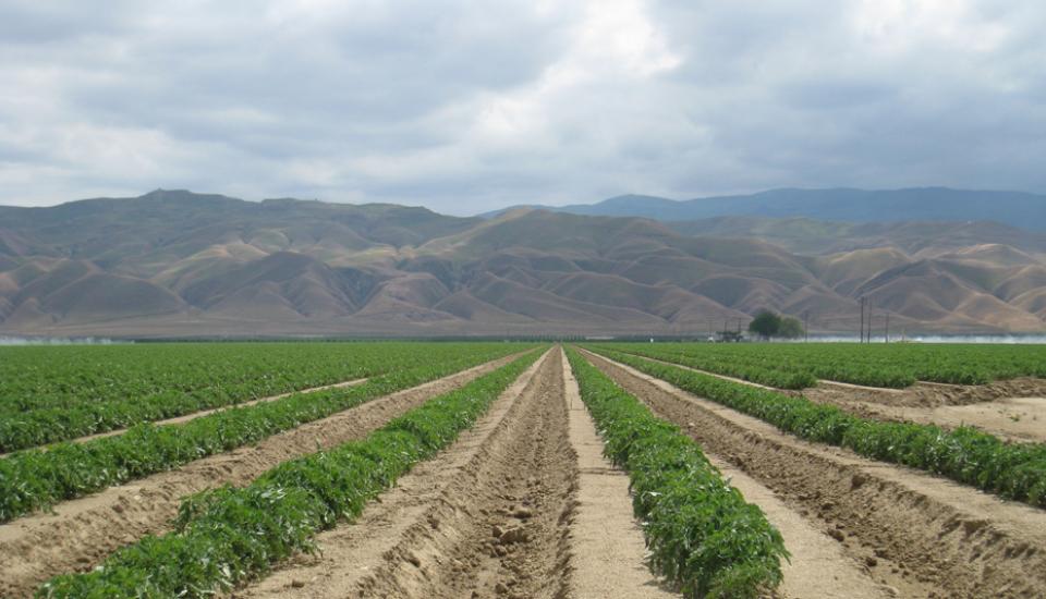
This tour ventured through California’s Central Valley, known as the nation’s breadbasket thanks to an imported supply of surface water and local groundwater. Covering about 20,000 square miles through the heart of the state, the valley provides 25 percent of the nation’s food, including 40 percent of all fruits, nuts and vegetables consumed throughout the country.
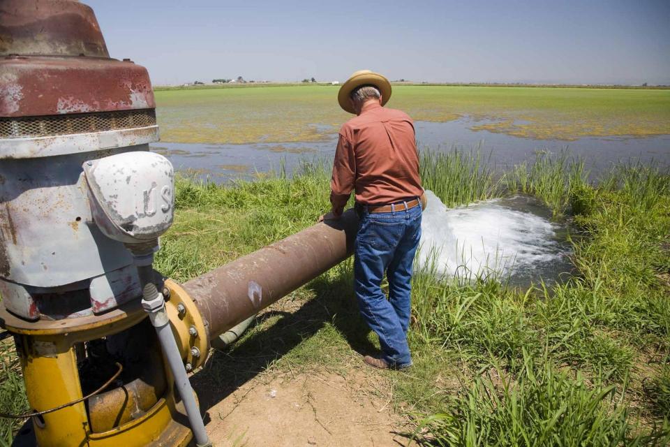
Across a sprawling corner of southern Tulare County snug against the Sierra Nevada, a bounty of navel oranges, grapes, pistachios, hay and other crops sprout from the loam and clay of the San Joaquin Valley. Groundwater helps keep these orchards, vineyards and fields vibrant and supports a multibillion-dollar agricultural economy across the valley. But that bounty has come at a price. Overpumping of groundwater has depleted aquifers, dried up household wells and degraded ecosystems.
Innovative efforts to accelerate
restoration of headwater forests and to improve a river for the
benefit of both farmers and fish. Hard-earned lessons for water
agencies from a string of devastating California wildfires.
Efforts to drought-proof a chronically water-short region of
California. And a broad debate surrounding how best to address
persistent challenges facing the Colorado River.
These were among the issues Western Water explored in
2019, and are still worth taking a look at in case you missed
them.
To survive the next drought and meet
the looming demands of the state’s groundwater sustainability
law, California is going to have to put more water back in the
ground. But as other Western states have found, recharging
overpumped aquifers is no easy task.
Successfully recharging aquifers could bring multiple benefits
for farms and wildlife and help restore the vital interconnection
between groundwater and rivers or streams. As local areas around
California draft their groundwater sustainability plans, though,
landowners in the hardest hit regions of the state know they will
have to reduce pumping to address the chronic overdraft in which
millions of acre-feet more are withdrawn than are naturally
recharged.
Bruce Babbitt, the former Arizona
governor and secretary of the Interior, has been a thoughtful,
provocative and sometimes forceful voice in some of the most
high-profile water conflicts over the last 40 years, including
groundwater management in Arizona and the reduction of
California’s take of the Colorado River. In 2016, former
California Gov. Jerry Brown named Babbitt as a special adviser to
work on matters relating to the Sacramento-San Joaquin Delta and
the Delta tunnels plan.
Groundwater helped make Kern County
the king of California agricultural production, with a $7 billion
annual array of crops that help feed the nation. That success has
come at a price, however. Decades of unchecked groundwater
pumping in the county and elsewhere across the state have left
some aquifers severely depleted. Now, the county’s water managers
have less than a year left to devise a plan that manages and
protects groundwater for the long term, yet ensures that Kern
County’s economy can continue to thrive, even with less water.
The whims of political fate decided
in 2018 that state bond money would not be forthcoming to help
repair the subsidence-damaged parts of Friant-Kern Canal, the
152-mile conduit that conveys water from the San Joaquin River to
farms that fuel a multibillion-dollar agricultural economy along
the east side of the fertile San Joaquin Valley.
There’s going to be a new governor
in California next year – and a host of challenges both old and
new involving the state’s most vital natural resource, water.
So what should be the next governor’s water priorities?
That was one of the questions put to more than 150 participants
during a wrap-up session at the end of the Water Education
Foundation’s Sept. 20 Water Summit in Sacramento.
The Sacramento and San Joaquin
rivers are the two major Central Valley waterways that feed the
Delta, the hub of California’s water supply
network. Our last water tours of
2018 will look in-depth at how these rivers are managed and
used for agriculture, cities and the environment. You’ll see
infrastructure, learn about efforts to restore salmon runs and
talk to people with expertise on these rivers.
More than a decade in the making, an
ambitious plan to deal with the vexing problem of salt and
nitrates in the soils that seep into key groundwater basins of
the Central Valley is moving toward implementation. But its
authors are not who you might expect.
An unusual collaboration of agricultural interests, cities, water
agencies and environmental justice advocates collaborated for
years to find common ground to address a set of problems that
have rendered family wells undrinkable and some soil virtually
unusable for farming.
New water storage is the holy grail
primarily for agricultural interests in California, and in 2014
the door to achieving long-held ambitions opened with the passage
of Proposition
1, which included $2.7 billion for the public benefits
portion of new reservoirs and groundwater storage projects. The
statute stipulated that the money is specifically for the
benefits that a new storage project would offer to the ecosystem,
water quality, flood control, emergency response and recreation.
California voters may experience a sense of déjà vu this year when they are asked twice in the same year to consider water bonds — one in June, the other headed to the November ballot.
Both tackle a variety of water issues, from helping disadvantaged communities get clean drinking water to making flood management improvements. But they avoid more controversial proposals, such as new surface storage, and they propose to do some very different things to appeal to different constituencies.
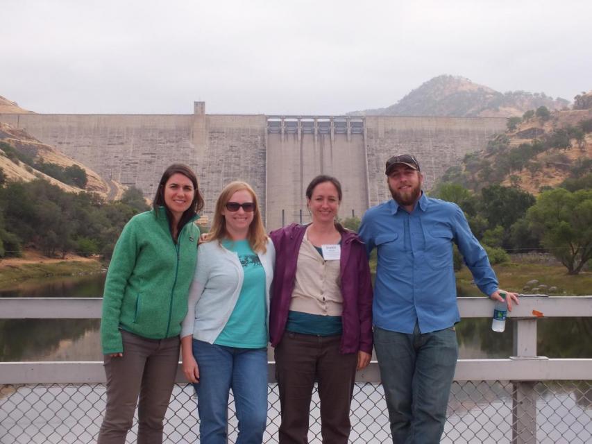
Get a unique view of the San Joaquin Valley’s key dams and
reservoirs that store and transport water on our March Central
Valley Tour.
Our Central Valley
Tour, March 14-16, offers a broad view of water issues
in the San Joaquin Valley. In addition to the farms, orchards,
critical habitat for threatened bird populations, flood bypasses
and a national wildlife refuge, we visit some of California’s
major water infrastructure projects.
Participants of this tour snaked along the San Joaquin River to
learn firsthand about one of the nation’s largest and most
expensive river restoration projects.
The San Joaquin River was the focus of one of the most
contentious legal battles in California water history,
ending in a 2006 settlement between the federal government,
Friant Water Users Authority and a coalition of environmental
groups.
The 2-day, 1-night tour traveled along the river from Friant
Dam near Fresno to the confluence of the Merced River. As it
weaved across an historic farming region, participants learn
about the status of the river’s restoration and how the
challenges of the plan are being worked out.
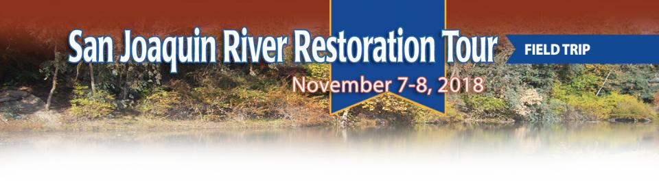
A few tickets are still available for our Nov. 1-2 San Joaquin River
Restoration Tour, a once-a-year educational opportunity to
see the program’s progress first-hand. The tour begins and ends
in Fresno with an overnight stay in Los Banos.
Explore more than 100 miles of Central California’s longest river
while learning about one of the nation’s largest and costliest
river restorations. Our San Joaquin River
Restoration Tour on Nov. 1-2 will feature speakers from key
governmental agencies and stakeholder groups who will explain the
restoration program’s goals and progress.
The Sacramento and San Joaquin are the two major rivers in the
Central Valley that feed the Delta, the hub of
California’s water supply network.
Our last two water tours of 2017 will take in-depth looks at how
these rivers are managed and used for agriculture, cities and the
environment. You’ll see infrastructure, learn about efforts to
restore salmon runs and talk to people with expertise on these
rivers.
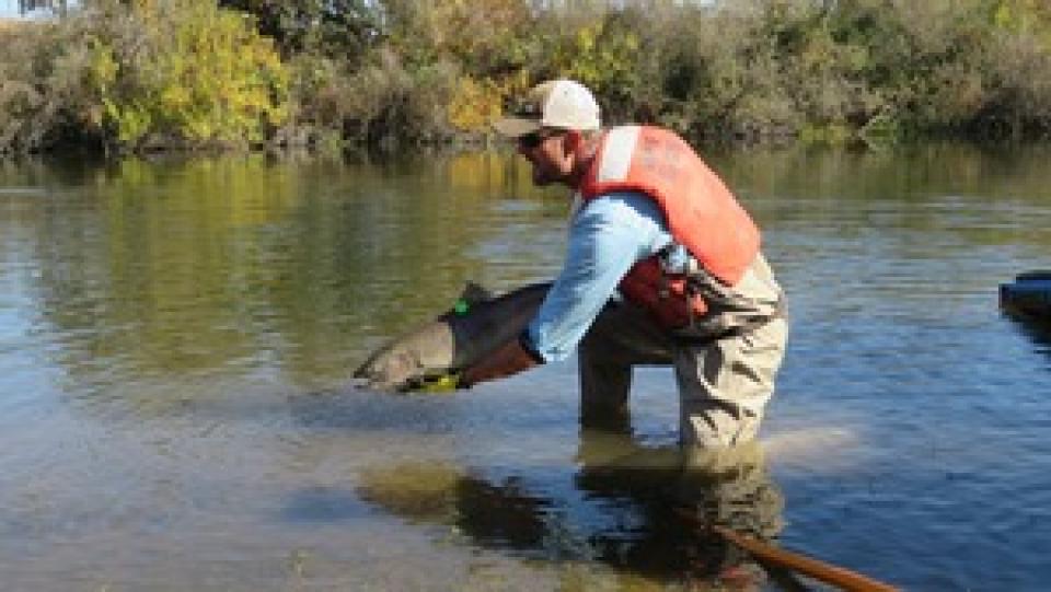
Protecting and restoring California’s populations of threatened
and endangered Chinook salmon and steelhead trout have been a big
part of the state’s water management picture for more than 20
years. Significant resources have been dedicated to helping the
various runs of the iconic fish, with successes and setbacks. In
a landscape dramatically altered from its natural setting,
finding a balance between the competing demands for water is
challenging.
Our water tours give a behind-the-scenes look at major water
issues in California. On our Central Valley Tour, March
8-10, you will visit wildlife habitat areas – some of which are
closed to the public – and learn directly from the experts who
manage them, in addition to seeing farms, large dams and other
infrastructure.
The recent deluge has led to changes in drought conditions in
some areas of California and even public scrutiny of the
possibility that the drought is over. Many eyes are focused on
the San Joaquin Valley, one of the areas hardest hit by reduced
surface water supplies. On our Central Valley Tour, March
8-10, we will visit key water delivery and storage sites in the
San Joaquin Valley, including Friant Dam and Millerton Lake
on the San Joaquin River.
ARkStorm stands for an atmospheric
river (“AR”) that carries precipitation levels expected to occur
once every 1,000 years (“k”). The concept was presented in a 2011
report by the U.S. Geological Survey (USGS) intended to elevate
the visibility of the very real threats to human life, property
and ecosystems posed by extreme storms on the West Coast.
Contaminants exist in water supplies from both natural and
manmade sources. Even those chemicals present without human
intervention can be mobilized from introduction of certain
pollutants from both
point and nonpoint sources.
Both the drought and high nitrate levels in shallow groundwater have necessitated deeper
drilling of new wells in the San Joaquin Valley, only to expose
water with heightened
arsenic levels. Arsenic usually exists in water as arsenate
or arsenite, the latter of which is more frequent in deep lake
sediments or groundwater with little oxygen and is both
more harmful and difficult to remove.
Whiskeytown Lake, a major reservoir in the foothills of the
Klamath Mountains nine miles west of Redding, was
built at the site of one of Shasta County’s first Gold Rush
communities. Whiskeytown, originally called
Whiskey Creek Diggings, was founded in 1849 and named in
reference to a whiskey barrel rolling off a citizen’s pack mule;
it may also refer to miners drinking a barrel per day.
A new era of groundwater management
began in 2014 with the passage of the Sustainable Groundwater
Management Act (SGMA), which aims for local and regional agencies
to develop and implement sustainable groundwater management
plans with the state as the backstop.
SGMA defines “sustainable groundwater management” as the
“management and use of groundwater in a manner that can be
maintained during the planning and implementation horizon without
causing undesirable results.”
This issue examines the impacts of California’s epic
drought, especially related to water supplies for San Joaquin
Valley rural communities and farmland.
This handbook provides crucial
background information on the Sustainable Groundwater Management
Act, signed into law in 2014 by Gov. Jerry Brown. The handbook
also includes a section on options for new governance.
This 3-day, 2-night tour, which we do every spring,
travels the length of the San Joaquin Valley, giving participants
a clear understanding of the State Water Project and Central
Valley Project.
This 30-minute documentary-style DVD on the history and current
state of the San Joaquin River Restoration Program includes an
overview of the geography and history of the river, historical
and current water delivery and uses, the genesis and timeline of
the 1988 lawsuit, how the settlement was reached and what was
agreed to.
This 25-minute documentary-style DVD, developed in partnership
with the California Department of Water Resources, provides an
excellent overview of climate change and how it is already
affecting California. The DVD also explains what scientists
anticipate in the future related to sea level rise and
precipitation/runoff changes and explores the efforts that are
underway to plan and adapt to climate.
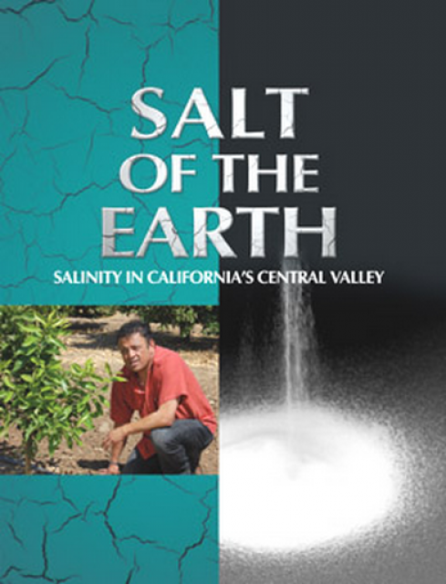
Salt. In a small amount, it’s a gift from nature. But any doctor
will tell you, if you take in too much salt, you’ll start to have
health problems. The same negative effect is happening to land in
the Central Valley. The problem scientists call “salinity” poses
a growing threat to our food supply, our drinking water quality
and our way of life. The problem of salt buildup and potential –
but costly – solutions are highlighted in this 2008 public
television documentary narrated by comedian Paul Rodriguez.
A 20-minute version of the 2008 public television documentary
Salt of the Earth: Salinity in California’s Central Valley. This
DVD is ideal for showing at community forums and speaking
engagements to help the public understand the complex issues
surrounding the problem of salt build up in the Central Valley
potential – but costly – solutions. Narrated by comedian Paul
Rodriquez.
This 3-day, 2-night tour travels the length of the San Joaquin
Valley, giving participants a clear understanding of the State
Water Project and Central Valley Project.
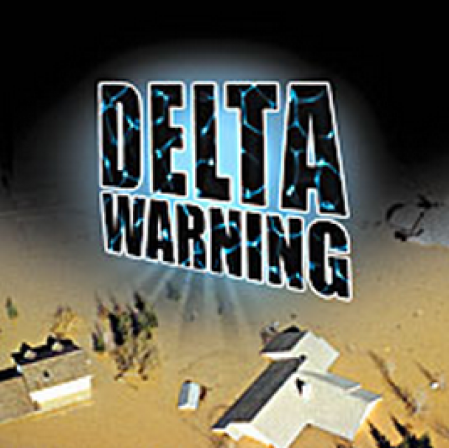
15-minute DVD that graphically portrays the potential disaster
should a major earthquake hit the Sacramento-San Joaquin Delta.
“Delta Warning” depicts what would happen in the event of an
earthquake registering 6.5 on the Richter scale: 30 levee breaks,
16 flooded islands and a 300 billion gallon intrusion of salt
water from the Bay – the “big gulp” – which would shut down the
State Water Project and Central Valley Project pumping plants.
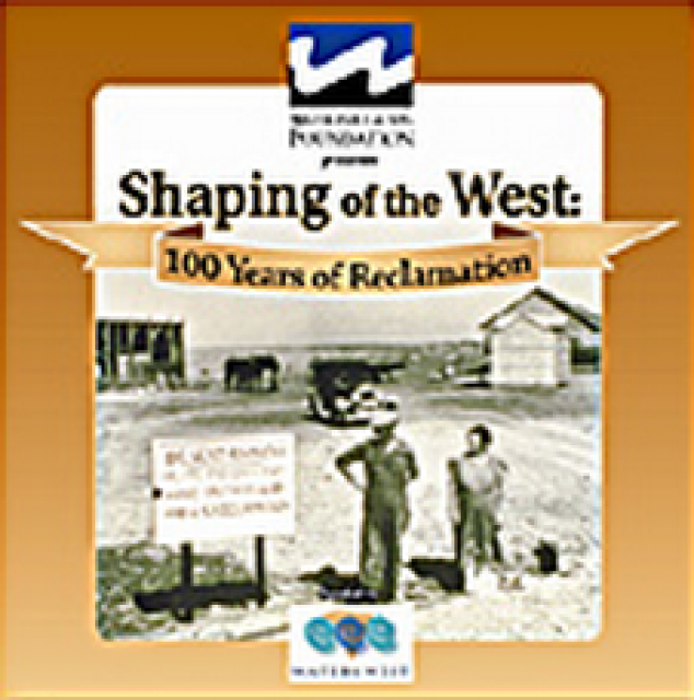
30-minute DVD that traces the history of the U.S. Bureau of
Reclamation and its role in the development of the West. Includes
extensive historic footage of farming and the construction of
dams and other water projects, and discusses historic and modern
day issues.
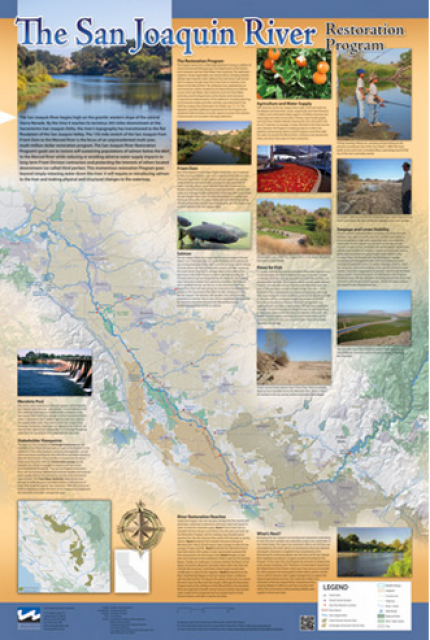
This beautiful 24×36 inch poster, suitable for framing, features
a map of the San Joaquin River. The map text focuses on the San
Joaquin River Restoration Program, which aims to restore flows
and populations of Chinook salmon to the river below Friant Dam
to its confluence with the Merced River. The text discusses the
history of the program, its goals and ongoing challenges with
implementation.
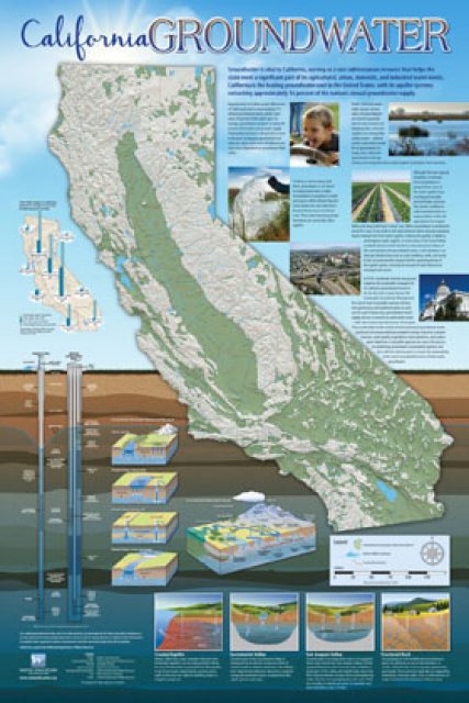
Fashioned after the popular California Water Map, this 24×36 inch
poster was extensively re-designed in 2017 to better illustrate
the value and use of groundwater in California, the main types of
aquifers, and the connection between groundwater and surface
water.
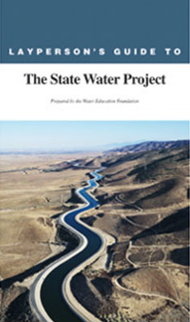
The 24-page Layperson’s Guide to the State Water Project provides
an overview of the California-funded and constructed State Water
Project.
The State Water Project is best known for the 444-mile-long
aqueduct that provides water from the Delta to San Joaquin Valley
agriculture and southern California cities. The guide contains
information about the project’s history and facilities.
The 24-page Layperson’s Guide to Integrated Regional Water
Management (IRWM) is an in-depth, easy-to-understand publication
that provides background information on the principles of IRWM,
its funding history and how it differs from the traditional water
management approach.
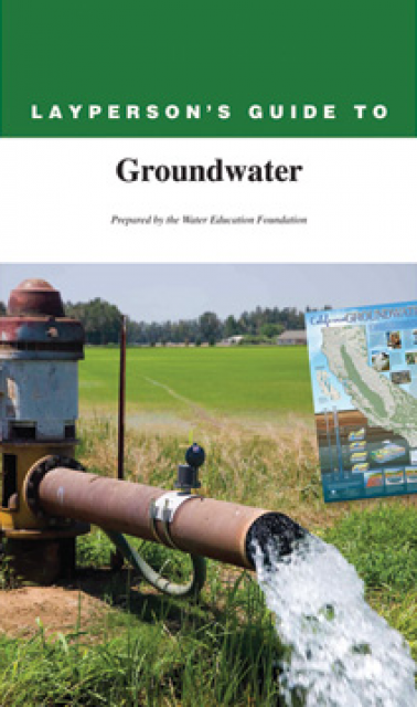
The 28-page Layperson’s Guide to Groundwater is an in-depth,
easy-to-understand publication that provides background and
perspective on groundwater. The guide explains what groundwater
is – not an underground network of rivers and lakes! – and the
history of its use in California.
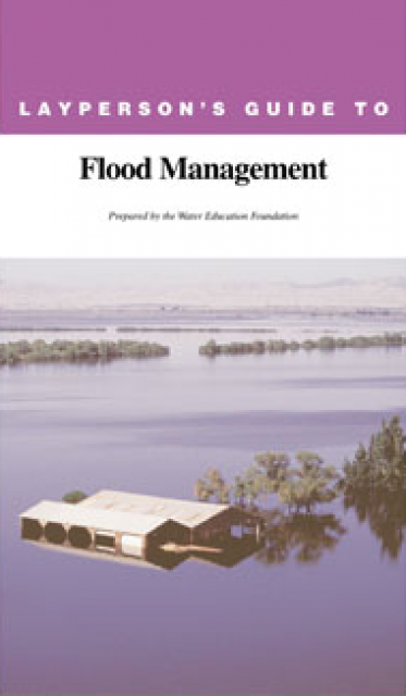
The 24-page Layperson’s Guide to Flood Management explains the
physical flood control system, including levees; discusses
previous flood events (including the 1997 flooding); explores
issues of floodplain management and development; provides an
overview of flood forecasting; and outlines ongoing flood control
projects.
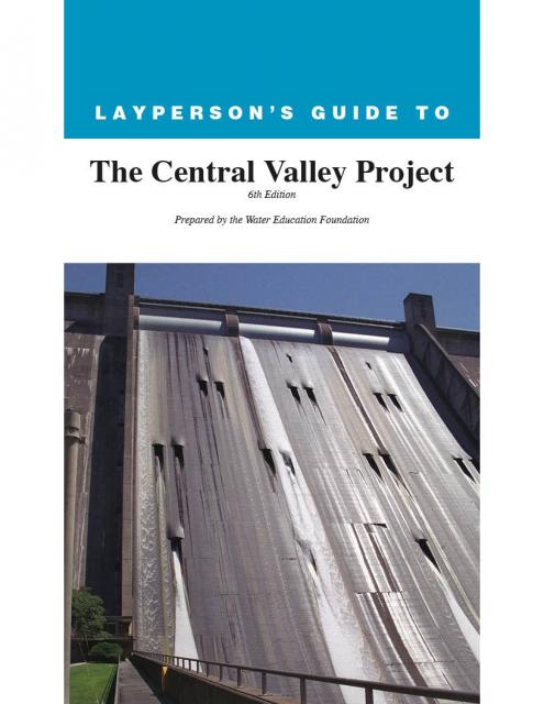
The 24-page Layperson’s Guide to the Central Valley Project
explores the history and development of the federal Central
Valley Project (CVP), California’s largest surface water delivery
system. In addition to the project’s history, the guide describes
the various CVP facilities, CVP operations, the benefits the CVP
brought to the state and the CVP Improvement Act (CVPIA).
A new look for our most popular product! And it’s the perfect
gift for the water wonk in your life.
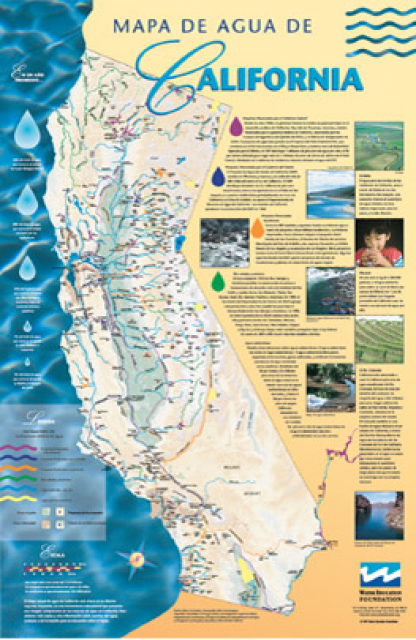
Our 24×36 inch California Water Map is widely known for being the
definitive poster that shows the integral role water plays in the
state. On this updated version, it is easier to see California’s
natural waterways and man-made reservoirs and aqueducts
– including federally, state and locally funded
projects – the wild and scenic rivers system, and
natural lakes. The map features beautiful photos of
California’s natural environment, rivers, water projects,
wildlife, and urban and agricultural uses and the
text focuses on key issues: water supply, water use, water
projects, the Delta, wild and scenic rivers and the Colorado
River.
Located in the middle of California, the San Joaquin Valley is
bracketed on both sides by mountain ranges. Long and flat, the
valley’s hot, dry summers are followed by cool, foggy winters
that make it one of the most productive agricultural regions in
the world.
The valley stretches from across mid-California between coastal
ranges in west and the Sierras on the east. The region includes
large cities such as Fresno and Bakersfield, national parks such
as Yosemite and Kings, millions of people, and fertile farmland.
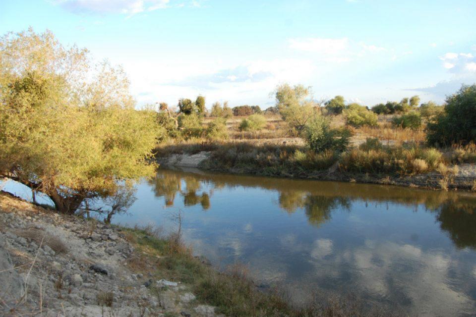
Flowing 366 miles from the Sierra
Nevada to Suisun Bay, the San Joaquin River provides irrigation
water to thousands of acres of San Joaquin Valley farms and
drinking water to some of the valley’s cities. It also is the
focal point for one of the nation’s most ambitious river
restoration projects to revive salmon populations.
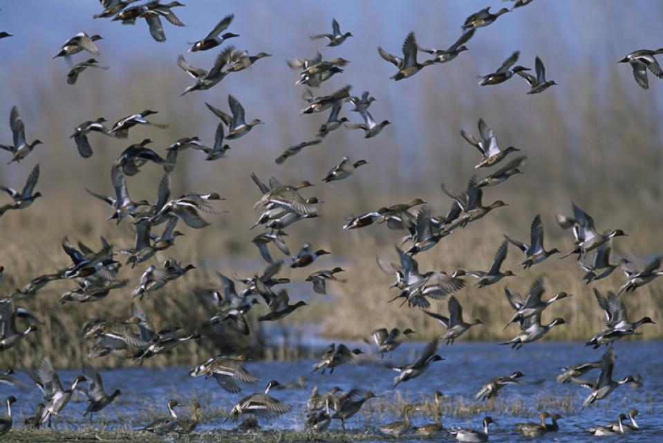
The Pacific Flyway is one of four
major North American migration routes for birds, especially
waterfowl, and extends from Alaska and Canada, through
California, to Mexico and South America. Each year, birds follow
ancestral patterns as they travel the flyway on their annual
north-south migration. Along the way, they need stopover sites
such as wetlands with suitable habitat and food supplies. In
California, 90 percent of historic wetlands have been lost.
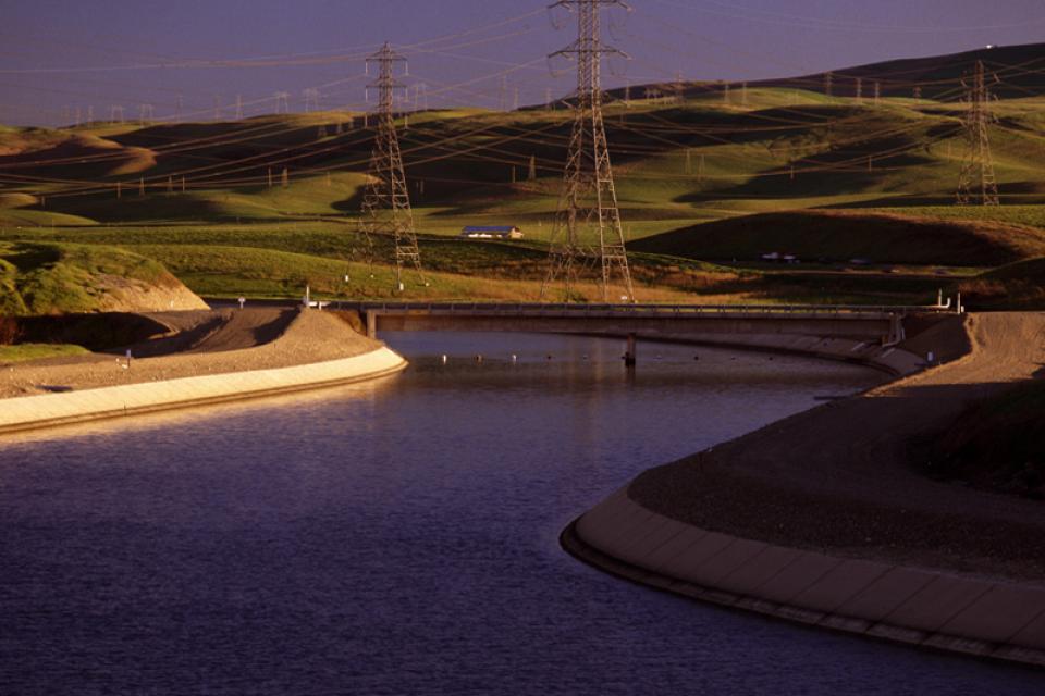
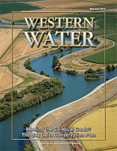
This issue of Western Water looks at the BDCP and the
Coalition to Support Delta Projects, issues that are aimed at
improving the health and safety of the Delta while solidifying
California’s long-term water supply reliability.
This printed issue of Western Water features a
roundtable discussion with Anthony Saracino, a water resources
consultant; Martha Davis, executive manager of policy development
with the Inland Empire Utilities Agency and senior policy advisor
to the Delta Stewardship Council; Stuart Leavenworth, editorial
page editor of The Sacramento Bee and Ellen Hanak, co-director of
research and senior fellow at the Public Policy Institute of
California.
This printed issue of Western Water examines the issues
associated with the State Water Board’s proposed revision of the
water quality Bay-Delta Plan, most notably the question of
whether additional flows are needed for the system, and how they
might be provided.
This printed issue of Western Water examines
groundwater banking, a water management strategy with appreciable
benefits but not without challenges and controversy.
This printed copy of Western Water examines the challenges facing
small water systems, including drought preparedness, limited
operating expenses and the hurdles of complying with costlier
regulations. Much of the article is based on presentations at the
November 2007 Small Systems Conference sponsored by the Water
Education Foundation and the California Department of Water
Resources.
This Western Water looks at proposed new measures to deal with
the century-old problem of salinity with a special focus on San
Joaquin Valley farms and cities.


")
")

")
")
")
")
")
")
")
")
")
")