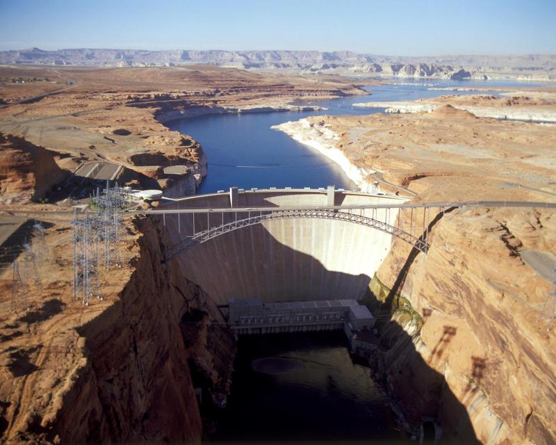
The construction of Glen Canyon Dam in north-central Arizona also
created Lake Powell. Lake Powell serves as a holding tank for the
Colorado River Upper Basin States: Colorado, New Mexico, Utah and
Wyoming.
Every year, boating enthusiasts across the Southwest hitch
watercraft to their vehicles and haul them down to Lake Mead,
a Colorado River reservoir straddling Arizona and
Nevada. This year, though, they’ll have to contend with
dramatically low water levels. According to the U.S. Bureau of
Reclamation, the reservoir’s 2025 elevation is the third lowest
it’s seen in a decade, and the Colorado’s
meager snowpack isn’t expected to help
matters. In response, the National Park Service is taking
steps to ensure that visitors can still recreate on the lake
this summer and beyond. But the future remains uncertain for
the country’s largest reservoir. … With reduced
supply, Lake Mead’s elevation is dwindling. At the end of May,
the reservoir sat at just 1,057 feet above sea level, according
to the Bureau of Reclamation. That’s 5 feet lower than the end
of April, which was another 4 feet lower than in March.
… For eons, the Colorado River flowed through this canyon,
its pounding rapids carving the landscape. In 1963, though, the
government—determined to tame the river and feed the
Southwest’s unrelenting appetite for water—built Glen Canyon
Dam. Slowly, year by year, the giant reservoir it created
backed upstream, drowning 18 rapids whole and transforming 186
miles of what had been a rushing river into a wide, still,
man-made pool. After that, it was eerily quiet, the river
current slackening as it submitted to the lake. But if you
visit this place now, you’ll hear a rumble. And there, right in
front of you, you’ll see it: white water flashing in the sun. A
standing wave big enough to flip a boat. Water moving and
moving fast. A rapid, drowned for 60 years, is emerging from
the depths. To understand this story, we’ll need to time
travel.
Monitors observing Lake Powell’s water levels are issuing a
dire warning: The second largest reservoir in the country, and
one of the most popular destinations for Arizonans and Western
tourists, will suffer yet another year of
drought and accelerated decline. Hydrologists
say this is the consequence of a lack of winter 2024 runoff,
itself the product of an unseasonably dry cold season. Experts
predict the winter melt, which is responsible for replenishing
the endangered lake, will total just 55% of the annual average.
… As the lake continues to shrink, surrounding states
disagree on how to reduce their 40 million residents’
collective water use to stave off the reservoir’s
total destruction. Arizona, California, Colorado, Nevada, New
Mexico, Utah and Wyoming legislators are sparing over which
locales should decrease their residential, commercial, and
agricultural intakes.
Many of California’s reservoirs have filled nearly to capacity
this year with runoff from the ample snowpack in the Sierra
Nevada. But the situation is very different along the Colorado
River, another vital water source for Southern California,
where a very dry spring has shrunk the amount of runoff
streaming into reservoirs. The latest forecast from the federal
Colorado Basin River Forecast Center shows that the river’s
flows into Lake Powell will probably be about 46% of average
over the next three months. … The snowpack in the upper
Colorado River Basin reached 89% of the median level on April
1, but the outlook worsened over the last two months because of
persistent dryness, warm temperatures and dry soils in the
mountains that have absorbed a portion of the runoff.
… The water level of Lake Powell, on
the Utah-Arizona border, sits at 33% of capacity. Downstream
near Las Vegas, Lake Mead is 32% full.
… The mountains that feed the Colorado River with snowmelt
are strikingly dry, with many ranges holding less than 50
percent of their average snow for this time of year. The low
totals could spell trouble for the nation’s largest reservoirs,
but those dry conditions don’t seem to be ringing alarm bells
for Colorado River policymakers. Inflows to Lake Powell, the
nation’s second largest reservoir, are expected to be 55
percent of average this year, according to federal
data released this week. … The federal offices that
manage Western water are in disarray amid layoffs and
restructuring since Donald Trump returned to the White House.
The Bureau of Reclamation, the top federal
agency for Colorado River dams and reservoirs, is without a
permanent commissioner. All the while, state and federal
policymakers are spending most of their time and attention on
drawing up new water-sharing rules.
The Trump administration is proposing a jaw-dropping $609
million cut to the massive Central Utah Project, which supplies
water to millions of people in northern Utah. … “The Budget
provides $1.2 billion for the Bureau of Reclamation and the
Central Utah Project. The Budget reduces funding for programs
that have nothing to do with building and maintaining water
infrastructure, such as habitat restoration. Instead, the
Budget focuses Reclamation and the Central Utah Project on
their core missions of maintaining assets that provide safe,
reliable, and efficient management of water resources
throughout the western United States,” the reduction item says.
The U.S. Department of Interior said Wednesday it extended more
than a dozen contracts with water-rights holders in California
and Arizona that aim to boost water funding and conservation
efforts in the Colorado River system for its seven western
states. Interior officials say it marked “major progress” with
the Bureau of Reclamation in securing a continuation of 18
short-term agreements with tribal, municipal and agricultural
water users in the lower Colorado River basin that will, they
said, “result in additional water savings” through 2026 and,
likewise, secure its short-term health as the region looks to
its post-2026 water-use guidelines for Lake Powell and Lake
Mead. … Scott Cameron, a senior adviser to U.S. Interior
Secretary Doug Burgum, said the Trump administration
was focused on strengthening the Colorado River system’s
drought response and “safeguarding the interests of western
communities” for more than 40 million citizens and hydropower
fuel resources in its seven states.
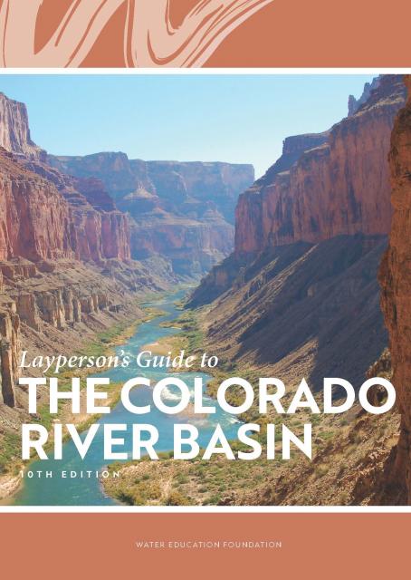
Learn the history and challenges facing the West’s most dramatic
and developed river.
The Layperson’s Guide to the Colorado River Basin introduces the
1,450-mile river that sustains 40 million people and millions of
acres of farmland spanning seven states and parts of northern
Mexico.
The 28-page primer explains how the river’s water is shared and
managed as the Southwest transitions to a hotter and drier
climate.
The climate-driven shrinking of the
Colorado River is expanding the influence of Native American
tribes over how the river’s flows are divided among cities, farms
and reservations across the Southwest.
The tribes are seeing the value of their largely unused river
water entitlements rise as the Colorado dwindles, and they are
gaining seats they’ve never had at the water bargaining table as
government agencies try to redress a legacy of exclusion.
The states of the Lower Colorado
River Basin have traditionally played an oversized role in
tapping the lifeline that supplies 40 million people in the West.
California, Nevada and Arizona were quicker to build major canals
and dams and negotiated a landmark deal that requires the Upper
Basin to send predictable flows through the Grand Canyon, even
during dry years.
But with the federal government threatening unprecedented water
cuts amid decades of drought and declining reservoirs, the Upper
Basin states of Wyoming, Utah, Colorado and New Mexico are
muscling up to protect their shares of an overallocated river
whose average flows in the Upper Basin have already dropped
20 percent over the last century.
They have formed new agencies to better monitor their interests,
moved influential Colorado River veterans into top negotiating
posts and improved their relationships with Native American
tribes that also hold substantial claims to the river.
When the Colorado River Compact was
signed 100 years ago, the negotiators for seven Western states
bet that the river they were dividing would have ample water to
meet everyone’s needs – even those not seated around the table.
A century later, it’s clear the water they bet on is not there.
More than two decades of drought, lake evaporation and overuse of
water have nearly drained the river’s two anchor reservoirs, Lake
Powell on the Arizona-Utah border and Lake Mead near Las Vegas.
Climate change is rendering the basin drier, shrinking spring
runoff that’s vital for river flows, farms, tribes and cities
across the basin – and essential for refilling reservoirs.
The states that endorsed the Colorado River Compact in 1922 – and
the tribes and nation of Mexico that were excluded from the table
– are now straining to find, and perhaps more importantly accept,
solutions on a river that may offer just half of the water that
the Compact assumed would be available. And not only are
solutions not coming easily, the relationships essential for
compromise are getting more frayed.
With 25 years of experience working
on the Colorado River, Chuck Cullom is used to responding to
myriad challenges that arise on the vital lifeline that seven
states, more than two dozen tribes and the country of Mexico
depend on for water. But this summer problems on the
drought-stressed river are piling up at a dizzying pace:
Reservoirs plummeting to record low levels, whether Hoover Dam
and Glen Canyon Dam can continue to release water and produce
hydropower, unprecedented water cuts and predatory smallmouth
bass threatening native fish species in the Grand Canyon.
“Holy buckets, Batman!,” said Cullom, executive director of the
Upper Colorado River Commission. “I mean, it’s just on and on and
on.”
Momentum is building for a unique
interstate deal that aims to transform wastewater from Southern
California homes and business into relief for the stressed
Colorado River. The collaborative effort to add resiliency to a
river suffering from overuse, drought and climate change is being
shaped across state lines by some of the West’s largest water
agencies.
Climate scientist Brad Udall calls
himself the skunk in the room when it comes to the Colorado
River. Armed with a deck of PowerPoint slides and charts that
highlight the Colorado River’s worsening math, the Colorado State
University scientist offers a grim assessment of the river’s
future: Runoff from the river’s headwaters is declining, less
water is flowing into Lake Powell – the key reservoir near the
Arizona-Utah border – and at the same time, more water is being
released from the reservoir than it can sustainably provide.
Twenty years ago, the Colorado River
Basin’s hydrology began tumbling into a historically bad stretch.
The weather turned persistently dry. Water levels in the system’s
anchor reservoirs of Lake Powell and Lake Mead plummeted. A river
system relied upon by nearly 40 million people, farms and
ecosystems across the West was in trouble. And there was no guide
on how to respond.
Managing water resources in the Colorado River Basin is not for the timid or those unaccustomed to big challenges. Careers are devoted to responding to all the demands put upon the river: water supply, hydropower, recreation and environmental protection.
All of this while the Basin endures a seemingly endless drought and forecasts of increasing dryness in the future.
Sprawled across a desert expanse
along the Utah-Arizona border, Lake Powell’s nearly 100-foot high
bathtub ring etched on its sandstone walls belie the challenges
of a major Colorado River reservoir at less than half-full. How
those challenges play out as demand grows for the river’s water
amid a changing climate is fueling simmering questions about
Powell’s future.
Innovative efforts to accelerate
restoration of headwater forests and to improve a river for the
benefit of both farmers and fish. Hard-earned lessons for water
agencies from a string of devastating California wildfires.
Efforts to drought-proof a chronically water-short region of
California. And a broad debate surrounding how best to address
persistent challenges facing the Colorado River.
These were among the issues Western Water explored in
2019, and are still worth taking a look at in case you missed
them.
The Colorado River is arguably one
of the hardest working rivers on the planet, supplying water to
40 million people and a large agricultural economy in the West.
But it’s under duress from two decades of drought and decisions
made about its management will have exceptional ramifications for
the future, especially as impacts from climate change are felt.
The Colorado River Basin’s 20 years
of drought and the dramatic decline in water levels at the
river’s key reservoirs have pressed water managers to adapt to
challenging conditions. But even more extreme — albeit rare —
droughts or floods that could overwhelm water managers may lie
ahead in the Basin as the effects of climate change take hold,
say a group of scientists. They argue that stakeholders who are
preparing to rewrite the operating rules of the river should plan
now for how to handle these so-called “black swan” events so
they’re not blindsided.
Summer is a good time to take a
break, relax and enjoy some of the great beaches, waterways and
watersheds around California and the West. We hope you’re getting
a chance to do plenty of that this July.
But in the weekly sprint through work, it’s easy to miss
some interesting nuggets you might want to read. So while we’re
taking a publishing break to work on other water articles planned
for later this year, we want to help you catch up on
Western Water stories from the first half of this year
that you might have missed.
Even as stakeholders in the Colorado River Basin celebrate the recent completion of an unprecedented drought plan intended to stave off a crashing Lake Mead, there is little time to rest. An even larger hurdle lies ahead as they prepare to hammer out the next set of rules that could vastly reshape the river’s future.
Set to expire in 2026, the current guidelines for water deliveries and shortage sharing, launched in 2007 amid a multiyear drought, were designed to prevent disputes that could provoke conflict.
As stakeholders labor to nail down
effective and durable drought contingency plans for the Colorado
River Basin, they face a stark reality: Scientific research is
increasingly pointing to even drier, more challenging times
ahead.
The latest sobering assessment landed the day after Thanksgiving,
when U.S. Global Change Research Program’s Fourth National Climate
Assessment concluded that Earth’s climate is changing rapidly
compared to the pace of natural variations that have occurred
throughout its history, with greenhouse gas emissions largely the
cause.
As the Colorado River Basin becomes
drier and shortage conditions loom, one great variable remains:
How much of the river’s water belongs to Native American tribes?
Native Americans already use water from the Colorado River and
its tributaries for a variety of purposes, including leasing it
to non-Indian users. But some tribes aren’t using their full
federal Indian reserved water right and others have water rights
claims that have yet to be resolved. Combined, tribes have rights
to more water than some states in the Colorado River Basin.
The Colorado River Basin is more
than likely headed to unprecedented shortage in 2020 that could
force supply cuts to some states, but work is “furiously”
underway to reduce the risk and avert a crisis, Bureau of
Reclamation Commissioner Brenda Burman told an audience of
California water industry people.
During a keynote address at the Water Education Foundation’s
Sept. 20 Water Summit in Sacramento, Burman said there is
opportunity for Colorado River Basin states to control their
destiny, but acknowledged that in water, there are no guarantees
that agreement can be reached.
Water means life for all the Grand Canyon’s inhabitants, including the many varieties of insects that are a foundation of the ecosystem’s food web. But hydropower operations upstream on the Colorado River at Glen Canyon Dam, in Northern Arizona near the Utah border, disrupt the natural pace of insect reproduction as the river rises and falls, sometimes dramatically. Eggs deposited at the river’s edge are often left high and dry and their loss directly affects available food for endangered fish such as the humpback chub.
Amy Haas recently became the first non-engineer and the first woman to serve as executive director of the Upper Colorado River Commission in its 70-year history, putting her smack in the center of a host of daunting challenges facing the Upper Colorado River Basin.
Yet those challenges will be quite familiar to Haas, an attorney who for the past year has served as deputy director and general counsel of the commission. (She replaced longtime Executive Director Don Ostler). She has a long history of working within interstate Colorado River governance, including representing New Mexico as its Upper Colorado River commissioner and playing a central role in the negotiation of the recently signed U.S.-Mexico agreement known as Minute 323.
Nowhere is the domino effect in
Western water policy played out more than on the Colorado River,
and specifically when it involves the Lower Basin states of
California, Nevada and Arizona. We are seeing that play out now
as the three states strive to forge a Drought Contingency Plan.
Yet that plan can’t be finalized until Arizona finds a unifying
voice between its major water players, an effort you can read
more about in the latest in-depth article of Western Water.
Even then, there are some issues to resolve just within
California.
It’s high-stakes time in Arizona. The state that depends on the
Colorado River to help supply its cities and farms — and is
first in line to absorb a shortage — is seeking a unified plan
for water supply management to join its Lower Basin neighbors,
California and Nevada, in a coordinated plan to preserve water
levels in Lake Mead before
they run too low.
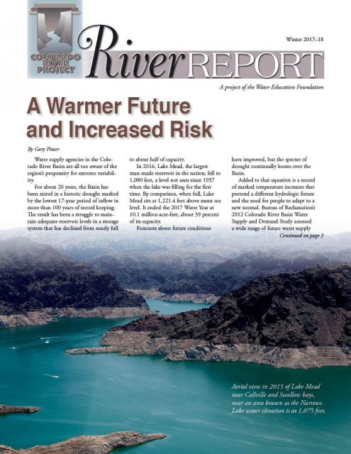
If the lake’s elevation falls below 1,075 feet above sea level,
the secretary of the Interior would declare a shortage and
Arizona’s deliveries of Colorado River water would be reduced by
320,000 acre-feet. Arizona says that’s enough to serve about 1
million households in one year.
Tickets are now on sale for the Water Education Foundation’s April 11-13 tour of the Lower Colorado River.
Don’t miss this opportunity to visit key sites along one of the nation’s most famous rivers, including a private tour of Hoover Dam, Central Arizona Project’s Mark Wilmer pumping plant and the Havasu National Wildlife Refuge. The tour also visits the Salton Sea, Slab City, the All-American Canal and farming regions in the Imperial and Coachella valleys.
Rising temperatures from climate change are having a noticeable
effect on how much water is flowing down the Colorado River. Read
the latest River Report to learn more about what’s
happening, and how water managers are responding.
This issue of Western Water discusses the challenges
facing the Colorado River Basin resulting from persistent
drought, climate change and an overallocated river, and how water
managers and others are trying to face the future.
A troublesome invasive species is
the quagga mussel, a tiny freshwater mollusk that attaches itself
to water utility infrastructure and reproduces at a rapid rate,
causing damage to pipes and pumps.
First found in the Great Lakes in 1988 (dumped with ballast water
from overseas ships), the quagga mussel along with the zebra
mussel are native to the rivers and lakes of eastern Europe and
western Asia, including the Black, Caspian and Azov Seas and the
Dneiper River drainage of Ukraine and Ponto-Caspian
Sea.
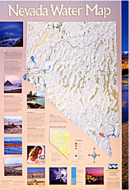
This 24×36 inch poster, suitable for framing, illustrates the
water resources available for Nevada cities, agriculture and the
environment. It features natural and manmade water resources
throughout the state, including the Truckee and Carson rivers,
Lake Tahoe, Pyramid Lake and the course of the Colorado River
that forms the state’s eastern boundary.
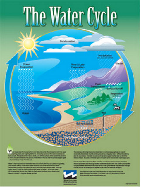
Water as a renewable resource is depicted in this 18×24 inch
poster. Water is renewed again and again by the natural
hydrologic cycle where water evaporates, transpires from plants,
rises to form clouds, and returns to the earth as precipitation.
Excellent for elementary school classroom use.
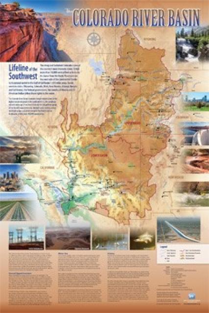
Redesigned in 2017, this beautiful map depicts the seven
Western states that share the Colorado River with Mexico. The
Colorado River supplies water to nearly 40 million people in
Arizona, California, Colorado, Nevada, New Mexico, Utah, Wyoming
and Mexico. Text on this beautiful, 24×36-inch map, which is
suitable for framing, explains the river’s apportionment, history
and the need to adapt its management for urban growth and
expected climate change impacts.
A new look for our most popular product! And it’s the perfect
gift for the water wonk in your life.
Our 24×36-inch California Water Map is widely known for being the
definitive poster that shows the integral role water plays in the
state. On this updated version, it is easier to see California’s
natural waterways and man-made reservoirs and aqueducts
– including federally, state and locally funded
projects – the wild and scenic rivers system, and
natural lakes. The map features beautiful photos of
California’s natural environment, rivers, water projects,
wildlife, and urban and agricultural uses and the
text focuses on key issues: water supply, water use, water
projects, the Delta, wild and scenic rivers and the Colorado
River.
The construction of Glen Canyon Dam
in 1964 created Lake Powell. Both are located in north-central
Arizona near the Utah border. Lake Powell acts as a holding tank
for outflow from the Colorado River Upper Basin States: Colorado,
New Mexico, Utah and Wyoming.
The water stored in Lake Powell is used for recreation, power
generation and delivering water to the Lower Basin states of
California, Arizona, and Nevada.
In 2005, after six years of severe
drought in the Colorado River Basin, federal officials and
representatives of the seven basin states — California, Arizona,
Nevada, New Mexico, Colorado, Utah and Wyoming — began building a
framework to better respond to drought conditions and coordinate
the operations of the basin’s two key reservoirs, Lake Powell and
Lake Mead.
The resulting Interim Guidelines for Lower Basin Shortages and
the Coordinated Operations for Lake Powell and Lake Mead (Interim
Guidelines) identified the conditions for shortage determinations
and details of coordinated reservoir operations. The 2007 Interim
Guidelines remain in effect through Dec. 31, 2025.
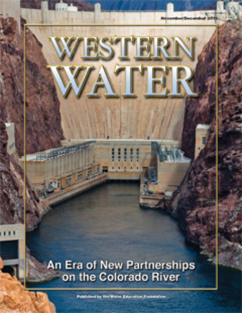
This printed issue of Western Water examines how the various
stakeholders have begun working together to meet the planning
challenges for the Colorado River Basin, including agreements
with Mexico, increased use of conservation and water marketing,
and the goal of accomplishing binational environmental
restoration and water-sharing programs.
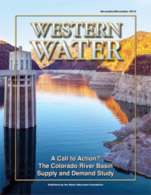
This printed issue of Western Water examines the
Colorado River Basin Water Supply and Demand Study and what its
finding might mean for the future of the lifeblood of the
Southwest.
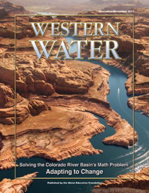
This printed issue of Western Water explores the
historic nature of some of the key agreements in recent years,
future challenges, and what leading state representatives
identify as potential “worst-case scenarios.” Much of the content
for this issue of Western Water came from the in-depth
panel discussions at the Colorado River Symposium. The Foundation
will publish the full proceedings of the Symposium in 2012.
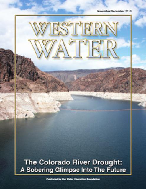
This printed issue of Western Water examines the
Colorado River drought, and the ongoing institutional and
operational changes underway to maintain the system and meet the
future challenges in the Colorado River Basin.
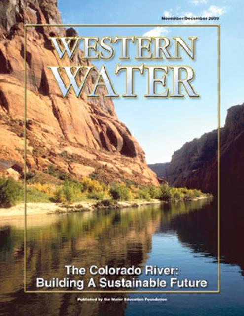
This printed issue of Western Water explores some of the major
challenges facing Colorado River stakeholders: preparing for
climate change, forging U.S.-Mexico water supply solutions and
dealing with continued growth in the basins states. Much of the
content for this issue of Western Water came from the in-depth
panel discussions at the September 2009 Colorado River Symposium.
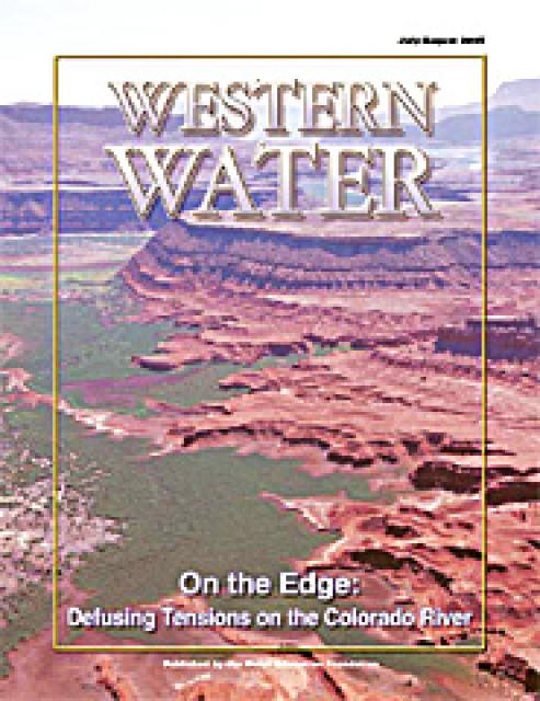
With interstate discussions of critical Colorado River issues
seemingly headed for stalemate, Secretary of the Interior Gale
Norton stepped in May 2 to defuse, or at least defer, a
potentially divisive debate over water releases from Lake Powell.


 and other tributaries of the upper Colorado River have declined dramatically and contributed to the precipitous declines of Lake Powell and Lake Mead. (Source: The Water Desk)")
")
")
")
")
")
")
")
")
")
")

")
")

")
")
")

")