The journey is over. The 310-mile First Descent paddle from the
headwaters of the Wood River to Requa, where the Klamath Rivers
pours into the Pacific Ocean, ended Friday when a group of
teenaged kayakers from tribes living along the the river and
its tributaries arrived at a spit at the river’s end. A
gathering of relatives, friends and other watched as the
kayakers broke through the fog and into
view. … Along with congratulating the young
paddlers and giving them words of encouragement, a recurring
theme was celebrating the removal of four Klamath River dams
and the return of salmon. Fittingly, the ceremonies, which
moved from the spit to the road in Requa, were adjacent to what
was intended to be a fish processing plant but is not operating
because of the lack of salmon. Speakers also noted that weeks
after the removal of the dams, salmon were seen beyond the John
C. Boyle Dam near Keno.
Two years ago, the U.S. Supreme Court slashed federal Clean
Water Act protection of wetlands, streams, and all of our clean
water with its decision in the Sackett v. EPA case. NRDC
scientists mapped the potential impact of the Sackett decision
and found it devastating—threatening harmful repercussions for
droughts, wildfires, flooding, wildlife, and the drinking water
supply. In the absence of federal protection, the
imperative to defend our shared waters falls increasingly on
individuals, states, and Native American Tribal
Nations. NRDC is actively working to prevent any further
weakening of the Clean Water Act (which the federal U.S.
Environmental Protection Agency intends to pursue) and to
ensure the law remains a robust tool for all wetland and stream
advocates, including Indigenous Peoples. Tribal Nations protect
and manage millions of acres of wetlands in the United States,
and with commitments made by the U.S. government to Tribal
co-management and co-stewardship of federal lands, the amount
of clean water safeguarded by Tribal Nations is growing.
Five years ago, Plains Miwok cultural practitioner Don Hankins
got a surprising invitation from Russ Ryan, a project manager
at the Metropolitan Water District of Southern California. The
agency owns four islands in the Sacramento-San Joaquin River
Delta, including one called Webb Tract, and Ryan asked Hankins
for help stewarding them from an Indigenous perspective.
Hankins was skeptical at first. … But Hankins feels a
deep-rooted responsibility toward the Delta. He was also moved
when Ryan visited him at California State University Chico,
where he’s a professor of geography and planning. On a walk in
Big Chico Creek Ecological Reserve, the pair forged a
partnership that included bringing tribes into planning a new
wetland on Webb Tract from the very beginning. “It’s a game
changer,” says Hankins, noting that this is the first time
tribes have been integral to a restoration project in the
Delta.
Along the Klamath River in Northern California, where logging
companies once cut ancient redwood trees, vast tracts of land
have been returned to the Yurok Tribe in a years-long effort
that tribal leaders say will enable the restoration of forests
and the protection of a watershed that is
vital for salmon. The effort, which unfolded gradually over the
last 23 years, culminated in May as Western Rivers Conservancy
turned over 14,968 acres to the Yurok Tribe. It was the last
portion of 47,097 acres that the nonprofit group acquired and
transferred to the tribe in what is thought to be the largest
“land back” deal in California history. Members of the tribe
say they are celebrating the return of their ancestral lands
along Blue Creek, a major tributary that meets
the Klamath about 40 miles south of the Oregon border. Blue
Creek holds cultural and spiritual significance for the Yurok,
and its cold, clear waters provide a refuge for salmon.
A federal judge ruled Monday that the U.S. Forest Service
cannot transfer land containing Oak Flat, a site sacred to the
Western Apache, to a copper mining company until two cases
against the project are settled after the Forest Service
publishes its final environmental review for the project. …
The legal battle over Oak Flat, known in Apache as Chi’chil
Biłdagoteel, has been one of the most high-profile mining cases
in the country over the past decade. … It would …
use as much water each year as the city of
Tempe, home to Arizona State University and 190,000
people. It would pull water from the same tapped-out
aquifer the Phoenix metro area relies on,
where Arizona has prohibited more extraction except for
exempted uses like mines.
The Navajo Nation Commission on Emergency Management (CEM)
unanimously approved Resolution No. 25-005, officially
declaring a State of Emergency in response to worsening drought
conditions across the Nation. All six commissioners voted in
favor of the resolution. … Resolution 25-005 addresses a
range of urgent concerns, including critically low
precipitation, deteriorating rangelands, declining water
infrastructure, and heightened wildfire risks. The declaration
calls on livestock owners to reduce herd sizes, instructs
Grazing Officials to update tally counts, and encourages
farmers to shift to drought-resistant crops. It also places
restrictions on irrigation to conserve dwindling lake and
reservoir supplies. … The resolution authorizes
$6,553,730 from the Agricultural Infrastructure Fund (AIF) to
be directed toward critical repairs to windmills and the
installation of water storage systems in drought-affected
communities.
The Bureau of Reclamation announced an investment of $1.1
million to the Colorado River Indian Tribes to assess the
Colorado River Indian Irrigation Project. The funding will
assist the tribe to review existing infrastructure and identify
necessary maintenance. It will also be used to identify
potential opportunities to install new equipment and utilize
updated technology to modernize the project. “We appreciate the
Colorado River Indian Tribe’s collaboration for many years on
implementing its decreed water rights and the Water Resiliency
Act,” said Acting Commissioner David Palumbo. “We look forward
to utilizing this funding to further this partnership.” This
assessment is intended to assist the Colorado River Indian
Tribes as they evaluate a potential title transfer of the
project in order to take direct ownership. This could allow for
water leasing and other opportunities that could
contribute to overall water savings in the Colorado River
Basin.
After months of deliberation, the New Mexico Water Quality
Control Commission on May 14 voted to prohibit any discharge of
treated “produced water” from oil and gas extraction to ground
and surface waters. Produced water flows back to the
surface during fracking and conventional oil and gas drilling
and contains chemicals used in the extraction process as well
as numerous other hazardous compounds, including arsenic and
benzene, both human carcinogens. New Mexico creates around
two billion barrels—84 billion gallons—of this toxic wastewater
each year. Cleaning through multi-stage filtration,
desalination and other processes could allow for the reuse of
produced water for irrigation and other commercial
applications, saving precious water resources. But
environmental advocates, scientists and the New Mexico
Environmental Department (NMED) have urged that proper
regulations are not yet in place to make such reuse safe.
… Roughly 73 square miles (189 square kilometers) of
homelands have been returned to the Yurok, more than doubling
the tribe’s land holdings, according to a deal announced
Thursday. Completion of the land-back conservation deal along
the lower Klamath River — a partnership with
Western Rivers Conservancy and other environmental groups — is
being called the largest in California history. The Yurok
Tribe had 90% of its territory taken during the California Gold
Rush in the mid-1800s, suffering massacres and disease from
settlers. … The Yurok people will now manage these lands
and waterways. The tribe’s plans include reintroducing fire as
a forest management tool, clearing lands for prairie
restoration, removing invasive species and planting trees while
providing work for some of the tribe’s more than 5,000 members
and helping restoresalmon
and wildlife.
The Agua Caliente Band of Cahuilla Indians, Coachella Valley
Water District and Desert Water Agency have agreed to settle
two long running water rights lawsuits, which the three parties
said in a news release will “enhance certainty and stability
over the future of water management and increases supply
reliability for Coachella Valley residents.” The
tribe’s historic water rights are affirmed in the
agreement, placing them at the head of the line for
water from a vast aquifer stretching under much of the
Coachella Valley, but they agreed to share it in times of
drought or water restrictions. Congress must approve the
proposed settlement, and the tribe and the agencies will also
ask for $500 million in federal funds and $15 million in state
funds under new legislation. More than 2,700 acres of the
280,000-acre Santa Rosa and San Jacinto Mountains National
Monument currently managed by the Bureau of Reclamation would
also be transferred in trust for the tribe’s use and benefit to
the Bureau of Indian Affairs.
The First Descent Expedition of the Klamath River by young
members of Tribes living along the river will begin Thursday,
June 12. Participants in the Ríos to Rivers Paddle Tribal
Waters Program will lead the first-ever 30-day source-to-sea
descent of the newly undammed Klamath River. An opening
celebration marking the beginning of the month-long,
310-plus-miles expedition will be held June 12 at the
headwaters of the Wood River, an invitation-only event. From
the starting point, the kayakers will cross Upper Klamath Lake,
portage around the Link River Dam, and cross Lake Ewauna to the
Klamath River. … Organizers said the event will “explore
the long-awaited return of Chinook salmon to their ancestral
spawning grounds, the far-reaching benefits of dam removal and
the revival of an entire ecosystem. Experts will share
insights on water quality improvements, habitat restoration and
the lasting impacts on wildlife and river communities.”
This special, first-ever Foundation water tour will not be offered every year! Join us as we examine water issues along the 263-mile Klamath River, from its spring-fed headwaters in south-central Oregon to its redwood-lined estuary on the Pacific Ocean in California.
Running Y Resort
5500 Running Y Rd
Klamath Falls, OR 97601
Six tribes in the Upper Colorado River Basin, including two in
Colorado, have gained long-awaited access to discussions about
the basin’s water issues — talks that were formerly
limited to states and the federal government. Under an
agreement finalized this month, the tribes will meet every two
months to discuss Colorado River issues with an interstate
water policy commission, the Upper Colorado River Commission,
or UCRC. It’s the first time in the commission’s 76-year
history that tribes have been formally included, and the timing
is key as negotiations about the river’s future intensify.
… Most immediately, the commission wants a key number:
How much water goes unused by tribes and flows down to the
Lower Basin?
Sustaining the American Southwest is the Colorado River. But
demand, damming, diversion, and drought are draining this vital
water resource at alarming rates. The future of water in the
region – particularly from the Colorado River – was top of mind
at the 10th Annual Eccles Family Rural West Conference, an
event organized by the Bill Lane Center for the American West
that brings together policymakers, practitioners, and scholars
to discuss solutions to urgent problems facing rural Western
regions.
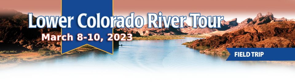
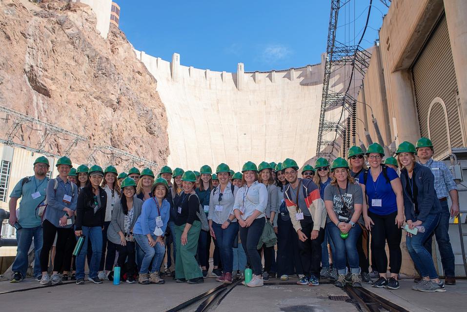
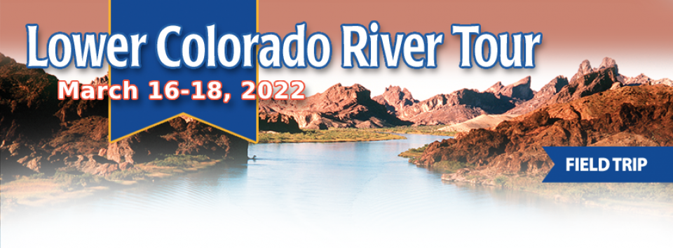
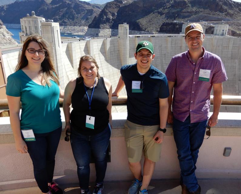
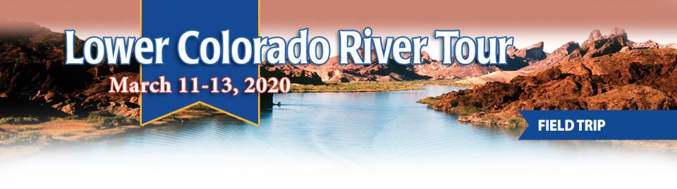
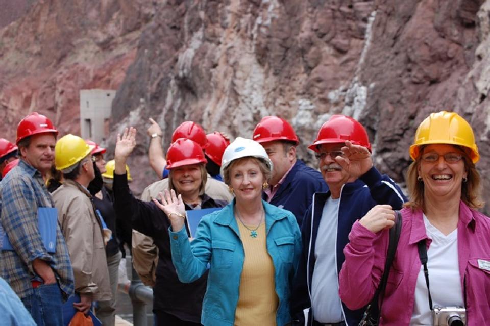
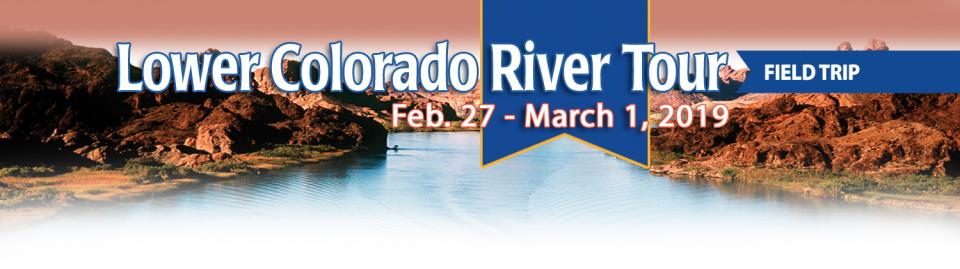
This tour explored the lower Colorado River firsthand where virtually every drop of the river is allocated, yet demand is growing from myriad sources — increasing population, declining habitat, drought and climate change.
The 1,450-mile river is a lifeline to some 40 million people in the Southwest across seven states, 30 tribal nations and Mexico. How the Lower Basin states – Arizona, California and Nevada – use and manage this water to meet agricultural, urban, environmental and industrial needs was the focus of this tour.
Hilton Garden Inn Las Vegas Strip South
7830 S Las Vegas Blvd
Las Vegas, NV 89123
Learn the history and challenges facing the West’s most dramatic
and developed river.
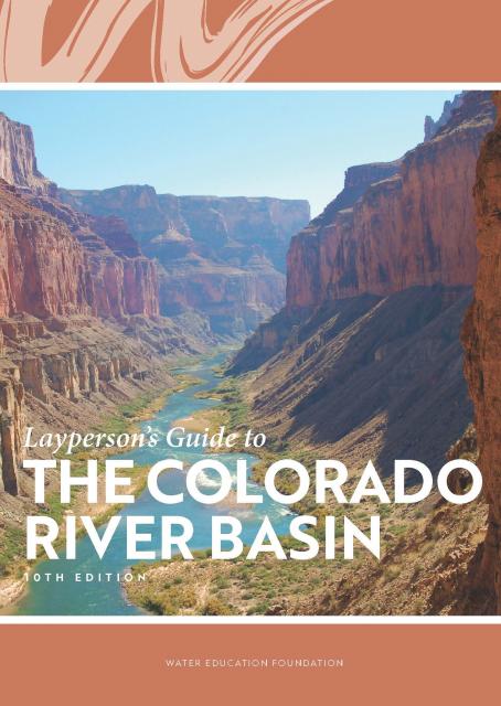
The Layperson’s Guide to the Colorado River Basin introduces the
1,450-mile river that sustains 40 million people and millions of
acres of farmland spanning seven states and parts of northern
Mexico.
The 28-page primer explains how the river’s water is shared and
managed as the Southwest transitions to a hotter and drier
climate.
The U.S. Senate Indian Affairs Committee is holding an
important hearing Thursday on S. 2385, a bill to
refine the tools needed to help Tribal communities gain access
to something that most non-Indian communities in the western
United States have long taken for granted: federally subsidized
systems to deliver safe, clean drinking water to our homes.
… This is the sort of bill (there’s a companion on the
House side) that makes a huge amount of sense, but could easily
get sidetracked in the chaos of Congress. The ideal path is for
the crucial vetting to happen in a process such as Thursday’s
hearing, and then to attach it to one of those omnibus things
that Congress uses these days to get non-controversial stuff
done. Clean water for Native communities should pretty clearly
be non-controversial.
The climate-driven shrinking of the
Colorado River is expanding the influence of Native American
tribes over how the river’s flows are divided among cities, farms
and reservations across the Southwest.
The tribes are seeing the value of their largely unused river
water entitlements rise as the Colorado dwindles, and they are
gaining seats they’ve never had at the water bargaining table as
government agencies try to redress a legacy of exclusion.
The states of the Lower Colorado
River Basin have traditionally played an oversized role in
tapping the lifeline that supplies 40 million people in the West.
California, Nevada and Arizona were quicker to build major canals
and dams and negotiated a landmark deal that requires the Upper
Basin to send predictable flows through the Grand Canyon, even
during dry years.
But with the federal government threatening unprecedented water
cuts amid decades of drought and declining reservoirs, the Upper
Basin states of Wyoming, Utah, Colorado and New Mexico are
muscling up to protect their shares of an overallocated river
whose average flows in the Upper Basin have already dropped
20 percent over the last century.
They have formed new agencies to better monitor their interests,
moved influential Colorado River veterans into top negotiating
posts and improved their relationships with Native American
tribes that also hold substantial claims to the river.
This tour explored the lower Colorado River firsthand where virtually every drop of the river is allocated, yet demand is growing from myriad sources — increasing population, declining habitat, drought and climate change.
The 1,450-mile river is a lifeline to some 40 million people in the Southwest across seven states, 30 tribal nations and Mexico. How the Lower Basin states – Arizona, California and Nevada – use and manage this water to meet agricultural, urban, environmental and industrial needs was the focus of this tour.
Hilton Garden Inn Las Vegas Strip South
7830 S Las Vegas Blvd
Las Vegas, NV 89123
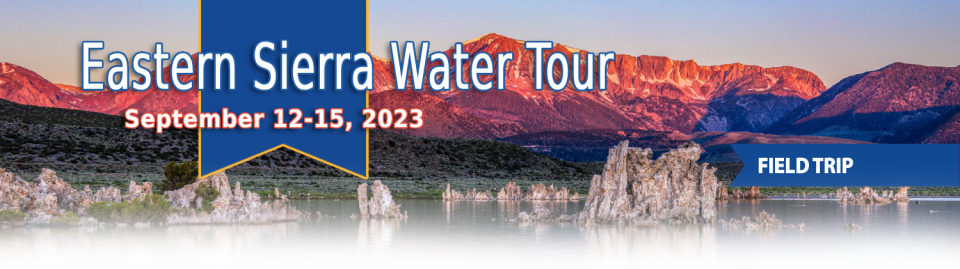
This special Foundation water tour journeyed along the Eastern Sierra from the Truckee River to Mono Lake, through the Owens Valley and into the Mojave Desert to explore a major source of water for Southern California, this year’s snowpack and challenges for towns, farms and the environment.
When the Colorado River Compact was
signed 100 years ago, the negotiators for seven Western states
bet that the river they were dividing would have ample water to
meet everyone’s needs – even those not seated around the table.
A century later, it’s clear the water they bet on is not there.
More than two decades of drought, lake evaporation and overuse of
water have nearly drained the river’s two anchor reservoirs, Lake
Powell on the Arizona-Utah border and Lake Mead near Las Vegas.
Climate change is rendering the basin drier, shrinking spring
runoff that’s vital for river flows, farms, tribes and cities
across the basin – and essential for refilling reservoirs.
The states that endorsed the Colorado River Compact in 1922 – and
the tribes and nation of Mexico that were excluded from the table
– are now straining to find, and perhaps more importantly accept,
solutions on a river that may offer just half of the water that
the Compact assumed would be available. And not only are
solutions not coming easily, the relationships essential for
compromise are getting more frayed.
With 25 years of experience working
on the Colorado River, Chuck Cullom is used to responding to
myriad challenges that arise on the vital lifeline that seven
states, more than two dozen tribes and the country of Mexico
depend on for water. But this summer problems on the
drought-stressed river are piling up at a dizzying pace:
Reservoirs plummeting to record low levels, whether Hoover Dam
and Glen Canyon Dam can continue to release water and produce
hydropower, unprecedented water cuts and predatory smallmouth
bass threatening native fish species in the Grand Canyon.
“Holy buckets, Batman!,” said Cullom, executive director of the
Upper Colorado River Commission. “I mean, it’s just on and on and
on.”
As water interests in the Colorado
River Basin prepare to negotiate a new set of operating
guidelines for the drought-stressed river, Amelia Flores wants
her Colorado River Indian Tribes (CRIT) to be involved in the
discussion. And she wants CRIT seated at the negotiating table
with something invaluable to offer on a river facing steep cuts
in use: its surplus water.
CRIT, whose reservation lands in California and Arizona are
bisected by the Colorado River, has some of the most senior water
rights on the river. But a federal law enacted in the late 1700s,
decades before any southwestern state was established, prevents
most tribes from sending any of its water off its reservation.
The restrictions mean CRIT, which holds the rights to nearly a
quarter of the entire state of Arizona’s yearly allotment of
river water, is missing out on financial gain and the chance to
help its river partners.
Martha Guzman recalls those awful
days working on water and other issues as a deputy legislative
secretary for then-Gov. Jerry Brown. California was mired in a
recession and the state’s finances were deep in the red. Parks
were cut, schools were cut, programs were cut to try to balance a
troubled state budget in what she remembers as “that terrible
time.”
She now finds herself in a strikingly different position: As
administrator of the U.S. Environmental Protection Agency’s
Region 9, she has a mandate to address water challenges across
California, Nevada, Arizona and Hawaii and $1 billion to help pay
for it. It is the kind of funding, she said, that is usually
spread out over a decade. Guzman called it the “absolutely
greatest opportunity.”
This tour explored the lower Colorado River firsthand where virtually every drop of the river is allocated, yet demand is growing from myriad sources — increasing population, declining habitat, drought and climate change.
The 1,450-mile river is a lifeline to some 40 million people in the Southwest across seven states, 30 tribal nations and Mexico. How the Lower Basin states – Arizona, California and Nevada – use and manage this water to meet agricultural, urban, environmental and industrial needs was the focus of this tour.
Hyatt Place Las Vegas At Silverton Village
8380 Dean Martin Drive
Las Vegas, NV 89139
Climate scientist Brad Udall calls
himself the skunk in the room when it comes to the Colorado
River. Armed with a deck of PowerPoint slides and charts that
highlight the Colorado River’s worsening math, the Colorado State
University scientist offers a grim assessment of the river’s
future: Runoff from the river’s headwaters is declining, less
water is flowing into Lake Powell – the key reservoir near the
Arizona-Utah border – and at the same time, more water is being
released from the reservoir than it can sustainably provide.
The lower Colorado River has virtually every drop allocated, yet demand is growing from myriad sources — increasing population, declining habitat, drought and climate change.
The 1,450-mile river is a lifeline to 40 million people in the Southwest across seven states, 30 tribal nations and Mexico. How the Lower Basin states – Arizona, California and Nevada – use and manage this water to meet agricultural, urban, environmental and industrial needs was the focus of this tour.
Hyatt Place Las Vegas At Silverton Village
8380 Dean Martin Drive
Las Vegas, NV 89139
For more than 20 years, Tanya
Trujillo has been immersed in the many challenges of the Colorado
River, the drought-stressed lifeline for 40 million people from
Denver to Los Angeles and the source of irrigation water for more
than 5 million acres of winter lettuce, supermarket melons and
other crops.
Trujillo has experience working in both the Upper and Lower
Basins of the Colorado River, basins that split the river’s water
evenly but are sometimes at odds with each other. She was a
lawyer for the state of New Mexico, one of four states in the
Upper Colorado River Basin, when key operating guidelines for
sharing shortages on the river were negotiated in 2007. She later
worked as executive director for the Colorado River Board of
California, exposing her to the different perspectives and
challenges facing California and the other states in the river’s
Lower Basin.
This event explored the lower Colorado River where virtually every drop of the river is allocated, yet demand is growing from myriad sources — increasing population, declining habitat, drought and climate change.
The 1,450-mile river is a lifeline to 40 million people in the Southwest across seven states and Mexico. How the Lower Basin states – Arizona, California and Nevada – use and manage this water to meet agricultural, urban, environmental and industrial needs was the focus of this tour.
The Colorado River is arguably one
of the hardest working rivers on the planet, supplying water to
40 million people and a large agricultural economy in the West.
But it’s under duress from two decades of drought and decisions
made about its management will have exceptional ramifications for
the future, especially as impacts from climate change are felt.
We have an unknown distance yet to run, an unknown river to explore. What falls there are, we know not; what rocks beset the channel, we know not; what walls ride over the river, we know not. Ah, well! We may conjecture many things.
~John Wesley Powell
Powell scrawled those words in his journal as he and his expedition paddled their way into the deep walls of the Grand Canyon on a stretch of the Colorado River in August 1869. Three months earlier, the 10-man group had set out on their exploration of the iconic Southwest river by hauling their wooden boats into a major tributary of the Colorado, the Green River in Wyoming, for their trip into the “great unknown,” as Powell described it.
Even as stakeholders in the Colorado River Basin celebrate the recent completion of an unprecedented drought plan intended to stave off a crashing Lake Mead, there is little time to rest. An even larger hurdle lies ahead as they prepare to hammer out the next set of rules that could vastly reshape the river’s future.
Set to expire in 2026, the current guidelines for water deliveries and shortage sharing, launched in 2007 amid a multiyear drought, were designed to prevent disputes that could provoke conflict.
This tour explored the lower Colorado River where virtually every drop of the river is allocated, yet demand is growing from myriad sources — increasing population, declining habitat, drought and climate change.
The 1,450-mile river is a lifeline to 40 million people in the Southwest across seven states and Mexico. How the Lower Basin states – Arizona, California and Nevada – use and manage this water to meet agricultural, urban, environmental and industrial needs is the focus of this tour.
Silverton Hotel
3333 Blue Diamond Road
Las Vegas, NV 89139
The growing leadership of women in water. The Colorado River’s persistent drought and efforts to sign off on a plan to avert worse shortfalls of water from the river. And in California’s Central Valley, promising solutions to vexing water resource challenges.
These were among the topics that Western Water news explored in 2018.
We’re already planning a full slate of stories for 2019. You can sign up here to be alerted when new stories are published. In the meantime, take a look at what we dove into in 2018:
As the Colorado River Basin becomes
drier and shortage conditions loom, one great variable remains:
How much of the river’s water belongs to Native American tribes?
Native Americans already use water from the Colorado River and
its tributaries for a variety of purposes, including leasing it
to non-Indian users. But some tribes aren’t using their full
federal Indian reserved water right and others have water rights
claims that have yet to be resolved. Combined, tribes have rights
to more water than some states in the Colorado River Basin.
Amy Haas recently became the first non-engineer and the first woman to serve as executive director of the Upper Colorado River Commission in its 70-year history, putting her smack in the center of a host of daunting challenges facing the Upper Colorado River Basin.
Yet those challenges will be quite familiar to Haas, an attorney who for the past year has served as deputy director and general counsel of the commission. (She replaced longtime Executive Director Don Ostler). She has a long history of working within interstate Colorado River governance, including representing New Mexico as its Upper Colorado River commissioner and playing a central role in the negotiation of the recently signed U.S.-Mexico agreement known as Minute 323.
We explored the lower Colorado River where virtually every drop
of the river is allocated, yet demand is growing from myriad
sources — increasing population, declining habitat, drought and
climate change.
The 1,450-mile river is a lifeline to 40 million people in
the Southwest across seven states and Mexico. How the Lower Basin
states – Arizona, California and Nevada – use and manage this
water to meet agricultural, urban, environmental and industrial
needs was the focus of this tour.
Hampton Inn Tropicana
4975 Dean Martin Drive, Las Vegas, NV 89118
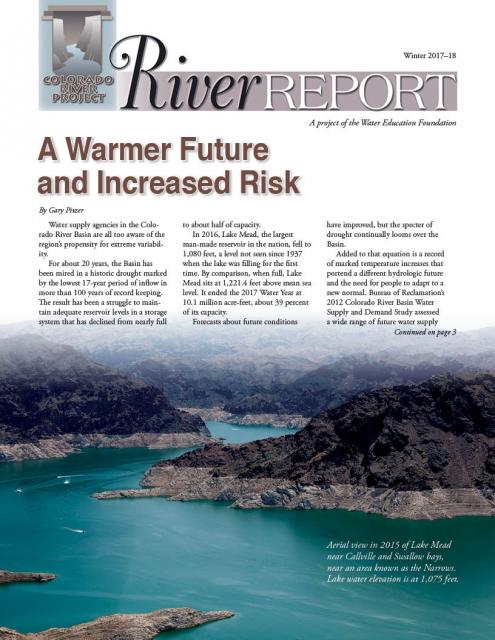
Rising temperatures from climate change are having a noticeable
effect on how much water is flowing down the Colorado River. Read
the latest River Report to learn more about what’s
happening, and how water managers are responding.
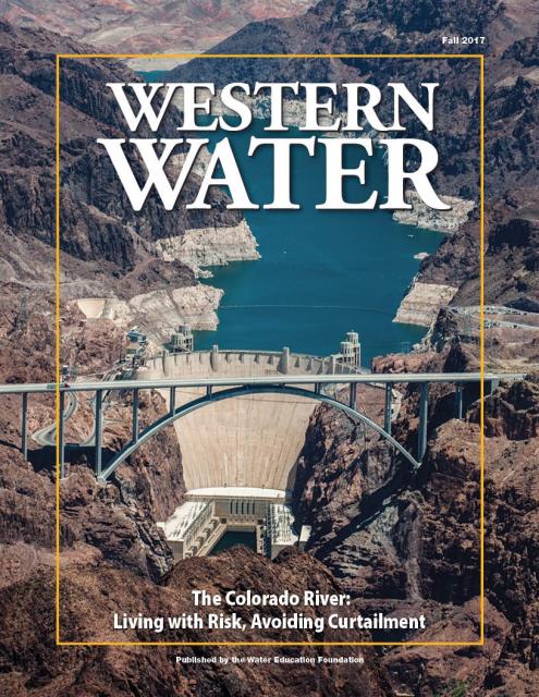
This issue of Western Water discusses the challenges
facing the Colorado River Basin resulting from persistent
drought, climate change and an overallocated river, and how water
managers and others are trying to face the future.
This three-day, two-night tour explored the lower Colorado River
where virtually every drop of the river is allocated, yet demand
is growing from myriad sources — increasing population,
declining habitat, drought and climate change.
The 1,450-mile river is a lifeline to 40 million people in
the Southwest across seven states and Mexico. How the Lower Basin
states – Arizona, California and Nevada – use and manage this
water to meet agricultural, urban, environmental and industrial
needs is the focus of this tour.
Best Western McCarran Inn
4970 Paradise Road
Las Vegas, NV 89119
The American River originates high
in the Sierra Nevada just west of Lake Tahoe, in the Tahoe and
Eldorado national forests.
The birthplace of the California Gold Rush, the river today is a
prime recreational destination and a major water supply source
for the federal Central Valley Project.
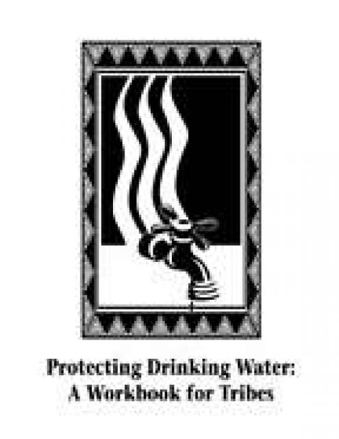
This 109-page publication details the importance of protecting
source water – surface water and groundwater – on reservations
from pollution and includes a step-by-step work plan for tribes
interested in developing a protection plan for their drinking
water. The workbook is designed to serve as a template for such
programs, with forms and tables for photocopying. It also offers
a simplified approach for assessment and protection that focuses
on identifying and managing immediate contamination threats.
20-minute version of the 2012 documentary The Klamath Basin: A
Restoration for the Ages. This DVD is ideal for showing at
community forums and speaking engagements to help the public
understand the complex issues related to complex water management
disputes in the Klamath River Basin. Narrated by actress Frances
Fisher.
For over a century, the Klamath River Basin along the Oregon and
California border has faced complex water management disputes. As
relayed in this 2012, 60-minute public television documentary
narrated by actress Frances Fisher, the water interests range
from the Tribes near the river, to energy producer PacifiCorp,
farmers, municipalities, commercial fishermen, environmentalists
– all bearing legitimate arguments for how to manage the water.
After years of fighting, a groundbreaking compromise may soon
settle the battles with two epic agreements that hold the promise
of peace and fish for the watershed. View an excerpt from the
documentary here.
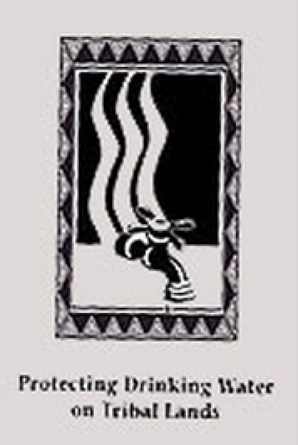
This 30-minute DVD explains the importance of developing a source
water assessment program (SWAP) for tribal lands and by profiling
three tribes that have created SWAPs. Funded by a grant from the
U.S. Environmental Protection Agency, the video complements the
Foundation’s 109-page workbook, Protecting Drinking Water: A
Workbook for Tribes, which includes a step-by-step work plan for
Tribes interested in developing a protection plan for their
drinking water.
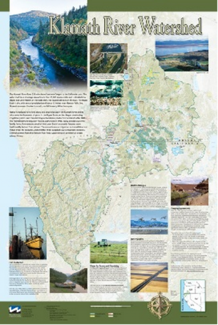
This beautiful 24×36-inch poster, suitable for framing, displays
the rivers, lakes and reservoirs, irrigated farmland, urban areas
and Indian reservations within the Klamath River Watershed. The
map text explains the many issues facing this vast,
15,000-square-mile watershed, including fish restoration;
agricultural water use; and wetlands. Also included are
descriptions of the separate, but linked, Klamath Basin
Restoration Agreement and the Klamath Hydroelectric Agreement,
and the next steps associated with those agreements. Development
of the map was funded by a grant from the U.S. Fish and Wildlife
Service.
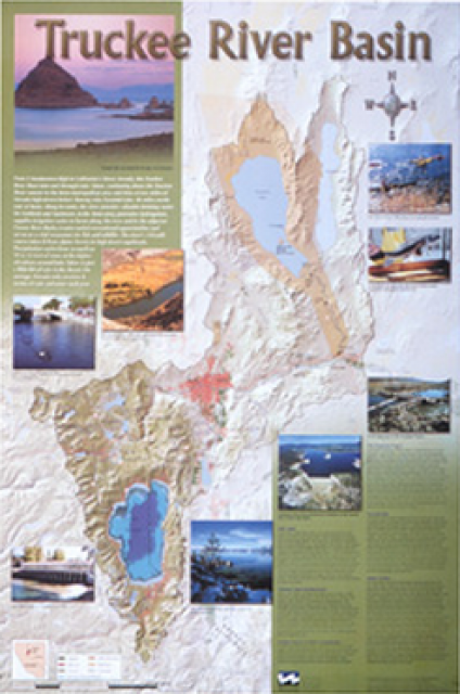
This beautiful 24×36-inch poster, suitable for framing, displays
the rivers, lakes and reservoirs, irrigated farmland, urban areas
and Indian reservations within the Truckee River Basin, including
the Newlands Project, Pyramid Lake and Lake Tahoe. Map text
explains the issues surrounding the use of the Truckee-Carson
rivers, Lake Tahoe water quality improvement efforts, fishery
restoration and the effort to reach compromise solutions to many
of these issues.
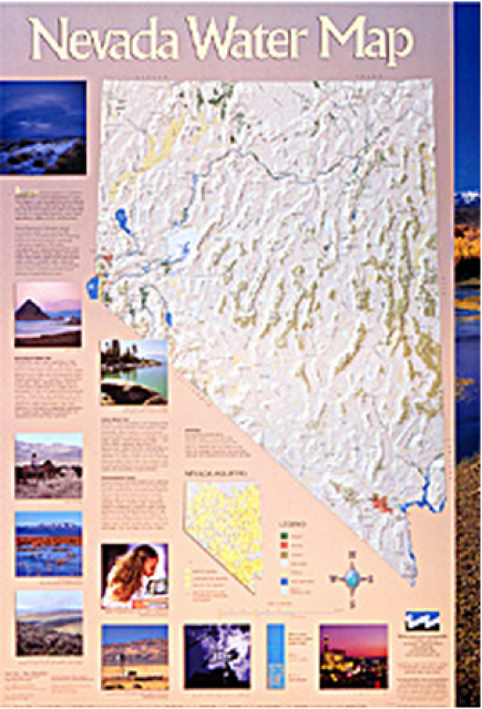
This 24×36 inch poster, suitable for framing, illustrates the
water resources available for Nevada cities, agriculture and the
environment. It features natural and manmade water resources
throughout the state, including the Truckee and Carson rivers,
Lake Tahoe, Pyramid Lake and the course of the Colorado River
that forms the state’s eastern boundary.
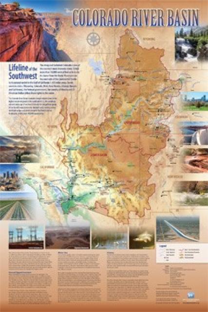
Redesigned in 2017, this beautiful map depicts the seven
Western states that share the Colorado River with Mexico. The
Colorado River supplies water to nearly 40 million people in
Arizona, California, Colorado, Nevada, New Mexico, Utah, Wyoming
and Mexico. Text on this beautiful, 24×36-inch map, which is
suitable for framing, explains the river’s apportionment, history
and the need to adapt its management for urban growth and
expected climate change impacts.
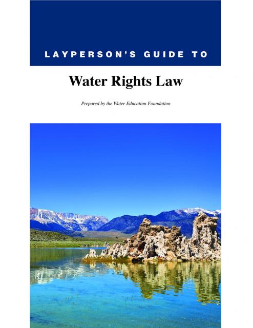
The 28-page Layperson’s Guide to Water Rights Law, recognized as
the most thorough explanation of California water rights law
available to non-lawyers, traces the authority for water flowing
in a stream or reservoir, from a faucet or into an irrigation
ditch through the complex web of California water rights.
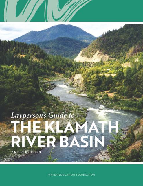
The Water Education Foundation’s second edition of
the Layperson’s Guide to The Klamath River Basin is
hot off the press and available for purchase.
Updated and redesigned, the easy-to-read overview covers the
history of the region’s tribal, agricultural and environmental
relationships with one of the West’s largest rivers — and a
vast watershed that hosts one of the nation’s oldest and
largest reclamation projects.
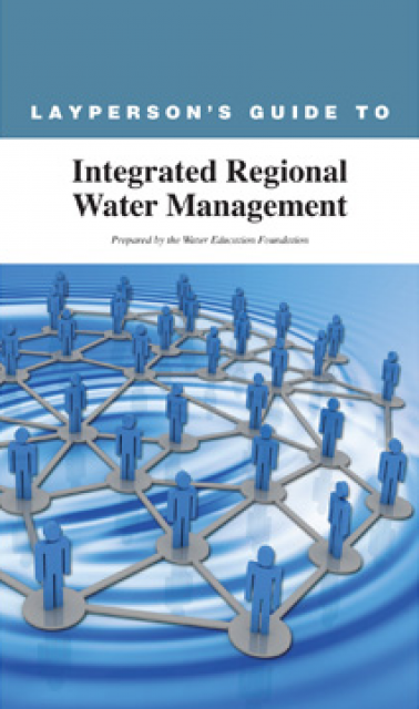
The 24-page Layperson’s Guide to Integrated Regional Water
Management (IRWM) is an in-depth, easy-to-understand publication
that provides background information on the principles of IRWM,
its funding history and how it differs from the traditional water
management approach.
The Klamath River Basin is one of the West’s most important and
contentious watersheds.
The watershed is known for its unusual geography straddling
California and Oregon. Unlike many western rivers, the
Klamath does not originate in snowcapped mountains but rather on
a volcanic plateau.
A broad patchwork of spring-fed streams and rivers in
south-central Oregon drains into Upper Klamath Lake and down into
Lake Ewauna in the city of Klamath Falls. The outflow from Ewauna
marks the beginning of the 263-mile Klamath River.
The Klamath courses south through the steep Cascade Range and
west along the rugged Siskiyou Mountains to a redwood-lined
estuary on the Pacific Ocean just south of Crescent City,
draining a watershed of 10 million acres.
A bounty of resources – water, salmon, timber and minerals – and
a wide range of users turned the remote region into a hotspot for
economic development and multiparty water disputes (See
Klamath River
timeline).
Though the basin has only 115,000 residents, there is seldom
enough water to go around. Droughts are common. The water
scarcity inflames tensions between agricultural,
environmental and tribal interests, namely the basin’s four major
tribes: the Klamath Tribes, the Karuk, Hoopa Valley and Yurok.
Klamath water-use conflicts routinely spill into courtrooms,
state legislatures and Congress.
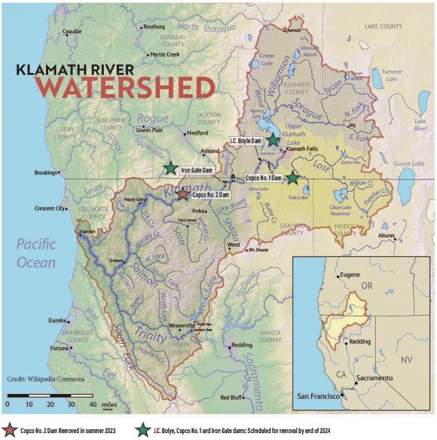
In 2023, a historic removal of four powers dams on the river
began, signaling hope for restoration of the river and its fish
and easing tensions between competing water interests. In
February 2024, Interior Secretary Deb Haaland
announced a “historic” agreement between tribes and farmers
in the basin over chronic water shortages. The deal
called for a wide range of river and creek restoration work and
modernization of agricultural water supply infrastructure.
Water Development
Farmers and ranchers have drawn irrigation water from basin
rivers and lakes since the late 1900s. Vast wetlands around
Upper Klamath Lake and upstream were drained to grow crops. Some
wetlands have been restored, primarily for migratory birds.
In 1905, the federal government authorized construction of the
Klamath Project, a network of irrigation canals, storage
reservoirs and hydroelectric dams to grow an agricultural
economy in the mostly dry Upper Basin. The Project managed by the
U.S. Bureau of Reclamation irrigates about 240,000 acres and
supplies the Lower Klamath Lake and Tule Lake national wildlife
refuges managed by the U.S. Fish and Wildlife Service.
Water Management
Since 1992, federal mandates to restore populations of fish
protected by the Endangered Species
Act have led in some dry years to drastic cuts in
water deliveries to Klamath Project irrigators.
Water in Upper Klamath Lake must be kept above certain
levels for the endangered shortnose and Lost River suckers. Lake
levels and Klamath River flows below Iron Gate Dam also must be
regulated for the benefit of threatened coho salmon (See
Klamath Basin
Chinook and Coho Salmon).
Conflict
In 2001, Reclamation all but cut off irrigation water to hundreds
of basin farmers and ranchers, citing a severe drought and legal
obligations to protect imperiled fish. In response, thousands of
farmers, ranchers and residents flocked to downtown Klamath Falls
to form a “bucket brigade” protest, emptying buckets of water
into the closed irrigation canal. The demonstrations stretched
into the summer, with protestors forcing open the irrigation
headgates on multiple occasions. Reclamation later released some
water to help farmers.
In September 2002, a catastrophic
disease outbreak in the lower Klamath River killed tens of
thousands of ocean-going salmon. The Pacific Coast Federation of
Fishermen’s Associations sued Reclamation, alleging the Klamath
Project’s irrigation deliveries had violated the Endangered
Species Act. The fishing industry eventually prevailed, and
a federal court ordered an increase to minimum flows in the lower
Klamath.
Compromise
The massive salmon kill and dramatic water shut-off set in motion
a sweeping compromise between the basin’s many competing water
interests: the Klamath Basin Restoration Agreement and the
Klamath Hydroelectric Settlement Agreement. The 2010 agreements
included:
Removal of four hydroelectric dams
$92.5 million over 10 years to pay farmers to use less water,
increase reservoir storage and help pay for water conservation
and groundwater management projects.
$47 million over 10 years to buy or lease water rights to
increase flows for salmon recovery.
Dam Removals
Congress never funded the two agreements, allowing the key
provisions to expire. The restoration accord dissolved in 2016.
The hydroelectric pact, however, was revived in an amended
version that did not require federal legislation.
The new deal led to the nation’s largest dam removal project ever
undertaken.
California and Oregon formed a
nonprofit organization called the Klamath River Renewal
Corporation to take control of the four essentially obsolete
power dams – J.C. Boyle, Copco No. 1, Copco No. 2 and Iron Gate –
and oversee a $450 million dam demolition and river restoration
project.
Taking out the dams will open more than 420 miles of river and
spawning streams that had been blocked for more than a century,
including cold water pools salmon and trout need to survive the
warming climate.
Demolition crews took out the smallest dam in 2023 and all four
dams were taken down by the end of 2024.
The images of yellow heavy machinery tearing into the dam’s
spillway gates prompted a cathartic release for many who have
been fighting for decades to open this stretch of the Klamath.
“I’m still in a little bit of shock,” said Toz Soto,
the Karuk fisheries program manager. “This is actually
happening…It’s kind of like the dog that finally caught the car,
except we’re chasing dam removal.”
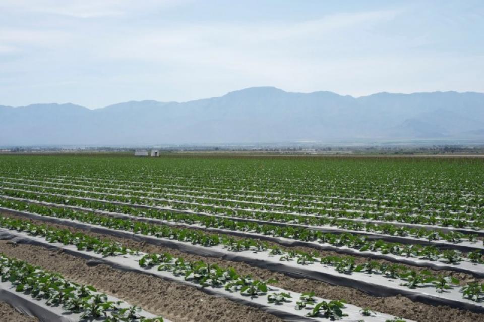
The Coachella Valley in Southern California’s Inland Empire is
one of several valleys throughout the state with a water district
established to support agriculture.
Like the others, the Coachella Valley Water District in Riverside
County delivers water to arid agricultural lands and constructs,
operates and maintains a regional agricultural drainage system.
These systems collect drainage water from individual farm drain
outlets and convey the water to a point of reuse, disposal or
dilution.
Every five years the California Department of Water Resources
updates its strategic plan for managing the state’s water
resources, as required by state law.
The California Water Plan, or Bulletin 160, projects the
status and trends of the state’s water supplies and demands
under a range of future scenarios.
This printed issue of Western Water explores the
historic nature of some of the key agreements in recent years,
future challenges, and what leading state representatives
identify as potential “worst-case scenarios.” Much of the content
for this issue of Western Water came from the in-depth
panel discussions at the Colorado River Symposium. The Foundation
will publish the full proceedings of the Symposium in 2012.
This printed issue of Western Water explores some of the major
challenges facing Colorado River stakeholders: preparing for
climate change, forging U.S.-Mexico water supply solutions and
dealing with continued growth in the basins states. Much of the
content for this issue of Western Water came from the in-depth
panel discussions at the September 2009 Colorado River Symposium.
This issue of Western Water examines the challenges facing state,
federal and tribal officials and other stakeholders as they work
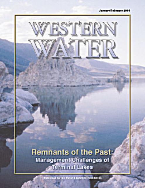
to manage terminal lakes. It includes background information on
the formation of these lakes, and overviews of the water quality,
habitat and political issues surrounding these distinctive bodies
of water. Much of the information in this article originated at
the September 2004 StateManagement Issues at Terminal Water
Bodies/Closed Basins conference.


 and other tributaries of the upper Colorado River have declined dramatically and contributed to the precipitous declines of Lake Powell and Lake Mead. (Source: The Water Desk)")

")
")
")
")
")
")
")
")
")
: Karla Nemeth, director, California Department of Water Resources; Gloria Gray, chair, Metropolitan Water District of Southern California; Brenda Burman, Bureau of Reclamation Commissioner; Jayne Harkins, commissioner, International Boundary and Water Commission, U.S. and Mexico; Amy Haas, executive director, Upper Colorado River Commission.")

")
")

. Credit: U.S. Bureau of Reclamation")