The story of California’s surface water— water that remains on
the earth’s surface, in rivers, streams, lakes, reservoirs or
oceans—is one that reflects the state’s geographic
complexity.
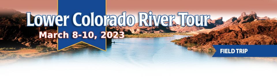
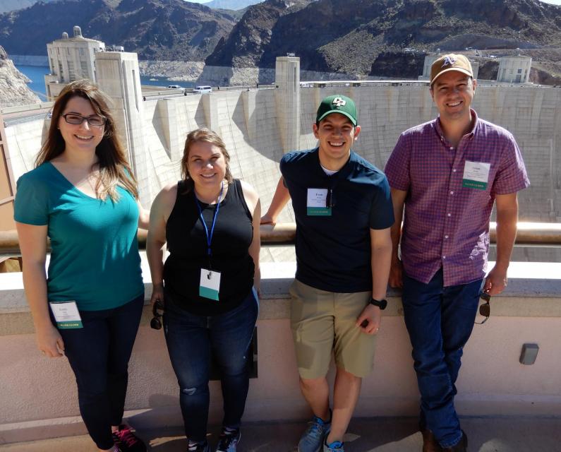
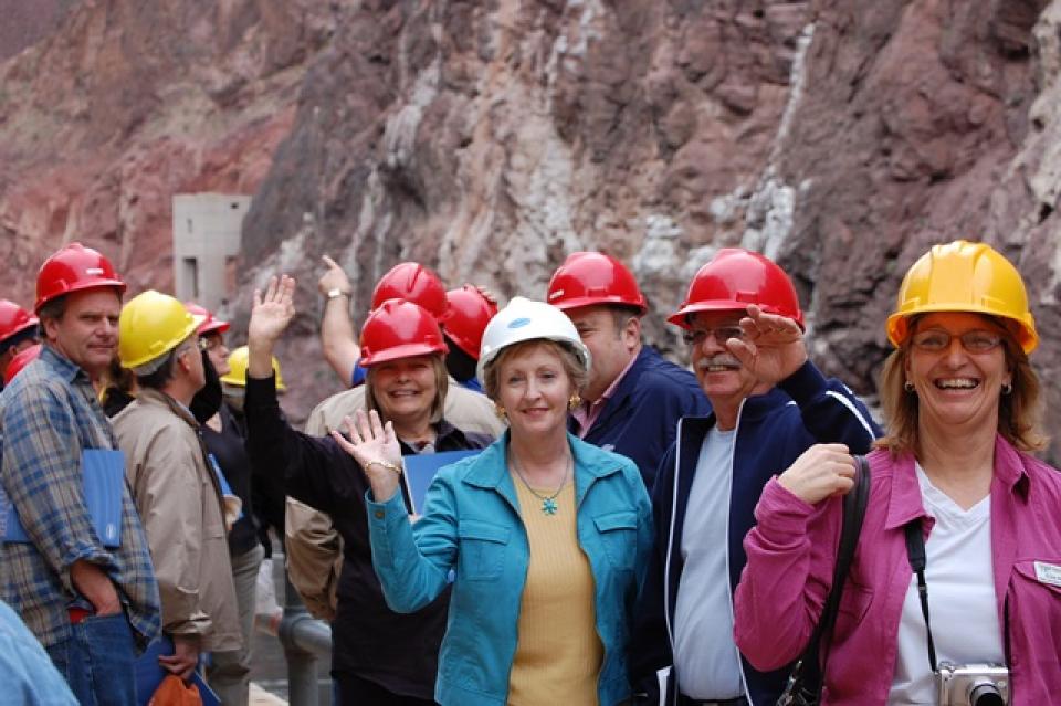
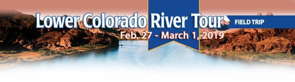
Explore the lower Colorado River firsthand where virtually every drop of the river is allocated, yet demand is growing from myriad sources — increasing population, declining habitat, drought and climate change.
The 1,450-mile river is a lifeline to some 40 million people in the Southwest across seven states, 30 tribal nations and Mexico. How the Lower Basin states – Arizona, California and Nevada – use and manage this water to meet agricultural, urban, environmental and industrial needs is the focus of this tour.
Hilton Garden Inn Las Vegas Strip South
7830 S Las Vegas Blvd
Las Vegas, NV 89123
Cities across California and the Southwest are significantly
increasing and diversifying their use of recycled wastewater as
traditional water supplies grow tighter.
The 5th edition of our Layperson’s Guide to Water Recycling
covers the latest trends and statistics on water reuse as a
strategic defense against prolonged drought and climate change.
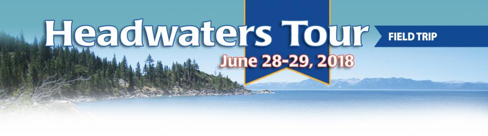
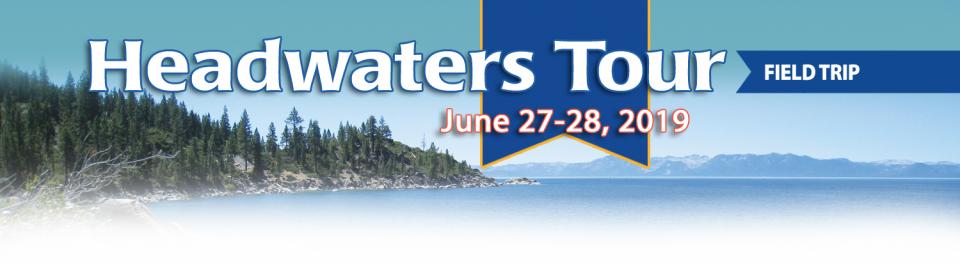
On this first-ever Foundation water tourwe examined water issues along the 263-mile Klamath River, from its spring-fed headwaters in south-central Oregon to its redwood-lined estuary on the Pacific Ocean in California.
Running Y Resort
5500 Running Y Rd
Klamath Falls, OR 97601
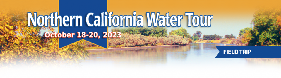
This tour explored the Sacramento River and its tributaries through a scenic landscape while learning about the issues associated with a key source for the state’s water supply.
All together, the river and its tributaries supply 35 percent of California’s water and feed into two major projects: the State Water Project and the federal Central Valley Project.
Water Education Foundation
2151 River Plaza Drive, Suite 205
Sacramento, CA 95833
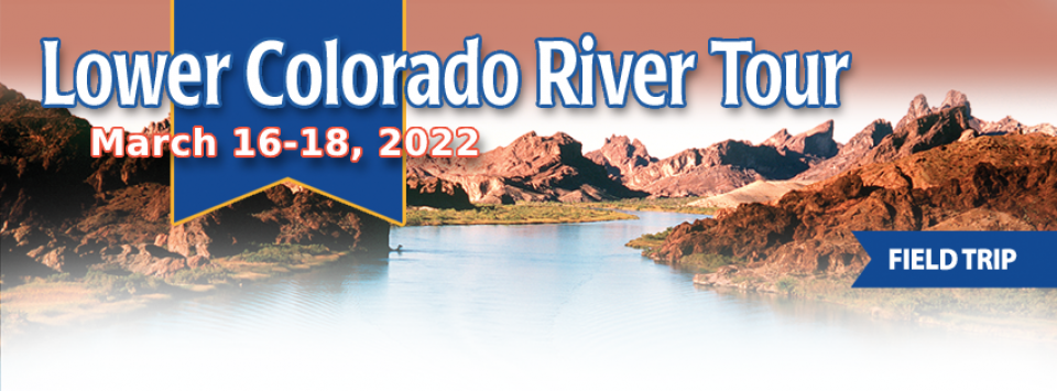
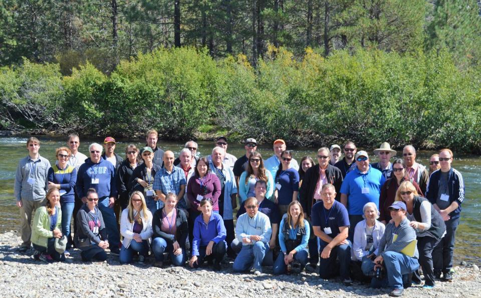
This tour explored the lower Colorado River firsthand where virtually every drop of the river is allocated, yet demand is growing from myriad sources — increasing population, declining habitat, drought and climate change.
The 1,450-mile river is a lifeline to some 40 million people in the Southwest across seven states, 30 tribal nations and Mexico. How the Lower Basin states – Arizona, California and Nevada – use and manage this water to meet agricultural, urban, environmental and industrial needs was the focus of this tour.
Hilton Garden Inn Las Vegas Strip South
7830 S Las Vegas Blvd
Las Vegas, NV 89123
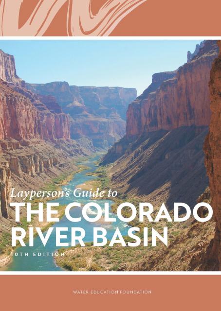
Learn the history and challenges facing the West’s most dramatic
and developed river.
The Layperson’s Guide to the Colorado River Basin introduces the
1,450-mile river that sustains 40 million people and millions of
acres of farmland spanning seven states and parts of northern
Mexico.
The 28-page primer explains how the river’s water is shared and
managed as the Southwest transitions to a hotter and drier
climate.
This tour explored the Sacramento River and its tributaries through a scenic landscape while learning about the issues associated with a key source for the state’s water supply.
All together, the river and its tributaries supply 35 percent of California’s water and feed into two major projects: the State Water Project and the federal Central Valley Project.
Water Education Foundation
2151 River Plaza Drive, Suite 205
Sacramento, CA 95833
The states of the Lower Colorado
River Basin have traditionally played an oversized role in
tapping the lifeline that supplies 40 million people in the West.
California, Nevada and Arizona were quicker to build major canals
and dams and negotiated a landmark deal that requires the Upper
Basin to send predictable flows through the Grand Canyon, even
during dry years.
But with the federal government threatening unprecedented water
cuts amid decades of drought and declining reservoirs, the Upper
Basin states of Wyoming, Utah, Colorado and New Mexico are
muscling up to protect their shares of an overallocated river
whose average flows in the Upper Basin have already dropped
20 percent over the last century.
They have formed new agencies to better monitor their interests,
moved influential Colorado River veterans into top negotiating
posts and improved their relationships with Native American
tribes that also hold substantial claims to the river.
Tiny pieces of plastic waste shed
from food wrappers, grocery bags, clothing, cigarette butts,
tires and paint are invading the environment and every facet of
daily life. Researchers know the plastic particles have even made
it into municipal water supplies, but very little data exists
about the scope of microplastic contamination in drinking
water.
After years of planning, California this year is embarking on a
first-of-its-kind data-gathering mission to illuminate how
prevalent microplastics are in the state’s largest drinking water
sources and help regulators determine whether they are a public
health threat.
This tour explored the lower Colorado River firsthand where virtually every drop of the river is allocated, yet demand is growing from myriad sources — increasing population, declining habitat, drought and climate change.
The 1,450-mile river is a lifeline to some 40 million people in the Southwest across seven states, 30 tribal nations and Mexico. How the Lower Basin states – Arizona, California and Nevada – use and manage this water to meet agricultural, urban, environmental and industrial needs was the focus of this tour.
Hilton Garden Inn Las Vegas Strip South
7830 S Las Vegas Blvd
Las Vegas, NV 89123
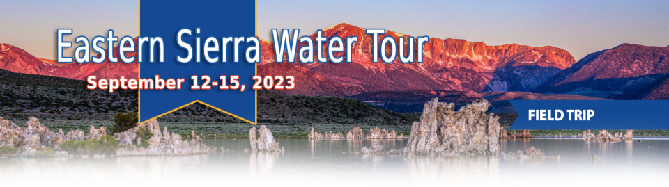
This special Foundation water tour journeyed along the Eastern Sierra from the Truckee River to Mono Lake, through the Owens Valley and into the Mojave Desert to explore a major source of water for Southern California, this year’s snowpack and challenges for towns, farms and the environment.
Growing up in the shadow of the
Rocky Mountains, Andrew Schwartz never missed an opportunity to
play in – or study – a Colorado snowstorm. During major
blizzards, he would traipse out into the icy wind and heavy
drifts of snow pretending to be a scientist researching in
Antarctica.
Decades later, still armed with an obsession for extreme weather,
Schwartz has landed in one of the snowiest places in the West,
leading a research lab whose mission is to give California water
managers instant information on the depth and quality of snow
draping the slopes of the Sierra Nevada.
This tour explored the Sacramento River and its tributaries through a scenic landscape while learning about the issues associated with a key source for the state’s water supply.
All together, the river and its tributaries supply 35 percent of California’s water and feed into two major projects: the State Water Project and the federal Central Valley Project.
Water Education Foundation
2151 River Plaza Drive, Suite 205
Sacramento, CA 95833
With 25 years of experience working
on the Colorado River, Chuck Cullom is used to responding to
myriad challenges that arise on the vital lifeline that seven
states, more than two dozen tribes and the country of Mexico
depend on for water. But this summer problems on the
drought-stressed river are piling up at a dizzying pace:
Reservoirs plummeting to record low levels, whether Hoover Dam
and Glen Canyon Dam can continue to release water and produce
hydropower, unprecedented water cuts and predatory smallmouth
bass threatening native fish species in the Grand Canyon.
“Holy buckets, Batman!,” said Cullom, executive director of the
Upper Colorado River Commission. “I mean, it’s just on and on and
on.”
This tour explored the Sacramento River and its tributaries
through a scenic landscape while learning about the issues
associated with a key source for the state’s water supply.
All together, the river and its tributaries supply 35 percent of
California’s water and feed into two major projects: the State
Water Project and the federal Central Valley Project.
Water Education Foundation
2151 River Plaza Drive, Suite 205
Sacramento, CA 95833
This tour explored the lower Colorado River firsthand where virtually every drop of the river is allocated, yet demand is growing from myriad sources — increasing population, declining habitat, drought and climate change.
The 1,450-mile river is a lifeline to some 40 million people in the Southwest across seven states, 30 tribal nations and Mexico. How the Lower Basin states – Arizona, California and Nevada – use and manage this water to meet agricultural, urban, environmental and industrial needs was the focus of this tour.
Hyatt Place Las Vegas At Silverton Village
8380 Dean Martin Drive
Las Vegas, NV 89139
The lower Colorado River has virtually every drop allocated, yet demand is growing from myriad sources — increasing population, declining habitat, drought and climate change.
The 1,450-mile river is a lifeline to 40 million people in the Southwest across seven states, 30 tribal nations and Mexico. How the Lower Basin states – Arizona, California and Nevada – use and manage this water to meet agricultural, urban, environmental and industrial needs was the focus of this tour.
Hyatt Place Las Vegas At Silverton Village
8380 Dean Martin Drive
Las Vegas, NV 89139
This tour guided participants on a virtual exploration of the Sacramento River and its tributaries and learn about the issues associated with a key source for the state’s water supply.
All together, the river and its tributaries supply 35 percent of California’s water and feed into two major projects: the State Water Project and the federal Central Valley Project.
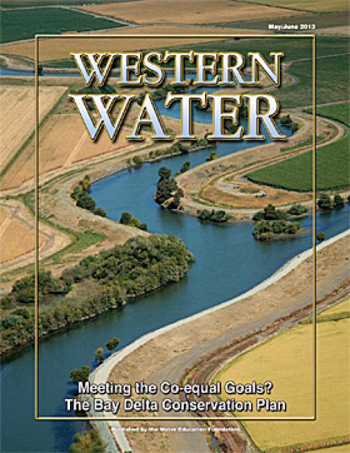
This tour guided participants on a virtual journey deep into California’s most crucial water and ecological resource – the Sacramento-San Joaquin Delta. The 720,000-acre network of islands and canals support the state’s two major water systems – the State Water Project and the Central Valley Project. The Delta and the connecting San Francisco Bay form the largest freshwater tidal estuary of its kind on the West coast.
On average, more than 60 percent of
California’s developed water supply originates in the Sierra
Nevada and the southern spur of the Cascade Range. Our water
supply is largely dependent on the health of our Sierra forests,
which are suffering from ecosystem degradation, drought,
wildfires and widespread tree mortality.
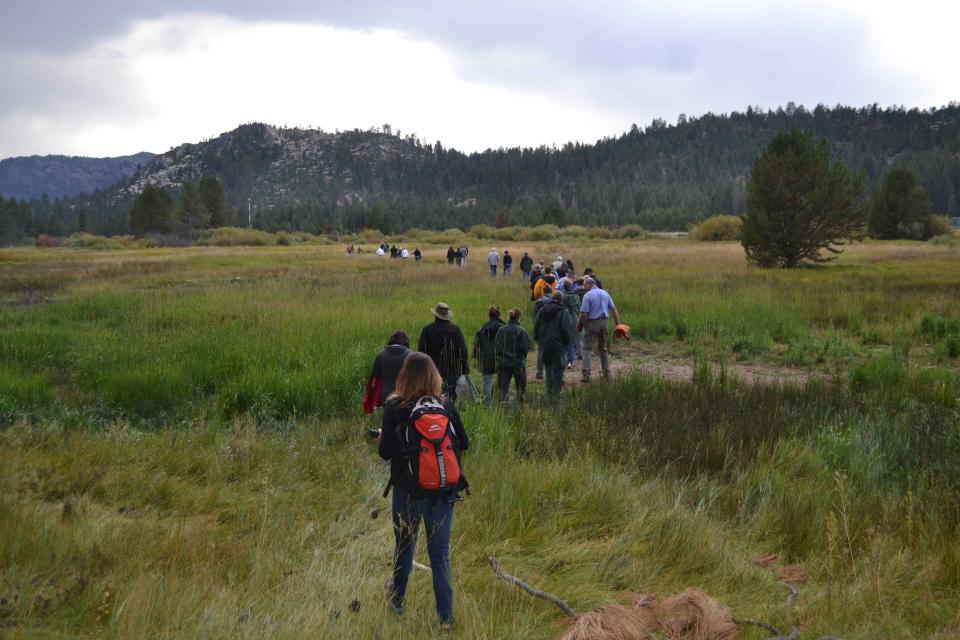
This tour ventured into the Sierra to examine water issues
that happen upstream but have dramatic impacts downstream and
throughout the state.
This event explored the lower Colorado River where virtually every drop of the river is allocated, yet demand is growing from myriad sources — increasing population, declining habitat, drought and climate change.
The 1,450-mile river is a lifeline to 40 million people in the Southwest across seven states and Mexico. How the Lower Basin states – Arizona, California and Nevada – use and manage this water to meet agricultural, urban, environmental and industrial needs was the focus of this tour.
The Colorado River is arguably one
of the hardest working rivers on the planet, supplying water to
40 million people and a large agricultural economy in the West.
But it’s under duress from two decades of drought and decisions
made about its management will have exceptional ramifications for
the future, especially as impacts from climate change are felt.
California is chock full of rivers and creeks, yet the state’s network of stream gauges has significant gaps that limit real-time tracking of how much water is flowing downstream, information that is vital for flood protection, forecasting water supplies and knowing what the future might bring.
That network of stream gauges got a big boost Sept. 30 with the signing of SB 19. Authored by Sen. Bill Dodd (D-Napa), the law requires the state to develop a stream gauge deployment plan, focusing on reactivating existing gauges that have been offline for lack of funding and other reasons. Nearly half of California’s stream gauges are dormant.
To survive the next drought and meet
the looming demands of the state’s groundwater sustainability
law, California is going to have to put more water back in the
ground. But as other Western states have found, recharging
overpumped aquifers is no easy task.
Successfully recharging aquifers could bring multiple benefits
for farms and wildlife and help restore the vital interconnection
between groundwater and rivers or streams. As local areas around
California draft their groundwater sustainability plans, though,
landowners in the hardest hit regions of the state know they will
have to reduce pumping to address the chronic overdraft in which
millions of acre-feet more are withdrawn than are naturally
recharged.
The southern part of California’s Central Coast from San Luis Obispo County to Ventura County, home to about 1.5 million people, is blessed with a pleasing Mediterranean climate and a picturesque terrain. Yet while its unique geography abounds in beauty, the area perpetually struggles with drought.
Indeed, while the rest of California breathed a sigh of relief with the return of wet weather after the severe drought of 2012–2016, places such as Santa Barbara still grappled with dry conditions.
The majestic beauty of the Sierra
Nevada forest is awe-inspiring, but beneath the dazzling blue
sky, there is a problem: A century of fire suppression and
logging practices have left trees too close together. Millions of
trees have died, stricken by drought and beetle infestation.
Combined with a forest floor cluttered with dry brush and debris,
it’s a wildfire waiting to happen.
Fires devastate the Sierra watersheds upon which millions of
Californians depend — scorching the ground, unleashing a
battering ram of debris and turning hillsides into gelatinous,
stream-choking mudflows.
Summer is a good time to take a
break, relax and enjoy some of the great beaches, waterways and
watersheds around California and the West. We hope you’re getting
a chance to do plenty of that this July.
But in the weekly sprint through work, it’s easy to miss
some interesting nuggets you might want to read. So while we’re
taking a publishing break to work on other water articles planned
for later this year, we want to help you catch up on
Western Water stories from the first half of this year
that you might have missed.
New to this year’s slate of water
tours, our Edge of
Drought Tour Aug. 27-29 will venture into the Santa
Barbara area to learn about the challenges of limited local
surface and groundwater supplies and the solutions being
implemented to address them.
Despite Santa Barbara County’s decision to lift a drought
emergency declaration after this winter’s storms replenished
local reservoirs, the region’s hydrologic recovery often has
lagged behind much of the rest of the state.
Each day, people living on the streets and camping along waterways across California face the same struggle – finding clean drinking water and a place to wash and go to the bathroom.
Some find friendly businesses willing to help, or public restrooms and drinking water fountains. Yet for many homeless people, accessing the water and sanitation that most people take for granted remains a daily struggle.
We have an unknown distance yet to run, an unknown river to explore. What falls there are, we know not; what rocks beset the channel, we know not; what walls ride over the river, we know not. Ah, well! We may conjecture many things.
~John Wesley Powell
Powell scrawled those words in his journal as he and his expedition paddled their way into the deep walls of the Grand Canyon on a stretch of the Colorado River in August 1869. Three months earlier, the 10-man group had set out on their exploration of the iconic Southwest river by hauling their wooden boats into a major tributary of the Colorado, the Green River in Wyoming, for their trip into the “great unknown,” as Powell described it.
Even as stakeholders in the Colorado River Basin celebrate the recent completion of an unprecedented drought plan intended to stave off a crashing Lake Mead, there is little time to rest. An even larger hurdle lies ahead as they prepare to hammer out the next set of rules that could vastly reshape the river’s future.
Set to expire in 2026, the current guidelines for water deliveries and shortage sharing, launched in 2007 amid a multiyear drought, were designed to prevent disputes that could provoke conflict.
One of California Gov. Gavin
Newsom’s first actions after taking office was to appoint Wade
Crowfoot as Natural Resources Agency secretary. Then, within
weeks, the governor laid out an ambitious water agenda that
Crowfoot, 45, is now charged with executing.
That agenda includes the governor’s desire for a “fresh approach”
on water, scaling back the conveyance plan in the Sacramento-San
Joaquin Delta and calling for more water recycling, expanded
floodplains in the Central Valley and more groundwater recharge.
This tour explored the lower Colorado River where virtually every drop of the river is allocated, yet demand is growing from myriad sources — increasing population, declining habitat, drought and climate change.
The 1,450-mile river is a lifeline to 40 million people in the Southwest across seven states and Mexico. How the Lower Basin states – Arizona, California and Nevada – use and manage this water to meet agricultural, urban, environmental and industrial needs is the focus of this tour.
Silverton Hotel
3333 Blue Diamond Road
Las Vegas, NV 89139
The whims of political fate decided
in 2018 that state bond money would not be forthcoming to help
repair the subsidence-damaged parts of Friant-Kern Canal, the
152-mile conduit that conveys water from the San Joaquin River to
farms that fuel a multibillion-dollar agricultural economy along
the east side of the fertile San Joaquin Valley.
The growing leadership of women in water. The Colorado River’s persistent drought and efforts to sign off on a plan to avert worse shortfalls of water from the river. And in California’s Central Valley, promising solutions to vexing water resource challenges.
These were among the topics that Western Water news explored in 2018.
We’re already planning a full slate of stories for 2019. You can sign up here to be alerted when new stories are published. In the meantime, take a look at what we dove into in 2018:
As stakeholders labor to nail down
effective and durable drought contingency plans for the Colorado
River Basin, they face a stark reality: Scientific research is
increasingly pointing to even drier, more challenging times
ahead.
The latest sobering assessment landed the day after Thanksgiving,
when U.S. Global Change Research Program’s Fourth National Climate
Assessment concluded that Earth’s climate is changing rapidly
compared to the pace of natural variations that have occurred
throughout its history, with greenhouse gas emissions largely the
cause.
The 1992 election to the United
States Senate was famously coined the “Year of the Woman” for the
record number of women elected to the upper chamber.
In the water world, 2018 has been a similar banner year, with
noteworthy appointments of women to top leadership posts in
California — Karla Nemeth at the California Department of Water
Resources and Gloria Gray at the Metropolitan Water District of
Southern California.
In the universe of California water, Tim Quinn is a professor emeritus. Quinn has seen — and been a key player in — a lot of major California water issues since he began his water career 40 years ago as a young economist with the Rand Corporation, then later as deputy general manager with the Metropolitan Water District of Southern California, and finally as executive director of the Association of California Water Agencies. In December, the 66-year-old will retire from ACWA.
In 1983, a landmark California Supreme Court ruling extended the public trust doctrine to tributary creeks that feed Mono Lake, which is a navigable water body even though the creeks themselves were not. The ruling marked a dramatic shift in water law and forced Los Angeles to cut back its take of water from those creeks in the Eastern Sierra to preserve the lake.
Now, a state appellate court has for the first time extended that same public trust doctrine to groundwater that feeds a navigable river, in this case the Scott River flowing through a picturesque valley of farms and alfalfa in Siskiyou County in the northern reaches of California.
This tour explored the Sacramento River and its tributaries
through a scenic landscape as participants learned about the
issues associated with a key source for the state’s water supply.
All together, the river and its tributaries supply 35 percent of
California’s water and feed into two major projects: the State
Water Project and the federal Central Valley Project. Tour
participants got an on-site update of Oroville Dam spillway
repairs.
There’s going to be a new governor
in California next year – and a host of challenges both old and
new involving the state’s most vital natural resource, water.
So what should be the next governor’s water priorities?
That was one of the questions put to more than 150 participants
during a wrap-up session at the end of the Water Education
Foundation’s Sept. 20 Water Summit in Sacramento.
The Colorado River Basin is more
than likely headed to unprecedented shortage in 2020 that could
force supply cuts to some states, but work is “furiously”
underway to reduce the risk and avert a crisis, Bureau of
Reclamation Commissioner Brenda Burman told an audience of
California water industry people.
During a keynote address at the Water Education Foundation’s
Sept. 20 Water Summit in Sacramento, Burman said there is
opportunity for Colorado River Basin states to control their
destiny, but acknowledged that in water, there are no guarantees
that agreement can be reached.
An hour’s drive north of Sacramento sits a picture-perfect valley hugging the eastern foothills of Northern California’s Coast Range, with golden hills framing grasslands mostly used for cattle grazing.
Back in the late 1800s, pioneer John Sites built his ranch there and a small township, now gone, bore his name. Today, the community of a handful of families and ranchers still maintains a proud heritage.
Farmers in the Central Valley are broiling about California’s plan to increase flows in the Sacramento and San Joaquin river systems to help struggling salmon runs avoid extinction. But in one corner of the fertile breadbasket, River Garden Farms is taking part in some extraordinary efforts to provide the embattled fish with refuge from predators and enough food to eat.
And while there is no direct benefit to one farm’s voluntary actions, the belief is what’s good for the fish is good for the farmers.
Amy Haas recently became the first non-engineer and the first woman to serve as executive director of the Upper Colorado River Commission in its 70-year history, putting her smack in the center of a host of daunting challenges facing the Upper Colorado River Basin.
Yet those challenges will be quite familiar to Haas, an attorney who for the past year has served as deputy director and general counsel of the commission. (She replaced longtime Executive Director Don Ostler). She has a long history of working within interstate Colorado River governance, including representing New Mexico as its Upper Colorado River commissioner and playing a central role in the negotiation of the recently signed U.S.-Mexico agreement known as Minute 323.
Sixty percent of California’s developed water supply
originates high in the Sierra Nevada mountains. Our water
supply is largely dependent on the health of our Sierra forests,
which are suffering from ecosystem degradation, drought,
wildfires and widespread tree mortality.
We headed into the foothills and the mountains to examine
water issues that happen upstream but have dramatic impacts
downstream and throughout the state.
GEI (Tour Starting Point)
2868 Prospect Park Dr.
Rancho Cordova, CA 95670.
New water storage is the holy grail
primarily for agricultural interests in California, and in 2014
the door to achieving long-held ambitions opened with the passage
of Proposition
1, which included $2.7 billion for the public benefits
portion of new reservoirs and groundwater storage projects. The
statute stipulated that the money is specifically for the
benefits that a new storage project would offer to the ecosystem,
water quality, flood control, emergency response and recreation.
It’s high-stakes time in Arizona. The state that depends on the
Colorado River to help supply its cities and farms — and is
first in line to absorb a shortage — is seeking a unified plan
for water supply management to join its Lower Basin neighbors,
California and Nevada, in a coordinated plan to preserve water
levels in Lake Mead before
they run too low.
If the lake’s elevation falls below 1,075 feet above sea level,
the secretary of the Interior would declare a shortage and
Arizona’s deliveries of Colorado River water would be reduced by
320,000 acre-feet. Arizona says that’s enough to serve about 1
million households in one year.
For decades, cannabis has been grown
in California – hidden away in forested groves or surreptitiously
harvested under the glare of high-intensity indoor lamps in
suburban tract homes.
In the past 20 years, however, cannabis — known more widely as
marijuana – has been moving from being a criminal activity to
gaining legitimacy as one of the hundreds of cash crops in the
state’s $46 billion-dollar agriculture industry, first legalized
for medicinal purposes and this year for recreational use.
As we continue forging ahead in 2018
with our online version of Western Water after 40 years
as a print magazine, we turned our attention to a topic that also
got its start this year: recreational marijuana as a legal use.
State regulators, in the last few years, already had been beefing
up their workforce to tackle the glut in marijuana crops and
combat their impacts to water quality and supply for people, fish
and farming downstream. Thus, even if these impacts were perhaps
unbeknownst to the majority of Californians who approved
Proposition 64 in 2016, we thought it important to see if
anything new had evolved from a water perspective now that
marijuana was legal.
We explored the lower Colorado River where virtually every drop
of the river is allocated, yet demand is growing from myriad
sources — increasing population, declining habitat, drought and
climate change.
The 1,450-mile river is a lifeline to 40 million people in
the Southwest across seven states and Mexico. How the Lower Basin
states – Arizona, California and Nevada – use and manage this
water to meet agricultural, urban, environmental and industrial
needs was the focus of this tour.
Hampton Inn Tropicana
4975 Dean Martin Drive, Las Vegas, NV 89118
California voters may experience a sense of déjà vu this year when they are asked twice in the same year to consider water bonds — one in June, the other headed to the November ballot.
Both tackle a variety of water issues, from helping disadvantaged communities get clean drinking water to making flood management improvements. But they avoid more controversial proposals, such as new surface storage, and they propose to do some very different things to appeal to different constituencies.
Sixty percent of California’s developed water supply
originates high in the Sierra Nevada mountains. Our water
supply is largely dependent on the health of our Sierra forests,
which are suffering from ecosystem degradation, drought,
wildfires and widespread tree mortality.
This three-day, two-night tour explored the lower Colorado River
where virtually every drop of the river is allocated, yet demand
is growing from myriad sources — increasing population,
declining habitat, drought and climate change.
The 1,450-mile river is a lifeline to 40 million people in
the Southwest across seven states and Mexico. How the Lower Basin
states – Arizona, California and Nevada – use and manage this
water to meet agricultural, urban, environmental and industrial
needs is the focus of this tour.
Best Western McCarran Inn
4970 Paradise Road
Las Vegas, NV 89119
This tour explored the Sacramento River and its tributaries
through a scenic landscape as participants learned about the
issues associated with a key source for the state’s water supply.
All together, the river and its tributaries supply 35 percent of
California’s water and feed into two major projects: the State
Water Project and the federal Central Valley Project. Tour
participants got an on-site update of repair efforts on the
Oroville Dam spillway.
One of the wettest years in California history that ended a
record five-year drought has rejuvenated the call for new storage
to be built above and below ground.
In a state that depends on large surface water reservoirs to help
store water before moving it hundreds of miles to where it is
used, a wet year after a long drought has some people yearning
for a place to sock away some of those flood flows for when they
are needed.
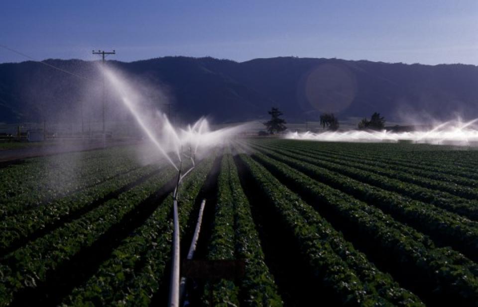
Irrigation is the artificial supply
of water to grow crops or plants. Obtained from either surface or groundwater, it optimizes
agricultural production when the amount of rain and where it
falls is insufficient. Different irrigation
systems are not necessarily mutually exclusive, but in
practical use are often combined. Much of the agriculture in
California and the West relies on irrigation.
The United States
Geographical Survey (USGS) defines freshwater as containing
less than 1,000 milligrams per liter dissolved solids. However,
500 milligrams per liter is usually the cutoff for municipal and
commercial use. Most of the Earth’s water is saline, 97.5
percent with only 2.5 percent fresh.
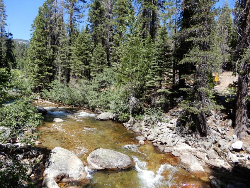
Springs are where groundwater becomes surface water, acting as openings
where subsurface water can discharge onto the ground or directly
into other water bodies. They can also be considered the
consequence of an overflowing
aquifer. As a result, springs often serve as headwaters to streams.
Sloughs (pronounced “slews”) are shallow lakes or swamps. Generally
they serve as backwaters –
or a stagnant part of a river – and are consequently located at
edges of rivers where a stream or other canal once flowed.
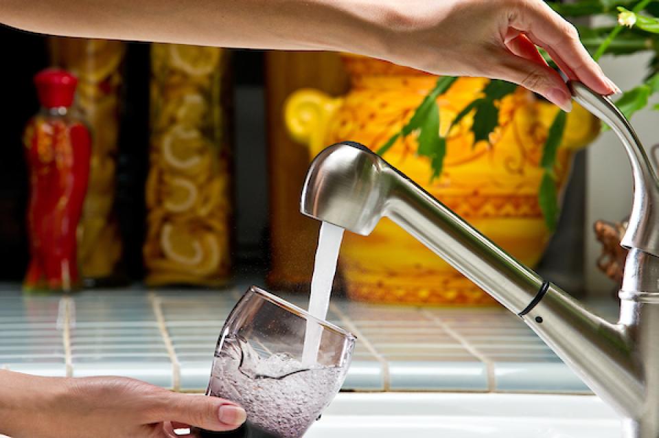
Potable water, also known as
drinking water, comes from surface and ground sources and is
treated to levels that that meet state and federal standards for
consumption.
Water from natural sources is treated for microorganisms,
bacteria, toxic chemicals, viruses and fecal matter. Drinking
raw, untreated water can cause gastrointestinal problems such as
diarrhea, vomiting or fever.
A hydrograph illustrates a type of activity of water during a
specific time frame. Salinity and acidity are sometimes measured,
but the most common types
are stage and discharge hydrographs. These graphs show how
surface water flow responds to fluxes in precipitation.
Scientifically and legislatively, lakes are indistinguishable
from ponds, but lakes generally are considered to be longer and
deeper lentic, or still, waters. In the 18th and
19th centuries, scientists attempted to distinguish
the two more formally, stating that ponds were shallow enough to
allow sunlight to penetrate to the bottom, but this exists
today as an unofficial point.
A tributary is a river or stream
that enters a larger body of water, especially a lake or river.
The receiving water into which a tributary feeds is called the
“mainstem,” and the point where they come together is referred to
as the “confluence.”
With a holding capacity of more than 260 billion gallons, Diamond
Valley Lake is Southern California’s largest reservoir. It sits
about 90 miles southeast of Los Angeles and just west of Hemet in
Riverside County where it was built in 2000. The offstream
reservoir was created by three large dams that connect the surrounding
hills, costing around $1.9 billion and doubling the region’s
water storage capacity.
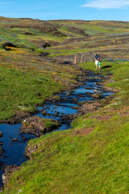
Headwaters are the source of a
stream or river. They are located at the furthest point from
where the water body empties or merges with
another. Two-thirds of California’s surface water supply
originates in these mountainous and typically forested regions.
The proposed Sites Reservoir would
be an off-river storage basin on the west side of the Sacramento
Valley, about 78 miles northwest of Sacramento. It would capture
stormwater flows from the Sacramento River for release in dry
years for fish and wildlife, farms, communities and
businesses.
The water would be held in a 14,000-acre basin of grasslands
surrounded by the rolling eastern foothills of the Coast Range.
Known as Antelope Valley, the sparsely populated area in Glenn
and Colusa counties is used for livestock grazing.
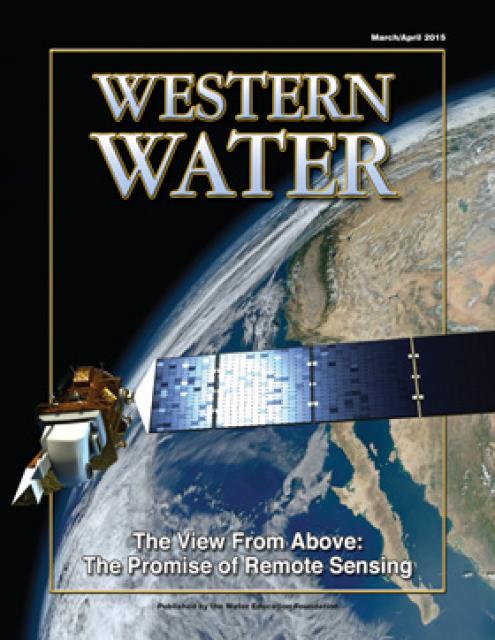
This issue looks at remote sensing applications and how satellite
information enables analysts to get a better understanding of
snowpack, how much water a plant actually uses, groundwater
levels, levee stability and more.
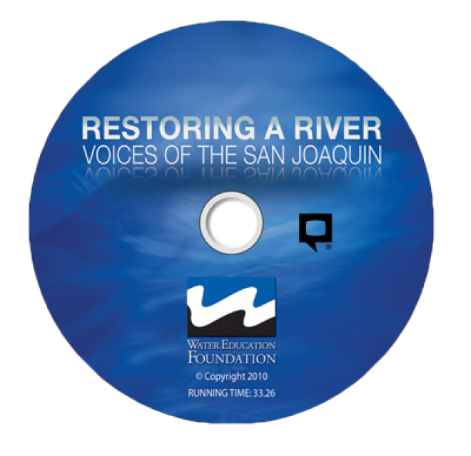
This 30-minute documentary-style DVD on the history and current
state of the San Joaquin River Restoration Program includes an
overview of the geography and history of the river, historical
and current water delivery and uses, the genesis and timeline of
the 1988 lawsuit, how the settlement was reached and what was
agreed to.
This 25-minute documentary-style DVD, developed in partnership
with the California Department of Water Resources, provides an
excellent overview of climate change and how it is already
affecting California. The DVD also explains what scientists
anticipate in the future related to sea level rise and
precipitation/runoff changes and explores the efforts that are
underway to plan and adapt to climate.
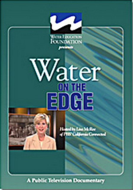
Water truly has shaped California into the great state it is
today. And if it is water that made California great, it’s the
fight over – and with – water that also makes it so critically
important. In efforts to remap California’s circulatory system,
there have been some critical events that had a profound impact
on California’s water history. These turning points not only
forced a re-evaluation of water, but continue to impact the lives
of every Californian. This 2005 PBS documentary offers a
historical and current look at the major water issues that shaped
the state we know today. Includes a 12-page viewer’s guide with
background information, historic timeline and a teacher’s lesson.
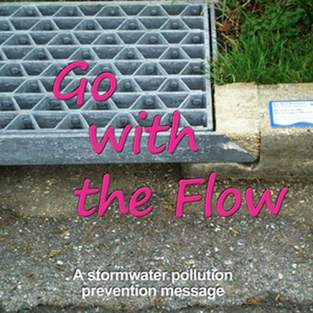
This 7-minute DVD is designed to teach children in grades 5-12
about where storm water goes – and why it is so important to
clean up trash, use pesticides and fertilizers wisely, and
prevent other chemicals from going down the storm drain. The
video’s teenage actors explain the water cycle and the difference
between sewer drains and storm drains, how storm drain water is
not treated prior to running into a river or other waterway. The
teens also offer a list of BMPs – best management practices that
homeowners can do to prevent storm water pollution.
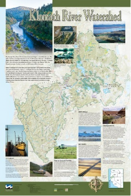
This beautiful 24×36-inch poster, suitable for framing, displays
the rivers, lakes and reservoirs, irrigated farmland, urban areas
and Indian reservations within the Klamath River Watershed. The
map text explains the many issues facing this vast,
15,000-square-mile watershed, including fish restoration;
agricultural water use; and wetlands. Also included are
descriptions of the separate, but linked, Klamath Basin
Restoration Agreement and the Klamath Hydroelectric Agreement,
and the next steps associated with those agreements. Development
of the map was funded by a grant from the U.S. Fish and Wildlife
Service.
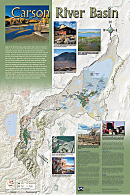
A companion to the Truckee River Basin Map poster, this
24×36-inch poster, suitable for framing, explores the Carson
River, and its link to the Truckee River. The map includes the
Lahontan Dam and reservoir, the Carson Sink, and the farming
areas in the basin. Map text discusses the region’s hydrology and
geography, the Newlands Project, land and water use within the
basin and wetlands. Development of the map was funded by a grant
from the U.S. Bureau of Reclamation Mid-Pacific Region, Lahontan
Basin Area Office.
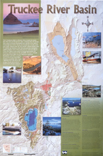
This beautiful 24×36-inch poster, suitable for framing, displays
the rivers, lakes and reservoirs, irrigated farmland, urban areas
and Indian reservations within the Truckee River Basin, including
the Newlands Project, Pyramid Lake and Lake Tahoe. Map text
explains the issues surrounding the use of the Truckee-Carson
rivers, Lake Tahoe water quality improvement efforts, fishery
restoration and the effort to reach compromise solutions to many
of these issues.
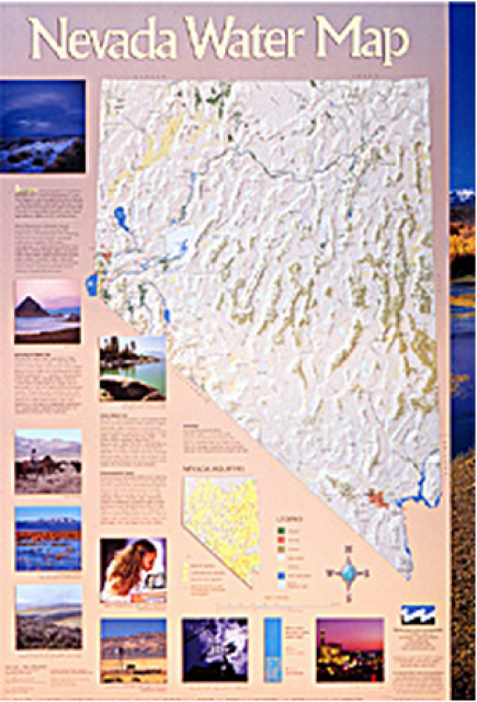
This 24×36 inch poster, suitable for framing, illustrates the
water resources available for Nevada cities, agriculture and the
environment. It features natural and manmade water resources
throughout the state, including the Truckee and Carson rivers,
Lake Tahoe, Pyramid Lake and the course of the Colorado River
that forms the state’s eastern boundary.
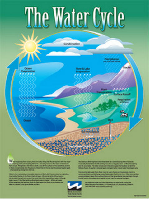
Water as a renewable resource is depicted in this 18×24 inch
poster. Water is renewed again and again by the natural
hydrologic cycle where water evaporates, transpires from plants,
rises to form clouds, and returns to the earth as precipitation.
Excellent for elementary school classroom use.
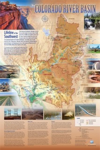
Redesigned in 2017, this beautiful map depicts the seven
Western states that share the Colorado River with Mexico. The
Colorado River supplies water to nearly 40 million people in
Arizona, California, Colorado, Nevada, New Mexico, Utah, Wyoming
and Mexico. Text on this beautiful, 24×36-inch map, which is
suitable for framing, explains the river’s apportionment, history
and the need to adapt its management for urban growth and
expected climate change impacts.
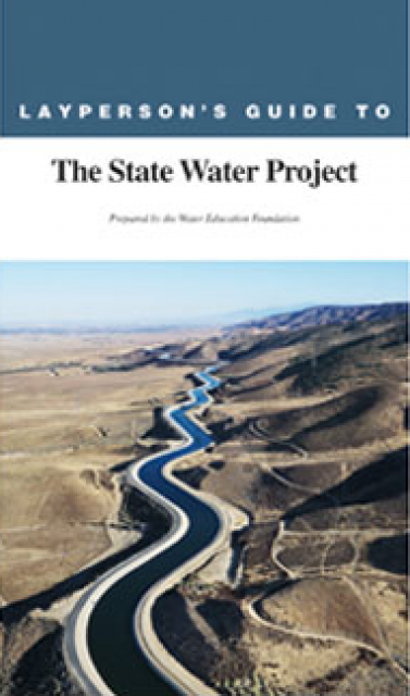
The 24-page Layperson’s Guide to the State Water Project provides
an overview of the California-funded and constructed State Water
Project.
The State Water Project is best known for the 444-mile-long
aqueduct that provides water from the Delta to San Joaquin Valley
agriculture and southern California cities. The guide contains
information about the project’s history and facilities.
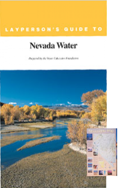
The 28-page Layperson’s Guide to Nevada Water provides an
overview of the history of water development and use in Nevada.
It includes sections on Nevada’s water rights laws, the history
of the Truckee and Carson rivers, water supplies for the Las
Vegas area, groundwater, water quality, environmental issues and
today’s water supply challenges.
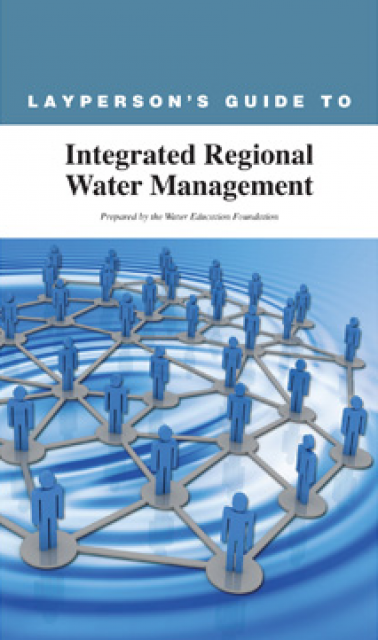
The 24-page Layperson’s Guide to Integrated Regional Water
Management (IRWM) is an in-depth, easy-to-understand publication
that provides background information on the principles of IRWM,
its funding history and how it differs from the traditional water
management approach.
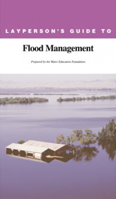
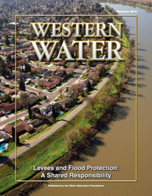
The 24-page Layperson’s Guide to Flood Management explains the
physical flood control system, including levees; discusses
previous flood events (including the 1997 flooding); explores
issues of floodplain management and development; provides an
overview of flood forecasting; and outlines ongoing flood control
projects.
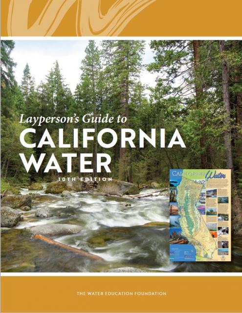
The 24-page Layperson’s Guide to California Water provides an
excellent overview of the history of water development and use in
California. It includes sections on flood management; the state,
federal and Colorado River delivery systems; Delta issues; water
rights; environmental issues; water quality; and options for
stretching the water supply such as water marketing and
conjunctive use. New in this 10th edition of the guide is a
section on the human need for water.
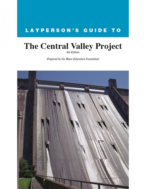
The 24-page Layperson’s Guide to the Central Valley Project
explores the history and development of the federal Central
Valley Project (CVP), California’s largest surface water delivery
system. In addition to the project’s history, the guide describes
the various facilities, operations and benefits the water
project brings to the state along with the CVP
Improvement Act (CVPIA).
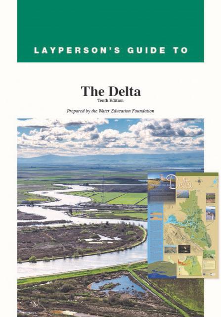
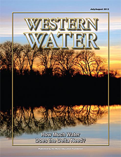
The 24-page Layperson’s Guide to the Delta explores the competing
uses and demands on California’s Sacramento-San Joaquin Delta.
Included in the guide are sections on the history of the Delta,
its role in the state’s water system, and its many complex issues
with sections on water quality, levees, salinity and agricultural
drainage, fish and wildlife, and water distribution.
A new look for our most popular product! And it’s the perfect
gift for the water wonk in your life.
Our 24×36-inch California Water Map is widely known for being the
definitive poster that shows the integral role water plays in the
state. On this updated version, it is easier to see California’s
natural waterways and man-made reservoirs and aqueducts
– including federally, state and locally funded
projects – the wild and scenic rivers system, and
natural lakes. The map features beautiful photos of
California’s natural environment, rivers, water projects,
wildlife, and urban and agricultural uses and the
text focuses on key issues: water supply, water use, water
projects, the Delta, wild and scenic rivers and the Colorado
River.
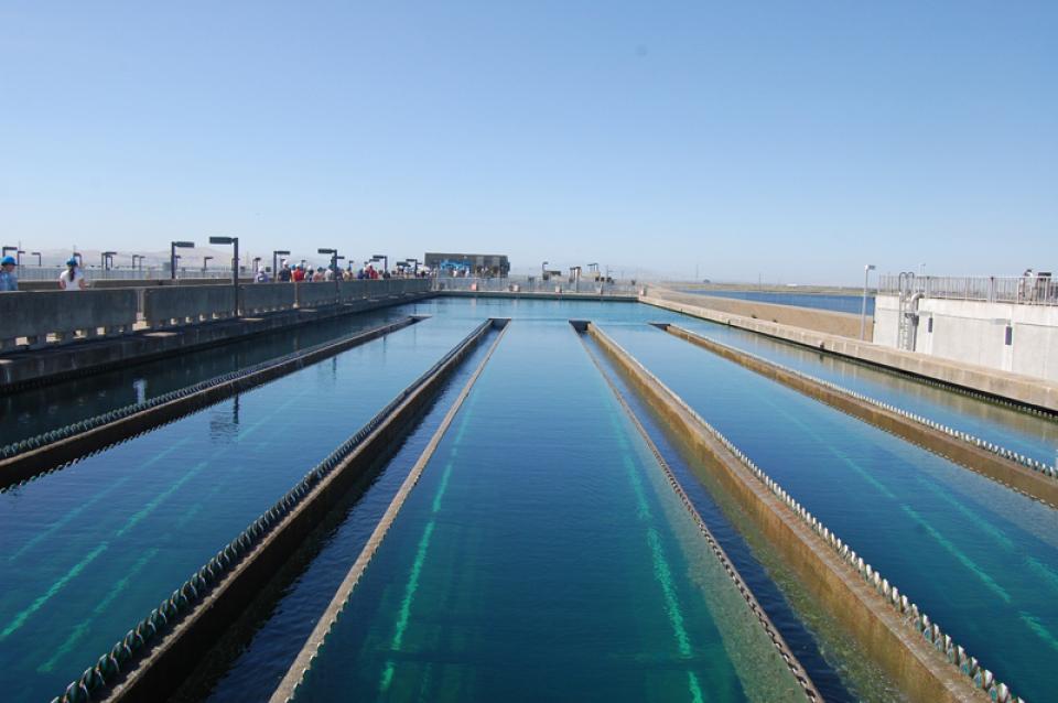
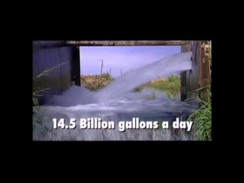
A tremendous amount of time and technology is expended to make
surface water safe to drink. Surface water undergoes many
processes before it reaches a consumer’s tap.
The story of California’s surface water— water that remains on
the earth’s surface, in rivers, streams, lakes, reservoirs or
oceans—is one that reflects the state’s geographic complexity.
About 75 percent of California’s surface water supply originates
in the northern third of the state, but around 80 percent of
water demand occurs in the southern two-thirds of the state. And
the demand for water is highest during the dry summer months when
there is little natural precipitation or snowmelt.
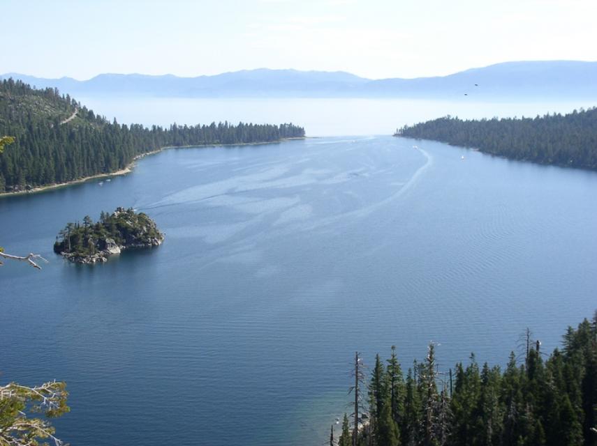
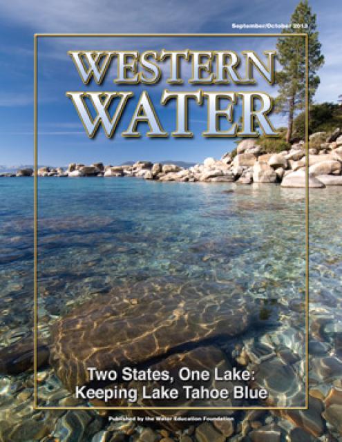
Lake Tahoe is one of the world’s most beautiful yet vulnerable
lakes. Renowned for its remarkable clarity, Tahoe straddles the
Nevada-California border, stretching 22 miles long and 12 miles
wide in a granitic bowl high in the Sierra Nevada.
Tahoe sits 6,225 feet above sea level. Its deepest point is 1,645
feet, making it the second-deepest lake in the nation, after
Oregon’s Crater Lake, and the tenth deepest in the world.
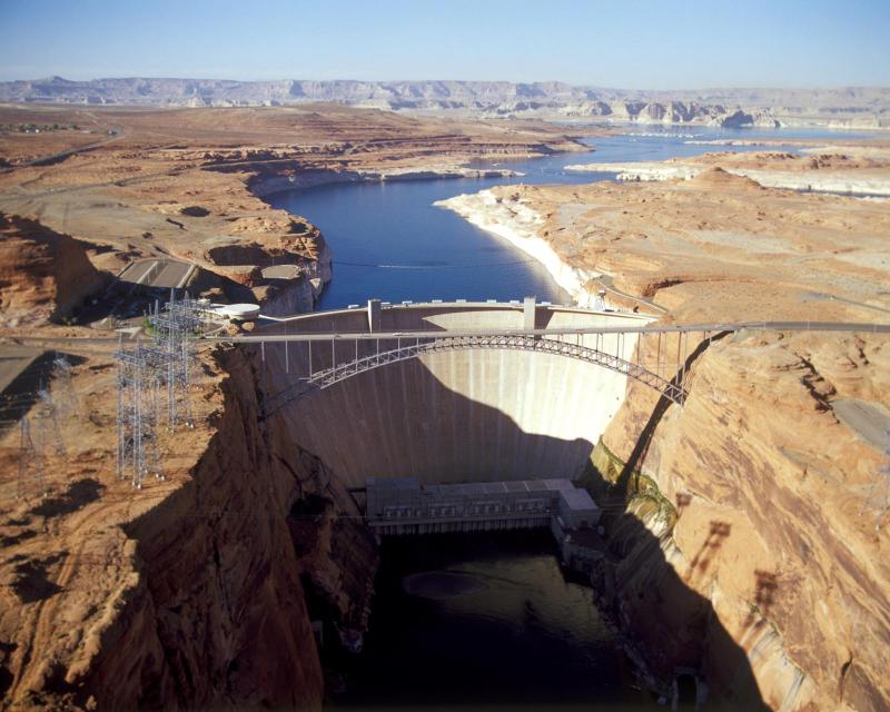
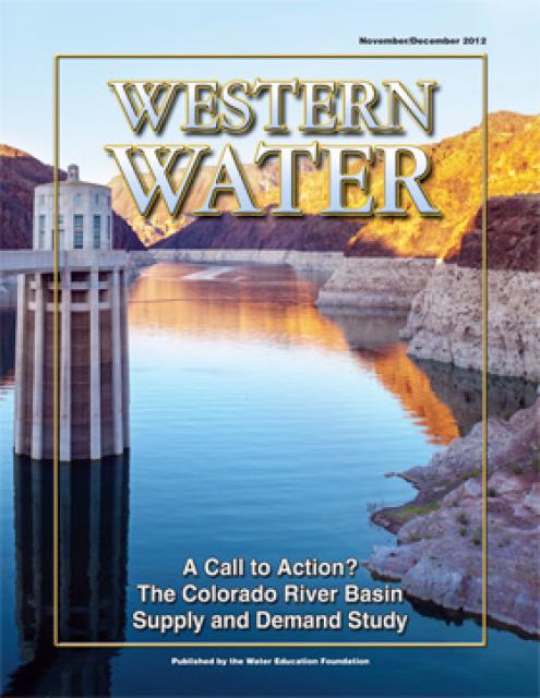
The construction of Glen Canyon Dam
in 1964 created Lake Powell. Both are located in north-central
Arizona near the Utah border. Lake Powell acts as a holding tank
for outflow from the Colorado River Upper Basin States: Colorado,
New Mexico, Utah and Wyoming.
The water stored in Lake Powell is used for recreation, power
generation and delivering water to the Lower Basin states of
California, Arizona, and Nevada.
This issue of Western Water looks at the BDCP and the
Coalition to Support Delta Projects, issues that are aimed at
improving the health and safety of the Delta while solidifying
California’s long-term water supply reliability.
This printed issue of Western Water features a
roundtable discussion with Anthony Saracino, a water resources
consultant; Martha Davis, executive manager of policy development
with the Inland Empire Utilities Agency and senior policy advisor
to the Delta Stewardship Council; Stuart Leavenworth, editorial
page editor of The Sacramento Bee and Ellen Hanak, co-director of
research and senior fellow at the Public Policy Institute of
California.
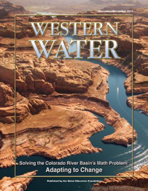
This printed issue of Western Water examines the
Colorado River Basin Water Supply and Demand Study and what its
finding might mean for the future of the lifeblood of the
Southwest.
This printed issue of Western Water examines the issues
associated with the State Water Board’s proposed revision of the
water quality Bay-Delta Plan, most notably the question of
whether additional flows are needed for the system, and how they
might be provided.
This printed issue of Western Water discusses several
flood-related issues, including the proposed Central Valley Flood
Protection Plan, the FEMA remapping process and the dispute
between the state and the Corps regarding the levee vegetation
policy.
This printed issue of Western Water explores the
historic nature of some of the key agreements in recent years,
future challenges, and what leading state representatives
identify as potential “worst-case scenarios.” Much of the content
for this issue of Western Water came from the in-depth
panel discussions at the Colorado River Symposium. The Foundation
will publish the full proceedings of the Symposium in 2012.
This printed issue of Western Water examines science –
the answers it can provide to help guide management decisions in
the Delta and the inherent uncertainty it holds that can make
moving forward such a tenuous task.
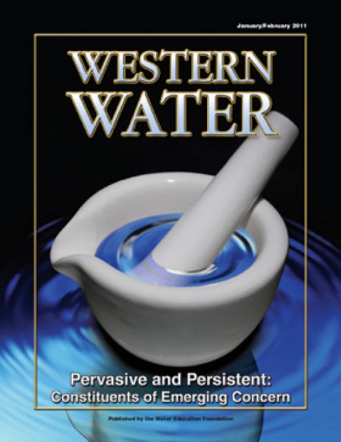
This printed issue of Western Water, based on presentations
at the November 3-4, 2010 Water Quality Conference in Ontario,
Calif., looks at constituents of emerging concerns (CECs) – what
is known, what is yet to be determined and the potential
regulatory impacts on drinking water quality.
This printed issue of Western Water examines the area
of origin laws, what they mean to those who claim their
protections and the possible implications of the Tehama Colusa
Canal Authority’s lawsuit against the Bureau of Reclamation.
This printed copy of Western Water examines California’s drought
– its impact on water users in the urban and agricultural sector
and the steps being taken to prepare for another dry year should
it arrive.
This issue of Western Water looks at the political
landscape in Washington, D.C., and Sacramento as it relates to
water issues in 2007. Several issues are under consideration,
including the means to deal with impending climate change, the
fate of the San Joaquin River, the prospects for new surface
storage in California and the Delta.
This issue of Western Water looks at some of the issues
facing drinking water providers, such as compliance with
increasingly stringent treatment requirements, the need to
improve source water quality and the mission of continually
informing consumers about the quality of water they receive.
This issue of Western Water examines PPCPs – what they are, where
they come from and whether the potential exists for them to
become a water quality problem. With the continued emphasis on
water quality and the fact that many water systems in the West
are characterized by flows dominated by effluent contributions,
PPCPs seem likely to capture interest for the foreseeable future.
This issue of Western Water examines the challenges facing state,
federal and tribal officials and other stakeholders as they work
to manage terminal lakes. It includes background information on
the formation of these lakes, and overviews of the water quality,
habitat and political issues surrounding these distinctive bodies
of water. Much of the information in this article originated at
the September 2004 StateManagement Issues at Terminal Water
Bodies/Closed Basins conference.
This issue of Western Water examines the Los Angeles River,
certainly the most unique waterway in California and perhaps the
world because of the degree to which it has been transformed by
human hands. Despite the makeover, current efforts are focused on
making the river something different; a place not so foreboding,
more welcoming and possibly a distant remnant of what existed
centuries ago.
According to political debate and the popular press, the purpose
of adding surface water storage reservoirs to California’s
existing system is to provide water for urban growth and
agricultural crops. But that viewpoint touches only the surface
of a more complex policy and operations issue spelled out in the
CALFED Record of Decision (ROD): the need to expand storage
capacity to increase the existing system’s flexibility, improve
water quality and provide water for fish, as well as meet the
needs of a growing population.
Traditionally treated as two separate resources, surface water
and groundwater are increasingly linked in California as water
leaders search for a way to close the gap between water demand
and water supply. Although some water districts have coordinated
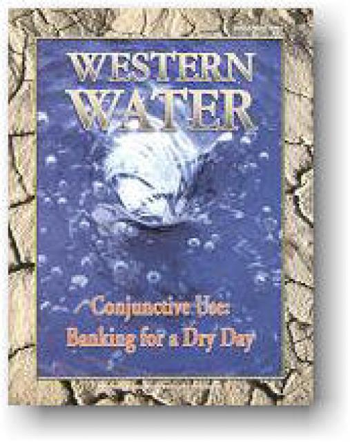
use of surface water and groundwater for years, conjunctive use
has become the catchphrase when it comes to developing additional
water supply for the 21st century.


 and other tributaries of the upper Colorado River have declined dramatically and contributed to the precipitous declines of Lake Powell and Lake Mead. (Source: The Water Desk)")
")

")
")

")
 and temperature. This gauge near downtown Sacramento measures water depth. (Source: California Department of Water Resources)")
")
")
")


")
")
")
")
")
: Karla Nemeth, director, California Department of Water Resources; Gloria Gray, chair, Metropolitan Water District of Southern California; Brenda Burman, Bureau of Reclamation Commissioner; Jayne Harkins, commissioner, International Boundary and Water Commission, U.S. and Mexico; Amy Haas, executive director, Upper Colorado River Commission.")
")
")
")
")
")
")
")
")
")
")


")