Water and energy are interconnected. A frequent term to describe
this relationship is the “water-energy nexus.”
Energy for Water: Energy is needed to store water, get it where
it is needed and also treat it to be used:
* Extracting water from rivers and streams or pumping it
from aquifers, and then conveying it over hills and into storage
facilities is a highly energy intensive process. The State Water
Project (SWP) pumps water 700 miles, including up nearly 2,000
feet over the Tehachapi Mountains. The SWP is the largest single
user of energy in California. It consumes an average of 5 billion
kWh per year. That’s about 2 to 3 percent of all electricity
consumed in California
* Water treatment facilities use energy to pump and process
water for use in homes, businesses and industry
* Consumers use energy to treat water with softeners or
filters, to circulate and pressurize water and to heat and cool
water
* Wastewater plants use energy to pump wastewater to
treatment plants, and also to aerate and filter it at the plant.
Different end uses require more electricity for delivery than
others. Water for residential, commercial and industrial end-use
needs the most energy (11 percent), followed by agricultural
end-use (3 percent), residential, commercial and industrial
supply and treatment (3 percent), agricultural water supply and
treatment (1 percent) and wastewater treatment (1 percent),
according to the California Energy Commission.
Water for Energy: Water is used to generate electricity
* Water is needed either to process raw materials used in a
facility or maintaining a plant,or to just generate electricity
itself.
Overall, the electricity industry is second only to agriculture
as the largest user of water in the United States. Electricity
production from fossil fuels and nuclear energy requires 190,000
million gallons of water per day, accounting for 39 percent of
all freshwater withdrawals in the nation. Coal, the most abundant
fossil fuel, currently accounts for 52 percent of U.S.
electricity generation, and each kWh generated from coal requires
withdrawal of 25 gallons of water.
Wyoming may be home to the famous bubbling geothermal features
in Yellowstone National Park, but that doesn’t mean the state
is a hot spot for generating electricity using heat from inside
the earth. A new federal assessment identified Wyoming as
part of a massive underground geothermal energy resource that
could generate electricity equal to 10% of America’s current
power supply, though state-specific research suggests only
modest potential for Wyoming. A May U.S. Geological
Survey’s report on geothermal systems in the Great Basin found
that the arid lands of Nevada and adjoining parts of
California, Oregon, Idaho, Utah and a sliver of
Wyoming’s western border with Idaho contain enough
geothermal energy to generate 135 gigawatts of electricity from
the upper 6 kilometers of the Earth’s crust.
Santa Clara leaders are raising concerns about how the city’s
dozens of data centers affect residents and the environment.
Santa Clara has more standalone data centers than any other
California city — 55 in operation and three in the pipeline,
according to the city. Demand is growing as more people use the
internet and digitally demanding technology advances, such as
artificial intelligence. With data centers providing the city
with millions in revenue, officials are questioning impacts to
water and the electrical grid. … (Planning
Commissioner Priya) Cherukuru, who is the executive director of
space planning for Stanford Health Care, said Santa Clara needs
to conduct a deeper study on the strain data centers put on
city resources, such as electricity and water. Data centers use
water to cool their densely packed servers. Ahmed Aly, the
city’s principal engineer for water and sewer utilities, said
more data centers are starting to use water efficient cooling
systems, and 31 data centers in the city use recycled
water.
Santa Monica is known for its ocean views, sunny skies, and
strong environmental values. But there’s a challenge on the
horizon that could test the city’s priorities: water. If Santa
Monica follows through on California’s state housing
requirements, which call for tens of thousands of new homes,
the city’s water supply will not be able to keep up. That could
mean building something the city and its neighbors have never
had before: a desalination plant. And powering it might require
making some tough decisions, possibly even considering nuclear
energy, something many local environmentalists have long
opposed. … If solar and wind alone can’t reliably power
a desalination plant, and fossil fuels are off the table for
climate reasons, nuclear might be the only option left. That
means environmentalists, residents, and city leaders may have
to ask themselves a hard question: are we willing to rethink
nuclear energy in order to solve an urgent water and housing
problem? –Written by Santa Monica Architects for a Responsible
Tomorrow
… California is grappling with two pressing issues: a
shrinking water supply and the growing demand for clean,
dependable energy. SGMA requires local agencies to balance
groundwater use by 2040. Meanwhile, statewide power demand is
expected to rise 80% by 2045. In response, AB 1156 would allow
landowners to lease their farmland for solar panel
installation. “This land is fallow this year. Obviously, as you
can see in the background, we don’t have anything growing there
— and that’s because of the SGMA regulations, along with quite
a bit of other land that we have.” Mike Frey said. Mike
Frey is a fifth-generation farmer in Buttonwillow. His family
has been farming in Kern County since 1962, growing almonds,
pistachios, cotton, wheat, corn, potatoes, and carrots. Now,
he’s working to turn that fallow land into a solar farm.
… The corporate race to amass computing resources to train
and run artificial intelligence models and store information in
the cloud has sparked a data center boom in the desert—just far
enough away from Nevada’s communities to elude wide notice and,
some fear, adequate scrutiny. The full scale and potential
environmental impacts of the developments aren’t known, because
the footprint, energy needs, and water
requirements are often closely guarded corporate secrets. Most
of the companies didn’t respond to inquiries from MIT
Technology Review, or declined to provide additional
information about the projects. … The build-out of a
dense cluster of energy and water-hungry data centers in a
small stretch of the nation’s driest state, where climate
change is driving up temperatures faster than anywhere else in
the country, has begun to raise alarms among water experts,
environmental groups, and residents.
We expect U.S. hydropower generation will increase by 7.5% in
2025 but will remain 2.4% below the 10-year average in our May
Short-Term Energy Outlook (STEO). Hydropower generation in 2024
fell to 241 billion kilowatthours (BkWh), the lowest since at
least 2010; in 2025, we expect generation will be 259.1 BkWh.
This amount of generation would represent 6% of the electricity
generation in the country. About half of the hydropower
generating capacity in the country is in the western states of
Washington, Oregon, and California, so we closely monitor
precipitation patterns in this region to inform our hydropower
outlook. Precipitation conditions have been mixed across
the western United States since October. According to the
WestWide Drought Tracker, more precipitation than normal has
fallen in northern California, Oregon, and the eastern half of
Washington state. … In contrast, precipitation was below
normal in parts of Washington, Montana, Idaho, and Southern
California.
From a small California winery to a large-scale energy project
in China, floating photovoltaics—or “floatovoltaics”—are
gaining in popularity. Commonly installed over artificial water
bodies, from irrigation ponds and reservoirs to wastewater
treatment plants, floating solar projects can maximize space
for producing clean energy while sparing natural
lands. But where there is water, there are waterbirds.
Little is known about the impacts—positive or negative—floating
solar projects may have on birds and other wildlife. A paper
from the University of California, Davis, published in the
journal Nature Water, is among the first to outline key
considerations to better align renewable energy and
biodiversity goals.
A pilot project from a team of oil industry veterans could save
one of California’s key clean energy resources from terminal
decline. On Thursday, the Oklahoma City-based GreenFire Energy
announced that they had restored new life to a defunct well in
The Geysers, the world’s largest geothermal power station — and
one that has been in a state of slow, decades-long collapse.
… The reason for the decline: the ferocious pace at
which conventional forms of geothermal energy can use up water.
… GreenFire’s next-gen system, which sits atop a well
that had also been largely abandoned for lack of pressure,
takes an approach that produces power without losing water.
Turn on the tap, and you have reasonably clean water to use
instantly. That is because electricity pumps water to your
faucets. Electricity is generated by heating water into steam
to run turbines unless you use wind or photovoltaic (PV) energy
sources for electrical production. Often, these essential
connections are not mentioned in public information. Especially
in drought-prone places, the simple fact is that you need water
for energy, and it takes energy to move, chill, or heat water.
Southern California is in a drought, and parts of the western
deserts are in severe drought conditions. We may realize that
hydroelectric power production from dammed rivers is diminished
in periods of extended drought. Living well in a water deficit
region requires enormous use of electrical energy to move water
from mountainous northern California to our desert and semiarid
regions.
Around the world, farmers are retooling their land to harvest
the hottest new commodity: sunlight. As the price of renewable
energy technology has plummeted and water has gotten more
scarce, growers are fallowing acreage and installing solar
panels. Some are even growing crops beneath them, which is
great for plants stressed by too many rays. Still others are
letting that shaded land go wild, providing habitat for
pollinators and fodder for grazing livestock. According to a
new study, this practice of agrisolar has been quite lucrative
for farmers in California’s Central Valley
over the last 25 years — and for the environment. Researchers
looked at producers who had idled land and installed solar,
using the electricity to run equipment like water pumps and
selling the excess power to utilities.
*IMPORTANT* In anticipation of high demand, the Foundation will be allocating tickets via a lottery method with a maximum of 3 entrants per organization. To enter, please thoroughly review the tour details below so you’re fully aware of the time and financial commitments, then complete this entry form. Entrants selected via the ticket lottery will be contacted beginning on June 12 with an opportunity to register for the tour.
This special, first-ever Foundation water tour will not be offered every year! Join us as we examine water issues along the 263-mile Klamath River, from its spring-fed headwaters in south-central Oregon to its redwood-lined estuary on the Pacific Ocean in California.
Running Y Resort
5500 Running Y Rd
Klamath Falls, OR 97601
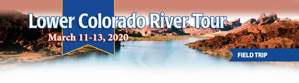
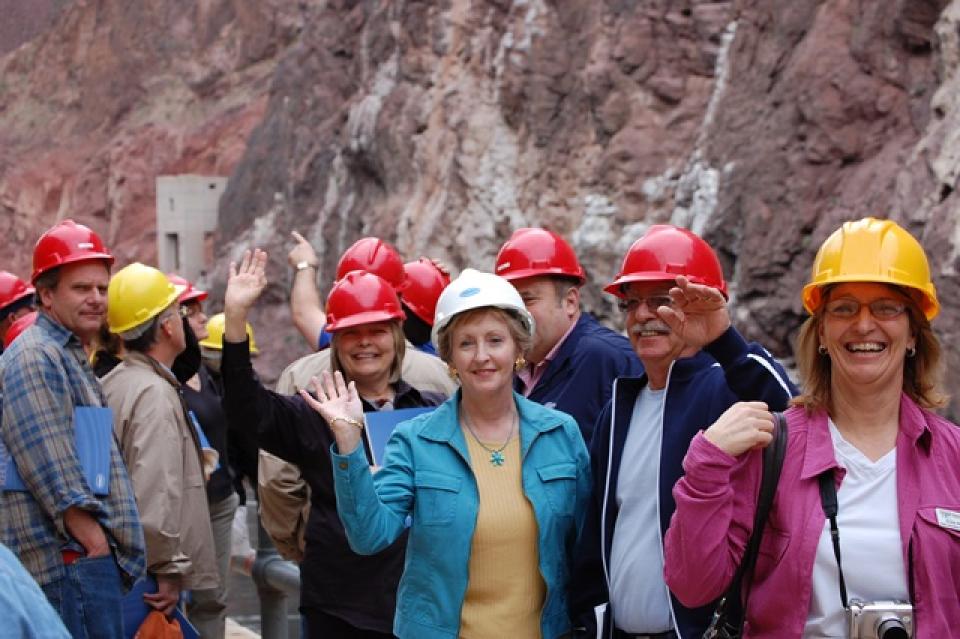
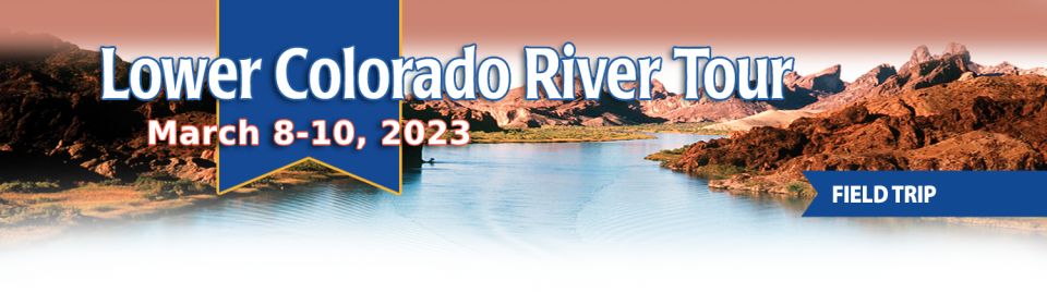
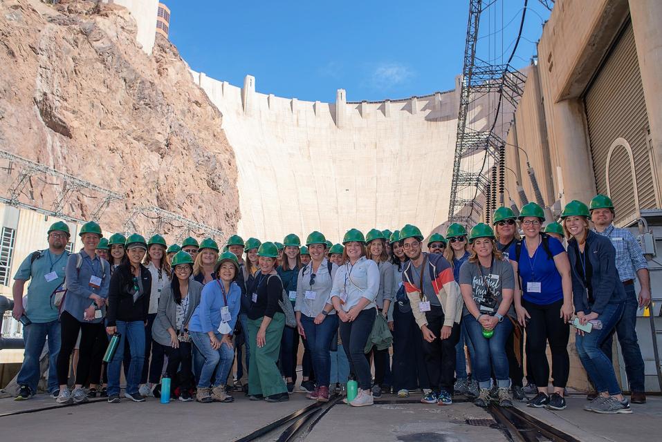
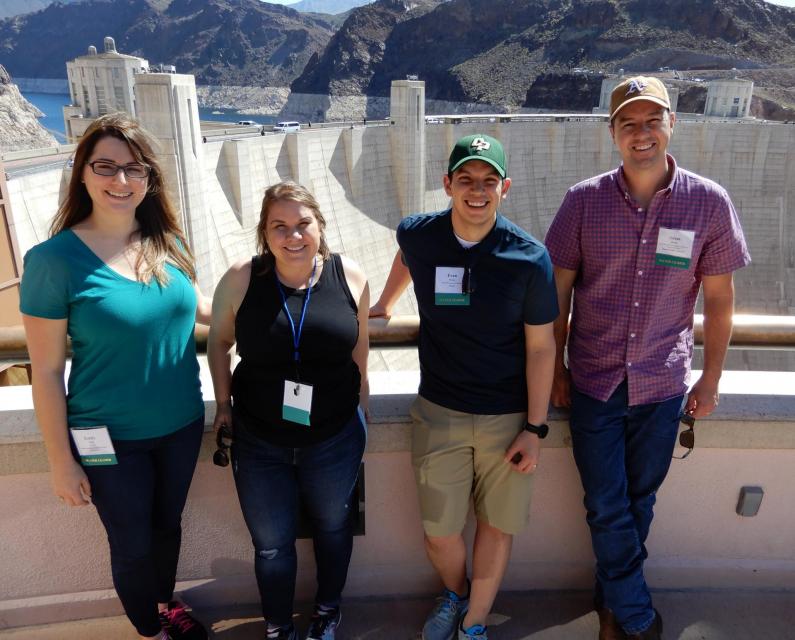
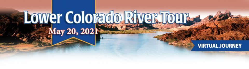
This tour explored the lower Colorado River firsthand where virtually every drop of the river is allocated, yet demand is growing from myriad sources — increasing population, declining habitat, drought and climate change.
The 1,450-mile river is a lifeline to some 40 million people in the Southwest across seven states, 30 tribal nations and Mexico. How the Lower Basin states – Arizona, California and Nevada – use and manage this water to meet agricultural, urban, environmental and industrial needs was the focus of this tour.
Hilton Garden Inn Las Vegas Strip South
7830 S Las Vegas Blvd
Las Vegas, NV 89123
Learn the history and challenges facing the West’s most dramatic
and developed river.
The Layperson’s Guide to the Colorado River Basin introduces the
1,450-mile river that sustains 40 million people and millions of
acres of farmland spanning seven states and parts of northern
Mexico.
The 28-page primer explains how the river’s water is shared and
managed as the Southwest transitions to a hotter and drier
climate.
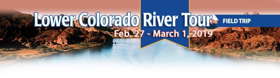
This tour explored the lower Colorado River firsthand where virtually every drop of the river is allocated, yet demand is growing from myriad sources — increasing population, declining habitat, drought and climate change.
The 1,450-mile river is a lifeline to some 40 million people in the Southwest across seven states, 30 tribal nations and Mexico. How the Lower Basin states – Arizona, California and Nevada – use and manage this water to meet agricultural, urban, environmental and industrial needs was the focus of this tour.
Hilton Garden Inn Las Vegas Strip South
7830 S Las Vegas Blvd
Las Vegas, NV 89123
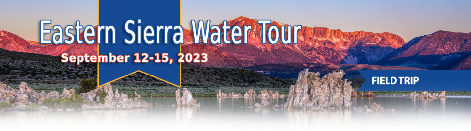
This special Foundation water tour journeyed along the Eastern Sierra from the Truckee River to Mono Lake, through the Owens Valley and into the Mojave Desert to explore a major source of water for Southern California, this year’s snowpack and challenges for towns, farms and the environment.
This tour explored the lower Colorado River firsthand where virtually every drop of the river is allocated, yet demand is growing from myriad sources — increasing population, declining habitat, drought and climate change.
The 1,450-mile river is a lifeline to some 40 million people in the Southwest across seven states, 30 tribal nations and Mexico. How the Lower Basin states – Arizona, California and Nevada – use and manage this water to meet agricultural, urban, environmental and industrial needs was the focus of this tour.
Hyatt Place Las Vegas At Silverton Village
8380 Dean Martin Drive
Las Vegas, NV 89139
The lower Colorado River has virtually every drop allocated, yet demand is growing from myriad sources — increasing population, declining habitat, drought and climate change.
The 1,450-mile river is a lifeline to 40 million people in the Southwest across seven states, 30 tribal nations and Mexico. How the Lower Basin states – Arizona, California and Nevada – use and manage this water to meet agricultural, urban, environmental and industrial needs was the focus of this tour.
Hyatt Place Las Vegas At Silverton Village
8380 Dean Martin Drive
Las Vegas, NV 89139
This event explored the lower Colorado River where virtually every drop of the river is allocated, yet demand is growing from myriad sources — increasing population, declining habitat, drought and climate change.
The 1,450-mile river is a lifeline to 40 million people in the Southwest across seven states and Mexico. How the Lower Basin states – Arizona, California and Nevada – use and manage this water to meet agricultural, urban, environmental and industrial needs was the focus of this tour.
The majestic beauty of the Sierra
Nevada forest is awe-inspiring, but beneath the dazzling blue
sky, there is a problem: A century of fire suppression and
logging practices have left trees too close together. Millions of
trees have died, stricken by drought and beetle infestation.
Combined with a forest floor cluttered with dry brush and debris,
it’s a wildfire waiting to happen.
Fires devastate the Sierra watersheds upon which millions of
Californians depend — scorching the ground, unleashing a
battering ram of debris and turning hillsides into gelatinous,
stream-choking mudflows.
This tour explored the lower Colorado River where virtually every drop of the river is allocated, yet demand is growing from myriad sources — increasing population, declining habitat, drought and climate change.
The 1,450-mile river is a lifeline to 40 million people in the Southwest across seven states and Mexico. How the Lower Basin states – Arizona, California and Nevada – use and manage this water to meet agricultural, urban, environmental and industrial needs is the focus of this tour.
Silverton Hotel
3333 Blue Diamond Road
Las Vegas, NV 89139
We explored the lower Colorado River where virtually every drop
of the river is allocated, yet demand is growing from myriad
sources — increasing population, declining habitat, drought and
climate change.
The 1,450-mile river is a lifeline to 40 million people in
the Southwest across seven states and Mexico. How the Lower Basin
states – Arizona, California and Nevada – use and manage this
water to meet agricultural, urban, environmental and industrial
needs was the focus of this tour.
Hampton Inn Tropicana
4975 Dean Martin Drive, Las Vegas, NV 89118
This three-day, two-night tour explored the lower Colorado River
where virtually every drop of the river is allocated, yet demand
is growing from myriad sources — increasing population,
declining habitat, drought and climate change.
The 1,450-mile river is a lifeline to 40 million people in
the Southwest across seven states and Mexico. How the Lower Basin
states – Arizona, California and Nevada – use and manage this
water to meet agricultural, urban, environmental and industrial
needs is the focus of this tour.
Best Western McCarran Inn
4970 Paradise Road
Las Vegas, NV 89119
This 30-minute documentary-style DVD on the history and current
state of the San Joaquin River Restoration Program includes an
overview of the geography and history of the river, historical
and current water delivery and uses, the genesis and timeline of
the 1988 lawsuit, how the settlement was reached and what was
agreed to.
This 25-minute documentary-style DVD, developed in partnership
with the California Department of Water Resources, provides an
excellent overview of climate change and how it is already
affecting California. The DVD also explains what scientists
anticipate in the future related to sea level rise and
precipitation/runoff changes and explores the efforts that are
underway to plan and adapt to climate.
20-minute DVD that explains the problem with polluted stormwater,
and steps that can be taken to help prevent such pollution and
turn what is often viewed as a “nuisance” into a water resource
through various activities.
Many Californians don’t realize that when they turn on the
faucet, the water that flows out could come from a source close
to home or one hundreds of miles away. Most people take their
water for granted; not thinking about the elaborate systems and
testing that go into delivering clean, plentiful water to
households throughout the state. Where drinking water comes from,
how it’s treated, and what people can do to protect its quality
are highlighted in this 2007 PBS documentary narrated by actress
Wendie Malick.
A 30-minute version of the 2007 PBS documentary Drinking Water:
Quenching the Public Thirst. This DVD is ideal for showing at
community forums and speaking engagements to help the public
understand the complex issues surrounding the elaborate systems
and testing that go into delivering clean, plentiful water to
households throughout the state.
Water truly has shaped California into the great state it is
today. And if it is water that made California great, it’s the
fight over – and with – water that also makes it so critically
important. In efforts to remap California’s circulatory system,
there have been some critical events that had a profound impact
on California’s water history. These turning points not only
forced a re-evaluation of water, but continue to impact the lives
of every Californian. This 2005 PBS documentary offers a
historical and current look at the major water issues that shaped
the state we know today. Includes a 12-page viewer’s guide with
background information, historic timeline and a teacher’s lesson.
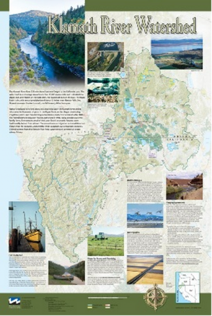
This beautiful 24×36-inch poster, suitable for framing, displays
the rivers, lakes and reservoirs, irrigated farmland, urban areas
and Indian reservations within the Klamath River Watershed. The
map text explains the many issues facing this vast,
15,000-square-mile watershed, including fish restoration;
agricultural water use; and wetlands. Also included are
descriptions of the separate, but linked, Klamath Basin
Restoration Agreement and the Klamath Hydroelectric Agreement,
and the next steps associated with those agreements. Development
of the map was funded by a grant from the U.S. Fish and Wildlife
Service.
A companion to the Truckee River Basin Map poster, this
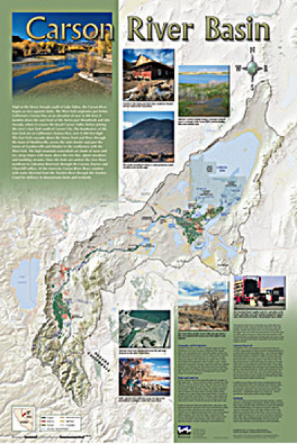
24×36-inch poster, suitable for framing, explores the Carson
River, and its link to the Truckee River. The map includes the
Lahontan Dam and reservoir, the Carson Sink, and the farming
areas in the basin. Map text discusses the region’s hydrology and
geography, the Newlands Project, land and water use within the
basin and wetlands. Development of the map was funded by a grant
from the U.S. Bureau of Reclamation Mid-Pacific Region, Lahontan
Basin Area Office.
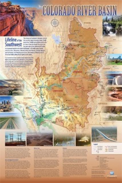
Redesigned in 2017, this beautiful map depicts the seven
Western states that share the Colorado River with Mexico. The
Colorado River supplies water to nearly 40 million people in
Arizona, California, Colorado, Nevada, New Mexico, Utah, Wyoming
and Mexico. Text on this beautiful, 24×36-inch map, which is
suitable for framing, explains the river’s apportionment, history
and the need to adapt its management for urban growth and
expected climate change impacts.
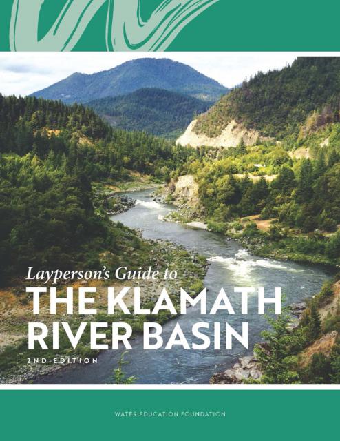
The Water Education Foundation’s second edition of
the Layperson’s Guide to The Klamath River Basin is
hot off the press and available for purchase.
Updated and redesigned, the easy-to-read overview covers the
history of the region’s tribal, agricultural and environmental
relationships with one of the West’s largest rivers — and a
vast watershed that hosts one of the nation’s oldest and
largest reclamation projects.
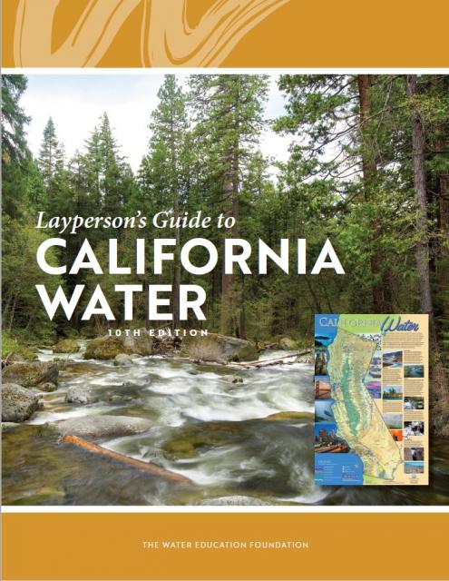
The 24-page Layperson’s Guide to California Water provides an
excellent overview of the history of water development and use in
California. It includes sections on flood management; the state,
federal and Colorado River delivery systems; Delta issues; water
rights; environmental issues; water quality; and options for
stretching the water supply such as water marketing and
conjunctive use. New in this 10th edition of the guide is a
section on the human need for water.
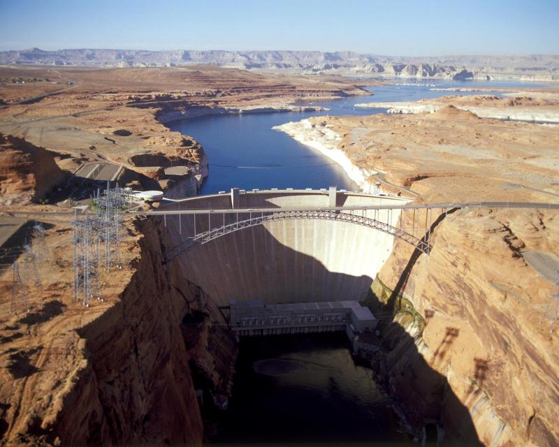
The construction of Glen Canyon Dam
in 1964 created Lake Powell. Both are located in north-central
Arizona near the Utah border. Lake Powell acts as a holding tank
for outflow from the Colorado River Upper Basin States: Colorado,
New Mexico, Utah and Wyoming.
The water stored in Lake Powell is used for recreation, power
generation and delivering water to the Lower Basin states of
California, Arizona, and Nevada.
Every five years the California Department of Water Resources
updates its strategic plan for managing the state’s water
resources, as required by state law.
The California Water Plan, or Bulletin 160, projects the
status and trends of the state’s water supplies and demands
under a range of future scenarios.
This printed issue of Western Water looks at hydraulic
fracturing, or “fracking,” in California. Much of the information
in the article was presented at a conference hosted by the
Groundwater Resources Association of California.
The connection between water and energy is more relevant than
ever. After existing in separate realms for years, the maxim that
it takes water to produce energy and energy to produce water has
prompted a re-thinking of management strategies, including an
emphasis on renewable energy use by water agencies.
This printed issue of Western Water looks at the energy
requirements associated with water use and the means by which
state and local agencies are working to increase their knowledge
and improve the management of both resources.
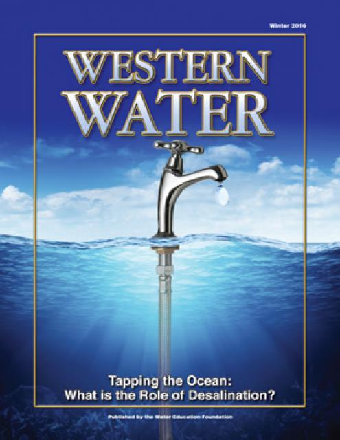
This printed issue of Western Water examines
desalination – an issue that is marked by great optimism and
controversy – and the expected role it might play as an
alternative water supply strategy.
This printed copy of Western Water examines climate change –
what’s known about it, the remaining uncertainty and what steps
water agencies are talking to prepare for its impact. Much of the
information comes from the October 2007 California Climate Change
and Water Adaptation Summit sponsored by the Water Education
Foundation and DWR and the November 2007 California Water Policy
Conference sponsored by Public Officials for Water and
Environmental Reform.
Hydropower generation is prevalent in the West, where rapidly
flowing river systems have been tapped for generations to produce
electricity. Hydropower is a clean, steady and reliable energy
source, but the damming of rivers has exacted a toll on the
environment, affecting, among other things, the migration of fish
to vestigial spawning grounds. Many of those projects are due to
be relicensed by the Federal Energy Regulatory Commission.
The California power crisis has made international headlines. But
what is the link between water and power in California? How is
the state’s dry spell affecting its hydropower generation? How
has the electric crisis affected water users in the state? These
questions and others are addressed in this issue of Western
Water.


")