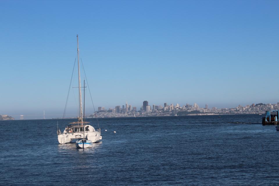
The San Francisco Bay (Bay) drains water from 40 percent of
California. This includes flows originating from the Sierra
Nevada mountain range and the Sacramento and San Joaquin rivers
that make their way down through Sacramento-San Joaquin Bay Delta
through the Bay to the Pacific Ocean.
The Bay is the largest harbor on the U.S. Pacific Coast and
covers about 400 square miles with an average depth of 14 feet.
Its deepest point is 360 feet at the Golden Gate.
Every year, more than 67 million tons of cargo pass through the
Golden Gate. The Bay also supports commercial bait shrimp,
herring and Dungeness crab fisheries.
The Bay is a vital estuary and a key link in the Pacific Flyway,
and millions of waterfowl use the shallow portions of the bay as
a refuge each year.
Richmond agreed to pay a $336,000 fine after it was found to
have released poorly treated sewage water into the San
Francisco Bay for more than a year. Half of that money will go
toward environmental education for children. Between July 31,
2022, and Dec. 31, 2023, inadequately treated wastewater was
released 112 times from the Richmond Municipal Sewer District
Water Pollution Control Plant at 601 Canal Blvd., the San
Francisco Bay Regional Water District announced Friday. Each
violation cost the city $3,000, according to a settlement
agreement between the city and water district. Richmond’s water
pollution control plant is responsible for reducing the amount
of harmful chemicals and pollutants flushed down toilets and
dumped in the drains of Richmond homes, businesses and
industrial operations before flowing into the San Francisco
Bay.
The tiny native oysters of San
Francisco Bay managed to outlive the Gold Rush,
bay-shore development and decades of punishing pollution. New
research shows they have a fighting chance to survive global
warming as well. … In recent years, extreme heat waves
killed thousands of shellfish that inhabit the same type of
intertidal zone, including mussels that were baked in their
shells in both the Pacific Northwest and Northern California
during low tide. Scientists involved with oyster restoration
were really concerned when that happened, said Chela Zabin,
ecologist at the Smithsonian Environmental Research Center and
one of two dozen co-authors on the study. … The
study, which was published last month and involved significant
team effort in 26 locations up and down the West Coast, with
funding from the nonprofit organization the Nature Conservancy,
showed that native oysters thrive in a wide range of
habitats.
A new study from the San Francisco Estuary Institute shows
concerning levels of “forever chemicals” — or per- and
polyfluoroalkyl substances — in at least 10 fish species in the
San Francisco Bay, with contamination levels particularly high
in the southern region. PFAS chemicals are considered dangerous
due to their near-ubiquity in food and everyday-use products,
as well as their inability to break down easily in the body and
environment. They have been linked to a variety of conditions
and diseases, including some cancers and reproductive issues.
Studies have shown elevated PFAS levels in freshwater fish, and
even though saltwater fish tend to see lower amounts, Rebecca
Sutton, managing senior scientist at the San Francisco Estuary
Institute, said studying fish in bodies of water like the San
Francisco Bay is still critical.
Across California, water utility managers, elected officials,
and state regulators are working to address a critical
challenge: funding essential water infrastructure investments
that deliver public health through the provision of reliable
water service, while minimizing customer rate impacts. To
tackle this issue, the California Water Association (CWA) has
developed the Water Affordability Framework to guide efforts in
maintaining affordability and sustainability for the six
million Californians our member utilities
serve. … Over the next 5 years, CWA members plan to
invest up to $5 billion in new water infrastructure projects,
including pipeline replacements and meter upgrades. Our members
remain committed to minimizing costs and exploring strategies
to keep water service affordable, while navigating the
financial implications of future regulations.
Contaminants known as “forever chemicals” have been discovered
in San Francisco Bay fish at levels that could pose a health
threat to people who eat fish caught there, according to new
research published today. Linked to an array of health
conditions such as cancers, heart disease and pregnancy
disorders, per- and polyfluoroalkyl substances resist breaking
down in the environment. … Researchers from the San Francisco
Estuary Institute found the chemicals in striped bass,
largemouth bass, leopard shark, white croaker, white sturgeon
and other fish collected between 2009 and 2019 throughout San
Francisco Bay. Recreational and subsistence anglers catch
striped bass and the other fish from boats, shores or piers,
but they are not sold commercially.
The Remote Sensing of Mercury Pollution in South San Francisco
Bay project aims to create maps of multiple chemical forms—or
“species”—of mercury across time and space, giving resource
managers new tools to monitor water quality, especially after
extreme storms. By combining satellite imagery, shipboard
radiometry, and in-water sampling, researchers are building a
time series of data on mercury species, including
methylmercury, a particularly dangerous form that accumulates
in fish and other wildlife. … Understanding where and when
mercury levels spike is crucial to ecosystem health. This is
especially important as climate-driven storms and floods become
more frequent, churning up bottom sediments and releasing
previously trapped mercury into the water column.
Residents who live in the Remen Tract neighborhood — an
unincorporated plot of land located within Pleasanton — have
depended on temporary fire hoses connected to fire hydrants for
months as their main source of water for their homes. These
temporary connections, according to neighbors and a city
spokesperson, were installed as a remedy for a main waterline
that broke in August 2024. After previously notifying the
residents, the city removed its fire hose connections last
Wednesday — mainly due to safety concerns regarding the rest of
the city’s water supply — leaving those six homes and residents
without water. … And what was more surprising to
… residents who live in that neighborhood was the city
informing them it will not be fixing their waterline, leaving
many scrambling to figure out how or if they should pay for
those repairs.
House Republicans passed a measure Thursday that would repeal
the government’s decision to place California’s longfin
smelt, a finger-sized fish, on the endangered species
list. House members passed the resolution, introduced by
California Rep. Doug LaMalfa (R-Richvale), in a 216-195 vote
that followed party lines. The resolution now goes to the
Republican-controlled Senate. “We want to block the U.S.
Fish and Wildlife Service’s misguided decision to list the San
Francisco Bay Delta population of the longfin smelt as being
endangered,” LaMalfa, who represents a rice-growing region in
Northern California, said before the vote. He said the agency’s
decision last year to declare the fish species endangered was
“unscientific” and said it’s making it harder to deliver water
from the Sacramento-San Joaquin River Delta to farmers.
Congress is expected to vote Thursday on a Republican
resolution to reverse endangered species protection for a tiny
inhabitant of San Francisco Bay that opponents say could set a
dangerous precedent. The resolution aims to remove the
endangered species status of longfin smelt in
the San Francisco Bay. The fish received that designation in
July under the Biden administration. Rep. Doug LaMalfa, a
Republican from Butte County, introduced the resolution in
March under the Congressional Review Act, saying it was
necessary to protect the state’s water supply. Opponents say
the time period for such a resolution already expired and that
the Republican effort is part of an unprecedented attack on
endangered species protections.
The California Department of Fish and Wildlife recommended
Alternative 3 – Salmon Closure during the final days of the
Pacific Fisheries Management Council (PFMC) meeting mirroring
the opinions of commercial and recreational charter boat
anglers. The department’s position is a significant change from
early March. The PFMC meetings are being held in Seattle from
April 6 to 11, and the final recommendations of the council
will be forwarded to the California Fish and Game Commission in
May.
Blasted by sun and beaten by waves,
plastic bottles and bags shed fibers and tiny flecks of
microplastic debris that litter the San Francisco Bay where they
can choke the marine life that inadvertently consumes it.
Estuaries are places where fresh and
salt water mix, usually at the point where a river enters the
ocean. They are the meeting point between riverine environments
and the sea, with a combination of tides, waves, salinity, fresh
water flow and sediment. The constant churning means there are
elevated levels of nutrients, making estuaries highly productive
natural habitats.
Understanding the importance of the Bay-Delta ecosystem and
working to restore it means grasping the scope of what it once
was.
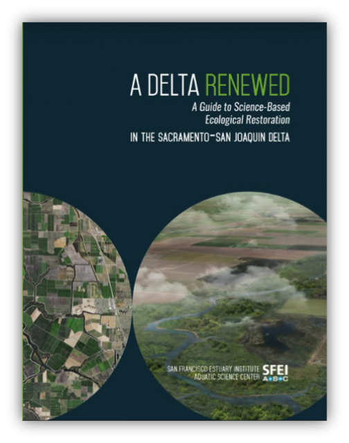
That’s the takeaway message of a report released Nov. 14 by the
San Francisco Estuary Institute.
The report, “A
Delta Renewed,” is the latest in a series sponsored by the
California Department of Fish and Wildlife (DFW). Written by
several authors, the report says there is “cause for hope” to
achieving large-scale Delta restoration in a way that supports
people, farms and the environment. SFEI calls itself “one of
California’s premier aquatic and ecosystem science institutes.”
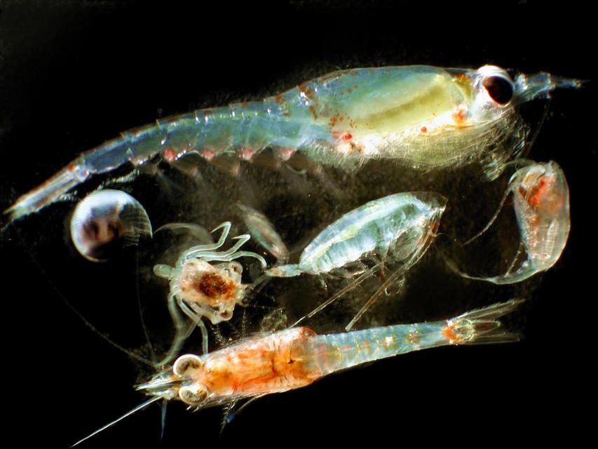
Zooplankton, which are floating
aquatic microorganisms too small and weak to swim against
currents, are are important food sources for many fish species in
the Delta such as salmon, sturgeon and Delta smelt.
This 3-day, 2-night tour, which we do every year,
takes participants to the heart of California water policy – the
Sacramento-San Joaquin Delta and San Francisco Bay.
The Pacific Flyway is one of four
major North American migration routes for birds, especially
waterbirds, and stretches from Alaska in the north
to Patagonia in South America.
Each year, birds follow ancestral patterns as they travel the
flyway on their annual north-south migration. Along the way, they
need stopover sites such as wetlands with suitable habitat and
food supplies. In California, 95 percent of historic
wetlands have been lost, yet the Central Valley hosts some of the
world’s largest populations of wintering birds.
This 25-minute documentary-style DVD, developed in partnership
with the California Department of Water Resources, provides an
excellent overview of climate change and how it is already
affecting California. The DVD also explains what scientists
anticipate in the future related to sea level rise and
precipitation/runoff changes and explores the efforts that are
underway to plan and adapt to climate.
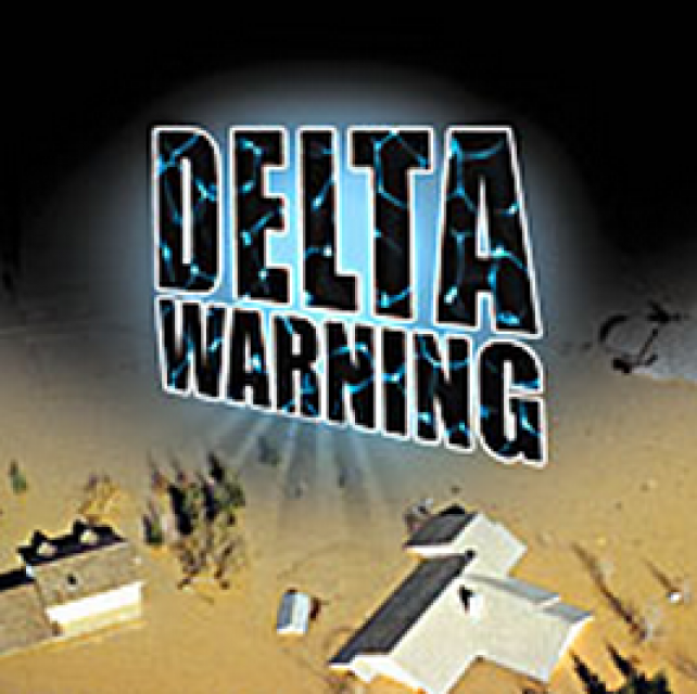
15-minute DVD that graphically portrays the potential disaster
should a major earthquake hit the Sacramento-San Joaquin Delta.
“Delta Warning” depicts what would happen in the event of an
earthquake registering 6.5 on the Richter scale: 30 levee breaks,
16 flooded islands and a 300 billion gallon intrusion of salt
water from the Bay – the “big gulp” – which would shut down the
State Water Project and Central Valley Project pumping plants.
Water truly has shaped California into the great state it is
today. And if it is water that made California great, it’s the
fight over – and with – water that also makes it so critically
important. In efforts to remap California’s circulatory system,
there have been some critical events that had a profound impact
on California’s water history. These turning points not only
forced a re-evaluation of water, but continue to impact the lives
of every Californian. This 2005 PBS documentary offers a
historical and current look at the major water issues that shaped
the state we know today. Includes a 12-page viewer’s guide with
background information, historic timeline and a teacher’s lesson.
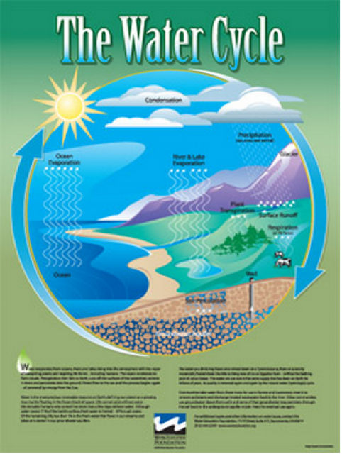
Water as a renewable resource is depicted in this 18×24 inch
poster. Water is renewed again and again by the natural
hydrologic cycle where water evaporates, transpires from plants,
rises to form clouds, and returns to the earth as precipitation.
Excellent for elementary school classroom use.
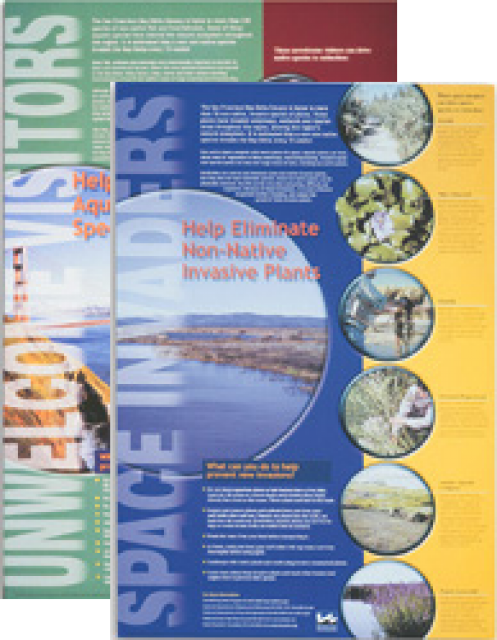
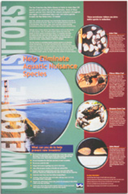
This 24×36 inch poster, suitable for framing, explains how
non-native invasive animals can alter the natural ecosystem,
leading to the demise of native animals. “Unwelcome Visitors”
features photos and information on four such species – including
the zerbra mussel – and explains the environmental and economic
threats posed by these species.
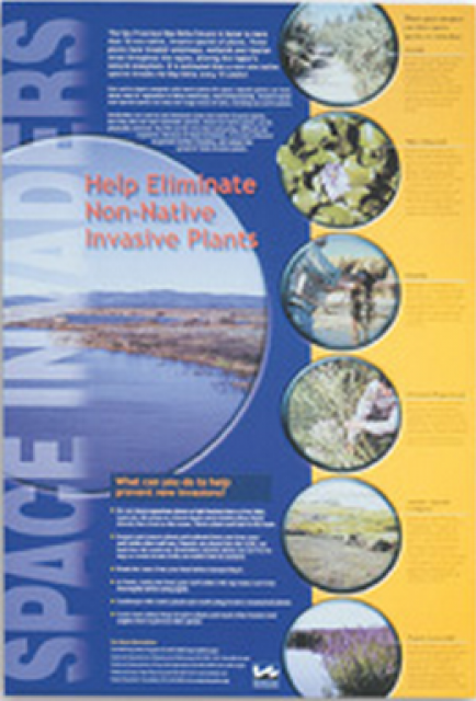
This 24×36 inch poster, suitable for framing, explains how
non-native invasive plants can alter the natural ecosystem,
leading to the demise of native plants and animals. “Space
Invaders” features photos and information on six non-native
plants that have caused widespread problems in the Bay-Delta
Estuary and elsewhere.
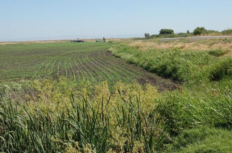
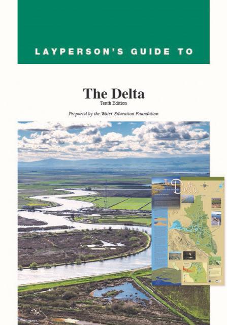
The 24-page Layperson’s Guide to the Delta explores the competing
uses and demands on California’s Sacramento-San Joaquin Delta.
Included in the guide are sections on the history of the Delta,
its role in the state’s water system, and its many complex issues
with sections on water quality, levees, salinity and agricultural
drainage, fish and wildlife, and water distribution.
A new look for our most popular product! And it’s the perfect
gift for the water wonk in your life.
Our 24×36-inch California Water Map is widely known for being the
definitive poster that shows the integral role water plays in the
state. On this updated version, it is easier to see California’s
natural waterways and man-made reservoirs and aqueducts
– including federally, state and locally funded
projects – the wild and scenic rivers system, and
natural lakes. The map features beautiful photos of
California’s natural environment, rivers, water projects,
wildlife, and urban and agricultural uses and the
text focuses on key issues: water supply, water use, water
projects, the Delta, wild and scenic rivers and the Colorado
River.
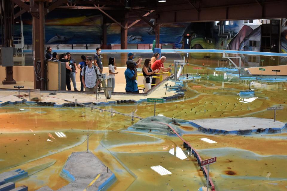
Operated by the U.S. Army Corps of Engineers, the
Bay Model is a giant hydraulic replica of San Francisco
Bay and the Sacramento-San Joaquin
Delta. It is housed in a converted World II-era
warehouse in Sausalito near San Francisco.
Hundreds of gallons of water are pumped through the
three-dimensional, 1.5-acre model to simulate a tidal ebb
and flow lasting 14 minutes.
Invasive species, also known as
exotics, are plants, animals, insects and aquatic species
introduced into non-native habitats.
Often, invasive species travel to non-native areas by ship,
either in ballast water released into harbors or attached to the
sides of boats. From there, introduced species can then spread
and significantly alter ecosystems and the natural food chain as
they go. Another example of non-native species introduction is
the dumping of aquarium fish into waterways.
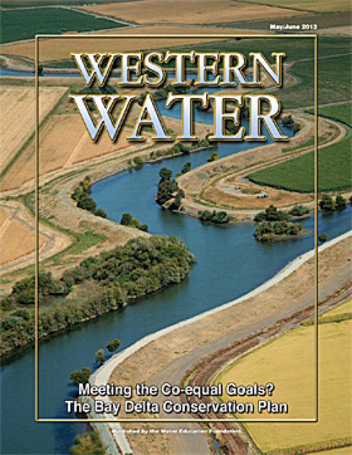
This issue of Western Water looks at the BDCP and the
Coalition to Support Delta Projects, issues that are aimed at
improving the health and safety of the Delta while solidifying
California’s long-term water supply reliability.
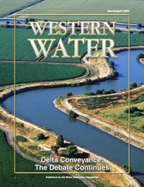
This printed issue of Western Water provides an overview of the
idea of a dual conveyance facility, including questions
surrounding its cost, operation and governance
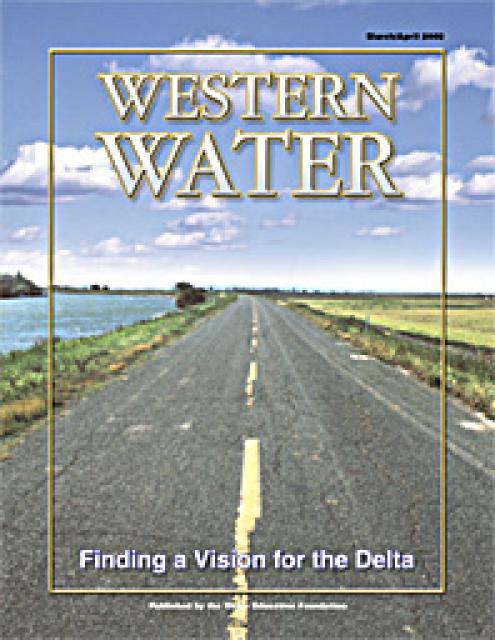
This printed copy of Western Water examines the Delta through the
many ongoing activities focusing on it, most notably the Delta
Vision process. Many hours of testimony, research, legal
proceedings, public hearings and discussion have occurred and
will continue as the state seeks the ultimate solution to the
problems tied to the Delta.


")