Wetlands are among the most important ecosystems in the world.
They produce high levels of oxygen, filter toxic chemicals out of
water, reduce flooding and erosion and recharge groundwater. They
also serve as critical habitat for wildlife, including a large
percentage of plants and animals on California’s endangered
species list.
As the state has grown into one of the world’s leading economies,
Californians have developed and transformed the state’s marshes,
swamps and tidal flats, losing as much as 90 percent of the
original wetlands acreage—a greater percentage of loss than any
other state in the nation.
While the conversion of wetlands has slowed, the loss in
California is significant and it affects a range of factors from
water quality to quality of life.
Wetlands still remain in every part of the state, with the
greatest concentration in the Sacramento-San Joaquin Delta and
its watershed, which includes the Central Valley. The Delta
wetlands are especially important because they are part of the
vast complex of waterways that provide two-thirds of California’s
drinking water.
The Trump administration’s speedy timeline for enacting a major
Clean Water Act rule has drawn pushback from state regulators,
local governments, utilities and environmentalists, who said
they will be scrambling over the holidays to digest the
proposal. EPA and the Army Corps of Engineers gave the public
45 days to comment on the proposed new “waters of the U.S.”
definition unveiled Nov. 17. … The proposal would
shrink the number of wetlands and streams regulated by
the Clean Water Act. It seeks comment on a range of
technical issues, including how “wet” wetlands and small
streams must be to qualify for the law’s protections.
The federal government is limiting which bodies of water are
eligible for protection under the Clean Water
Act. Now, Colorado is working on its own set of rules
for places that will no longer be federally protected,
following a 2024 bipartisan law. … The Sackett
ruling, along with the new proposal to only protect permanent
rivers and wetlands directly connected to them, poses a problem
for Colorado and other Mountain West states. Because of the
region’s reliance on snowmelt for much of its water supply,
bodies of water are often ephemeral, or intermittent.
A Trump administration proposal to reduce the scope of the
Clean Water Act would exclude more waters than
at any other point in the past 50 years. But it also left open
the possibility of going even further. Administration officials
last week unveiled their plan to define “waters of the U.S.,” a
frequently litigated term that delineates which waters and
wetlands are regulated by the 1972 law. … [The proposal]
suggests including only rivers, streams and other waterways
that flow at least for the duration of the “wet season.” The
proposal also floats an alternative approach: exclusively
regulating perennial waters and wetlands.
There’s a big new development going up in Mountain View along
the edge of San Francisco Bay. … Workers are putting the
finishing touches on a three-year effort to restore 435 acres
of former industrial salt evaporation ponds to natural wetlands
and tidal marshes, along with building new public bayfront
hiking trails. … The $20 million project, which is scheduled
to be completed by the end of December, is the latest chapter
in an ongoing saga in which the state, federal government and
environmental groups are slowly converting 15,100 acres of
former salt ponds that ring the South Bay, Peninsula and
East Bay back to habitat for ducks, shorebirds, fish, even
leopard sharks, bat rays and harbor seals.
A large portion of wetlands in the Mountain West could lose
federal protections under a new proposal from the Environmental
Protection Agency (EPA). But a couple of states in the region
are working to build their own safeguards. On Nov. 17, EPA
Administrator Lee Zeldin and the Army Corps of Engineers
announced a proposal for a narrowed definition of “Waters of
the United States” (WOTUS), the designation that determines
which rivers, streams and wetlands qualify for protection under
the Clean Water Act. … Two Mountain
West states—New Mexico and Colorado—are developing their own
systems to protect waters that have lost federal oversight.
Now that the former Motel 6 building, restaurant, and parking
lot have been demolished from the Upper Truckee Marsh in South
Lake Tahoe, planning is underway to bring this wetland back to
life. To support the next phase of this project, the Tahoe Fund
announced “A Million for the Marsh” campaign to raise the first
$1 million of private funds to help secure the public funds the
California Tahoe Conservancy will need to revive this area and
bring significant improvements to Lake Tahoe’s clarity.
Colorado Parks and Wildlife wants to see more beavers back at
their historic range in the state. That’s clear from the
“overarching goal” stated in a recently released draft
strategy: “Increase beaver populations and beaver-occupied
wetland habitats in Colorado until social or ecological
carrying capacity is reached.” Those social and ecological
factors are complicated — also clear from the 125-page document
called the Beaver Conservation and Management Strategy.
… In building dams, beavers are known to affect stream
flows in a way that guards against flooding, protects
water quality by controlling debris and combats drought by
recharging groundwater.
Southwestern states are bracing for many of their streams to
lose federal safeguards under the EPA’s proposal to lift Clean
Water Act protections for many wetlands and waterways across
the US. New Mexico, Arizona, California, and other arid states
face the brunt of the Environmental Protection Agency’s
proposal because it explicitly excludes streams that only run
when it rains—one of the most common kinds of waterways in the
desert Southwest. The EPA proposed Monday a reduced scope of
federal jurisdiction over waterways and wetlands as waters of
the US, or WOTUS. The proposal appeared in the Federal Register
pre-publication notices Wednesday and is open for public
comment for 45 days.
… Known as the Nestor Tract, all 105 acres or so were once
prime habitat for species native to the Central Valley,
including giant garter snakes, and relatively abundant in the
Natomas Basin. This is, historically, a flood-prone swath of
wetlands along the Sacramento River, running from the southern
rice fields of Sutter County down to the north of Sacramento.
… That balance, made possible by greater levees and flood
protections, has existed for more than 20 years, as bartered by
Sacramento and Sutter County, and orchestrated by The Natomas
Basin Conservancy. But proposals from Sacramento County now
threaten to upend that arrangement, leaving the capital city,
Sutter County and dwindling species like the giant garter snake
with uncertain fates.
Mountain meadows make up a small percentage of the land area in
the Sierra Nevada, but not as small a percentage as once
thought. This is exciting news as they have an outsized impact,
often functioning as high-elevation floodplains. As snow melts
in the springtime, meadows act like a sponge for cold
water, holding on to it until the drier months of the
year when downstream communities need water most. They also act
as a biodiversity hotspot for birds, fish, amphibians, wetland
plants, and insects. And a new model is revealing that there
may be more meadows in the Sierra than previously
estimated.
It’s the time of year when storms begin rolling in again across
Northern California, bringing much-needed water to the dry
landscape. And that precipitation is causing life to rebloom
again in the region’s vernal pools, small temporary wetlands
caused by rainwater filling up depressions in the ground.
… Near Mather Field in Sacramento, the public has a
chance to see some of these vernal pools, which date back
between 50,000 and 200,000 years. David Rosen is the Director
of Educational Programming and Lead Naturalist with the
nonprofit Sacramento Splash. He recently spoke with
Insight Host Vicki Gonzalez about the uniqueness of the vernal
pool habitat, and how his organization is helping to bring that
science to the greater public.
The Environmental Protection Agency announced Monday it is
redefining the scope of the nation’s bedrock clean water law to
significantly limit the wetlands it covers, building on a
Supreme Court decision two years ago that removed federal
protections for vast areas. When finalized, the new “Waters of
the United States” rule will ensure that federal jurisdiction
of the Clean Water Act is focused on relatively permanent,
standing or continuously flowing bodies of water, such as
streams, oceans, rivers and lakes, along with wetlands that are
directly connected to such bodies of water, the EPA said.
The Trump administration will soon roll out a sweeping Clean
Water Act rule that could erode protections for many
wetlands and small streams. The White House on Friday
finished reviewing EPA’s plan to redefine which waters are
covered by the law, signaling that the proposal is ready to be
released to the public. The issue is a top priority for the
Trump administration. EPA Administrator Lee Zeldin announced in
March plans to amend the scope of the Clean Water Act through a
new “waters of the U.S.” definition, marking the fifth time in
less than 15 years that would be changed.
Thanks to their use of a unique methodology, a McGill-led
research team has obtained new insights into how boulders
affect snow melt in mountainous northern environments, with
implications for local water resources. The team found
that snow near boulders melts faster, not only because rocks
radiate heat, but also due to subtle processes that reshape the
snow’s surface. This information will help researchers
understand how small-scale processes affect downstream water
resources. … The paper is published in the journal Cold
Regions Science and Technology.
A new website, the San Francisco Bay State of the Birds,
created by the San Francisco Bay Joint Venture and Point Blue
Conservation Science, provides scientists, policymakers, and
the public with an up-to-date look at which Bay Area bird
populations are thriving and which are declining, and what that
says about the health of San Francisco Bay’s wetlands
and waters. The findings suggest that the populations
of Bay Area marsh birds and wetland ducks are doing well,
shorebirds and diving ducks are declining, indicating that some
habitats are rebounding from “rapidly evolving climate change
and biodiversity challenges,” according to the project
researchers, while others still need conservation attention.
In the continuing effort of the New River Improvement Project
to improve the local ecosystem, volunteers from far and near
joined the Imperial Irrigation District’s Community Action Day
to plant more than 1,000 native plants in local wetlands on
Saturday, Nov 1. … These native plants will help the
wetland grow stronger to serve its natural function of
filtering the water of the New River, aiding in erosion and
waste control. … [T]hose same contaminants would end up
polluting the Salton Sea as well. Now, with
the New River Improvement Project completed, any polluted water
has its physical debris separated and is treated before
entering the New River.
After the heavy rains earlier this month, when remnants of a
Pacific hurricane flooded much of the city, Maricopa’s
flatlands have been teeming with unexpected life. Among the
most striking visitors: great egrets, the tall, snow-white
wading birds more commonly seen in coastal wetlands than desert
farmland. … When the Gila and Santa Cruz Rivers dried up
under decades of groundwater pumping and diversion, canals and
agricultural basins elsewhere in the state offered replacement
habitat. Over time, egrets followed these human-made water
routes inland. … So, when Maricopa’s washes flood, they act
like temporary extensions of those migration corridors.
At a ceremony Oct. 29 marking the return of 17,030 acres of
Tule River Indian Tribe lands, tribal members talked about the
larger benefit of reclaiming their ancestral ground, including
flood protection. Tribal plans include
restoring the headwaters of Deer Creek high in the Sierra
Nevada, which could provide greater protection for the southern
Tulare County communities of Terra Bella, Earlimart,
Allensworth and Alpaugh on the San Joaquin Valley floor.
… Restoration along Deer Creek will improve
groundwater recharge, protect sensitive
cultural areas and creek crossings.
… They’re technically called beaver dam analogues — since
with their complex patterns of sticks and mud, they’re supposed
to imitate real beaver dams. … [F]ake beaver dams aren’t
meant to last forever. They’ll be maintained annually for about
five years (unless real beavers take over earlier), but the
result when established in the right place can be remarkable,
restoring and rejuvenating wetlands, replenishing the water
table, keeping water higher up in systems longer in the year,
and providing habitat for everything from insects, frogs and
toads to elk and moose, and yes, even beavers.
The government shutdown has not had much effect on the human
visitors at the Cosumnes River Preserve, but it may have a
lasting impact on sandhill cranes and other birds that pass
through this fall: Federal water bird counts in October were
canceled. … So far, the two water bird surveys planned
for October have been canceled. That means the three sandhill
cranes that landed in the managed wetland on Sunday (Oct. 26) a
little after noon were only counted informally this month; it
also means that staff could have a harder time pinpointing when
different migrating species arrived in the area. The surveys
help inform water management in the
park.
… Lake Powell’s water levels have been retreating for
the past two decades, revealing vast swaths of once-submerged
land. The falling water levels have jeopardized hydropower
generation and added anxiety to policy talks about managing the
region’s water supply. At the same time, they have put stunning
geologic features and lush riverside habitats back in the open
air. … Beavers are architects that make those animal
communities even stronger. … Recent studies have
tracked the emergence of old river features and the return of
native plants. This one aims to track the return of healthy
ecosystems, using beavers as a marker of progress.
The return of fully planted rice crops to the Sacramento Valley
following years of drought has restored another essential
feature of the region. After harvest, reservoirs replenished by
last year’s historic storms enabled farmers to flood more of
their fields this winter, creating wetland habitat for
migrating waterfowl. … Today, around 300,000 acres of the
valley’s rice paddies are flooded each winter to provide food
and shelter for 7 million ducks and geese, according to the
California Rice Commission. More than 200 species of wildlife,
including threatened species such as Sandhill Cranes, rely on
the fields. Especially over the past decade, state and federal
programs have been developed to incentivize winter flooding,
defraying some of the cost, and rice farmers have embraced
their role in wildlife conservation.
A new but little-known change in
California law designating aquifers as “natural infrastructure”
promises to unleash a flood of public funding for projects that
increase the state’s supply of groundwater.
The change is buried in a sweeping state budget-related law,
enacted in July, that also makes it easier for property owners
and water managers to divert floodwater for storage underground.
It was exactly the sort of deluge
California groundwater agencies have been counting on to
replenish their overworked aquifers.
The start of 2023 brought a parade of torrential Pacific storms
to bone dry California. Snow piled up across the Sierra Nevada at
a near-record pace while runoff from the foothills gushed into
the Central Valley, swelling rivers over their banks and filling
seasonal creeks for the first time in half a decade.
Suddenly, water managers and farmers toiling in one of the
state’s most groundwater-depleted regions had an opportunity to
capture stormwater and bank it underground. Enterprising agencies
diverted water from rushing rivers and creeks into manmade
recharge basins or intentionally flooded orchards and farmland.
Others snagged temporary permits from the state to pull from
streams they ordinarily couldn’t touch.
Land and waterway managers labored
hard over the course of a century to control California’s unruly
rivers by building dams and levees to slow and contain their
water. Now, farmers, environmentalists and agencies are undoing
some of that work as part of an accelerating campaign to restore
the state’s major floodplains.
Biologists have designed a variety
of unique experiments in the past decade to demonstrate the
benefits that floodplains provide for small fish. Tracking
studies have used acoustic tags to show that chinook salmon
smolts with access to inundated fields are more likely than their
river-bound cohorts to reach the Pacific Ocean. This is because
the richness of floodplains offers a vital buffet of nourishment
on which young salmon can capitalize, supercharging their growth
and leading to bigger, stronger smolts.
Water is flowing once again
to the Colorado River’s delta in Mexico, a vast region that
was once a natural splendor before the iconic Western river was
dammed and diverted at the turn of the last century, essentially
turning the delta into a desert.
In 2012, the idea emerged that water could be intentionally sent
down the river to inundate the delta floodplain and regenerate
native cottonwood and willow trees, even in an overallocated
river system. Ultimately, dedicated flows of river water were
brokered under cooperative
efforts by the U.S. and Mexican governments.
State work to improve wildlife habitat and tamp down dust at California’s ailing Salton Sea is finally moving forward. Now the sea may be on the verge of getting the vital ingredient needed to supercharge those restoration efforts – money.
The shrinking desert lake has long been a trouble spot beset by rising salinity and unhealthy, lung-irritating dust blowing from its increasingly exposed bed. It shadows discussions of how to address the Colorado River’s two-decade-long drought because of its connection to the system. The lake is a festering health hazard to nearby residents, many of them impoverished, who struggle with elevated asthma risk as dust rises from the sea’s receding shoreline.
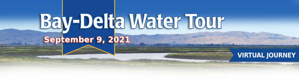
This tour guided participants on a virtual journey deep into California’s most crucial water and ecological resource – the Sacramento-San Joaquin Delta. The 720,000-acre network of islands and canals support the state’s two major water systems – the State Water Project and the Central Valley Project. The Delta and the connecting San Francisco Bay form the largest freshwater tidal estuary of its kind on the West coast.
Out of sight and out of mind to most
people, the Salton Sea in California’s far southeast corner has
challenged policymakers and local agencies alike to save the
desert lake from becoming a fetid, hyper-saline water body
inhospitable to wildlife and surrounded by clouds of choking
dust.
The sea’s problems stretch beyond its boundaries in Imperial and
Riverside counties and threaten to undermine multistate
management of the Colorado River. A 2019 Drought Contingency Plan for the
Lower Colorado River Basin was briefly stalled when the Imperial
Irrigation District, holding the river’s largest water
allocation, balked at participating in the plan because, the
district said, it ignored the problems of the Salton Sea.
Deep, throaty cadenced calls —
sounding like an off-key bassoon — echo over the grasslands,
farmers’ fields and wetlands starting in late September of each
year. They mark the annual return of sandhill cranes to the
Cosumnes River Preserve,
46,000 acres located 20 miles south of Sacramento on the edge of
the Sacramento-San Joaquin Delta.
For the bulk of her career, Jayne
Harkins has devoted her energy to issues associated with the
management of the Colorado River, both with the U.S. Bureau of
Reclamation and with the Colorado River Commission of Nevada.
Now her career is taking a different direction. Harkins, 58, was
appointed by President Trump last August to take the helm of the
United States section of the U.S.-Mexico agency that oversees
myriad water matters between the two countries as they seek to
sustainably manage the supply and water quality of the Colorado
River, including its once-thriving Delta in Mexico, and other
rivers the two countries share. She is the first woman to be
named the U.S. Commissioner of the International Boundary and
Water Commission for either the United States or Mexico in the
commission’s 129-year history.
There’s going to be a new governor
in California next year – and a host of challenges both old and
new involving the state’s most vital natural resource, water.
So what should be the next governor’s water priorities?
That was one of the questions put to more than 150 participants
during a wrap-up session at the end of the Water Education
Foundation’s Sept. 20 Water Summit in Sacramento.
Farmers in the Central Valley are broiling about California’s plan to increase flows in the Sacramento and San Joaquin river systems to help struggling salmon runs avoid extinction. But in one corner of the fertile breadbasket, River Garden Farms is taking part in some extraordinary efforts to provide the embattled fish with refuge from predators and enough food to eat.
And while there is no direct benefit to one farm’s voluntary actions, the belief is what’s good for the fish is good for the farmers.
Deep, throaty cadenced calls —
sounding like an off-key bassoon — echo over the grasslands,
farmers’ fields and wetlands starting in late September of each
year. They mark the annual return of sandhill cranes to the
Cosumnes River Preserve,
46,000 acres located 20 miles south of Sacramento on the edge of
the Sacramento-San Joaquin Delta.
California voters may experience a sense of déjà vu this year when they are asked twice in the same year to consider water bonds — one in June, the other headed to the November ballot.
Both tackle a variety of water issues, from helping disadvantaged communities get clean drinking water to making flood management improvements. But they avoid more controversial proposals, such as new surface storage, and they propose to do some very different things to appeal to different constituencies.
Along the banks of the
Sacramento-San Joaquin Delta in Oakley, about 50 miles southwest
of Sacramento, is a park that harkens back to the days when the
Delta lured Native Americans, Spanish explorers, French fur
trappers, and later farmers to its abundant wildlife and rich
soil.
That historical Delta was an enormous marsh linked to the two
freshwater rivers entering from the north and south, and tidal
flows coming from the San Francisco Bay. After the Gold Rush,
settlers began building levees and farms, changing the landscape
and altering the habitat.
As vital as the Colorado River is to the United States and
Mexico, so is the ongoing process by which the two countries
develop unique agreements to better manage the river and balance
future competing needs.
The prospect is challenging. The river is over allocated as urban
areas and farmers seek to stretch every drop of their respective
supplies. Since a historic treaty between the two countries was
signed in 1944, the United States and Mexico have periodically
added a series of arrangements to the treaty called minutes that
aim to strengthen the binational ties while addressing important
water supply, water quality and environmental concerns.
This 28-page report describes the watersheds of the Sierra Nevada
region and details their importance to California’s overall water
picture. It describes the region’s issues and challenges,
including healthy forests, catastrophic fire, recreational
impacts, climate change, development and land use.
The report also discusses the importance of protecting and
restoring watersheds in order to retain water quality and enhance
quantity. Examples and case studies are included.
This 30-minute documentary, produced in 2011, explores the past,
present and future of flood management in California’s Central
Valley. It features stories from residents who have experienced
the devastating effects of a California flood firsthand.
Interviews with long-time Central Valley water experts from
California Department of Water Resources (FloodSAFE), U.S. Army
Corps of Engineers, Bureau of Reclamation, Central Valley Flood
Management Program and environmental groups are featured as they
discuss current efforts to improve the state’s 150-year old flood
protection system and develop a sustainable, integrated, holistic
flood management plan for the Central Valley.
This 25-minute documentary-style DVD, developed in partnership
with the California Department of Water Resources, provides an
excellent overview of climate change and how it is already
affecting California. The DVD also explains what scientists
anticipate in the future related to sea level rise and
precipitation/runoff changes and explores the efforts that are
underway to plan and adapt to climate.
15-minute DVD that graphically portrays the potential disaster
should a major earthquake hit the Sacramento-San Joaquin Delta.
“Delta Warning” depicts what would happen in the event of an
earthquake registering 6.5 on the Richter scale: 30 levee breaks,
16 flooded islands and a 300 billion gallon intrusion of salt
water from the Bay – the “big gulp” – which would shut down the
State Water Project and Central Valley Project pumping plants.
Water truly has shaped California into the great state it is
today. And if it is water that made California great, it’s the
fight over – and with – water that also makes it so critically
important. In efforts to remap California’s circulatory system,
there have been some critical events that had a profound impact
on California’s water history. These turning points not only
forced a re-evaluation of water, but continue to impact the lives
of every Californian. This 2005 PBS documentary offers a
historical and current look at the major water issues that shaped
the state we know today. Includes a 12-page viewer’s guide with
background information, historic timeline and a teacher’s lesson.
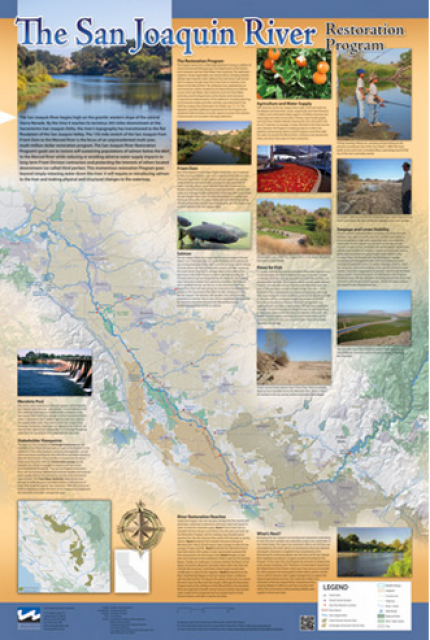
This beautiful 24×36 inch poster, suitable for framing, features
a map of the San Joaquin River. The map text focuses on the San
Joaquin River Restoration Program, which aims to restore flows
and populations of Chinook salmon to the river below Friant Dam
to its confluence with the Merced River. The text discusses the
history of the program, its goals and ongoing challenges with
implementation.
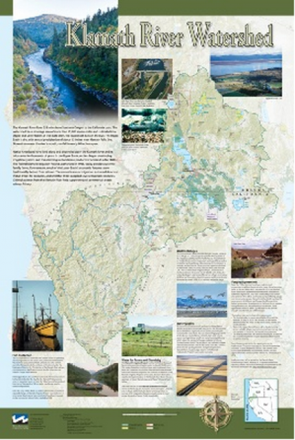
This beautiful 24×36-inch poster, suitable for framing, displays
the rivers, lakes and reservoirs, irrigated farmland, urban areas
and Indian reservations within the Klamath River Watershed. The
map text explains the many issues facing this vast,
15,000-square-mile watershed, including fish restoration;
agricultural water use; and wetlands. Also included are
descriptions of the separate, but linked, Klamath Basin
Restoration Agreement and the Klamath Hydroelectric Agreement,
and the next steps associated with those agreements. Development
of the map was funded by a grant from the U.S. Fish and Wildlife
Service.
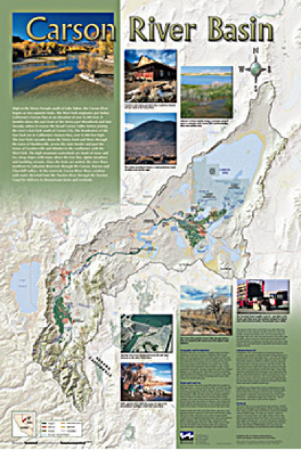
A companion to the Truckee River Basin Map poster, this
24×36-inch poster, suitable for framing, explores the Carson
River, and its link to the Truckee River. The map includes the
Lahontan Dam and reservoir, the Carson Sink, and the farming
areas in the basin. Map text discusses the region’s hydrology and
geography, the Newlands Project, land and water use within the
basin and wetlands. Development of the map was funded by a grant
from the U.S. Bureau of Reclamation Mid-Pacific Region, Lahontan
Basin Area Office.
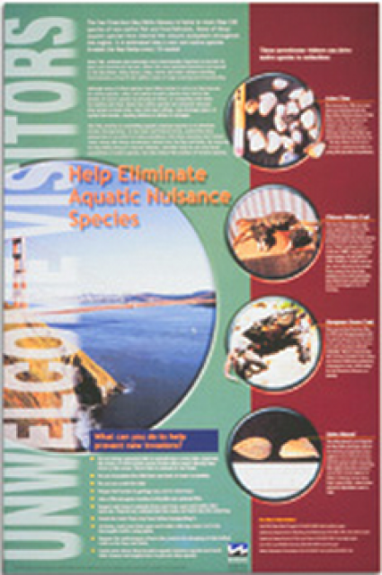
This 24×36 inch poster, suitable for framing, explains how
non-native invasive animals can alter the natural ecosystem,
leading to the demise of native animals. “Unwelcome Visitors”
features photos and information on four such species – including
the zerbra mussel – and explains the environmental and economic
threats posed by these species.
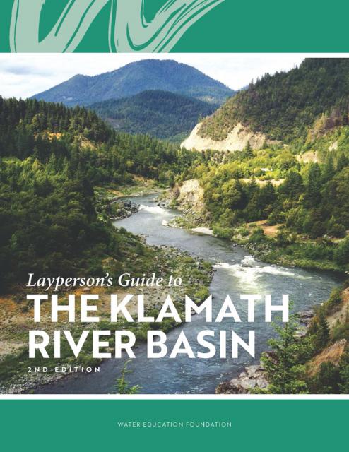
The Water Education Foundation’s second edition of
the Layperson’s Guide to The Klamath River Basin is
hot off the press and available for purchase.
Updated and redesigned, the easy-to-read overview covers the
history of the region’s tribal, agricultural and environmental
relationships with one of the West’s largest rivers — and a
vast watershed that hosts one of the nation’s oldest and
largest reclamation projects.
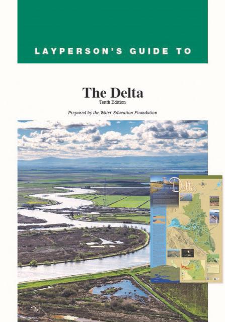
The 24-page Layperson’s Guide to the Delta explores the competing
uses and demands on California’s Sacramento-San Joaquin Delta.
Included in the guide are sections on the history of the Delta,
its role in the state’s water system, and its many complex issues
with sections on water quality, levees, salinity and agricultural
drainage, fish and wildlife, and water distribution.
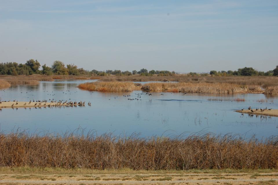
The Pacific Flyway is one of four
major North American migration routes for birds, especially
waterbirds, and stretches from Alaska in the north
to Patagonia in South America.
Each year, birds follow ancestral patterns as they travel the
flyway on their annual north-south migration. Along the way, they
need stopover sites such as wetlands with suitable habitat and
food supplies. In California, 95 percent of historic
wetlands have been lost, yet the Central Valley hosts some of the
world’s largest populations of wintering birds.
In the Central Valley, wetlands—partly or seasonally saturated
land that supports aquatic life and distinct ecosystems— provide
critical habitat for a variety of wildlife.
This printed issue of Western Water examines how the various
stakeholders have begun working together to meet the planning
challenges for the Colorado River Basin, including agreements
with Mexico, increased use of conservation and water marketing,
and the goal of accomplishing binational environmental
restoration and water-sharing programs.
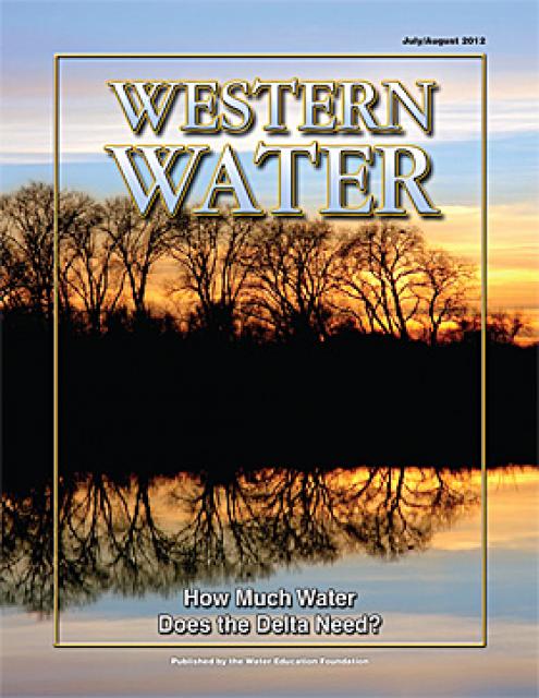
This printed issue of Western Water examines the issues
associated with the State Water Board’s proposed revision of the
water quality Bay-Delta Plan, most notably the question of
whether additional flows are needed for the system, and how they
might be provided.
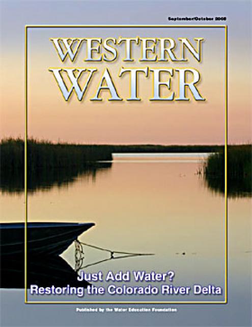
This printed copy of Western Water examines the Colorado River
Delta, its ecological significance and the lengths to which
international, state and local efforts are targeted and achieving
environmental restoration while recognizing the needs of the
entire river’s many users.


")
")

")
")
")
")
")
")
")