Stretching along the eastern edge of the state, the Sierra Nevada
region incorporates more than 25 percent of California’s land
area and forms one of the world’s most diverse watersheds.
It features granite cliffs, lush forests and alpine meadows on
the westside, and stark desert landscapes at the base of the
eastside. Wildlife includes bighorn sheep, mule deer, black bear
and mountain lions, hawks, eagles, and trout.
The majority of total annual precipitation – in the form of rain
and snow – falls in the Sierra Nevada. Snowmelt from the Sierra
provides water for irrigation for farms that produce half of the
nation’s fruit, nuts and vegetables, and also is a vital source
for dairies, which have made California the largest milk producer
in the country.
In addition, Sierra snowmelt provides drinking water to Sierra
Nevada residents and a portion of drinking water to 23 million
people living in cities stretching from the Bay Area to Southern
California.
A spring Sierra storm dropped more than a foot of snow
in parts of the northern Sierra, according to a report
from the California-Nevada River Forecast Center. Snow totals
from automated gauges showed the heaviest snowfall in Alpine
County, where Leavitt Lake recorded 15 inches and Ebbetts Pass
measured 13 inches. Carson Pass and Monitor Pass each saw 9
inches. In Placer County, Palisades Tahoe reported 14
inches of snow, while the Central Sierra Snow Lab measured 12
inches. … The snowfall totals are based on provisional data
from automated gauges and have not yet been fully verified,
according to the forecast center.
California’s dismal snowpack is about to get a
late-season boost. A weekend storm is forecast to drop feet of
snow across the Sierra Nevada, prompting the National Weather
Service to issue a winter storm watch. The watch is
in effect from Friday evening through Saturday evening above
4,500 feet for the west slope of the northern Sierra, including
Interstate 80 and Highway 50. … Forecast snowfall totals
were trending higher, with 2 feet of snow possible
along I-80 over Donner Summit above 4,500 feet. The
highest peaks, including ski resorts, could pick more than 3
feet of snow, with localized totals up to 4
feet.
… [A] 2008 legal mandate means the Truckee Meadows Water
Authority (TMWA) is required to align regional growth with its
two main critical water resources: the vibrant, snow-fed
Truckee River and the deep, silent aquifers lying beneath the
valley floor. … Adam Sullivan, the former state engineer for
Nevada, confirms the scale of the problem. He notes that
about half of Nevada’s 256 groundwater basins are
“over-appropriated,” meaning more water rights exist on paper
than the land can yield, and 25% are already being
over-pumped. The fear that development will outpace the
aquifer isn’t hypothetical; other western cities have already
hit the wall.
California’s snowpack is supposed to reach its peak April 1, so
today, state surveyors hold their final Sierra snow survey of
the year. But instead of peak snow, there’s almost none.
Snow across California’s Sierra Nevada measured just
18% of average Monday — among the smallest in decades.
A month of record-shattering heat thawed the snow and sent
runoff coursing into streams and rivers, leaving only minimal
water in the mountains as the state heads into dry
season. The early melt is a symptom of global warming that
scientists say is becoming more pronounced.
A stunning heatwave that shattered records in the US west is
threatening to rapidly melt the sparse snowpack and ramp up
wildfire risks in the seasons ahead. … This heatwave is
also posing significant threats to the water supply. After one
of the warmest winters in the west, the snow that feeds
streams, reservoirs and soil moisture as it melts through the
summer season is already dismally scarce in key watersheds.
… “Anomalous warmth and historic snow drought will still
lead to ecological and wildfire-related impacts as soon as this
spring, and possibly wider water challenges by late summer and
beyond,” climate scientist Daniel Swain said.
Other snowmelt and heat wave news around the West:
To replenish California’s chronically depleted aquifers, the
state’s Department of Water Resources is taking a hard look at
a new line of attack: Pairing more sophisticated reservoir
operations with groundwater recharge. Water managers are aiming
to make greater use of the increased floodwater that’s expected
to come with flashier, more intense storms and earlier
snowmelt. The new approach is known as
FIRO-MAR, which stands for Forecast-Informed
Reservoir Operations-Managed Aquifer Recharge. In December, DWR
released a study focused on the five main tributary watersheds
of California’s second-largest river, the San Joaquin, that
provides the most comprehensive assessment of the concept’s
potential yet.
… [A] rapidly-shrinking snowpack is undercutting plans from
the governor’s office and White House, exposing the limits of
California’s water playbook and leaving the state on
the precipice of drought. The early-season heat wave
now gripping the state is wiping out much of its remaining
Sierra Nevada snowpack, which acts as a frozen reservoir to
dribble out roughly a third of California’s water supply
throughout the spring and summer. … The Department of
Water Resources said on Wednesday that it got permission from
the Army Corps of Engineers, which oversees flood control,
to fill up Lake Oroville past the usual safety limit
meant to accommodate possible floods to capture remaining
snowmelt.
Three weeks after Tahoe’s biggest snowstorm in decades, Donner
Summit has as much dirt as snow. Feet of powder quickly
disappeared, as rain and unusually warm temperatures depleted
gains from the February blizzard that had been cheered at the
time as a potential season-saving event. California’s
snowpack is already its lowest since 2015, and
record-shattering March heat arriving next week will make it
worse. The rate of melting is “unprecedented,” said Tim
Bardsley, a hydrologist at the National Weather Service office
in Reno. The entire snowpack, he said, has been wiped away
along sunny parts of the Lake Tahoe shoreline.
Other snowpack and water supply news around the West:
… The [Western] region is currently in the grip of a severe
snow drought, as more precipitation falls as rain.
… Scientists seem to have found a way to help alleviate
the West’s fire and ice problems simultaneously, at least in
Washington state. Working in the forests of the Cascade
Mountains, researchers divided plots on the south and north
slopes of a ridge and thinned their vegetation to varying
degrees. … Western states will no doubt be interested in what
these researchers found: up to 30 percent more snowpack on the
thinned plots compared to the areas left unkempt. Scaled up,
that would mean an additional 4 million gallons of
water per 100 acres of forest.
Growing up in the shadow of the
Rocky Mountains, Andrew Schwartz never missed an opportunity to
play in – or study – a Colorado snowstorm. During major
blizzards, he would traipse out into the icy wind and heavy
drifts of snow pretending to be a scientist researching in
Antarctica.
Decades later, still armed with an obsession for extreme weather,
Schwartz has landed in one of the snowiest places in the West,
leading a research lab whose mission is to give California water
managers instant information on the depth and quality of snow
draping the slopes of the Sierra Nevada.
On average, more than 60 percent of
California’s developed water supply originates in the Sierra
Nevada and the southern spur of the Cascade Range. Our water
supply is largely dependent on the health of our Sierra forests,
which are suffering from ecosystem degradation, drought,
wildfires and widespread tree mortality.
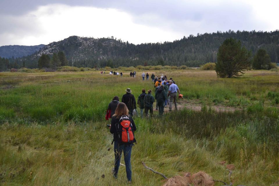
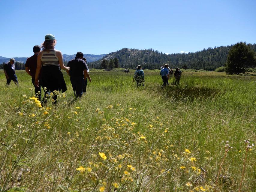
This tour ventured into the Sierra to examine water issues
that happen upstream but have dramatic impacts downstream and
throughout the state.
Innovative efforts to accelerate
restoration of headwater forests and to improve a river for the
benefit of both farmers and fish. Hard-earned lessons for water
agencies from a string of devastating California wildfires.
Efforts to drought-proof a chronically water-short region of
California. And a broad debate surrounding how best to address
persistent challenges facing the Colorado River.
These were among the issues Western Water explored in
2019, and are still worth taking a look at in case you missed
them.
Many of California’s watersheds are
notoriously flashy – swerving from below-average flows to jarring
flood conditions in quick order. The state needs all the water it
can get from storms, but current flood management guidelines are
strict and unyielding, requiring reservoirs to dump water each
winter to make space for flood flows that may not come.
However, new tools and operating methods are emerging that could
lead the way to a redefined system that improves both water
supply and flood protection capabilities.
It’s been a year since two devastating wildfires on opposite ends
of California underscored the harsh new realities facing water
districts and cities serving communities in or adjacent to the
state’s fire-prone wildlands. Fire doesn’t just level homes, it
can contaminate water, scorch watersheds, damage delivery systems
and upend an agency’s finances.
The majestic beauty of the Sierra
Nevada forest is awe-inspiring, but beneath the dazzling blue
sky, there is a problem: A century of fire suppression and
logging practices have left trees too close together. Millions of
trees have died, stricken by drought and beetle infestation.
Combined with a forest floor cluttered with dry brush and debris,
it’s a wildfire waiting to happen.
Fires devastate the Sierra watersheds upon which millions of
Californians depend — scorching the ground, unleashing a
battering ram of debris and turning hillsides into gelatinous,
stream-choking mudflows.
Registration opens today for the
Water Education Foundation’s 36th annual Water
Summit, set for Oct. 30 in Sacramento. This year’s
theme, Water Year 2020: A Year of Reckoning,
reflects fast-approaching deadlines for the State Groundwater
Management Act as well as the pressing need for new approaches to
water management as California and the West weather intensified
flooding, fire and drought. To register for this can’t-miss
event, visit our Water Summit
event page.
Registration includes a full day of discussions by leading
stakeholders and policymakers on key issues, as well as coffee,
materials, gourmet lunch and an outdoor reception by the
Sacramento River that will offer the opportunity to network with
speakers and other attendees. The summit also features a silent
auction to benefit our Water Leaders program featuring
items up for bid such as kayaking trips, hotel stays and lunches
with key people in the water world.
Our 36th annual
Water Summit,
happening Oct. 30 in Sacramento, will feature the theme “Water
Year 2020: A Year of Reckoning,” reflecting upcoming regulatory
deadlines and efforts to improve water management and policy in
the face of natural disasters.
The Summit will feature top policymakers and leading stakeholders
providing the latest information and a variety of viewpoints on
issues affecting water across California and the West.
One of California Gov. Gavin
Newsom’s first actions after taking office was to appoint Wade
Crowfoot as Natural Resources Agency secretary. Then, within
weeks, the governor laid out an ambitious water agenda that
Crowfoot, 45, is now charged with executing.
That agenda includes the governor’s desire for a “fresh approach”
on water, scaling back the conveyance plan in the Sacramento-San
Joaquin Delta and calling for more water recycling, expanded
floodplains in the Central Valley and more groundwater recharge.
There’s going to be a new governor
in California next year – and a host of challenges both old and
new involving the state’s most vital natural resource, water.
So what should be the next governor’s water priorities?
That was one of the questions put to more than 150 participants
during a wrap-up session at the end of the Water Education
Foundation’s Sept. 20 Water Summit in Sacramento.
Sixty percent of California’s developed water supply
originates high in the Sierra Nevada mountains. Our water
supply is largely dependent on the health of our Sierra forests,
which are suffering from ecosystem degradation, drought,
wildfires and widespread tree mortality.
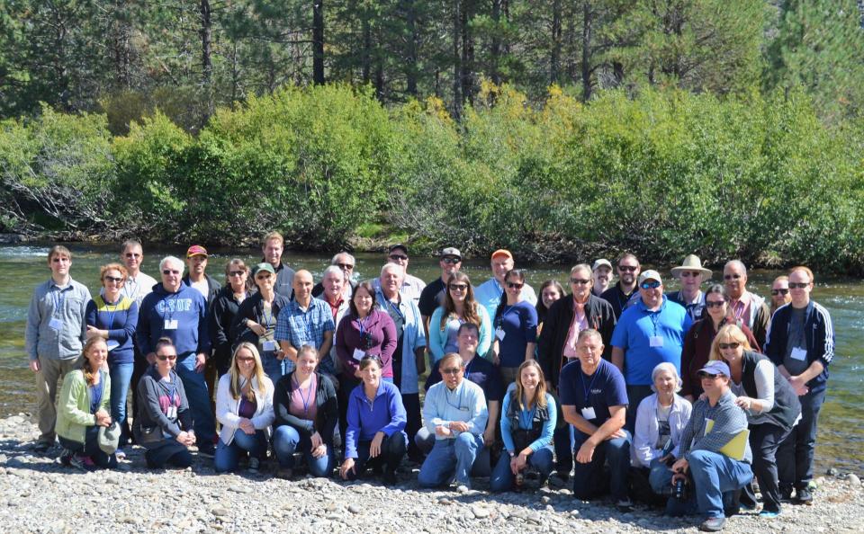
We headed into the foothills and the mountains to examine
water issues that happen upstream but have dramatic impacts
downstream and throughout the state.
GEI (Tour Starting Point)
2868 Prospect Park Dr.
Rancho Cordova, CA 95670.
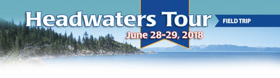
Water supply for
California’s cities and farms is largely dependent on
snowmelt from the upper watershed in the Sierra Nevada. But that
paradigm is being challenged by wildfires, climate change and
widespread tree mortality.
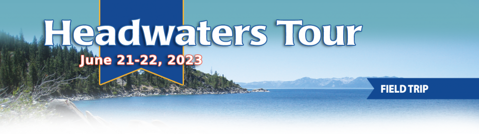
Join us for a two-day tour as we head into the Sierra foothills
and up into the mountains to examine water issues that happen
upstream, but have dramatic impacts on water supply and quality
downstream and throughout the state.
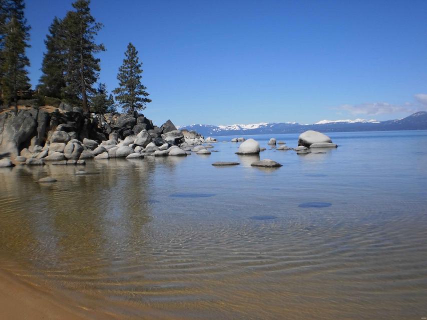
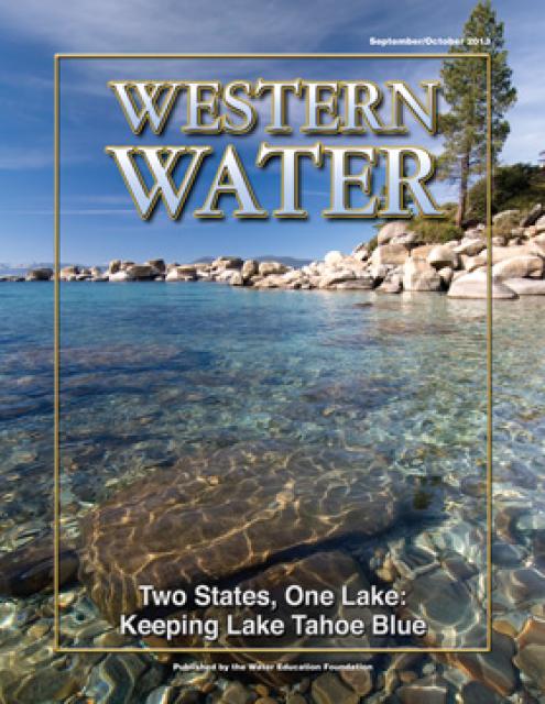
Lake
Tahoe, the iconic high Sierra water body that straddles
California and Nevada, has sat for more than 10,000 years at the
heart of the Washoe tribe’s territory. In fact, the name Tahoe
came from the tribal word dá’aw, meaning lake.
The lake’s English name was the source of debate for about 100
years after it was first “discovered” in 1844 by people of
European descent when Gen. John C. Fremont’s expedition made its
way into the region. Not long after, a man who carried mail on
snowshoes from Placerville to Nevada City named it Lake Bigler in
honor of John Bigler, who served as California’s third governor.
But because Bigler was an ardent secessionist, the federal
Interior Department during the Civil War introduced the name
Tahoe in 1862. Meanwhile, California kept it as Lake Bigler and
didn’t officially recognize the name as Lake Tahoe until 1945.
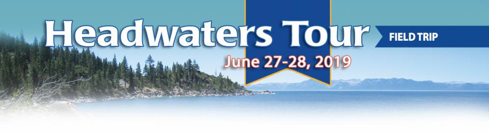
Sixty percent of California’s developed water supply originates
high in the Sierra Nevada.Thus, the state’s water supply is
largely dependent on the health of Sierra forests, which are
suffering from ecosystem degradation, drought, wildfires and
widespread tree mortality.
Join us as we head into the Sierra foothills and up to the
mountains to examine water issues that happen upstream but have
dramatic impacts downstream and throughout California.
California voters may experience a sense of déjà vu this year when they are asked twice in the same year to consider water bonds — one in June, the other headed to the November ballot.
Both tackle a variety of water issues, from helping disadvantaged communities get clean drinking water to making flood management improvements. But they avoid more controversial proposals, such as new surface storage, and they propose to do some very different things to appeal to different constituencies.
Every day, people flock to Daniel
Swain’s social media platforms to find out the latest news and
insight about California’s notoriously unpredictable weather.
Swain, a climate scientist at the Institute of the
Environment and Sustainability at UCLA, famously coined the
term “Ridiculously Resilient Ridge” in December 2013 to describe
the large, formidable high-pressure mass that was parked over the
West Coast during winter and diverted storms away from
California, intensifying the drought.
Swain’s research focuses on atmospheric processes that cause
droughts and floods, along with the changing character of extreme
weather events in a warming world. A lifelong Californian and
alumnus of University of California, Davis, and Stanford
University, Swain is best known for the widely read Weather West blog, which provides
unique perspectives on weather and climate in California and the
western United States. In a recent interview with Western
Water, he talked about the Ridiculously Resilient Ridge, its
potential long-term impact on California weather, and what may
lie ahead for the state’s water supply.
Sixty percent of California’s developed water supply
originates high in the Sierra Nevada mountains. Our water
supply is largely dependent on the health of our Sierra forests,
which are suffering from ecosystem degradation, drought,
wildfires and widespread tree mortality.
Sixty percent of California’s developed water supply originates
high in the Sierra Nevada. Thus, the state’s water supply is
largely dependent on the health of Sierra forests, which are
suffering from ecosystem degradation, drought, wildfires and
widespread tree mortality.
Join us as we head into the Sierra foothills and the mountains to
examine water issues that happen upstream but have dramatic
impacts downstream and throughout California.
ARkStorm stands for an atmospheric
river (“AR”) that carries precipitation levels expected to occur
once every 1,000 years (“k”). The concept was presented in a 2011
report by the U.S. Geological Survey (USGS) intended to elevate
the visibility of the very real threats to human life, property
and ecosystems posed by extreme storms on the West Coast.
Owens Lake is a dry lake at the terminus of the Owens River
just west of Death Valley and on the eastern side of the Sierra Nevada. For at least
800,000 years, the lake had a continuous flow of water, until
1913 when the Los Angeles Department of Water and Power
(LADWP) completed the 233-mile Los Angeles
Aqueduct to supplement the budding metropolis’
increasing water demands.
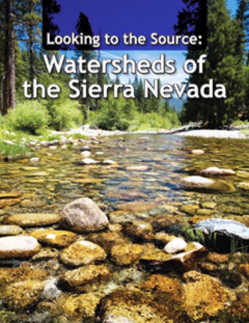
This 28-page report describes the watersheds of the Sierra Nevada
region and details their importance to California’s overall water
picture. It describes the region’s issues and challenges,
including healthy forests, catastrophic fire, recreational
impacts, climate change, development and land use.
The report also discusses the importance of protecting and
restoring watersheds in order to retain water quality and enhance
quantity. Examples and case studies are included.
This 25-minute documentary-style DVD, developed in partnership
with the California Department of Water Resources, provides an
excellent overview of climate change and how it is already
affecting California. The DVD also explains what scientists
anticipate in the future related to sea level rise and
precipitation/runoff changes and explores the efforts that are
underway to plan and adapt to climate.
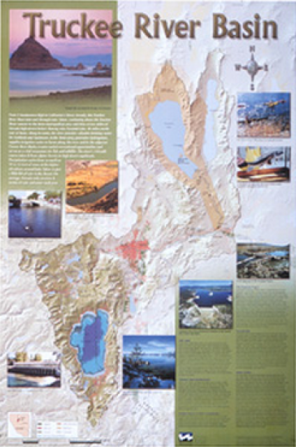
This beautiful 24×36-inch poster, suitable for framing, displays
the rivers, lakes and reservoirs, irrigated farmland, urban areas
and Indian reservations within the Truckee River Basin, including
the Newlands Project, Pyramid Lake and Lake Tahoe. Map text
explains the issues surrounding the use of the Truckee-Carson
rivers, Lake Tahoe water quality improvement efforts, fishery
restoration and the effort to reach compromise solutions to many
of these issues.
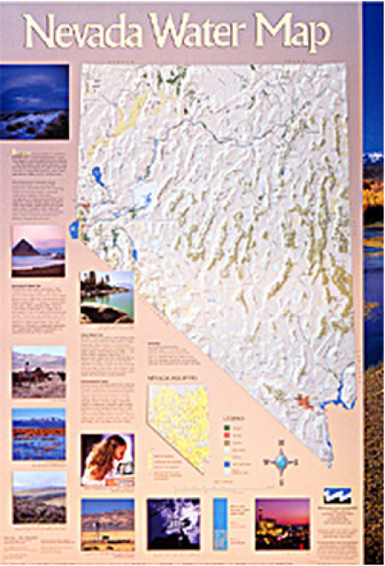
This 24×36 inch poster, suitable for framing, illustrates the
water resources available for Nevada cities, agriculture and the
environment. It features natural and manmade water resources
throughout the state, including the Truckee and Carson rivers,
Lake Tahoe, Pyramid Lake and the course of the Colorado River
that forms the state’s eastern boundary.
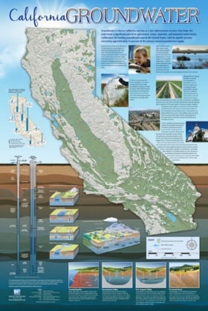
Fashioned after the popular California Water Map, this 24×36-inch
poster was extensively re-designed in 2017 to better illustrate
the value and use of groundwater in California, the main types of
aquifers, and the connection between groundwater and surface
water.
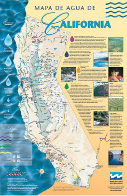
A new look for our most popular product! And it’s the perfect
gift for the water wonk in your life.
Our 24×36-inch California Water Map is widely known for being the
definitive poster that shows the integral role water plays in the
state. On this updated version, it is easier to see California’s
natural waterways and man-made reservoirs and aqueducts
– including federally, state and locally funded
projects – the wild and scenic rivers system, and
natural lakes. The map features beautiful photos of
California’s natural environment, rivers, water projects,
wildlife, and urban and agricultural uses and the
text focuses on key issues: water supply, water use, water
projects, the Delta, wild and scenic rivers and the Colorado
River.
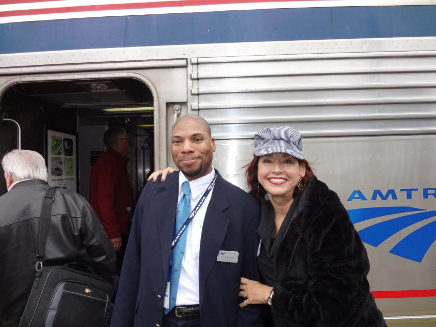
Travel across the state on Amtrak’s famed California
Zephyr, from the edge of sparkling San Francisco Bay,
through the meandering channels of the Delta, past rich Central
Valley farmland, growing cities, historic mining areas and into
the Sierra Nevada mountain range.
Stretching 450 miles long and up to
50 miles wide, the Sierra Nevada makes up more than a quarter of
California’s land area and forms its largest watersheds,
providing more than half of the state’s developed water supply to
residents, agriculture and other businesses.*
The East Fork begins in the mountains of California’s Sonora Pass
and after flowing through California and Nevada, it meets the
West Fork just south of Carson City. The West Fork forms at
California’s Carson Pass, running through California and into
Nevada to its junction with the East Fork.


")
")
")
")
")


")
")