Monitoring Land Subsidence in the San Joaquin Valley
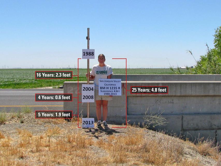
 Land subsidence caused by
groundwater pumping has been observed in the San Joaquin Valley
for decades. Increased reliance on aquifers during the last
decade resulted in subsidence rates in excess of a foot per year
in some parts of the region.
While subsidence was minimal in 2017 due to one of the wettest years on record, any return to dry conditions would likely set the stage for subsidence to resume as the region relies more heavily on groundwater than surface water.
Attendees at this free workshop in Fresno learned about the continued monitoring of subsidence impacts that are being conducted until longer-term Sustainable Groundwater Management Act (SGMA) implementation can begin to control subsidence.
Subsidence puts key water conveyance and flood control infrastructure at risk of damage. Over time, long-term subsidence has destroyed thousands of public and private groundwater well casings in the San Joaquin Valley.
The workshop highlighted ongoing land subsidence monitoring, monitoring techniques, assistance from the California Department of Water Resources (DWR) for local agency SGMA compliance, and featured current results of satellite-based remote sensing monitoring being performed by the National Aeronautics and Space Administration for DWR.
This special free workshop, sponsored by the California Department of Water Resources and the Water Education Foundation, was geared toward groundwater users and basin managers across the San Joaquin Valley.
Topics discussed:
- Update on valley groundwater and subsidence conditions
- Update on SGMA program activities
- Techniques for monitoring land subsidence, including radar remote sensing, extensometers, and GPS
Location:
The workshop was held at the Alice Peters Auditorium (PB 191) in the University Business Center at Fresno State.
Alice Peters Auditorium
Fresno, CA 93740


