Drought— an extended period of
limited or no precipitation— is a fact of life in California and
the West, with water resources following boom-and-bust patterns.
No portion of the West has been immune to drought during the last
century and drought occurs with much greater frequency in the
West than in other regions of the country.
Most of the West experiences what is classified as severe to
extreme drought more than 10 percent of the time, and a
significant portion of the region experiences severe to extreme
drought more than 15 percent of the time, according to the
National Drought Mitigation Center.
Experts who have studied recent droughts say a drought occurs
about once every 10 years somewhere in the United States.
Droughts are believed to be the most costly of all natural
disasters because of their widespread effects on agriculture and
related industries, as well as on urbanized areas. One of those
decennial droughts could cost as much as $38 billion, according
to one estimate.
Because droughts cannot be prevented, experts are looking for
better ways to forecast them and new approaches to managing
droughts when they occur.
The Navajo Nation has officially declared a drought emergency
after President Buu Nygren signed the declaration on Wednesday,
June 10, putting immediate measures into effect to address
worsening conditions across the reservation. The declaration,
which was unanimously approved by the Commission on Emergency
Management (CEM) on Tuesday before being signed by Nygren,
responds to severe and ongoing drought conditions that
have reduced precipitation, strained water supplies, degraded
rangelands, lowered reservoir levels, and threatened
the economic well-being of Navajo communities. … The
commission also recommended allocating $6,553,730 from the
Agricultural Infrastructure Fund to support drought mitigation
efforts, including windmill repairs and related water
infrastructure improvements.
Colorado’s drought is only expected to worsen with more dry
weather for the forecasted future and a below-average snowpack
to fill reservoirs, leading water managers and authorities to
urge conservation to ensure we have enough water for essential
functions like firefighting. … “Our snow pack is at 30% or
less of normal,” [Ruedi Water and Power Authority
Chair Greg] Poschman said. “Our reservoirs aren’t going to
fill this year, and we need to restrict water use — otherwise
it’s going to be very dire in the valley, and it affects
everyone. Outdoor watering is the biggest concern.” He
emphasized that overuse of water could reduce what is available
for the things that are vital, such as firefighting efforts,
which are expected to continue to worsen in tandem with the
drought.
… Last week, Gov. Jared Polis declared a statewide
drought emergency. After record-low snowpack and persistent
above average temperatures, every county in Colorado is drier
than average. … The emergency declaration coincides with
moving to phase 3 of the state’s drought response plan. It
allows the Governor to access and appropriate money available
in Colorado’s disaster emergency fund and sets up stronger
state coordination on dispersing those resources. In addition,
it opens the possibility of asking the White House to issue a
federal emergency declaration. As it currently stands,
farmers and ranchers can apply for a suite of relief options
ranging from emergency loans, to grants for crop loss, to
reimbursements for the travel costs of hauling extra feed or
water for livestock.
Like many communities in the American Southwest, Las Vegas is
facing a prolonged drought that is forcing policy leaders to
make tough decisions about how best to mitigate the declining
water supply. In 2021, state lawmakers passed a measure that
ostensibly banned all irrigation of so-called “non-functional
turf.” The law officially goes into effect next January, but
the Southern Nevada Water Authority has already begun working
to replace that grass with more drought-tolerant landscaping,
mostly through rebates for customers who choose to
re-landscape. A lawsuit is now challenging the Southern Nevada
Water Authority’s grass removal program in federal court. The
suit claims that the program’s enforcement is overzealous and
is potentially causing environmental harm.
Gov. Jared Polis on Thursday issued a statewide drought
emergency declaration, potentially freeing up additional state
funding for the state’s response to record-low snowpack
and prolonged warm temperatures across
Colorado. Colorado’s snowpack peaked in early March about
a month earlier than usual and at the lowest level since 1987.
Farmers, ranchers, fishing and rafting outfitters, and cities
and reservoir managers are already feeling the impacts of tight
water supplies this year on their wallets and water supply
budgets. Polis’ declaration follows recommendations Monday from
the Colorado Drought Task Force and the Water Conditions
Monitoring Committee.
Denver Parks and Recreation is taking steps to reduce water use
across the city as drought conditions persist along Colorado’s
Front Range. The department announced a water reduction
strategy in response to Denver Water’s Stage 1 Drought
declaration, which calls for voluntary conservation
efforts to help protect water supplies. As part
of the plan, Denver Parks and Recreation will reduce irrigation
at select parks, medians and other landscaped areas. Officials
said watering schedules will be adjusted to focus on
maintaining the health and safety of trees and high-use
recreational spaces while allowing some turf areas to go
dormant. … City officials said they will continue
monitoring drought conditions and could implement additional
conservation measures if conditions worsen.
Members of the Colorado Drought Task Force want Gov. Jared
Polis to issue an emergency proclamation to unlock more help,
potentially from state coffers, in face of worrisome drought
conditions. After a historically bad winter that ended a
month early, Colorado is already feeling the impacts — whether
that’s financial strain, tough business decisions or an
overstressed environment. As part of the state’s response,
the task force recommended Monday moving into the
highest level, phase three, of the state’s drought response
plan. The move could allow the state to tap more
resources or seek a presidential declaration. … The
officials gathered for their third meeting in Winter Park to
hear updates about drought conditions and impacts on fisheries,
water providers and wildfire risk.
… In recent weeks the Interior Department has contacted farm
districts, cities, tribes and other water users in
Arizona, California and Nevada looking to
extend Biden administration contracts that paid out nearly $1.4
billion from Democrats’ signature climate law to entities that
agreed to fallow fields, tighten conservation measures or
otherwise forgo water deliveries. At the same time,
Interior Secretary Doug Burgum ordered up a list of projects
from the region’s seven governors to address the river’s
long-term problems, for which the federal government could be a
“potential cost-share partner.” The menu of proposals they
delivered a week ago includes 85 projects totaling more than
$50 billion — a price tag that far exceeds what Interior
currently has in its coffers.
Denver Water customers have yet to embrace a strict water diet
this year, cutting water use just 5% this month as the outdoor
watering season begins. The utility, which serves 1.5 million
customers, has asked residents and businesses to slash
water use by 20% this summer to combat extreme
drought. At the same time, reservoirs, unable to
refill after melting snows evaporated early due to a surprising
March heatwave, are dropping. The utility said its storage
system is just 79% full, down from the 89% mark normally seen
at this time of year. … Aurora homeowners and businesses
have cut use 6.5%, Aurora Water spokesperson Shonnie Cline
said. And the city’s reservoirs are similarly low, standing at
just 56% full. This time last year they were 66% full.
Mendocino County is not in a drought. That was the message
Tuesday, May 19, from county Department of Transportation
staff, who delivered the first formal drought briefing since
the county adopted its Drought Resilience Plan on May 20, 2025
— nearly a year ago to the day. … Jeanine Jones,
interstate resources manager for the California Department of
Water Resources, gave the statewide picture and a warning about
the El Niño headlines now circulating. A strong El Niño does
not reliably mean a wet California winter, she said. She
pointed to water year 2016, when one of the strongest El Niño
events on record fell in the fifth year of the 2012-2017
drought.
The state and the Colorado River Water Conservation District, a
public water policy and planning agency on the Western Slope,
have a new plan to protect mountain towns from losing their
water supply during an unprecedented drought this
summer. The District’s proposed emergency water supply
plan was approved at the Colorado Water Conservation Board
meeting on Wednesday. Colorado River District general
manager Andy Mueller said that the Colorado River Basin is in a
historic drought, and “safeguards that we put in place more
than 80 years ago are failing.” The emergency plan would
protect certain water users on the main stem of the Colorado
River by replacing water that would have historically come from
Green Mountain Reservoir. This year forecasts say it won’t fill
up for the first time in history.
Gov. Spencer Cox declared a state of emergency Thursday, noting
every county is in a state of severe or extreme drought after
a dry winter marked by record warmth robbed Utah of its
snowpack and left rivers and streams running
low. The declaration opens the door for farmers
and ranchers to tap into federal funding and loans managed by
the state. It also gave state leaders another opportunity to
urge homeowners to cut back on watering their lawns and replace
some of their grass with less thirsty plants. … Cox
said about two-thirds of residential water is used outdoors and
pleaded with Utahns to stay vigilant and avoid watering too
much. But he said any restrictions are a decision for local
leaders and water districts, not for state officials.
New Mexico Gov. Michelle Lujan Grisham on Wednesday declared a
statewide emergency due to widespread drought and severe
wildfire conditions, which mobilizes various state agencies to
provide affected communities with resources. The
governor’s executive order cites the state’s historically low
snowpack, high spring temperatures, severe winds and
ongoing wildfires. It directs the state’s Drought Task Force to
ensure communities receive “available information and resources
to enable them to prepare for and respond to drought conditions
and conserve and protect New Mexico’s water
supplies.” Coinciding with the executive order, the
governor’s office publicized a new website — the Drought
Information Portal.
Lupine and California golden poppies are already blooming
everywhere. They’re more than beautiful, and tougher than they
look: Wildflowers can teach us a lot about surviving
drought. A new study shows wildflowers employ a
mixture of strategies, some intentionally risky and others
cautiously conservative, both above-ground and below, to thrive
in conditions that can vary widely from year to year. With
climate change making drought more frequent
and more severe, this work hones the ability of land managers
to predict which plants will thrive in which ecosystems in the
future.
A broad coalition of Colorado River water users is calling on
the federal government to provide at least $2 billion in new
funding for drought programs. The letter to congress comes from
a strikingly diverse group. Its co-signers include farm
districts, environmental nonprofits, Native American tribes,
cities and others. The Colorado River has been stretched thin
for more than two decades. A 26-year megadrought,
fueled by climate change, has shrunk supplies.
Policymakers across the Southwest have not done enough to rein
in demand accordingly. As a result, the nation’s two largest
reservoirs have dropped to anxiety-inducing low levels for the
users that depend on their water.
The West is entering the summer in a drought. The Wyoming state
engineer’s office is in charge of water rights in the state.
It’s preparing for the summer with some water restrictions
already in place. Wyoming Public Radio’s Kamila Kudelska spoke
with Deputy State Engineer Jack Morey to learn about what this
summer might look like. … KK: Could you say some
examples of some tributaries that would be affected that you
said have never been affected before? JM: On the western side
of the state, there’s a lot of tributaries. … I think it
would be safe to say pretty much any tributary in Wyoming,
there’s a chance of being on regulation this summer.
Arizona climate experts recommended Thursday that Governor
Katie Hobbs renew a drought declaration in effect since 1999 as
the state continues to reel from the hottest March on
record. … In Northern Arizona, wildfires are
already raging about a month ahead of schedule. Little to no
snowpack, drought-stressed trees and a lot of dead pinyon and
juniper means a higher risk this year for crown fires, in which
fire climbs to the tops of trees and quickly spreads across the
canopy. … Both the 1999 declaration and a later drought
declaration enacted in 2007 by then-Governor Janet Napolitano
will remain in effect for the foreseeable future. Hobbs last
renewed the declarations in 2024.
The Catalan Institute for Water Research (ICRA) and the
California Institute for Water Resources have signed a
collaboration agreement aimed at addressing the impact of
climate change and droughts, two elements that are increasingly
frequent in both territories. This agreement will promote
scientific cooperation in research, innovation, and
technological development related to sustainable water
management, and to promote the movement of researchers between
both two centres. The two institutions sealed their cooperation
arangement with Catalan president Salvador Illa present in
California, while ICRA researchers visited the University of
California. … Additionally, a Catalonia-California
seminar on water management is planned to be held in California
in November 2026.
The Trump administration will release $47 million in
long-awaited federal funding for four Colorado water projects
aiming to fight the Colorado River Basin’s prolonged drought.
The Biden administration promised Coloradans up to $152 million
in January 2025 to restore ecosystems, repair
infrastructure and address drought impacts. The Trump
administration immediately froze the grants pending review.
… This week’s announcement is the latest in a slow
trickle of released funding from the federal agency. In
addition to $25.6 million for the southwestern Colorado water
projects, the Bureau of Reclamation also released $4.6 million
for wetland restoration, floodplain improvements, erosion
control and more on conserved lands in western Colorado.
In the wake of one of the hottest, driest winters on record,
communities in the Roaring Fork Valley are bracing for summer
with more-severe water restrictions, fines for the worst
offenders and a water conservation outreach campaign. At its
regular meeting Tuesday, Aspen City Council approved staff’s
recommendation of moving to a Stage 3 Water Shortage in a 4-1
vote. The city had been in Stage 2 since September. Stage 3
restricts outdoor irrigation to just two days a week: Tuesday
and Friday for even addresses; Wednesday and Saturday for odd
addresses; and no watering at all on Mondays, Thursdays or
Sundays.
… As utilities cope with weather extremes by scrambling to
repair their infrastructure and tapping new water sources, the
cost is beginning to show up in residents’ bills. Between 1998
and 2020, the average cost of water, sewer and trash collection
services increased more than twice as much as the overall U.S.
consumer price index. … Longer and more intense
droughts have triggered restrictions on water use from Florida
to Colorado. … Water has long been one of the most
affordable utility bills for American households. … But
climate change is increasingly battering utilities with weather
— and costs — they did not plan for. … Amid a
decades-long megadrought that has diminished aquifers and
caused a catastrophic decline in river flows, residents
of Southern California have seen rate increases of up to 17
percent over the past two years.
Recognizing “very dry conditions,” the state’s [Wyo.] water
boss Tuesday declared an emergency to allow ranchers to more
easily get water to their stock. State Engineer Brandon Gebhart
gave local water supervisors the authority to move what’s known
as the “point of use” of water that sustains livestock. Four
district supervisors can now authorize the shift in water use
with a simple form instead of requiring more burdensome changes
to permits at state offices in Cheyenne. The emergency
authorization came as the state faces a dire summer, Gebhart
told legislators and members of the Water Development
Commission on Wednesday.
A late spring snowstorm is offering a brief reprieve from
drought conditions across the Front Range, but experts say the
region still has a long way to go. … Denver7 Chief
Meteorologist Lisa Hidalgo said the storm did provide some
benefit to the state’s snowpack but cautioned that drought
concerns remain. “I think at one point we were down to about
18% of normal — as of this morning with this most recent snow,
statewide snowpack is at about 25% of normal,” Hidalgo said.
“People are still going to be mindful, and we’ll likely see
more drought restrictions pop up here.” Many Front Range
residents are already under water restrictions, including
limits on lawn irrigation.
Colorado’s trout fisheries could face a difficult summer,
impacting the state’s billion-dollar angling industry, as
widespread drought conditions drive predictions that
streamflows will be well below-average. Kirk Klancke, the
president of the Colorado Headwaters Chapter of Trout
Unlimited, said he is concerned that the drought will stress
fisheries this summer, especially if temperatures are anywhere
near as elevated as they were this winter. “If this summer is
anything like this past winter was, the chances are pretty good
that there’s going to be fish kills in our streams,” Klancke
said. … Colorado, and much of the West, experienced one
of the hottest, driest winters on record.
… Firefighters and wildfire experts say that perception
matches reality. Wildfires have become more intense and more
extreme, according to Bakersfield Battalion Chief AJ Clark, who
pointed to major incidents in recent years. … But
according to those who have spent decades studying this
phenomenon, the drivers behind worsening wildfire seasons may
surprise people who assume drought is the primary cause.
“Plants are the source of the fire, the fuel,” UC Riverside
wildfire expert Dr. Richard Minnich said. “So the more it
rains, the more it burns in the climate around here. We think
somehow that drought is a necessary thing. It’s not, not really
at all.”
*IMPORTANT* In anticipation of high demand, the Foundation will be allocating tickets via a lottery method with a maximum of 3 entrants per organization. Tickets will be released in batches over time. Details coming soon.
This special, first-ever Foundation water tour will only be offered once! Join us on this special journey as we examine water issues along the Kern River, from its mountain-fed headwaters in the southern Sierra Nevada to its terminus in the Central Valley west of Bakersfield. Among the planned stops are both upper forks of the Kern River, Lake Isabella, lower Kern River canyon, the Friant-Kern Canal, irrigated agriculture in the valley, the Kern Water Bank and more.
Hyatt Place Bakersfield
310 Coffee Rd.
Bakersfield, CA 93309
The 24-page Layperson’s Guide to California Water provides an
excellent overview of the history of water development and use in
California. It includes the latest information on the state’s
changing hydrology, recent water conservation legislation and the
state’s efforts to stretch the available water supplies.
The 24-page Layperson’s Guide to the Delta explores the competing
uses and demands on California’s Sacramento-San Joaquin
Delta. The 11th edition examines this critical
water hub and its myriad challenges. The 2025 version
includes the latest information on the tunnel project, habitat
restoration efforts, climate change impacts and an updated
section on the legal and political facets of the Delta.
This tour explored the lower Colorado River firsthand where virtually every drop of the river is allocated, yet demand is growing from myriad sources — increasing population, declining habitat, drought and climate change.
The 1,450-mile river is a lifeline to some 40 million people in the Southwest across seven states, 30 tribal nations and Mexico. How the Lower Basin states – Arizona, California and Nevada – use and manage this water to meet agricultural, urban, environmental and industrial needs was the focus of this tour.
Hilton Garden Inn Las Vegas Strip South
7830 S Las Vegas Blvd
Las Vegas, NV 89123
On this first-ever Foundation water tourwe examined water issues along the 263-mile Klamath River, from its spring-fed headwaters in south-central Oregon to its redwood-lined estuary on the Pacific Ocean in California.
Running Y Resort
5500 Running Y Rd
Klamath Falls, OR 97601
Last year’s snow deluge in California, which quickly erased a
two decade long megadrought, was essentially a
once-in-a-lifetime rescue from above, a new study found. Don’t
get used to it because with climate change the 2023 California
snow bonanza —a record for snow on the ground on April 1 — will
be less likely in the future, said the study in Monday’s
journal Proceedings of the National Academy of Sciences.
… UCLA climate scientist Daniel Swain, who wasn’t part
of the study but specializes in weather in the U.S. West, said,
“I would not be surprised if 2023 was the coldest, snowiest
winter for the rest of my own lifetime in California.”
This tour explored the lower Colorado River firsthand where virtually every drop of the river is allocated, yet demand is growing from myriad sources — increasing population, declining habitat, drought and climate change.
The 1,450-mile river is a lifeline to some 40 million people in the Southwest across seven states, 30 tribal nations and Mexico. How the Lower Basin states – Arizona, California and Nevada – use and manage this water to meet agricultural, urban, environmental and industrial needs was the focus of this tour.
Hilton Garden Inn Las Vegas Strip South
7830 S Las Vegas Blvd
Las Vegas, NV 89123
Learn the history and challenges facing the West’s most dramatic
and developed river.
The Layperson’s Guide to the Colorado River Basin introduces the
1,450-mile river that sustains 40 million people and millions of
acres of farmland spanning seven states and parts of northern
Mexico.
The 28-page primer explains how the river’s water is shared and
managed as the Southwest transitions to a hotter and drier
climate.
State health officials know that extreme heat can cost lives
and send people to the hospital, just like wildfire smoke. Now,
new research finds that when people are exposed to both hazards
simultaneously — as is increasingly the case in California —
heart and respiratory crises outpace the expected sum of
hospitalizations compared to when the conditions occur
separately. … The study joins a growing body of research
about the intersection of different climate risks. Last month,
California-based think-tank the Pacific
Institute published a report about how converging
hazards — including wildfires, drought, flooding, sea level
rise and intensifying storms — are harming access to drinking
water and sanitation in California and other parts of the
world. The deadly 2018 Camp fire in Butte
County impacted an estimated 2,438 private wells, the
report said.
After more than two decades of
drought, water utilities serving the largest urban regions in the
arid Southwest are embracing a drought-proof source of drinking
water long considered a supply of last resort: purified sewage.
Water supplies have tightened to the point that Phoenix and the
water supplier for 19 million Southern California residents are
racing to adopt an expensive technology called “direct potable
reuse” or “advanced purification” to reduce their reliance on
imported water from the dwindling Colorado River.
The climate-driven shrinking of the
Colorado River is expanding the influence of Native American
tribes over how the river’s flows are divided among cities, farms
and reservations across the Southwest.
The tribes are seeing the value of their largely unused river
water entitlements rise as the Colorado dwindles, and they are
gaining seats they’ve never had at the water bargaining table as
government agencies try to redress a legacy of exclusion.
Water conservation has become a way of life throughout the West
with a growing recognition that water supply is not unlimited.
Drought is the most common motivator of increased water
conservation. However, the gradual drying of the West due to
climate change means the amount of fresh water available for
drinking, irrigation, industry and other uses must be used as
efficiently as possible.
Every five years the California Department of Water Resources
updates its strategic plan for managing the state’s water
resources, as required by state law.
The California Water Plan, or Bulletin 160, projects the
status and trends of the state’s water supplies and demands
under a range of future scenarios.
A new but little-known change in
California law designating aquifers as “natural infrastructure”
promises to unleash a flood of public funding for projects that
increase the state’s supply of groundwater.
The change is buried in a sweeping state budget-related law,
enacted in July, that also makes it easier for property owners
and water managers to divert floodwater for storage underground.
A new underground mapping technology
that reveals the best spots for storing surplus water in
California’s Central Valley is providing a big boost to the
state’s most groundwater-dependent communities.
The maps provided by the California Department of Water Resources
for the first time pinpoint paleo valleys and similar prime
underground storage zones traditionally found with some guesswork
by drilling exploratory wells and other more time-consuming
manual methods. The new maps are drawn from data on the
composition of underlying rock and soil gathered by low-flying
helicopters towing giant magnets.
The unique peeks below ground are saving water agencies’
resources and allowing them to accurately devise ways to capture
water from extreme storms and soak or inject the surplus
underground for use during the next drought.
“Understanding where you’re putting and taking water from really
helps, versus trying to make multimillion-dollar decisions based
on a thumb and which way the wind is blowing,” said Aaron Fukuda,
general manager of the Tulare Irrigation District, an early
adopter of the airborne electromagnetic or
AEM technology in California.
The states of the Lower Colorado
River Basin have traditionally played an oversized role in
tapping the lifeline that supplies 40 million people in the West.
California, Nevada and Arizona were quicker to build major canals
and dams and negotiated a landmark deal that requires the Upper
Basin to send predictable flows through the Grand Canyon, even
during dry years.
But with the federal government threatening unprecedented water
cuts amid decades of drought and declining reservoirs, the Upper
Basin states of Wyoming, Utah, Colorado and New Mexico are
muscling up to protect their shares of an overallocated river
whose average flows in the Upper Basin have already dropped
20 percent over the last century.
They have formed new agencies to better monitor their interests,
moved influential Colorado River veterans into top negotiating
posts and improved their relationships with Native American
tribes that also hold substantial claims to the river.
This tour explored the lower Colorado River firsthand where virtually every drop of the river is allocated, yet demand is growing from myriad sources — increasing population, declining habitat, drought and climate change.
The 1,450-mile river is a lifeline to some 40 million people in the Southwest across seven states, 30 tribal nations and Mexico. How the Lower Basin states – Arizona, California and Nevada – use and manage this water to meet agricultural, urban, environmental and industrial needs was the focus of this tour.
Hilton Garden Inn Las Vegas Strip South
7830 S Las Vegas Blvd
Las Vegas, NV 89123
It was exactly the sort of deluge
California groundwater agencies have been counting on to
replenish their overworked aquifers.
The start of 2023 brought a parade of torrential Pacific storms
to bone dry California. Snow piled up across the Sierra Nevada at
a near-record pace while runoff from the foothills gushed into
the Central Valley, swelling rivers over their banks and filling
seasonal creeks for the first time in half a decade.
Suddenly, water managers and farmers toiling in one of the
state’s most groundwater-depleted regions had an opportunity to
capture stormwater and bank it underground. Enterprising agencies
diverted water from rushing rivers and creeks into manmade
recharge basins or intentionally flooded orchards and farmland.
Others snagged temporary permits from the state to pull from
streams they ordinarily couldn’t touch.
This special Foundation water tour journeyed along the Eastern Sierra from the Truckee River to Mono Lake, through the Owens Valley and into the Mojave Desert to explore a major source of water for Southern California, this year’s snowpack and challenges for towns, farms and the environment.
Growing up in the shadow of the
Rocky Mountains, Andrew Schwartz never missed an opportunity to
play in – or study – a Colorado snowstorm. During major
blizzards, he would traipse out into the icy wind and heavy
drifts of snow pretending to be a scientist researching in
Antarctica.
Decades later, still armed with an obsession for extreme weather,
Schwartz has landed in one of the snowiest places in the West,
leading a research lab whose mission is to give California water
managers instant information on the depth and quality of snow
draping the slopes of the Sierra Nevada.
When the Colorado River Compact was
signed 100 years ago, the negotiators for seven Western states
bet that the river they were dividing would have ample water to
meet everyone’s needs – even those not seated around the table.
A century later, it’s clear the water they bet on is not there.
More than two decades of drought, lake evaporation and overuse of
water have nearly drained the river’s two anchor reservoirs, Lake
Powell on the Arizona-Utah border and Lake Mead near Las Vegas.
Climate change is rendering the basin drier, shrinking spring
runoff that’s vital for river flows, farms, tribes and cities
across the basin – and essential for refilling reservoirs.
The states that endorsed the Colorado River Compact in 1922 – and
the tribes and nation of Mexico that were excluded from the table
– are now straining to find, and perhaps more importantly accept,
solutions on a river that may offer just half of the water that
the Compact assumed would be available. And not only are
solutions not coming easily, the relationships essential for
compromise are getting more frayed.
The three-year span, 2019 to 2022, was officially the driest ever
statewide going back to 1895 when modern records began in
California. But that most recent period of overall drought
also saw big swings from very wet to very dry stretches such
as the 2021-2022 water year that went from a relatively
wet Oct.-Dec. beginning to the driest Jan.-March period in the
state’s history.
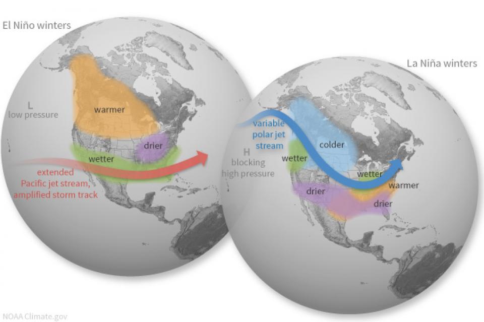
With La Niña conditions predicted to persist into the
winter, what can reliably be said about the prospects for
Water Year 2023? Does La Niña really mean anything for California
or is it all washed up as a predictor in this new reality of
climate whiplash, and has any of this affected our reliance on
historical patterns to forecast California’s water supply?
Participants found out what efforts are being made to
improve sub-seasonal to seasonal (S2S) precipitation
forecasting for California and the Colorado River Basin at our
one-day Winter Outlook Workshop December
8 in Irvine, CA.
Beckman Center
Huntington Room
100 Academy Way
Irvine, California 92617
With 25 years of experience working
on the Colorado River, Chuck Cullom is used to responding to
myriad challenges that arise on the vital lifeline that seven
states, more than two dozen tribes and the country of Mexico
depend on for water. But this summer problems on the
drought-stressed river are piling up at a dizzying pace:
Reservoirs plummeting to record low levels, whether Hoover Dam
and Glen Canyon Dam can continue to release water and produce
hydropower, unprecedented water cuts and predatory smallmouth
bass threatening native fish species in the Grand Canyon.
“Holy buckets, Batman!,” said Cullom, executive director of the
Upper Colorado River Commission. “I mean, it’s just on and on and
on.”
This printed issue of Western Water explores some of the major
challenges facing Colorado River stakeholders: preparing for
climate change, forging U.S.-Mexico water supply solutions and
dealing with continued growth in the basins states. Much of the
content for this issue of Western Water came from the in-depth
panel discussions at the September 2009 Colorado River Symposium.
As water interests in the Colorado
River Basin prepare to negotiate a new set of operating
guidelines for the drought-stressed river, Amelia Flores wants
her Colorado River Indian Tribes (CRIT) to be involved in the
discussion. And she wants CRIT seated at the negotiating table
with something invaluable to offer on a river facing steep cuts
in use: its surplus water.
CRIT, whose reservation lands in California and Arizona are
bisected by the Colorado River, has some of the most senior water
rights on the river. But a federal law enacted in the late 1700s,
decades before any southwestern state was established, prevents
most tribes from sending any of its water off its reservation.
The restrictions mean CRIT, which holds the rights to nearly a
quarter of the entire state of Arizona’s yearly allotment of
river water, is missing out on financial gain and the chance to
help its river partners.
Managers of California’s most
overdrawn aquifers were given a monumental task under the state’s
landmark Sustainable Groundwater Management Act: Craft viable,
detailed plans on a 20-year timeline to bring their beleaguered
basins into balance. It was a task that required more than 250
newly formed local groundwater agencies – many of them in the
drought-stressed San Joaquin Valley – to set up shop, gather
data, hear from the public and collaborate with neighbors on
multiple complex plans, often covering just portions of a
groundwater basin.
Momentum is building for a unique
interstate deal that aims to transform wastewater from Southern
California homes and business into relief for the stressed
Colorado River. The collaborative effort to add resiliency to a
river suffering from overuse, drought and climate change is being
shaped across state lines by some of the West’s largest water
agencies.
This tour explored the lower Colorado River firsthand where virtually every drop of the river is allocated, yet demand is growing from myriad sources — increasing population, declining habitat, drought and climate change.
The 1,450-mile river is a lifeline to some 40 million people in the Southwest across seven states, 30 tribal nations and Mexico. How the Lower Basin states – Arizona, California and Nevada – use and manage this water to meet agricultural, urban, environmental and industrial needs was the focus of this tour.
Hyatt Place Las Vegas At Silverton Village
8380 Dean Martin Drive
Las Vegas, NV 89139
This tour ventured through California’s Central Valley, known as the nation’s breadbasket thanks to an imported supply of surface water and local groundwater. Covering about 20,000 square miles through the heart of the state, the valley provides 25 percent of the nation’s food, including 40 percent of all fruits, nuts and vegetables consumed throughout the country.
Climate scientist Brad Udall calls
himself the skunk in the room when it comes to the Colorado
River. Armed with a deck of PowerPoint slides and charts that
highlight the Colorado River’s worsening math, the Colorado State
University scientist offers a grim assessment of the river’s
future: Runoff from the river’s headwaters is declining, less
water is flowing into Lake Powell – the key reservoir near the
Arizona-Utah border – and at the same time, more water is being
released from the reservoir than it can sustainably provide.
For more than 20 years, Tanya
Trujillo has been immersed in the many challenges of the Colorado
River, the drought-stressed lifeline for 40 million people from
Denver to Los Angeles and the source of irrigation water for more
than 5 million acres of winter lettuce, supermarket melons and
other crops.
Trujillo has experience working in both the Upper and Lower
Basins of the Colorado River, basins that split the river’s water
evenly but are sometimes at odds with each other. She was a
lawyer for the state of New Mexico, one of four states in the
Upper Colorado River Basin, when key operating guidelines for
sharing shortages on the river were negotiated in 2007. She later
worked as executive director for the Colorado River Board of
California, exposing her to the different perspectives and
challenges facing California and the other states in the river’s
Lower Basin.
Water as a renewable resource is depicted in this 18×24 inch
poster. Water is renewed again and again by the natural
hydrologic cycle where water evaporates, transpires from plants,
rises to form clouds, and returns to the earth as precipitation.
Excellent for elementary school classroom use.
This page is a resource for all things drought – where you
can find real-time reservoir levels, drought severity
maps, special reports, a newsfeed of current
developments and general background on droughts in California and
the West, as well as answers to common drought questions and tips
for how you can save water at home.
What is Drought?
Drought – an extended period of limited or no
precipitation – is a fact of life in California and the
West, with water resources following boom-and-bust patterns.
In spring 2026, record-high temperatures across the West
obliterated much of the region’s already meager snowpack,
sparking governors Utah and New Mexico to declare drought
emergencies and some cities, such as Denver, to launch mandatory
watering use reductions.
The Colorado River Basin, which spans seven U.S. states and
portions of Mexico, has been battered by an extended drought
since 2000. Scientists now believe the drought ranks among the
worst in more than 1,200 years. During the winter of 2025-2026,
snowpack in the river’s mountain headwaters in Colorado, Utah and
Wyoming reached record lows, prompting hydrologists to project
runoff into the river during the critical April-July period to be
just 13 percent of average.
California has weathered several severe droughts over the past
quarter century, most recently from 2020-2022, when Gov. Gavin
Newsom declared drought emergencies in all 58 of the state’s
counties. Newsom relaxed those restrictions in March 2023,
after an exceptionally wet winter filled reservoirs and packed
the Sierra Nevada with record snowfall. But drought fears
have returned again. In May 2026, statewide reservoir levels
stood at 117 percent of average, but snowpack was just 21
percent of average, raising concerns about water supplies the
following year.
Read more about droughts and their
impacts in Aquapedia, our online water
encyclopedia
Las Vegas, known for its searing summertime heat and glitzy casino fountains, is projected to get even hotter in the coming years as climate change intensifies. As temperatures rise, possibly as much as 10 degrees by end of the century, according to some models, water demand for the desert community is expected to spike. That is not good news in a fast-growing region that depends largely on a limited supply of water from an already drought-stressed Colorado River.
When you oversee the largest
supplier of treated water in the United States, you tend to think
big.
Jeff Kightlinger, general manager of the Metropolitan Water
District of Southern California for the last 15 years, has
focused on diversifying his agency’s water supply and building
security through investment. That means looking beyond MWD’s
borders to ensure the reliable delivery of water to two-thirds of
California’s population.
As California’s seasons become
warmer and drier, state officials are pondering whether the water
rights permitting system needs revising to better reflect the
reality of climate change’s effect on the timing and volume of
the state’s water supply.
A report by the State Water Resources Control Board recommends
that new water rights permits be tailored to California’s
increasingly volatile hydrology and be adaptable enough to ensure
water exists to meet an applicant’s demand. And it warns
that the increasingly whiplash nature of California’s changing
climate could require existing rights holders to curtail
diversions more often and in more watersheds — or open
opportunities to grab more water in climate-induced floods.
A government agency that controls much of California’s water
supply released its initial allocation for 2021, and the
numbers reinforced fears that the state is falling into another
drought. The U.S. Bureau of Reclamation said Tuesday that most
of the water agencies that rely on the Central Valley Project
will get just 5% of their contract supply, a dismally low
number. Although the figure could grow if California gets more
rain and snow, the allocation comes amid fresh weather
forecasts suggesting the dry winter is continuing. The National
Weather Service says the Sacramento Valley will be warm and
windy the next few days, with no rain in the forecast.
Across a sprawling corner of southern Tulare County snug against the Sierra Nevada, a bounty of navel oranges, grapes, pistachios, hay and other crops sprout from the loam and clay of the San Joaquin Valley. Groundwater helps keep these orchards, vineyards and fields vibrant and supports a multibillion-dollar agricultural economy across the valley. But that bounty has come at a price. Overpumping of groundwater has depleted aquifers, dried up household wells and degraded ecosystems.
Twenty years ago, the Colorado River
Basin’s hydrology began tumbling into a historically bad stretch.
The weather turned persistently dry. Water levels in the system’s
anchor reservoirs of Lake Powell and Lake Mead plummeted. A river
system relied upon by nearly 40 million people, farms and
ecosystems across the West was in trouble. And there was no guide
on how to respond.
Practically every drop of water that flows through the meadows, canyons and plains of the Colorado River Basin has reams of science attached to it. Snowpack, streamflow and tree ring data all influence the crucial decisions that guide water management of the iconic Western river every day.
Dizzying in its scope, detail and complexity, the scientific information on the Basin’s climate and hydrology has been largely scattered in hundreds of studies and reports. Some studies may conflict with others, or at least appear to. That’s problematic for a river that’s a lifeline for 40 million people and more than 4 million acres of irrigated farmland.
Sprawled across a desert expanse
along the Utah-Arizona border, Lake Powell’s nearly 100-foot high
bathtub ring etched on its sandstone walls belie the challenges
of a major Colorado River reservoir at less than half-full. How
those challenges play out as demand grows for the river’s water
amid a changing climate is fueling simmering questions about
Powell’s future.
The Colorado River is arguably one
of the hardest working rivers on the planet, supplying water to
40 million people and a large agricultural economy in the West.
But it’s under duress from two decades of drought and decisions
made about its management will have exceptional ramifications for
the future, especially as impacts from climate change are felt.
Every other year we hold an
invitation-only Colorado River Symposium attended by various
stakeholders from across the seven Western states and Mexico that
rely on the iconic river. We host this three-day event in Santa
Fe, N.M., where the 1922 Colorado River Compact was signed, as
part of our mission to catalyze critical conversations to build
bridges and inform collaborative decision-making.
Many of California’s watersheds are
notoriously flashy – swerving from below-average flows to jarring
flood conditions in quick order. The state needs all the water it
can get from storms, but current flood management guidelines are
strict and unyielding, requiring reservoirs to dump water each
winter to make space for flood flows that may not come.
However, new tools and operating methods are emerging that could
lead the way to a redefined system that improves both water
supply and flood protection capabilities.
California is chock full of rivers and creeks, yet the state’s network of stream gauges has significant gaps that limit real-time tracking of how much water is flowing downstream, information that is vital for flood protection, forecasting water supplies and knowing what the future might bring.
That network of stream gauges got a big boost Sept. 30 with the signing of SB 19. Authored by Sen. Bill Dodd (D-Napa), the law requires the state to develop a stream gauge deployment plan, focusing on reactivating existing gauges that have been offline for lack of funding and other reasons. Nearly half of California’s stream gauges are dormant.
The southern part of California’s Central Coast from San Luis Obispo County to Ventura County, home to about 1.5 million people, is blessed with a pleasing Mediterranean climate and a picturesque terrain. Yet while its unique geography abounds in beauty, the area perpetually struggles with drought.
Indeed, while the rest of California breathed a sigh of relief with the return of wet weather after the severe drought of 2012–2016, places such as Santa Barbara still grappled with dry conditions.
The Colorado River Basin’s 20 years
of drought and the dramatic decline in water levels at the
river’s key reservoirs have pressed water managers to adapt to
challenging conditions. But even more extreme — albeit rare —
droughts or floods that could overwhelm water managers may lie
ahead in the Basin as the effects of climate change take hold,
say a group of scientists. They argue that stakeholders who are
preparing to rewrite the operating rules of the river should plan
now for how to handle these so-called “black swan” events so
they’re not blindsided.
Summer is a good time to take a
break, relax and enjoy some of the great beaches, waterways and
watersheds around California and the West. We hope you’re getting
a chance to do plenty of that this July.
But in the weekly sprint through work, it’s easy to miss
some interesting nuggets you might want to read. So while we’re
taking a publishing break to work on other water articles planned
for later this year, we want to help you catch up on
Western Water stories from the first half of this year
that you might have missed.
New to this year’s slate of water
tours, our Edge of
Drought Tour Aug. 27-29 will venture into the Santa
Barbara area to learn about the challenges of limited local
surface and groundwater supplies and the solutions being
implemented to address them.
Despite Santa Barbara County’s decision to lift a drought
emergency declaration after this winter’s storms replenished
local reservoirs, the region’s hydrologic recovery often has
lagged behind much of the rest of the state.
On average, more than 60 percent of
California’s developed water supply originates in the Sierra
Nevada and the southern spur of the Cascade Range. Our water
supply is largely dependent on the health of our Sierra forests,
which are suffering from ecosystem degradation, drought,
wildfires and widespread tree mortality.
This tour ventured into the Sierra to examine water issues
that happen upstream but have dramatic impacts downstream and
throughout the state.
Even as stakeholders in the Colorado River Basin celebrate the recent completion of an unprecedented drought plan intended to stave off a crashing Lake Mead, there is little time to rest. An even larger hurdle lies ahead as they prepare to hammer out the next set of rules that could vastly reshape the river’s future.
Set to expire in 2026, the current guidelines for water deliveries and shortage sharing, launched in 2007 amid a multiyear drought, were designed to prevent disputes that could provoke conflict.
One of California Gov. Gavin
Newsom’s first actions after taking office was to appoint Wade
Crowfoot as Natural Resources Agency secretary. Then, within
weeks, the governor laid out an ambitious water agenda that
Crowfoot, 45, is now charged with executing.
That agenda includes the governor’s desire for a “fresh approach”
on water, scaling back the conveyance plan in the Sacramento-San
Joaquin Delta and calling for more water recycling, expanded
floodplains in the Central Valley and more groundwater recharge.
This tour journeyed through a scenic landscape and
explored an area of California dealing with
persistent threats to its water supply and quality. Along
the way, we learned about solutions that were being
implemented.
Although Santa Barbara County had lifted its drought
emergency declaration after the 2019 storms replenished
local reservoirs, the region’s hydrologic recovery has often
lagged behind much of the rest of the state. It is a region
particularly prone to drought, wildfires and mudslides.
Groundwater helped make Kern County
the king of California agricultural production, with a $7 billion
annual array of crops that help feed the nation. That success has
come at a price, however. Decades of unchecked groundwater
pumping in the county and elsewhere across the state have left
some aquifers severely depleted. Now, the county’s water managers
have less than a year left to devise a plan that manages and
protects groundwater for the long term, yet ensures that Kern
County’s economy can continue to thrive, even with less water.
For the bulk of her career, Jayne
Harkins has devoted her energy to issues associated with the
management of the Colorado River, both with the U.S. Bureau of
Reclamation and with the Colorado River Commission of Nevada.
Now her career is taking a different direction. Harkins, 58, was
appointed by President Trump last August to take the helm of the
United States section of the U.S.-Mexico agency that oversees
myriad water matters between the two countries as they seek to
sustainably manage the supply and water quality of the Colorado
River, including its once-thriving Delta in Mexico, and other
rivers the two countries share. She is the first woman to be
named the U.S. Commissioner of the International Boundary and
Water Commission for either the United States or Mexico in the
commission’s 129-year history.
Although Santa Monica may be the most aggressive Southern California water provider to wean itself from imported supplies, it is hardly the only one looking to remake its water portfolio.
In Los Angeles, a city of about 4 million people, efforts are underway to dramatically slash purchases of imported water while boosting the amount from recycling, stormwater capture, groundwater cleanup and conservation. Mayor Eric Garcetti in 2014 announced a plan to reduce the city’s purchase of imported water from Metropolitan Water District by one-half by 2025 and to provide one-half of the city’s supply from local sources by 2035. (The city considers its Eastern Sierra supplies as imported water.)
Imported water from the Sierra
Nevada and the Colorado River built Southern California. Yet as
drought, climate change and environmental concerns render those
supplies increasingly at risk, the Southland’s cities have ramped
up their efforts to rely more on local sources and less on
imported water.
Far and away the most ambitious goal has been set by the city of
Santa Monica, which in 2014 embarked on a course to be virtually
water independent through local sources by 2023. In the 1990s,
Santa Monica was completely dependent on imported water. Now, it
derives more than 70 percent of its water locally.
The growing leadership of women in water. The Colorado River’s persistent drought and efforts to sign off on a plan to avert worse shortfalls of water from the river. And in California’s Central Valley, promising solutions to vexing water resource challenges.
These were among the topics that Western Water news explored in 2018.
We’re already planning a full slate of stories for 2019. You can sign up here to be alerted when new stories are published. In the meantime, take a look at what we dove into in 2018:
As stakeholders labor to nail down
effective and durable drought contingency plans for the Colorado
River Basin, they face a stark reality: Scientific research is
increasingly pointing to even drier, more challenging times
ahead.
The latest sobering assessment landed the day after Thanksgiving,
when U.S. Global Change Research Program’s Fourth National Climate
Assessment concluded that Earth’s climate is changing rapidly
compared to the pace of natural variations that have occurred
throughout its history, with greenhouse gas emissions largely the
cause.
In the universe of California water, Tim Quinn is a professor emeritus. Quinn has seen — and been a key player in — a lot of major California water issues since he began his water career 40 years ago as a young economist with the Rand Corporation, then later as deputy general manager with the Metropolitan Water District of Southern California, and finally as executive director of the Association of California Water Agencies. In December, the 66-year-old will retire from ACWA.
Just because El Niño may be lurking
off in the tropical Pacific, does that really offer much of a
clue about what kind of rainy season California can expect in
Water Year 2019?
Will a river of storms pound the state, swelling streams and
packing the mountains with deep layers of heavy snow much like
the exceptionally wet 2017 Water Year (Oct. 1, 2016 to Sept. 30,
2017)? Or will this winter sputter along like last winter,
leaving California with a second dry year and the possibility of
another potential drought? What can reliably be said about the
prospects for Water Year 2019?
At Water Year
2019: Feast or Famine?, a one-day event on Dec. 5 in Irvine,
water managers and anyone else interested in this topic will
learn about what is and isn’t known about forecasting
California’s winter precipitation weeks to months ahead, the
skill of present forecasts and ongoing research to develop
predictive ability.
“Dry, hot and on fire” is how the
California Department of Water Resources described Water Year
2018 in a recent report.
Water Year 2018 – from Oct. 1, 2017 to Sept. 30, 2018 -
marked a return to dry conditions statewide following an
exceptionally wet 2017, according to DWR’s Water
Year 2018 report. But 2017 was exceptional as all but two of
the water years in the past decade experienced drought.
Was Water Year 2018 simply a single dry year or does it
signal the beginning of another drought? And what can
reliably be said about the prospects for Water Year 2019? Does El
Niño really mean anything for California or is it all washed up
as a predictor?
Attendees found out at this one-day event Dec. 5 in
Irvine, Water Year 2019: Feast or
Famine?
Beckman Center
Auditorium - Huntington Room
100 Academy Way
Irvine, California 92617
There’s going to be a new governor
in California next year – and a host of challenges both old and
new involving the state’s most vital natural resource, water.
So what should be the next governor’s water priorities?
That was one of the questions put to more than 150 participants
during a wrap-up session at the end of the Water Education
Foundation’s Sept. 20 Water Summit in Sacramento.
People in California and the
Southwest are getting stingier with water, a story that’s told by
the acre-foot.
For years, water use has generally been described in terms of
acre-foot per a certain number of households, keying off the
image of an acre-foot as a football field a foot deep in water.
The long-time rule of thumb: One acre-foot of water would supply
the indoor and outdoor needs of two typical urban households for
a year.
The Colorado River Basin is more
than likely headed to unprecedented shortage in 2020 that could
force supply cuts to some states, but work is “furiously”
underway to reduce the risk and avert a crisis, Bureau of
Reclamation Commissioner Brenda Burman told an audience of
California water industry people.
During a keynote address at the Water Education Foundation’s
Sept. 20 Water Summit in Sacramento, Burman said there is
opportunity for Colorado River Basin states to control their
destiny, but acknowledged that in water, there are no guarantees
that agreement can be reached.
Amy Haas recently became the first non-engineer and the first woman to serve as executive director of the Upper Colorado River Commission in its 70-year history, putting her smack in the center of a host of daunting challenges facing the Upper Colorado River Basin.
Yet those challenges will be quite familiar to Haas, an attorney who for the past year has served as deputy director and general counsel of the commission. (She replaced longtime Executive Director Don Ostler). She has a long history of working within interstate Colorado River governance, including representing New Mexico as its Upper Colorado River commissioner and playing a central role in the negotiation of the recently signed U.S.-Mexico agreement known as Minute 323.
Nowhere is the domino effect in
Western water policy played out more than on the Colorado River,
and specifically when it involves the Lower Basin states of
California, Nevada and Arizona. We are seeing that play out now
as the three states strive to forge a Drought Contingency Plan.
Yet that plan can’t be finalized until Arizona finds a unifying
voice between its major water players, an effort you can read
more about in the latest in-depth article of Western Water.
Even then, there are some issues to resolve just within
California.
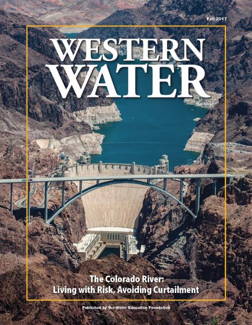
It’s high-stakes time in Arizona. The state that depends on the
Colorado River to help supply its cities and farms — and is
first in line to absorb a shortage — is seeking a unified plan
for water supply management to join its Lower Basin neighbors,
California and Nevada, in a coordinated plan to preserve water
levels in Lake Mead before
they run too low.
If the lake’s elevation falls below 1,075 feet above sea level,
the secretary of the Interior would declare a shortage and
Arizona’s deliveries of Colorado River water would be reduced by
320,000 acre-feet. Arizona says that’s enough to serve about 1
million households in one year.
We explored the lower Colorado River where virtually every drop
of the river is allocated, yet demand is growing from myriad
sources — increasing population, declining habitat, drought and
climate change.
The 1,450-mile river is a lifeline to 40 million people in
the Southwest across seven states and Mexico. How the Lower Basin
states – Arizona, California and Nevada – use and manage this
water to meet agricultural, urban, environmental and industrial
needs was the focus of this tour.
Hampton Inn Tropicana
4975 Dean Martin Drive, Las Vegas, NV 89118
This winter’s wild swings in weather
– an early lack of rain, then late-season Sierra snowstorms,
followed by a torrent of subtropical moisture – shows the need in
California for long-range tools to better manage water supply.
At a Paleo
Drought Workshop in San Pedro on April 19, six experts will
discuss research on centuries-long precipitation and streamflow
records, new forecasting tools and planning strategies to help
reduce Southern California’s vulnerability to drought.
Learn what new tree-ring studies in
Southern California watersheds reveal about drought, hear about
efforts to improve subseasonal to seasonal weather forecasting
and get the latest on climate change impacts that will alter
drought vulnerability in the future.
At our Paleo
Drought Workshop on April 19th in San Pedro, you will hear
from experts at NASA Jet Propulsion Laboratory, University of
Arizona and California Department of Water Resources.
Dramatic swings in weather patterns
over the past few years in California are stark reminders of
climate variability and regional vulnerability. Alternating years
of drought and intense rain events make long-term planning for
storing and distributing water a challenging task.
Current weather forecasting capabilities provide details for
short time horizons. Attend the Paleo Drought
Workshop in San Pedro on April 19 to learn more about
research efforts to improve sub-seasonal to seasonal
precipitation forecasting, known as S2S, and how those models
could provide more useful weather scenarios for resource
managers.
California’s 2012-2016 drought
revealed vulnerabilities for water users throughout the state,
and the long-term record suggests more challenges may lie ahead.
An April 19
workshop in San Pedro will highlight new information about
drought durations in Southern California watersheds dating
back centuries.
Every day, people flock to Daniel
Swain’s social media platforms to find out the latest news and
insight about California’s notoriously unpredictable weather.
Swain, a climate scientist at the Institute of the
Environment and Sustainability at UCLA, famously coined the
term “Ridiculously Resilient Ridge” in December 2013 to describe
the large, formidable high-pressure mass that was parked over the
West Coast during winter and diverted storms away from
California, intensifying the drought.
Swain’s research focuses on atmospheric processes that cause
droughts and floods, along with the changing character of extreme
weather events in a warming world. A lifelong Californian and
alumnus of University of California, Davis, and Stanford
University, Swain is best known for the widely read Weather West blog, which provides
unique perspectives on weather and climate in California and the
western United States. In a recent interview with Western
Water, he talked about the Ridiculously Resilient Ridge, its
potential long-term impact on California weather, and what may
lie ahead for the state’s water supply.
Rising temperatures from climate change are having a noticeable
effect on how much water is flowing down the Colorado River. Read
the latest River Report to learn more about what’s
happening, and how water managers are responding.
This issue of Western Water discusses the challenges
facing the Colorado River Basin resulting from persistent
drought, climate change and an overallocated river, and how water
managers and others are trying to face the future.
For decades, no matter the weather, the message has been preached
to Californians: use water wisely, especially outdoors, which
accounts for most urban water use.
Enforcement of that message filters to the local level, where
water agencies routinely target the notorious “gutter flooder”
with gentle reminders and, if necessary, financial penalties.
Sixty percent of California’s developed water supply
originates high in the Sierra Nevada mountains. Our water
supply is largely dependent on the health of our Sierra forests,
which are suffering from ecosystem degradation, drought,
wildfires and widespread tree mortality.
In a state with such topsy-turvy weather as California, the
ability of forecasters to peer into the vast expanse of the
Pacific Ocean and accurately predict the arrival of storms is a
must to improve water supply reliability and flood management
planning.
The problem, according to Jeanine Jones, interstate resources
manager with the state Department of Water Resources, is
that “we have been managing with 20th century
technology with respect to our ability to do weather
forecasting.”
During drought, people conserve water. That’s a good thing for
public water agencies and the state as a whole but the reduction
in use ultimately means less money flowing into the budgets of
those very agencies that need funds to treat water to drinkable
standards, maintain a distribution system, and build a more
drought-proof supply.
“There are two things that can’t happen to a water utility – you
can’t run out of money and you can’t run out of water,” said Tom
Esqueda, public utilities director for the city of Fresno. He was
a panelist at a June 16 discussion in Sacramento about drought
resiliency sponsored by the Public Policy Institute of California
(PPIC).
Years of drought have sapped California’s water supply, creating
an accumulated deficit exacerbated by increasingly warmer
temperatures, a top researcher said at a recent briefing.
Michael Dettinger, research hydrologist with the U.S. Geological
Survey, said parts of California have fallen more than two years
behind where they should be in terms of receiving “normal”
precipitation. The situation augurs what would be expected under
projected climate change conditions as average annual
temperatures warm and the snow level declines.
A hydrograph illustrates a type of activity of water during a
specific time frame. Salinity and acidity are sometimes measured,
but the most common types
are stage and discharge hydrographs. These graphs show how
surface water flow responds to fluxes in precipitation.
California is no stranger to drought. When conditions become dry,
water storage declines and water conservation mandates make news
headlines; questions from the public often surface about what
appear to be easy solutions to augment the state’s water supply.
But the answers can be complicated and, in the end, there is no
silver bullet to ensure a resilient water supply, especially
during drought.
We explore “frequently asked questions” often posed by the public
and provide answers below. Simply click on the question for the
answer to appear.
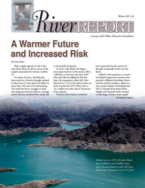
The dramatic decline in water levels in Lake Mead and Lake Powell
is perhaps the most visible sign of the historic drought that has
gripped the Colorado River Basin for the past 16 years. In 2000,
the reservoirs stood at nearly 100 percent capacity; today, Lake
Powell is at 49 percent capacity while Lake Mead has dropped to
38 percent. Before the late season runoff of Miracle May, it
looked as if Mead might drop low enough to trigger the first-ever
Lower Basin shortage determination in 2016.
Read the excerpt below from the Sept./Oct. 2015 issue along
with the editor’s note. Click here to subscribe to Western
Water and get full access.
This free briefing sponsored by the Department of Water Resources
and the Water Education Foundation will discuss forecasts of
water project operations in the coming year.
Water year 2016 has officially begun, and all eyes are on the
weather and the potential runoff. But even if the projected heavy
El Niño becomes reality, the state’s drought-impacted reservoirs
are still a major concern.
This issue examines the impacts of California’s epic
drought, especially related to water supplies for San Joaquin
Valley rural communities and farmland.
Drought doesn’t instantly ravage
the way flooding does. It advances at a steady, determined pace,
building and spreading during several years. Fields wither,
reservoirs drop to dangerously low levels and the memory of what
constitutes a normal water supply becomes more distant.
Read the excerpt below from the Sept./Oct. 2015 issue along
with the editor’s note. Click here to subscribe to Western Water and
get full access.
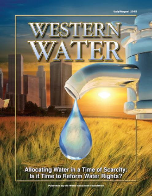
California’s severe drought has put its water rights system under
scrutiny, raising the question whether a complete overhaul is
necessary to better allocate water use.
(Read the excerpt below from the July/August 2015 issue along
with the editor’s note. Click here
to subscribe to Western Water and get full access.)
Introduction
California’s severe drought has put its water rights system under
scrutiny, raising the question whether a complete overhaul is
necessary to better allocate water use.
This 2-day, 1-night tour traveled through the San Joaquin Valley
to explore the impacts of California’s unprecedented four-year
drought on the nation’s breadbasket and what steps are being
taken to avert disaster.
This 3-day, 2-night tour followed the course of the
lower Colorado River through Nevada, Arizona and California, and
included a private tour of Hoover Dam.
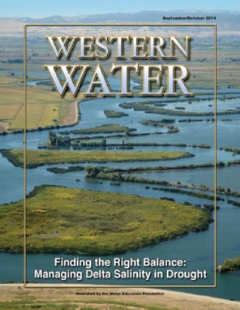
In wet years, dry years and every type of water year in between,
the daily intrusion and retreat of salinity in the Sacramento-San
Joaquin Delta is a constant pattern.
The cycle of ebb and flood is the defining nature of an estuary
and prior to its transformation into an agricultural tract in
the mid-19th century, the Delta was a freshwater marsh with
plants, birds, fish and wildlife that thrived on the edge of the
saltwater/freshwater interface.
Living in the semi-arid, Mediterranean climate of California,
drought always lingers on the horizon. People believe they are
ready to face the next dry period, then conditions arrive testing
whether that is the case.
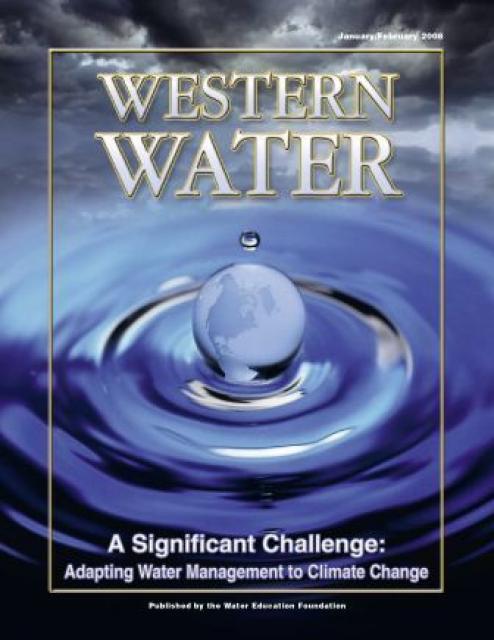
This printed copy of Western Water examines climate change –
what’s known about it, the remaining uncertainty and what steps
water agencies are talking to prepare for its impact. Much of the
information comes from the October 2007 California Climate Change
and Water Adaptation Summit sponsored by the Water Education
Foundation and DWR and the November 2007 California Water Policy
Conference sponsored by Public Officials for Water and
Environmental Reform.
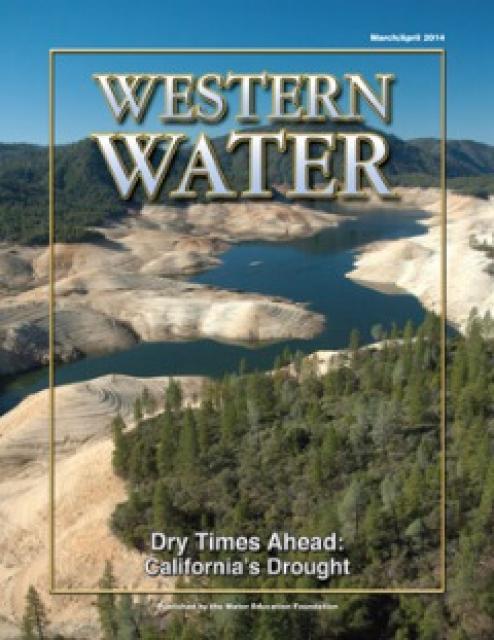
This printed copy of Western Water examines California’s drought
– its impact on water users in the urban and agricultural sector
and the steps being taken to prepare for another dry year should
it arrive.
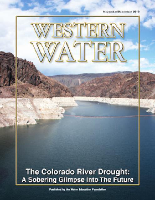
This printed issue of Western Water examines the
Colorado River drought, and the ongoing institutional and
operational changes underway to maintain the system and meet the
future challenges in the Colorado River Basin.
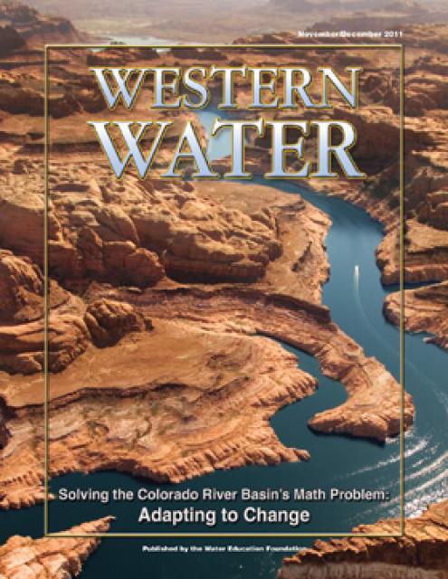
This printed issue of Western Water explores the
historic nature of some of the key agreements in recent years,
future challenges, and what leading state representatives
identify as potential “worst-case scenarios.” Much of the content
for this issue of Western Water came from the in-depth
panel discussions at the Colorado River Symposium. The Foundation
will publish the full proceedings of the Symposium in 2012.
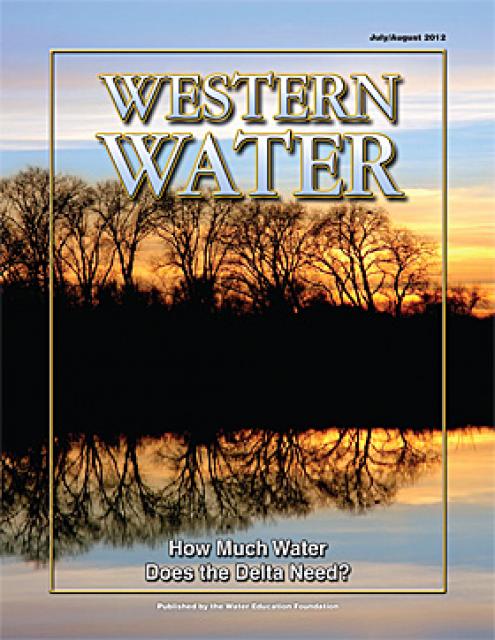
This printed issue of Western Water examines the issues
associated with the State Water Board’s proposed revision of the
water quality Bay-Delta Plan, most notably the question of
whether additional flows are needed for the system, and how they
might be provided.
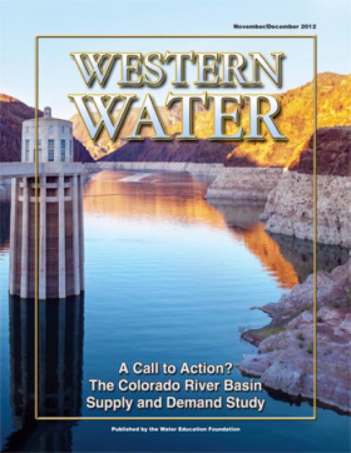
This printed issue of Western Water examines the
Colorado River Basin Water Supply and Demand Study and what its
finding might mean for the future of the lifeblood of the
Southwest.
This printed issue of Western Water features a
roundtable discussion with Anthony Saracino, a water resources
consultant; Martha Davis, executive manager of policy development
with the Inland Empire Utilities Agency and senior policy advisor
to the Delta Stewardship Council; Stuart Leavenworth, editorial
page editor of The Sacramento Bee and Ellen Hanak, co-director of
research and senior fellow at the Public Policy Institute of
California.
This printed issue of Western Water This issue of Western Water
looks at climate change through the lens of some of the latest
scientific research and responses from experts regarding
mitigation and adaptation.
This printed issue of Western Water examines how the various
stakeholders have begun working together to meet the planning
challenges for the Colorado River Basin, including agreements
with Mexico, increased use of conservation and water marketing,
and the goal of accomplishing binational environmental
restoration and water-sharing programs.
This printed issue of Western Water looks at California
groundwater and whether its sustainability can be assured by
local, regional and state management. For more background
information on groundwater please refer to the Foundation’s
Layperson’s Guide to Groundwater.
This 25-minute documentary-style DVD, developed in partnership
with the California Department of Water Resources, provides an
excellent overview of climate change and how it is already
affecting California. The DVD also explains what scientists
anticipate in the future related to sea level rise and
precipitation/runoff changes and explores the efforts that are
underway to plan and adapt to climate.
Many Californians don’t realize that when they turn on the
faucet, the water that flows out could come from a source close
to home or one hundreds of miles away. Most people take their
water for granted; not thinking about the elaborate systems and
testing that go into delivering clean, plentiful water to
households throughout the state. Where drinking water comes from,
how it’s treated, and what people can do to protect its quality
are highlighted in this 2007 PBS documentary narrated by actress
Wendie Malick.
A 30-minute version of the 2007 PBS documentary Drinking Water:
Quenching the Public Thirst. This DVD is ideal for showing at
community forums and speaking engagements to help the public
understand the complex issues surrounding the elaborate systems
and testing that go into delivering clean, plentiful water to
households throughout the state.
This 3-day, 2-night tour travels the length of the San Joaquin
Valley, giving participants a clear understanding of the State
Water Project and Central Valley Project.
This beautiful 24×36-inch poster, suitable for framing, displays
the rivers, lakes and reservoirs, irrigated farmland, urban areas
and Indian reservations within the Truckee River Basin, including
the Newlands Project, Pyramid Lake and Lake Tahoe. Map text
explains the issues surrounding the use of the Truckee-Carson
rivers, Lake Tahoe water quality improvement efforts, fishery
restoration and the effort to reach compromise solutions to many
of these issues.
This 24×36 inch poster, suitable for framing, illustrates the
water resources available for Nevada cities, agriculture and the
environment. It features natural and manmade water resources
throughout the state, including the Truckee and Carson rivers,
Lake Tahoe, Pyramid Lake and the course of the Colorado River
that forms the state’s eastern boundary.
The 24-page Layperson’s Guide to the State Water Project provides
an overview of the California-funded and constructed State Water
Project.
The State Water Project is best known for the 444-mile-long
aqueduct that provides water from the Delta to San Joaquin Valley
agriculture and southern California cities. The guide contains
information about the project’s history and facilities.
The 28-page Layperson’s Guide to Nevada Water provides an
overview of the history of water development and use in Nevada.
It includes sections on Nevada’s water rights laws, the history
of the Truckee and Carson rivers, water supplies for the Las
Vegas area, groundwater, water quality, environmental issues and
today’s water supply challenges.
The Water Education Foundation’s second edition of
the Layperson’s Guide to The Klamath River Basin is
hot off the press and available for purchase.
Updated and redesigned, the easy-to-read overview covers the
history of the region’s tribal, agricultural and environmental
relationships with one of the West’s largest rivers — and a
vast watershed that hosts one of the nation’s oldest and
largest reclamation projects.
The 24-page Layperson’s Guide to Integrated Regional Water
Management (IRWM) is an in-depth, easy-to-understand publication
that provides background information on the principles of IRWM,
its funding history and how it differs from the traditional water
management approach.
The 28-page Layperson’s Guide to Groundwater is an in-depth,
easy-to-understand publication that provides background and
perspective on groundwater. The guide explains what groundwater
is – not an underground network of rivers and lakes! – and the
history of its use in California.
The 24-page Layperson’s Guide to the Central Valley Project
explores the history and development of the federal Central
Valley Project (CVP), California’s largest surface water delivery
system. In addition to the project’s history, the guide describes
the various facilities, operations and benefits the water
project brings to the state along with the CVP
Improvement Act (CVPIA).
Redesigned in 2017, this beautiful map depicts the seven
Western states that share the Colorado River with Mexico. The
Colorado River supplies water to nearly 40 million people in
Arizona, California, Colorado, Nevada, New Mexico, Utah, Wyoming
and Mexico. Text on this beautiful, 24×36-inch map, which is
suitable for framing, explains the river’s apportionment, history
and the need to adapt its management for urban growth and
expected climate change impacts.
It seems not a matter of if but when seawater desalination will
fulfill the promise of providing parts of California with a
reliable, drought-proof source of water. With a continuing
drought and uncertain water deliveries, the state is in the grip
of a full-on water crisis, and there are many people who see
desalination as a way to provide some relief to areas struggling
to maintain an adequate water supply.
Drought—an extended period of
limited or no precipitation—is a fact of life in California and
the West, with water resources following boom-and-bust patterns.
During California’s 2012–2016 drought, much of the state
experienced severe drought conditions: significantly less
precipitation and snowpack, reduced streamflow and higher
temperatures. Those same conditions reappeared early in 2021
prompting Gov. Gavin Newsom in May to declare drought emergencies
in watersheds across 41 counties in California.
California’s seasonal weather is influenced by El Niño and La
Niña – temporary climatic conditions that, depending on their
severity, make the weather wetter or drier than normal.
El Niño and La Niña episodes typically last 9 to 12 months,
but some may last for years. While their frequency can be quite
irregular, El Niño and La Niña events occur on average every two
to seven years. Typically, El Niño occurs more frequently than La
Niña, according to the National Oceanic and Atmospheric
Administration (NOAA).
A new look for our most popular product! And it’s the perfect
gift for the water wonk in your life.
Our 24×36-inch California Water Map is widely known for being the
definitive poster that shows the integral role water plays in the
state. On this updated version, it is easier to see California’s
natural waterways and man-made reservoirs and aqueducts
– including federally, state and locally funded
projects – the wild and scenic rivers system, and
natural lakes. The map features beautiful photos of
California’s natural environment, rivers, water projects,
wildlife, and urban and agricultural uses and the
text focuses on key issues: water supply, water use, water
projects, the Delta, wild and scenic rivers and the Colorado
River.
30-minute DVD that traces the history of the U.S. Bureau of
Reclamation and its role in the development of the West. Includes
extensive historic footage of farming and the construction of
dams and other water projects, and discusses historic and modern
day issues.
Just before summer officially began in June, Gov. Arnold
Schwarzenegger publicly proclaimed what many people already knew:
California is in a drought. Consecutive years of sub par rainfall
coupled with a 2008 snowpack that literally dried up and blew
away before it could turn into runoff forced the issuance of the
state’s first drought declaration since 1991.
When a drought occurs as it has this year, the response is
couched in the three Rs of the waste hierarchy: reduce, reuse and
recycle.
The reduction part is well-known. State and local officials are
urging people to use less water in everything they do, from
landscape irrigation to shorter showers. Spurred by California’s
difficulties, Gov. Arnold Schwarzenegger on June 4 declared a
statewide drought. On July 10, the governor and Sen. Dianne
Feinstein announced their support of the Safe, Clean, Reliable
Drinking Water Supply Act of 2008 – a $9.3 billion bond proposal
that would allocate $250 million for water recycling projects.
Water truly has shaped California into the great state it is
today. And if it is water that made California great, it’s the
fight over – and with – water that also makes it so critically
important. In efforts to remap California’s circulatory system,
there have been some critical events that had a profound impact
on California’s water history. These turning points not only
forced a re-evaluation of water, but continue to impact the lives
of every Californian. This 2005 PBS documentary offers a
historical and current look at the major water issues that shaped
the state we know today. Includes a 12-page viewer’s guide with
background information, historic timeline and a teacher’s lesson.


")
 and other tributaries of the upper Colorado River have declined dramatically and contributed to the precipitous declines of Lake Powell and Lake Mead. (Source: The Water Desk)")

")
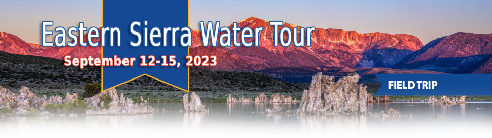
")
")
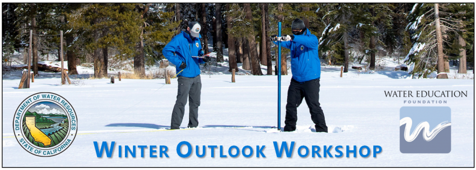
")
")
")
")
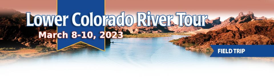
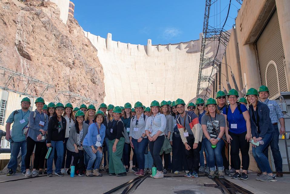
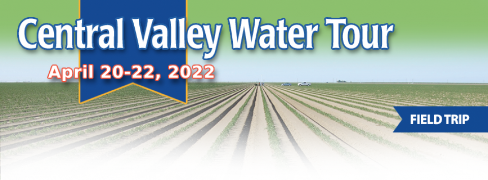
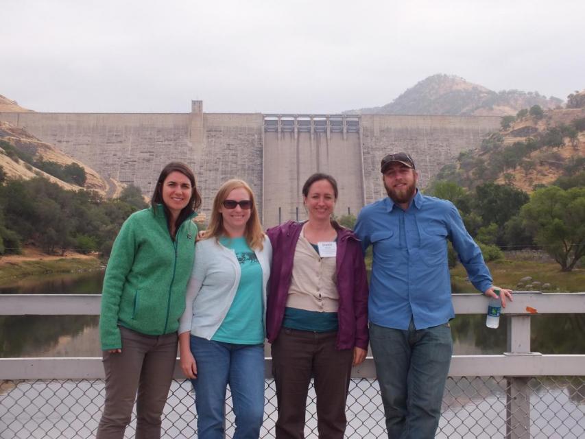
")
")
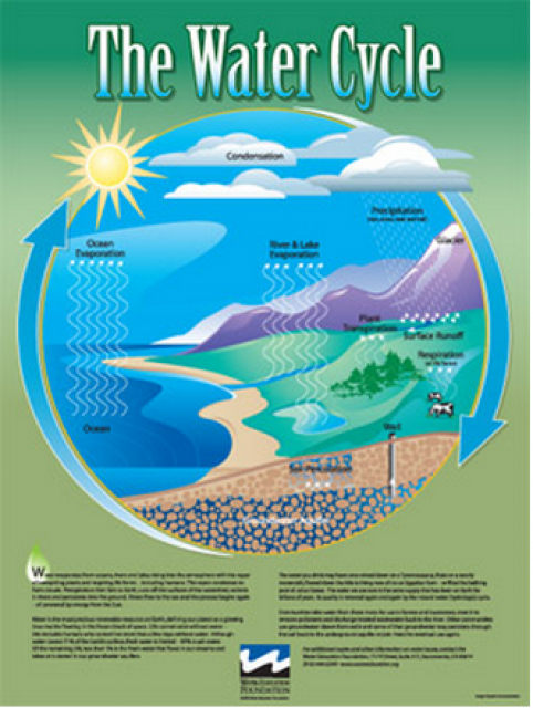

")
")
")
")
")
")
")
")
")
 and temperature. This gauge near downtown Sacramento measures water depth. (Source: California Department of Water Resources)")
")
")


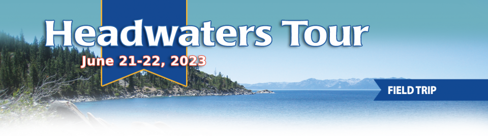
")
")
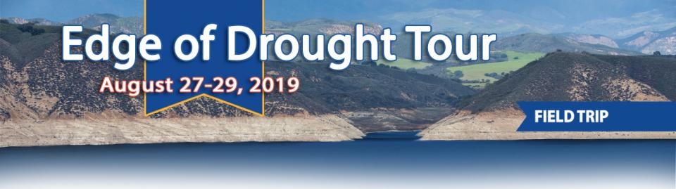
")
")
 treats dry weather urban runoff to remove pollutants such as sediment, oil, grease, and pathogens for nonpotable use. (Image: City of Santa Monica)")
: Karla Nemeth, director, California Department of Water Resources; Gloria Gray, chair, Metropolitan Water District of Southern California; Brenda Burman, Bureau of Reclamation Commissioner; Jayne Harkins, commissioner, International Boundary and Water Commission, U.S. and Mexico; Amy Haas, executive director, Upper Colorado River Commission.")
")
")
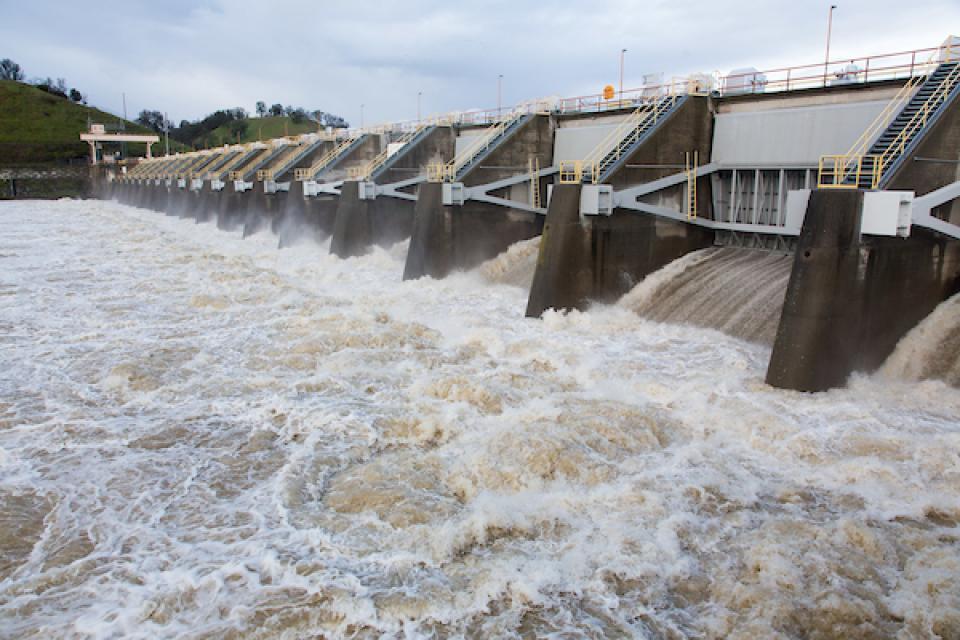

")
")
")
")
")