

WESTERN WATER-California Water Agencies Hoped A Deluge Would Recharge Their Aquifers. But When It Came, Some Couldn’t Use It
Read our Western Water In-Depth, Water Word of the Day and Five Don't-Miss Water Reads from Across the West
Dear Western Water readers:
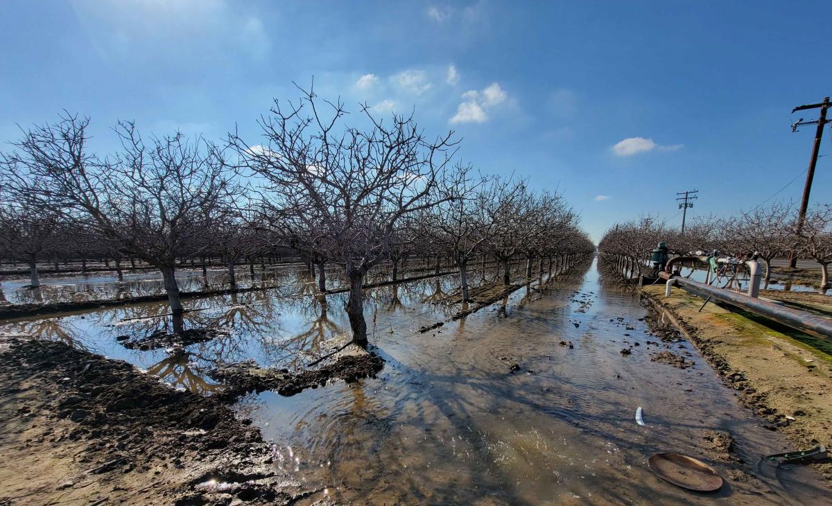 It was exactly the sort of deluge
California groundwater agencies have been counting on to
replenish their overworked aquifers.
It was exactly the sort of deluge
California groundwater agencies have been counting on to
replenish their overworked aquifers.
Suddenly, water managers and farmers toiling in one of the state’s most groundwater-depleted regions had an opportunity to capture stormwater and bank it underground. Enterprising agencies diverted water from rushing rivers and creeks into manmade recharge basins or intentionally flooded orchards and farmland.
Yet not everyone was able to fully capitalize on Mother Nature’s gift, as some recharge efforts were held up by red tape or inadequate infrastructure or simply weren’t ready.
The latest Western Water article explores where farmers and agencies were able to capture the storm as well as hurdles that are continuing to slow groundwater recharge efforts in drought-hit areas where the water is desperately needed. Read full story here.
Water Around the West
Five don’t-miss articles from California and across the West:
Restored floodplain helped small California town survive atmospheric river: Experts and residents say a California town likely survived January’s devastating floods due to a floodplain restoration project near the San Joaquin and Tuolumne rivers, Reuters’ Daniel Trotta reports.
Feds may alter Colorado River forecast methods slammed as too rosy: The federal government is considering updating its monthly Colorado River forecasting methods, a move scientists have been clamoring for and one that could reduce how much water is released from Lake Powell and Lake Mead, writes Tony Davis of the Arizona Daily Star.
Tamping down on the dust: Earth Island Journal’s Naoki Nitta examines how the ancient practice of dryland farming could temper the negative impacts fallowing could have in the Central Valley, including massive dust storms and pest scourges.
In times of scarcity, California’s best new source of water? Reuse: Expensive water supply solutions like ocean desalination grab headlines but water recycling and other reuse projects are gaining in popularity in California, writes & the West’s Caroline Reinhart.
In California, women learn how to protect their ancestral lands with fire: Debra Utacia Krol of the Arizona Republic highlights a first-ever all-Indigenous, all-female training camp in the Klamath River Basin where 50 women learned prescribed fire strategies that can improve watershed health and protect biological diversity.
Water Word of the Day
 A new era of groundwater management
in California began in 2014 with the passage of the
Sustainable Groundwater Management Act
(SGMA). Since then, hundreds of local agencies have
formed and submitted plans to the state that outline how they
will more effectively manage groundwater resources and avoid
“undesirable results” like degraded water quality, land
subsidence, stream depletion and harmful effects on drinking
water wells. SGMA remains a work in progress as managers of
overdrafted basins have until 2040 or 2042 to achieve groundwater
sustainability. You can read more about SGMA and other
water-related issues in Aquapedia, our
free online water encyclopedia.
A new era of groundwater management
in California began in 2014 with the passage of the
Sustainable Groundwater Management Act
(SGMA). Since then, hundreds of local agencies have
formed and submitted plans to the state that outline how they
will more effectively manage groundwater resources and avoid
“undesirable results” like degraded water quality, land
subsidence, stream depletion and harmful effects on drinking
water wells. SGMA remains a work in progress as managers of
overdrafted basins have until 2040 or 2042 to achieve groundwater
sustainability. You can read more about SGMA and other
water-related issues in Aquapedia, our
free online water encyclopedia.
At the Foundation
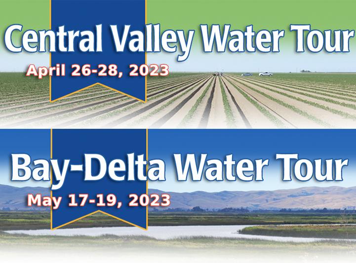 Registration is now open for two of
our spring water tours — the Central Valley
Tour, April 26-28, and our popular
Bay-Delta Tour,
May 17-19. The Central Valley Tour focuses on the San
Joaquin Valley, which is facing challenges after years of
drought, dwindling water supplies, decreasing water quality and
farmland conversion for urban growth. The Bay-Delta Tour
traverses the Sacramento-San Joaquin Delta, a 720,000-acre
network of islands and canals that supports the state’s water
system and is California’s most crucial water and ecological
resource. Check our Water Tours
page to learn more about each tour and find out
where else we’re going in 2023.
Registration is now open for two of
our spring water tours — the Central Valley
Tour, April 26-28, and our popular
Bay-Delta Tour,
May 17-19. The Central Valley Tour focuses on the San
Joaquin Valley, which is facing challenges after years of
drought, dwindling water supplies, decreasing water quality and
farmland conversion for urban growth. The Bay-Delta Tour
traverses the Sacramento-San Joaquin Delta, a 720,000-acre
network of islands and canals that supports the state’s water
system and is California’s most crucial water and ecological
resource. Check our Water Tours
page to learn more about each tour and find out
where else we’re going in 2023.
Water Academy
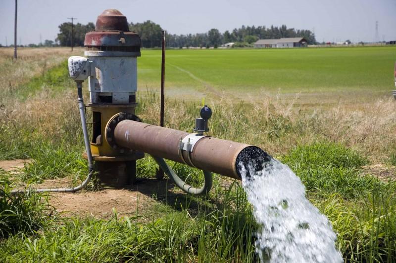
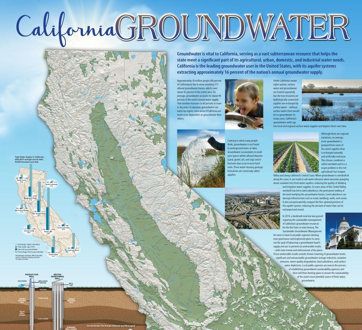 Water pumped from wells in a typical
year quenches 40 percent of California’s water needs — in a
drought it can be closer to 60 percent. Our California
Groundwater Map illustrates the main geologic
conditions that make up the more than 500 groundwater basins,
explains the value and use of groundwater in California, the main
types of aquifers, and the connection between groundwater and
surface water. In addition, graphics illustrate examples of
production and monitoring wells. Grab a copy of the frameable
24×36 inch poster map
here.
Water pumped from wells in a typical
year quenches 40 percent of California’s water needs — in a
drought it can be closer to 60 percent. Our California
Groundwater Map illustrates the main geologic
conditions that make up the more than 500 groundwater basins,
explains the value and use of groundwater in California, the main
types of aquifers, and the connection between groundwater and
surface water. In addition, graphics illustrate examples of
production and monitoring wells. Grab a copy of the frameable
24×36 inch poster map
here.


