An aquifer is a geologic formation that stores, transmits, and
yields significant quantities of water to wells or springs.
Aquifers come in two types. Some are formed in the space between
porous materials such as sand, gravel, silt or clay and are known
as alluvial aquifers or unconfined aquifers. However, in many
places in California, there are aquifers beneath a rock layer
that does not allow water to permeate in measurable amounts.
These are known as confined aquifers.
Confined aquifers under pressure are known as artesian aquifers.
This pressure can push water to the surface, which when drilled
are called artesian wells.
To replenish California’s
chronically depleted aquifers, the state’s Department of Water
Resources is taking a hard look at a new line of attack: Pairing
more sophisticated reservoir operations with groundwater
recharge. Water managers are aiming to make greater use of the
increased floodwater that’s expected to come with flashier, more
intense storms and earlier snowmelt.
A new but little-known change in
California law designating aquifers as “natural infrastructure”
promises to unleash a flood of public funding for projects that
increase the state’s supply of groundwater.
The change is buried in a sweeping state budget-related law,
enacted in July, that also makes it easier for property owners
and water managers to divert floodwater for storage underground.
A new underground mapping technology
that reveals the best spots for storing surplus water in
California’s Central Valley is providing a big boost to the
state’s most groundwater-dependent communities.
The maps provided by the California Department of Water Resources
for the first time pinpoint paleo valleys and similar prime
underground storage zones traditionally found with some guesswork
by drilling exploratory wells and other more time-consuming
manual methods. The new maps are drawn from data on the
composition of underlying rock and soil gathered by low-flying
helicopters towing giant magnets.
The unique peeks below ground are saving water agencies’
resources and allowing them to accurately devise ways to capture
water from extreme storms and soak or inject the surplus
underground for use during the next drought.
“Understanding where you’re putting and taking water from really
helps, versus trying to make multimillion-dollar decisions based
on a thumb and which way the wind is blowing,” said Aaron Fukuda,
general manager of the Tulare Irrigation District, an early
adopter of the airborne electromagnetic or
AEM technology in California.
It was exactly the sort of deluge
California groundwater agencies have been counting on to
replenish their overworked aquifers.
The start of 2023 brought a parade of torrential Pacific storms
to bone dry California. Snow piled up across the Sierra Nevada at
a near-record pace while runoff from the foothills gushed into
the Central Valley, swelling rivers over their banks and filling
seasonal creeks for the first time in half a decade.
Suddenly, water managers and farmers toiling in one of the
state’s most groundwater-depleted regions had an opportunity to
capture stormwater and bank it underground. Enterprising agencies
diverted water from rushing rivers and creeks into manmade
recharge basins or intentionally flooded orchards and farmland.
Others snagged temporary permits from the state to pull from
streams they ordinarily couldn’t touch.
Growing up in the shadow of the
Rocky Mountains, Andrew Schwartz never missed an opportunity to
play in – or study – a Colorado snowstorm. During major
blizzards, he would traipse out into the icy wind and heavy
drifts of snow pretending to be a scientist researching in
Antarctica.
Decades later, still armed with an obsession for extreme weather,
Schwartz has landed in one of the snowiest places in the West,
leading a research lab whose mission is to give California water
managers instant information on the depth and quality of snow
draping the slopes of the Sierra Nevada.
To survive the next drought and meet
the looming demands of the state’s groundwater sustainability
law, California is going to have to put more water back in the
ground. But as other Western states have found, recharging
overpumped aquifers is no easy task.
Successfully recharging aquifers could bring multiple benefits
for farms and wildlife and help restore the vital interconnection
between groundwater and rivers or streams. As local areas around
California draft their groundwater sustainability plans, though,
landowners in the hardest hit regions of the state know they will
have to reduce pumping to address the chronic overdraft in which
millions of acre-feet more are withdrawn than are naturally
recharged.
The southern part of California’s Central Coast from San Luis Obispo County to Ventura County, home to about 1.5 million people, is blessed with a pleasing Mediterranean climate and a picturesque terrain. Yet while its unique geography abounds in beauty, the area perpetually struggles with drought.
Indeed, while the rest of California breathed a sigh of relief with the return of wet weather after the severe drought of 2012–2016, places such as Santa Barbara still grappled with dry conditions.
Our event calendar is an excellent
resource for keeping up with water events in California and the
West.
Groundwater is top of mind for many water managers as they
prepare to meet next January’s deadline for submitting
sustainability plans required under California’s Sustainable
Groundwater Management Act. We have several upcoming featured
events listed on our calendar that focus on a variety of relevant
groundwater topics:
Groundwater helped make Kern County
the king of California agricultural production, with a $7 billion
annual array of crops that help feed the nation. That success has
come at a price, however. Decades of unchecked groundwater
pumping in the county and elsewhere across the state have left
some aquifers severely depleted. Now, the county’s water managers
have less than a year left to devise a plan that manages and
protects groundwater for the long term, yet ensures that Kern
County’s economy can continue to thrive, even with less water.
Although Santa Monica may be the most aggressive Southern California water provider to wean itself from imported supplies, it is hardly the only one looking to remake its water portfolio.
In Los Angeles, a city of about 4 million people, efforts are underway to dramatically slash purchases of imported water while boosting the amount from recycling, stormwater capture, groundwater cleanup and conservation. Mayor Eric Garcetti in 2014 announced a plan to reduce the city’s purchase of imported water from Metropolitan Water District by one-half by 2025 and to provide one-half of the city’s supply from local sources by 2035. (The city considers its Eastern Sierra supplies as imported water.)
Imported water from the Sierra
Nevada and the Colorado River built Southern California. Yet as
drought, climate change and environmental concerns render those
supplies increasingly at risk, the Southland’s cities have ramped
up their efforts to rely more on local sources and less on
imported water.
Far and away the most ambitious goal has been set by the city of
Santa Monica, which in 2014 embarked on a course to be virtually
water independent through local sources by 2023. In the 1990s,
Santa Monica was completely dependent on imported water. Now, it
derives more than 70 percent of its water locally.
The whims of political fate decided
in 2018 that state bond money would not be forthcoming to help
repair the subsidence-damaged parts of Friant-Kern Canal, the
152-mile conduit that conveys water from the San Joaquin River to
farms that fuel a multibillion-dollar agricultural economy along
the east side of the fertile San Joaquin Valley.
The growing leadership of women in water. The Colorado River’s persistent drought and efforts to sign off on a plan to avert worse shortfalls of water from the river. And in California’s Central Valley, promising solutions to vexing water resource challenges.
These were among the topics that Western Water news explored in 2018.
We’re already planning a full slate of stories for 2019. You can sign up here to be alerted when new stories are published. In the meantime, take a look at what we dove into in 2018:
In 1983, a landmark California Supreme Court ruling extended the public trust doctrine to tributary creeks that feed Mono Lake, which is a navigable water body even though the creeks themselves were not. The ruling marked a dramatic shift in water law and forced Los Angeles to cut back its take of water from those creeks in the Eastern Sierra to preserve the lake.
Now, a state appellate court has for the first time extended that same public trust doctrine to groundwater that feeds a navigable river, in this case the Scott River flowing through a picturesque valley of farms and alfalfa in Siskiyou County in the northern reaches of California.
There’s going to be a new governor
in California next year – and a host of challenges both old and
new involving the state’s most vital natural resource, water.
So what should be the next governor’s water priorities?
That was one of the questions put to more than 150 participants
during a wrap-up session at the end of the Water Education
Foundation’s Sept. 20 Water Summit in Sacramento.
As California embarks on its unprecedented mission to harness groundwater pumping, the Arizona desert may provide one guide that local managers can look to as they seek to arrest years of overdraft.
Groundwater is stressed by a demand that often outpaces natural and artificial recharge. In California, awareness of groundwater’s importance resulted in the landmark Sustainable Groundwater Management Act in 2014 that aims to have the most severely depleted basins in a state of balance in about 20 years.
Spurred by drought and a major
policy shift, groundwater management has assumed an unprecedented
mantle of importance in California. Local agencies in the
hardest-hit areas of groundwater depletion are drawing plans to
halt overdraft and bring stressed aquifers to the road of
recovery.
Along the way, an army of experts has been enlisted to help
characterize the extent of the problem and how the Sustainable
Groundwater Management Act of 2014 is implemented in a manner
that reflects its original intent.
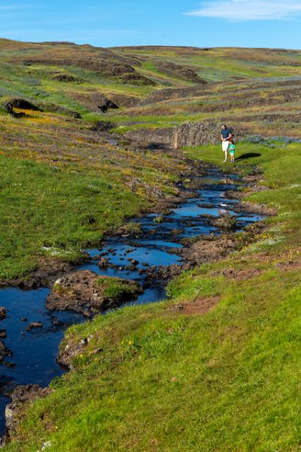
Springs are where groundwater becomes surface water, acting as openings
where subsurface water can discharge onto the ground or directly
into other water bodies. They can also be considered the
consequence of an overflowing
aquifer. As a result, springs often serve as headwaters to streams.
This printed issue of Western Water looks at California
groundwater and whether its sustainability can be assured by
local, regional and state management. For more background
information on groundwater please refer to the Foundation’s
Layperson’s Guide to Groundwater.
This printed issue of Western Water examines
groundwater management and the extent to which stakeholders
believe more efforts are needed to preserve and restore the
resource.
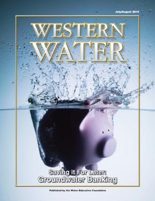
This printed issue of Western Water examines
groundwater banking, a water management strategy with appreciable
benefits but not without challenges and controversy.
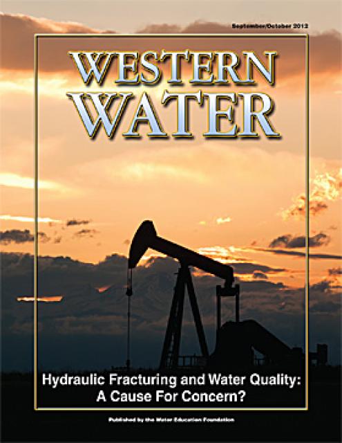
This printed issue of Western Water looks at hydraulic
fracturing, or “fracking,” in California. Much of the information
in the article was presented at a conference hosted by the
Groundwater Resources Association of California.
This 25-minute documentary-style DVD, developed in partnership
with the California Department of Water Resources, provides an
excellent overview of climate change and how it is already
affecting California. The DVD also explains what scientists
anticipate in the future related to sea level rise and
precipitation/runoff changes and explores the efforts that are
underway to plan and adapt to climate.
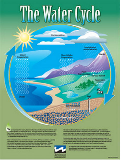
Water as a renewable resource is depicted in this 18×24 inch
poster. Water is renewed again and again by the natural
hydrologic cycle where water evaporates, transpires from plants,
rises to form clouds, and returns to the earth as precipitation.
Excellent for elementary school classroom use.
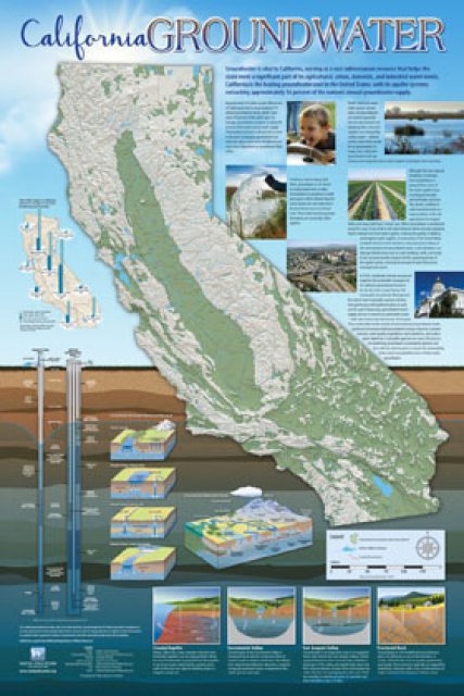
Fashioned after the popular California Water Map, this 24×36-inch
poster was extensively re-designed in 2017 to better illustrate
the value and use of groundwater in California, the main types of
aquifers, and the connection between groundwater and surface
water.
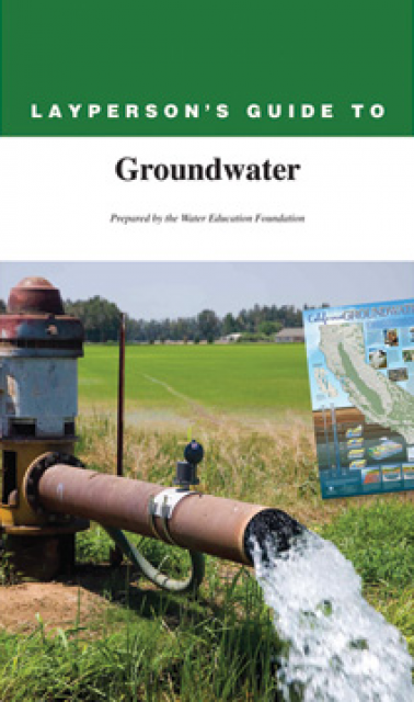
The 28-page Layperson’s Guide to Groundwater is an in-depth,
easy-to-understand publication that provides background and
perspective on groundwater. The guide explains what groundwater
is – not an underground network of rivers and lakes! – and the
history of its use in California.
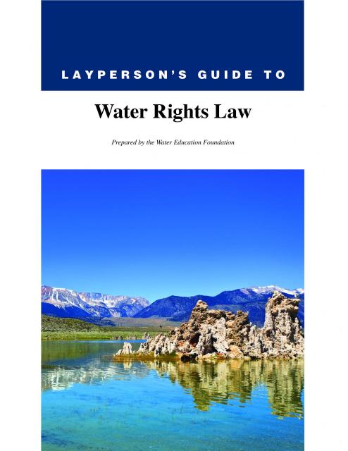
The 28-page Layperson’s Guide to Water Rights Law, recognized as
the most thorough explanation of California water rights law
available to non-lawyers, traces the authority for water flowing
in a stream or reservoir, from a faucet or into an irrigation
ditch through the complex web of California water rights.


")

")
")
")
")
")

")
")
 treats dry weather urban runoff to remove pollutants such as sediment, oil, grease, and pathogens for nonpotable use. (Image: City of Santa Monica)")
")
: Karla Nemeth, director, California Department of Water Resources; Gloria Gray, chair, Metropolitan Water District of Southern California; Brenda Burman, Bureau of Reclamation Commissioner; Jayne Harkins, commissioner, International Boundary and Water Commission, U.S. and Mexico; Amy Haas, executive director, Upper Colorado River Commission.")
")
")
")
")