Header link June 22, 2020

LinkedIn

  • Read more
Header link September 15, 2014

Cart

  • Read more
Header link November 3, 2015

Donate Now

  • Read more
Header link May 15, 2014

Twitter

  • Read more
Header link May 15, 2014

Facebook

  • Read more
Instagram
Header link May 15, 2014

Instagram

  • Read more
Header link May 15, 2014

Contact Us

  • Read more
More options
Water Education Foundation
Home
Water Education Foundation
Everything about California water that matters
  • Water Academy
    • Agriculture
      • Agricultural Conservation
      • Agricultural Drainage
    • Background Information
      • Legislation — California and Federal
      • Regulations — California and Federal
      • Water History
      • Water Rights
    • Bay-Delta
      • Bay Delta
      • Bay Delta Conservation Plan
      • Delta Issues
      • Delta Smelt
      • Sacramento San Joaquin Delta
      • San Francisco Bay
      • Suisun Marsh
    • Dams, Reservoirs and Water Projects
      • California Aqueduct
      • Central Valley Project
      • Folsom Dam
      • Friant Dam
      • Hetch Hetchy
      • Hoover Dam
      • Infrastructure
      • Lake Mead
      • Lake Powell
      • Oroville Dam
      • San Luis Dam
      • Shasta Dam
      • State Water Project
    • Environmental Issues
      • Anadromous Fish Restoration
      • Ecosystem
      • Endangered Species Act
      • Invasive species
      • Lake Tahoe
      • Mono Lake
      • Public Trust Doctrine
      • Salmon
      • San Joaquin River Restoration
      • Watershed
      • Wetlands
    • Leaders and Experts
    • Regions
      • Central Coast
      • Central Valley
      • Mexico
      • Nevada
      • North Coast
      • Pyramid Lake
      • Sacramento Valley
      • Salton Sea
      • San Joaquin Valley
      • Sierra Nevada
      • Southern California
      • Tulare Lake Basin
    • Rivers
      • Carson River
      • Colorado River
      • Klamath River
      • New River
      • North Coast Rivers
      • Russian River
      • Sacramento River
      • Truckee River
      • San Joaquin River
    • Water Issues
      • Climate Change
      • Coronavirus
      • Drought
      • Earthquakes
      • Energy and Water
      • Floods
      • Fracking
      • Growth
      • Hydropower
      • Levees
      • Tribal Water Issues
      • Water Conservation
    • Water Quality
      • Drinking Water
      • Nitrate contamination
      • Pollution
      • Stormwater
      • Wastewater
      • Water Quality
    • Water Supply and Management
      • Acre Foot
      • Aquifers
      • California Water Plan
      • Conjunctive Use
      • Desalination
      • Grey water
      • Groundwater
      • Integrated Regional Water Management
      • Recreation
      • Surface Water
      • Water Marketing and Banking
      • Water Rates
      • Water Recycling
      • Water Supply
      • Water Transfers
  • Tours & Events
    • Water Tours
      • 2025 Tour Sponsors
    • Events
    • Event Calendar
    • Past Tours & Events
      • Anne J. Schneider Fund Lecture Series
  • Specialized Programs
    • Water Leaders
      • Cohort Rosters
      • Yearly Class Reports
      • Your Alumni Network
      • Alumni Profiles
    • Project WET
      • Workshops
      • Supplementary Materials
      • California Content Standard Correlations
      • Foundation School Programs
        • Elementary Programs
        • Secondary Programs
      • Water Kids
      • California Project WET Gazette
      • Gazette Archives
    • Colorado River Project
    • GRA Scholastic Fund Program
  • Maps & Guides
    • Maps & Posters
    • Layperson's Guides
    • Map & Guide Bundles
    • Books
    • Colorado River Materials
    • California Runoff Rundown
    • Other Publications
    • Water Awareness Materials
    • Downloadable Publications
    • Videos and DVDs
      • Video Clips
    • School Age Publications
    • Stickers
    • Free Programs and Publications
  • Newsroom
    • Western Water News
    • Aquafornia
      • About Aquafornia
    • Information Desk
    • Western Water Magazine Archive
      • Full Print Edition
      • Print Edition Excerpts
    • River Report Archive
  • Aquapedia
    • Alphabetical List of Subjects
      • A
      • B
      • C
      • D
      • E
      • F
      • G
      • H
      • I
      • J
      • K
      • L
      • M
      • N
      • O
      • P
      • Q
      • R
      • S
      • T
      • U
      • V
      • W
      • X
      • Y
      • Z
    • Historical Water People
    • Where Does My Water Come From?
      • Northern California
      • Sacramento
      • North Bay
      • South Bay
      • Central Valley
      • Los Angeles
      • Inland Empire
      • San Diego
      • All California Water Sources
    • Timelines
    • Videos
    • Image Gallery
    • Water Directory
      • Federal Agencies
      • State Agencies in California
      • Environmental Organizations
      • Other California Organizations
      • State and Federal Legislative Committees
      • Water Associations and Groups
      • Western States Water Agencies and Districts
    • Online Resources
    • Useful Acronyms
    • About Aquapedia
  • About
    • About Us
      • Board of Directors
      • Staff Biographies
      • Job Openings
    • Announcements
    • Support Our Mission
      • Become a Member
      • Donate in Honor/Memory
      • Planned Giving
    • Contact Us
Aquapedia banner
Banner May 22, 2014

Your Online Water Encyclopedia

  • Read more

S

Overview February 11, 2014

S

  • Read more
Aquapedia background February 11, 2014

Sacramento River

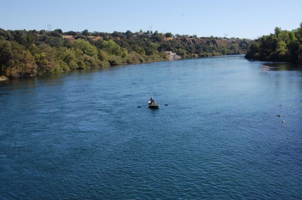
California’s largest river, the Sacramento, provides about 30 percent of the state’s surface water runoff. 

Once called “the Nile of the West,” the Sacramento River drains the inland slopes of the Klamath Mountains, the Cascade Range, the Coast Ranges and the western slopes of the northern Sierra Nevada. The river stretches some 384 miles from its headwaters near Mount Shasta to the Sacramento-San Joaquin Delta.

  • Read more
Aquapedia background February 11, 2014 Layperson's Guide to the Delta Sacramento-San Joaquin Delta Map

Sacramento-San Joaquin Delta

Image shows an aerial view of the Sacramento-San Joaquin DeltaThe Sacramento-San Joaquin Delta is the largest freshwater tidal estuary of its kind on the west coast of the Americas, providing important habitat for birds on the Pacific Flyway and for salmon and other fish that live in or pass through the Delta. It’s also the hub of California’s two largest surface water delivery projects, the federal Central Valley Project and the State Water Project. The Delta provides a portion of the drinking water for some 30 million Californians and irrigation water for large portions of the state’s $61 billion agricultural industry.

For nearly half a century, the Delta has been embroiled in continuing controversy over the struggle to restore the faltering ecosystem while maintaining its role as the hub of the state’s water supply. That challenge continues to this day and will be made more difficult by the growing impacts of climate change.   

  • Read more
Aquapedia background May 26, 2026

Sacramento-San Joaquin Delta Ecosystem

Image shows Lookout Slough Tidal Habitat Restoration Project in Solano County, an open water habitat for fish and wildlife in the Sacramento-San Joaquin Delta.The Sacramento-San Joaquin Delta, part of the largest freshwater tidal estuary on the West Coast, supports more than 55 fish species and more than 750 plant and wildlife species. The Delta’s most iconic native fish is salmon, which rely on a healthy ecosystem for food and refuge during their migration from the streams where they were born through the estuary to the ocean, and then back again to spawn. But the Delta ecosystem has been put under increasing stress by a combination of factors, imperiling not just populations of salmon, but several other species as well.

  • Read more
Aquapedia background May 29, 2026

Sacramento-San Joaquin Delta Governance

Image shows an aerial view of the Sacramento-San Joaquin Delta.Dozens of agencies have interests or jurisdiction in the Sacramento-San Joaquin Delta, ranging from federal and state water supply and wildlife agencies to local governments and water agencies that rely on the Delta for their supplies. While that makes for a messy and constantly changing regulatory tangle, two state agencies, the State Water Resources Control Board and, to a somewhat lesser extent, the Delta Stewardship Council, act as the primary water management referees. State and federal courts have, at times, weighed in as well.

  • Read more
Aquapedia background May 29, 2026

Sacramento-San Joaquin Delta Infrastructure

Image shows the Delta Cross Channel, a diversion channel built as part of the federal Central Valley Project.
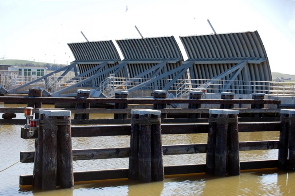
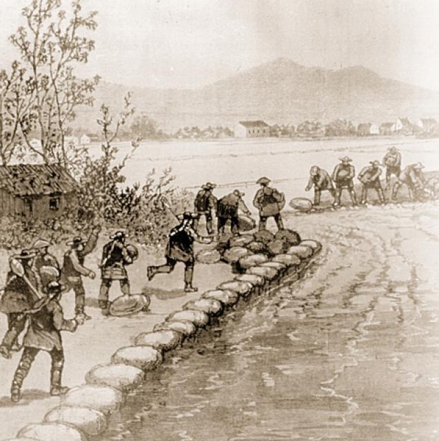
For roughly a century, between the mid-1800s and the 1950s, the primary infrastructure in the Delta consisted of levees built to enable farming in the Delta itself. But with construction of the Central Valley Project (CVP) and the State Water Project (SWP), the Delta became a critical link in the state’s complex water distribution system. Today, the majority of people, farms and businesses in California depend on water transported through the Sacramento-San Joaquin Delta.

  • Read more
Aquapedia background February 11, 2014

Sacramento-San Joaquin Delta and Salinity

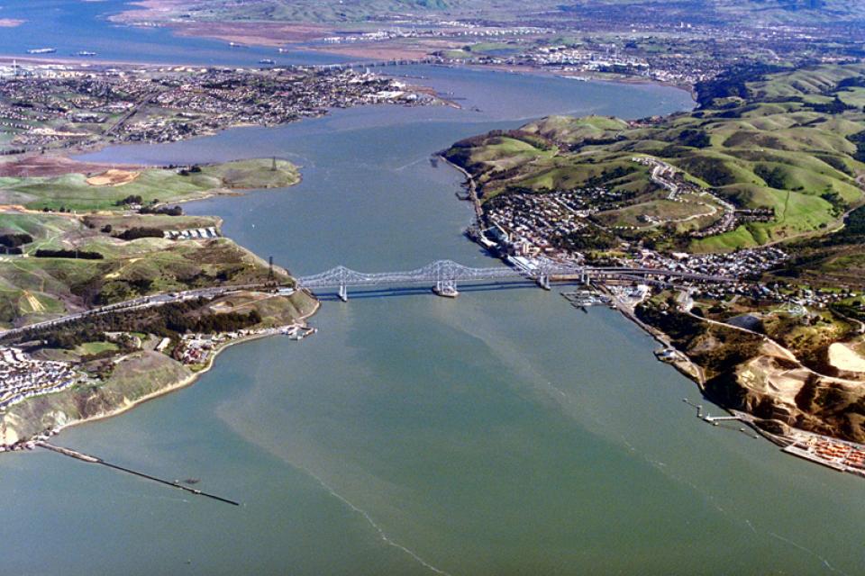
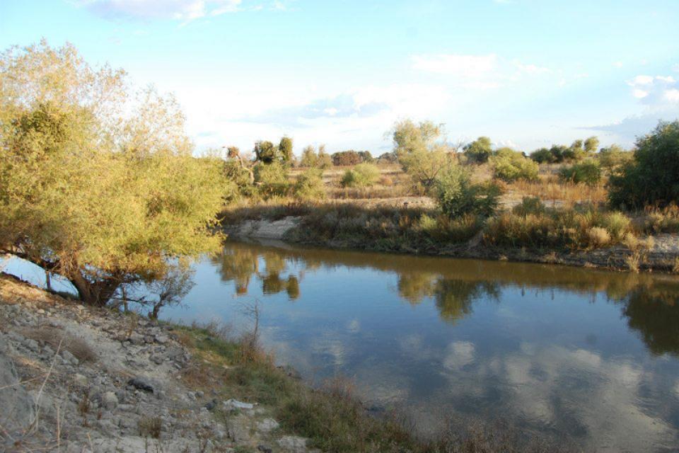
The Sacramento-San Joaquin Delta always has been at the mercy of river flows and brackish tides.

Before human intervention, salty ocean water from the San Francisco Bay flooded the vast Delta marshes during dry summers when mountain runoff ebbed. Then, during winter, heavy runoff from the mountains repelled sea water intrusion.

  • Read more
Historic sketch of laborers building a levee in the Sacramento-San Joaquin Delta.
Aquapedia background February 11, 2014

Sacramento-San Joaquin Delta Chronology

1772 First recorded sighting of the Bay Delta by Spanish explorers.

1849 Settlers begin farming in the Delta.

1861 Reclamation District Act authorized, allowing drainage of Delta lands and construction of sturdier flood control levees.

1879 The striped bass is brought by rail from the East Coast to the Delta.

  • Read more
Aquapedia background February 11, 2014

Sacramento-San Joaquin Delta Inflow Outflow

The fresh water inflow and outflow of the Sacramento-San Joaquin Delta is critical to its vitality and survival.

Freshwater flows from the Delta meets saltwater from the ocean near Suisun Marsh located to the east of San Francisco Bay. Suisun Marsh and adjoining bays are the brackish transition between fresh and salt water. But the location of that transition is not fixed.

  • Read more
Aquapedia background February 11, 2014 California Water Map Layperson's Guide to California Water

Safe Drinking Water Act

The federal Safe Drinking Water Act sets standards for drinking water quality in the United States.

Launched in 1974 and administered by the U.S. Environmental Protection Agency, the Safe Drinking Water Act oversees states, communities, and water suppliers who implement the drinking water standards at the local level.

The act’s regulations apply to every public water system in the United States but do not include private wells serving less than 25 people.

According to the EPA, there are more than 160,000 public water systems in the United States.

  • Read more
Aquapedia background September 7, 2016

Salinity

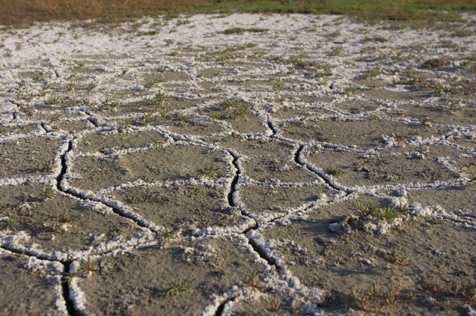
Excess salinity poses a growing threat to food production, drinking water quality and public health. Salts increase the cost of urban drinking water and wastewater treatment, which are paid for by residents and businesses. Increasing salinity is likely the largest long-term chronic water quality impairment to surface and groundwater in California’s Central Valley.

  • Read more
Aquapedia background February 11, 2014 Colorado River Basin Map

Salton Sea

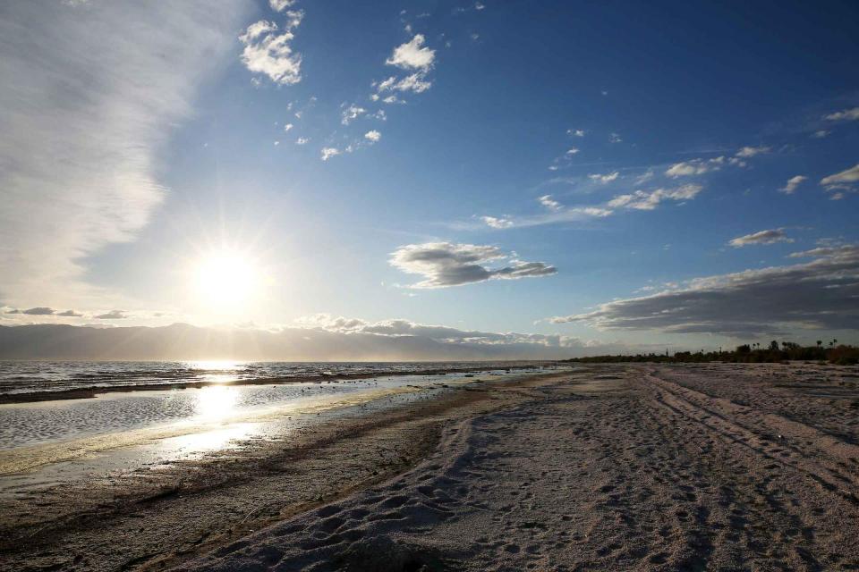
As part of the historic Colorado River Delta, the Salton Sea regularly filled and dried for thousands of years due to its elevation of 237 feet below sea level.

The most recent version of the Salton Sea was formed in 1905 when the Colorado River broke through a series of dikes and flooded the seabed for two years, creating California’s largest inland body of water. The Salton Sea, which is saltier than the Pacific Ocean, includes 130 miles of shoreline and is larger than Lake Tahoe. 

  • Read more
Aquapedia background February 11, 2014

San Francisco Bay

San Francisco Bay and the inter-connected Sacramento-San Joaquin Delta form the largest estuary on the Pacific West Coast.

The estuary is shaped by water flows from two directions.

  • Read more
Aquapedia background February 11, 2014

San Joaquin River and San Joaquin River Restoration Program

San Joaquin RiverFlowing 366 miles from the Sierra Nevada to Suisun Bay, the San Joaquin River provides irrigation water to thousands of acres of San Joaquin Valley farms and drinking water to some of the valley’s cities. It also is the focal point for one of the nation’s most ambitious river restoration projects to revive salmon populations.

  • Read more
Aquapedia background February 11, 2014

San Joaquin Valley

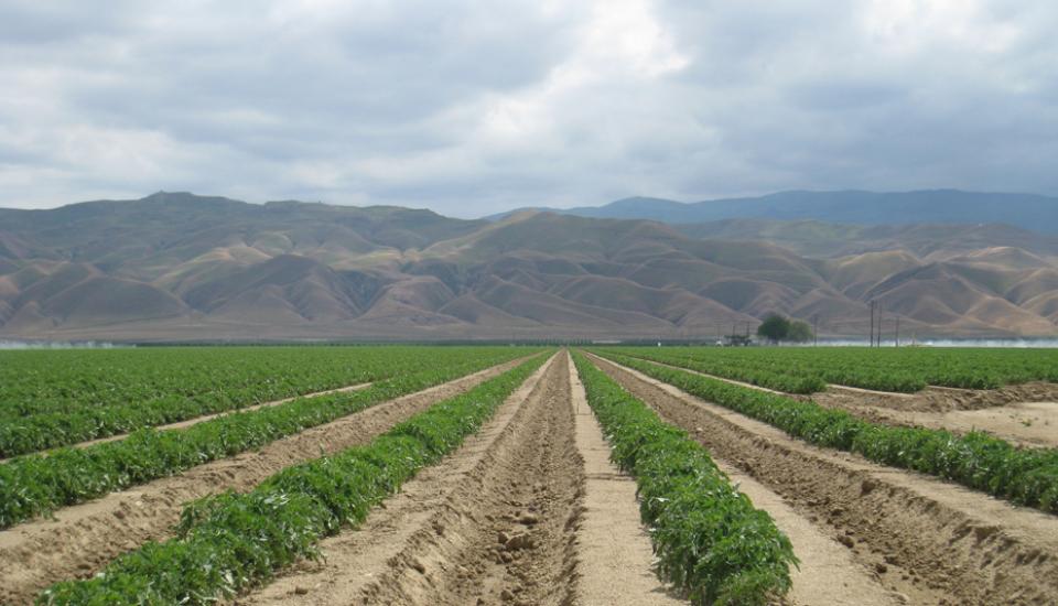
Located in the middle of California, the San Joaquin Valley is bracketed on both sides by mountain ranges. Long and flat, the valley’s hot, dry summers are followed by cool, foggy winters that make it one of the most productive agricultural regions in the world.

The valley stretches from across mid-California between coastal ranges in west and the Sierras on the east. The region includes large cities such as Fresno and Bakersfield, national parks such as Yosemite and Kings, millions of people, and fertile farmland.

  • Read more
Image shows land in 2007 that once comprised the now-closed Kesterson Reservoir.
Aquapedia background February 11, 2014

San Luis Drain

The San Luis Drain centers on the controversial idea of funneling agriculture drainage water for discharge in the Sacramento-San Joaquin Delta.

  • Read more
Aerial view of San Luis Reservoir
Aquapedia background February 11, 2014 Dams Layperson's Guide to the Central Valley Project Layperson's Guide to the State Water Project

San Luis Reservoir

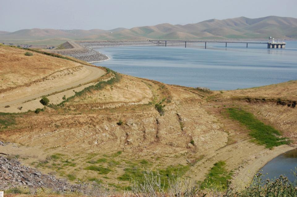
The San Luis Reservoir is the nation’s largest off-stream reservoir, serving as a key water facility for both the State Water Project (SWP) and the federal Central Valley Project (CVP).

  • Read more
Aquapedia background February 11, 2014

Santa Ana River

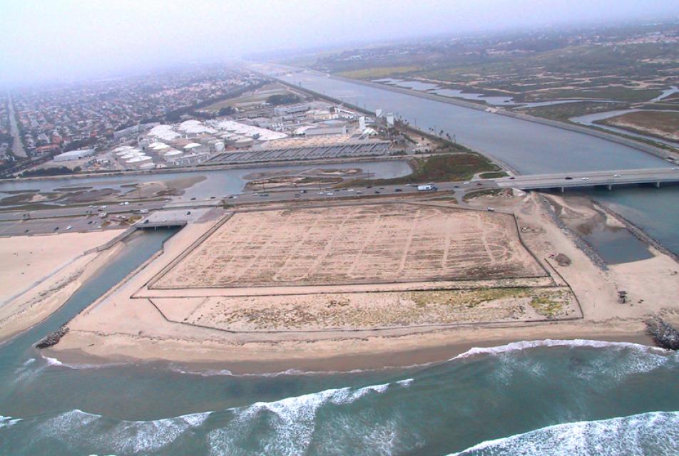
Southern California’s Santa Ana River is the largest watershed drain­age south of the Sierra and is located largely in a highly urbanized, highly regulated setting.

At about 100 miles long and with more than 50 tributaries, the Santa Ana spans parts of San Bernardino, Riverside and Orange counties as it drains 2,840 square miles of land.

  • Read more
Aquapedia background August 15, 2016

Saturated Zone

Area below the water table in which the soil is completely saturated with groundwater.

  • Read more
Aquapedia background January 30, 2014 Anne J. Schneider Fund Lecture Series

Anne J. Schneider

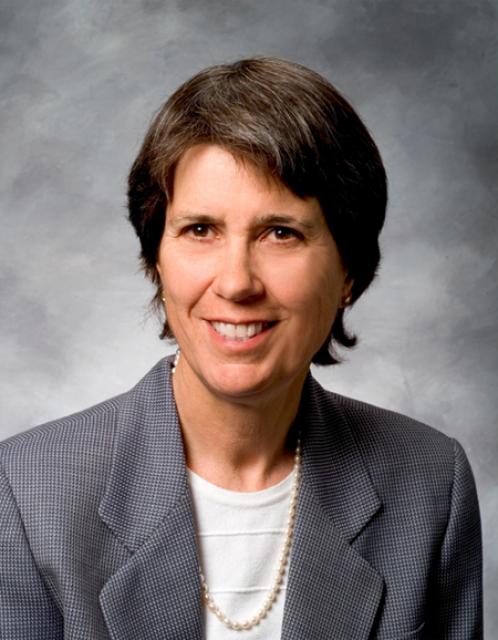
Anne J. Schneider (1947-2010) is acknowledged as one of the first women to become well-known and well-respected in the field of California and Western water law. “Anne was an amazing person — an accomplished college athlete, mountain climber, skier, marathon runner, velodrome and long-distance cyclist; a devoted mother; a dedicated conservationist,” said Justice Ronald B. Robie in the Inaugural Anne J. Schneider Memorial Lecture in May 2012.

  • Read more
Aquapedia background February 11, 2014

Seawater Intrusion

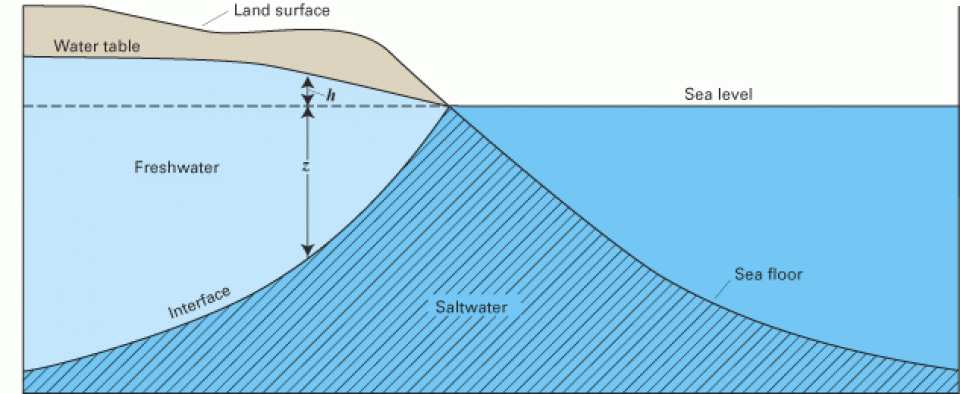
Seawater intrusion can harm groundwater quality in a variety of places, both coastal and inland, throughout California.

Along the coast, seawater intrusion into aquifers is connected to overdrafting of groundwater. Additionally, in the interior, groundwater pumping can draw up salty water from ancient seawater isolated in subsurface sediments.

  • Read more
  • 1
  • 2
  • 3
  • next ›
  • last »

Aquapedia

  • Alphabetical List of Subjects
    • A
    • B
    • C
    • D
    • E
    • F
    • G
    • H
    • I
    • J
    • K
    • L
    • M
    • N
    • O
    • P
    • Q
    • R
    • S
    • T
    • U
    • V
    • W
    • X
    • Y
    • Z
  • Historical Water People
  • Where Does My Water Come From?
  • Timelines
  • Videos
  • Image Gallery
  • Water Directory
  • Online Resources
  • Useful Acronyms
  • About Aquapedia
Footer pod May 20, 2014

Water Education Foundation

Copyright © 2026 Water Education Foundation. All rights reserved.

The Water Education Foundation is a nonprofit, tax-exempt, 501(c)3 organization, federal tax ID #942419885.

Privacy Policy

Donor Privacy Policy

  • Read more
Footer pod May 20, 2014

Contact Information

2151 River Plaza Drive, Suite 205
Sacramento CA 95833

Telephone (916) 444-6240

Contact Us via email

  • Read more

Quicklinks

Footer quicklink May 20, 2014

Contact Us

  • Read more
Footer quicklink May 20, 2014

Donate Today

  • Read more
Footer quicklink May 20, 2014

Tours

  • Read more
Footer quicklink May 20, 2014

Newsletter Signup

  • Read more
Footer quicklink May 20, 2014

Foundation News

  • Read more
Footer quicklink May 20, 2014

Calendar

  • Read more

Log in

  • Create new account
  • Request new password

Commands

  • Support portal
  • Log in