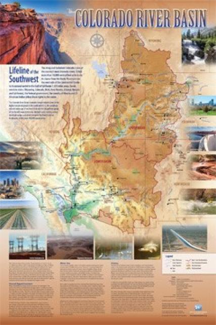
Colorado River
 Often referred to as the lifeline of
the Southwest, the Colorado River and its tributaries provide
water to nearly 40 million people and irrigate 5 million acres of
farmland in California, Arizona, Nevada, Colorado, New Mexico,
Utah and Wyoming. It also serves about 2.3 million people and
500,000 farmland acres in northern Mexico. The river’s water is
critical for 30 federally recognized Native American tribes,
Grand Canyon National Park and several other units of the
National Park system, and a number of wildlife refuges. Colorado
River dams can provide enough electricity for about 4.2 million
homes.
Often referred to as the lifeline of
the Southwest, the Colorado River and its tributaries provide
water to nearly 40 million people and irrigate 5 million acres of
farmland in California, Arizona, Nevada, Colorado, New Mexico,
Utah and Wyoming. It also serves about 2.3 million people and
500,000 farmland acres in northern Mexico. The river’s water is
critical for 30 federally recognized Native American tribes,
Grand Canyon National Park and several other units of the
National Park system, and a number of wildlife refuges. Colorado
River dams can provide enough electricity for about 4.2 million
homes.
BACKGROUND
From its headwaters in Colorado and Wyoming, the Colorado River runs some 1,450 miles toward the Gulf of California. Native Americans have lived in the Colorado River Basin for at least 12,000 years, but it wasn’t until 1869 that an expedition led by John Wesley Powell first mapped the Colorado and the Green River, its largest tributary.
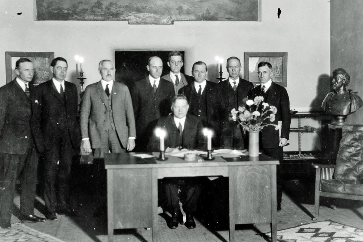
The Colorado River Compact, signed in 1922, set the stage for a massive water-development effort on the river. Over the years, the Compact was supplemented by a series of treaties, compacts, decrees, statutes and other agreements collectively known as the Law of the River.
 The Compact divided 15 million
acre-feet of water evenly between the Upper Basin — Colorado,
Wyoming, Utah and New Mexico — and the Lower Basin — California,
Arizona and Nevada. In 1944, a treaty with Mexico granted that
country 1.5 million acre-feet of the river’s water, making for a
total of 16.5 million acre-feet allocated under the Law of the
River.
The Compact divided 15 million
acre-feet of water evenly between the Upper Basin — Colorado,
Wyoming, Utah and New Mexico — and the Lower Basin — California,
Arizona and Nevada. In 1944, a treaty with Mexico granted that
country 1.5 million acre-feet of the river’s water, making for a
total of 16.5 million acre-feet allocated under the Law of the
River.
Roughly three-quarters of the river’s water is diverted for a wide variety of irrigated agriculture, from small ditch companies in the headwaters states to massive irrigation districts in the Palo Verde, Imperial and Coachella valleys in California, in central and southwestern Arizona, and in Mexico.
Much of the water is diverted outside of the Colorado River Basin itself for municipal use. In Colorado, water is diverted across the Continental Divide to supply Denver and other Front Range cities. Water is diverted in Utah to Salt Lake City and other communities on the Wasatch Front. In New Mexico, water is diverted into the Rio Grande Basin to serve Albuquerque; in Wyoming to serve Cheyenne; and in California to the heavily urbanized coastal plain across six counties that includes the cities of Los Angeles and San Diego.
CONTROVERSIES AND CHALLENGES
In dividing the river’s water between the Upper and Lower basins, the Colorado River Compact set up fundamental tensions between the two regions related to their responsibilities to each other, which continue to this day. It also raised a number of differences in interpretation over ambiguities in the Law of the River that have yet to be resolved. Three of the biggest are the Upper Basin’s precise obligation to provide water to the Lower Basin downstream; the relative responsibilities of the Upper and Lower basins in ensuring that Mexico receives its legal entitlement to water; and how water that the Lower Basin uses from local tributaries — most prominently, the Gila River in Arizona — factors into its Compact entitlement. For the most part, these controversies have not been raised in court but are increasingly likely to as the river’s flows decline and supplies for each of the basins become tighter.
A quarrel between Arizona and California, however, did result in a protracted legal battle over their respective shares of the river. By 1952, that quarrel led to the Arizona v. California case. Arizona wanted to ensure that its share of water allocated under the Law of the River remained intact so that it could develop what would become the Central Arizona Project (CAP) to deliver water to the growing cities of Phoenix and Tucson, as well as farms. Arizona appealed to the U.S. Supreme Court to confirm California’s limits of 4.4 million acre-feet annually, plus half of any surplus. The court’s 1963 opinion and 1964 decree confirmed this and established Arizona’s 2.8 million acre-feet annual allocation (not counting supply from tributaries like the Gila River).
Serving as the “lifeline of the Southwest,” the Colorado River provides water to 40 million people and more than 5 million acres of farmland in a region encompassing some 246,000 square miles.
In 1968, an agreement was struck between California and Arizona, leading to the Colorado River Basin Project Act. The act authorized construction of the CAP but stipulated that CAP would take the first cut in the Lower Basin in the event of a shortage to ensure California would still receive its full 4.4 million acre-feet. Though that bargain resolved the quarrel, at least on paper, it continues to be a source of occasional tension between the two states.
Because water use in California outpaced that in Arizona and Nevada, which were more slowly “growing into” their full Colorado River apportionments, the state for decades continued to rely on surplus water in the Lower Basin to meet demands in excess of its basic water apportionment. But as populations in Arizona and Nevada grew and used more of their share of the river, California was pressured to cut back.
In 2003, the Interior secretary restricted California’s use for the first time to its basic apportionment of 4.4 million acre-feet. To comply, the state adopted the “4.4 Plan,” aimed at gradually reducing its use of the river through agricultural and urban conservation, water transfers, fallowing agreements, groundwater banking and lining sections of the All-American Canal to prevent seepage. A significant component was a long-term water transfer between the Imperial Irrigation District and San Diego County Water Authority. The transfers have reduced runoff from farmland into the Salton Sea, shrinking the sea and causing health and environmental concerns that the state is still working to address.
Another issue of contention has been salinity levels in the river, which are primarily caused by runoff from farmland upstream that carries salts into the river. The problem is felt most acutely by Mexico which, as the user last in line on the river, gets water with the highest concentrations of salt. In 1961, Mexico filed a diplomatic protest over the problem. That led to the 1974 Colorado River Basin Salinity Control Act, which established a suite of measures to control salt levels in the river.
Historically, the Colorado River sustained a range of habitats and ecosystems on its path through mountains and deserts toward the Colorado River Delta, where the river empties into the Gulf of California. Today, however, practically every drop of the river’s water is allocated for use and, in most years, it no longer reaches the sea.
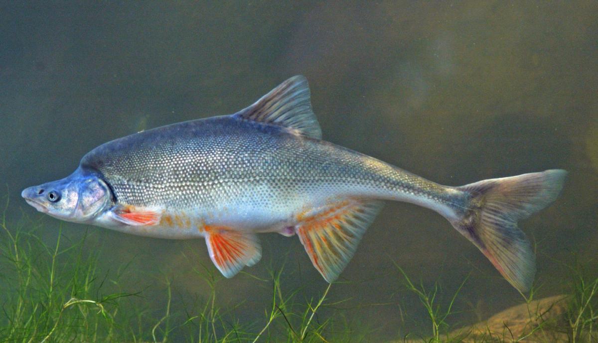 Due to the impacts of dams and
reservoirs, 44 of 49 fish species native to the Colorado River
Basin are threatened, endangered or extinct. Since the 1990s,
several programs have been launched to boost endangered species
and restore their habitat, including the Upper Colorado River
Endangered Fish Recovery Program, the San Juan River Basin
Recovery Implementation Program, the Glen Canyon Adaptive
Management Program and the Lower
Colorado River Multi-Species Conservation Program.
Due to the impacts of dams and
reservoirs, 44 of 49 fish species native to the Colorado River
Basin are threatened, endangered or extinct. Since the 1990s,
several programs have been launched to boost endangered species
and restore their habitat, including the Upper Colorado River
Endangered Fish Recovery Program, the San Juan River Basin
Recovery Implementation Program, the Glen Canyon Adaptive
Management Program and the Lower
Colorado River Multi-Species Conservation Program.
Mexico, working together with a number of U.S. conservation organizations, was also instrumental in launching an effort to restore the faltering ecosystem in the Colorado River Delta. Minutes 319 and 323 — essentially supplements to the 1944 U.S.-Mexico water treaty — provide a framework for environmental restoration in the Delta, including the release of “pulse flows” from Mexico’s Morelos Dam, on the U.S.-Mexico border, into the Delta.
Meanwhile, Native American tribes in the Colorado River Basin have been increasingly asserting their treaty rights to water from the river. In its 1908 Winters decision, the U.S. Supreme Court ruled that the treaties creating tribal reservations convey a right not only to land, but to water as well. Today, 22 of the 30 federally recognized tribes in the Colorado River Basin hold rights to 3.2 million acre-feet, or about one-fifth of the water apportioned under the Colorado River Compact, with other tribal claims still unresolved.
The most intractable problem on the river is that the numbers on which the Law of the River are built simply don’t work. The Compact and the subsequent treaty with Mexico allocated 16.5 million acre-feet. But annual flows from 1922, when the Compact was signed, until the end of the 20th century averaged just 14.7 million-acre-feet. That problem has only gotten worse during the 21st century. In 2000, a drought began on the Colorado River that has persisted to the present day, and which scientists now understand as the worst drought on the river in at least 1,200 years. Since the drought started in 2000, flows have averaged 12.4 million acre-feet, just 75 percent of the amount allocated under the Law of the River.
The so-called Millennium Drought spurred a series of negotiations among the seven states and Mexico to develop new operational strategies to weather the growing crisis. A set of “interim guidelines,” was signed in 2007, and in 2019, the Basin states agreed to a set of “drought contingency plans” that layered additional shortage protections onto the existing interim guidelines.
The entire package of agreements first negotiated in 2007 helped stave off a shortage declaration for nearly a decade and a half. But in August 2021, the U.S. Bureau of Reclamation announced the first-ever shortage, prompting cuts to Arizona, Nevada and Mexico starting in January 2022, reductions that have continued in subsequent years.
LOOKING AHEAD
 The 2007 interim guidelines and
drought contingency plans expire in 2026, so the seven Colorado
River states have been working to negotiate a successor
agreement. But the negotiations have proven extremely
contentious, and the states may only be able to reach a consensus
on a new, short-term agreement — or have an operating agreement
unilaterally imposed on them by the secretary of the Interior.
The prospect of a legal fight over disputed provisions in the Law
of the River, or against the Interior department, is also high.
The 2007 interim guidelines and
drought contingency plans expire in 2026, so the seven Colorado
River states have been working to negotiate a successor
agreement. But the negotiations have proven extremely
contentious, and the states may only be able to reach a consensus
on a new, short-term agreement — or have an operating agreement
unilaterally imposed on them by the secretary of the Interior.
The prospect of a legal fight over disputed provisions in the Law
of the River, or against the Interior department, is also high.
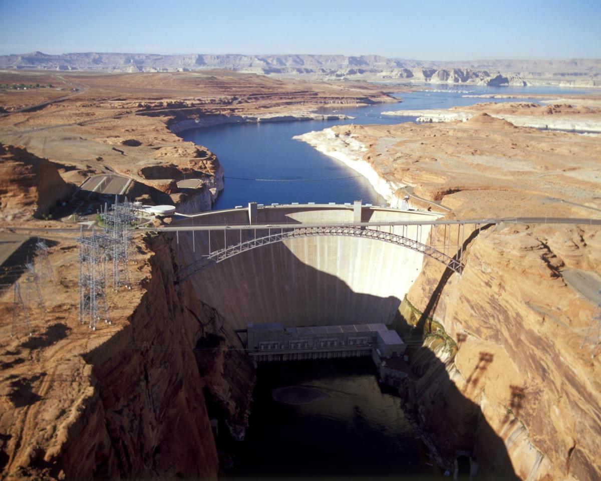
This is a critical era on the Colorado River. Lake Powell could drop low enough that electricity can no longer be generated there by the end of 2026. And flows in the river are likely to decline even further.
Climate models suggest that increased temperatures could result in an additional decline of 4 to 20 percent in flows by the middle of this century.
Updated: June 2026.
")