California’s climate, characterized by warm, dry summers and mild
winters, makes the state’s water supply unpredictable. For
instance, runoff and precipitation in California can be quite
variable. The northwestern part of the state can receive more
than 140 inches per year while the inland deserts bordering
Mexico can receive less than 4 inches.
By the Numbers:
Precipitation averages about 193 million acre-feet per year.
In a normal precipitation year, about half of the state’s
available surface water – 35 million acre-feet – is collected in
local, state and federal reservoirs.
California is home to more than 1,300 reservoirs.
About two-thirds of annual runoff evaporates, percolates into
the ground or is absorbed by plants, leaving about 71 million
acre-feet in average annual runoff.
El Niño has arrived in the Pacific Ocean, and federal
forecasters say it could become one of the strongest on record
by winter — raising the odds for, but not guaranteeing, a
wetter and more volatile rainy season in California. Scientists
at the National Oceanic and Atmospheric Administration on
Thursday announced there is a 63% chance that very strong El
Niño conditions will appear from November to January. … Some
computer models are showing water temperatures could jump to
5.4 degrees Fahrenheit above normal, said Daniel Swain, a
climate scientist with the University of California Agriculture
and Natural Resources division. … He mentioned higher
chances of major winter rainstorms in California, which could
bring huge snow totals to the Sierra, along with
higher chances of Pacific hurricanes.
Monsoon season is Arizona’s stormiest time of year. Each June
into early July, our predominant winds shift out of the south
as high pressure builds near the Four Corners. That shift in
the winds brings in moisture, which rises to form towering
thunderstorms in the heat of the day. The monsoon season
officially begins on June 15 and runs until September 30.
During that time, thunderstorms often form in the heat of the
day, bringing heavy rain, lightning, damaging winds, dust
storms, and flooding. Not all monsoons are the same,
though. Some years, our monsoon season is hot and dry, while
other years are not as hot and very rainy. … The NOAA
Climate Prediction Center has odds favoring a
wetter-than-normal monsoon across Arizona this year.
Reservoir levels in the East Bay are above average for this
time of year, signaling residents won’t have to conserve water
– or incur extra drought-related charges – in the coming summer
months. Water storage levels are nearly full at 96%, according
to the most recent East Bay Municipal Utility District water
supply report. Nelsy Rodriguez, a public information
representative for EBMUD, said that an early Sierra Nevada
snowpack melt, in addition to a lot of April rain, helped
refill reservoirs. “We are in a strong position heading
into summer. We are well above any potential drought trigger,”
Rodriguez said. “We have enough storage now to meet our
customers’ needs.”
The Kern County Water Agency will erase a $14 million debt and
continue selling water at a lower rate to the Western Hills
Water District as part of a deal struck just days before it
said it would cut off the tap. The draft deal caps more than a
year of start-and-stop threats from KCWA to cut off water to
Western Hills, which is the exclusive purveyor to the 600-home
Diablo Grande development in the foothills west of Patterson.
The most recent cut-off date was May 31. … The details
of the deal are still vague as the two sides have only signed a
“letter of intent.” … However, some basics, including the
erasure of the $14 million debt, were released in a public
announcement sent to Diablo Grande residents.
… A late-season storm has brought rain across much of
California, particularly the northern half, and snow to
the higher elevations of the Sierra Nevada range. Many
locations have recorded a quarter inch to an inch of rain this
week. The precipitation is welcome at a time of year when
vegetation is drying out and the risk of wildfires is
increasing. … But the low threat of fires is not
expected to last long with a return to warm, dry weather
forecast for next week. … On Tuesday, thunderstorms
rumbled through the Central Valley, and short bursts of rain
and hail were reported in the greater Sacramento area. On
Wednesday, snow dusted the Sierra Nevada. … “These are
beneficial rains, nothing that causes flooding,” said Brian
Hurley, a meteorologist with the Weather Prediction Center.
In an event earlier this month, PPIC Water Policy Center
research associate Kyle Greenspan presented new research about
California’s efforts to reduce severe wildfire hazards.
… Scott Stephens, Henry Vaux special professor of forest
policy at UC Berkeley, explained the problem. “It’s about
what’s going on inside that fire. Maybe 30–40% of that 2020
year of fire was high severity, so you’re killing all trees
over thousands of acres continuously. That’s incredibly
detrimental.” It’s particularly problematic for the state’s
water supply, the vast majority of which originates in
California’s headwaters regions, like the Sierra-Cascade
Mountains.
A late-season storm is rolling through the Sierra Nevada this
week, bringing snowfall, high winds and
lightning. Although the storm system is expected to target
the whole region, the most snow is likely to fall in the
central and southern Sierra. From Tuesday through Thursday,
up to about 8 inches [of snow] could stick on the
highest peaks, according to the National Weather
Service office in Reno. … There’s about an 80% chance of
at least light precipitation regionwide, as temperatures dip 15
to 20 degrees below the averages for late May. Snow levels
could drop to 5,500 feet by Wednesday morning; hover between
6,500 and 7,500 feet from Wednesday through Thursday morning;
and then rise up to 8,000 feet by Thursday afternoon.
Something is brewing over the Pacific Ocean that will have
wide-reaching implications for weather across the globe. As it
grows, so does the buzz over the potential for a super El Niño.
A Super El Niño is a stronger-than-normal El Niño, meaning
the surface waters of the Pacific are warming along the
equator. And some weather experts are predicting this one could
be a record-setter. That translates to the potential for
flooding, landslides, record temperatures and a supercharged
hurricane season. … Cowboy State Daily meteorologist Don Day
is aware of these predictions and projections. … “We are
undoubtedly going to have an El Niño, and it’s going to be a
strong one, but I’m telling people to proceed with caution,” he
said. “Making leaps into projections of what’ll happen six
months down the road is not smart.”
A late-season snowstorm has brought several inches of May
powder to the high country, offering a modest but welcome boost
to a state grappling with drought conditions. Snow fell
steadily throughout the day Monday and into Tuesday morning,
with more than five inches of snow reported in Aspen Springs,
Walden, Nederland, Sawpit, and Estes Park. … While the storm
is part of a pattern of late-April and May precipitation
events, the 9NEWS Weather Impact Team has cautioned it will do
little to reverse the region’s critically low snowpack [in the
headwaters of the Colorado River].
Statewide snowpack is currently sitting around 20% of
normal, and even lower in parts of Clear Creek County,
where it stands at just 9%. … Still, the moisture carries
real benefits as Colorado begins the summer season.
It’s the time of year, when a massive 100-foot rubber
dam emerges from the bottom of the Russian River near
Forestville. That’s to ensure the 600,000 residents of Sonoma
and Marin counties who rely on the river for drinking water
have a stable supply during summer, when demand for water
increases but river levels are lower. Monday marked the
start of the three-day process of raising the dam, which was
first raised in the 1970s. … Most of the year, residents
of the area consume 20-40 million gallons of water a day. At
the height of summer, consumption can reach up to 60 million
gallons a day.
Scientists predict that an upcoming “Super El Niño” will make
2026 to 2027 the hottest years on record and bring significant
sea level rise to the Bay. An update on Thursday from the
National Weather Service’s Climate Prediction Center said that
El Niño is likely to emerge as soon as May and persist through
the end of winter. While El Niño, a warming of the ocean,
and La Niña, a cooling of the ocean, are natural patterns that
come and go every 2 to 7 years, this year’s El Niño could be
one of the strongest on record. … Beyond sustained sea
level rise, scientists expect major storms and flooding
starting this winter. They predict that these storms will be
particularly strong as the effects of El Niño compound with the
effects of climate change.
The likelihood of a potentially powerful El Niño taking shape
in the Pacific Ocean is rising, heightening concerns that
Southern California could be in for an extreme rainy season.
There is now an 82% chance that El Niño is likely to
emerge over the next few months, up from the 61%
chance estimated a month ago. And there’s now a 96% chance
that the climate pattern — characterized by warmer
ocean waters in the central and eastern tropical Pacific — will
be in force this winter, the National Weather Service’s Climate
Prediction Center said Thursday. … While it’s no given
that El Niño will bring a potent rain season to Southern
California, some previously high-powered patterns have been
monsters.
Yesterday, the Klamath National Forest released the final snow
surveys of the season which found that snowpack in the Scott
River watershed had almost entirely disappeared by May 1. State
and federal water officials have described this year’s snowpack
conditions as among the worst California has seen in modern
recordkeeping. According to the U.S. Forest Service, snow depth
and snow water equivalent — the amount of water stored in the
snowpack — measured just 0.8% of historical average.
… The findings mirror statewide trends documented this
spring. The California Department of Water Resources announced
on April 1 that surveyors found “no measurable snow” during the
critical Phillips Station snow survey in the Sierra Nevada
after what officials described as a record-hot and
exceptionally dry March.
In a clear sign that California is not facing water shortages
or a drought this summer, Lake Oroville, the state’s
second-largest reservoir and a key component of California’s
water system, has nearly filled to the top. The massive
reservoir, contained behind America’s tallest dam, was 99% full
on Tuesday afternoon, at 122% of its historical average for
mid-May and still slowly rising, with just two feet to go to
fill entirely. … The water from Oroville and the State
Water Project is sent hundreds of miles to cities and farms
across the state, serving 27 million people from San
Jose to San Diego. … The very low snowpack
[this year, however] means that as Oroville and other massive
reservoirs are slowly drawn down … they won’t be topped up in
the coming months by melting snow. So although this year’s
reservoir levels are good news, experts say, another wet winter
will be needed next year because by this fall,
reservoir levels may be lower than normal.
The debate over Sacramento’s water has been going on for
decades. From farming to urban uses, it’s a natural resource
that is in high demand, especially during droughts. On Monday
night, a celebration was held to announce that a new signed
agreement in place to make sure there’s enough water in the
future. Ashlee Casey with the Sacramento Water Forum said that
opposing groups including environmentalists, developers,
farmers and cities have all reached an agreement on how to best
use water that’s released from Folsom Dam and flows
down the American River. … Water usage is
outlined in a 334-page document that will guide the region over
the next 25 years.
Colorado waved goodbye to winter with a late-season blast, as a
May snowstorm brought more than 2 feet of snow to some areas of
the state. But was the storm enough to keep the snowpack above
the zeroth percentile? The statewide snowpack is at 25% of
median as of May 8, meaning the mountains have
one-quarter of the typical amount of snow-water equivalent
compared to the median for that specific date. Despite
still being on the lower end of snowpack for an average spring
in Colorado, the state is officially out of historically low
levels for the first week of May. … While this is good
news, Colorado is still on track to lose its snowpack earlier
than normal.
Winter is months away, but the mere possibility that a major El
Niño will whack places like San Diego late this year is
stirring deep concern in the town square that is social media.
A flood tide of people are saying they’re worried that warm
water from the equatorial Pacific will produce a “super” El
Niño that will enhance winds, waves and rain storms on the West
Coast. … “Confidence is building, the trends are there,”
said Brian D’Agostino, who oversees wildfire and climate
science at San Diego Gas & Electric. “El Niño is on the way.”
… There’s no guarantee of this. “The research is still
being done on what impacts this will have,” said D’Agostino,
who is responsible for spotting storms that could damage
SDG&E’s delivery system.
A super El Niño is increasingly likely later this year, and it
could become record strong with potential global impacts on
rainfall and temperatures from summer through winter.
… The majority of model forecasts now suggest there is
at least a 50-50 chance this El Niño could become a “super El
Niño,” one in which ocean surface temperatures are at least 2
degrees Celsius warmer than average. … In winter, the
southern, or subtropical, branch of the jet stream usually is
turbocharged in a stronger El Niño. That means a wetter
winter usually is the result across the southern tier of states
from parts of California and the Desert Southwest.
… This could also mean more snow across these areas if
the air is cold enough.
A spring snowstorm across the Denver metro area is
bringing moisture and a temporary break from dry conditions,
but water managers say it will do little to improve the
region’s long-term supply. Despite steady rain and snow in
cities like Denver and Aurora, the storm largely missed key
mountain basins that feed the reservoirs serving much of the
Front Range. … Most of the water used in Aurora and
Denver comes from snowpack in the mountains, which melts
gradually and flows into river systems like the South Platte,
Colorado and Arkansas basins. This year, that snowpack has been
far below normal. … As a result, even a noticeable storm
in the metro area is not expected to make much of a difference.
*IMPORTANT* In anticipation of high demand, the Foundation will be allocating tickets via a lottery method with a maximum of 3 entrants per organization. Tickets will be released in batches over time. Details coming soon.
This special, first-ever Foundation water tour will only be offered once! Join us on this special journey as we examine water issues along the Kern River, from its mountain-fed headwaters in the southern Sierra Nevada to its terminus in the Central Valley west of Bakersfield. Among the planned stops are both upper forks of the Kern River, Lake Isabella, lower Kern River canyon, the Friant-Kern Canal, irrigated agriculture in the valley, the Kern Water Bank and more.
Hyatt Place Bakersfield
310 Coffee Rd.
Bakersfield, CA 93309
The 24-page Layperson’s Guide to California Water provides an
excellent overview of the history of water development and use in
California. It includes the latest information on the state’s
changing hydrology, recent water conservation legislation and the
state’s efforts to stretch the available water supplies.
The 24-page Layperson’s Guide to the Delta explores the competing
uses and demands on California’s Sacramento-San Joaquin
Delta. The 11th edition examines this critical
water hub and its myriad challenges. The 2025 version
includes the latest information on the tunnel project, habitat
restoration efforts, climate change impacts and an updated
section on the legal and political facets of the Delta.
This tour explored the lower Colorado River firsthand where virtually every drop of the river is allocated, yet demand is growing from myriad sources — increasing population, declining habitat, drought and climate change.
The 1,450-mile river is a lifeline to some 40 million people in the Southwest across seven states, 30 tribal nations and Mexico. How the Lower Basin states – Arizona, California and Nevada – use and manage this water to meet agricultural, urban, environmental and industrial needs was the focus of this tour.
Hilton Garden Inn Las Vegas Strip South
7830 S Las Vegas Blvd
Las Vegas, NV 89123
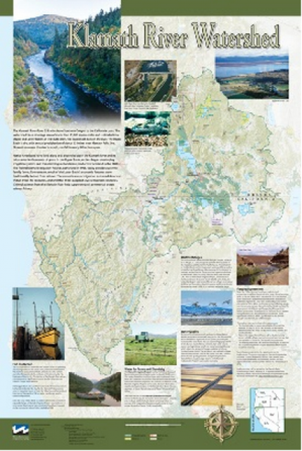
On this first-ever Foundation water tourwe examined water issues along the 263-mile Klamath River, from its spring-fed headwaters in south-central Oregon to its redwood-lined estuary on the Pacific Ocean in California.
Running Y Resort
5500 Running Y Rd
Klamath Falls, OR 97601
This tour explored the Sacramento River and its tributaries through a scenic landscape while learning about the issues associated with a key source for the state’s water supply.
All together, the river and its tributaries supply 35 percent of California’s water and feed into two major projects: the State Water Project and the federal Central Valley Project.
Water Education Foundation
2151 River Plaza Drive, Suite 205
Sacramento, CA 95833
Much of California’s water supply
originates in the Sierra Nevada, making it dependent on the
health of forests. But those forests are suffering from
widespread tree mortality and other ecosystem degradation
resulting mostly from the growing frequency and severity
of droughts and wildfires.
On our Headwaters
Tour July 24-25, we will visit Eldorado and Tahoe
national forests to learn about new forest management practices,
including wildfire prevention and recovery.
With temperatures spiking across
California this week, now is a great time to reserve your
spot on our Headwaters Tour July
24-25 when we’ll explore the role of the Sierra
Nevada snowpack in the state’s water supply and how heatwaves can
accelerate snowmelt.
A steady stream of water spilled from Lake Casitas Friday, a
few days after officials declared the Ojai Valley reservoir had
reached capacity for the first time in a quarter century. Just
two years earlier, the drought-stressed reservoir, which
provides drinking water for the Ojai
Valley and parts of Ventura, had dropped under 30%.
The Casitas Municipal Water District was looking at emergency
measures if conditions didn’t improve, board President Richard
Hajas said. Now, the lake is full, holding roughly 20 years of
water.
Last year’s snow deluge in California, which quickly erased a
two decade long megadrought, was essentially a
once-in-a-lifetime rescue from above, a new study found. Don’t
get used to it because with climate change the 2023 California
snow bonanza —a record for snow on the ground on April 1 — will
be less likely in the future, said the study in Monday’s
journal Proceedings of the National Academy of Sciences.
… UCLA climate scientist Daniel Swain, who wasn’t part
of the study but specializes in weather in the U.S. West, said,
“I would not be surprised if 2023 was the coldest, snowiest
winter for the rest of my own lifetime in California.”
This tour explored the lower Colorado River firsthand where virtually every drop of the river is allocated, yet demand is growing from myriad sources — increasing population, declining habitat, drought and climate change.
The 1,450-mile river is a lifeline to some 40 million people in the Southwest across seven states, 30 tribal nations and Mexico. How the Lower Basin states – Arizona, California and Nevada – use and manage this water to meet agricultural, urban, environmental and industrial needs was the focus of this tour.
Hilton Garden Inn Las Vegas Strip South
7830 S Las Vegas Blvd
Las Vegas, NV 89123
Learn the history and challenges facing the West’s most dramatic
and developed river.
The Layperson’s Guide to the Colorado River Basin introduces the
1,450-mile river that sustains 40 million people and millions of
acres of farmland spanning seven states and parts of northern
Mexico.
The 28-page primer explains how the river’s water is shared and
managed as the Southwest transitions to a hotter and drier
climate.
Moab is a growing town of 5,300 that up to 5 million people
visit each year to hike nearby Arches and Canyonlands national
parks, ride mountain bikes and all-terrain vehicles, or raft
the Colorado River. Like any western resort town, it
desperately needs affordable housing. What locals say it
doesn’t need is a high-end development on a sandbar projecting
into the Colorado River, where groves of cottonwoods, willows
and hackberries flourish. “Delusional,” shameful” or
“outrageous” is what many locals call this Kane Creek
Preservation and Development project. - Written by Mary Moran, a contributor to Writers on
the Range
After more than two decades of
drought, water utilities serving the largest urban regions in the
arid Southwest are embracing a drought-proof source of drinking
water long considered a supply of last resort: purified sewage.
Water supplies have tightened to the point that Phoenix and the
water supplier for 19 million Southern California residents are
racing to adopt an expensive technology called “direct potable
reuse” or “advanced purification” to reduce their reliance on
imported water from the dwindling Colorado River.
The climate-driven shrinking of the
Colorado River is expanding the influence of Native American
tribes over how the river’s flows are divided among cities, farms
and reservations across the Southwest.
The tribes are seeing the value of their largely unused river
water entitlements rise as the Colorado dwindles, and they are
gaining seats they’ve never had at the water bargaining table as
government agencies try to redress a legacy of exclusion.
This tour explored the Sacramento River and its tributaries through a scenic landscape while learning about the issues associated with a key source for the state’s water supply.
All together, the river and its tributaries supply 35 percent of California’s water and feed into two major projects: the State Water Project and the federal Central Valley Project.
Water Education Foundation
2151 River Plaza Drive, Suite 205
Sacramento, CA 95833
A new but little-known change in
California law designating aquifers as “natural infrastructure”
promises to unleash a flood of public funding for projects that
increase the state’s supply of groundwater.
The change is buried in a sweeping state budget-related law,
enacted in July, that also makes it easier for property owners
and water managers to divert floodwater for storage underground.
A new underground mapping technology
that reveals the best spots for storing surplus water in
California’s Central Valley is providing a big boost to the
state’s most groundwater-dependent communities.
The maps provided by the California Department of Water Resources
for the first time pinpoint paleo valleys and similar prime
underground storage zones traditionally found with some guesswork
by drilling exploratory wells and other more time-consuming
manual methods. The new maps are drawn from data on the
composition of underlying rock and soil gathered by low-flying
helicopters towing giant magnets.
The unique peeks below ground are saving water agencies’
resources and allowing them to accurately devise ways to capture
water from extreme storms and soak or inject the surplus
underground for use during the next drought.
“Understanding where you’re putting and taking water from really
helps, versus trying to make multimillion-dollar decisions based
on a thumb and which way the wind is blowing,” said Aaron Fukuda,
general manager of the Tulare Irrigation District, an early
adopter of the airborne electromagnetic or
AEM technology in California.
Much of California’s water supply
originates in the Sierra Nevada, making it dependent on the
health of forests. But those forests are suffering from
widespread tree mortality and other ecosystem degradation
resulting mostly from the growing frequency and severity
of droughts and wildfires.
The states of the Lower Colorado
River Basin have traditionally played an oversized role in
tapping the lifeline that supplies 40 million people in the West.
California, Nevada and Arizona were quicker to build major canals
and dams and negotiated a landmark deal that requires the Upper
Basin to send predictable flows through the Grand Canyon, even
during dry years.
But with the federal government threatening unprecedented water
cuts amid decades of drought and declining reservoirs, the Upper
Basin states of Wyoming, Utah, Colorado and New Mexico are
muscling up to protect their shares of an overallocated river
whose average flows in the Upper Basin have already dropped
20 percent over the last century.
They have formed new agencies to better monitor their interests,
moved influential Colorado River veterans into top negotiating
posts and improved their relationships with Native American
tribes that also hold substantial claims to the river.
This tour explored the lower Colorado River firsthand where virtually every drop of the river is allocated, yet demand is growing from myriad sources — increasing population, declining habitat, drought and climate change.
The 1,450-mile river is a lifeline to some 40 million people in the Southwest across seven states, 30 tribal nations and Mexico. How the Lower Basin states – Arizona, California and Nevada – use and manage this water to meet agricultural, urban, environmental and industrial needs was the focus of this tour.
Hilton Garden Inn Las Vegas Strip South
7830 S Las Vegas Blvd
Las Vegas, NV 89123
It was exactly the sort of deluge
California groundwater agencies have been counting on to
replenish their overworked aquifers.
The start of 2023 brought a parade of torrential Pacific storms
to bone dry California. Snow piled up across the Sierra Nevada at
a near-record pace while runoff from the foothills gushed into
the Central Valley, swelling rivers over their banks and filling
seasonal creeks for the first time in half a decade.
Suddenly, water managers and farmers toiling in one of the
state’s most groundwater-depleted regions had an opportunity to
capture stormwater and bank it underground. Enterprising agencies
diverted water from rushing rivers and creeks into manmade
recharge basins or intentionally flooded orchards and farmland.
Others snagged temporary permits from the state to pull from
streams they ordinarily couldn’t touch.
This special Foundation water tour journeyed along the Eastern Sierra from the Truckee River to Mono Lake, through the Owens Valley and into the Mojave Desert to explore a major source of water for Southern California, this year’s snowpack and challenges for towns, farms and the environment.
Growing up in the shadow of the
Rocky Mountains, Andrew Schwartz never missed an opportunity to
play in – or study – a Colorado snowstorm. During major
blizzards, he would traipse out into the icy wind and heavy
drifts of snow pretending to be a scientist researching in
Antarctica.
Decades later, still armed with an obsession for extreme weather,
Schwartz has landed in one of the snowiest places in the West,
leading a research lab whose mission is to give California water
managers instant information on the depth and quality of snow
draping the slopes of the Sierra Nevada.
When the Colorado River Compact was
signed 100 years ago, the negotiators for seven Western states
bet that the river they were dividing would have ample water to
meet everyone’s needs – even those not seated around the table.
A century later, it’s clear the water they bet on is not there.
More than two decades of drought, lake evaporation and overuse of
water have nearly drained the river’s two anchor reservoirs, Lake
Powell on the Arizona-Utah border and Lake Mead near Las Vegas.
Climate change is rendering the basin drier, shrinking spring
runoff that’s vital for river flows, farms, tribes and cities
across the basin – and essential for refilling reservoirs.
The states that endorsed the Colorado River Compact in 1922 – and
the tribes and nation of Mexico that were excluded from the table
– are now straining to find, and perhaps more importantly accept,
solutions on a river that may offer just half of the water that
the Compact assumed would be available. And not only are
solutions not coming easily, the relationships essential for
compromise are getting more frayed.
This tour explored the Sacramento River and its tributaries through a scenic landscape while learning about the issues associated with a key source for the state’s water supply.
All together, the river and its tributaries supply 35 percent of California’s water and feed into two major projects: the State Water Project and the federal Central Valley Project.
Water Education Foundation
2151 River Plaza Drive, Suite 205
Sacramento, CA 95833
The three-year span, 2019 to 2022, was officially the driest ever
statewide going back to 1895 when modern records began in
California. But that most recent period of overall drought
also saw big swings from very wet to very dry stretches such
as the 2021-2022 water year that went from a relatively
wet Oct.-Dec. beginning to the driest Jan.-March period in the
state’s history.
With La Niña conditions predicted to persist into the
winter, what can reliably be said about the prospects for
Water Year 2023? Does La Niña really mean anything for California
or is it all washed up as a predictor in this new reality of
climate whiplash, and has any of this affected our reliance on
historical patterns to forecast California’s water supply?
Participants found out what efforts are being made to
improve sub-seasonal to seasonal (S2S) precipitation
forecasting for California and the Colorado River Basin at our
one-day Winter Outlook Workshop December
8 in Irvine, CA.
Beckman Center
Huntington Room
100 Academy Way
Irvine, California 92617
With 25 years of experience working
on the Colorado River, Chuck Cullom is used to responding to
myriad challenges that arise on the vital lifeline that seven
states, more than two dozen tribes and the country of Mexico
depend on for water. But this summer problems on the
drought-stressed river are piling up at a dizzying pace:
Reservoirs plummeting to record low levels, whether Hoover Dam
and Glen Canyon Dam can continue to release water and produce
hydropower, unprecedented water cuts and predatory smallmouth
bass threatening native fish species in the Grand Canyon.
“Holy buckets, Batman!,” said Cullom, executive director of the
Upper Colorado River Commission. “I mean, it’s just on and on and
on.”
A pilot program in the Salinas Valley run remotely out of Los Angeles is offering a test case for how California could provide clean drinking water for isolated rural communities plagued by contaminated groundwater that lack the financial means or expertise to connect to a larger water system.
As water interests in the Colorado
River Basin prepare to negotiate a new set of operating
guidelines for the drought-stressed river, Amelia Flores wants
her Colorado River Indian Tribes (CRIT) to be involved in the
discussion. And she wants CRIT seated at the negotiating table
with something invaluable to offer on a river facing steep cuts
in use: its surplus water.
CRIT, whose reservation lands in California and Arizona are
bisected by the Colorado River, has some of the most senior water
rights on the river. But a federal law enacted in the late 1700s,
decades before any southwestern state was established, prevents
most tribes from sending any of its water off its reservation.
The restrictions mean CRIT, which holds the rights to nearly a
quarter of the entire state of Arizona’s yearly allotment of
river water, is missing out on financial gain and the chance to
help its river partners.
Managers of California’s most
overdrawn aquifers were given a monumental task under the state’s
landmark Sustainable Groundwater Management Act: Craft viable,
detailed plans on a 20-year timeline to bring their beleaguered
basins into balance. It was a task that required more than 250
newly formed local groundwater agencies – many of them in the
drought-stressed San Joaquin Valley – to set up shop, gather
data, hear from the public and collaborate with neighbors on
multiple complex plans, often covering just portions of a
groundwater basin.
This tour explored the Sacramento River and its tributaries
through a scenic landscape while learning about the issues
associated with a key source for the state’s water supply.
All together, the river and its tributaries supply 35 percent of
California’s water and feed into two major projects: the State
Water Project and the federal Central Valley Project.
Water Education Foundation
2151 River Plaza Drive, Suite 205
Sacramento, CA 95833
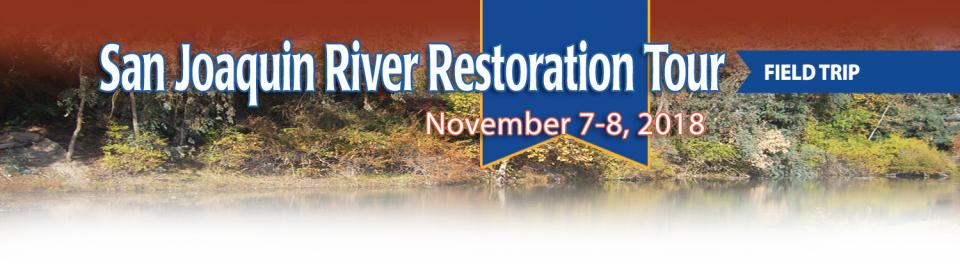
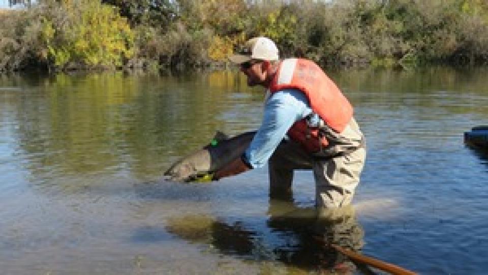
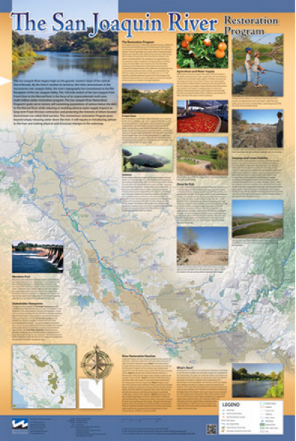
This tour traveled along the San Joaquin River to learn firsthand
about one of the nation’s largest and most expensive river
restoration projects.
The San Joaquin River was the focus of one of the most
contentious legal battles in California water history,
ending in a 2006 settlement between the federal government,
Friant Water Users Authority and a coalition of environmental
groups.
Hampton Inn & Suites Fresno
327 E Fir Ave
Fresno, CA 93720
Momentum is building for a unique
interstate deal that aims to transform wastewater from Southern
California homes and business into relief for the stressed
Colorado River. The collaborative effort to add resiliency to a
river suffering from overuse, drought and climate change is being
shaped across state lines by some of the West’s largest water
agencies.
This tour explored the lower Colorado River firsthand where virtually every drop of the river is allocated, yet demand is growing from myriad sources — increasing population, declining habitat, drought and climate change.
The 1,450-mile river is a lifeline to some 40 million people in the Southwest across seven states, 30 tribal nations and Mexico. How the Lower Basin states – Arizona, California and Nevada – use and manage this water to meet agricultural, urban, environmental and industrial needs was the focus of this tour.
Hyatt Place Las Vegas At Silverton Village
8380 Dean Martin Drive
Las Vegas, NV 89139
This tour ventured through California’s Central Valley, known as the nation’s breadbasket thanks to an imported supply of surface water and local groundwater. Covering about 20,000 square miles through the heart of the state, the valley provides 25 percent of the nation’s food, including 40 percent of all fruits, nuts and vegetables consumed throughout the country.
Climate scientist Brad Udall calls
himself the skunk in the room when it comes to the Colorado
River. Armed with a deck of PowerPoint slides and charts that
highlight the Colorado River’s worsening math, the Colorado State
University scientist offers a grim assessment of the river’s
future: Runoff from the river’s headwaters is declining, less
water is flowing into Lake Powell – the key reservoir near the
Arizona-Utah border – and at the same time, more water is being
released from the reservoir than it can sustainably provide.
For more than 20 years, Tanya
Trujillo has been immersed in the many challenges of the Colorado
River, the drought-stressed lifeline for 40 million people from
Denver to Los Angeles and the source of irrigation water for more
than 5 million acres of winter lettuce, supermarket melons and
other crops.
Trujillo has experience working in both the Upper and Lower
Basins of the Colorado River, basins that split the river’s water
evenly but are sometimes at odds with each other. She was a
lawyer for the state of New Mexico, one of four states in the
Upper Colorado River Basin, when key operating guidelines for
sharing shortages on the river were negotiated in 2007. She later
worked as executive director for the Colorado River Board of
California, exposing her to the different perspectives and
challenges facing California and the other states in the river’s
Lower Basin.
This tour guided participants on a virtual exploration of the Sacramento River and its tributaries and learn about the issues associated with a key source for the state’s water supply.
All together, the river and its tributaries supply 35 percent of California’s water and feed into two major projects: the State Water Project and the federal Central Valley Project.
This tour guided participants on a virtual journey deep into California’s most crucial water and ecological resource – the Sacramento-San Joaquin Delta. The 720,000-acre network of islands and canals support the state’s two major water systems – the State Water Project and the Central Valley Project. The Delta and the connecting San Francisco Bay form the largest freshwater tidal estuary of its kind on the West coast.
Las Vegas, known for its searing summertime heat and glitzy casino fountains, is projected to get even hotter in the coming years as climate change intensifies. As temperatures rise, possibly as much as 10 degrees by end of the century, according to some models, water demand for the desert community is expected to spike. That is not good news in a fast-growing region that depends largely on a limited supply of water from an already drought-stressed Colorado River.
On average, more than 60 percent of
California’s developed water supply originates in the Sierra
Nevada and the southern spur of the Cascade Range. Our water
supply is largely dependent on the health of our Sierra forests,
which are suffering from ecosystem degradation, drought,
wildfires and widespread tree mortality.
This tour ventured into the Sierra to examine water issues
that happen upstream but have dramatic impacts downstream and
throughout the state.
When you oversee the largest
supplier of treated water in the United States, you tend to think
big.
Jeff Kightlinger, general manager of the Metropolitan Water
District of Southern California for the last 15 years, has
focused on diversifying his agency’s water supply and building
security through investment. That means looking beyond MWD’s
borders to ensure the reliable delivery of water to two-thirds of
California’s population.
As California slowly emerges from
the depths of the COVID-19 pandemic, one remnant left behind by
the statewide lockdown offers a sobering reminder of the economic
challenges still ahead for millions of the state’s residents and
the water agencies that serve them – a mountain of water debt.
Water affordability concerns, long an issue in a state where
millions of people struggle to make ends meet, jumped into
overdrive last year as the pandemic wrenched the economy. Jobs
were lost and household finances were upended. Even with federal
stimulus aid and unemployment checks, bills fell by the wayside.
As California’s seasons become
warmer and drier, state officials are pondering whether the water
rights permitting system needs revising to better reflect the
reality of climate change’s effect on the timing and volume of
the state’s water supply.
A report by the State Water Resources Control Board recommends
that new water rights permits be tailored to California’s
increasingly volatile hydrology and be adaptable enough to ensure
water exists to meet an applicant’s demand. And it warns
that the increasingly whiplash nature of California’s changing
climate could require existing rights holders to curtail
diversions more often and in more watersheds — or open
opportunities to grab more water in climate-induced floods.
This beautifully illustrated 24×36-inch poster, suitable for
framing and display in any office or classroom, highlights the
Sacramento-San Joaquin River Delta, its place as a center of
farming, its importance as an ecological resource and its
vital role in California’s water supply system.
The text, photos and graphics explain issues related to land
subsidence, levees and flooding, urbanization, farming, fish and
wildlife protection. An inset map illustrates the tidal action
that increases the salinity of the Delta’s waterways.
A government agency that controls much of California’s water
supply released its initial allocation for 2021, and the
numbers reinforced fears that the state is falling into another
drought. The U.S. Bureau of Reclamation said Tuesday that most
of the water agencies that rely on the Central Valley Project
will get just 5% of their contract supply, a dismally low
number. Although the figure could grow if California gets more
rain and snow, the allocation comes amid fresh weather
forecasts suggesting the dry winter is continuing. The National
Weather Service says the Sacramento Valley will be warm and
windy the next few days, with no rain in the forecast.
Members of the 2020 Water Leaders class examined how
to adapt water management to climate change. Read their
policy recommendations in the class report, Adapting
California Water Management to Climate Change: Charting a Path
Forward, to learn more.
Twenty years ago, the Colorado River
Basin’s hydrology began tumbling into a historically bad stretch.
The weather turned persistently dry. Water levels in the system’s
anchor reservoirs of Lake Powell and Lake Mead plummeted. A river
system relied upon by nearly 40 million people, farms and
ecosystems across the West was in trouble. And there was no guide
on how to respond.
Radically transformed from its ancient origin as a vast tidal-influenced freshwater marsh, the Sacramento-San Joaquin Delta ecosystem is in constant flux, influenced by factors within the estuary itself and the massive watersheds that drain though it into the Pacific Ocean.
Lately, however, scientists say the rate of change has kicked into overdrive, fueled in part by climate change, and is limiting the ability of science and Delta water managers to keep up. The rapid pace of upheaval demands a new way of conducting science and managing water in the troubled estuary.
Colorado is home to the headwaters
of the Colorado River and the water policy decisions made in the
Centennial State reverberate throughout the river’s sprawling
basin that stretches south to Mexico. The stakes are huge in a
basin that serves 40 million people, and responding to the water
needs of the economy, productive agriculture, a robust
recreational industry and environmental protection takes
expertise, leadership and a steady hand.
Sprawled across a desert expanse
along the Utah-Arizona border, Lake Powell’s nearly 100-foot high
bathtub ring etched on its sandstone walls belie the challenges
of a major Colorado River reservoir at less than half-full. How
those challenges play out as demand grows for the river’s water
amid a changing climate is fueling simmering questions about
Powell’s future.
Voluntary agreements in California
have been touted as an innovative and flexible way to improve
environmental conditions in the Sacramento-San Joaquin Delta
and the rivers that feed it. The goal is to provide river flows
and habitat for fish while still allowing enough water to be
diverted for farms and cities in a way that satisfies state
regulators.
The Colorado River is arguably one
of the hardest working rivers on the planet, supplying water to
40 million people and a large agricultural economy in the West.
But it’s under duress from two decades of drought and decisions
made about its management will have exceptional ramifications for
the future, especially as impacts from climate change are felt.
Every other year we hold an
invitation-only Colorado River Symposium attended by various
stakeholders from across the seven Western states and Mexico that
rely on the iconic river. We host this three-day event in Santa
Fe, N.M., where the 1922 Colorado River Compact was signed, as
part of our mission to catalyze critical conversations to build
bridges and inform collaborative decision-making.
Members of the 2019 Water Leaders class examined the
emerging issue of wildfire impacts on California’s water
supply and quality. Read their policy recommendations in the
class report, Fire and Water: An Emerging Nexus in
California, to learn more.
Many of California’s watersheds are
notoriously flashy – swerving from below-average flows to jarring
flood conditions in quick order. The state needs all the water it
can get from storms, but current flood management guidelines are
strict and unyielding, requiring reservoirs to dump water each
winter to make space for flood flows that may not come.
However, new tools and operating methods are emerging that could
lead the way to a redefined system that improves both water
supply and flood protection capabilities.
It’s been a year since two devastating wildfires on opposite ends
of California underscored the harsh new realities facing water
districts and cities serving communities in or adjacent to the
state’s fire-prone wildlands. Fire doesn’t just level homes, it
can contaminate water, scorch watersheds, damage delivery systems
and upend an agency’s finances.
California is chock full of rivers and creeks, yet the state’s network of stream gauges has significant gaps that limit real-time tracking of how much water is flowing downstream, information that is vital for flood protection, forecasting water supplies and knowing what the future might bring.
That network of stream gauges got a big boost Sept. 30 with the signing of SB 19. Authored by Sen. Bill Dodd (D-Napa), the law requires the state to develop a stream gauge deployment plan, focusing on reactivating existing gauges that have been offline for lack of funding and other reasons. Nearly half of California’s stream gauges are dormant.
To survive the next drought and meet
the looming demands of the state’s groundwater sustainability
law, California is going to have to put more water back in the
ground. But as other Western states have found, recharging
overpumped aquifers is no easy task.
Successfully recharging aquifers could bring multiple benefits
for farms and wildlife and help restore the vital interconnection
between groundwater and rivers or streams. As local areas around
California draft their groundwater sustainability plans, though,
landowners in the hardest hit regions of the state know they will
have to reduce pumping to address the chronic overdraft in which
millions of acre-feet more are withdrawn than are naturally
recharged.
The southern part of California’s Central Coast from San Luis Obispo County to Ventura County, home to about 1.5 million people, is blessed with a pleasing Mediterranean climate and a picturesque terrain. Yet while its unique geography abounds in beauty, the area perpetually struggles with drought.
Indeed, while the rest of California breathed a sigh of relief with the return of wet weather after the severe drought of 2012–2016, places such as Santa Barbara still grappled with dry conditions.
The majestic beauty of the Sierra
Nevada forest is awe-inspiring, but beneath the dazzling blue
sky, there is a problem: A century of fire suppression and
logging practices have left trees too close together. Millions of
trees have died, stricken by drought and beetle infestation.
Combined with a forest floor cluttered with dry brush and debris,
it’s a wildfire waiting to happen.
Fires devastate the Sierra watersheds upon which millions of
Californians depend — scorching the ground, unleashing a
battering ram of debris and turning hillsides into gelatinous,
stream-choking mudflows.
High in the headwaters of the Colorado River, around the hamlet of Kremmling, Colorado, generations of families have made ranching and farming a way of life, their hay fields and cattle sustained by the river’s flow. But as more water was pulled from the river and sent over the Continental Divide to meet the needs of Denver and other cities on the Front Range, less was left behind to meet the needs of ranchers and fish.
“What used to be a very large river that inundated the land has really become a trickle,” said Mely Whiting, Colorado counsel for Trout Unlimited. “We estimate that 70 percent of the flow on an annual average goes across the Continental Divide and never comes back.”
Registration opens today for the
Water Education Foundation’s 36th annual Water
Summit, set for Oct. 30 in Sacramento. This year’s
theme, Water Year 2020: A Year of Reckoning,
reflects fast-approaching deadlines for the State Groundwater
Management Act as well as the pressing need for new approaches to
water management as California and the West weather intensified
flooding, fire and drought. To register for this can’t-miss
event, visit our Water Summit
event page.
Registration includes a full day of discussions by leading
stakeholders and policymakers on key issues, as well as coffee,
materials, gourmet lunch and an outdoor reception by the
Sacramento River that will offer the opportunity to network with
speakers and other attendees. The summit also features a silent
auction to benefit our Water Leaders program featuring
items up for bid such as kayaking trips, hotel stays and lunches
with key people in the water world.
Summer is a good time to take a
break, relax and enjoy some of the great beaches, waterways and
watersheds around California and the West. We hope you’re getting
a chance to do plenty of that this July.
But in the weekly sprint through work, it’s easy to miss
some interesting nuggets you might want to read. So while we’re
taking a publishing break to work on other water articles planned
for later this year, we want to help you catch up on
Western Water stories from the first half of this year
that you might have missed.
Our 36th annual
Water Summit,
happening Oct. 30 in Sacramento, will feature the theme “Water
Year 2020: A Year of Reckoning,” reflecting upcoming regulatory
deadlines and efforts to improve water management and policy in
the face of natural disasters.
The Summit will feature top policymakers and leading stakeholders
providing the latest information and a variety of viewpoints on
issues affecting water across California and the West.
New to this year’s slate of water
tours, our Edge of
Drought Tour Aug. 27-29 will venture into the Santa
Barbara area to learn about the challenges of limited local
surface and groundwater supplies and the solutions being
implemented to address them.
Despite Santa Barbara County’s decision to lift a drought
emergency declaration after this winter’s storms replenished
local reservoirs, the region’s hydrologic recovery often has
lagged behind much of the rest of the state.
Californians have been doing an
exceptional job
reducing their indoor water use, helping the state survive
the most recent drought when water districts were required to
meet conservation targets. With more droughts inevitable,
Californians are likely to face even greater calls to save water
in the future.
We have an unknown distance yet to run, an unknown river to explore. What falls there are, we know not; what rocks beset the channel, we know not; what walls ride over the river, we know not. Ah, well! We may conjecture many things.
~John Wesley Powell
Powell scrawled those words in his journal as he and his expedition paddled their way into the deep walls of the Grand Canyon on a stretch of the Colorado River in August 1869. Three months earlier, the 10-man group had set out on their exploration of the iconic Southwest river by hauling their wooden boats into a major tributary of the Colorado, the Green River in Wyoming, for their trip into the “great unknown,” as Powell described it.
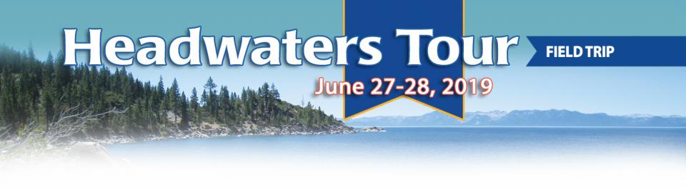
Sixty percent of California’s
developed water supply originates high in the Sierra Nevada,
making the state’s water supply largely dependent on the health
of Sierra forests. But those forests are suffering from ecosystem
degradation, drought, wildfires and widespread tree mortality.
On our Headwaters Tour
June 27-28, we will visit Eldorado and Tahoe national forests to
learn about new forest management practices, including efforts to
both prevent wildfires and recover from them.
Even as stakeholders in the Colorado River Basin celebrate the recent completion of an unprecedented drought plan intended to stave off a crashing Lake Mead, there is little time to rest. An even larger hurdle lies ahead as they prepare to hammer out the next set of rules that could vastly reshape the river’s future.
Set to expire in 2026, the current guidelines for water deliveries and shortage sharing, launched in 2007 amid a multiyear drought, were designed to prevent disputes that could provoke conflict.
One of California Gov. Gavin
Newsom’s first actions after taking office was to appoint Wade
Crowfoot as Natural Resources Agency secretary. Then, within
weeks, the governor laid out an ambitious water agenda that
Crowfoot, 45, is now charged with executing.
That agenda includes the governor’s desire for a “fresh approach”
on water, scaling back the conveyance plan in the Sacramento-San
Joaquin Delta and calling for more water recycling, expanded
floodplains in the Central Valley and more groundwater recharge.
Bruce Babbitt, the former Arizona
governor and secretary of the Interior, has been a thoughtful,
provocative and sometimes forceful voice in some of the most
high-profile water conflicts over the last 40 years, including
groundwater management in Arizona and the reduction of
California’s take of the Colorado River. In 2016, former
California Gov. Jerry Brown named Babbitt as a special adviser to
work on matters relating to the Sacramento-San Joaquin Delta and
the Delta tunnels plan.
Groundwater helped make Kern County
the king of California agricultural production, with a $7 billion
annual array of crops that help feed the nation. That success has
come at a price, however. Decades of unchecked groundwater
pumping in the county and elsewhere across the state have left
some aquifers severely depleted. Now, the county’s water managers
have less than a year left to devise a plan that manages and
protects groundwater for the long term, yet ensures that Kern
County’s economy can continue to thrive, even with less water.
For the bulk of her career, Jayne
Harkins has devoted her energy to issues associated with the
management of the Colorado River, both with the U.S. Bureau of
Reclamation and with the Colorado River Commission of Nevada.
Now her career is taking a different direction. Harkins, 58, was
appointed by President Trump last August to take the helm of the
United States section of the U.S.-Mexico agency that oversees
myriad water matters between the two countries as they seek to
sustainably manage the supply and water quality of the Colorado
River, including its once-thriving Delta in Mexico, and other
rivers the two countries share. She is the first woman to be
named the U.S. Commissioner of the International Boundary and
Water Commission for either the United States or Mexico in the
commission’s 129-year history.
Although Santa Monica may be the most aggressive Southern California water provider to wean itself from imported supplies, it is hardly the only one looking to remake its water portfolio.
In Los Angeles, a city of about 4 million people, efforts are underway to dramatically slash purchases of imported water while boosting the amount from recycling, stormwater capture, groundwater cleanup and conservation. Mayor Eric Garcetti in 2014 announced a plan to reduce the city’s purchase of imported water from Metropolitan Water District by one-half by 2025 and to provide one-half of the city’s supply from local sources by 2035. (The city considers its Eastern Sierra supplies as imported water.)
Imported water from the Sierra
Nevada and the Colorado River built Southern California. Yet as
drought, climate change and environmental concerns render those
supplies increasingly at risk, the Southland’s cities have ramped
up their efforts to rely more on local sources and less on
imported water.
Far and away the most ambitious goal has been set by the city of
Santa Monica, which in 2014 embarked on a course to be virtually
water independent through local sources by 2023. In the 1990s,
Santa Monica was completely dependent on imported water. Now, it
derives more than 70 percent of its water locally.
The whims of political fate decided
in 2018 that state bond money would not be forthcoming to help
repair the subsidence-damaged parts of Friant-Kern Canal, the
152-mile conduit that conveys water from the San Joaquin River to
farms that fuel a multibillion-dollar agricultural economy along
the east side of the fertile San Joaquin Valley.
The growing leadership of women in water. The Colorado River’s persistent drought and efforts to sign off on a plan to avert worse shortfalls of water from the river. And in California’s Central Valley, promising solutions to vexing water resource challenges.
These were among the topics that Western Water news explored in 2018.
We’re already planning a full slate of stories for 2019. You can sign up here to be alerted when new stories are published. In the meantime, take a look at what we dove into in 2018:
As stakeholders labor to nail down
effective and durable drought contingency plans for the Colorado
River Basin, they face a stark reality: Scientific research is
increasingly pointing to even drier, more challenging times
ahead.
The latest sobering assessment landed the day after Thanksgiving,
when U.S. Global Change Research Program’s Fourth National Climate
Assessment concluded that Earth’s climate is changing rapidly
compared to the pace of natural variations that have occurred
throughout its history, with greenhouse gas emissions largely the
cause.
This 2-day, 1-night tour offered participants the opportunity to
learn about water issues affecting California’s scenic Central
Coast and efforts to solve some of the challenges of a region
struggling to be sustainable with limited local supplies that
have potential applications statewide.
The 1992 election to the United
States Senate was famously coined the “Year of the Woman” for the
record number of women elected to the upper chamber.
In the water world, 2018 has been a similar banner year, with
noteworthy appointments of women to top leadership posts in
California — Karla Nemeth at the California Department of Water
Resources and Gloria Gray at the Metropolitan Water District of
Southern California.
The 2018 Water Leaders class examined ways to improve water
management through data. Read their recommendations in the class
report, Catch the Data Wave: Improving Water Management
through Data.
In the universe of California water, Tim Quinn is a professor emeritus. Quinn has seen — and been a key player in — a lot of major California water issues since he began his water career 40 years ago as a young economist with the Rand Corporation, then later as deputy general manager with the Metropolitan Water District of Southern California, and finally as executive director of the Association of California Water Agencies. In December, the 66-year-old will retire from ACWA.
As the Colorado River Basin becomes
drier and shortage conditions loom, one great variable remains:
How much of the river’s water belongs to Native American tribes?
Native Americans already use water from the Colorado River and
its tributaries for a variety of purposes, including leasing it
to non-Indian users. But some tribes aren’t using their full
federal Indian reserved water right and others have water rights
claims that have yet to be resolved. Combined, tribes have rights
to more water than some states in the Colorado River Basin.
Just because El Niño may be lurking
off in the tropical Pacific, does that really offer much of a
clue about what kind of rainy season California can expect in
Water Year 2019?
Will a river of storms pound the state, swelling streams and
packing the mountains with deep layers of heavy snow much like
the exceptionally wet 2017 Water Year (Oct. 1, 2016 to Sept. 30,
2017)? Or will this winter sputter along like last winter,
leaving California with a second dry year and the possibility of
another potential drought? What can reliably be said about the
prospects for Water Year 2019?
At Water Year
2019: Feast or Famine?, a one-day event on Dec. 5 in Irvine,
water managers and anyone else interested in this topic will
learn about what is and isn’t known about forecasting
California’s winter precipitation weeks to months ahead, the
skill of present forecasts and ongoing research to develop
predictive ability.
In 1983, a landmark California Supreme Court ruling extended the public trust doctrine to tributary creeks that feed Mono Lake, which is a navigable water body even though the creeks themselves were not. The ruling marked a dramatic shift in water law and forced Los Angeles to cut back its take of water from those creeks in the Eastern Sierra to preserve the lake.
Now, a state appellate court has for the first time extended that same public trust doctrine to groundwater that feeds a navigable river, in this case the Scott River flowing through a picturesque valley of farms and alfalfa in Siskiyou County in the northern reaches of California.
This tour explored the Sacramento River and its tributaries
through a scenic landscape as participants learned about the
issues associated with a key source for the state’s water supply.
All together, the river and its tributaries supply 35 percent of
California’s water and feed into two major projects: the State
Water Project and the federal Central Valley Project. Tour
participants got an on-site update of Oroville Dam spillway
repairs.
“Dry, hot and on fire” is how the
California Department of Water Resources described Water Year
2018 in a recent report.
Water Year 2018 – from Oct. 1, 2017 to Sept. 30, 2018 -
marked a return to dry conditions statewide following an
exceptionally wet 2017, according to DWR’s Water
Year 2018 report. But 2017 was exceptional as all but two of
the water years in the past decade experienced drought.
Was Water Year 2018 simply a single dry year or does it
signal the beginning of another drought? And what can
reliably be said about the prospects for Water Year 2019? Does El
Niño really mean anything for California or is it all washed up
as a predictor?
Attendees found out at this one-day event Dec. 5 in
Irvine, Water Year 2019: Feast or
Famine?
Beckman Center
Auditorium - Huntington Room
100 Academy Way
Irvine, California 92617
There’s going to be a new governor
in California next year – and a host of challenges both old and
new involving the state’s most vital natural resource, water.
So what should be the next governor’s water priorities?
That was one of the questions put to more than 150 participants
during a wrap-up session at the end of the Water Education
Foundation’s Sept. 20 Water Summit in Sacramento.
People in California and the
Southwest are getting stingier with water, a story that’s told by
the acre-foot.
For years, water use has generally been described in terms of
acre-foot per a certain number of households, keying off the
image of an acre-foot as a football field a foot deep in water.
The long-time rule of thumb: One acre-foot of water would supply
the indoor and outdoor needs of two typical urban households for
a year.
The Colorado River Basin is more
than likely headed to unprecedented shortage in 2020 that could
force supply cuts to some states, but work is “furiously”
underway to reduce the risk and avert a crisis, Bureau of
Reclamation Commissioner Brenda Burman told an audience of
California water industry people.
During a keynote address at the Water Education Foundation’s
Sept. 20 Water Summit in Sacramento, Burman said there is
opportunity for Colorado River Basin states to control their
destiny, but acknowledged that in water, there are no guarantees
that agreement can be reached.
An hour’s drive north of Sacramento sits a picture-perfect valley hugging the eastern foothills of Northern California’s Coast Range, with golden hills framing grasslands mostly used for cattle grazing.
Back in the late 1800s, pioneer John Sites built his ranch there and a small township, now gone, bore his name. Today, the community of a handful of families and ranchers still maintains a proud heritage.
Farmers in the Central Valley are broiling about California’s plan to increase flows in the Sacramento and San Joaquin river systems to help struggling salmon runs avoid extinction. But in one corner of the fertile breadbasket, River Garden Farms is taking part in some extraordinary efforts to provide the embattled fish with refuge from predators and enough food to eat.
And while there is no direct benefit to one farm’s voluntary actions, the belief is what’s good for the fish is good for the farmers.
Amy Haas recently became the first non-engineer and the first woman to serve as executive director of the Upper Colorado River Commission in its 70-year history, putting her smack in the center of a host of daunting challenges facing the Upper Colorado River Basin.
Yet those challenges will be quite familiar to Haas, an attorney who for the past year has served as deputy director and general counsel of the commission. (She replaced longtime Executive Director Don Ostler). She has a long history of working within interstate Colorado River governance, including representing New Mexico as its Upper Colorado River commissioner and playing a central role in the negotiation of the recently signed U.S.-Mexico agreement known as Minute 323.
Sixty percent of California’s developed water supply
originates high in the Sierra Nevada mountains. Our water
supply is largely dependent on the health of our Sierra forests,
which are suffering from ecosystem degradation, drought,
wildfires and widespread tree mortality.
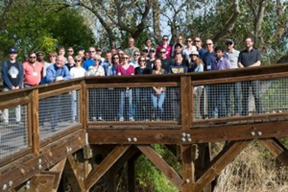
We headed into the foothills and the mountains to examine
water issues that happen upstream but have dramatic impacts
downstream and throughout the state.
GEI (Tour Starting Point)
2868 Prospect Park Dr.
Rancho Cordova, CA 95670.
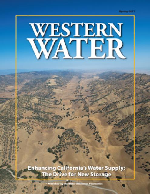
New water storage is the holy grail
primarily for agricultural interests in California, and in 2014
the door to achieving long-held ambitions opened with the passage
of Proposition
1, which included $2.7 billion for the public benefits
portion of new reservoirs and groundwater storage projects. The
statute stipulated that the money is specifically for the
benefits that a new storage project would offer to the ecosystem,
water quality, flood control, emergency response and recreation.
Nowhere is the domino effect in
Western water policy played out more than on the Colorado River,
and specifically when it involves the Lower Basin states of
California, Nevada and Arizona. We are seeing that play out now
as the three states strive to forge a Drought Contingency Plan.
Yet that plan can’t be finalized until Arizona finds a unifying
voice between its major water players, an effort you can read
more about in the latest in-depth article of Western Water.
Even then, there are some issues to resolve just within
California.
It’s high-stakes time in Arizona. The state that depends on the
Colorado River to help supply its cities and farms — and is
first in line to absorb a shortage — is seeking a unified plan
for water supply management to join its Lower Basin neighbors,
California and Nevada, in a coordinated plan to preserve water
levels in Lake Mead before
they run too low.
If the lake’s elevation falls below 1,075 feet above sea level,
the secretary of the Interior would declare a shortage and
Arizona’s deliveries of Colorado River water would be reduced by
320,000 acre-feet. Arizona says that’s enough to serve about 1
million households in one year.
As California embarks on its unprecedented mission to harness groundwater pumping, the Arizona desert may provide one guide that local managers can look to as they seek to arrest years of overdraft.
Groundwater is stressed by a demand that often outpaces natural and artificial recharge. In California, awareness of groundwater’s importance resulted in the landmark Sustainable Groundwater Management Act in 2014 that aims to have the most severely depleted basins in a state of balance in about 20 years.
Spurred by drought and a major
policy shift, groundwater management has assumed an unprecedented
mantle of importance in California. Local agencies in the
hardest-hit areas of groundwater depletion are drawing plans to
halt overdraft and bring stressed aquifers to the road of
recovery.
Along the way, an army of experts has been enlisted to help
characterize the extent of the problem and how the Sustainable
Groundwater Management Act of 2014 is implemented in a manner
that reflects its original intent.
For decades, cannabis has been grown
in California – hidden away in forested groves or surreptitiously
harvested under the glare of high-intensity indoor lamps in
suburban tract homes.
In the past 20 years, however, cannabis — known more widely as
marijuana – has been moving from being a criminal activity to
gaining legitimacy as one of the hundreds of cash crops in the
state’s $46 billion-dollar agriculture industry, first legalized
for medicinal purposes and this year for recreational use.
As we continue forging ahead in 2018
with our online version of Western Water after 40 years
as a print magazine, we turned our attention to a topic that also
got its start this year: recreational marijuana as a legal use.
State regulators, in the last few years, already had been beefing
up their workforce to tackle the glut in marijuana crops and
combat their impacts to water quality and supply for people, fish
and farming downstream. Thus, even if these impacts were perhaps
unbeknownst to the majority of Californians who approved
Proposition 64 in 2016, we thought it important to see if
anything new had evolved from a water perspective now that
marijuana was legal.
We explored the lower Colorado River where virtually every drop
of the river is allocated, yet demand is growing from myriad
sources — increasing population, declining habitat, drought and
climate change.
The 1,450-mile river is a lifeline to 40 million people in
the Southwest across seven states and Mexico. How the Lower Basin
states – Arizona, California and Nevada – use and manage this
water to meet agricultural, urban, environmental and industrial
needs was the focus of this tour.
Hampton Inn Tropicana
4975 Dean Martin Drive, Las Vegas, NV 89118
Learn what new tree-ring studies in
Southern California watersheds reveal about drought, hear about
efforts to improve subseasonal to seasonal weather forecasting
and get the latest on climate change impacts that will alter
drought vulnerability in the future.
At our Paleo
Drought Workshop on April 19th in San Pedro, you will hear
from experts at NASA Jet Propulsion Laboratory, University of
Arizona and California Department of Water Resources.
Joaquin Esquivel learned that life is
what happens when you make plans. Esquivel, who holds the public
member slot at the State Water Resources Control Board in
Sacramento, had just closed purchase on a house in Washington
D.C. with his partner when he was tapped by Gov. Jerry Brown a
year ago to fill the Board vacancy.
Esquivel, 35, had spent a decade in Washington, first in several
capacities with then Sen. Barbara Boxer, D-Calif., and then as
assistant secretary for federal water policy at the California
Natural Resources Agency. As a member of the State Water Board,
he shares with four other members the difficult task of
ensuring balance to all the uses of California’s water.
Does California need to revamp the way in which water is dedicated to the environment to better protect fish and the ecosystem at large? In the hypersensitive world of California water, where differences over who gets what can result in epic legislative and legal battles, the idea sparks a combination of fear, uncertainty and promise.
Saying that the way California manages water for the environment “isn’t working for anyone,” the Public Policy Institute of California (PPIC) shook things up late last year by proposing a redesigned regulatory system featuring what they described as water ecosystem plans and water budgets with allocations set aside for the environment.
Every day, people flock to Daniel
Swain’s social media platforms to find out the latest news and
insight about California’s notoriously unpredictable weather.
Swain, a climate scientist at the Institute of the
Environment and Sustainability at UCLA, famously coined the
term “Ridiculously Resilient Ridge” in December 2013 to describe
the large, formidable high-pressure mass that was parked over the
West Coast during winter and diverted storms away from
California, intensifying the drought.
Swain’s research focuses on atmospheric processes that cause
droughts and floods, along with the changing character of extreme
weather events in a warming world. A lifelong Californian and
alumnus of University of California, Davis, and Stanford
University, Swain is best known for the widely read Weather West blog, which provides
unique perspectives on weather and climate in California and the
western United States. In a recent interview with Western
Water, he talked about the Ridiculously Resilient Ridge, its
potential long-term impact on California weather, and what may
lie ahead for the state’s water supply.
The 2017 Water Leaders class
organized by the Water Education Foundation completed its year
with a report outlining policy recommendations for the
future of water storage in California.
The class of 20 from
various stakeholder groups and backgrounds that hailed from
cities and towns across the state had full editorial control to
chose recommendations. While they did not endorse a specific
storage proposal, they recommended that California:
Deepen your knowledge of California water issues at our popular
Water
101 Workshop and jump aboard the bus the next day to
visit the Sacramento-San Joaquin Delta, a 720,000-acre
network of islands and canals that supports the state’s water
system and is California’s most crucial water and ecological
resource.
Atmospheric rivers are relatively
narrow bands of moisture that ferry precipitation across the
Pacific Ocean to the West Coast and are key to California’s
water
supply.
They are commonly referred to as the “Pineapple Express” because
of their origins in tropical regions. While atmospheric rivers
are necessary to keep California’s water reservoirs full, some of
them are dangerous because the extreme rainfall and wind can
cause catastrophic flooding and damage.
Their presence has been likened to the West Coast version of the
hurricane hazard posed to the southeastern United States.
For decades, no matter the weather, the message has been preached
to Californians: use water wisely, especially outdoors, which
accounts for most urban water use.
Enforcement of that message filters to the local level, where
water agencies routinely target the notorious “gutter flooder”
with gentle reminders and, if necessary, financial penalties.
Sixty percent of California’s developed water supply
originates high in the Sierra Nevada mountains. Our water
supply is largely dependent on the health of our Sierra forests,
which are suffering from ecosystem degradation, drought,
wildfires and widespread tree mortality.
This tour explored the Sacramento River and its tributaries
through a scenic landscape as participants learned about the
issues associated with a key source for the state’s water supply.
All together, the river and its tributaries supply 35 percent of
California’s water and feed into two major projects: the State
Water Project and the federal Central Valley Project. Tour
participants got an on-site update of repair efforts on the
Oroville Dam spillway.
Participants of this tour snaked along the San Joaquin River to
learn firsthand about one of the nation’s largest and most
expensive river restoration projects.
The San Joaquin River was the focus of one of the most
contentious legal battles in California water history,
ending in a 2006 settlement between the federal government,
Friant Water Users Authority and a coalition of environmental
groups.
For as long as agriculture has existed in the Central Valley,
farmers have pumped water from the ground to sustain their
livelihood and grow food consumed by much of the nation. This has
caused the ground in certain places to sink, sometimes
dramatically, eliminating valuable aquifer storage space that can
never be restored.
One of the wettest years in California history that ended a
record five-year drought has rejuvenated the call for new storage
to be built above and below ground.
In a state that depends on large surface water reservoirs to help
store water before moving it hundreds of miles to where it is
used, a wet year after a long drought has some people yearning
for a place to sock away some of those flood flows for when they
are needed.
A critical aspect of California’s drive to create new water
storage is in place after the California Water Commission
approved regulations governing how those potential storage
projects could receive public funding under Prop. 1.
The Dec. 14 decision potentially paves the way for new surface
water projects, such as Sites Reservoir, and expansion of Los
Vaqueros reservoir in Contra Costa County.
This 24-page booklet details the conflict between
environmentalists, fish organizations and the Yuba County Water
Agency and how it was resolved through the Lower Yuba River
Accord – a unique agreement supported by 18 agencies and
non-governmental organizations. The publication details
the history and hydrology of the Yuba River, past and present
environmental concerns, and conflicts over dam operations and
protecting endangered fish is included.
This 30-minute documentary, produced in 2011, explores the past,
present and future of flood management in California’s Central
Valley. It features stories from residents who have experienced
the devastating effects of a California flood firsthand.
Interviews with long-time Central Valley water experts from
California Department of Water Resources (FloodSAFE), U.S. Army
Corps of Engineers, Bureau of Reclamation, Central Valley Flood
Management Program and environmental groups are featured as they
discuss current efforts to improve the state’s 150-year old flood
protection system and develop a sustainable, integrated, holistic
flood management plan for the Central Valley.
20-minute version of the 2012 documentary The Klamath Basin: A
Restoration for the Ages. This DVD is ideal for showing at
community forums and speaking engagements to help the public
understand the complex issues related to complex water management
disputes in the Klamath River Basin. Narrated by actress Frances
Fisher.
For over a century, the Klamath River Basin along the Oregon and
California border has faced complex water management disputes. As
relayed in this 2012, 60-minute public television documentary
narrated by actress Frances Fisher, the water interests range
from the Tribes near the river, to energy producer PacifiCorp,
farmers, municipalities, commercial fishermen, environmentalists
– all bearing legitimate arguments for how to manage the water.
After years of fighting, a groundbreaking compromise may soon
settle the battles with two epic agreements that hold the promise
of peace and fish for the watershed. View an excerpt from the
documentary here.
This 30-minute documentary-style DVD on the history and current
state of the San Joaquin River Restoration Program includes an
overview of the geography and history of the river, historical
and current water delivery and uses, the genesis and timeline of
the 1988 lawsuit, how the settlement was reached and what was
agreed to.
This 25-minute documentary-style DVD, developed in partnership
with the California Department of Water Resources, provides an
excellent overview of climate change and how it is already
affecting California. The DVD also explains what scientists
anticipate in the future related to sea level rise and
precipitation/runoff changes and explores the efforts that are
underway to plan and adapt to climate.
Salt. In a small amount, it’s a gift from nature. But any doctor
will tell you, if you take in too much salt, you’ll start to have
health problems. The same negative effect is happening to land in
the Central Valley. The problem scientists call “salinity” poses
a growing threat to our food supply, our drinking water quality
and our way of life. The problem of salt buildup and potential –
but costly – solutions are highlighted in this 2008 public
television documentary narrated by comedian Paul Rodriguez.
A 20-minute version of the 2008 public television documentary
Salt of the Earth: Salinity in California’s Central Valley. This
DVD is ideal for showing at community forums and speaking
engagements to help the public understand the complex issues
surrounding the problem of salt build up in the Central Valley
potential – but costly – solutions. Narrated by comedian Paul
Rodriquez.
20-minute DVD that explains the problem with polluted stormwater,
and steps that can be taken to help prevent such pollution and
turn what is often viewed as a “nuisance” into a water resource
through various activities.
Many Californians don’t realize that when they turn on the
faucet, the water that flows out could come from a source close
to home or one hundreds of miles away. Most people take their
water for granted; not thinking about the elaborate systems and
testing that go into delivering clean, plentiful water to
households throughout the state. Where drinking water comes from,
how it’s treated, and what people can do to protect its quality
are highlighted in this 2007 PBS documentary narrated by actress
Wendie Malick.
A 30-minute version of the 2007 PBS documentary Drinking Water:
Quenching the Public Thirst. This DVD is ideal for showing at
community forums and speaking engagements to help the public
understand the complex issues surrounding the elaborate systems
and testing that go into delivering clean, plentiful water to
households throughout the state.
15-minute DVD that graphically portrays the potential disaster
should a major earthquake hit the Sacramento-San Joaquin Delta.
“Delta Warning” depicts what would happen in the event of an
earthquake registering 6.5 on the Richter scale: 30 levee breaks,
16 flooded islands and a 300 billion gallon intrusion of salt
water from the Bay – the “big gulp” – which would shut down the
State Water Project and Central Valley Project pumping plants.
30-minute DVD that traces the history of the U.S. Bureau of
Reclamation and its role in the development of the West. Includes
extensive historic footage of farming and the construction of
dams and other water projects, and discusses historic and modern
day issues.
Water truly has shaped California into the great state it is
today. And if it is water that made California great, it’s the
fight over – and with – water that also makes it so critically
important. In efforts to remap California’s circulatory system,
there have been some critical events that had a profound impact
on California’s water history. These turning points not only
forced a re-evaluation of water, but continue to impact the lives
of every Californian. This 2005 PBS documentary offers a
historical and current look at the major water issues that shaped
the state we know today. Includes a 12-page viewer’s guide with
background information, historic timeline and a teacher’s lesson.
California’s little-known New River has been called one of North
America’s most polluted. A closer look reveals the New River is
full of ironic twists: its pollution has long defied cleanup, yet
even in its degraded condition, the river is important to the
border economies of Mexicali and the Imperial Valley and a
lifeline that helps sustain the fragile Salton Sea ecosystem.
Now, after decades of inertia on its pollution problems, the New
River has emerged as an important test of binational cooperation
on border water issues. These issues were profiled in the 2004
PBS documentary Two Sides of a River.
This 7-minute DVD is designed to teach children in grades 5-12
about where storm water goes – and why it is so important to
clean up trash, use pesticides and fertilizers wisely, and
prevent other chemicals from going down the storm drain. The
video’s teenage actors explain the water cycle and the difference
between sewer drains and storm drains, how storm drain water is
not treated prior to running into a river or other waterway. The
teens also offer a list of BMPs – best management practices that
homeowners can do to prevent storm water pollution.
This beautiful 24×36 inch poster, suitable for framing, features
a map of the San Joaquin River. The map text focuses on the San
Joaquin River Restoration Program, which aims to restore flows
and populations of Chinook salmon to the river below Friant Dam
to its confluence with the Merced River. The text discusses the
history of the program, its goals and ongoing challenges with
implementation.
This beautiful 24×36-inch poster, suitable for framing, displays
the rivers, lakes and reservoirs, irrigated farmland, urban areas
and Indian reservations within the Klamath River Watershed. The
map text explains the many issues facing this vast,
15,000-square-mile watershed, including fish restoration;
agricultural water use; and wetlands. Also included are
descriptions of the separate, but linked, Klamath Basin
Restoration Agreement and the Klamath Hydroelectric Agreement,
and the next steps associated with those agreements. Development
of the map was funded by a grant from the U.S. Fish and Wildlife
Service.
A companion to the Truckee River Basin Map poster, this
24×36-inch poster, suitable for framing, explores the Carson
River, and its link to the Truckee River. The map includes the
Lahontan Dam and reservoir, the Carson Sink, and the farming
areas in the basin. Map text discusses the region’s hydrology and
geography, the Newlands Project, land and water use within the
basin and wetlands. Development of the map was funded by a grant
from the U.S. Bureau of Reclamation Mid-Pacific Region, Lahontan
Basin Area Office.
This beautiful 24×36-inch poster, suitable for framing, displays
the rivers, lakes and reservoirs, irrigated farmland, urban areas
and Indian reservations within the Truckee River Basin, including
the Newlands Project, Pyramid Lake and Lake Tahoe. Map text
explains the issues surrounding the use of the Truckee-Carson
rivers, Lake Tahoe water quality improvement efforts, fishery
restoration and the effort to reach compromise solutions to many
of these issues.
This 24×36 inch poster, suitable for framing, illustrates the
water resources available for Nevada cities, agriculture and the
environment. It features natural and manmade water resources
throughout the state, including the Truckee and Carson rivers,
Lake Tahoe, Pyramid Lake and the course of the Colorado River
that forms the state’s eastern boundary.
Water as a renewable resource is depicted in this 18×24 inch
poster. Water is renewed again and again by the natural
hydrologic cycle where water evaporates, transpires from plants,
rises to form clouds, and returns to the earth as precipitation.
Excellent for elementary school classroom use.
Fashioned after the popular California Water Map, this 24×36-inch
poster was extensively re-designed in 2017 to better illustrate
the value and use of groundwater in California, the main types of
aquifers, and the connection between groundwater and surface
water.
The 28-page Layperson’s Guide to Water Rights Law, recognized as
the most thorough explanation of California water rights law
available to non-lawyers, traces the authority for water flowing
in a stream or reservoir, from a faucet or into an irrigation
ditch through the complex web of California water rights.
The 24-page Layperson’s Guide to the State Water Project provides
an overview of the California-funded and constructed State Water
Project.
The State Water Project is best known for the 444-mile-long
aqueduct that provides water from the Delta to San Joaquin Valley
agriculture and southern California cities. The guide contains
information about the project’s history and facilities.
The 28-page Layperson’s Guide to Nevada Water provides an
overview of the history of water development and use in Nevada.
It includes sections on Nevada’s water rights laws, the history
of the Truckee and Carson rivers, water supplies for the Las
Vegas area, groundwater, water quality, environmental issues and
today’s water supply challenges.
The Water Education Foundation’s second edition of
the Layperson’s Guide to The Klamath River Basin is
hot off the press and available for purchase.
Updated and redesigned, the easy-to-read overview covers the
history of the region’s tribal, agricultural and environmental
relationships with one of the West’s largest rivers — and a
vast watershed that hosts one of the nation’s oldest and
largest reclamation projects.
The 24-page Layperson’s Guide to Integrated Regional Water
Management (IRWM) is an in-depth, easy-to-understand publication
that provides background information on the principles of IRWM,
its funding history and how it differs from the traditional water
management approach.
The 28-page Layperson’s Guide to Groundwater is an in-depth,
easy-to-understand publication that provides background and
perspective on groundwater. The guide explains what groundwater
is – not an underground network of rivers and lakes! – and the
history of its use in California.
The 24-page Layperson’s Guide to the Central Valley Project
explores the history and development of the federal Central
Valley Project (CVP), California’s largest surface water delivery
system. In addition to the project’s history, the guide describes
the various facilities, operations and benefits the water
project brings to the state along with the CVP
Improvement Act (CVPIA).
A new look for our most popular product! And it’s the perfect
gift for the water wonk in your life.
Our 24×36-inch California Water Map is widely known for being the
definitive poster that shows the integral role water plays in the
state. On this updated version, it is easier to see California’s
natural waterways and man-made reservoirs and aqueducts
– including federally, state and locally funded
projects – the wild and scenic rivers system, and
natural lakes. The map features beautiful photos of
California’s natural environment, rivers, water projects,
wildlife, and urban and agricultural uses and the
text focuses on key issues: water supply, water use, water
projects, the Delta, wild and scenic rivers and the Colorado
River.
A watershed is the land area that drains snowmelt and rain into a
network of lakes, streams, rivers and other waterways. It
typically is identified by the largest draining watercourse
within the system. In California, for example, the Sacramento River Basin is the
state’s largest watershed.
California’s “Mediterranean”
climate, characterized by
warm, dry summers and mild winters, is considered one of its
great attractions, but it also can be unpredictable with flooding followed by drought and few years of “normal”
precipitation. [See also Hydrologic Cycle].
Stretching 450 miles long and up to
50 miles wide, the Sierra Nevada makes up more than a quarter of
California’s land area and forms its largest watersheds,
providing more than half of the state’s developed water supply to
residents, agriculture and other businesses.*
The San Luis Reservoir is the nation’s largest off-stream
reservoir, serving as a key water facility for both the
State Water
Project (SWP) and the federal Central Valley Project
(CVP).
The construction of Glen Canyon Dam
in 1964 created Lake Powell. Both are located in north-central
Arizona near the Utah border. Lake Powell acts as a holding tank
for outflow from the Colorado River Upper Basin States: Colorado,
New Mexico, Utah and Wyoming.
The water stored in Lake Powell is used for recreation, power
generation and delivering water to the Lower Basin states of
California, Arizona, and Nevada.
In 2005, after six years of severe
drought in the Colorado River Basin, federal officials and
representatives of the seven basin states — California, Arizona,
Nevada, New Mexico, Colorado, Utah and Wyoming — began building a
framework to better respond to drought conditions and coordinate
the operations of the basin’s two key reservoirs, Lake Powell and
Lake Mead.
The resulting Interim Guidelines for Lower Basin Shortages and
the Coordinated Operations for Lake Powell and Lake Mead (Interim
Guidelines) identified the conditions for shortage determinations
and details of coordinated reservoir operations. The 2007 Interim
Guidelines remain in effect through Dec. 31, 2026.
California will always be
inextricably linked to its water resources. Water continues
to shape the state’s development and no resource is as vital to
California’s urban centers, farms, industry, recreation, scenic
beauty and environmental preservation.
But California’s relationship to water is also one that continues
to generate controversy.
Applied water refers to water delivered by an application to a
user, either indoors or outdoors. Applied water use typically
occurs in an agricultural or urban setting.
In agriculture, applied water is typically supplied through
irrigation, which uses such devices as pipes and sprinklers.
There are also different types of systems including gravity flow
and pressurized systems.
With soil absorbing applied water and being porous (some water
can move down below a plant’s root zone), it is necessary to
apply more water than a crop might need.
This printed issue of Western Water looks at California
groundwater and whether its sustainability can be assured by
local, regional and state management. For more background
information on groundwater please refer to the Foundation’s
Layperson’s Guide to Groundwater.
This printed issue of Western Water examines how the various
stakeholders have begun working together to meet the planning
challenges for the Colorado River Basin, including agreements
with Mexico, increased use of conservation and water marketing,
and the goal of accomplishing binational environmental
restoration and water-sharing programs.
This printed issue of Western Water This issue of Western Water
looks at climate change through the lens of some of the latest
scientific research and responses from experts regarding
mitigation and adaptation.
This issue of Western Water looks at the BDCP and the
Coalition to Support Delta Projects, issues that are aimed at
improving the health and safety of the Delta while solidifying
California’s long-term water supply reliability.
This printed issue of Western Water features a
roundtable discussion with Anthony Saracino, a water resources
consultant; Martha Davis, executive manager of policy development
with the Inland Empire Utilities Agency and senior policy advisor
to the Delta Stewardship Council; Stuart Leavenworth, editorial
page editor of The Sacramento Bee and Ellen Hanak, co-director of
research and senior fellow at the Public Policy Institute of
California.
This printed issue of Western Water examines the issues
associated with the State Water Board’s proposed revision of the
water quality Bay-Delta Plan, most notably the question of
whether additional flows are needed for the system, and how they
might be provided.
This printed issue of Western Water discusses several
flood-related issues, including the proposed Central Valley Flood
Protection Plan, the FEMA remapping process and the dispute
between the state and the Corps regarding the levee vegetation
policy.
This printed issue of Western Water examines the
Colorado River drought, and the ongoing institutional and
operational changes underway to maintain the system and meet the
future challenges in the Colorado River Basin.
This printed issue of Western Water examines the
changed nature of the California Water Plan, some aspects of the
2009 update (including the recommendation for a water finance
plan) and the reaction by certain stakeholders.
This printed issue of Western Water looks at some of
the pieces of the 2009 water legislation, including the Delta
Stewardship Council, the new requirements for groundwater
monitoring and the proposed water bond.


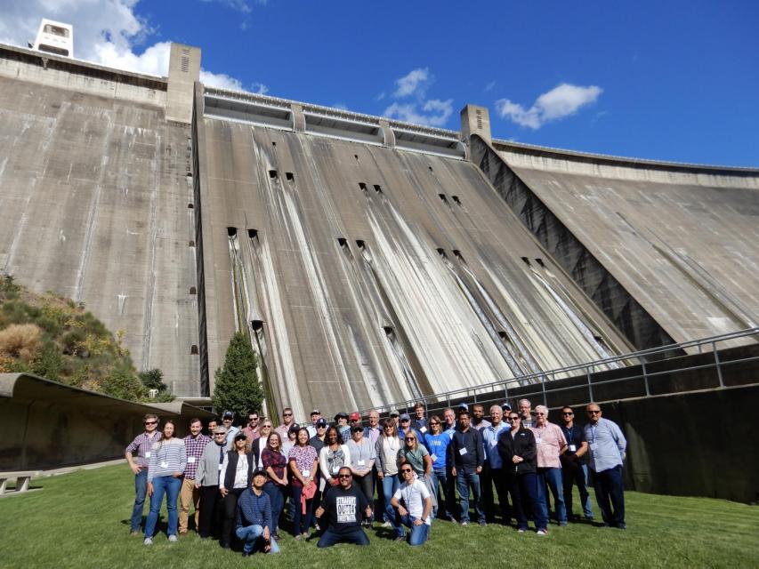
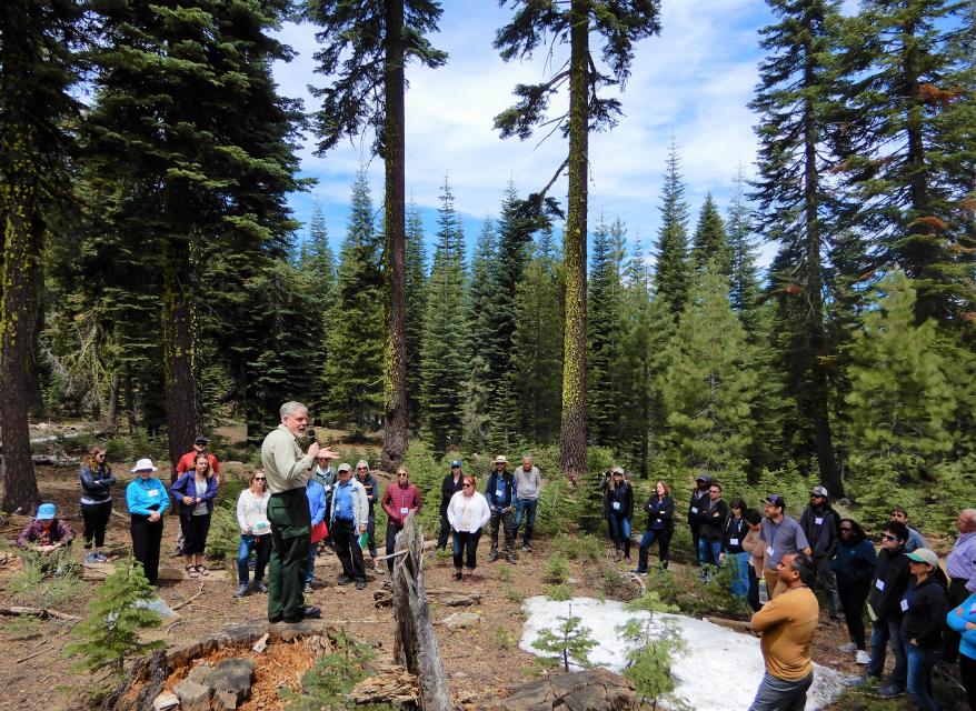


")
 and other tributaries of the upper Colorado River have declined dramatically and contributed to the precipitous declines of Lake Powell and Lake Mead. (Source: The Water Desk)")

")
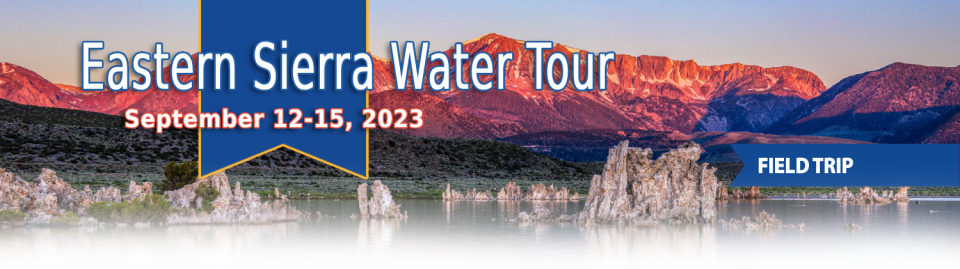
")
")
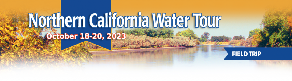
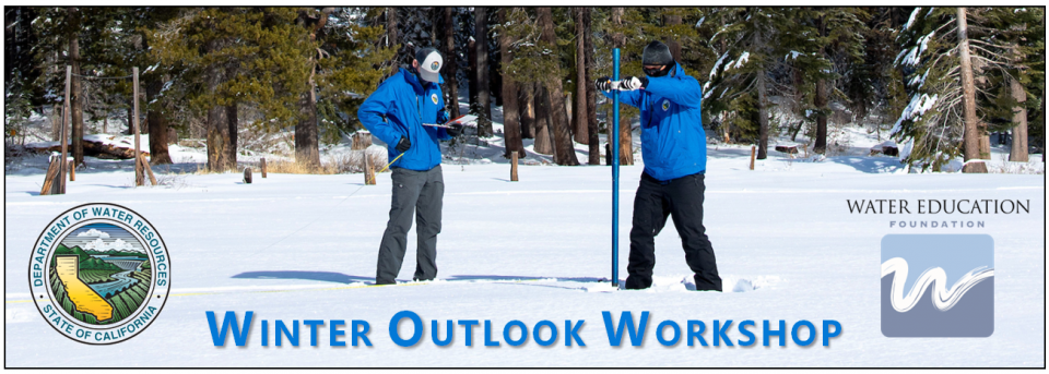
")
 are providing safe tap water to three disadvantaged communities in the Salinas Valley, including Santa Teresa Village near the city of Soledad. (Source: UCLA Samueli School of Engineering)")
")
")

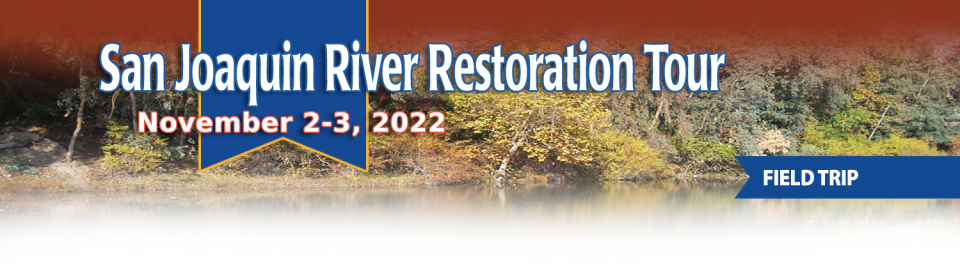
")
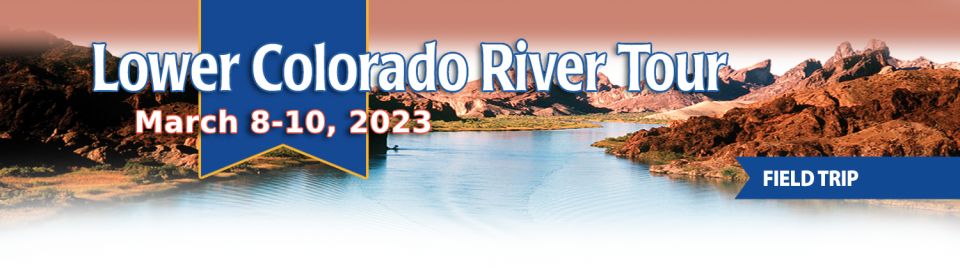
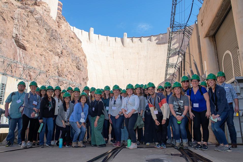
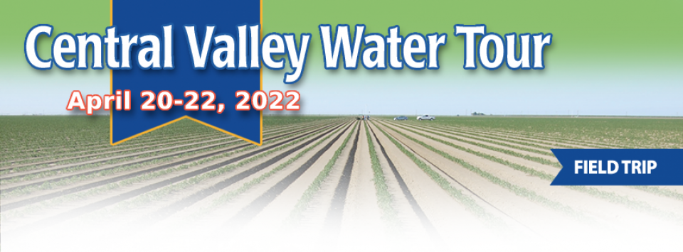
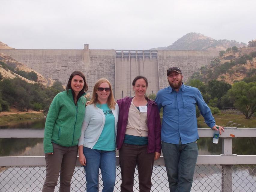
")
")
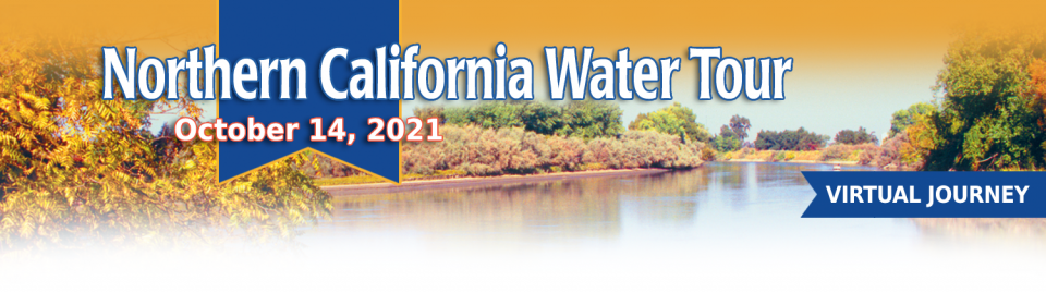
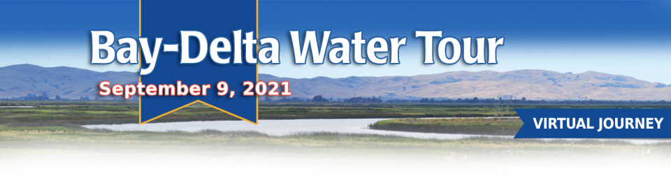
")
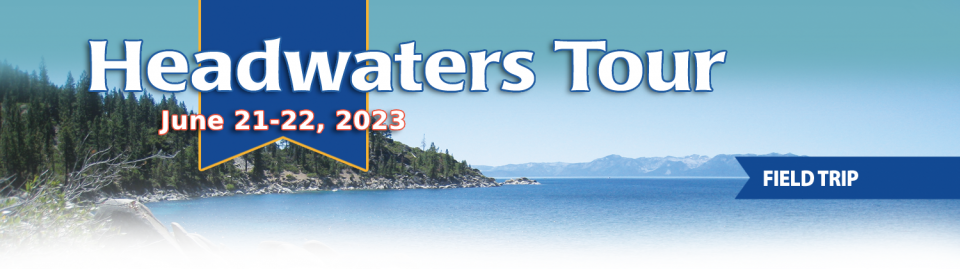
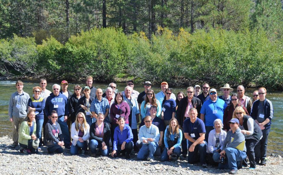
")
")
")
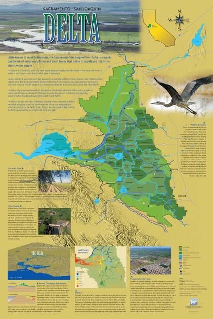
")
")
")
")
")
")
")
")
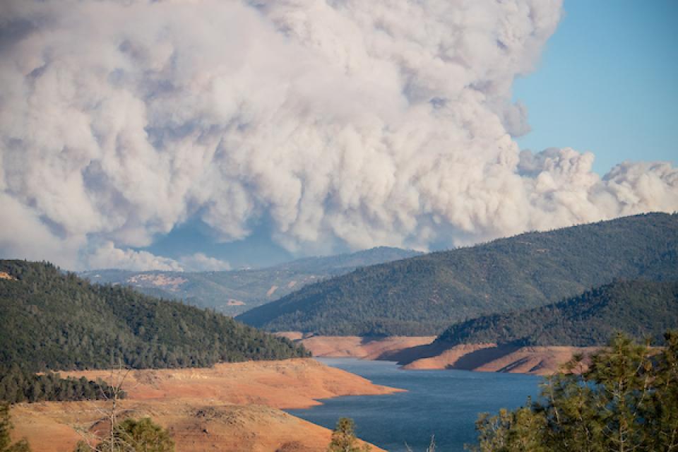
 and temperature. This gauge near downtown Sacramento measures water depth. (Source: California Department of Water Resources)")
")
")
")
")


")
")
")
")
")
")
")
 treats dry weather urban runoff to remove pollutants such as sediment, oil, grease, and pathogens for nonpotable use. (Image: City of Santa Monica)")
")
: Karla Nemeth, director, California Department of Water Resources; Gloria Gray, chair, Metropolitan Water District of Southern California; Brenda Burman, Bureau of Reclamation Commissioner; Jayne Harkins, commissioner, International Boundary and Water Commission, U.S. and Mexico; Amy Haas, executive director, Upper Colorado River Commission.")
")
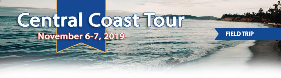

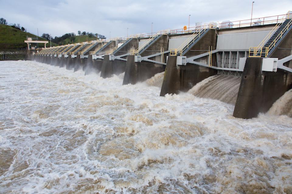
")

")
")
")
")
")
")
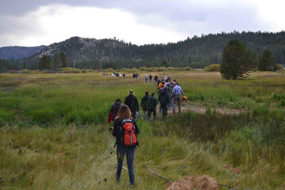
")

")
")
")
")
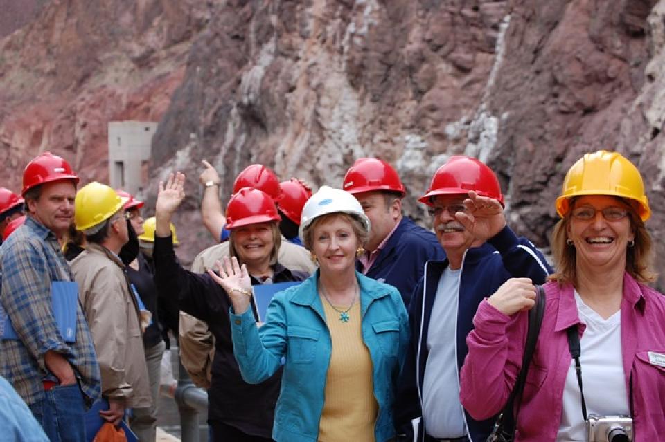


")