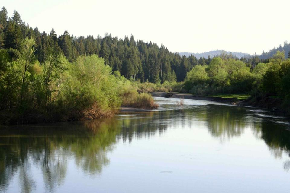
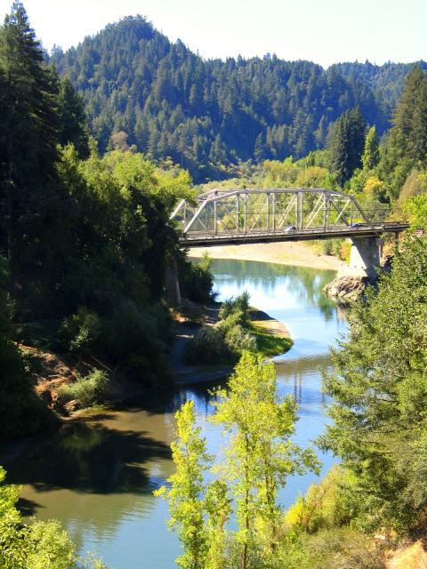
The Russian River drains the
sparsely populated, forested coastal area that stretches from San
Francisco to the Oregon border.
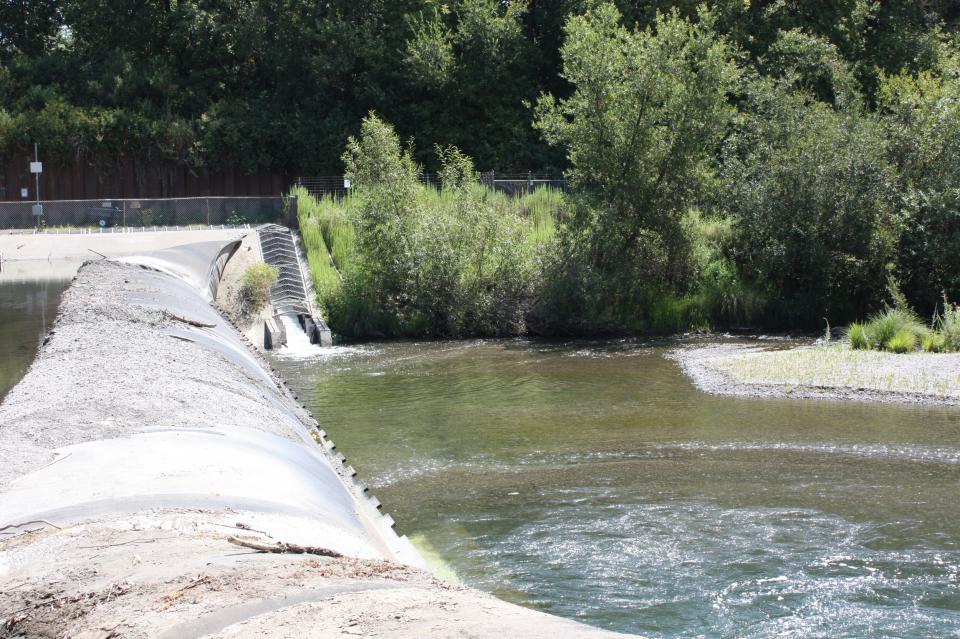
Along the Russian, federally funded dams have created Lake
Mendocino (at the Coyote Dam) and Lake Sonoma (Warm Springs Dam).
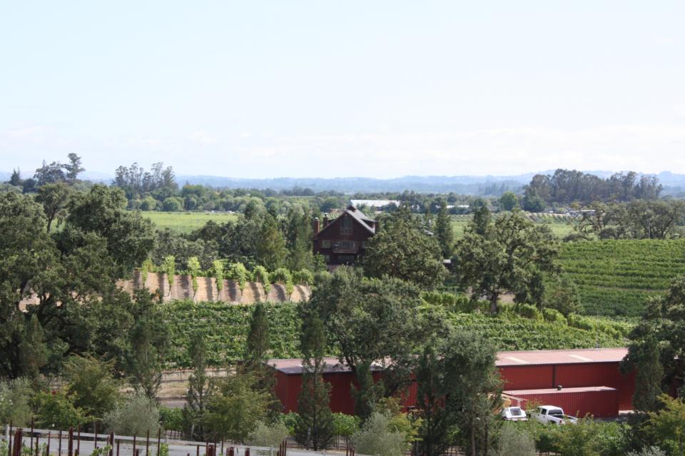
Locally built aqueducts channel water from these lakes into
growing Marin and Sonoma counties.
The Russian River is one of the most flood-prone rivers in
California, routinely overflowing during wet years. As storm
systems approach California, the wet bands of clouds are uplifted
by the Coast Range, releasing precipitation first and most
intensely on the coastal streams. One flood control dam is on the
Russian River and one on Dry Creek, a tributary to the Russian
River, which can capture about 20 percent of flood flows.
In addition to flooding issues, the Russian River faces other
challenges to balance competing demands for its water. In an area
that was once legacy to massive numbers of salmon and steelhead,
restoring the fishery has been a key focus, while water providers
must accommodate municipal needs as well as those of grape
growers in one of the world’s most prized wine-producing regions.
A long-awaited overhaul of the lower Russian River’s aging
wastewater system is on deck after Sonoma Water was awarded a
$47.8 million grant from the state. The money, funded
through California’s Clean Water State Revolving Fund program,
will support the Russian River Sanitation District’s efforts
to rehabilitate the system’s 34 miles of sewer lines
and four miles of mains. … The award is the
largest ever for Sonoma Water, the parent agency that first
applied for the grant in 2019. It has seen repeated spills on
its watch linked to the Neeley Road plant. The latest, and
largest in more than 40 years, came in January, when an
estimated 5.5 million gallons of wastewater, including
untreated sewage, overflowed from the treatment plant into the
lower Russian River for more than three days.
In December 2012, dam operators at Northern California’s Lake Mendocino watched as a series of intense winter storms bore down on them. The dam there is run by the U.S. Army Corps of Engineers’ San Francisco District, whose primary responsibility in the Russian River watershed is flood control. To make room in the reservoir for the expected deluge, the Army Corps released some 25,000 acre-feet of water downstream — enough to supply nearly 90,000 families for a year.
Many of California’s watersheds are
notoriously flashy – swerving from below-average flows to jarring
flood conditions in quick order. The state needs all the water it
can get from storms, but current flood management guidelines are
strict and unyielding, requiring reservoirs to dump water each
winter to make space for flood flows that may not come.
However, new tools and operating methods are emerging that could
lead the way to a redefined system that improves both water
supply and flood protection capabilities.
California is chock full of rivers and creeks, yet the state’s network of stream gauges has significant gaps that limit real-time tracking of how much water is flowing downstream, information that is vital for flood protection, forecasting water supplies and knowing what the future might bring.
That network of stream gauges got a big boost Sept. 30 with the signing of SB 19. Authored by Sen. Bill Dodd (D-Napa), the law requires the state to develop a stream gauge deployment plan, focusing on reactivating existing gauges that have been offline for lack of funding and other reasons. Nearly half of California’s stream gauges are dormant.
This 25-minute documentary-style DVD, developed in partnership
with the California Department of Water Resources, provides an
excellent overview of climate change and how it is already
affecting California. The DVD also explains what scientists
anticipate in the future related to sea level rise and
precipitation/runoff changes and explores the efforts that are
underway to plan and adapt to climate.
A new look for our most popular product! And it’s the perfect
gift for the water wonk in your life.
Our 24×36-inch California Water Map is widely known for being the
definitive poster that shows the integral role water plays in the
state. On this updated version, it is easier to see California’s
natural waterways and man-made reservoirs and aqueducts
– including federally, state and locally funded
projects – the wild and scenic rivers system, and
natural lakes. The map features beautiful photos of
California’s natural environment, rivers, water projects,
wildlife, and urban and agricultural uses and the
text focuses on key issues: water supply, water use, water
projects, the Delta, wild and scenic rivers and the Colorado
River.
The Russian River is one of the major northern streams that drain
the sparsely populated, forested coastal area that stretches from
San Francisco to the Oregon border.
Travel most anywhere in California and there is a river, creek or
stream nearby. Some are highly noticeable and are an integral
part of the community. Others are more obscure, with intermittent
flows or enclosed by boxed concrete flood channels that conceal
their true appearance. No matter the location, each area shares
some common themes: cooperation and conflict regarding water
allocations, greater water conservation, an awareness of
environmental stewardship, and plans that ensure long-term
sustainability.
This printed issue of Western Water examines the Russian and
Santa Ana rivers – areas with ongoing issues not dissimilar to
the rest of the state – managing supplies within a lingering
drought, improving water quality and revitalizing and restoring
the vestiges of the native past.


")
")
 and temperature. This gauge near downtown Sacramento measures water depth. (Source: California Department of Water Resources)")