Drought FAQs
California is no stranger to drought. When conditions become dry, water storage declines and water conservation mandates make news headlines; questions from the public often surface about what appear to be easy solutions to augment the state’s water supply. But the answers can be complicated and, in the end, there is no silver bullet to ensure a resilient water supply, especially during drought.
We explore “frequently asked questions” often posed by the public and provide answers below. Simply click on the question for the answer to appear.
Introduction
Water in California, sometimes referred to as “liquid gold,” drives and nourishes the state’s cities, farms, industry, recreation, scenic beauty and environment.
California water issues are complicated. The challenges start with the state’s Mediterranean climate, characterized by warm, dry summers and mild winters. The weather fluctuates and water conditions vary among wet and dry years, with a few years of “normal” tossed into the mix.
The primary source of the state’s water supplies is precipitation in the form of rain and snow. Most importantly, the Sierra Nevada mountain range accumulates snowpack during the winter that melts in late spring and flows downstream to fill reservoirs for later use.
Although surface water – the water in rivers, lakes and reservoirs – provides most of the water throughout the state, about one-third of the supply in a normal year comes from groundwater. During drought years, however, groundwater use increases to 40 percent or more. And some communities are 100 percent reliant on groundwater.
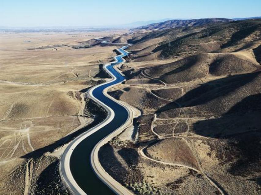
In addition, although nearly 75 percent of the precipitation falls in the northern portions of California, 80 percent of the demand occurs in the southern two-thirds of the state. To get water to where it’s needed, California has built one of the most sophisticated water storage and delivery systems in the world. An integrated mix of federal, state and locally owned dams, reservoirs, pumping plants and aqueducts transports surface water hundreds of miles from the source to taps and faucets throughout the state.
 Primarily, water is divided among three user groups:
agricultural, which grows more than 400 crops and produces nearly
half of the country’s fruits, vegetables and nuts; cities and
industry and 38 million people; and the environment, of which
some water is actively managed for wildlife refuges and
maintaining fish populations while other water in that category
is used as flow in wild and scenic rivers.
Of the state’s total water use, applied agricultural water use is 40.8 percent, applied urban water use is 10.6 percent and applied environmental use is 48.6 percent, according to the California Department of Water Resources, California Water Plan Update 2013. Applied water use is the total amount of water that is diverted from any source to meet demands of water users without adjusting for the water that is depleted, returned to the developed supply or considered irrecoverable. Applied water use varies significantly from year to year in response to hydrologic and management conditions, according to the Water Plan.
There are questions about the sustainability of the California water supply, especially when droughts occur and overall demands for water are increasing.
1. When does a drought end?
Drought is considered “a period of drier-than-normal conditions that result in water-related problems. The term ‘drought’ can have different meanings to different people, depending on how a water deficiency affects them,” according to the U.S. Geological Survey.
“Defining drought is based on impacts to water users,” according to the California Department of Water Resources (DWR). ”California is a big state and impacts vary with location. Hydrologic conditions causing impacts for water users in one location may not represent drought for water users in a different part of California, or for users with a different water supply. Individual water agencies may use criteria such as rainfall/runoff, amount of water in storage, or expected supply from a water wholesaler to define their water supply conditions.”
For example, according to DWR, an urban water retailer may define the ending of drought as a full reservoir or as a full water supply from its wholesale water supplier. A rancher grazing livestock on non-irrigated rangeland may define the ending of drought as precipitation conditions that result in adequate pasture to support cattle over the summer grazing season.
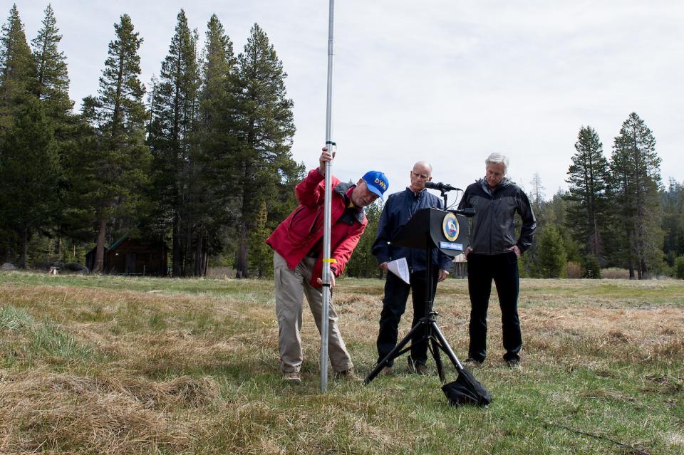 Because much of California’s developed water
supplies are supported in part by snowpack in the Sierra and
Cascade mountain ranges, recovery from drought conditions at the
statewide scale is facilitated by having adequate snowpack to
refill the major foothill reservoirs after the winter flood
season has passed and storage of snowmelt runoff for later in the
season can begin.
Storage, whether in surface water reservoirs or in groundwater basins, buffers drought impacts and influences the timing of when drought impacts occur. A single dry year does not constitute drought for most California water users because the state’s extensive system of water infrastructure and groundwater resources buffers the impacts of lack of a single winter’s precipitation. Following a multiyear dry period when precipitation (and snowpack) returns to normal conditions, storage may not recover as quickly – especially storage in groundwater basins where longer time periods are required for recharge to occur. Water users whose supplies are heavily dependent on storage may not consider drought to have ended until their storage has returned to average conditions.
2. How much rain does it take to end a drought?
It seems like a simple question, but the answer is not so easy – it depends on where you are and where your water supply comes from. California’s natural geography and hydrology are varied and so, too, is the state’s water infrastructure. Areas that tap multiple sources of water – such as groundwater, local reservoirs and the main federal/state projects – are better able to handle shortfalls than a region that relies on only one of those single sources of supply.
Historically, California’s multiyear droughts have been ended by a wet year that had several very large storms. This is an important point because California’s annual water budget is made up of only a handful of storms during the wintertime months. The state’s Mediterranean climate is characterized by warm, dry summers. The state has a pretty well-defined rainy season of November to April with December, January and February typically being the three wettest months of the year.
In a 2013 paper, Atmospheric Rivers as Drought Busters on the U.S. West Coast, Michael Dettinger, research hydrologist for the U.S. Geological Survey, determined that in California, about 33 percent to 40 percent of all persistent drought endings have been brought about by atmospheric river storms. Atmospheric rivers are present somewhere on Earth at all times. As large as 400 miles wide, the average atmospheric river transports an amount of water vapor equivalent to a foot of liquid covering 10 million acres. Only a portion of that water vapor turns into rain or snow. Atmospheric rivers can cause flooding, but they also can help bring a quick end to a long-term drought.
In the historical context of previous multiyear droughts in California, the wet years that ended the droughts were years that had somewhere in the ballpark of 150 percent of statewide average precipitation and about 150 percent of average snowpack, according to the Department of Water Resources.
3. Will an El Niño end a drought?
When looking toward a drought’s end, many people begin to cite what has become an all-too-familiar phrase: El Niño. But what is El Niño? The term refers to a climate phenomenon characterized by unusually warm water temperatures in the equatorial Pacific Ocean. El Niño can affect the location of the atmospheric jet streams.
Typical El Niño effects include warmer-than-average temperatures over western and central Canada, and over the western and northern United States. Wetter-than-average conditions are likely over portions of the U.S. Gulf Coast and Florida, while drier-than-average conditions can sometimes be expected in the Ohio Valley and the Pacific Northwest. The presence of El Niño can significantly influence weather patterns, ocean conditions and marine fisheries across large portions of the globe for an extended period of time. In some instances, El Niño may influence jet streams to shift southward, hitting California, bringing increased rainfall and potential accompanying floods, landslides and coastal erosion. The effects are variable across the state and may be more strongly felt in Southern California.
But there is no guarantee that an El Niño will be a drought-buster. Even a strong El Niño doesn’t necessarily guarantee a lot of precipitation. In the historical record, some strong El Niño years have been wet, some have been dry, and some have been average. Two extreme winters in California hydrology – 1982-83 (wet) and 1976-77 (dry) – were both stronger El Niño years.
4. Can we import more water from other states via canals or pipelines?
Among the Hail Mary strategies to beat California drought is the call for large-scale interstate pipelines to import water supplies from other states. Such projects have been suggested – and studied – for decades. Given the length of time required to study such a project and determine how to finance, permit and construct such behemoth infrastructure, pipelines can’t be considered a drought-response action. Today these projects face potential environmental and political roadblocks and their financing is uncertain in comparison to lower-cost alternatives.
Today’s engineering and high-tech prowess seemingly make anything possible, but to paraphrase a popular movie quote: “If you build it, where will the water to fill the pipeline come from?” And probably more importantly, who will pay for it?
The idea of using interstate pipelines to augment California water supplies has been studied through the years, starting in the 1960s. For example, a proposal emerged around 1966 for an undersea aqueduct to bring water from the Columbia River to Southern California. The plan was to route river water from Oregon to the Bureau of Reclamation’s Lake Mead. California deliveries would be made via the All-American Canal to Castaic Lake for use by the Metropolitan Water District of Southern California.
Although this concept was ultimately shot down, the seed was planted. For example, in 1991, the undersea aqueduct idea was resurrected when Alaska Governor Walter Hickel proposed the construction of a pipeline from southeastern Alaska to Northern California that would provide about 4 million acre-feet a year.
“The 1,400-mile-long pipeline would gather fresh water from southeast Alaskan rivers, then plunge into the Pacific Ocean, past the shoreline of British Columbia, Washington and Oregon, and finally inland to Lake Shasta in Northern California,” is an excerpt from the congressional report, “Alaskan Water for California? The Subsea Pipeline Option Background Paper, 1992.” The report noted the estimated cost per acre-foot of water was between $3,000 and $4,000, depending on the pipeline length. The report concluded that “water delivered by this pipeline would be much more expensive than any of the other options currently being considered or implemented by State [of California] and regional water authorities.”
Although interest has come and gone throughout the years, the question becomes whether an incredibly long undersea pipeline is even viable. Experts say numerous challenges make any proposal daunting:
Extensive feasibility studies – engineering, geotechnical and oceanographic – required prior to implementation can take years and years. It has been estimated oceanographic studies alone can take 10 years to complete.
Reliability comes into question with damage risk associated with natural phenomena such as earthquakes, landslides and tsunamis.
The cost is high, and political and environmental opposition is a given. Uncertainty surrounds permitting, financing, public acceptance and construction feasibility.
Despite the challenges, in 2012, the Bureau of Reclamation’s comprehensive study of the Colorado River basin’s water situation, “The Colorado River Basin Water Supply and Demand Study,” re-introduced the pipeline idea, among many others. The concept was to build a 600-mile-long water pipeline from the Missouri River to Denver. The pipeline would provide the Colorado River basin with 600,000 acre-feet of water annually, which could serve roughly a million single-family homes. The idea never made it further than the initial report. Overarching factors made that proposal impractical and politically unfeasible, yet experts say the fact that such an idea made it into the report in the first place indicates how serious the water shortage problem has become and the extent to which all options must be considered.
5. Can we build more seawater desalination plants along the California coast?
With more than 1,000 miles of shoreline abutting California, it would seem like a natural solution to build desalination plants up and the down the coast. After all, removing salt from seawater to produce drinking water seems like a “win-win.” But there are trade-offs to this seemingly drought-proof supply of water: The desal plants are expensive to build and operate, take a lot of energy, and can impact marine life. In 2015, there were some 17 desalination plants in some stage of planning along the coast. All eyes were on the Carlsbad Desalination Plant when it opened in San Diego County at the end of 2015 and began providing the San Diego area with 7 percent of its annual water supply.
Other potential desalination plants have been or are being studied in Huntington Beach, Oceanside, Camp Pendleton, Dana Point, El Segundo, Oceano, Cambria, Santa Cruz, Moss Landing and Pittsburg. In Santa Barbara, the city’s existing desalination plant was renovated and re-launched in May 2017. The plant was originally built during the 1987-1992 drought and was operated for only three months in 1992 before being taken off line as the drought ended. The city renovated the plant at a cost of $71 million.
The drawbacks of these plants, however, include higher water rates because of process costs; the desalination process requires high amounts of energy. Energy is the single-largest expense for desalination plants, accounting for as much as half of the costs to make drinking water from seawater. “Seawater desalination is very expensive, costing on average four to eight times more than other options,” according to “Proceed with Caution: California’s Drought and Seawater Desalination,” a white paper by the Natural Resources Defense Council and other organizations.
For instance, the Carlsbad plant cost about $1 billion to build and ratepayers will pay about $2,000 an acre-foot, an incremental cost, however, that will be blended into the overall costs of the San Diego area’s portfolio of water sources. Historically state and federal funding has been provided to local agencies for desalination research, feasibility studies, pilot projects and construction of new facilities.
When planning a facility, many issues must be taken into consideration, such as siting related to habitat value; public access; energy consumption and costs; potential co-location with power plants, wastewater treatment plants and other facilities with water intake or outfall structures; public health impacts; regulatory requirements and land use implications. The process of desalination can impact marine life during seawater intake as well as when releasing the brine byproduct and related discharges, according to Desalination (Brackish and Sea Water): A Resource Management Strategy of the California Water Plan.
The State Water Resources Control Board’s in 2015 adopted a desalination amendment to the Water Quality Control Plan for the Ocean Waters of California, which sets criteria for protecting marine life and water quality; gives direction for regional water boards when permitting desalination facilities by providing a statewide, uniform and consistent process; and provides implementation, monitoring and reporting requirements.
6. Can wind, tidal and wave energy be used to power more desalination plants?
The interest in building more ocean desalination plants generally leads to the question of how to power the energy-intensive facilities.
Offshore wind energy promises to be a significant energy source in the future that could be used to power desalination plants, yet it is cost-prohibitive and too unproven now.
During a June 2013 symposium hosted by the University of California, Davis and the California Energy Commission, experts estimated offshore wind turbines could provide 661 terawatt-hours (TWh) annually.
The experts listed many challenges, however, including California’s complex and lengthy regulatory process; the need for the large turbines to be placed on floating platforms – a technology still in the prototype stage – due to the deep Pacific Ocean waters; more environmental data to assess the risk to birds, fish, marine mammals; and risk assessments for noise and electromagnetic fields.
In short, offshore wind energy could promise bountiful power supply in the future, yet much work needs to be done before it is realized.
Ocean energy, including tidal power and wave power, also has been touted as a possibility to generate power to operate coastal desalination facilities.
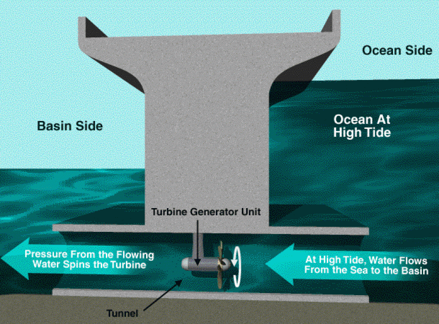
Tidal power is generated when the tide is high and, as water comes to shore, it is trapped in areas behind a dam. When the tide ebbs, the water behind the dam can be let out just like in a fresh water hydroelectric power plant. Tidal power requires a large elevation difference between low tide and high tide. In the United States, sufficiently large fluctuations only occur in Maine and Alaska.
 Wave energy has a more general application, with
potential especially along the Northern California coast. In
areas where there are continuous waves along the shoreline, wave
power devices can extract energy from the surface motion of ocean
waves or from pressure fluctuations below the surface.
The challenge is that only a small number of wave energy devices have been tested and evaluated. And, of those, only a few have been tested in actual ocean waves, rather than in artificial wave tanks. Other challenges are competing uses of the ocean (i.e. shipping, commercial fishing, naval operations) or environmental concerns in sensitive areas.
Also, in order to be viable, wave energy costs need to be below 10 cents a kilowatt hour; surveys have estimated the cost of the fledgling technology to be more than 20 cents a kilowatt hour.
In the late 2000s, PG&E filed for licenses with the Federal Energy Regulatory Commission (FERC), an independent government agency, for wave projects in Mendocino and Humboldt counties and raised $6 million in funding from the California Public Utilities Commission, which regulates privately owned electric, natural gas, telecommunications, water, railroad, rail transit, and passenger transportation companies.
PG&E first announced plans for the Humboldt County Offshore Wave Energy Power Plant that would convert wave motion into electricity about three miles off the Northern California coast in December 2007. The project was expected to begin delivering renewable, clean electricity in 2012.
“Harnessing the ocean’s energy on a utility scale is a critical achievement in renewable energy technology and this project represents our first step in that direction,” said Fong Wan, vice president of Energy Procurement, PG&E at the time. “Wave energy, along with solar thermal energy and biogas generated from cow manure, are examples of the innovative and promising sources of non-polluting, renewable energy PG&E is pursuing as part of our commitment to combat climate change.”
The utility also moved ahead with plans for a WaveConnect project off the coast near Mendocino.
In May 2009, however, PG&E canceled the Mendocino WaveConnect project because of engineering issues.
In November 2010, PG&E suspended the 5-megawatt project in Humboldt County. The California Public Utilities Commission concluded the project wasn’t viable. The technology was too new and the price tag too high, the PUC noted. In PG&E’s permit application, it had estimated that the project would require $50 million just to cover the expenses of installing the infrastructure for power transmission, monitoring and other equipment. The figure didn’t include the cost of the wave energy converters. The utility also pegged the operating and maintenance costs at about $5 million annually, although the number didn’t include any environmental protection measures. http://www.greentechmedia.com/articles/read/california-sinks-its-first-wave-energy-project-5059
7. Can we just build more dams and other storage?
California has more than 1,400 dams. Many were built for two primary reasons: to control floods and/or to store water for future use. The two goals go hand in hand in Mediterranean California, where just a few wet months can equal a year’s supply of snow and rain. Large amounts of precipitation in a short period of time, however, can cause rivers to overflow their banks, flooding cities and towns that were built close to waterways.
But dams also serve other purposes (often multiple purposes): hydropower production, recreation, and management of environmental water, e.g. storing water in reservoirs for later release to boost instream flows and reduce water temperatures – two important things for migrating salmon. Most of the state’s major rivers have at least one dam.
Dams can be on-stream or offstream. Offstream reservoirs are located away from streams and are filled by diverting water into them from a nearby river or water source. One of the largest in California is the joint state-federal San Luis Reservoir located south of the Sacramento-San Joaquin Delta. Other major offstream reservoirs include Los Vaqueros in Contra Costa County and Diamond Valley Lake in Riverside County.
The environmental movement that began in the 1970s backed by strong state and federal environmental laws slowed the construction of most new on-stream dams. Other proposed on-stream dam projects have been stopped by high construction costs, concerns over seismic safety (such as Auburn Dam on the American River), local and regional politics, and designation of waterways as wild and scenic rivers.
Building new dams to supplement California’s existing water supply system is possible, and strongly supported by some and strongly opposed by others. Some argue against dam building for the environmental change they bring to rivers; others say dams are a 20th-century idea in the 21st century, in part because their cost-to-benefit ratio (amount of water supply) does not pencil out compared to other potential sources of additional water.
“… the idea that surface storage is a silver bullet for the state’s water problems is a myth founded on the erroneous notion that large, unregulated amounts of water are available to fill new storage at a reasonable cost,” wrote the Public Policy Institute of California in its California Water Myths report. “New infrastructure can contribute to California’s water supply solutions, but it is not a cure-all.”
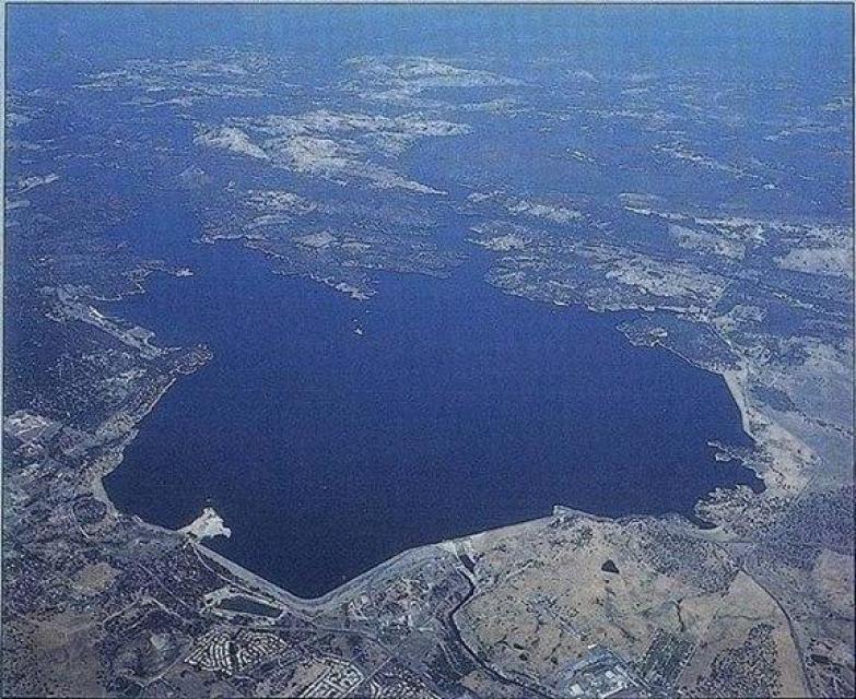
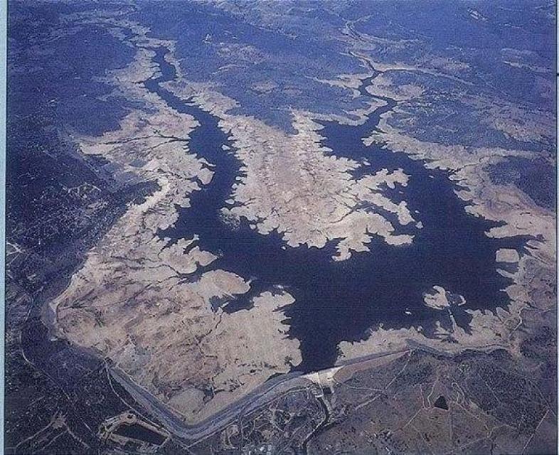 Throughout the years, many surface
storage ideas have been studied by state and federal agencies.
The most studied projects have been raising Shasta Dam; building
the offstream Sites Reservoir in the Sacramento Valley; in-Delta
storage; expanding Los Vaqueros Reservoir; and the San Luis
Reservoir Enlargement Investigation.
“Today, water storage provides multiple benefits, including seasonal fish flows, water cool enough to sustain salmon, improved water quality, and increased flexibility in water project operations,” according to the California Department of Water Resources’ website. “Whether behind dams or below ground, California needs new places to store water. Additional water storage would help the state cope with drought and climate change and benefit both people and the environment.”
Groundwater storage in some areas has become an attractive alternative to building additional surface storage. In the early 1990s the Semitropic Water Storage District in Wasco established its groundwater bank and currently has 700,000 acre-feet in storage. The nearby Kern Water Bank was created in 1995. Many districts operate their own groundwater banking programs. “Water banking is a form of conjunctive use in which water is allocated for current use, or stored in surface water reservoirs or in aquifers for later use,” according to the entry on groundwater banking on the Water Education Foundation’s Aquapedia online water encyclopedia. “Groundwater banking also has been promoted as a way to stabilize California’s water supply without the challenges associated with surface storage, and costs of building storage facilities.”
In 2014, California voters approved Proposition 1, a $7.5 billion water bond measure, which set aside $2.7 billion in funding for water storage projects, whether above or below ground. The process to choose projects for funding lies with the California Water Commission.
8. Can we just dig deeper groundwater wells?
California’s 515 groundwater basins and subbasins contribute approximately 38 percent toward the state’s total water supply during an average year, according to the California Department of Water Resources. During dry years, groundwater contributes up to 46 percent or more of the statewide annual supply, and serves as a critical buffer against the impacts of drought and climate change.
In some places, municipal, agricultural and disadvantaged communities rely on groundwater for up to 100 percent of their water supply needs.
 Historically, groundwater management was not
required by statute in California, and water users were free to
pump as much water as they needed – unless excess pumping caused
impacts that resulted in judicial administration of a groundwater
basin (due to litigation) or legislative establishment of special
powers for a local agency designated to manage groundwater in a
defined basin.
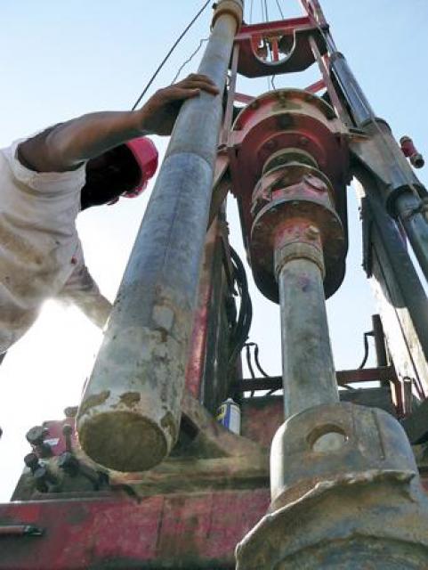
Excess groundwater pumping in many areas of the state resulted in long-term groundwater overdraft – taking more water out of basins than can be replenished by surface water recharge. Impacts of overdraft can include seawater intrusion, migration of poor quality water into agricultural and urban production wells, and land subsidence (sinking of the land surface). Land subsidence can cause structural damage to canals and other water infrastructure, reduce the protection provided by levees and flood control channels, and damage highways and bridges. During droughts the historical practice of drilling more and deeper wells also caused impacts to other pumpers – as when new, deep high-capacity wells would result in drying up of older, shallow private residential wells.
With enactment of the Sustainable Groundwater Management Act (SGMA) in late 2014, local jurisdictions are now being required to manage groundwater resources in the state’s more developed groundwater basins, and if local agencies fail to act, the state may step in and manage basins. Over the next two decades the so-called “race to the pump house” will likely become a thing of the past as SGMA requirements are put into place in the designated basins, and pumpers are required to limit their extractions to a water budget that reflects the surface water supplies available to recharge their groundwater basin.
However SGMA does not apply to fractured bedrock groundwater sources, which are a source of supply for many small rural water systems and private residential well owners. Counties have police powers that enable them to adopt local groundwater ordinances, an approach that some counties have used in response to drought impacts or complaints about well interference between new wells and older existing ones. Such complaints are likely to increase in the future as people continue to move into rural areas whose fractured rock groundwater sources may not be capable of supporting significant population growth.
9. Is my city running out of water?
Not all cities in California get their water from the same source, so when a drought hits the impacts may vary for each place. It also is important to distinguish between the meteorological elements of a drought and how a particular metropolitan area has prepared for it through, among other things, water storage, conveyance, recycling, water conservation, water markets and water banks.
One city in extreme drought may have groundwater to buffer its local surface supply while another may have to rely on imported water constrained by a drought-impacted snowmelt and be in worse shape. Even if a city has groundwater, its aquifer may be contaminated or over-pumped. Generally, the more sources of water a city has, the better it will be able to withstand periods of drought.
Voluntary conservation goals are usually the first step during a drought as water managers strive to raise awareness of wise water use. Water providers primarily focus on reducing outdoor water use because half of a typical home’s annual supply is used for irrigation and other outdoor activities.
As a drought worsens, a city may impose mandatory conservation measures by implementing, for example, a rule allowing for outdoor irrigation only once or twice a week. Indoor water use conservation goals are typically geared toward encouraging customers to take shorter showers and wash only full loads of laundry.
10. Why are my water rates going up if I’m using less water?
Water suppliers often raise rates during a drought because they have to cover the fixed costs of water system operations. And, if customers reduce their use when responding to voluntary or mandatory water conservation measures put in place by their local agency or city, then rates must be raised to compensate for the reduced amount of water sold. Also, when a water agency has to find more water sources to fill reservoirs depleted during a drought and hire temporary staff that support water conservation and enforce watering restrictions, it costs more money. Among the fixed costs are water treatment (disinfection) and energy costs associated with that treatment and delivery to customers’ taps. There also are personnel costs such as water plant operators and meter readers, and costs associated with infrastructure.
“Water is [of] great value in California,” says the Association of California Water Agencies (ACWA) on its Value of Water website section. “But the cost to treat and deliver water to your tap is going up.” As some of the factors contributing to increased costs, ACWA cited the following: drought, rising treatment costs, aging water infrastructure, increasing energy costs, costs of developing new supplies, and invasive species. Administration and personnel also are included in an agency’s fixed costs.
11. Are lawns the root of all evil?
Outdoor water use is the single largest use in the typical California home. Thus, in response to the drought that began in 2012, cities and water districts experimented with incentives to entice homeowners to get rid of their lawns to save water.
In addition, in April 2015 Gov. Jerry Brown called on Californians to remove 50 million square-feet of turf and replace it with drought-tolerant landscaping. This was to be accomplished by local water agency programs and a statewide residential turf rebate program overseen by the California Department of Water Resources.
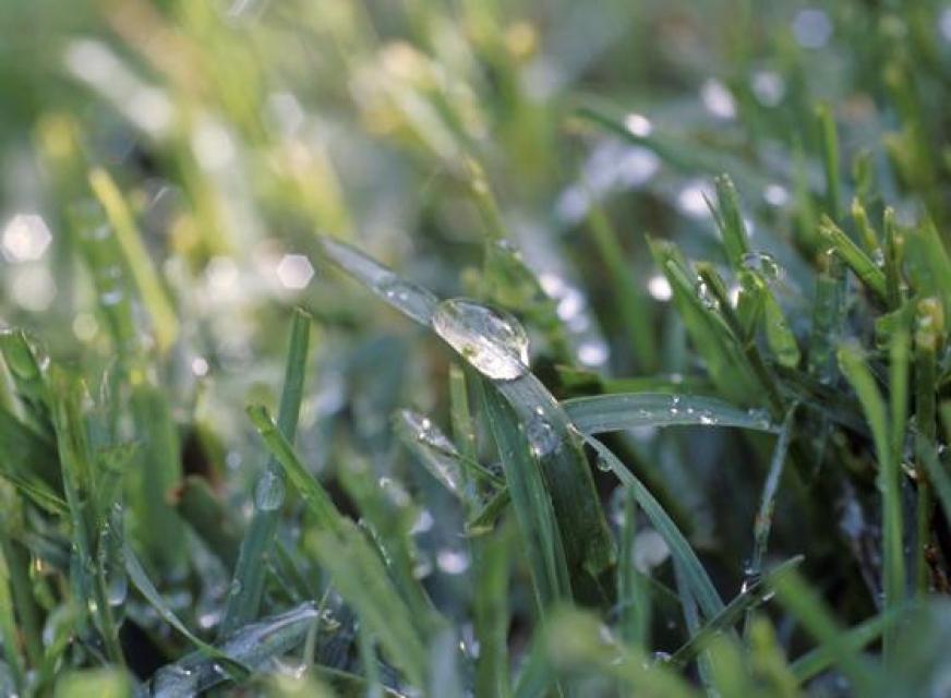 In mid-2015 Metropolitan Water District of Southern
California (MWD) upped the ante when its board of directors
approved the nation’s largest turf removal and water conservation
program with $310 million in rebate funds. In total, the program
was expected to save more than 70 million gallons of water across
the region. That’s enough water for 160,000 households for one
year. The response was enormous and before the end of 2015, all
turf removal funds had been exhausted. The agency announced that
it was on track to remove 160 million square feet of turf in
Southern
California.
Experts warn, however, that ripping out a lawn during a drought and replacing it with drought-tolerant landscaping is not necessarily the best thing to do as native and low-water use plants generally require a good amount of water during their first year in the ground to become established.
Outdoor water use varies considerably by geographic area due to climatic differences, and also due to factors such as lot size. Water used for landscaping can account for 50 percent of a home’s total water use, and in desert areas of California, it can be as high as 80 percent, according to a report by the Public Policy Institute of California.
Removing a lawn can reduce pollution, according to a study from the University of California at Irvine. The study indicated grass lawns pollute the environment with the required maintenance. Gasoline emissions created by lawn mowing and leaf blowing and the nitrous oxide released from soil after fertilizing are four times the amount of carbon naturally collected and stored by the lawn itself.
Yet on the other hand, lawns offer benefits. They reduce atmospheric carbon by absorbing carbon from the air and locking it up in the soil, mitigating impacts of greenhouse gas emissions. Lawns also function as an ideal natural filter to remove contaminants from urban stormwater, experts say. Turf features such as swales increase infiltration of urban runoff and are used as a nonstructural solution to stormwater management.
A popular trend is replacing thirsty lawns with artificial turf. Yet, as we learned from a Women’s World Cup soccer tournament in Canada in the summer of 2015, artificial turf creates heat. Air temperatures in the host cities of Winnipeg and Ottawa were in the high 70s at game times, yet the temperatures on the artificial grass fields ranged from 120 to 129 degrees.
Replacing lawns with artificial grass, gravel or pavement will drive up the overall temperatures. It’s called the “heat island” effect, where non-grassy surfaces can reflect heat from the sun and even warm adjacent buildings. That, in turn, can drive up electricity use and air conditioning bills. A 2015 legislatively mandated report prepared for the California Environmental Protection Agency found that the average summer heat island effect for larger cities was 9 degrees F, with up to 19 degrees being observed across the Los Angeles metropolitan area.
The California Urban Water Conservation Council noted in a 2015 report that “In the long term California cannot afford to spend $3 per square-foot to replace the roughly 2.5 million acres of turf grass” in the state.
12. Should California ban high-water crops?
When California experiences a drought, often a spotlight is shined on agricultural water use since the industry uses so much water. The historic drought that began in 2012 sparked questions about what is best for the common good vs. agricultural economics.
Critics complain about water being sent to irrigate
high-water-use crops such as almonds, pistachios and alfalfa.
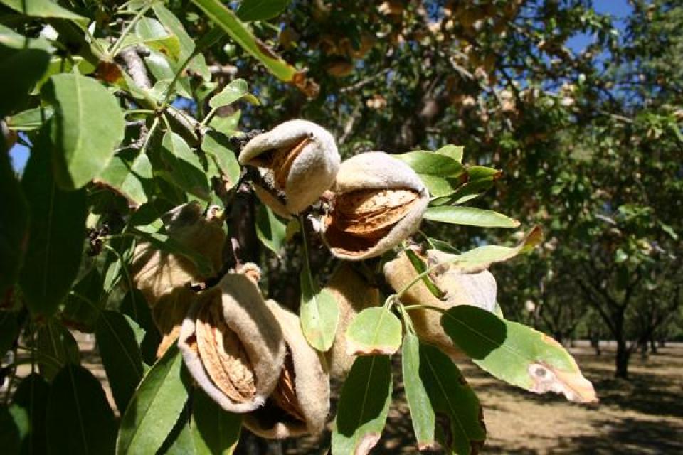
Farmers and other agricultural groups say they use water to grow food eaten by everyone, and that the market dictates the demand for certain commodities. Also, they point out, that while annual crops may be fallowed during a drought, permanent crops such as trees and vines need water every year, thus they can’t reduce those water needs.
California’s water code states that allocated water “must be for some useful or beneficial purpose” but there is no legal authority to ban high-water use crops. The viability of such a pursuit is questionable as it would require legislation and/or unprecedented action taken by the State Water Resources Control Board.
Much of the debate in California focused on almonds because of the state’s increasing amount of acreage devoted to this permanent crop that does require much water. But the number of acres devoted to almonds and other nut tree crops has increased because the marked demand increased. Almonds also are more lucrative than other crops. California produces 80 percent of the almonds sold to the world market, making the nuts the state’s most valuable farm export.
Another crop that has periodically been criticized for years is alfalfa. California’s mild climate allows for multiple cuttings of alfalfa. And although it does require much water, its end use is often for dairy cows in California, which is one of the nation’s leading dairy producers.
As a companion issue, some people advocate that consumers can influence the market – and the products – by not eating or drinking agricultural products in the “high water use” category. In reality, consumer avoidance of water-intensive foods would have very minimal impact on reducing the impacts of the drought in California.
13. Can water be transported to California in bulk, i.e. icebergs?
The idea of towing icebergs from the frigid waters of Antarctica or the North Atlantic to destinations in California has been floated for decades.
On April 1, 1978, the California Legislature endorsed the idea of towing two icebergs to Southern California. But federal support, along with $60 million to launch a pilot project, never materialized.
In 1990, the Ventura City Council decided to study the possibility of hauling icebergs and authorized a $175,000 research project to ferret out the possibility.
Today, iceberg towing is a fairly standard procedure in the Arctic to get them away from oil rigs, according to a Canadian government report. Yet, when it comes to relieving water worries thousands of miles away in California, the idea has not proved realistic for a number of reasons, including:
- Distance: The icebergs would need to be hauled from Greenland or Antarctica across warm waters.
- Economics: In 2011 French entrepreneur Georges Mougin worked up a computer simulation that showed it would be possible to transport an iceberg without it melting away entirely; however, the model clearly indicated it would be twice as expensive as seawater desalination.
- Physics: The saying “tip of the iceberg” comes from the fact that almost all of an iceberg is submerged under water. This presents problems: First, once an iceberg begins its journey and momentum builds, how would one apply the brakes? Plus, its size would make it difficult to get it anywhere near land.
There have been numerous historical concepts by investors to haul water by supertanker from water-rich areas such as Alaska or British Columbia to California. After oil tankers were required to have double hulls, there was interest in repurposing single-hulled oil tankers that could no longer be used for hauling oil. Bulk haulage of water is expensive, and these concepts failed to find a market in California.
Occasionally, investors have proposed to ship “designer water” from pristine sources such as glaciers to be sold as bottled water to affluent consumers, even when there is not a drought in California. In 2013, Aqua Omnis, a Reykjavik-based company, announced plans to ship water from Iceland aquifers to wherever it was needed. The company estimated it would cost $300 million to start the initial project, including seven ships, fuel and mooring equipment. At the end of 2017, its website said it was still seeking investment partners.
A California inventor, Terry Spragg, is pushing his patented “SpraggBag” technology to deliver water long distances by filling massive flexible fabric bags with potable water and towing them with diesel-powered drones in the ocean along the coast. On April 28-30, 1996, he performed a 100-mile demonstration in Washington hauling a 770,000-gallon waterbag from Port Angeles to Seattle. Yet, he hasn’t delivered any water due to costs and lack of investors. In a pitch to the Montecito Water District in June 2015, he estimated he could haul water from Humboldt Bay to Monterey at about $1,000 per acre-foot.
14. Can thinning forests increase water supply?
The concept of potentially thinning Sierra Nevada or Cascades forests to increase runoff and reduce wildfire risk has been talked about for decades. The concept has been explored in pilot-scale projects, but has not advanced to full-scale implementation as a water management tool. More recently, researchers also are examining the role of thinning in carbon management and greenhouse gas mitigation studies.
In 2015 The Nature Conservancy released a report indicating that thinning forests on public lands can reduce wildfire risk in the Northern Sierra and also conserve water. Thinning dense forests may lead to a 3 percent to 6 percent increase in mean annual stream flow to some watersheds, according to the report. The Feather River watershed, the report said, would show the greatest increased water flow due to thinning.
Several studies have shown that tree density in the Sierra is higher now than in the past. The Nature Conservancy report maintains that in densely packed forests where trees grow so close together, snow is trapped in branches and at the tops of trees. Exposed to wind and sun, the snow is blown away or evaporates, and never reaches the ground. Forest thinning would allow the snow to settle on the ground as snowpack.
Also, the higher water yields through forest thinning could theoretically provide a potential economic benefit to water agencies and hydropower operators. The money raised by generating additional hydropower could help to pay for forest thinning, which is done by the U.S. Forest Service for fuel management purposes. A Forest Service analysis of Northern California found the cost of thinning some forests runs from $1,000 to about $15,000 per acre.
U.S. Forest Service researchers didn’t refute the report, yet found the issue was complicated. Their research found that thinning could increase water yield, but greenery reduction and water gains were not proportional. Even with substantial thinning, water yield increases were relatively minimal. In general, water yield could increase by 3 percent, 8 percent and 13 percent if greenery were reduced by 20 percent, 50 percent and 80 percent, respectively.
Changes in temperature and precipitation also have profound effects on water yield from forests due to their influence on evapotranspiration – the combination of evaporation and water uptake through roots. “Temperature increases of 2 degrees Celsius (3.6 degrees Fahrenheit) could increase forest water use and decrease water yield by 11 percent. If precipitation is reduced by 10 or 20 percent, forest water yields could decrease by 20 or 39 percent, respectively,” said Ge Sun, Eastern Threat Center research hydrologist and lead author of the Forest Service study.
15. Can we use new technologies to limit evaporation to save water?
Evaporation is a natural part of the water budget – and in areas with a Mediterranean climate like California, a large component of the water budget. Annual evaporation is measured by agencies such as the U.S Department of Agriculture or the National Weather Service using a special four-foot diameter pan to mimic evaporation from a natural surface such as a lake or river. Average annual pan evaporation values in the warmer interior parts of California, such as in the Central Valley or Inland Empire in Southern California, may be 5 to 9 feet depending on local microclimate conditions.
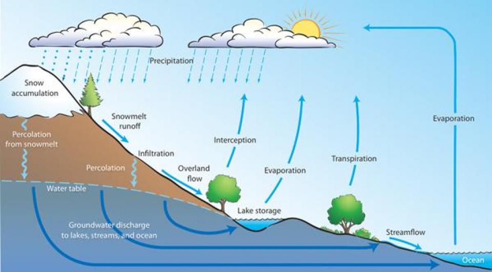 Reducing evaporation is one way to save water. Over
several decades new technologies and improvements to existing
technologies have been used in a variety of ways to reduce
evaporation associated with crop and landscape irrigation and
industrial cooling applications. The biggest prospective savings
come from continuing improvements in how water is applied for
crop and landscape irrigation, such as using irrigation scheduling technology to
precisely match applied water to crop water needs or installation
of high-efficiency sprinkler nozzles on residential lawns (which
have been supported in some communities’
rebate programs.
During droughts, the public sometimes asks questions about the possibility of adding oils or other chemicals to large surface water reservoirs to control evaporation. Research on this subject was popular in the 1950s and 1960s In the 1950s and 1960s, the Bureau of Reclamation tried it on Lake Hefner in Oklahoma City. It reduced evaporation by 9 percent yet created problems due to warm water temperatures and because wind blew the chemical layer off the lake. A similar experiment on Lake Hefner in 1966 reduced evaporation by up to 50 percent until the wind blew the chemical layer away.
With California’s modern water pollution control rules and environmental protection requirements, the concept of large-scale chemical addition to a major reservoir to control evaporation seems inconceivable today because of impacts to drinking water sources and aquatic ecosystems.
In an effort to protect water quality and also reduce evaporation, the Los Angeles Department of Water and Power in 2015 dumped 4-inch polyethylene “shade balls” – 96 million of them – into Southern California reservoirs. The balls help to block sunlight that encourages algae growth and toxic chemical reactions. A side-benefit is the shade balls are anticipated to keep about 300 million gallons of water a year (920 acre-feet per year) from evaporating.
16. Can we modify the weather to create more rain?
Weather modification (cloud seeding) has been investigated and conducted for more than 50 years. The idea is to add ice-forming particles to clouds to bring rain, with silver iodide used as the main seeding ingredient to cause ice crystals to form. Whether or not it actually creates new water remains to be conclusively proven, and the strategy has both supporters and detractors. A chief reason some water users support it is its very low cost in comparison to other approaches for developing new water sources.
According to a 2015 report by the Cooperative Institute for Research in Environmental Sciences (CIRES) at the National Oceanic and Atmospheric Administration’s Earth System Research Laboratory, “it is reasonable to conclude” that artificial enhancement of winter snowpack over mountain barriers is possible.
Other research, however, suggests that cloud seeding is not as effective as it had been hoped, according to a 2010 study by Pinhas Alpert, Zev Levin and Noam Halfon of Tel Aviv University’s Department of Geophysics and Planetary Sciences. The professors examined 50 years of data on cloud seeding, with an emphasis on the effects of seeding on rainfall amounts in a target area over the Sea of Galilee in the north of Israel, and determined that that changing weather patterns, not weather modification, were responsible for the higher amount of precipitation during these years.
Thus the scientific debate is not settled. A 2003 report by the National Academy of Science summarized the situation as “We know that human activities can affect the weather, and we know that seeding will cause some changes to a cloud. However, we are still unable to translate these induced changes into verifiable changes in rainfall, hail fall, and snowfall on the ground…”
The CIRES report states, “it is very difficult to quantify the seasonal increases to be expected both in snowpack and subsequent spring runoff” because each target area has to be investigated as to the meteorology of the winter clouds and their seedability, and the engineering aspects of effectively seeding the clouds “to maximize increases.”
The key to weather modification is treating the available clouds. Unfortunately, during a drought when there are few rain clouds, there is nothing to seed. The best times to seed clouds are during normal – or higher-than-normal – levels of precipitation when the extra rainfall can be saved in reservoirs for later use. However, a potential downside is liability risk for project proponents whose efforts are claimed to have augmented flood damages and snow removal costs.
17. Why do small water systems and private residential well owners seem to be running out of water?
There are approximately 2,300 small community water systems in California and more than 900,000 people (estimated) are served by them, according to the California State Water Resources Control Board. A community water system is a public water system that serves at least 15 service connections used by yearlong residents or regularly serves at least 25 yearlong residents of the area served by the system. A small community water system is a community water system that serves a population of 25 to 3,300 people (or 15 to 1,000 service connections).
Most of these systems serve small, rural communities in unincorporated areas, although some are located in urban areas. Water shortages in small rural water systems are a well-documented drought impact, an impact shared with private residential well owners in vulnerable areas.
Small water systems typically have a higher vulnerability to drought than do large systems for a variety of reasons:
- Often, they rely on a single water source and have no supplemental sources during a drought
- Systems in rural areas often rely on groundwater in fractured bedrock, which typically has lower yields than alluvial groundwater basin sources and is at great risk during drought
- They have a small ratepayer base, making major system improvements such as new wells unaffordable for residents
- Lack of financial capacity has resulted in deferred maintenance of aging distribution system infrastructure, and system water losses are very high
- They have very limited staff resources, with the smallest systems often relying only on a contract operator and members of a voluntary board of directors, and lack the capacity for planning and carrying out systems improvements and applying for grant programs
- They are in remote locations where connections to larger systems are physically and financially infeasible
- Changes in land use over time (new agricultural or residential development) have resulted in increased groundwater use, putting older, shallower wells at risk during dry periods
The problems are compounded by the fact that many people served by small systems are low-income or on a fixed income and cannot afford to collectively contribute to the projects needed to improve service. The per capita costs of building a new distribution system, for example, are much higher than for a larger system that supplies customers in the tens, if not hundreds, of thousands. Where a large metropolitan supplier may have to only raise rates pennies to pay for the cost of a new treatment plant or pipeline, the cost per household in a small system could be as high as hundreds of dollars per month.
Those rural communities hardest hit by drought often are reliant upon groundwater. In areas such as the San Joaquin Valley, wells for domestic use are shallower than those being used for crop irrigation. Thus pumping by the deeper, nearby wells can cause the shallower wells to go dry. Small towns often lack a backup or alternative supply.
These issues with groundwater wells extend to private well owners.
Historically the state has stepped in during droughts to provide emergency response assistance to small water systems. More recently, the state also has made emergency assistance available to private well owners, in the form of bottled water and trucked water in response to emergency proclamations. In 2014 and 2015, for example, drought emergency response legislation authorized funding for SWRCB’s drinking water program and for DWR to provide emergency assistance which included drilling new wells, installing emergency pipelines and relocating surface water intakes/emergency pumping facilities, and providing bulk and bottled water. The State Water Resources Control Board made emergency response grants to more than 100 small water systems, and the Department of Water Resources and the Office of Emergency Services provided emergency water sources for several thousand private well owners whose wells had gone dry.
18. Why does my community continue to allow new development during a drought?
Even now, with an increased focus on water supply limitations as demand exceeds supply, effects of climate change and feeling impacts of drought, communities up and down the state are looking toward continued growth in the future. The California Department of Finance projects the state’s population of 37.3 million in 2010 will increase by 41 percent to 52.6 million by 2060.
Expansion plans have raised questions. Are cities and planners failing to recognize a harsh new climate reality? Or are they ensuring a viable economic future and not overreacting to temporary conditions such as drought? And some people are wondering when citizens are being asked to cut water use by 20 to 25 percent, why cities keep approving new developments that require more water connections?
In many communities, development is considered the key to improving the economy and building a tax base. Local water districts have been focusing on building a resilient water supply and have made plans for this drought and future droughts by augmenting water supplies and focusing on water conservation and efficiency. In some Southern California communities, for example, the idea is to make new development “water-neutral.” In the end new development projects are approved or rejected by local boards and councils.
Smart water management, in part, has focused on reducing per capita use by stretching available supplies to support new development. In 2001 state lawmakers intended to prevent building beyond the water supply when they passed two “show-me-the-water” laws. Senate Bills 221 and 610 required local governments to review water supplies before approving developments of 500 or more units and to verify there was sufficient water to meet the project’s needs for 20 years, including a multiyear drought.
The California Department of Water Resources issued a guidebook for implementing the two laws.
As awareness increases and water supplies diminish, more development projects are held accountable for addressing and mitigating water concerns. Still, there is mounting concern in some communities that unfettered growth will deplete water resources and shortages may occur in the future. Historically, few communities have voluntarily imposed building moratoria to restrict development during times of water shortage. In many instances, developers have been asked to redesign projects and recalculate their water demands. Also, some new developments have been required to pay to import water to meet the demand and maintain a region’s aquifer.
Yet, some water experts and environmentalists warn that communities should not continue basing growth plans on the assumption that the water access they have today will be viable in future years. Eventually, local implementation of the Sustainable Groundwater Management Act (signed into law in 2014) may factor into this picture, as the local management entities will in effect have to manage “water budgets” for the groundwater basins covered by that legislation – an action that will force cities and counties to more directly consider water availability when they make land use planning decisions.
Also on a long-term timescale, the State of California has developed a climate change adaptation guide for local communities to assist them in planning for an expected warmer and drier future, and the Governor’s Office of Planning and Research periodically updates its General Plan Guidelines for city and county land use planning; these guidelines encourage local agencies to incorporate adaptation into planning for future development.
19. If California is experiencing severe drought conditions, why isn’t it crippling our economy?
The most visible economic impacts of drought are to California agriculture. California’s 76,400 farms and ranches lead the country in cash farm receipts with combined commodities representing nearly 13 percent of the U.S. total, according to production statistics from the California Department of Food and Agriculture. More than a third of the country’s vegetables and two-thirds of the country’s fruits and nuts are grown in California.
 Shortages of agricultural water supplies have
resulted in increasing amounts of land fallowing, especially
since the early 1990s in the Central Valley, which has felt the
combined impacts of drought, the Central Valley Project
Improvement Act, new Bay-Delta water quality requirements, and
Endangered Species Act biological opinions for Chinook salmon and
Delta smelt.
However, although agriculture is a $54 billion industry in California, the lack of agricultural water supplies may not be significantly reflected in the state’s overall economy. For example, a 2015 article by the nonpartisan Legislative Analyst’s Office (LAO), which provides budget advice to state lawmakers noted that California’s 2014 gross domestic product growth rate ranked ninth highest among the states despite a 7.3 percent drop in agricultural GDP.
Agriculture is a small share of the state’s economy, generating about 2 percent of the state’s gross domestic product and making up only 3-4 percent of all jobs in the state. The economic impacts of drought to agriculture are localized and depend on water supplies available to a specific area and the crops grown in that area, and also on national and international crop markets during the drought. For example, surface water shortages to south of Delta Central Valley Project contractors have resulted in San Joaquin Valley land fallowing during past droughts. In contrast, Imperial Valley lands irrigated by Colorado River water have historically not experienced similar drought impacts because of reliable supplies of Colorado River water as compared to CVP allocations of as low as zero to project contractors. Localized impacts can be severe for affected individuals; however, such as in San Joaquin Valley communities highly dependent on agricultural jobs, where community food banks saw long lines as a result of declines in farm employment.
A 2014 report by the Center for Watershed Sciences at the University of California, Davis, found that the drought caused losses of $810 million in crop revenue and $203 million in dairy and other livestock value, plus additional groundwater pumping costs of $454 million. These direct costs to agriculture totaled $1.5 billion. In addition, 17,100 seasonal and part-time agricultural jobs were lost, according to the 2014 UC Davis report “Economic Analysis of the 2014 Drought for California Agriculture.”
To help put these figures into perspective, the U.S. Bureau of Economic Analysis estimated that California’s 2014 gross state product was $2.31 trillion, and the U.S. Bureau of Labor Statistics estimated the seasonally adjusted number of non-farm jobs at the end of 2014 at more than 16 million.
20. Should we believe in new technologies that promise to reduce drought impacts?
There is no silver bullet when it comes to ideas about how to reduce drought impacts. Droughts create opportunities for both improved water management practices and for investors seeking financing or markets for proposed new products. While innovative new ideas and technologies may be proposed as concepts, the path to determine if they are technically viable and economically feasible can be lengthy and expensive. Some concepts might pay off; the problem is finding efficient, affordable, scalable projects that will make a difference.
Field testing and market research can help determine the practicality of new ideas, but such research takes time. Likewise, companies proposing new technologies need time to find investors and financing. For these reasons, new technologies are not typically immediately available for drought response. But innovations can help in the long-term picture – and during a future drought.
The EPA’s Office of Water published a report, Blueprint for Integrating Technology Innovation into the National Water Program, which highlighted the EPA’s plans for advancing technological innovation across various water programs. They established a business case for water technology innovation and identified “market opportunities” where technological innovation could help solve water challenges.
One source of partnership for innovations for conserving and eventually reusing water is EPA’s own WaterSense Program. The program is designed to bring together a variety of stakeholders to promote the value of water efficiency, encourage innovation in manufacturing, and decrease water use and reduce strain on water resources and infrastructure. The program offers information on WaterSense labeled products – faucets, toilets and other plumbing materials – that are backed by independent, third–party testing and certification, and meet the EPA’s specifications for water efficiency and performance.
Many of these types of products can help individual homeowners or businesses save on their water use but they are not, in and of themselves, capable of resolving a statewide drought.


