Find out what the Water Education Foundation is up to with
announcements about upcoming events, tours, new Western
Water articles on key water topics and more!
Sign up here to get announcements sent to
your inbox.
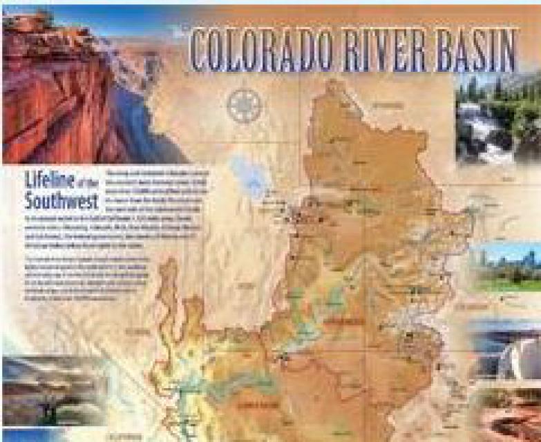
Today is Colorado River Day, the
anniversary of when the Grand River was renamed the Colorado
River, extending the name to the Colorado’s headwaters in 1921.
To mark the anniversary, we’re offering a 20% discount on
our Colorado River map, Layperson’s Guides and other Colorado
River educational materials.
This special sale is only today, Wednesday, July 25. Use the
promo code COLORADORIVERDAY at checkout to get your 20% discount.
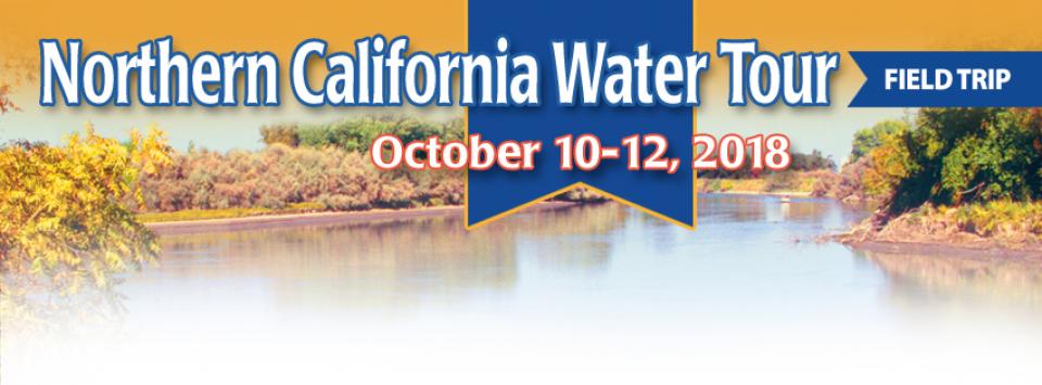
Get an up-close look at some of
California’s key water reservoirs and learn about farming
operations, habitat restoration, flood management and wetlands in
the Sacramento Valley on our Northern California Water Tour
Oct. 10-12.
Each year, participants on the Northern California Water Tour
enjoy three days exploring the Sacramento Valley during the
temperate fall. Join us as we travel through a scenic landscape
along the Sacramento and Feather rivers to learn about
issues associated with storing and delivering the state’s water
supply.
Wednesday is Colorado River Day, the
anniversary of when, in 1921, the Grand River was renamed the
Colorado River, extending the name to the Colorado’s headwaters.
To mark the occasion, we’re offering a 20% discount on our
Colorado River map, Layperson’s Guides and other Colorado River
educational materials.
Don’t miss out! This special sale is one day only, on Wednesday,
July 25. Use the promo code COLORADORIVERDAY at checkout to get
your 20% discount.
Controversial flow requirements for
the lower San Joaquin River designed to meet ecological needs of
the Sacramento-San Joaquin Delta will be among the topics
addressed during the Water Education Foundation’s Sept. 20 Water
Summit in Sacramento.
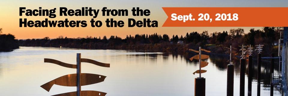
The Foundation’s 35th annual Water
Summit, Facing Reality from the Headwaters to the
Delta, will feature panels on the Delta, the Sierra
Nevada headwaters and the state’s human right to water law.
Bureau of Reclamation Commissioner Brenda Burman will be the
keynote speaker at lunch.
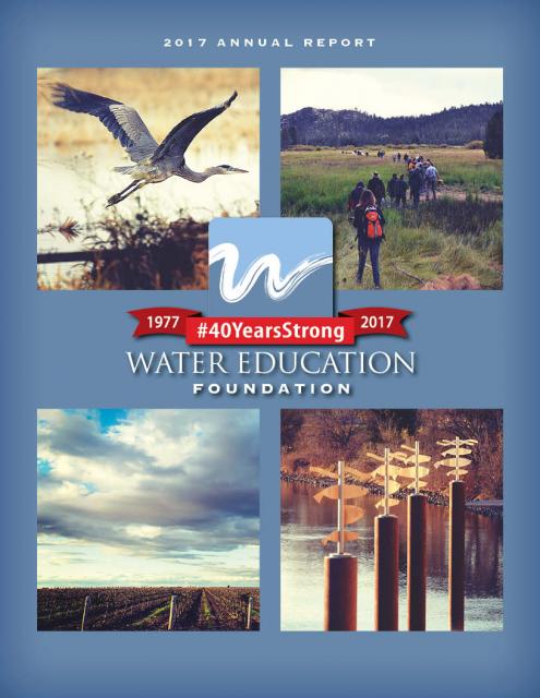
The Water Education Foundation’s
just-released 2017
Annual Report takes readers along to see the array of
educational events, trainings and publications we produced last
year to create a better understanding of water resources in
California and the Southwest.
Marking its 40th anniversary in 2017, the Foundation’s
annual report recaps its efforts for the year in words and
photos.
Those efforts include workshops and conferences, its
invitation-only Colorado River Symposium, its tours of critical
watersheds in California and along the lower Colorado River,
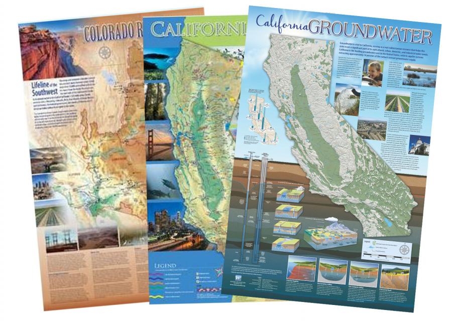
Project WET’s teacher training programs, the Foundation’s popular
poster-size water maps and Layperson’s Guides on climate change,
groundwater and the Colorado River Delta, and its flagship
publication, Western Water.
Jennifer Bowles, executive director
of the Water Education Foundation, will speak on a panel about
the media during the 25th Annual Urban Water Institute’s
conference in San Diego Aug 22-24.
Bowles, a veteran journalist and
executive editor of the Foundation’s Western Water
news, will join other media representatives, including Ry
Rivard of the Voice of San Diego, to discuss
Working with the Media in Changing Times. Former
Foundation Executive Director Rita Schmidt Sudman, author of
Water More or
Less, will moderate. See the draft agenda here.
To celebrate today’s Summer
Solstice, we’re offering a special 20% discount on our beautiful
poster-size water maps, Layperson’s Guides and other water
education materials.
Don’t miss out! This summer sale runs
through Friday, June 22. Use the promo code SOLSTICE at checkout
to get your discount.
Summer Solstice happens tomorrow,
and to celebrate, we’re offering a special
20% discount on our beautiful poster-size water maps,
Layperson’s Guides and other water education materials.
Don’t miss out! This summer sale starts now and runs through
Friday. Use the promo code SOLSTICE at checkout to get your
discount.
Our annual Water Summit, being held Sept. 20, will
feature critical conversations about water in California and
the West revolving around the theme: Facing
Reality from the Headwaters to the
Delta.
As debate continues to swirl around longer-term remedies for
California’s water challenges, the theme reflects the need for
straightforward dialogue about more immediate, on-the-ground
solutions.
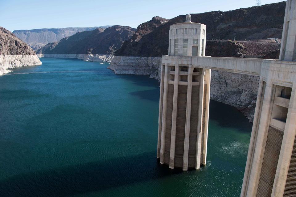
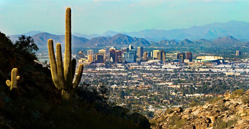
It’s
high-stakes time in Arizona. The state that is first in line
to absorb a shortage on the Colorado River is seeking a unified
approach for water supply management to join its Lower Basin
neighbors, California and Nevada, in a coordinated plan to
preserve water levels in Lake Mead before they run too low.
If the lake’s elevation falls below 1,075 feet above sea level,
the secretary of the Interior would declare a shortage and
Arizona’s deliveries of Colorado River water — water that helps
feed its farms and cities — would be reduced by 320,000
acre-feet — enough, Arizona says, to supply about 1 million
households a year.
Brenda Burman, commissioner of the
U.S. Bureau of Reclamation, will give the keynote lunch address
at our 35th annual conference, the Water
Summit, to be held Sept. 20 in Sacramento.
The daylong event will feature critical conversations about water
in California and the West revolving around the
theme: Facing Reality from the Headwaters to the
Delta.
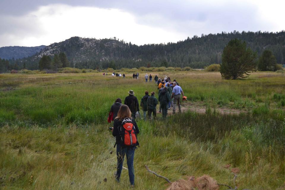
Our Headwaters Tour later this month
now includes a stop at the University of California, Berkeley’s
Sagehen Creek Field
Station, a Sierra Nevada research and training facility where
we’ll learn about forest ecology research and a forest
restoration project.
Spots are still available for the June 28-29 tour, but sign up quickly here to ensure
your spot!
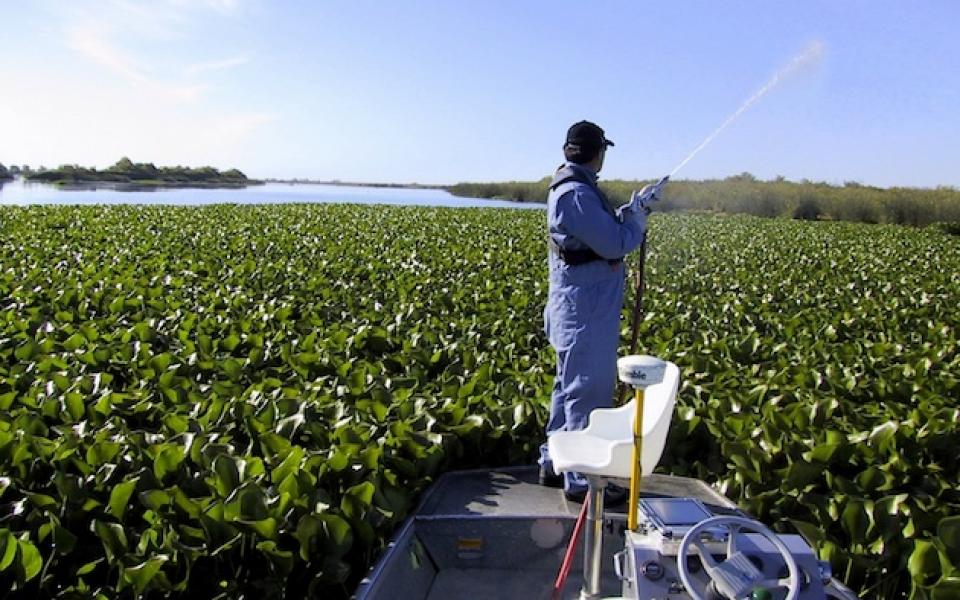
For more than 100 years, invasive
species have made the Sacramento-San Joaquin Delta their home,
disrupting the ecosystem and costing millions of dollars annually
in remediation.
The
latest invader is the nutria, a large rodent native to South
America that causes concern because of its propensity to devour
every bit of vegetation in sight and destabilize levees by
burrowing into them. Wildlife officials are trapping the animal
and trying to learn the extent of its infestation.
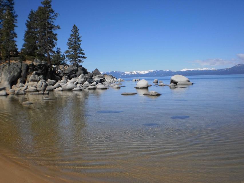
The Sierra Nevada mountains, which
are key to California’s water supply through snowmelt, are dotted
with nearly 130 million dead trees weakened by drought and insect
infestations.
The severe tree mortality has increased the risk of
devastating wildfires, reduced the ability of forests to absorb
greenhouse gases and limited the effectiveness of forests and
meadows to regulate water quality and moderate downhill flow.
While the 2012-2016 drought was one leading cause of tree
mortality in California, the dry conditions also exacerbated
tree infestations from more than a half-dozen different bark
beetles.
On our Headwaters Tour,
June 28-29, guests
will hear from leading forest managers and entomologists
about the extent of this epidemic, how it is
altering forests and impacting upper watersheds, and what
can be done to mitigate the damages.
“Facing Reality from the Headwaters
to the Delta” will be the theme of this year’s Water Summit, featuring top
policymakers and others sharing the latest information on key
issues affecting water in California and the Southwest.
The day-long event on Sept. 20 is the Water Education
Foundation’s premiere event of the year. It will be held at the
Westin Sacramento. Look for more details and speaker
announcements coming soon!
In the meantime, join Nutrien
Ag Solutions in securing a sponsorship opportunity and
gaining publicity for your organization by sponsoring lunch
or the evening reception along the beautiful Sacramento River.
Learn about all the sponsorship opportunities
here. Contact Kasey Chong
via email or at 916-812-2643 with any questions.
As California embarks on its
unprecedented mission to harness groundwater pumping, the Arizona
desert may provide one guide that local managers can look to as
they seek to arrest years of overdraft.
Groundwater is stressed by a demand that often outpaces natural
and artificial recharge. In California, awareness of
groundwater’s importance resulted in the landmark Sustainable
Groundwater Management Act in 2014 that aims to have the most
severely depleted basins in a state of balance in about 20 years.
Water supply for
California’s cities and farms is largely dependent on
snowmelt from the upper watershed in the Sierra Nevada. But that
paradigm is being challenged by wildfires, climate change and
widespread tree mortality.
Join us for a two-day tour as we head into the Sierra foothills
and up into the mountains to examine water issues that happen
upstream, but have dramatic impacts on water supply and quality
downstream and throughout the state.
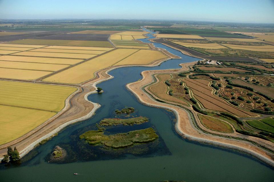
The Sacramento-San Joaquin Delta is
the West Coast’s largest estuary and a vital hub in California’s
complex water delivery system. It’s also a rich farming area, an
important wetlands – and an ecologically troubled region.
On our Bay-Delta Tour, May
16-18, participants will hear from a diverse group of
experts, including water managers, environmentalists, farmers,
engineers and scientists who will offer different perspectives on
the proposed tunnels project, efforts to revitalize the Delta,
and risks that threaten its delicate ecological balance. The
controversial tunnels project, which would carry water beneath
the Delta, got a boost recently when Metropolitan Water
District of Southern California
voted to cover nearly $11 billion of the construction
cost.
Join our team at the Water Education
Foundation, an impartial nonprofit in midtown Sacramento that has
been a trusted source of water news and educational programs in
California and across the West for more than 40 years.
We have a full-time opening for an energetic, motivated,
articulate and detail-oriented Programs Manager who serves
as a member of the Foundation’s events team while focusing
on one of its most popular programs – water tours.
Spurred by drought and a major
policy shift, groundwater management has assumed an unprecedented
mantle of importance in California. Local agencies in the
hardest-hit areas of groundwater depletion are drawing plans to
halt overdraft and bring stressed aquifers toward recovery. Along
the way, an army of experts has been enlisted to help
characterize the extent of the problem and how the Sustainable
Groundwater Management Act of 2014 is implemented.
One of those policy experts is Michael Kiparsky, director of the
Wheeler Water Institute within the Center for Law, Energy & the
Environment at the University of California, Berkeley, School of
Law. Kiparsky recently co-authored a report that focuses on a
pilot project in Santa Cruz County’s Pajaro Valley that he
says has intriguing potential for broader applicability.