Find out what the Water Education Foundation is up to with
announcements about upcoming events, tours, new Western
Water articles on key water topics and more!
Sign up here to get announcements sent to
your inbox.
The Big Day of Giving is today, and
your donation can help the Foundation continue its work to
enhance public understanding about California’s most
important natural resources — water.
The Big Day of
Giving is an annual 24-hour online event aimed at
raising funds for nonprofits in the Sacramento region and
highlighting the good work they do.
The Water Education Foundation has been around in California for
more than 40 years! Have you ever been curious about our Water
Leaders program, our tours or workshops, and Western
Water news?
Join us for a reception at our midtown Sacramento office from
4:30 to 6:30 p.m. May 3 to meet the staff, enjoy refreshments and
check out what we do. Sign up
here for the open house so we have a head count.
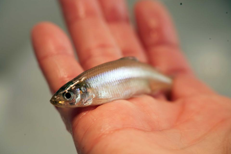
One of the most frequently discussed
animals in the Sacramento-San Joaquin Delta is fish. From the
anadromous life cycle of the salmon to the controversial and
little-understood Delta smelt to invasive species such as the
largemouth bass, few animals have a larger impact on water policy
and infrastructure in the Delta than the dozens of native and
introduced fish found there, especially those species considered
endangered.
On our annual Bay-Delta
Tour, May 16-18, you will spend three days immersed in
water-related topics, and among them is fish. Most notable is the
endangered Delta smelt, whose protections have at times halted
the pumps that send water from the Delta to the San Joaquin
Valley and Southern California.
Stop by our midtown Sacramento
office Thursday afternoon, May 3, to learn what we do to educate
and foster public understanding of one of California’s most
precious natural resources — water — and see how you can
support our work.
Join us for an open house and reception at our office from
4:30 to 6:30 p.m. to meet the staff, enjoy refreshments and check
out what we do. We’ll have local wines as well as beer donated by
Sacramento’s Track 7 Brewing Company. Sign up
here for the open house so we have a head count.
Join our team at the Water Education
Foundation, an impartial nonprofit in midtown Sacramento that has
been a trusted source of water news and educational programs in
California and across the West for more than 40 years.
We have a full-time opening for an energetic, motivated,
articulate and detail-oriented Programs Manager who serves
as a member of the Foundation’s events team while focusing
on one of its most popular programs – water tours.
Go deep into California’s water hub
on our Bay-Delta
Tour May 16-18, and see water conveyance, pumps and
storage systems, including components of the State Water Project
and the Central Valley Project.
Among the stops is a reservoir expansion project recently deemed
eligible by the California Water Commission for sought-after
state bond funds.
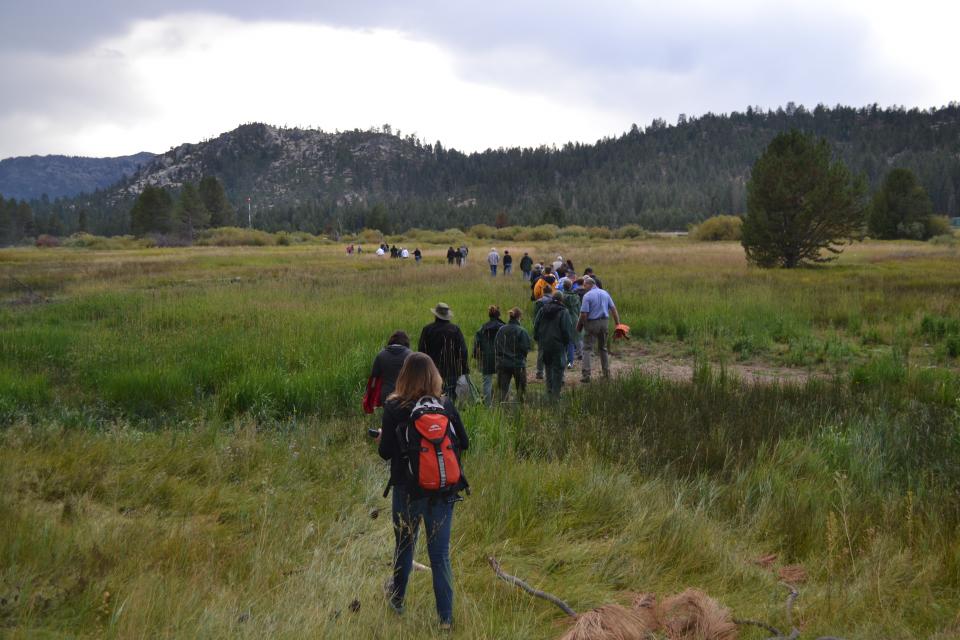
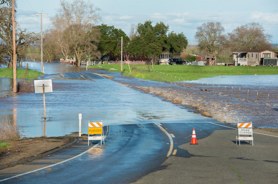
The Sacramento-San Joaquin Delta is
the West Coast’s largest estuary and a vital hub in California’s
complex water delivery system. It’s also a rich farming area, an
important wetlands – and an ecologically troubled region.
On our Bay-Delta Tour, May
16-18, participants will hear from a diverse group of
experts, including water managers, environmentalists, farmers,
engineers and scientists who will offer different perspectives on
the proposed tunnels project, efforts to revitalize the Delta,
and risks that threaten its delicate ecological balance. The
controversial tunnels project, which would carry water beneath
the Delta, got a boost last week when Metropolitan Water District
of Southern California
voted to cover nearly $11 billion of the construction
cost.
Sixty percent of California’s developed water supply originates
high in the Sierra Nevada.Thus, the state’s water supply is
largely dependent on the health of Sierra forests, which are
suffering from ecosystem degradation, drought, wildfires and
widespread tree mortality.
Join us as we head into the Sierra foothills and up to the
mountains to examine water issues that happen upstream but have
dramatic impacts downstream and throughout California.
This winter’s wild swings in weather
– an early lack of rain, then late-season Sierra snowstorms,
followed by a torrent of subtropical moisture – shows the need in
California for long-range tools to better manage water supply.
At a Paleo
Drought Workshop in San Pedro on April 19, six experts will
discuss research on centuries-long precipitation and streamflow
records, new forecasting tools and planning strategies to help
reduce Southern California’s vulnerability to drought.
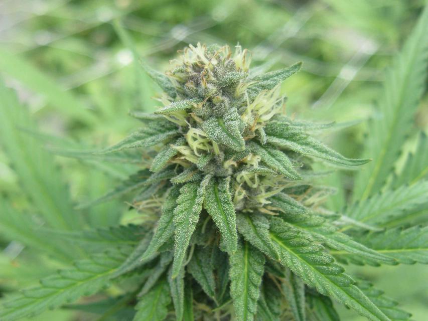
For decades, cannabis has been grown
in California – hidden away in forested groves or surreptitiously
harvested under the glare of high-intensity indoor lamps in
suburban tract homes.
In the past 20 years, however, cannabis – known more widely as
marijuana – has been moving from being a criminal activity to
gaining legitimacy as one of the hundreds of cash crops in the
state’s $46 billion-dollar agriculture industry, first legalized
for medicinal purposes and this year for recreational use.
The Sacramento-San Joaquin Delta,
the largest estuary on the West Coast, is a vital hub in
California’s complex water delivery system as well as a rich
farming region, an important wetlands area – and often, a source
of conflict.
Our Bay-Delta Tour, May
16-18, will allow participants to hear from a diverse group
of experts, including water managers, environmentalists, farmers,
engineers and scientists who will offer different perspectives on
the proposed tunnels project, efforts to revitalize the Delta,
and risks that threaten its delicate ecological balance. (The
controversial tunnels project got a boost this week when
Metropolitan Water District of Southern California
voted Tuesday to cover nearly $11 billion of the construction
cost).
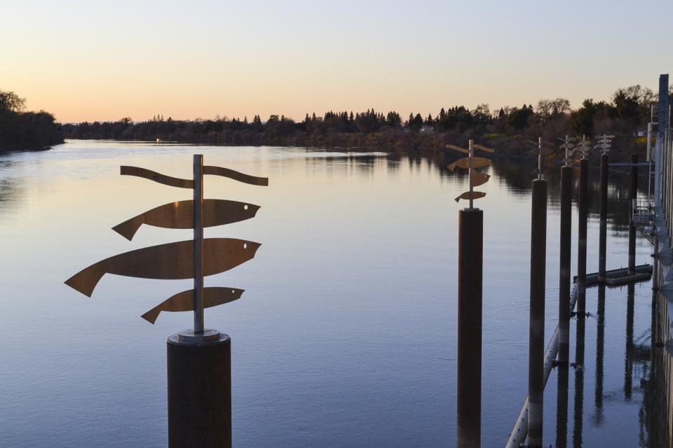
Formerly known as the Executive Briefing, this year’s
Water Summit will feature top policymakers and others sharing
the latest information on key issues affecting water in
California and the Southwest.
The day-long event on Sept. 20 is the Foundation’s premiere event
of the year, and will be held at the Westin Riverside in
Sacramento. Look for more details and speaker announcements
coming soon!
In the meantime, secure a sponsorship opportunity and gain
publicity for your organization by sponsoring lunch or the
evening reception along the beautiful Sacramento River.
California voters may do a
double-take this year when they step in the voting booth. Two
separate water-related bonds are headed to the polls – one in
June, another in November.
Western Water writer Gary Pitzer
sifts through the two bond measures, totaling $13 billion, to
explain what they would fund, who’s behind them and how they came
together.
Learn what new tree-ring studies in
Southern California watersheds reveal about drought, hear about
efforts to improve subseasonal to seasonal weather forecasting
and get the latest on climate change impacts that will alter
drought vulnerability in the future.
At our Paleo
Drought Workshop on April 19th in San Pedro, you will hear
from experts at NASA Jet Propulsion Laboratory, University of
Arizona and California Department of Water Resources.
Dramatic swings in weather patterns
over the past few years in California are stark reminders of
climate variability and regional vulnerability. Alternating years
of drought and intense rain events make long-term planning for
storing and distributing water a challenging task.
Current weather forecasting capabilities provide details for
short time horizons. Attend the Paleo Drought
Workshop in San Pedro on April 19 to learn more about
research efforts to improve sub-seasonal to seasonal
precipitation forecasting, known as S2S, and how those models
could provide more useful weather scenarios for resource
managers.
On our upcoming Lower Colorado River
Tour, you will not only meet water experts across the
Southwest and tour key infrastructure such as Hoover Dam, but
also enjoy recreational and cultural attractions.
Have you ever tasted a date shake? This treat is exclusive to
California’s southeast corner, where the Coachella Valley is
known as the nation’s largest date-growing region. You’ll have
the chance to enjoy one as we make a pit stop at a farm store.
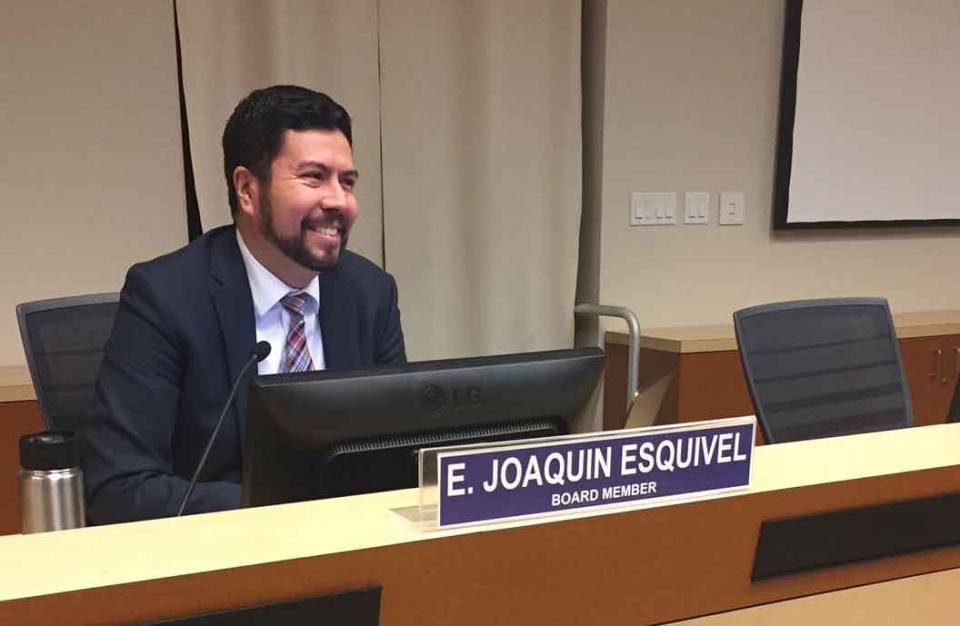
One year into the job, State Water
Resources Control Board member Joaquin Esquivel has been struck
by the complexity of the board’s work and how difficult it is to
set statewide policy that accounts for the geographic and
stakeholder diversity of California.
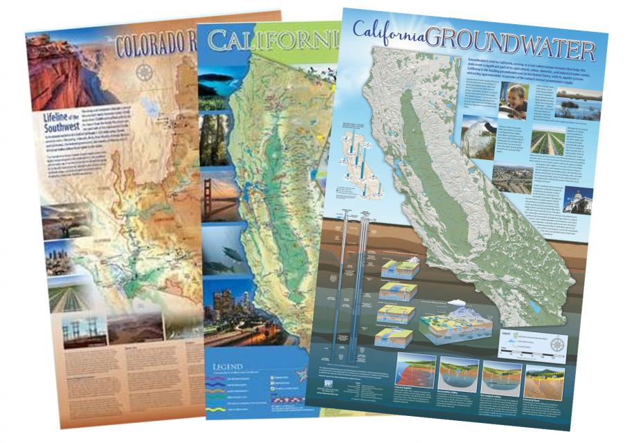
World Water Day is today, March 22,
and to mark the occasion the Foundation is offering a special 20
percent discount on our beautiful poster-size maps, layperson’s
guides and other water publications.
Use the promo code WORLDWATERDAY when checking out of our online
shopping store.
Our California Water
Map highlights the dams, reservoirs, canals, rivers, lakes
and other water bodies throughout the state and shows how water
moves through California. Another recently updated map is the
California
Groundwater Map, which illustrates how groundwater works, the
locations of groundwater basins around the state and the
challenges from overuse.
The San Joaquin Valley, known as the nation’s breadbasket, is one
of the nation’s most productive agricultural regions.
During our three-day Central Valley Tour, March
14-16, you will meet farmers who will explain how they
prepare the fields, irrigate their crops and harvest the produce
that helps feed the world. We also will drive through hundreds of
miles of farmland and visit the rivers, dams, reservoirs and
groundwater wells that provide the water.
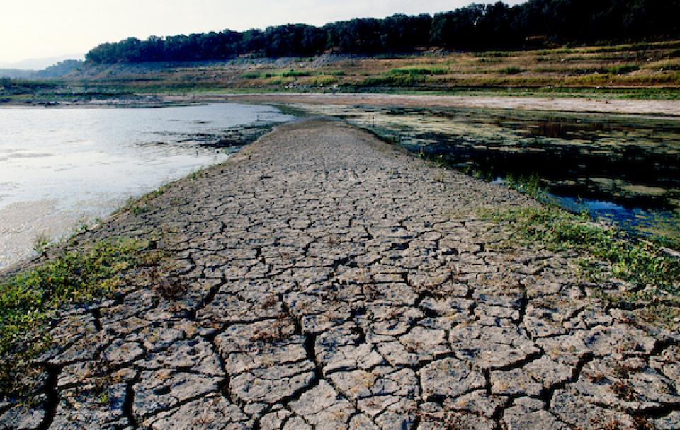
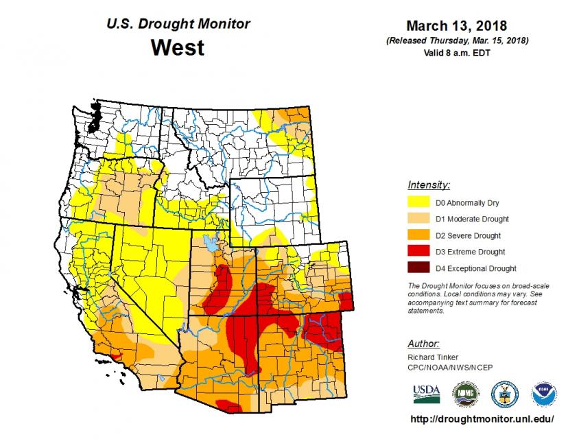
A drought has lingered in the
Colorado River Basin since 2000, causing reservoir storage to
decline from nearly full to about half of capacity. So far this
year, a meager snowpack in the Rocky Mountains hasn’t helped
much.
In fact, forecasters say this winter will likely go down as the
sixth-driest on record for the river system that supplies water
to seven states, including California, and Mexico.
On our Lower
Colorado River Tour, April 11-13, you will meet with water
managers from the three Lower Basin states: Nevada, Arizona and
California. The three states are working to finalize a Drought
Contingency Plan to take voluntary cuts to keep Lake Mead, the
nation’s largest reservoir, from hitting critical levels and
causing a shortage declaration.