Find out what the Water Education Foundation is up to with
announcements about upcoming events, tours, new Western
Water articles on key water topics and more!
Sign up here to get announcements sent to
your inbox.
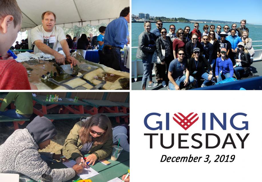
Happy New Year to all the friends, supporters, readers, and tour and workshop participants of the Water Education Foundation! We’re grateful to each and every person who interacted with us in 2019 and supported our mission.
As we turn the page to 2020, we’re looking ahead to a few changes.
We’re putting together an exciting lineup of Foundation
conferences for 2020! Mark your calendars now for both our Water
101 workshop, scheduled for Feb. 20 at McGeorge School of Law in
Sacramento, and our annual Water Summit, scheduled for Sept. 24
at the Westin Sacramento. Stay tuned for further announcements on
other events we are planning for 2020.
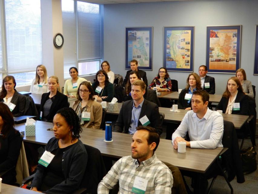
The 2019 Water Leaders class
organized by the Water Education Foundation completed its year
with a report outlining policy recommendations for better
managing the increasing risks of wildfire and impacts on water
supply and quality.
The class of 23 from
various stakeholder groups and backgrounds who hailed from cities
and towns across California had full editorial control to choose
recommendations.
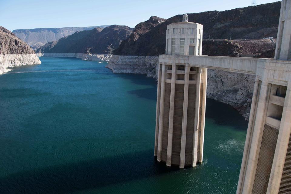
The Colorado River is arguably one
of the hardest working rivers on the planet, supplying water to
40 million people and a large agricultural economy in the
West. But it’s under duress from two decades of drought and
decisions made about its management will have exceptional
ramifications for the future, especially as impacts from climate
change are felt.
Our
latest article in Western Water, our flagship
publication, explores the debate over whether incremental change
or a grand vision is the best approach to resolving the most
pressing issues facing the Colorado River.
You can now register for our full slate of water tours for 2020
as well as our Water 101 workshop. Register up to six weeks
before any tour for “early bird” pricing!
Here are the details on all of our 2020 tours and the Water
101 workshop:
Applications for one of our most
popular programs, Water
Leaders, are due Monday, Dec. 9, by 5 p.m.
Launched in 1997 and now led by Executive Director
Jennifer
Bowles, the Water Leaders program gets you
out of the office and into the field — whether it’s on one of
our water tours to
the Delta or the lower Colorado River, or meeting with your
assigned mentor.
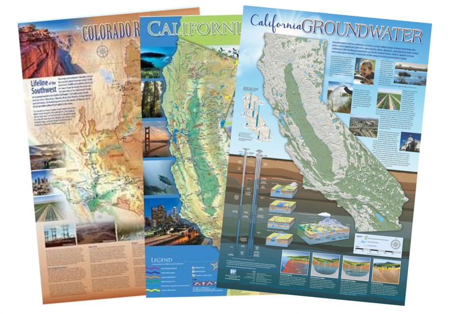
Time is running out to score a sweet
holiday gift deal for the water wonk in your life with a special
discount on our popular poster-size maps, layperson’s guides and
other water publications.
Until midnight Monday, use the discount code
HOLIDAYSALE19 at checkout to save 30 percent off
your purchase price for maps and publications.
You can also get a gift certificate to send someone to one of our
2020 water tours or our Water 101 Workshop. See below for
details.
And if you’re planning to do other Cyber Monday holiday shopping,
you can help support the Foundation by shopping through
AmazonSmile,
which will donate to the Foundation 0.5 percent of the price of
your eligible purchases. Learn more about this special donation program
here.
Score a sweet holiday gift deal for
the water wonk in your life with a special Black Friday/Cyber
Monday discount on our popular poster-size maps, layperson’s
guides and other water publications.
Use the discount code HOLIDAYSALE19 at checkout
to save 30 percent off your purchase price for maps and
publications. This limited-time discount starts today
and runs through midnight Monday, Dec. 2.
You can also get a gift certificate to send someone to one of our
2020 water tours or our Water 101 Workshop. See below for
details.
And if you’re planning to do other Black Friday/Cyber Monday
holiday shopping, you can help support the Foundation by shopping
through AmazonSmile,
which will donate to the Foundation 0.5 percent of the price of
your eligible purchases. Learn more about this special donation program
here.
It’s been a year since two
devastating wildfires on opposite ends of California underscored
harsh new realities facing water agencies serving communities in
or adjacent to the state’s fire-prone wildlands. Fire doesn’t
just level homes, it can contaminate water, scorch watersheds,
damage delivery systems and upend agency finances.
Our
latest article in Western Water,
our flagship publication, explores the hard-earned lessons water
managers have gleaned from the Camp Fire that swept through
Paradise, in Northern California, and the Woolsey Fire along the
Los Angeles-Ventura County border in Southern California. These
lessons are still being absorbed by water managers around
California a year later as they recognize that emergency
preparedness plans of yesterday may not be adequate for the
wildfire reality of today.
Registration is now open for one of
our most popular annual events, the Water 101 workshop, to be held Feb. 20 at
McGeorge School of Law in Sacramento. The workshop also includes
an optional tour the following day that will feature
collaborative and innovative water projects and programs.
Water 101 covers California’s water basics including the history,
geography, legal and political facets of water in the state,
as well a look at hot topics and current issues of concern.
Taught by some of California’s leading policy and legal
experts, the workshop offers attendees the opportunity
to deepen their understanding of the state’s water resources.
This holiday season, consider giving
the gift of water knowledge to the water wonk in your life.
We’re offering an array of intriguing gift options, from a ticket
to our popular Water 101 Workshop or one of our 2020 water tours
to one of our beautiful poster-size water maps, layperson’s
guides or other water publications.
Applications for one of our most
popular programs, Water Leaders,
are available for the 2020 class. The deadline is Dec. 9 at
5 p.m.
Launched in 1997 and now led by Executive Director Jennifer Bowles, the Water
Leaders program is a competitive, one-year class designed
for early to mid-career, up-and-coming community leaders from
diverse backgrounds. Class members deepen their water
knowledge and enhance their leadership skills through the
program.
During the year, class members get out of the office and into the
field — whether it’s on one of our water tours to the Delta or
the lower Colorado River. They also meet with an assigned
mentor and work with their classmates on developing policy
recommendations for a challenging water issue in California.
The deadline is nearing to apply for
our highly sought-after Water Leaders program for early to
mid-career water professionals, and registration is now open for
two popular events in 2020: our Water 101 Workshop and Lower
Colorado River Tour.
The yearlong Water
Leaders class is aimed at providing a deeper
understanding of California water issues and building leadership
skills with class members attending water tours, studying a
water-related topic in-depth and working with a mentor.
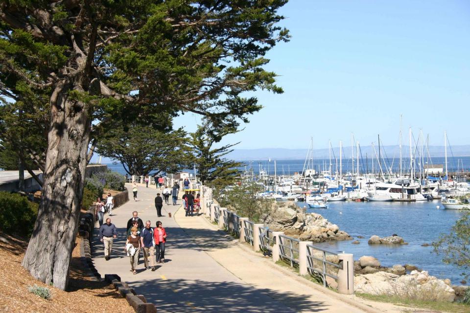
From the technology hub of San Jose
to the coastal enclave of Monterey and from the productive
agriculture of the Salinas Valley to the rolling vineyards of
Paso Robles, participants on our Central Coast Tour Nov. 6-7
will learn about efforts by water users to achieve sustainability
in a region grappling with limited local water supplies.
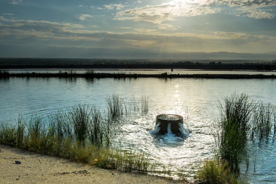
The sustainable management of
groundwater is an important issue across California, but water
users along the coast also must deal with seawater intrusion when
their basins become imbalanced. Learn how one water district is
working to quantify the problem and address it on our Central Coast Tour Nov. 6-7.
To survive the next drought and meet
the looming demands of the state’s groundwater sustainability
law, California is going to have to put more water back in the
ground. But as other Western states have found, recharging
overpumped aquifers is no easy task.
A UC Berkeley symposium in which water managers and others
from across the West assessed the opportunities and challenges of
improving troubled aquifers through managed aquifer recharge is
the focus of our latest article in Western
Water, our flagship publication.
A diverse roster of top
policymakers and water experts are on the
agenda for the Foundation’s 36th annual Water
Summit. The conference, Water Year 2020: A Year
of Reckoning, will feature compelling conversations
reflecting on upcoming regulatory deadlines and efforts to
improve water management and policy in the face of natural
disasters.
Tickets for the Water Summit are sold out, but by joining the waitlist we can
let you know when spaces open via cancellations.
Our last tour of 2019 is all new and
will journey through a region grappling with limited local water
supplies. Solutions to issues surrounding urban, agricultural and
environmental water use on the scenic Central Coast involve
potential lessons for all of California.
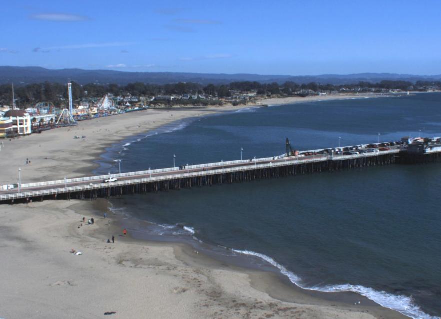
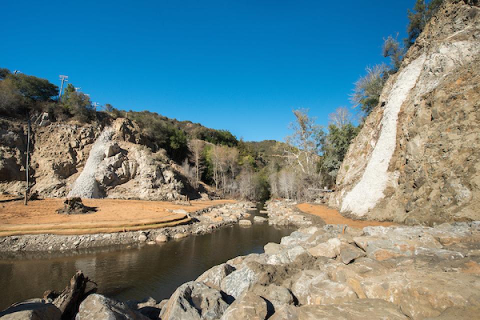
Get a firsthand look at a completed
dam removal project near Monterey on our Central Coast Tour Nov. 6-7.
The removal of San Clemente Dam on the Carmel River in 2015 was
the largest project of its kind in California, and lessons
learned from it are being applied to other projects across the
state and the nation.
Although safety concerns from sediment buildup and seismic
activity were the primary drivers for the dam’s removal, it also
opened up miles of spawning habitat for salmon and steelhead on
the Carmel River that had been blocked for nearly 100 years.